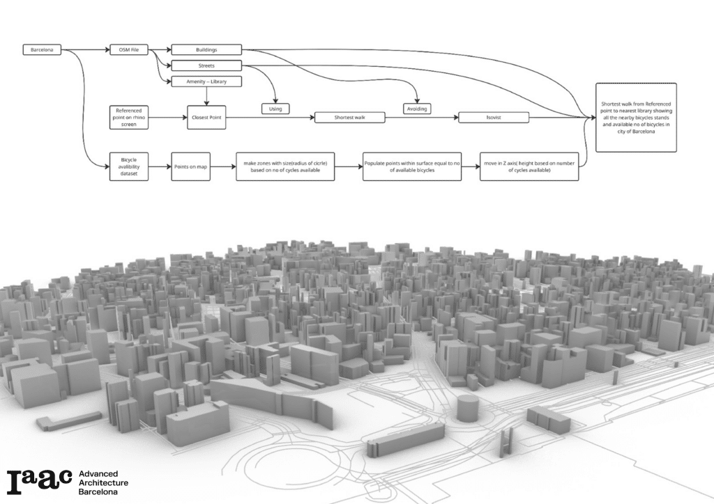
This project can be used to find the nearest library in the city of Barcelona from the input location. The system works by calculating the shortest route from a given starting point to the closest library location. Along this route, the script also displays information about nearby bike stations and the number of available bicycles at those nearby stations.
The purpose of this project is to combine accessibility to public libraries with urban mobility data. It helps us to understand how a person can reach a library using walking paths and bicycle infrastructure.
All the data was gathered from open sources like OSM and the open data BCN portal.
Workflow