
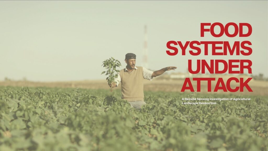
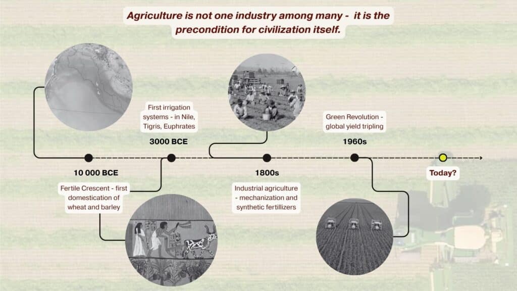
Agriculture is not simply another economic sector. It is the foundation of food security, livelihoods and social stability. Yet in many conflict zones, agricultural landscapes are systematically damaged through bombardment, infrastructure collapse, restricted access to farmland, and disruption of water systems.
While urban destruction is often visible and extensively documented, the destruction of food-producing landscapes remains harder to quantify. This project investigates how satellite imagery and AI-based image analysis can be used to identify, measure, and compare agricultural destruction across conflict zones.
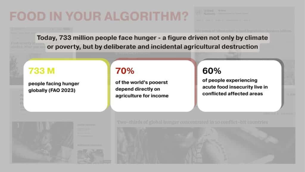
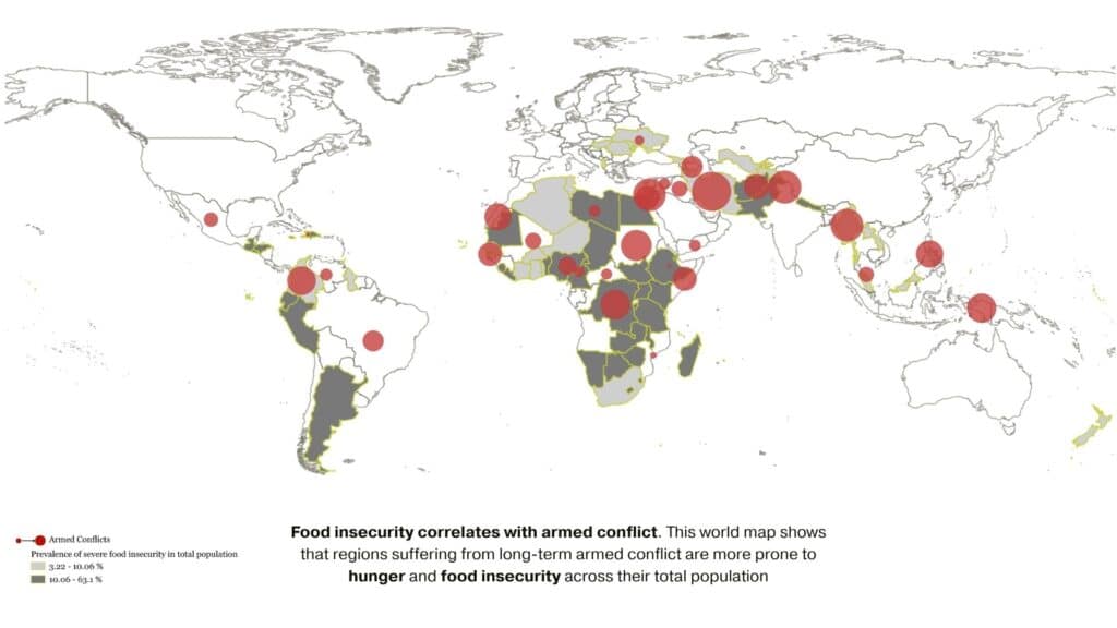
Today, millions of people experience acute food insecurity, and conflict remains one of its strongest drivers. Armed conflict simultaneously impacts all four pillars of food security:
- Availability
- Access
- Utilization
- Stability
When farmland, irrigation systems, supply chains, and markets are damaged, entire food systems can collapse.
Can satellite imagery and AI image analysis identify and compare agricultural destruction across conflict zones?
Our objective was to develop a repeatable methodology capable of detecting agricultural damage using freely available Earth observation data and machine learning techniques. By combining environmental indicators with AI-assisted image interpretation, we aimed to transform qualitative reports of food insecurity into measurable spatial evidence.
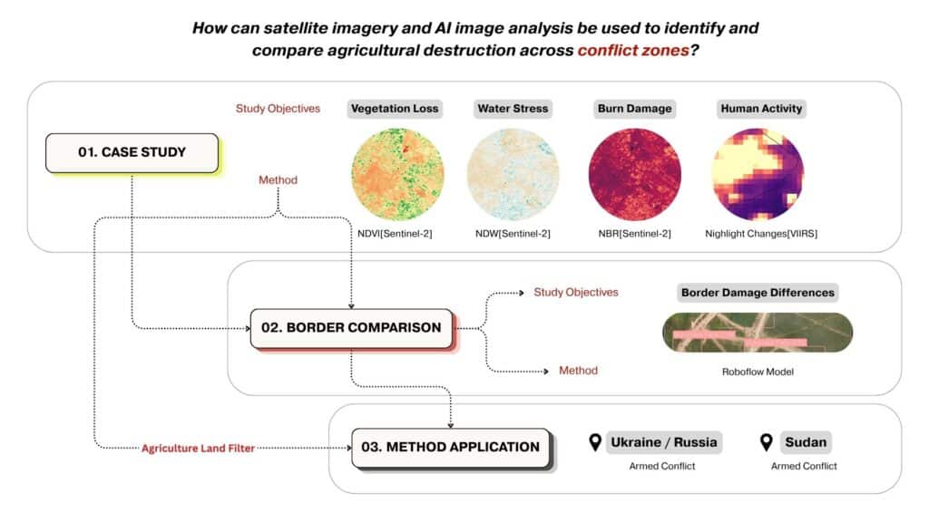
Methodology
The workflow combines remote sensing indicators with AI detection models. Five indicators were used:
NDVI – Vegetation Health
Measures plant productivity and agricultural vitality.
NDWI – Water Availability
Identifies moisture stress and water loss.
NBR – Burn Damage
Detects fire scars and surface degradation.
Nighttime Lights
Measures changes in human activity, infrastructure, and energy access.
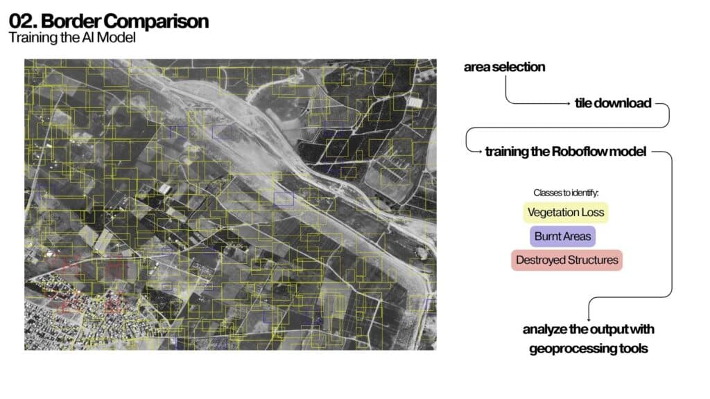
AI Object Detection
Custom Roboflow models were trained to identify:
- Vegetation loss
- Destroyed structures
- Burnt areas
Case Study – Beit Hanoun, Gaza
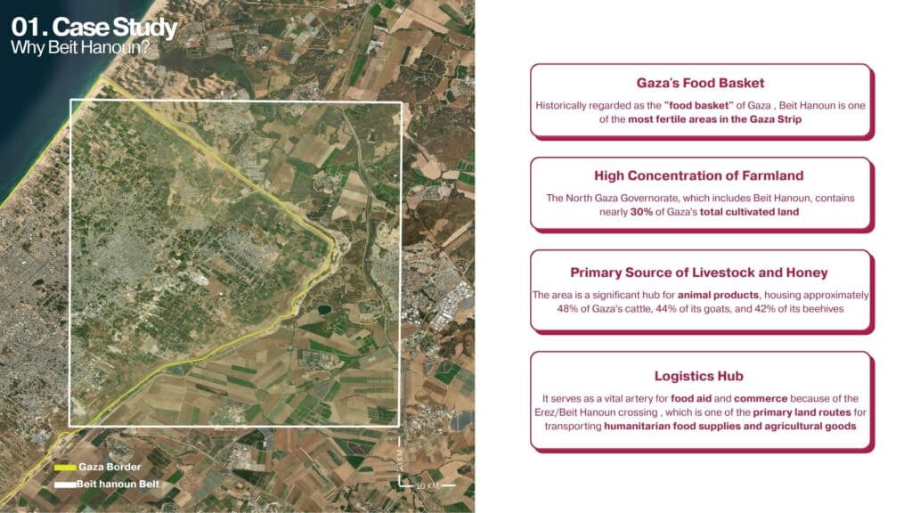
The Gaza Strip provides one of the most urgent examples of food system collapse under conflict.
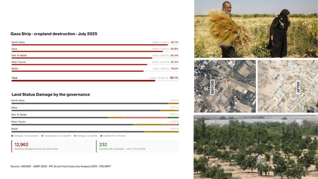
Before October 2023, local agriculture supplied approximately 44% of Gaza’s food needs. Following the escalation of conflict, agricultural land, greenhouses, irrigation infrastructure, and wastewater treatment systems experienced widespread damage.
Our analysis focuses on the Beit Hanoun agricultural belt, historically one of Gaza’s most productive farming regions.
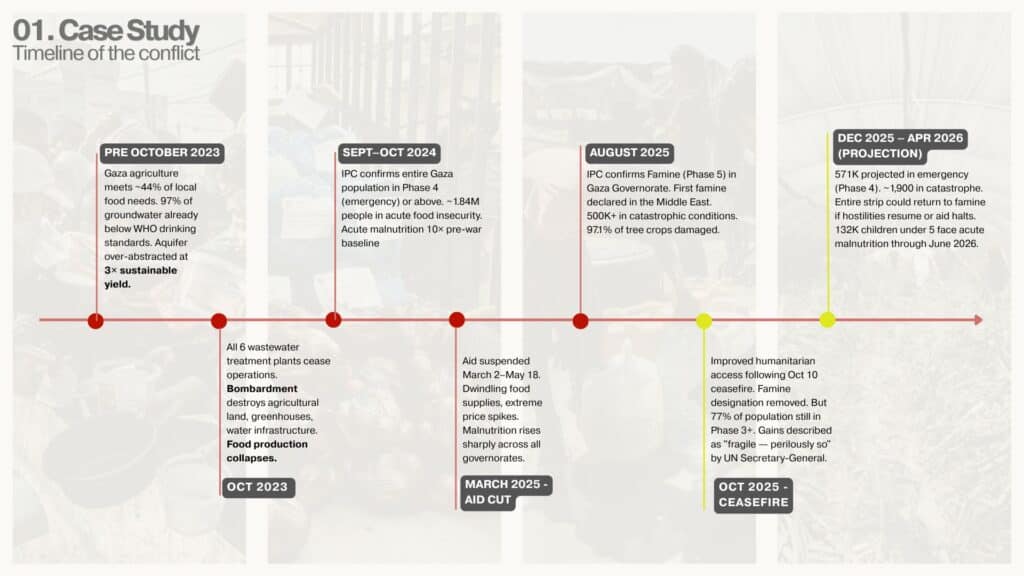
Timeline of Agricultural Collapse
The progression of conflict reveals how food systems can deteriorate rapidly when agricultural infrastructure is targeted or disrupted. Key milestones include:
- October 2023: destruction of agricultural and water infrastructure
- 2024–2025: widespread food insecurity and malnutrition
- 2025: famine declaration in parts of Gaza
- 2026 projections indicating continued vulnerability
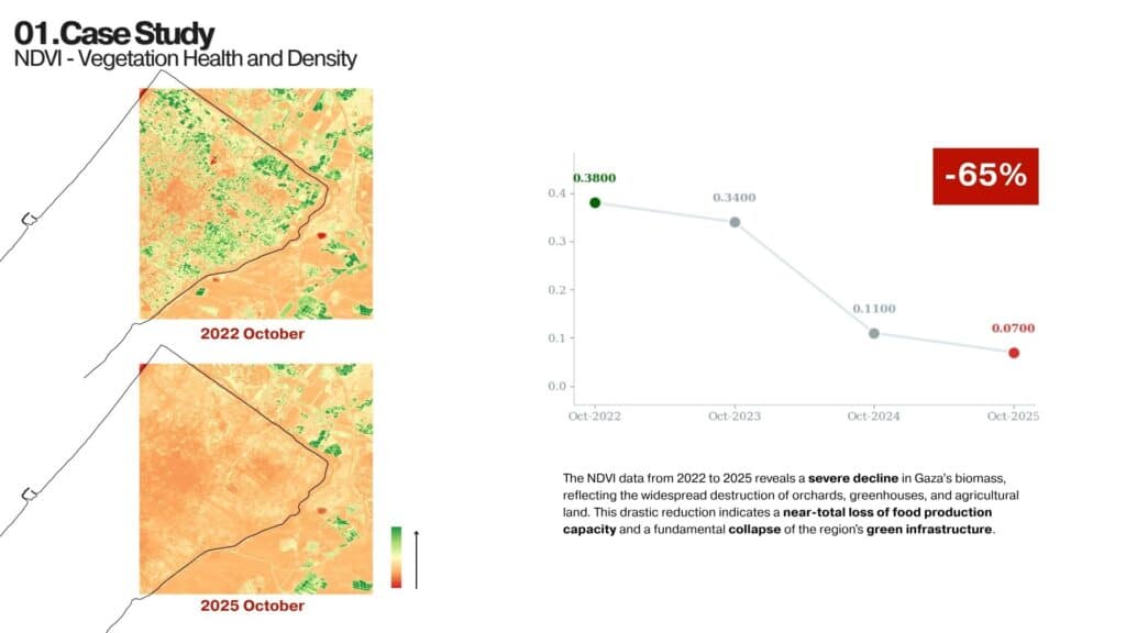
Measuring Agricultural Destruction
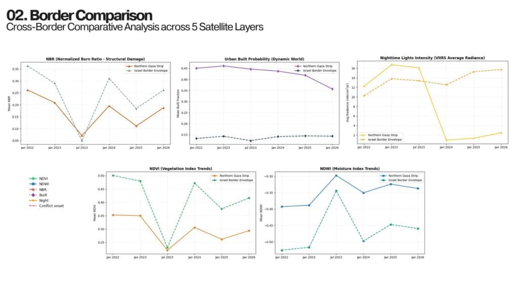
NDVI – Vegetation Loss
NDVI analysis revealed a dramatic decline in biomass across the Beit Hanoun agricultural belt. The loss of orchards, crops, and greenhouses produced a 65% decrease in vegetation health, indicating a severe reduction in food production capacity.
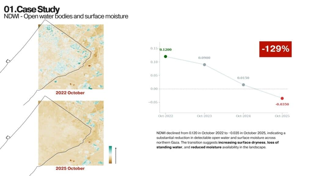
NDWI – Water Stress
Surface moisture and open water availability declined significantly between 2022 and 2025. The results suggest increasing dryness, reduced irrigation capacity, and a breakdown of agricultural water systems.
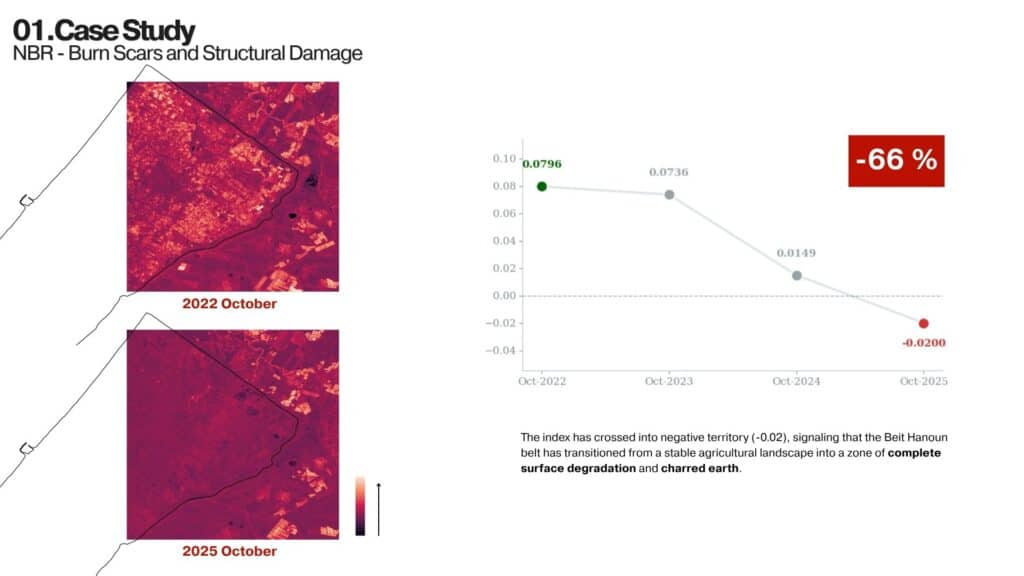
NBR – Burn Damage
Burn severity analysis revealed extensive fire damage and surface degradation throughout agricultural zones. The landscape transitioned from productive farmland into areas characterized by scorched and degraded terrain.
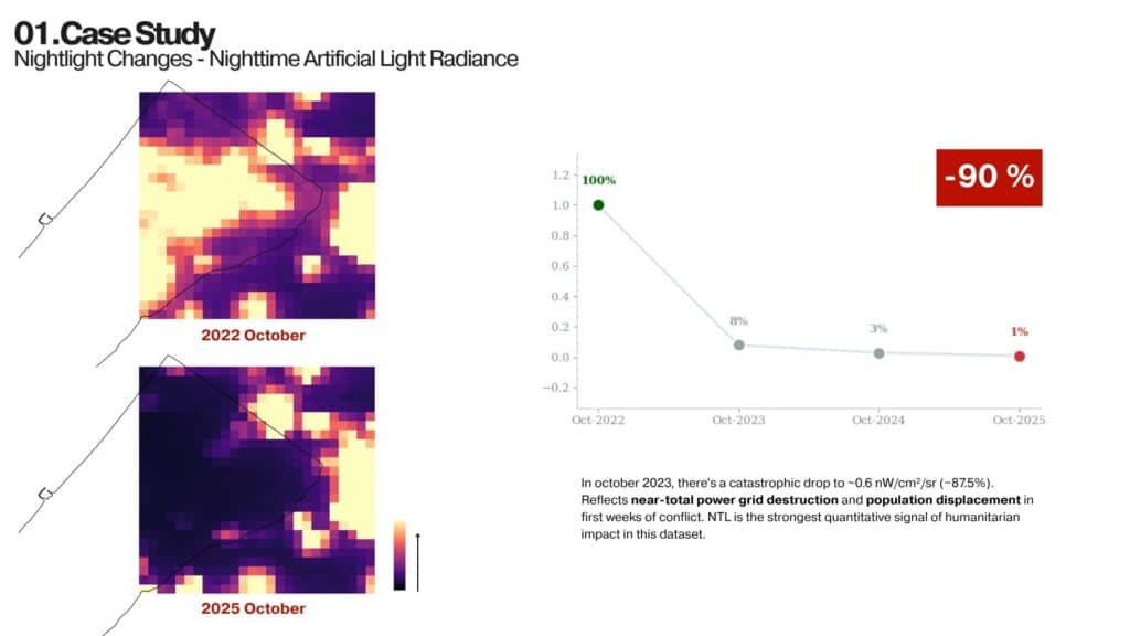
Nighttime Lights
Nighttime light intensity showed one of the strongest signals of humanitarian disruption. A decline of approximately 90% reflects widespread power loss, infrastructure damage, and population displacement.
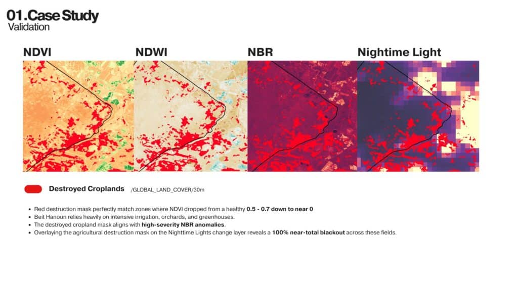
Validation
To validate our findings, remote sensing outputs were compared with:
- Cropland destruction datasets
- Dynamic World land cover classification
- Humanitarian reporting
- UNOSAT and FAO assessments
The strongest agreement occurred where vegetation loss, moisture decline, burn damage, and nighttime light reductions overlapped.
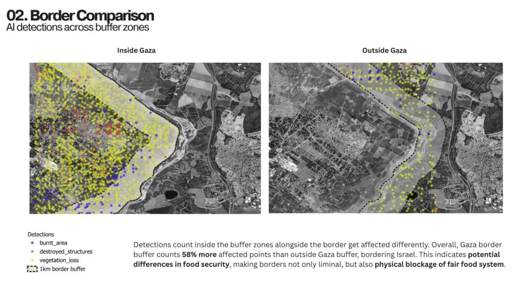
Border Comparison
Agricultural destruction is not distributed evenly. To investigate spatial inequalities, AI detections were compared across buffer zones on either side of the Gaza border. The analysis identified substantially higher concentrations of damage inside Gaza, highlighting how borders can function as food security gradients rather than neutral boundaries.
Applying the Method Globally
To test transferability, the methodology was applied to two additional conflict regions:
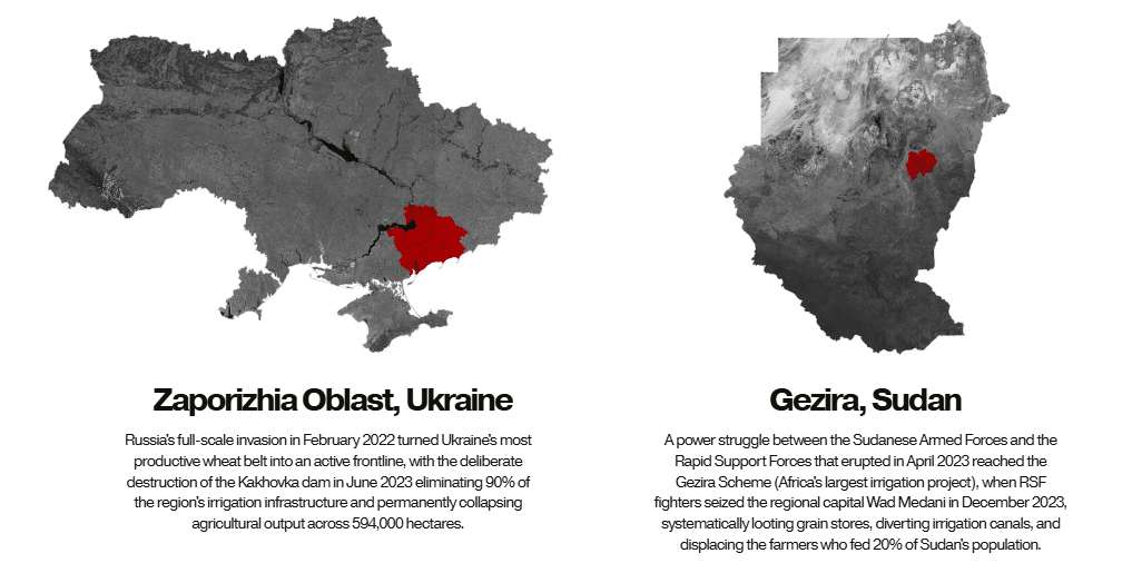
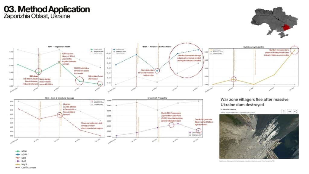
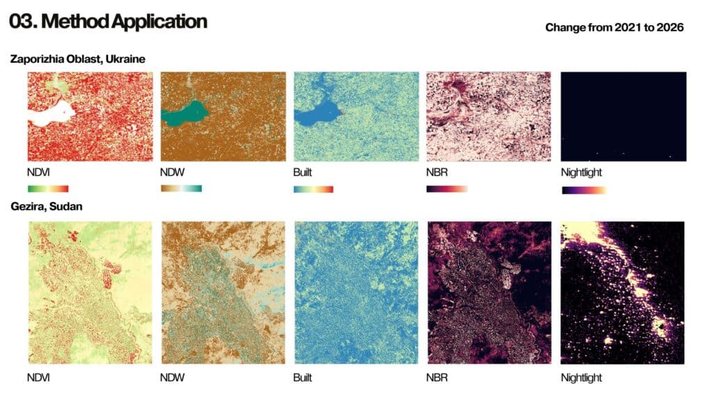
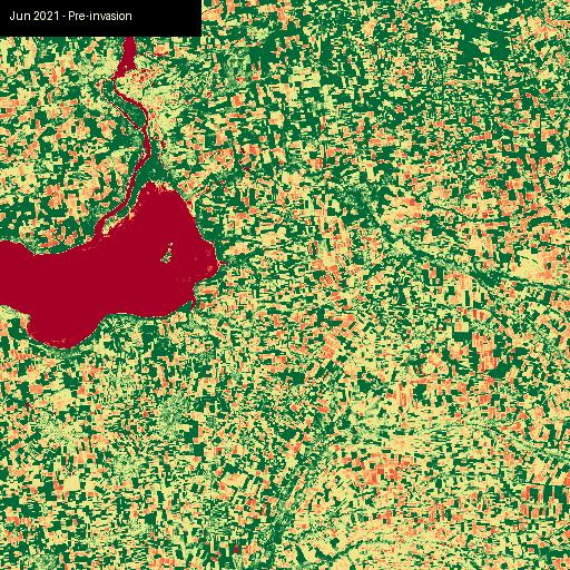
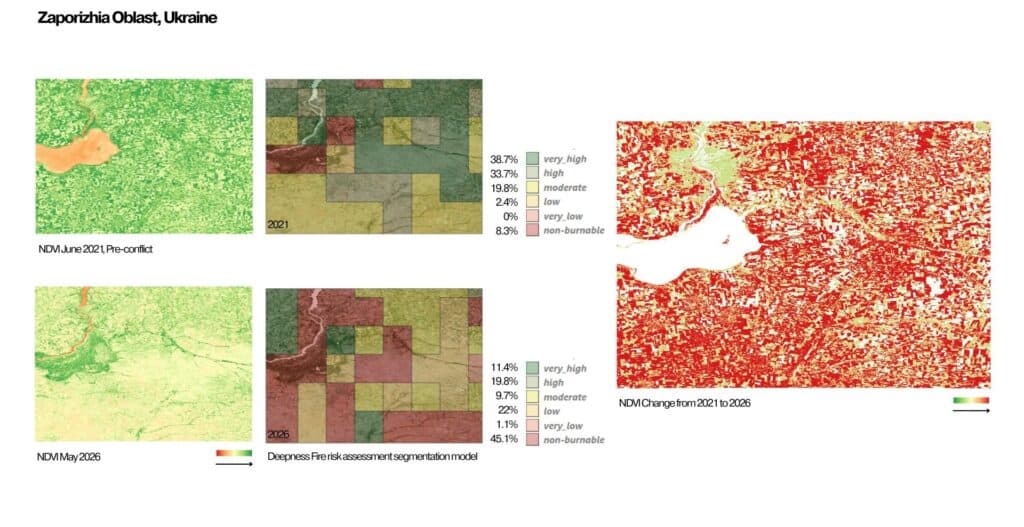
Zaporizhia Oblast, Ukraine
Agricultural decline was linked to active warfare and the destruction of irrigation infrastructure following the collapse of the Kakhovka Dam.
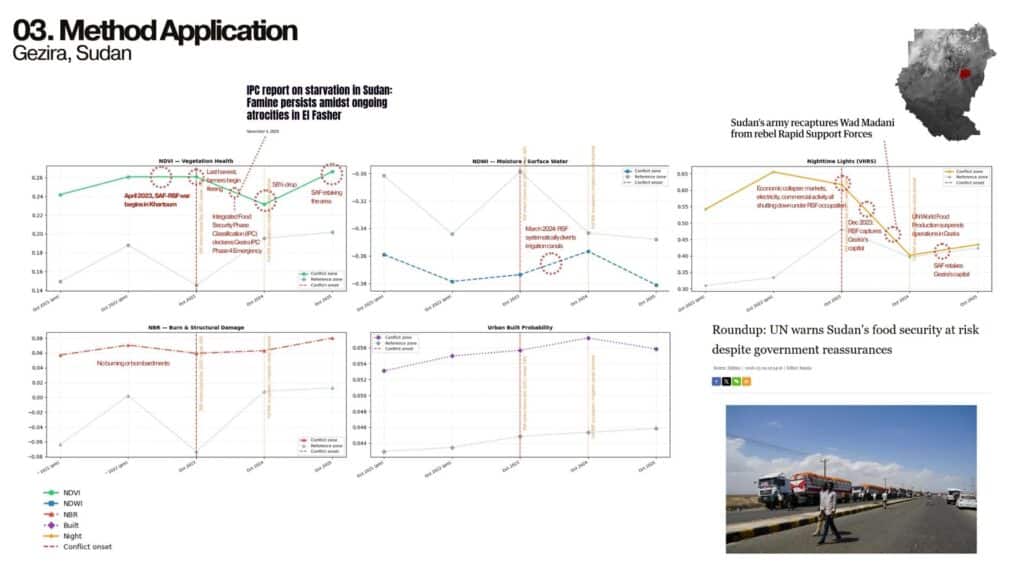
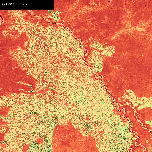
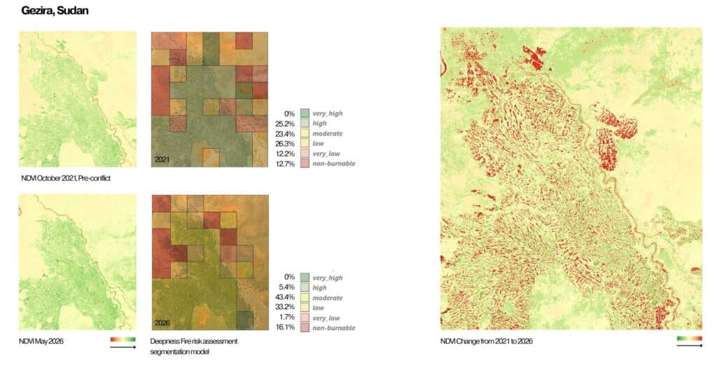
Gezira, Sudan
Food production losses emerged through irrigation disruption, displacement, and economic collapse rather than large-scale bombardment.
These examples demonstrate that agricultural destruction can occur through different mechanisms while producing similar food security outcomes.
Key Findings
Agricultural destruction emerges as a systematic consequence of conflict rather than an incidental byproduct. The system demonstrates that:
- Food systems can be monitored through satellite imagery.
- Multiple indicators provide stronger evidence than single datasets.
- Borders can create measurable food security inequalities.
- AI-assisted analysis can scale monitoring efforts across regions.
- Remote sensing can support humanitarian decision-making and recovery planning.
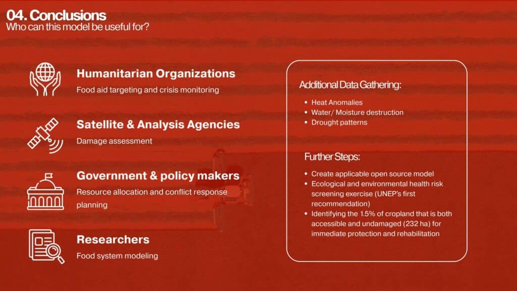
Future Work
The next phase of the project focuses on expanding the model through:
- Heat anomaly detection
- Drought monitoring
- Humanitarian aid datasets
- Open-source deployment
- Identification of recoverable agricultural land
The long-term goal is to create an accessible monitoring framework capable of supporting humanitarian organizations, policymakers, researchers, and recovery initiatives in conflict-affected regions.
Conclusion
Conflict destroys more than buildings. It disrupts the landscapes that sustain human life. By combining remote sensing, AI analysis, and food security research, Food Systems Under Attack provides a framework for making agricultural destruction visible, measurable, and actionable. The project demonstrates how satellite data can reveal hidden dimensions of humanitarian crises and support more informed responses to food system collapse.
