
Visualizing an urban simulation of free-agents affected by a specific intervention
The Objective
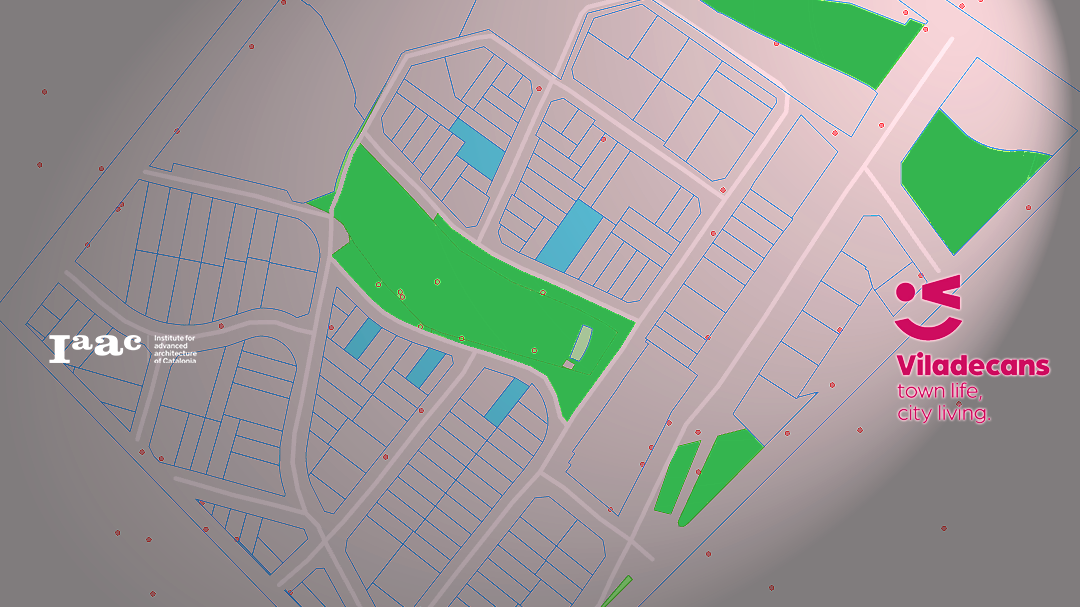
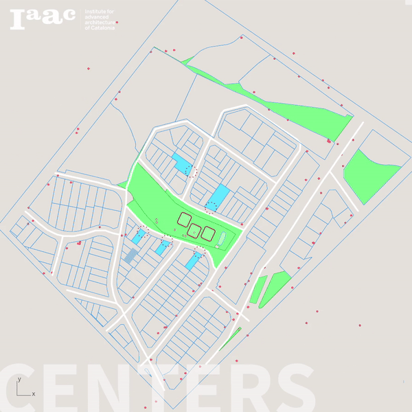
The objective of the project was to simulate the movement of people within a specific neighborhood in the city of Viladecans, Spain, and visualize the difference the movement patterns of the free agents would take prior to the intervention vs post intervention.
Why an Agent Simulation?
Agent-based simulation is effective in planning out potential urban interventions due to its ability to model complex systems and capture emergent behavior. Here’s why:
- Granular Representation:
- Agent-based simulations model individual entities (agents) and their interactions within an environment. This granular representation allows for a detailed examination of various factors influencing urban dynamics, such as individual behaviors, preferences, and decision-making processes.
- Dynamic Feedback Loops:
- Agents in the simulation can interact with each other and their environment in dynamic ways, leading to feedback loops and emergent behavior. This allows planners to observe how interventions may propagate through the system and affect different aspects of urban life over time.
- Scenario Exploration:
- Agent-based simulations enable the exploration of different scenarios and interventions by adjusting parameters and rules governing agent behavior. Planners can simulate various policy options, infrastructure changes, or urban designs to assess their potential impacts on factors like traffic flow, land use patterns, or social dynamics.
- Spatial Considerations:
- Agents in the simulation can be spatially situated within a virtual representation of the urban environment. This allows planners to analyze spatial patterns, distribution of resources, accessibility, and the spatial diffusion of interventions across the city.
- Adaptability and Flexibility:
- Agent-based models can be adapted and refined as new data becomes available or as the planning process evolves. This flexibility allows planners to iteratively refine their understanding of urban systems and make informed decisions based on updated simulations.
- Risk Assessment and Uncertainty Management:
- Agent-based simulations facilitate the assessment of risks and uncertainties associated with urban interventions. Planners can explore different scenarios under various conditions to identify potential challenges, vulnerabilities, or unintended consequences before implementation.
- Participatory Planning and Stakeholder Engagement:
- Agent-based simulations can be used as tools for participatory planning, involving stakeholders in the decision-making process. By visualizing simulation outcomes and engaging stakeholders in scenario exploration, planners can foster dialogue, build consensus, and co-create more inclusive urban interventions.
Overall, agent-based simulation provides a powerful tool for planners to understand the complexities of urban systems, explore alternative futures, and design more resilient, sustainable, and people-centered interventions in cities.
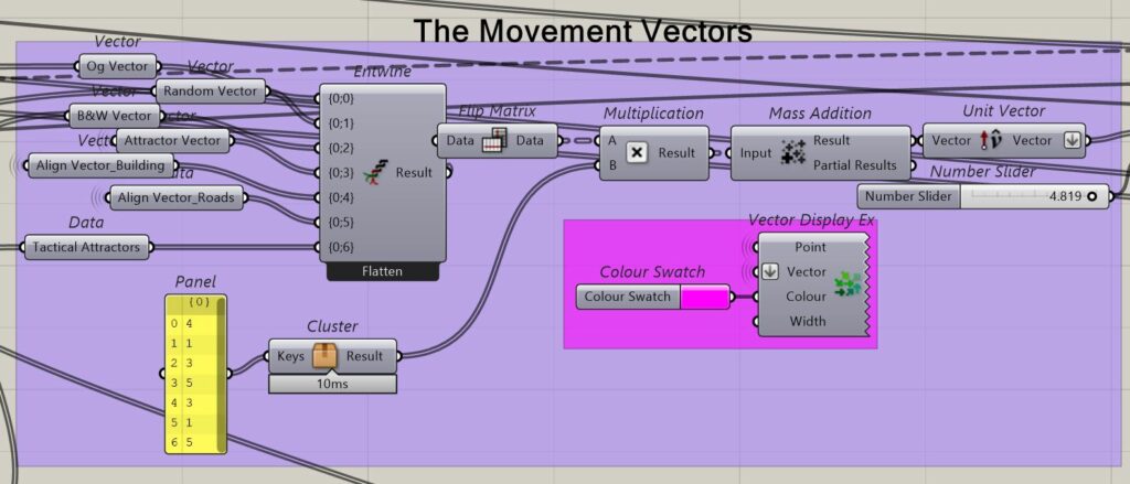
The Forces at play
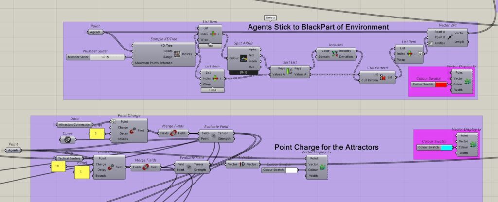
SETTING THE ENVIRONMENT
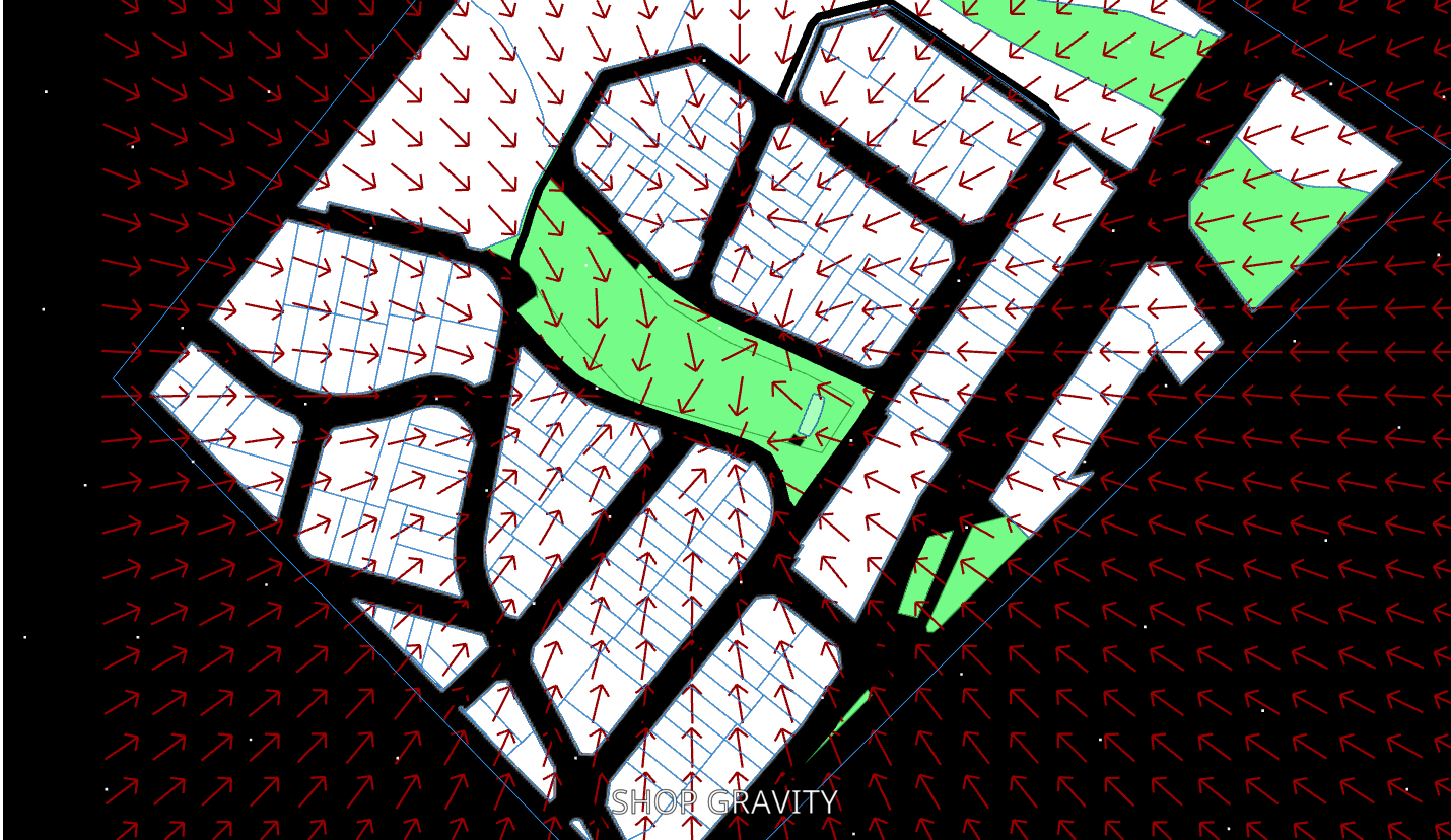
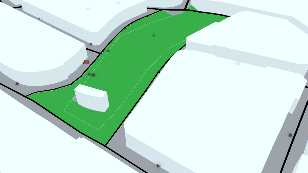
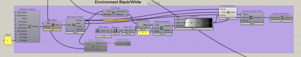
The Agents have to be assigned certain patterns of movement. This would entail a random X & Y vector movement. However prior to detailing more forces, it is imperative that that environment be set up in the right manner for the Agents to interact well with the set field of play. This would involve making sure that the agents stick only to the streets of your field of play. Thereby, we have a assigned a value for spaces within the buildings ‘0 for White’ & the spaces on the streets ”1 for Black.’ Through this logic we can assign values to all points on the map, and designate that our Agents must not get too close to ‘0’ (which would be White in this instance). This ensure that the Agents stick to the street.
Following which, the Vector field must be worked on, on the basis of the ‘Attractor Points’ on the map. In this instance, different shops/buildings along the central park in this neighborhood have been used as points of Attraction. One can notice the strength of this field as the vectors stop beyond a certain point on the map, indicating the reach of the pull. However, in the second instance, the Attraction of the Central Space wherein will house our Tactical Urban Intervention, has a stronger pull and larger reach, thereby enabling points in the surrounding neighborhoods to be more inclined to visit the neighborhood that holds the Tactical Centre.
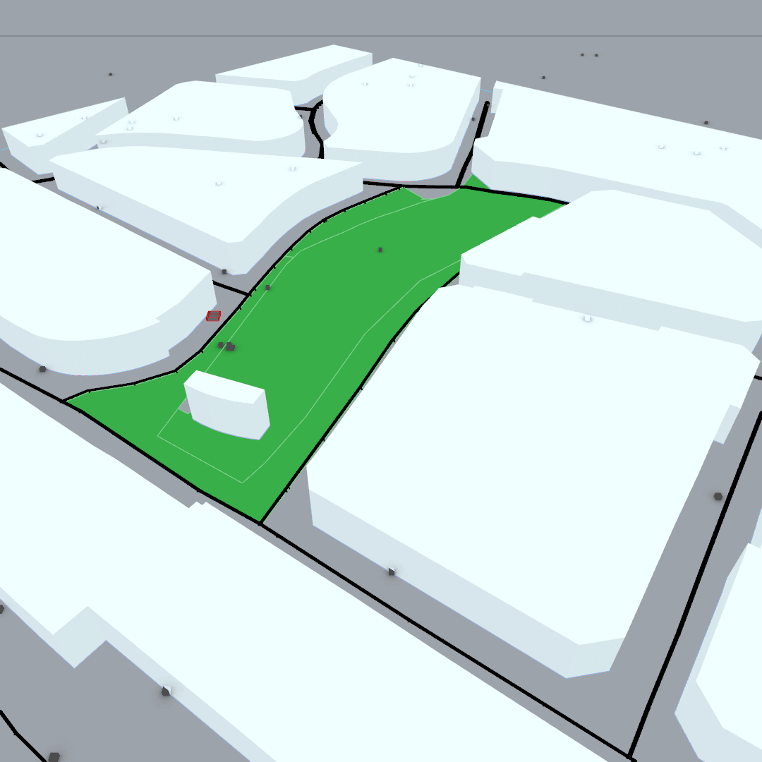
The Simulation in Action
The Simulation in action shows how people even from other neighborhoods visit and this increased footfall shows in the fact that local shops also have an increased flow of people into their shops. This thereby proves that there will be more revenue into business after the implementation of the Tactical Centers as compared to before.
Challenges faced
- the agents seems to group up and get stuck in some corners
- sometimes enter the buildings
