
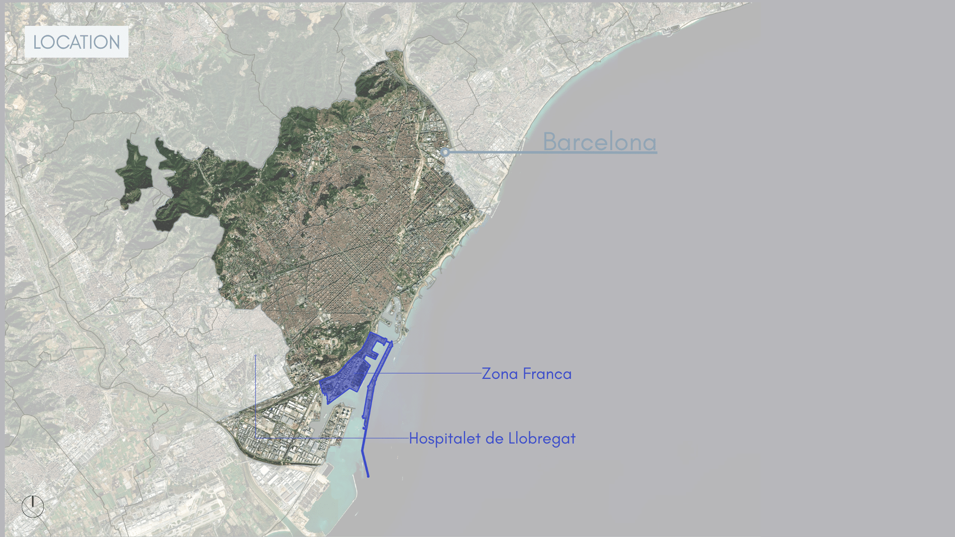
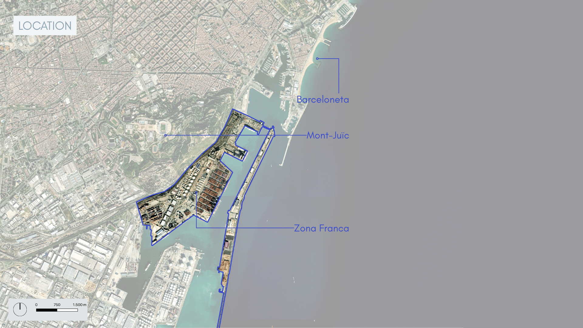
Barcelona is a city that faces many physical limitations to it’s expansion as a metropolis-the mountains contain development within them and the sea borders its other side. For the past 15 years, it has been struggling with an immense wave of tourism that has displaced locals from affordable housing in popular areas and historic neighborhoods have been taken over by the tourism industry. This project looks at how this issue could possibly be remediated by converting the large container port area into a new neighborhood for locals.The new neighborhood-Ciuitat Nova Franca-is the opportunity for a fresh chapter for Barcelona’s waterfront, evolving beyond its industrial past to create a dynamic residential neighborhood where walkability, cycling, and everyday life along the water take center stage-for locals.
Analysis
To understand the site we took two approaches; we did a self-guided site visit and did a comprehensive transit-asset mapping assessment utilizing open source data from OSM, Ajuntement Barcelona, and AMB transit authority.
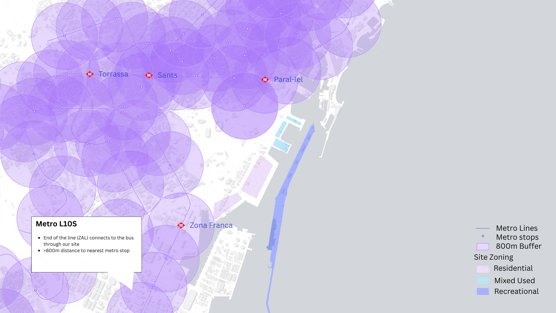
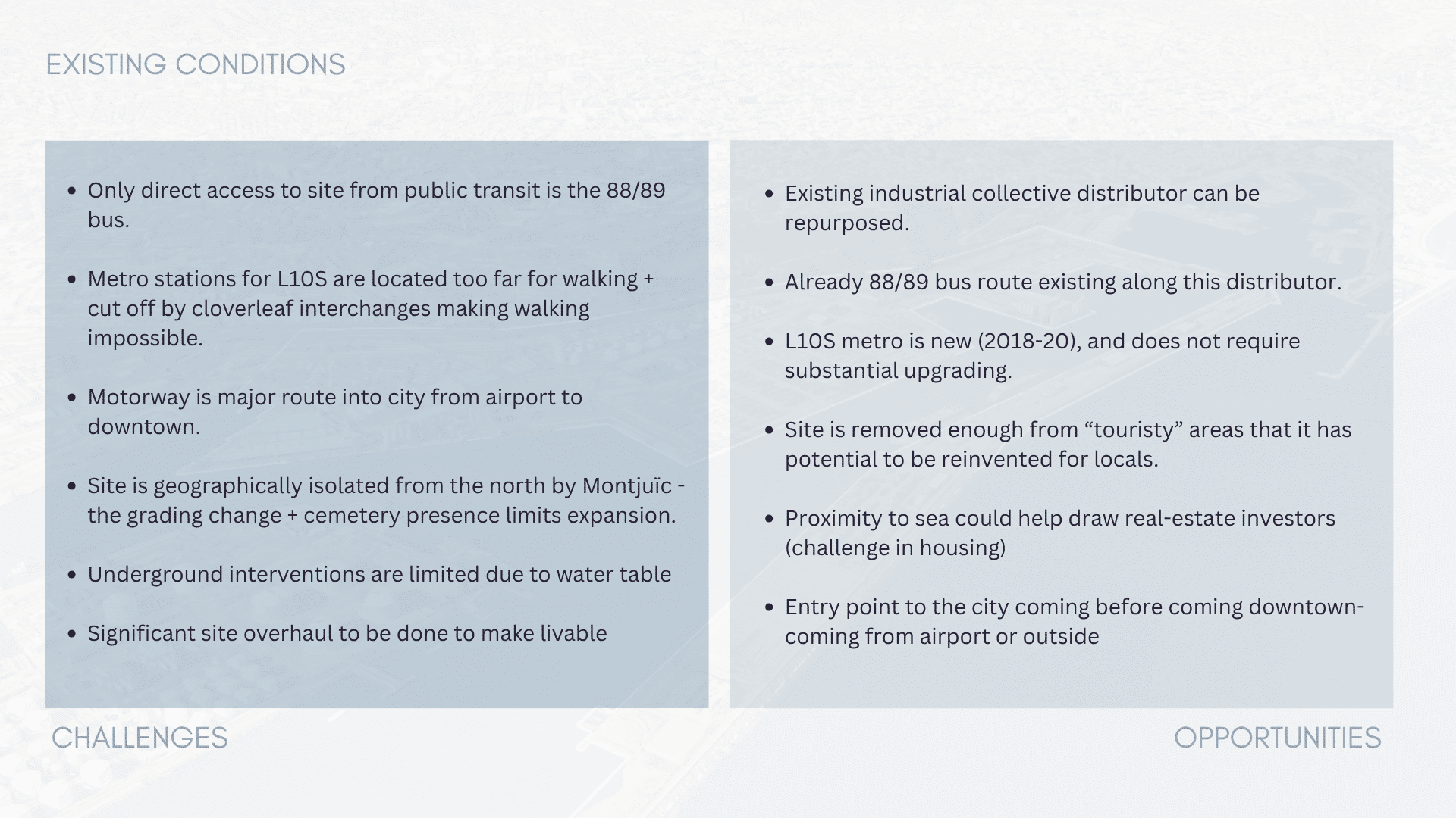
As this is almost exclusively industrial zones, walking around the site was not permitted-our workaround was to take the available public transit lines throughout to get better views and understand what the existing modes of connectivity were like. We started by taking the closest metro line to the site, the L10Sud line-finished in 2020, it connects from Torrassa-Sants to the industrial zone. We planned to get off the Zona Franca stop and transfer to the 88/89 buses that go through the cargo-freight zones-the bus stop was right across the street from the metro stop. However, once exiting the metro, what we found was a tangle of busy motorways made getting across the street to the bus stop a 90-minute journey. To catch the bus, we ended up having to go to the end of the metro line to the ZAL-Rui Vell stop to then walk 10 minutes to catch the bus. From there the bus made its way to Drassanes and Paral-lel, two major metro transfer hubs, weaving through a series of roundabout turns through a smaller distributing road only used by those working in the industrial areas. These site observations displayed the difficulty of accessing transit in this area, but also the existing connections to several major metro hubs.
These observations were further clarified by remote mapping of the transit in the area. The metro stops were all more than 800 meters away, not feasibly walkable for users in the area. Existing bus stops were frequent, but are only serviced every 10-20-minutes at peak use times and 30-60 minutes at off-peak; sufficient for its current industrial-worker use but would require reevaluation for a land-use change. Active transit like biking is cut-off from the rest of the city, making its way partially into a port area but then hitting a dead-end. Overall, the compounded existing transit map shows an area only currently serviced by bus, and lacking connectivity with other multi-modal transit.
Challenges & Opportunities
From our analysis we can better understand the area’s unique placement in the city:
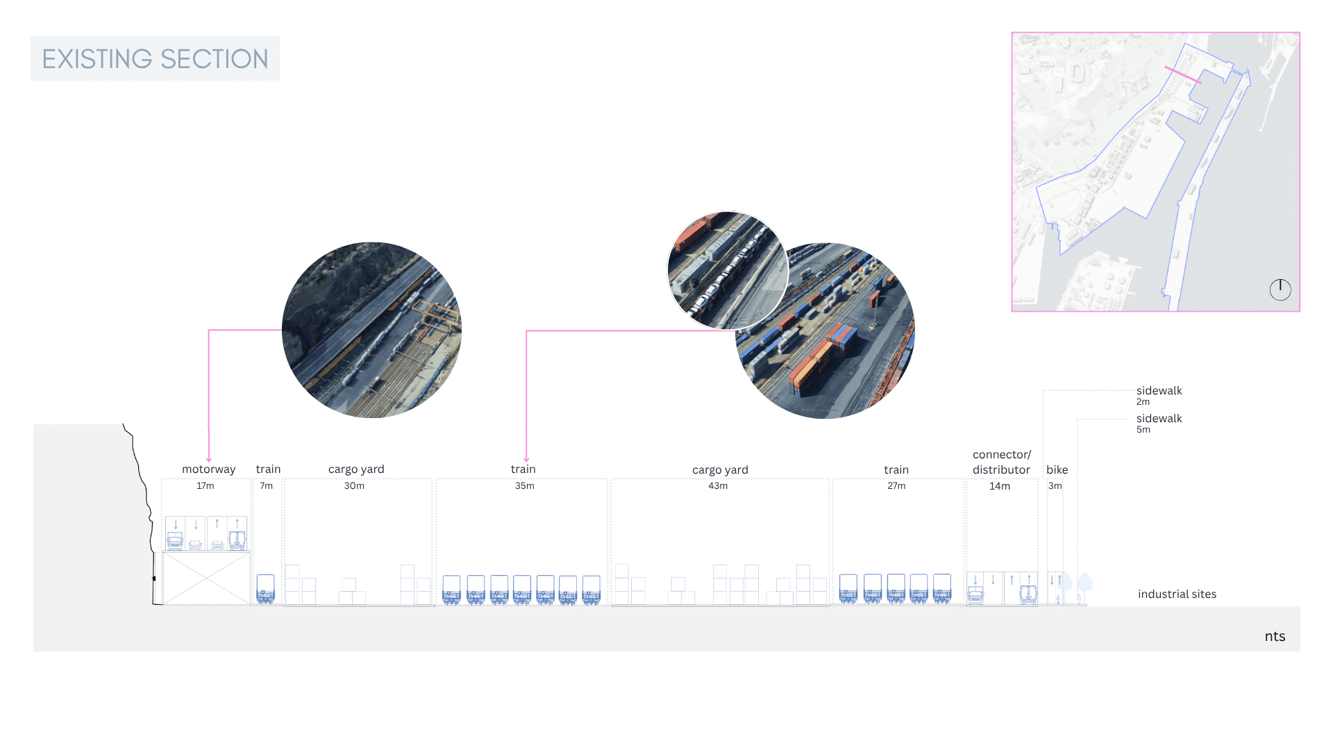
- It sits along the major raised motorway (B-10) that wraps its way around the entire perimeter of the city.
- It has 142 meters of major cargo rails running alongside the highway.
- Major transport infrastructure is contained by the shear front Montuiic
- Two entry points to the site are cloverleaf interchanges or major traffic circles.
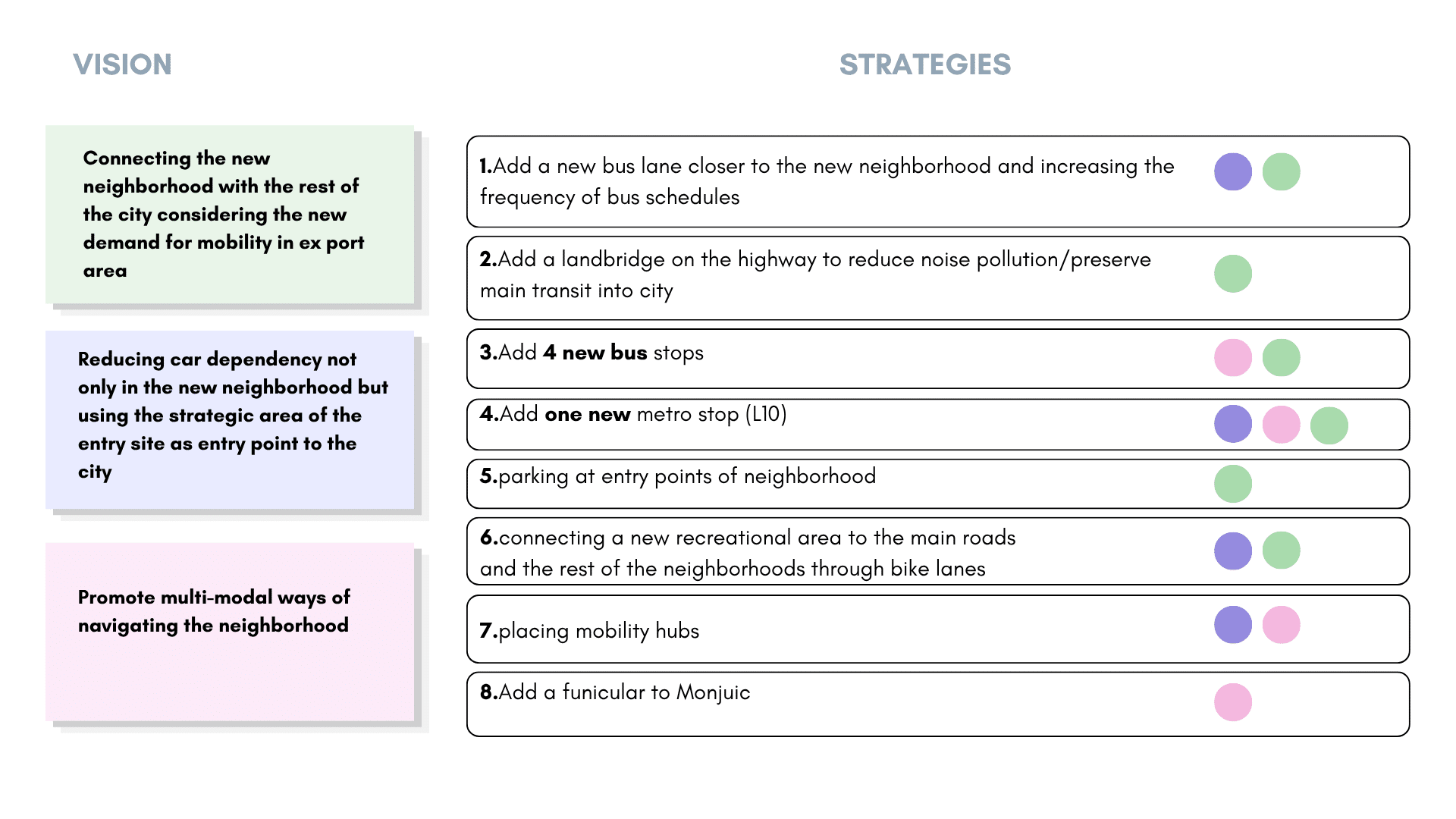
Vision & Strategies
To create the newly residential Ciutat Nova Franca we are proposing three main vision to guide the following strategies to create connectivity and promote active mobility in the area:
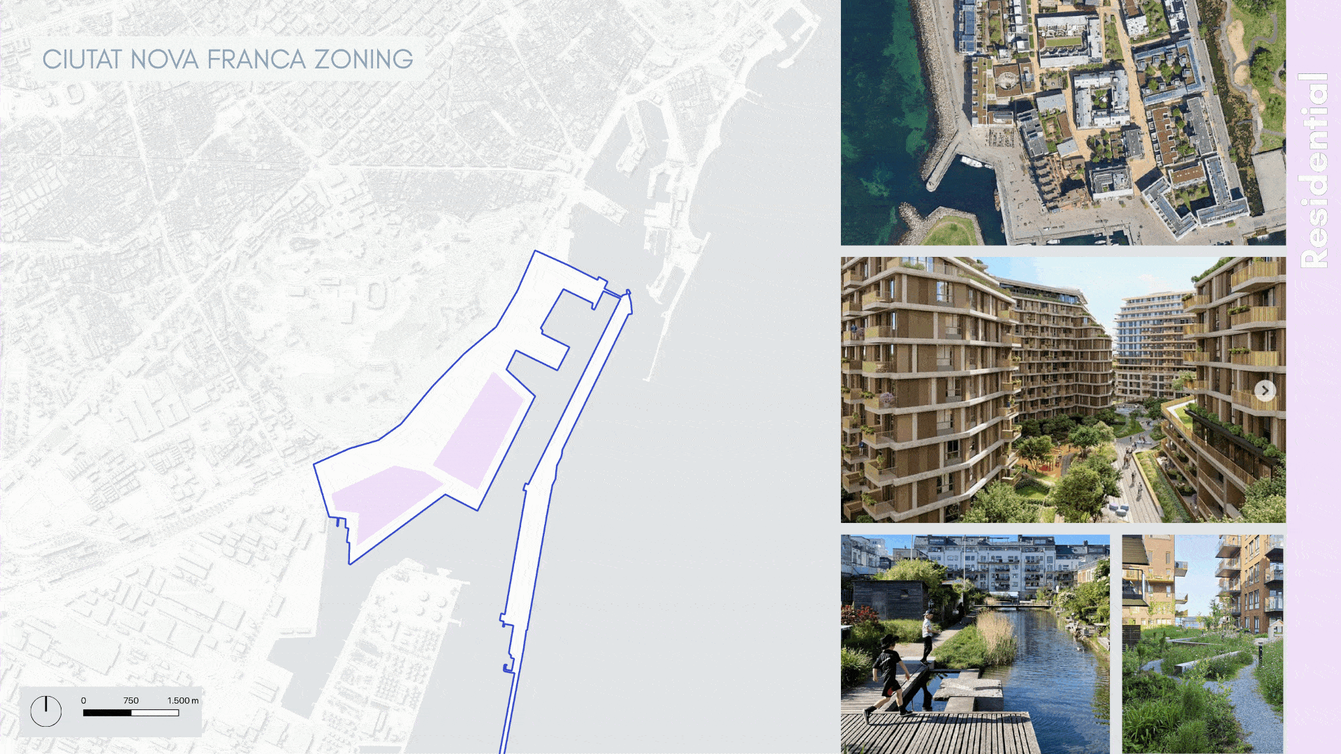
Site zoning
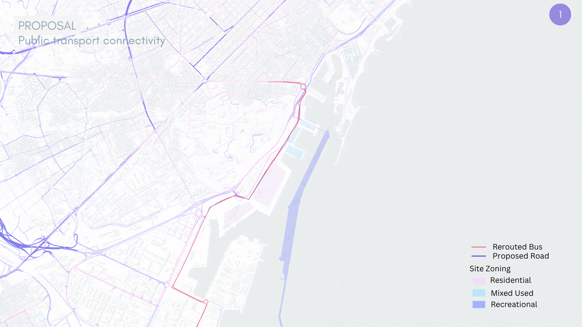
Proposal
Major notable strategies from this plan are:
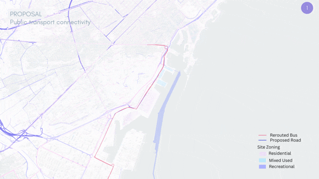
- The addition of bus-only express and local lanes, promoting efficient transit times for users, this comes with new additional stops and increased bus frequency to increase use.
- Adding a new metro stop “Ciutat Nova Franca” along the L10S at the junction where the existing 88/89 buses intersect at the cloverleaf interchange to avoid having to navigate that area, pushing users further into the industrial zone serviced by L10S.
- Bus connectivity to remain with Paral-lel(L2, L3, funicular) and Drassanes (L2) metro lines and new link with L10S Ciutat Nova Franca stop.
- Creating a mobility hub at the two entry points to the site that provide access to car parking with EV charging, car-sharing, bicycling sharing/renting, bike storage/docking stations, funicular access to the top of Montjuic.
- Extending the bike lane to connect on both sides of Montjuic, creating a continuous pedestrian and biking infrastructure to encourage active movement.
- Adding a pedestrian bridge at the far end of the site to connect the new linear recreational island back with the main site.
- If neighborhood develops to house a large population requiring increased transit options and connection, proposal of lowering the B10 highway to grade and adding a tram line connecting Drassanes (L2) with Ciutat Nova Franca (L10S)-a landbridge covering strategic areas of B10 to reduce noise pollution/preserve main transit into city.
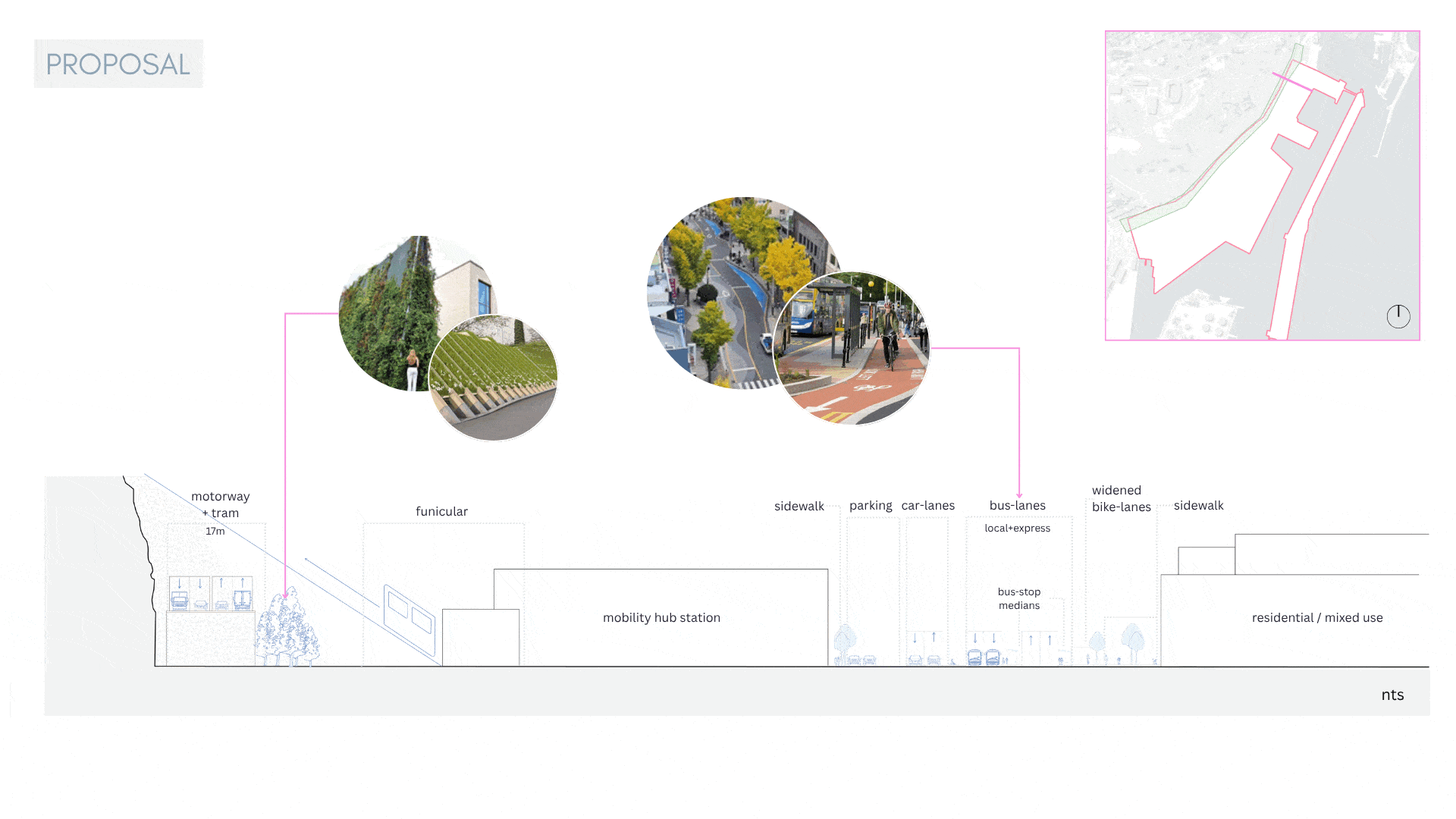
This section shows the repurposed cargo rail area as being used for dedicated-car lanes and a future mobility hub as described above. Bus only lanes sit to the inside near expanded bike lanes and sidewalk areas. Being near the sea, the new development is planned to be set-back to provide views and people-centric walking/relaxing spaces along the perimeter with access to shops/restaurants/ etc. The outer cruise ship docking island will be transformed into a linear biking/walking path out to the light-house, with the pedestrian bridge connecting to the residential area. Housing will be set back from the waterfront as in the mixed use area, with shared courtyards connecting back to the main distributing road for emergency access only.
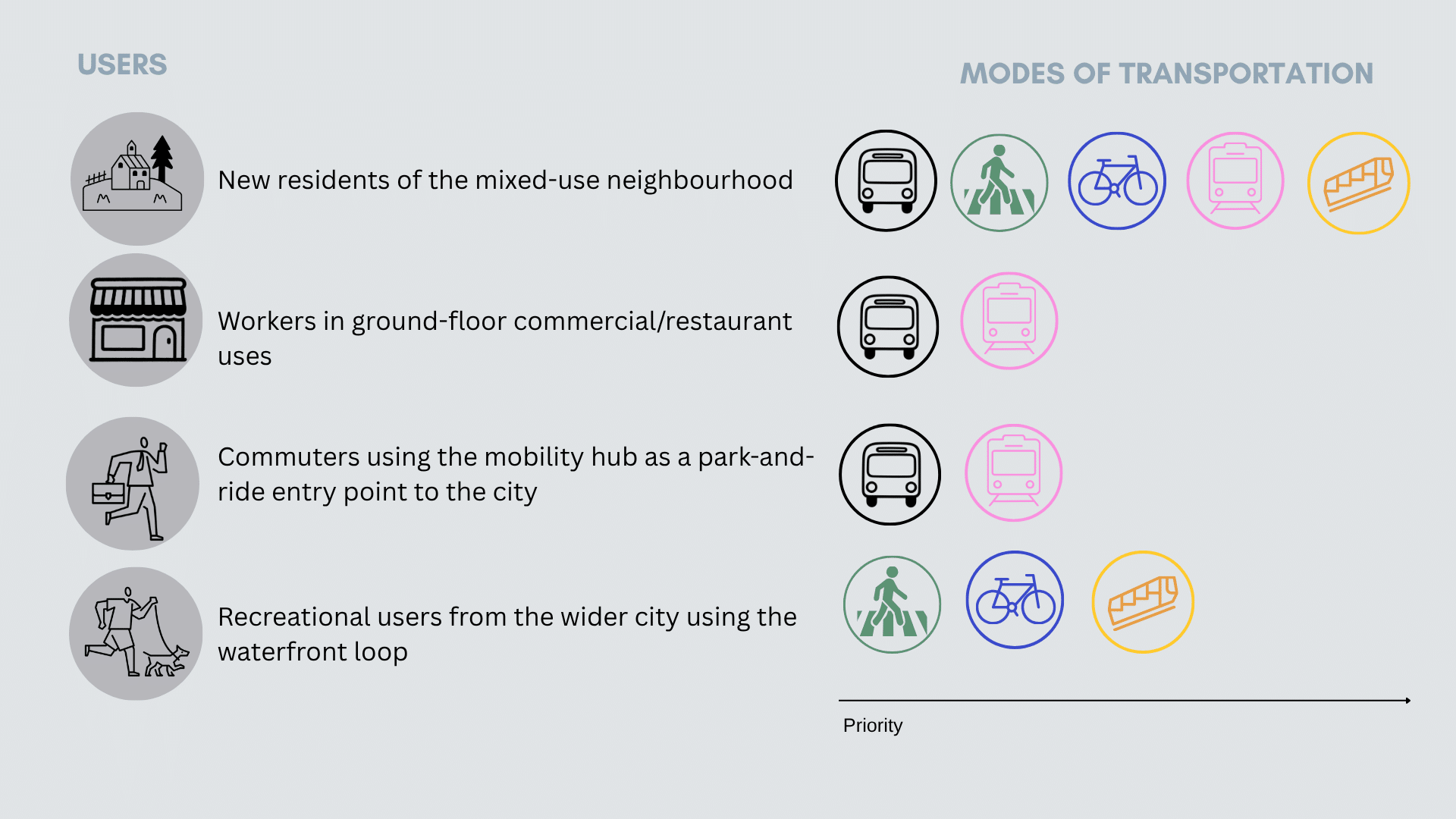
Users
The extensive rehabilitation of the area and coordination of improved connectivity of the site requires engagement governmental stakeholders like the TMB (Transport Metropolitans Barcelona) to small micro-mobility providers like BOLT and Smou to those already working in the area like the Port de Barcelona workers union. Developers and the Ajuntament of Barcelona will need to have a close partnership and understanding of the complexities developing this area.
The potential for a new neighborhood, that sits alongside the water, offers an opportunity for Barcelona to reimagine what neighborhoods geared towards locals could look like. With active transit modes and bus navigation, our proposal creates an area that those familiar with the city can easily access but does not invite tourism en-masse.
