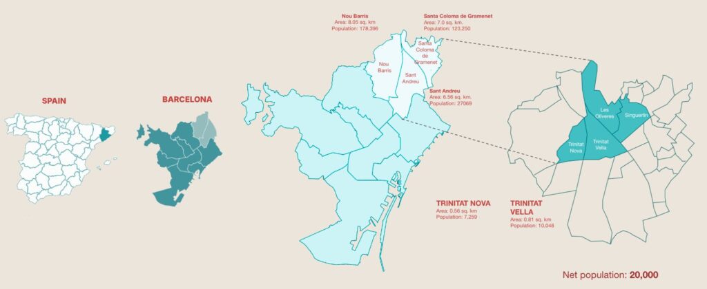
Trinitat Nova, Trinitat Vella and La Trinitat are three neighbourhoods in Barcelona separated by 600 metres and divided by decades of infrastructure built for the city rather than for the people who live in it.** Ronda de Dalt — a six-lane open-cut highway — severs ecological continuity, buries the 10th-century Rec Comtal waterway beneath concrete, and makes a journey that should take four minutes take thirty-five for the 31% of residents over the age of 65. Avinguda Meridiana adds eleven lanes of traffic and double the legal NO₂ limits. Between them, the two barriers have split two communities that are geographically proximate into separate urban lives.This project — developed as part of the C40 Reinventing Cities competition at IAAC — set out to locate where fragmentation is most severe, identify where intervention would have the highest spatial leverage, and propose design strategies grounded in what the analysis demanded rather than what the designers preferred.
What made this analysis methodologically distinctive was the relationship between primary and secondary data.** Rather than using interviews to illustrate findings after the analysis was complete, the team conducted ten resident interviews across all three neighbourhoods first — with participants ranging from 26 to 63 years old, across six countries of origin, with tenures from one to thirty-one years. Five spatial hypotheses were extracted from those interviews and used to direct the secondary data collection. In four out of five cases the data confirmed what residents told us. In the fifth — the finding that a mosque in Vella functions as the primary social hub for the Pakistani community, combining prayer, groceries and social life in a space absent from all municipal civic datasets — the residents corrected the data. The mosque was added to the civic infrastructure layer before scoring. A layer was changed because of what a resident said.