Understanding Surface Water Dynamics : Analysing Besos River Runoff, Accumulation, and Water Levels. The Besos River, flowing through Catalonia, Spain, is a significant water body supporting both ecosystems and human activities. Its hydrology plays a pivotal role in the regional environment and socioeconomic landscape. The dynamics of surface water runoff, accumulation, and water levels in the Besos River are subjects of keen interest and analysis for various reasons.
The Besos River in Catalonia, Spain, is intimately linked to the region’s land morphology, influencing its water dynamics significantly. The topography, including mountains, valleys, and plains, shapes the river’s flow, runoff, and accumulation patterns. Steep gradients expedite runoff, while flatter areas foster water accumulation, creating diverse ecosystems like wetlands. The river’s meandering course reflects its interaction with the surrounding landscape, while water levels respond to the topographic features. Understanding these dynamics aids environmental conservation, urban planning, and sustainable resource management along the Besos River.
The CUBE : The concept is to consolidate diverse data sets or information into a unified and visually comprehensive representation encapsulated within an infographic cube. This three-dimensional visualization method aims to present multifaceted information from various angles or facets, providing a singular and easily understandable perspective.

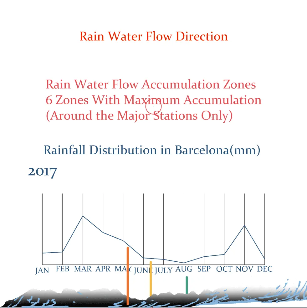
XZ Plane (Right) : Creating a comparative graph displaying the water levels at the three primary water stations of Besos River for each month from 2017 to 2022 allows for a direct comparison. This visual representation offers a clear understanding of how the water levels fluctuate over time across these stations. By observing and comparing these trends, it becomes easier to assess the respective capacities of these stations to handle water flow and manage water resources effectively along the Besos River.

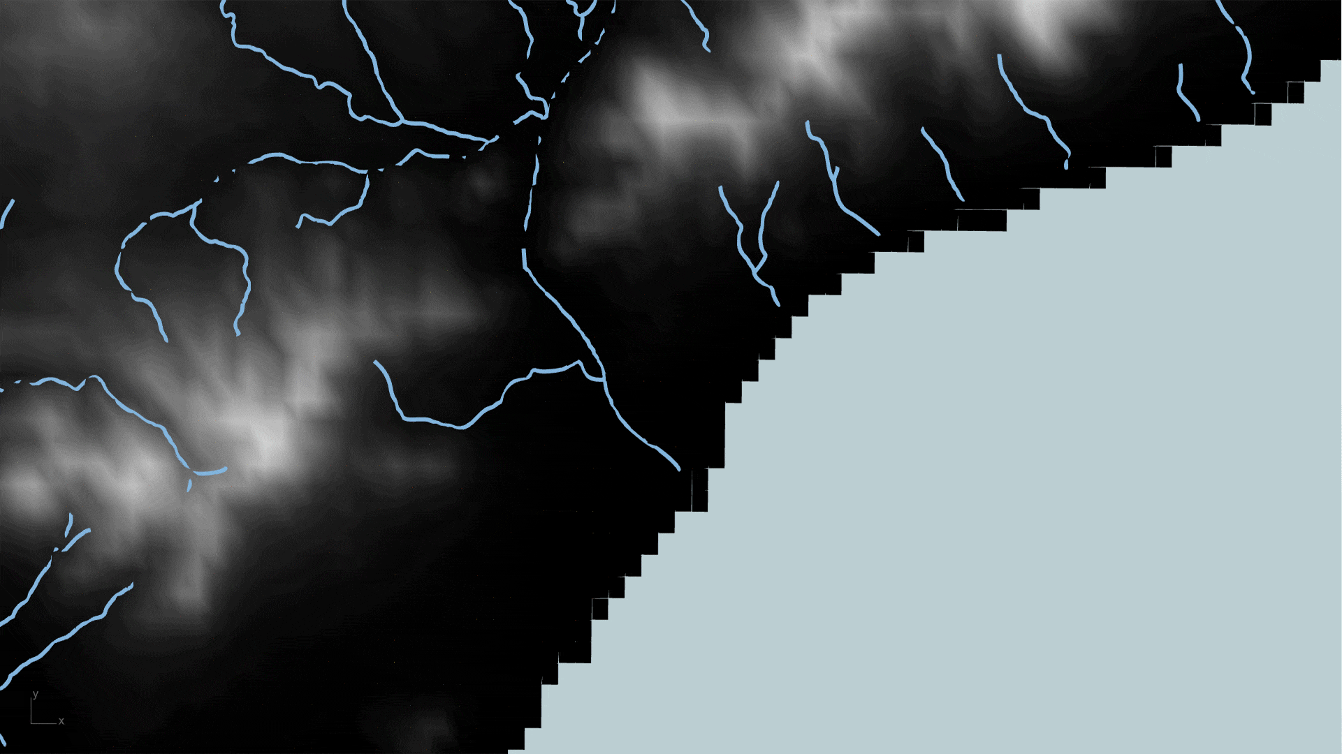
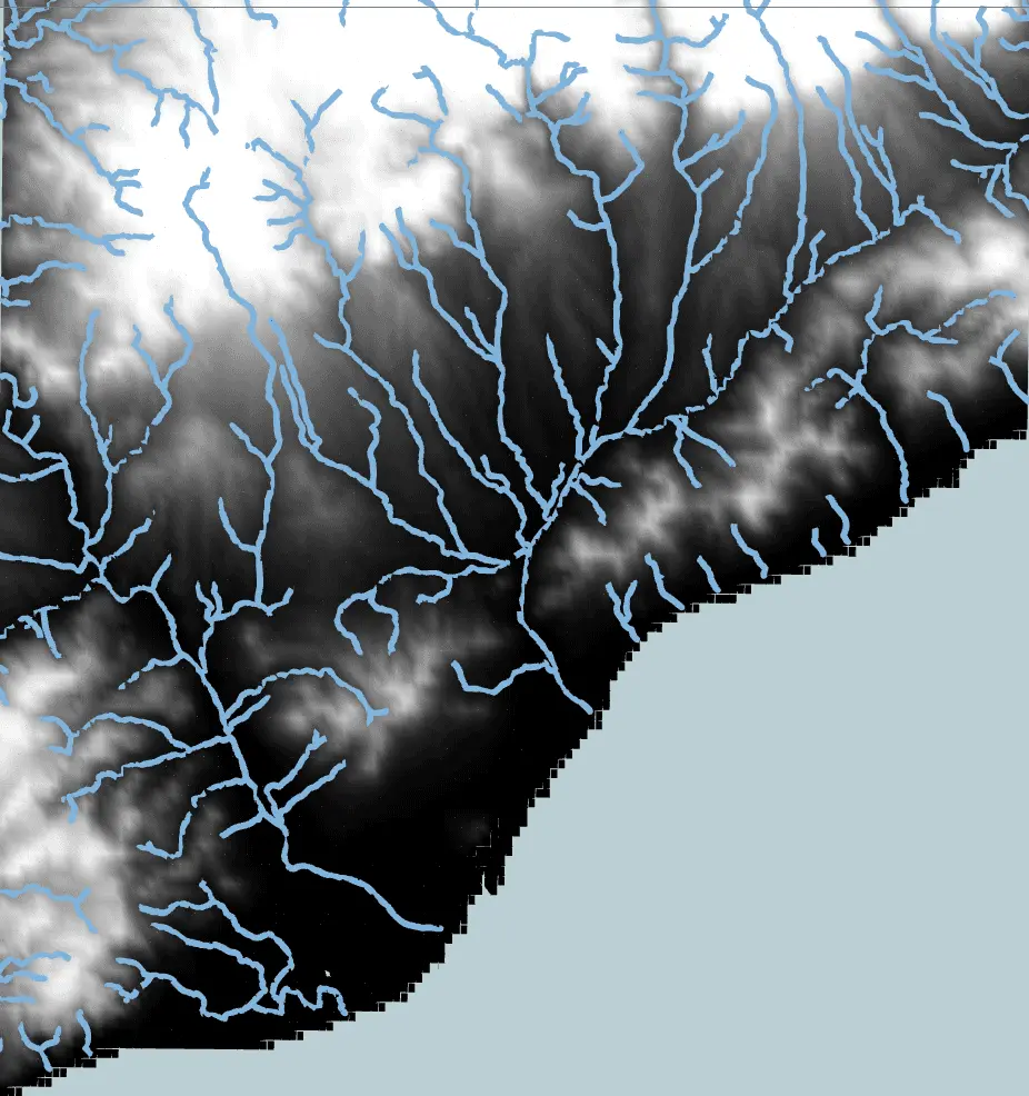
YZ Plane (Left) : Visualizing a graph displaying the monthly rainfall distribution in Barcelona from 2017 to 2022 provides a clearer depiction of how rainfall fluctuates over time. Understanding these fluctuations aids in comprehending the variations in water levels at different monitoring stations. Additionally, identifying major flow accumulation zones on maps, along with the flow direction, assists in grasping the areas where water collects the most and how these areas contribute to the river’s drainage system. This information sheds light on the catchment areas of the land and helps locate where water drains into the river, providing insights into the overall hydrological dynamics of the region.
Base : The landscape features like mountains, valleys, and plains play a crucial role in understanding how rivers behave. The way rivers flow and collect water directly affects the shape of the land. Visual representations, like flow accumulation circles on a map, are drawn in proportion to show where water gathers more, offering insights into how the terrain and rivers interact.
Source and Software’s :