Abstract
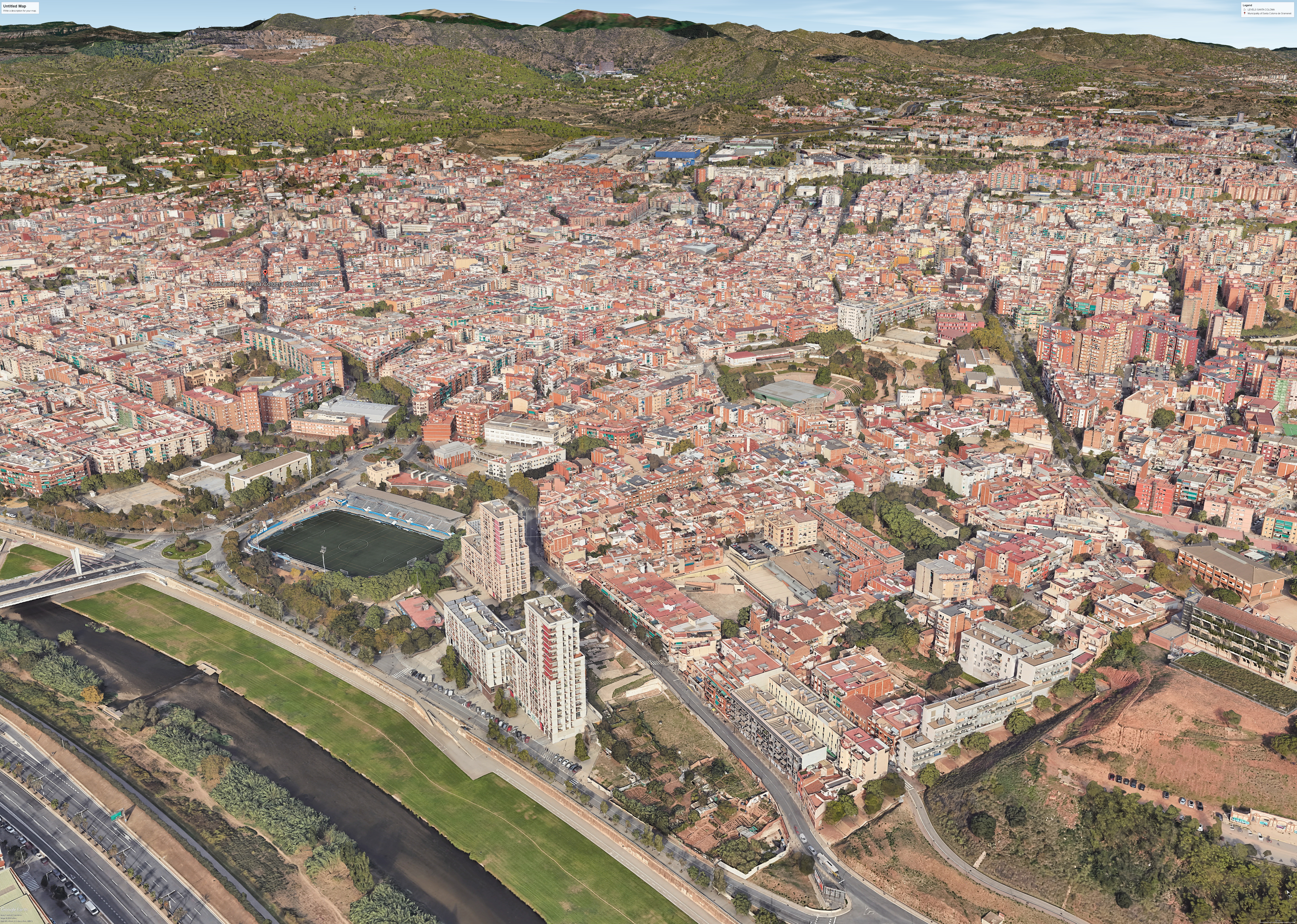
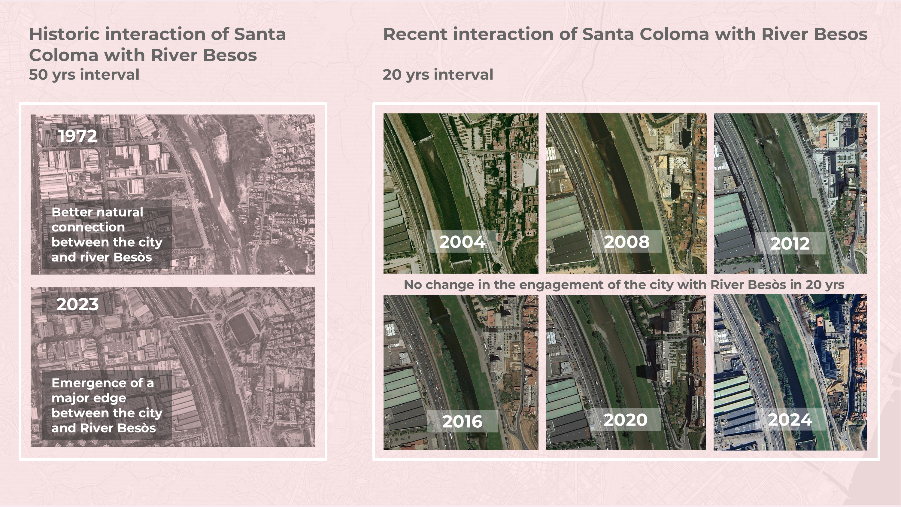
Flows 4 Santa Coloma is a project in the city of Santa Coloma, taking into consideration the Pla Pinta Verde proposed by the municipality of Santa Coloma. The project aims are aligned with the aims of the Pla Pinta Verde of connecting the existing green spaces to bridge the gap created because of the main road adjacent to the Besos River Parc that breaks the city’s green corridors. Fundamentally the project aims to use wayfinding as a driver to connect all open public and green spaces of the city, right from the Sierra de Marina mountain all the way down to the Besos River Parc. The lack in the sense of community in the site in focus, becomes an opportunity to re-establish the sense of identity for the people of Santa Coloma through Flows 4 Santa Coloma.
Methodology: Inception to Implementation
Introduction to Santa Coloma
Situating Santa Coloma in the metropolitan context
Importance of the project in the context of the Urban Agenda

People of Santa Coloma and what they perceive

Analysis of Santa Coloma
Site Description, Key Challenges and Assets
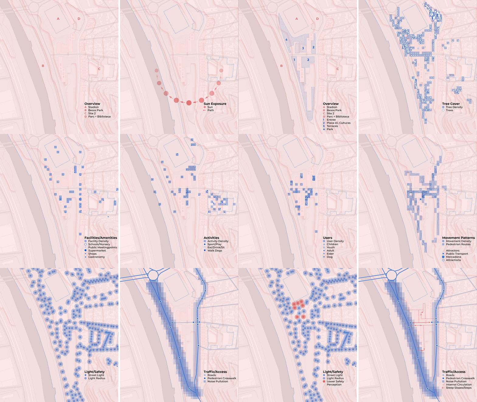
The area centers around key attractors like Mercadona, nearby green spaces, and public transport hubs, drawing diverse groups and creating vibrant activity. Valued for recreational and retail offerings, it has a high concentration of dining options in the east, though limited non-commercial meeting spaces pose challenges.
Unshaded areas experience problematic sun exposure at noon, while terraces offer popular sunset spots. Parks provide access to green areas, but surface sealing restricts permeability beyond tree grates and park zones. Despite generally good lighting, darker, sparsely used areas contribute to insecurity.
Enclosed by major transport connections, river access is limited, with high traffic on bordering roads leading to noise, pollution, and hazards. Internal movement feels “unjust,” with steep slopes and stairs adding to accessibility issues.
Flows 4 Santa Coloma: Conceptual Design
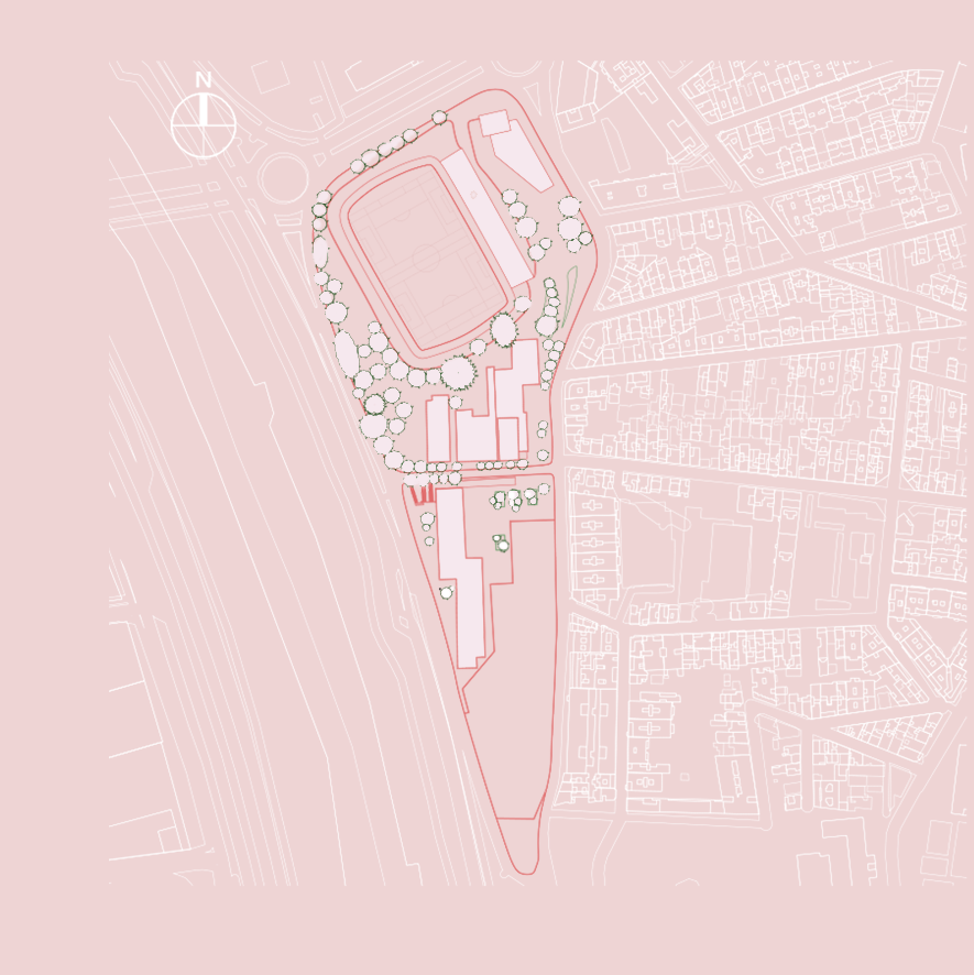
Existing masterplan
When we visited the site, we walked around it and one of the most important observation that we came up with was that this site had many different areas. This could be because of the height difference, the environmental conditions and the stakeholders that were occupying each space. Therefore, we were certain that this is something that we would like to improve and make a more cohesive design and connect the site to the river.
Developing our Masterplan
The development of the site started by taking the main axis, which is based on our research and observations regarding the existing human movement around the site. Then we started taking secondary paths, expanding on different parts of the site. The collective path that was created helped us to map out different areas that are visualised on the gif below.
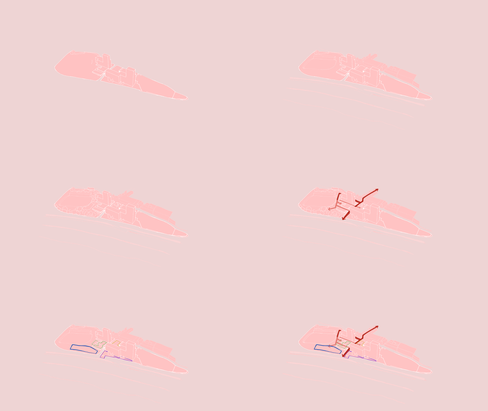
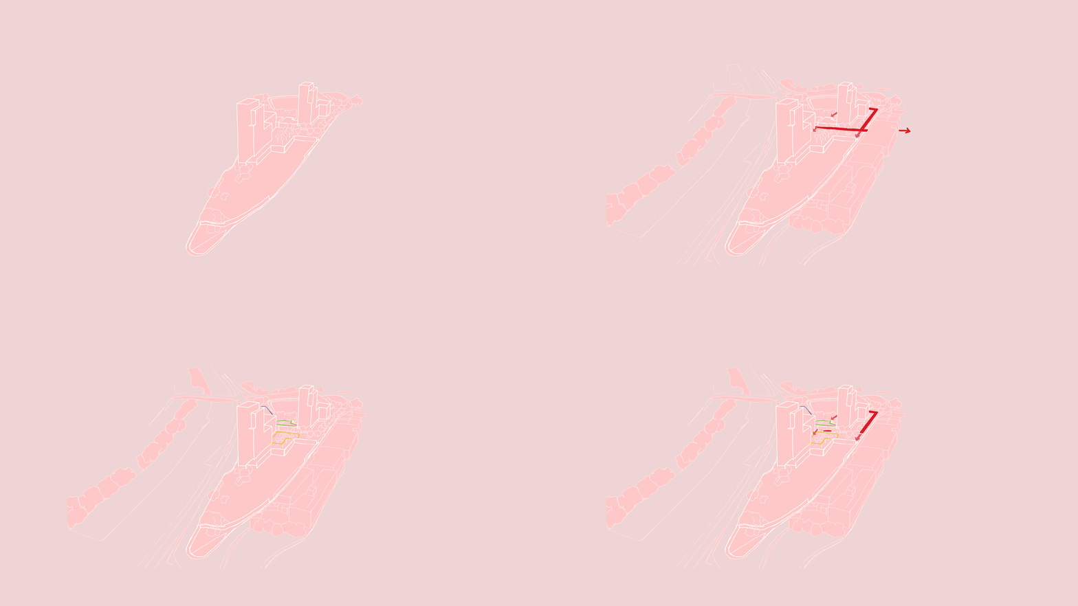
Our proposed conceptual masterplan vs the existing one
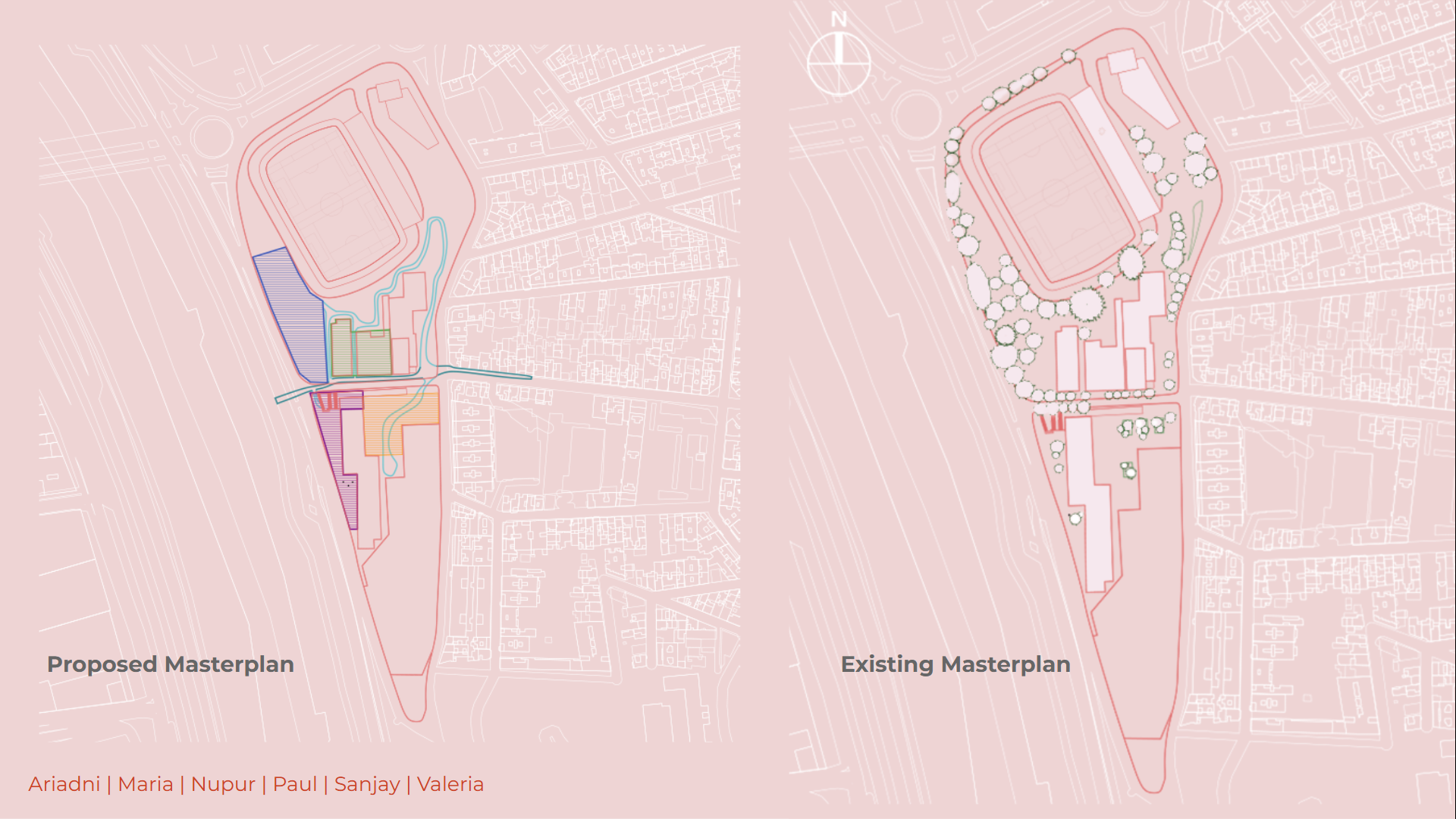
Identifying the different blocks/areas
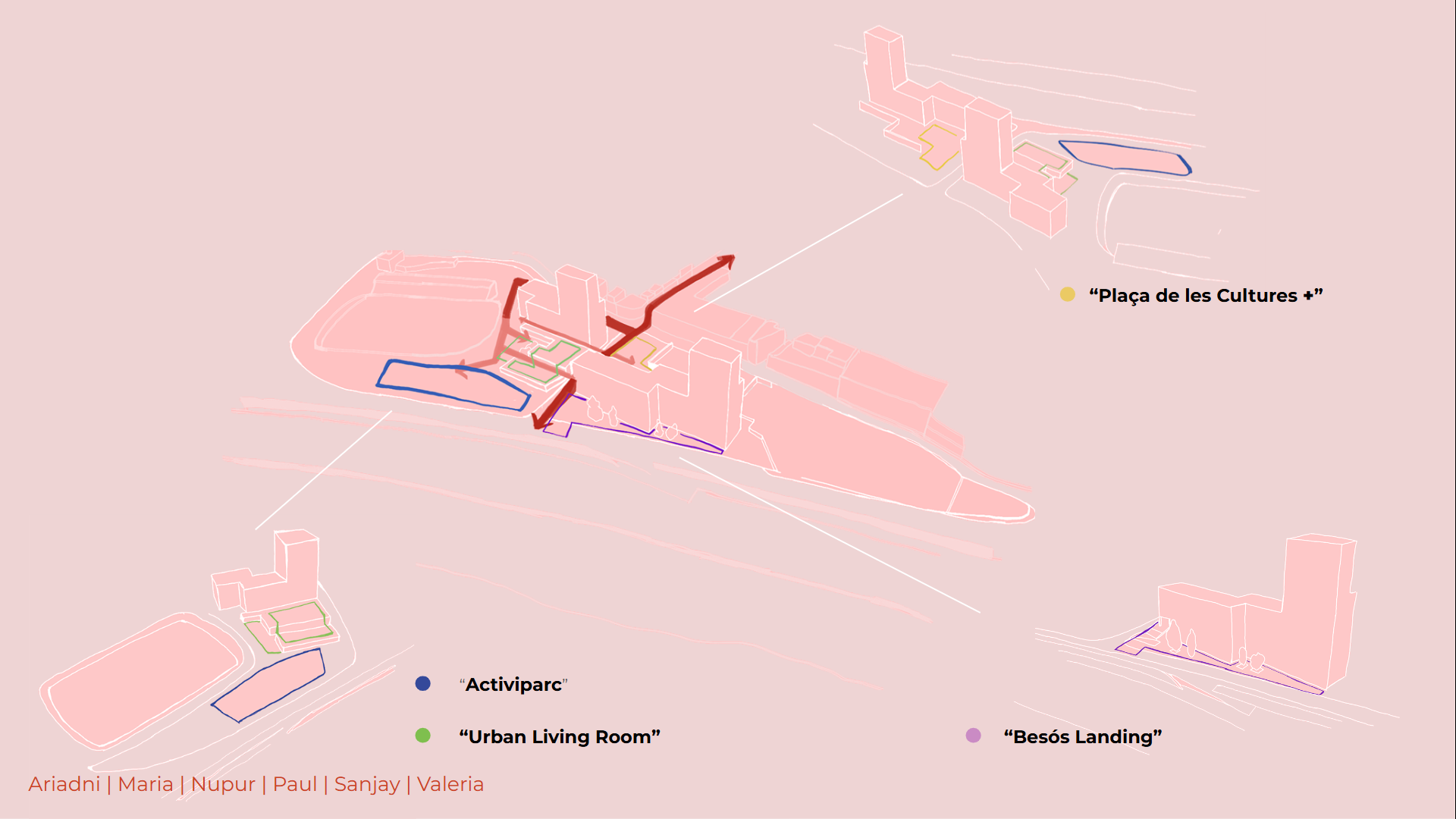
After mapping and positioning the different blocks, we started in developping their identity and characteristics. We firstly divided them into colors and then we named them in order to enhance their characteristics and purpose as seen on the diagram below
Flows 4 Santa Coloma: Detail Design
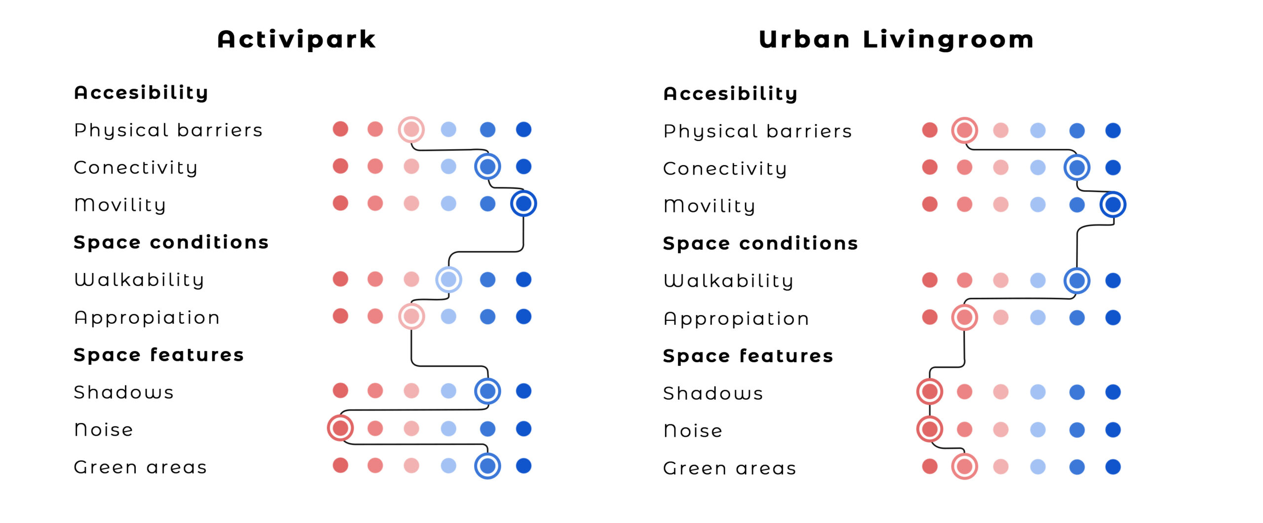
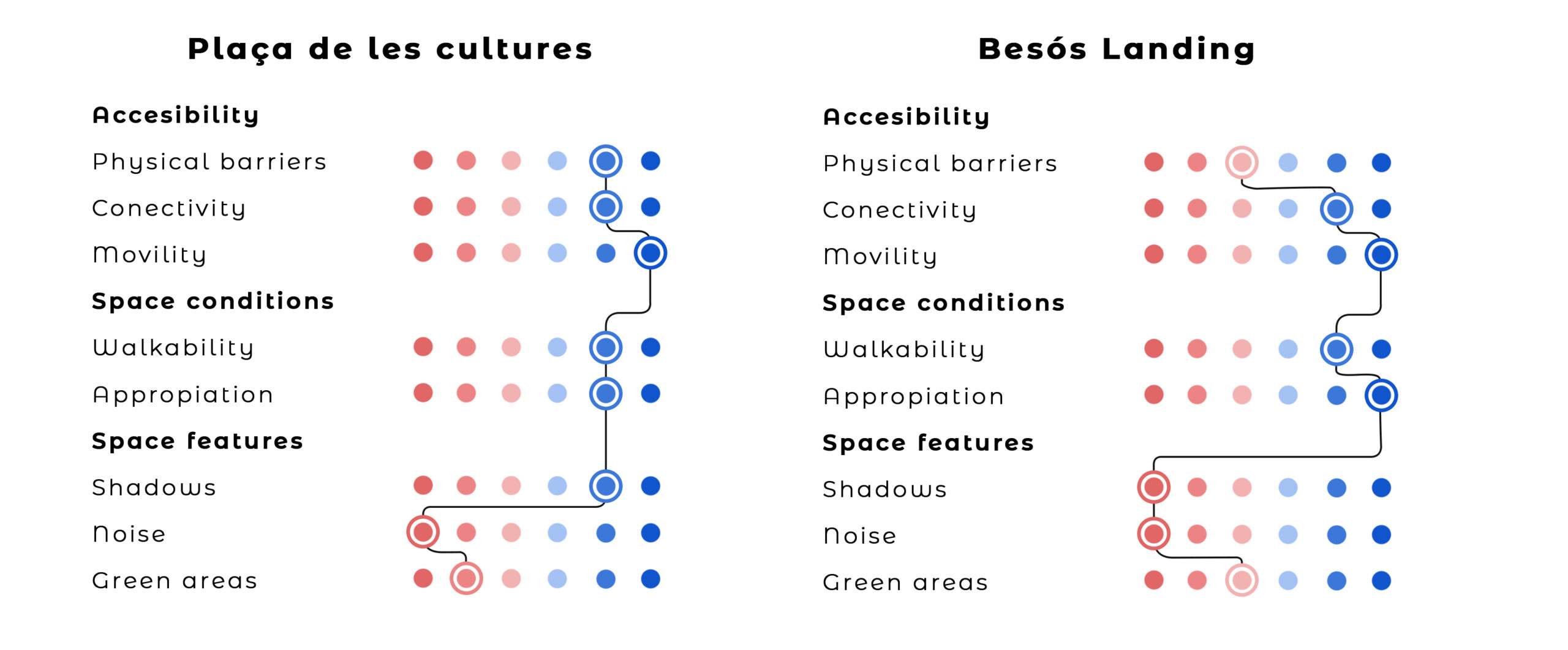
The four sites described above, were analyzed by using spatial indicators. Regarding accessibility it’s analyzed: physical barriers, connections and transport supply options. In terms of use, it observed activities but rather the amount of people use it. Finally, based on the quality of the space it take into account the climate protection, noise and amount of green areas. For classified them into a quantity way, we assigned a color for each of the categories: being pink the worst condition and blue the best.
Plaça de les cultures
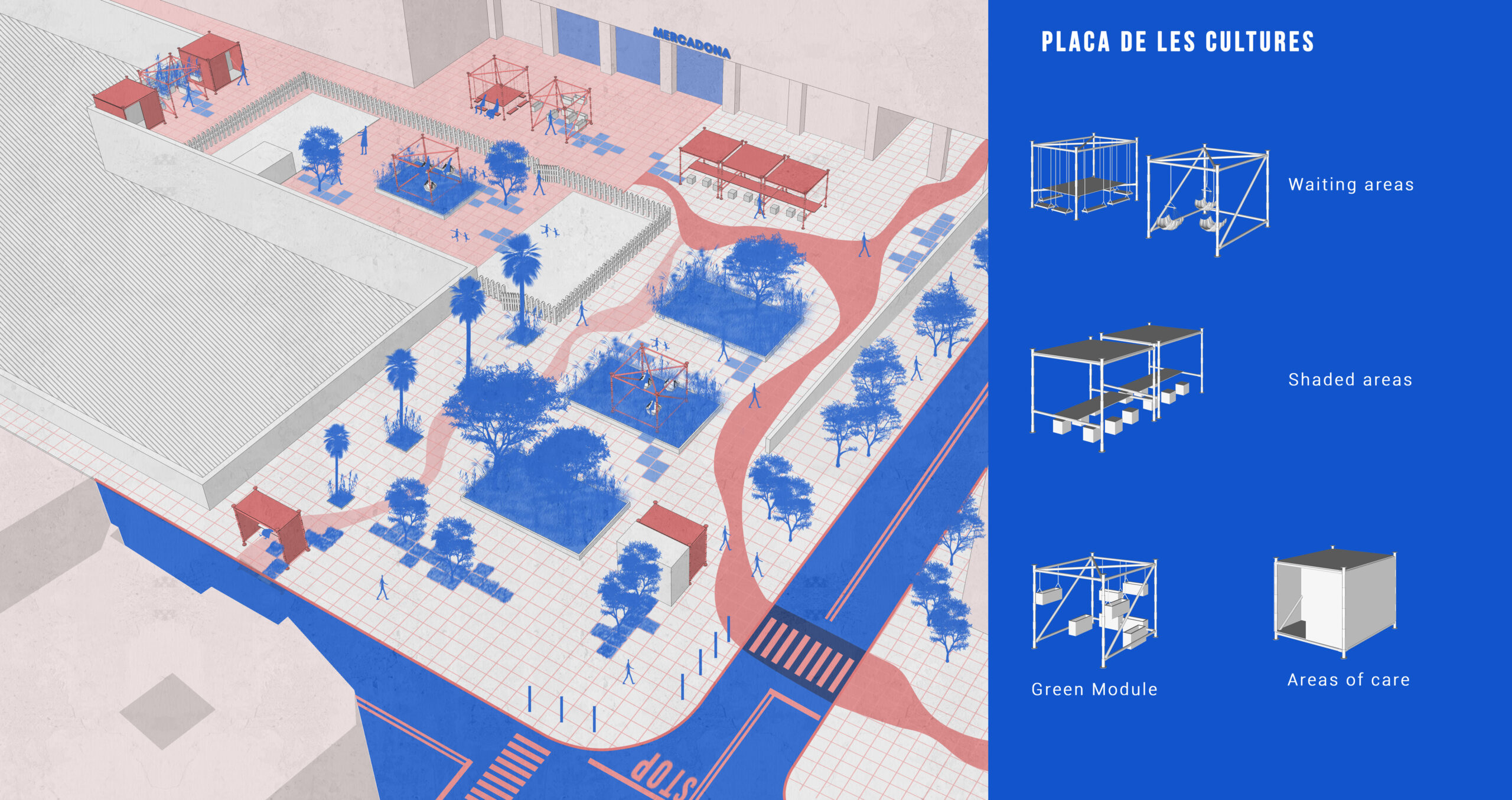
Based on the analysis of each site and taking into account our own perceptions and those of the community, we laid the foundations of our vision for Santa Coloma. The main idea is to explore different types of care prototypes, which promote more inclusive and safe spaces. The activities proposed here are only a brief approximation, while the particularity of the activities will be discussed in the community.
In the visualisation above, the activities are planned to promote a safe place for the youngest and oldest members of the community.
Besós Landing
The site is configured as a large meeting point. While maintaining the same premise of these care prototypes, this area is also constituted as the great gateway to the neighborhood and as a connector with the Besós River Park.
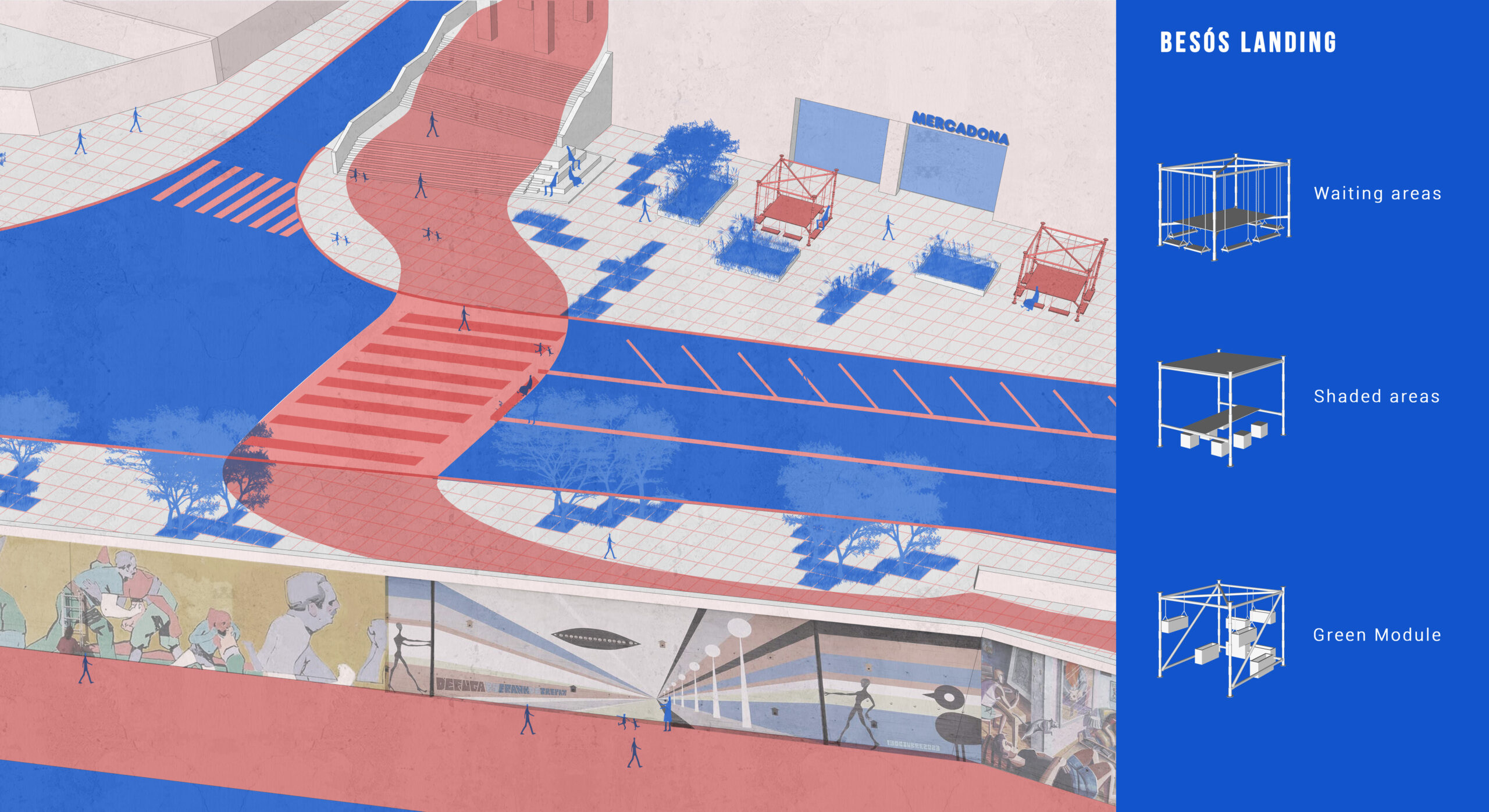
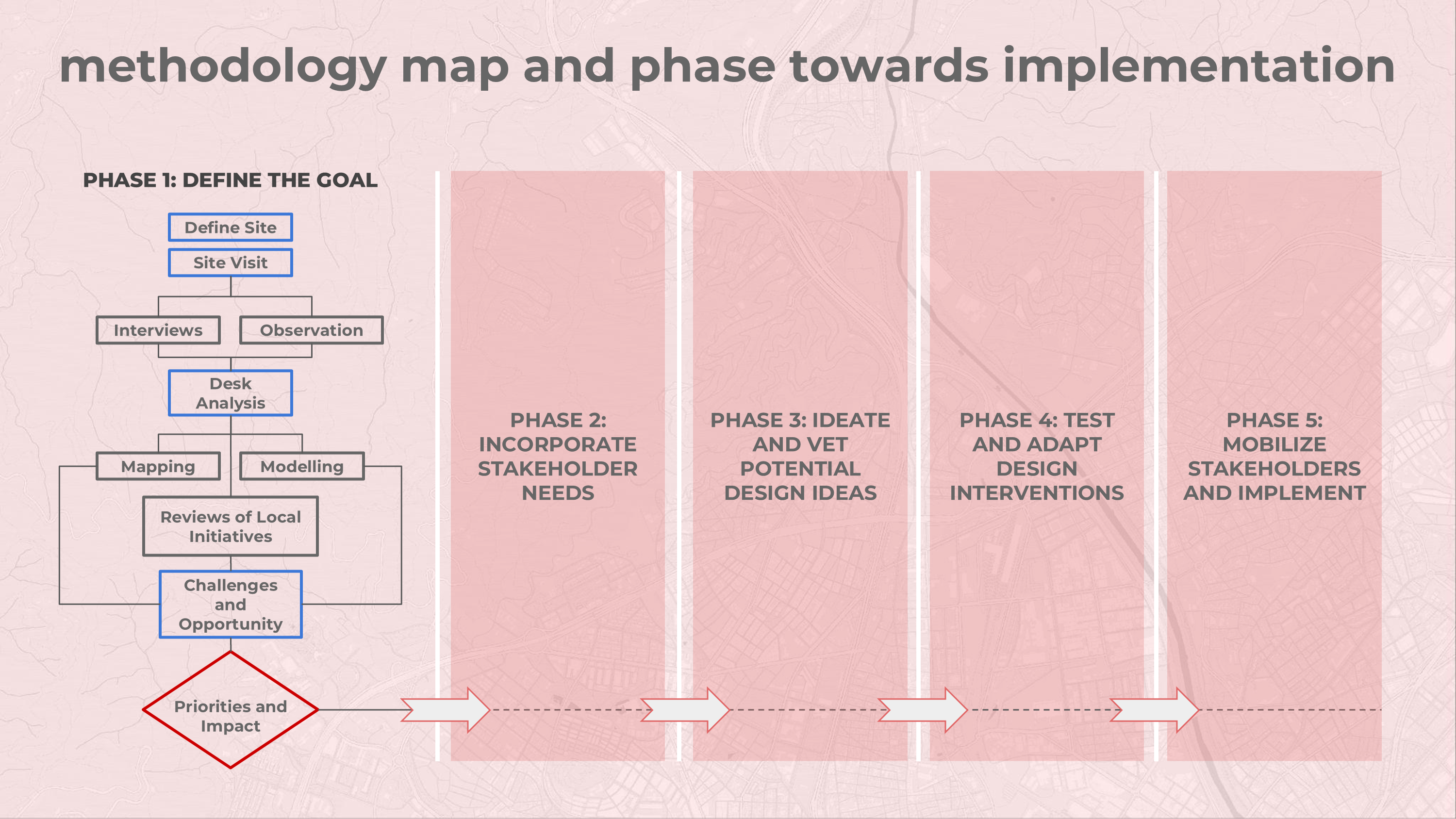
The full process of our proposal consists of five stages: defining the goal, incorporating stakeholders, ideating, testing prototypes, and implementing. We have designed it to for
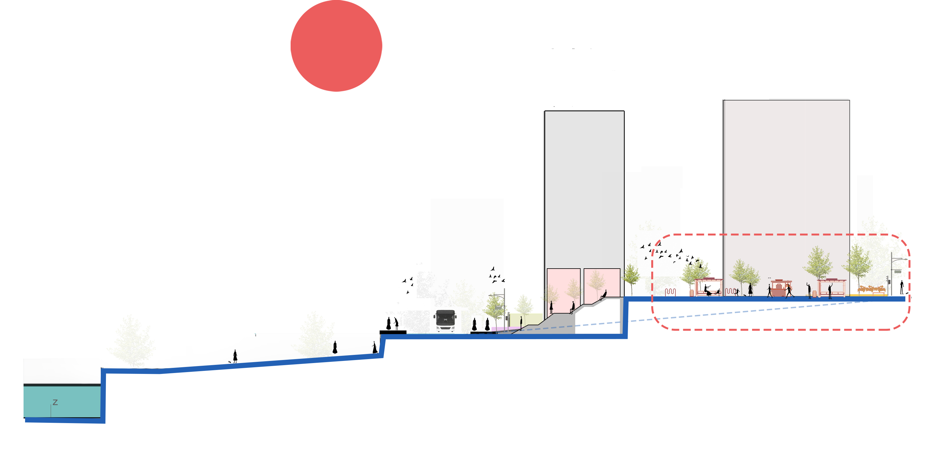
Section of the stairs and the placa,which caters the need of elderly people and also the kids with their parents.
The besos landing act as the attraction point into the placa which in turn gives connection to other public places in and around santa coloma we go up.

The section X cuts throught the other side of the placa.the terraces and the parks were used to the something more vibrant.
Flows 4 Santa Coloma: Implementation Strategy
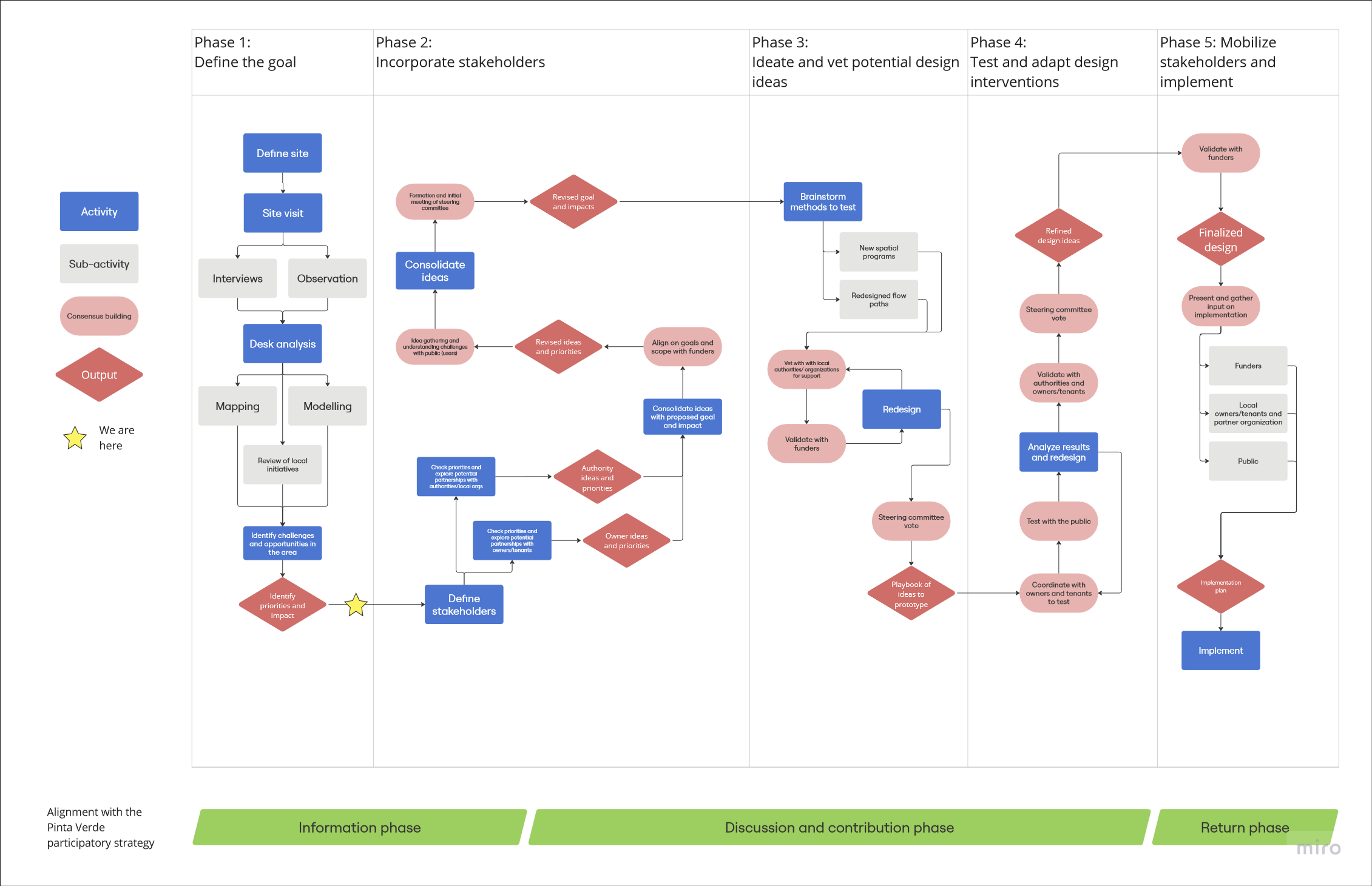
We envision including different stakeholders and adapting these designs to their priorities. As outlined in the analysis above, we have already advanced through much of Phase 1. To continue this project, we would next incorporate stakeholders to the planning process. Phase 2 begins with outlining the players we think should be involved throughout and engaging with them to understand their needs and how they might want to collaborate with us. In particular, we want to highlight the stakeholders we have already identified as crucial to the process. We have divided them into different categories depending on their role in developing the plans.
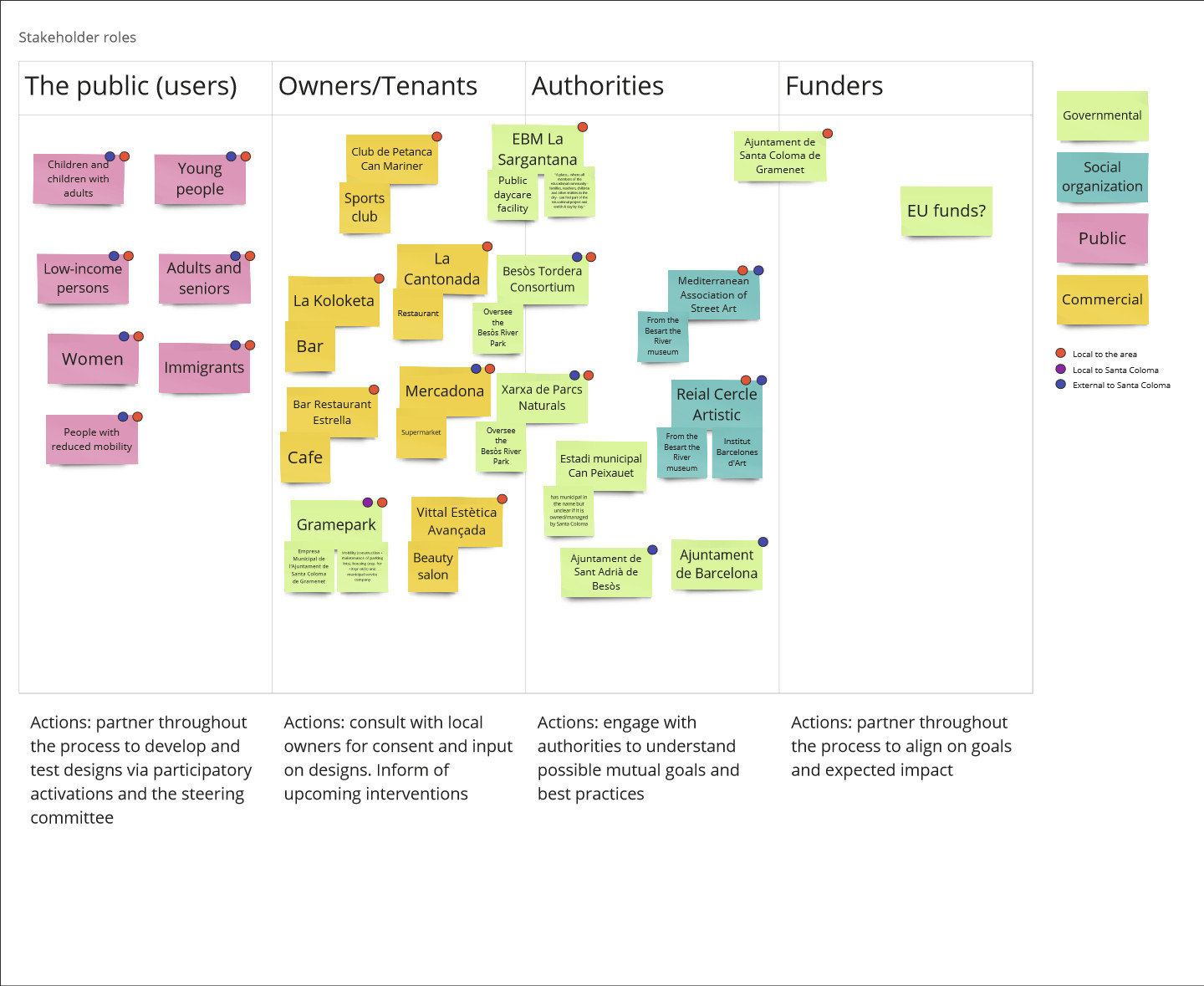
The members of the public can also be seen as the users of the space. The categories we have listed are not mutually exclusive, and people can fit into various of these identities, but we wanted to call out some important identities to be sure to involve. Owners and tenants are the local businesses and bodies within the zone, including dining establishments, a public daycare center, and a local petanca club. As our interventions can impact their business and local patterns, we want to be sure to know what benefits and challenges they foresee. Authorities are broadly the local organizations and government agencies that have an interest in the plans and might have relevant initiatives or can help us follow certain best practices as we prototype and implement. They may also be able to connect us with the public. Finally, we have the funder category, which includes the Santa Coloma de Gramenet Municipality. While they might have similar interests to the other authorities, the funder will also likely have a disproportionate amount of decision power.
To help spread decision-making power, we have incorporated a steering committee throughout the process. In particular, the steering committee will finalize: goals, designs to prototype, and designs to be submitted for implementation. These are key points throughout the design process, chosen to give the steering committee a determining role, but also limit the number of times they must meet and make participation accessible. Because funds are managed by the municipality, the steering committee will not be the only body with veto power. The steering committee is designed to be a crucial partner in shaping the outcomes of the process and ensuring diverse needs are considered and met.
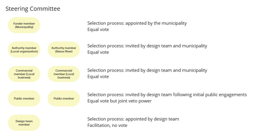
We propose a steering committee of seven voting stakeholders and one facilitator: one member from the Municipality of Santa Coloma de Gramenet, two members from local authorities and two members from local tenants invited by the design team and the Municipality, and two members of the public invited by the design team after initial participatory engagements with the broader public. The steering committee will come to a decision when a minimum of four votes including at least one member of the public are cast in favor of a motion. If the minimum cannot be reached, then the steering committee will trigger a redesign process by which more options are explored or current options are redesigned. If, after the redesign process, a minimum of four votes including a member of the public cannot be reached, the minimum of four votes will not need to include a member of the public. If four votes still cannot be reached, the design team member will be given a tie-breaking vote.
After consulting with various stakeholders in Phase 2, we move onto the Phases 3 and 4 where we design and test our designs with the public. In these stages we will produce a playbook of ideas to prototype as well as a concrete design for implementation. These phases heavily feature working with stakeholders to adapt the designs. Because we envision Phase 4 will end after about one year, we aim to keep the public engaged and enthusiastic about the work throughout that time.
To do so, we propose a variety of participatory space activations. These activations will feature interactive installations that allow the public to experience what a renovated space might feel like. For example, to inspire the public and activate the liminal space between the Besòs River, colorful chalk can be supplied throughout the proposed axis path and passersby, particularly children and young people, will be invited to to draw on the sidewalk, along the stairs, and through Plaça de les Cultures. Pop up installations in areas without much traffic can serve to help people imagine what these spaces could be like. For example, setting up a volleyball court or a temporary climbing wall for a week could serve to test how the public would take to having more sports opportunities in the area. To engage adults and seniors, they could be invited to participate in round table focus groups in the space, with prototypes of different urban furniture that the design team is testing. To better understand children’s perspectives in different pop ups, a video stories exercise can be done. By equipping children, adults with children, and young people with one-way cameras as they explore the space, these members of the public can document how they interact with the installations and for how long. The examples listed here are different possibilities, but final pop up ideas these would be developed in Phase 3 based on further public engagement.
Finally, Phase 5 will focus on implementation. After designs are finalized, the design team will collaborate with all stakeholders to host a town hall to present the finalized design and gather feedback on the implementation timeline from the broader community. Considerations will be made to choose an accessible location, potentially within the space itself, and a convenient time. Because not all interested participants might be able to participate in the town hall or find out about the implementation plans, social media posts linking to the municipal website and the final plans will allow others to stay up to date on the plans and weigh in on any open questions.

