
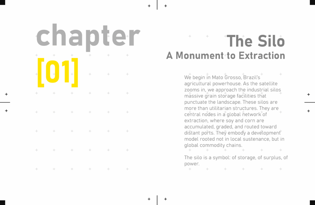
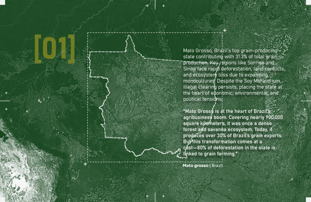
“The Amazon rainforest, often called the ‘lungs of the Earth,’ is rapidly disappearing. But this isn’t just an environmental crisis—it’s a geopolitical and economic issue. In the heart of this transformation lies [Mato Grosso], Brazil’s largest soy-producing state. Its key location fuels both economic growth and ecological destruction, leading to tensions over land use, trade policies, and environmental governance.”
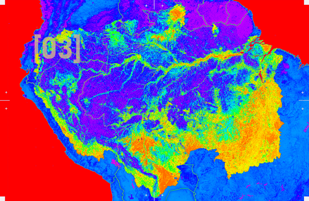
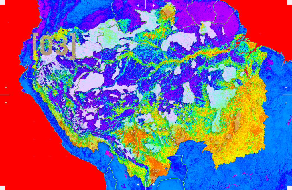
DATASET 01 – MOD13Q1.061 Terra Vegetation Indices 16-Day Global 250m
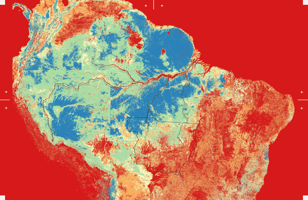
There are two primary vegetation layers. The first is the Normalized Difference Vegetation Index (NDVI) which is referred to as the continuity index to the existing National Oceanic and Atmospheric Administration-Advanced Very High Resolution Radiometer (NOAA-AVHRR) derived NDVI.
Understanding its vegetation health, changes, and threats is crucial for conservation and sustainable management. One of the most effective tools for monitoring vegetation is the Normalized Difference Vegetation Index (NDVI), a remote sensing technique that provides insights into plant health and biomass distribution. By integrating NDVI analysis with conservation efforts, we can better understand and protect the Amazon, ensuring that this critical biome remains resilient against human and environmental pressures.
DATASET 02 – Global map of forest types 2020
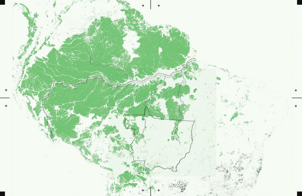
The global map of forest types provides a spatially explicit representation of primary forest, naturally regenerating forest and planted forest (including plantation forest) for the year 2020 at 10m spatial resolution.
Distinguishing primary forests, naturally regenerating forests, and planted forests. In the Amazon, this dataset enhances NDVI analysis by offering spatially explicit insights into forest composition and changes. By combining NDVI with this dataset, researchers can better understand deforestation patterns, forest recovery, and human-induced disturbances in the region.
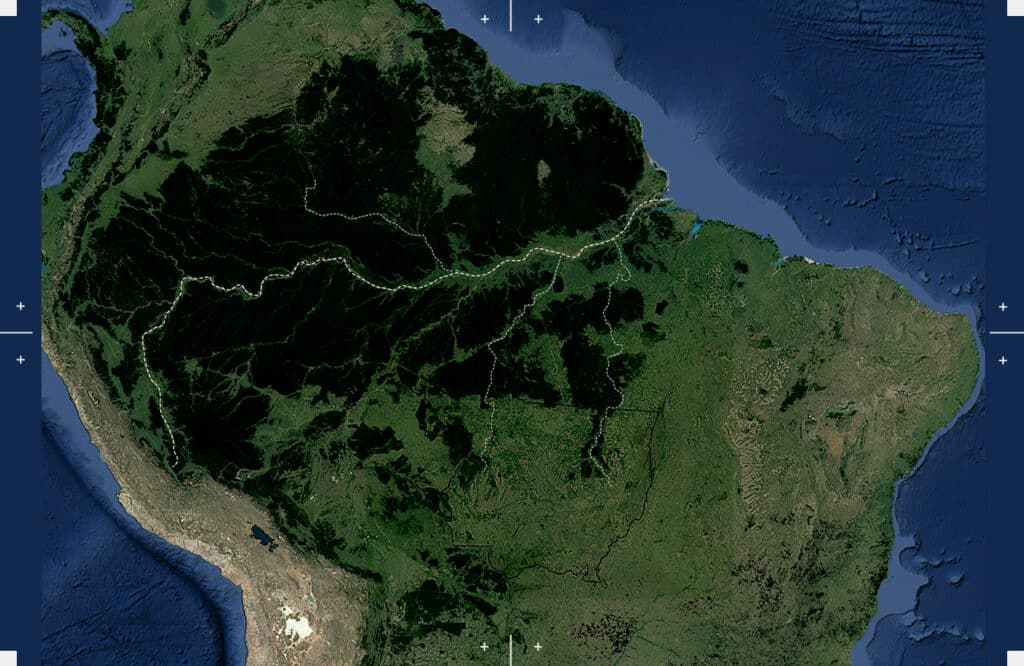
DATASET 03 – EC JRC global map of forest cover 2020, V2
The year 2020 corresponds to the cut-off date of the Regulation from the European Union “on the making available on the Union market and the export from the Union of certain commodities and products associated with deforestation and forest degradation” (EUDR, Regulation (EU) 2023/1115).
This dataset aligns with the EU Deforestation Regulation (EUDR), offering critical insights into deforestation and forest degradation linked to commodity-driven land-use changes. In the Amazon, integrating this dataset with NDVI allows researchers to track large-scale deforestation, assess compliance with environmental policies, and support conservation strategies against illegal land clearing.
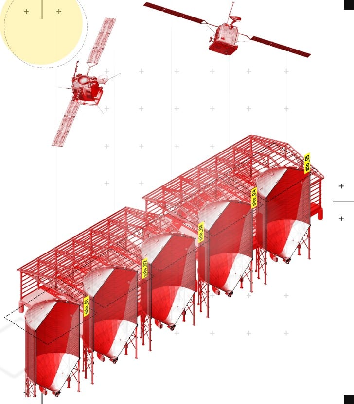
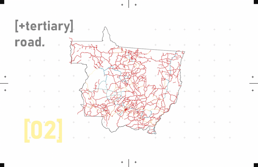
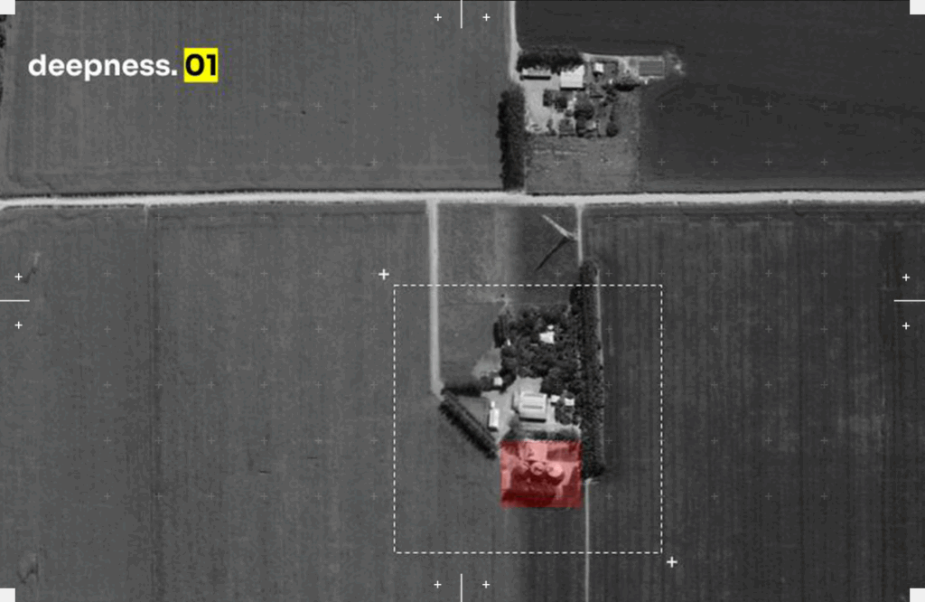
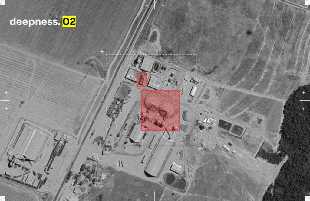
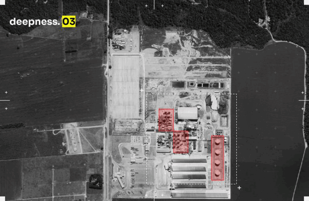
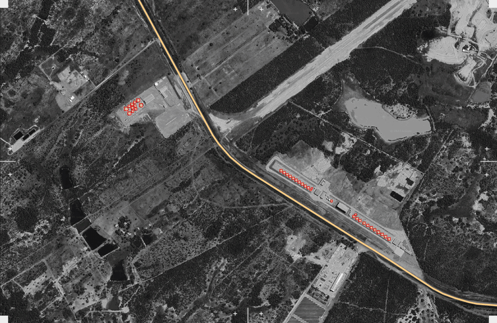
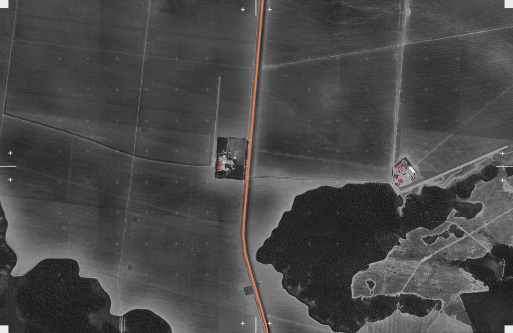
Silos in Mato Grosso are far more than storage facilities; they are critical nodes in an extensive extractive infrastructure that enables the rapid accumulation and export of grains such as soy and corn. Strategically located near large-scale farms and major transport routes like BR-163 and BR-364, silos serve as collection points where harvested crops are aggregated before being transported to ports for export, primarily to international markets. This network of silos reflects the industrial scale and logic of agribusiness in Mato Grosso, designed to maximize throughput and efficiency in the extraction of agricultural commodities. However, this system also symbolizes the broader ecological and social impacts of intensive monoculture expansion—displacing Indigenous territories and fragmenting biodiverse ecosystems. By mapping silo locations alongside deforestation and infrastructure layers, it becomes clear how these structures anchor an economy built on resource extraction, shaping both the landscape and local communities.
Silos in Mato Grosso act as central hubs for storing and moving vast quantities of grains, enabling large-scale agricultural export. They are key components of an extractive system that drives economic growth but also contributes to deforestation and displacement of Indigenous lands. Mapping silos reveals how industrial agriculture shapes both the land and local communities.

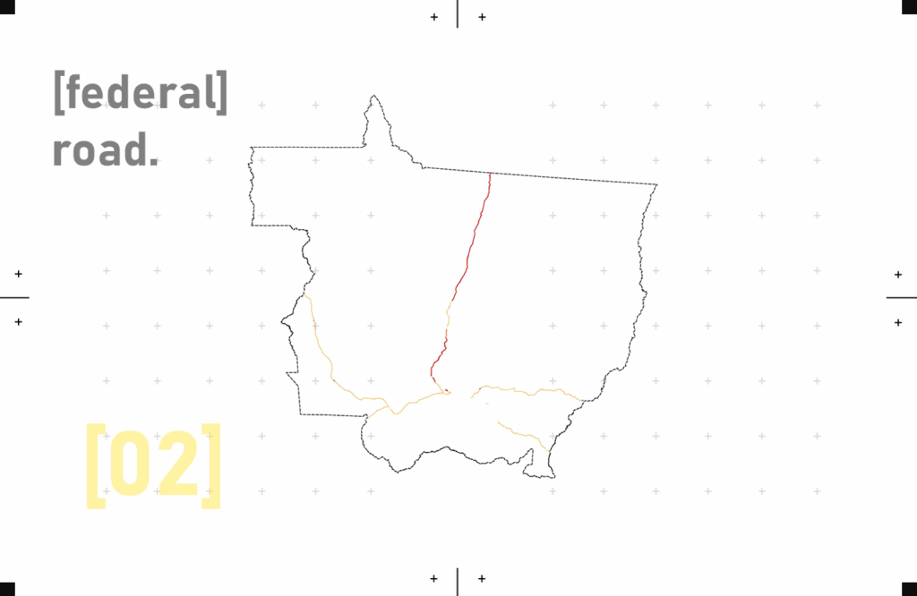
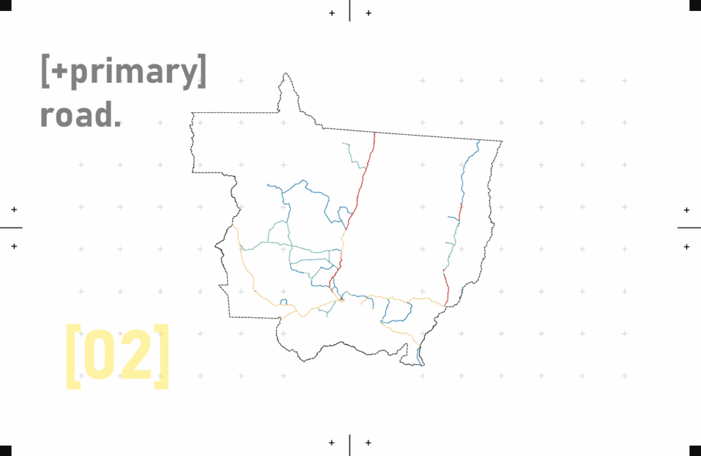
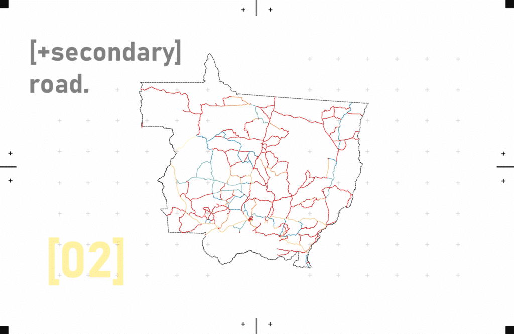
Colonial Infrastructure and the Logic of Extraction in Brazil
Brazil’s landscape of roads, railways, and ports has its origins in a deeply colonial logic: the systematic extraction of land, labor, and natural resources for external gain. From the 16th century onward, Portuguese colonizers mapped the interior not to understand it, but to control and exploit it. Early colonial expeditions—bandeiras—ventured inland, often violently, to claim territory, enslave Indigenous people, and locate gold and minerals. These movements laid the foundations for Brazil’s extractive geography.
During the empire and into the republican era, the construction of infrastructure—especially roads and railways—continued to serve the purpose of extraction. Rather than integrating territories for the benefit of local populations, these routes were designed to move resources like sugar, rubber, timber, and eventually soy and cattle, from the hinterlands to coastal ports for export. The logic was clear: connect the interior to the outside world, not to itself.
The BR-163 highway, which cuts through the heart of the Amazon and Mato Grosso, is a modern extension of this colonial vision. Framed as a development corridor, it in fact follows an age-old pattern—transforming Indigenous territory and biodiverse ecosystems into logistical landscapes of extraction. Today’s grain silos and trucking networks echo the past: new tools, same function.
Mapping these roads with satellite imagery and machine learning reveals not only patterns of land use change, but the historical continuity of exploitation embedded in infrastructure.
Indigenous Territories and Biome Retention: The Living Resistance to Extraction
In Brazil, Indigenous territories are not just spaces of cultural identity—they are frontline buffers against deforestation and ecological collapse. While much of the Amazon and the Cerrado biomes have been fragmented by extractive agriculture and infrastructure, studies consistently show that areas under Indigenous stewardship retain far more native vegetation and biodiversity than surrounding lands.
This is no coincidence. Long before colonial mapping imposed grids, borders, and roads, Indigenous communities managed the land through intricate systems of ecological knowledge—preserving forest cover, managing fire, and maintaining biodiversity. Their cosmologies and lifeways are deeply entwined with the land, offering a radically different model of co-existence than the colonial logic of extraction.
However, the expansion of grain farming in states like Mato Grosso, accelerated by roads like BR-163, continues to threaten these territories. The very infrastructure that enables commodity flows also penetrates protected biomes, increases land conflict, and invites illegal land grabbing. Mapping this dynamic through satellite imagery reveals not just environmental change, but a territorial struggle—between extractive economies and Indigenous resistance.
Indigenous lands, when respected and upheld, act as ecological strongholds, preserving the Amazon biome’s continuity. Defending their rights and sovereignty is not only a matter of justice—it is a necessity for the planet’s ecological future.
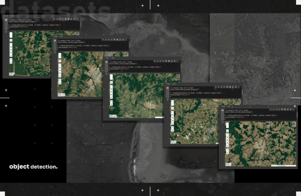
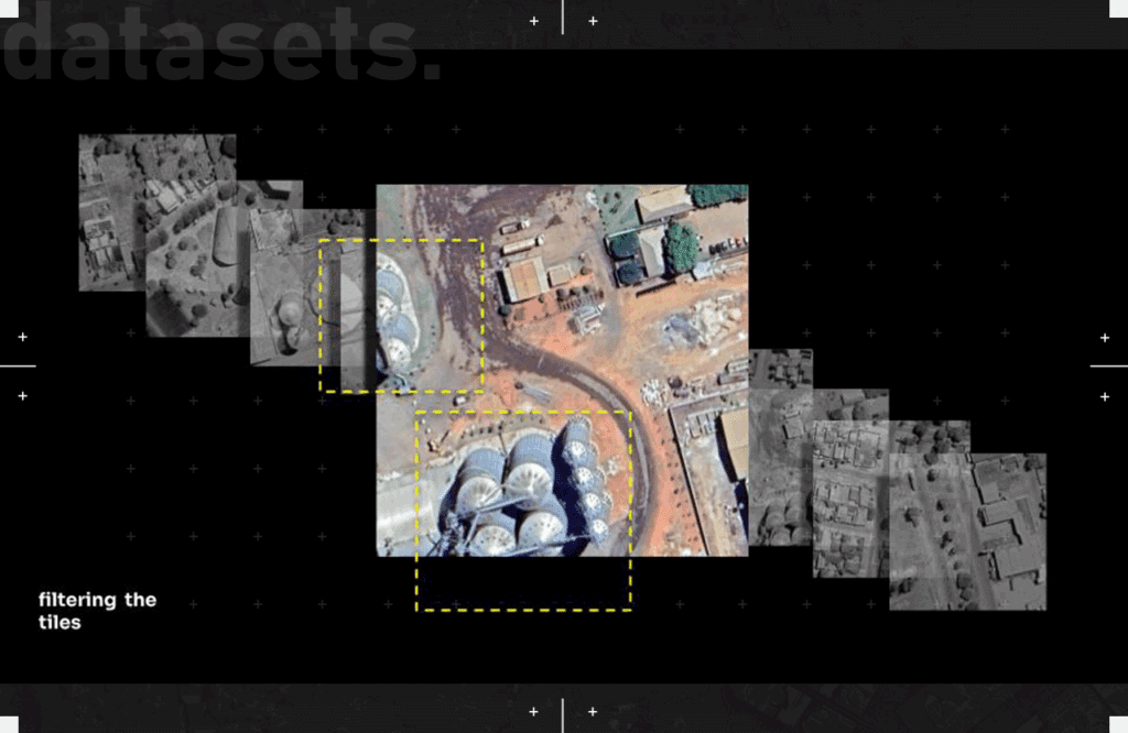
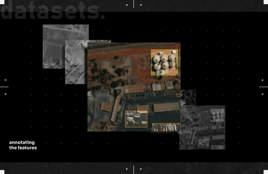
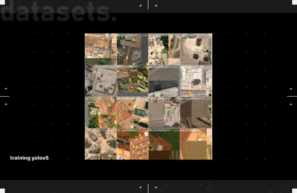
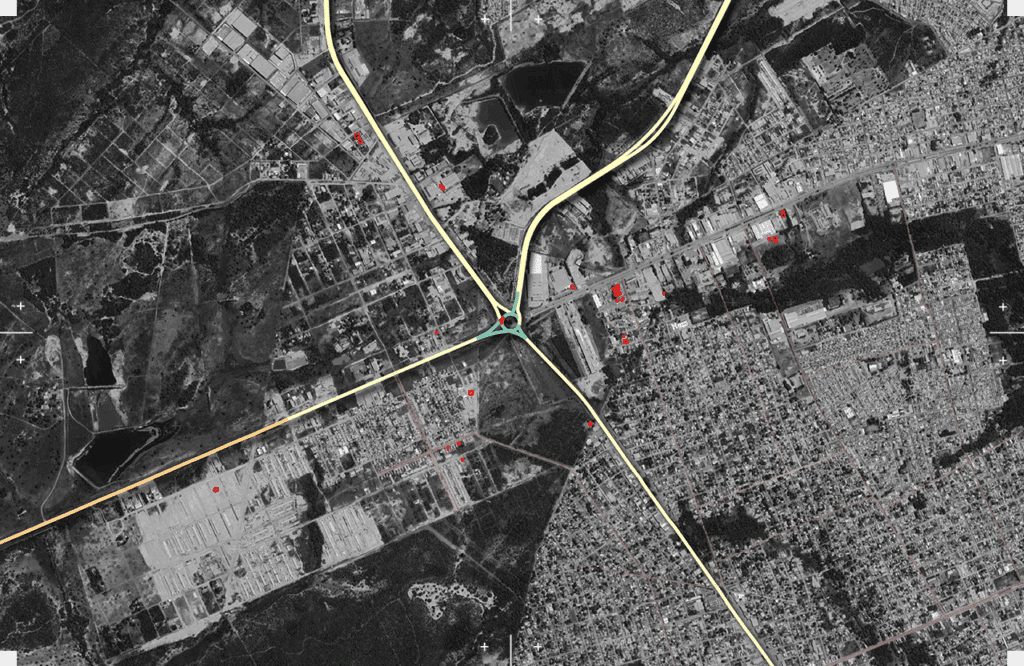
Object Detection and Silos as Markers of Deforestation
In the context of Mato Grosso’s expanding grain frontier, silos are not neutral infrastructure—they are indicators of ecological transformation. These large-scale storage facilities, along with temporary silo-bags and truck networks, form the logistical backbone of industrial agriculture. Their presence in formerly forested zones often signals a completed cycle of deforestation: clearing, cultivation, and consolidation into the global commodity chain.
Using object detection models such as YOLO X, we trained machine learning algorithms to recognize and classify these structures from satellite imagery. By detecting silos and mapping their spatial distribution along the BR-163 highway, our project identifies not just where farming occurs, but how deeply the extractive logic has embedded itself into the landscape. These objects, when tracked over time, reveal the material footprint of grain farming, and help expose patterns of land grabbing, biome loss, and frontier expansion.
In this way, silos become proxies for power and transformation—visible signatures of deforestation and the restructuring of land around market priorities. The process of detecting them is more than technical; it is political. It allows us to make visible the infrastructures of extraction that continue to erode one of the planet’s most vital ecosystems.
Would you like a shorter versio
Mapping as the Convergence of Infrastructure and Ecology
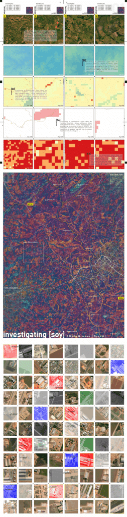
The maps produced in this project are not static representations—they are dynamic intersections of ecological and infrastructural realities. By combining satellite-based vegetation indices (like NDVI), global forest type data, and object-detected features such as silos, silo-bags, and transport networks, we construct layered visualizations that expose how industrial grain farming reshapes the land. These maps reveal more than deforested zones; they show the entire machinery of extraction, embedded in spatial patterns of logistics and ecology. The presence of silos indicates not just production, but permanence—land that has transitioned fully from forest to farm. When overlaid with forest loss data and biome classifications, these maps become tools of territorial diagnosis, helping us trace how and where agricultural infrastructure fractures the continuity of the Amazon biome. In essence, mapping here is both an analytical and political act: a way to make visible the overlapping forces of environmental degradation and economic expansion, and to question whose landscapes are being reshaped—and at what cost.
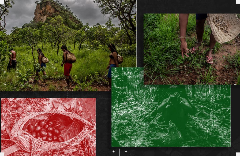
Most of the 20,000 surviving Xavante people live in the Cerrado, a patchwork of spindly forest and wooded grassland, covering 40% of the western Brazilian state. Drier and less dense than the Amazon forest to the north, the Cerrado has its own exotic flora and fauna. Conservation biologists call it the most biologically rich savanna in the world; researchers report that five percent of the world’s plant and animal species live there.
This project is not just about detecting silos or mapping cleared land—it’s about tracing the deeper systems that convert living forests into extractive frontiers. By merging ecological data with machine learning, we expose the spatial signatures of deforestation and the infrastructures that sustain it.
Grain silos, highways, and storage bags may seem mundane, but together they tell a story of dispossession, transformation, and urgency. Through mapping, we aim to make this story visible—not just to document change, but to provoke action.
In a time when environmental collapse is accelerating, the tools we use to observe the world must also serve to protect it.
This is a call to see clearly, and to act accordingly.
