Optimizing Helsinki’s Boulevard Densification Method
Helsinki, the vibrant capital of Finland, faces significant changes as it prepares for the future. With important challenges ahead such as the continuous population growth for the next decades and the associated risk of urban sprawl in suburban developments, the city must address the issue of land fragmentation by transforming its current car-centric transportation network towards a more sustainable and inclusive mobility system. According to METREX, the Network of European Metropolitan Regions & Areas, until 2036, 100.000 inhabitants will be located along 7 highway corridors and an estimated 30-40 km of motorway-like highways will be converted into boulevards.

The project aims to generate and optimize the linear densification model in the case of Helsinki. The whole process is based on the implementation of an evolutionary algorithm and the generative design process in urban design using the Wallacei X component for the optimization process.
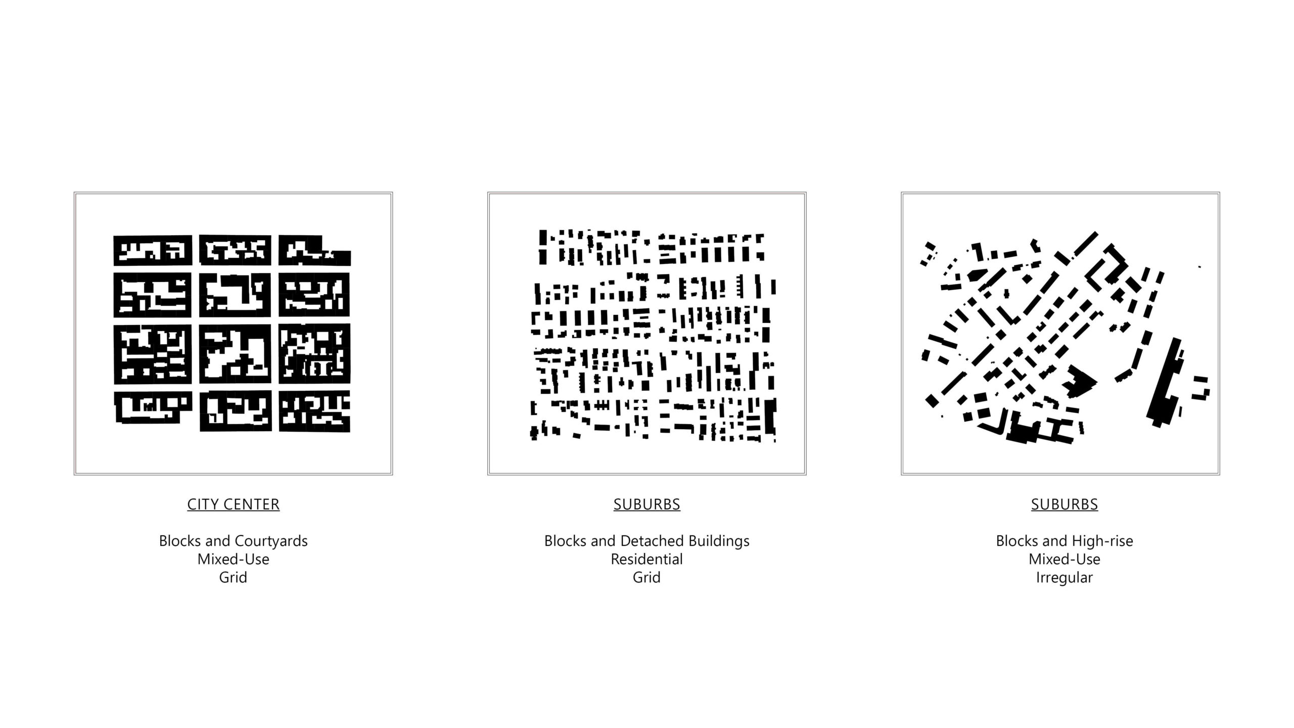
To begin the process, it is essential to analyze and comprehend the current urban structure of Helsinki, which can be categorized into three primary urban typologies: [1] block with central courtyards, [2] low-rise developments, [3] intermediate density consisting of blocks of flats.
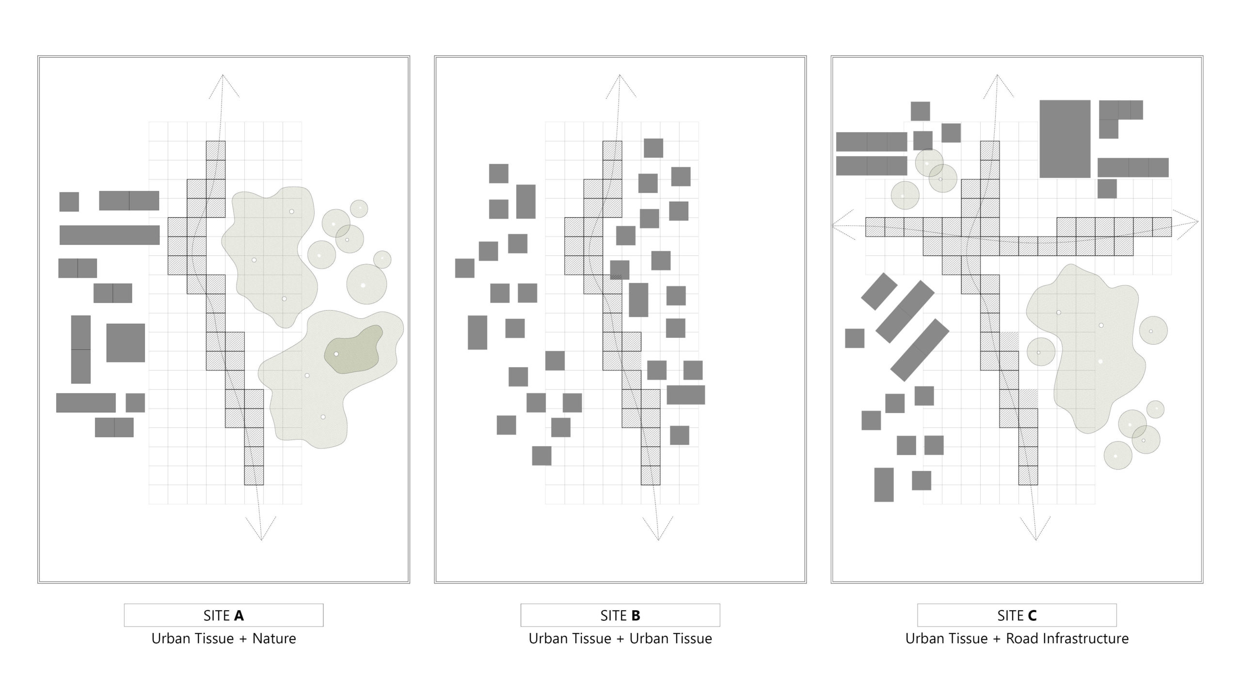
Following, the different edge conditions were studied that each corridor has, presenting particular challenges. The selected site belongs to type A, that is characterized by the close proximity to natural patches on one of the sides. This condition will be a main driver and constraint to set the objectives of the master planning, particularly affecting the relationship between the built and unbuilt area and its density.

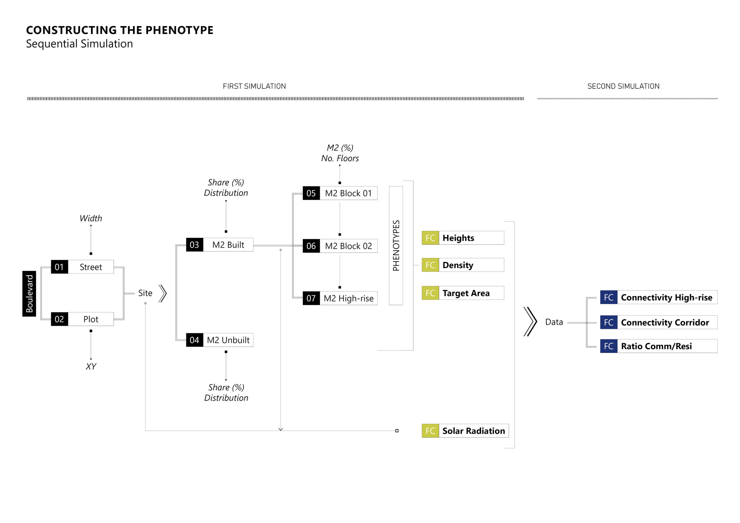
The optimization of Helsinki’s Boulevard Densification Method utilizes a sequential evolutionary simulation process, to arrive at a more resolved solution-set.
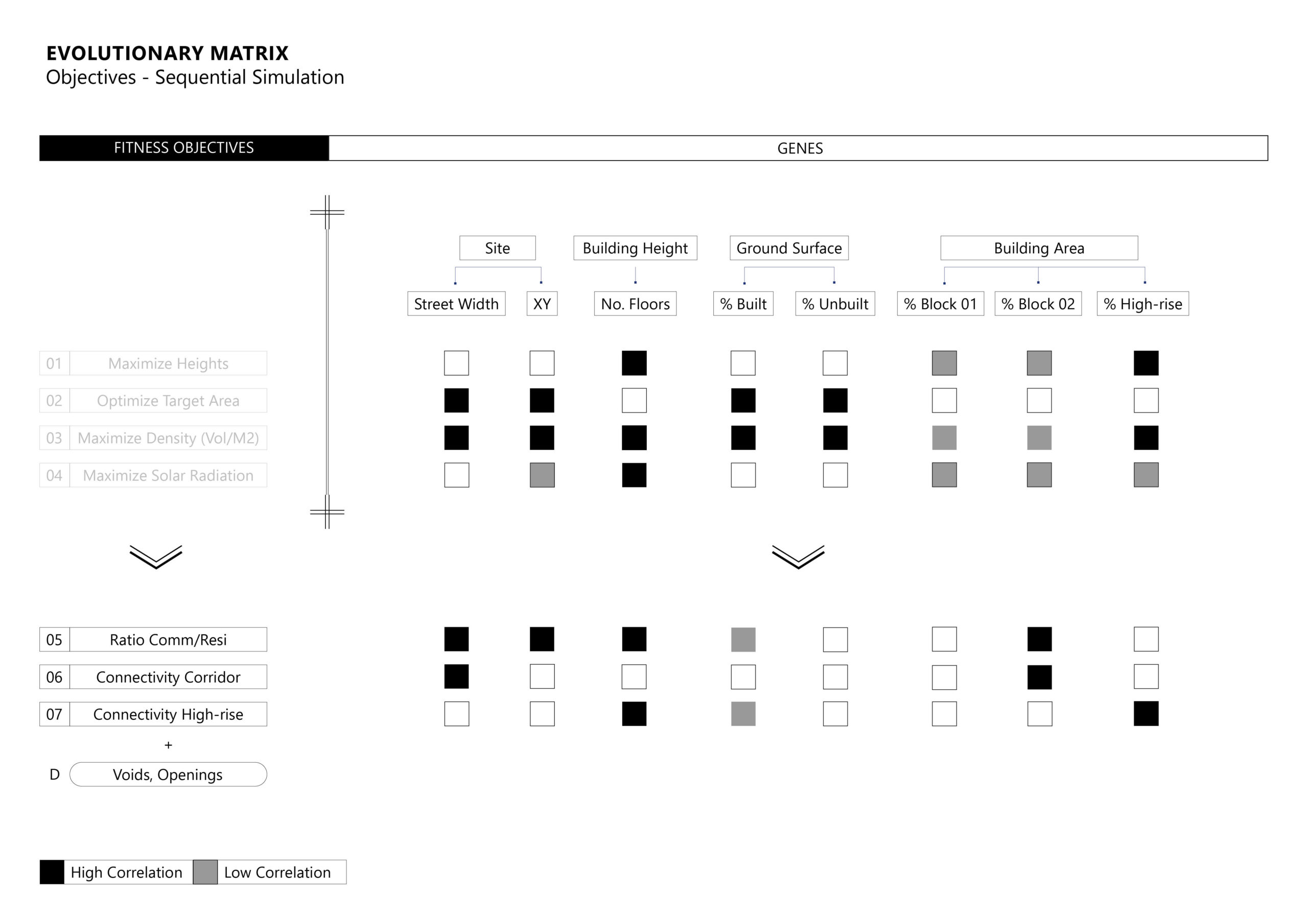
- In the first simulation, 4 main objectives are defined: maximizing Heights (+), maximizing Solar Radiation (+), maximizing Density of the intervention (built up area/un-built area) (+) and minimizing the between the targeted total square meters of intervention divided by the produced square meters (-)
- In the second simulation, the main objectives of the first simulation are became secondary objectives along with the openings (voids) and 3 main objectives are defined: the Land uses distribution and specifically the ration between public/offices/commercial and residential, the Natural Connectivity (from the one to the other side of the boulevard) and the “sky bridges” Connectivity between the high rise structures.
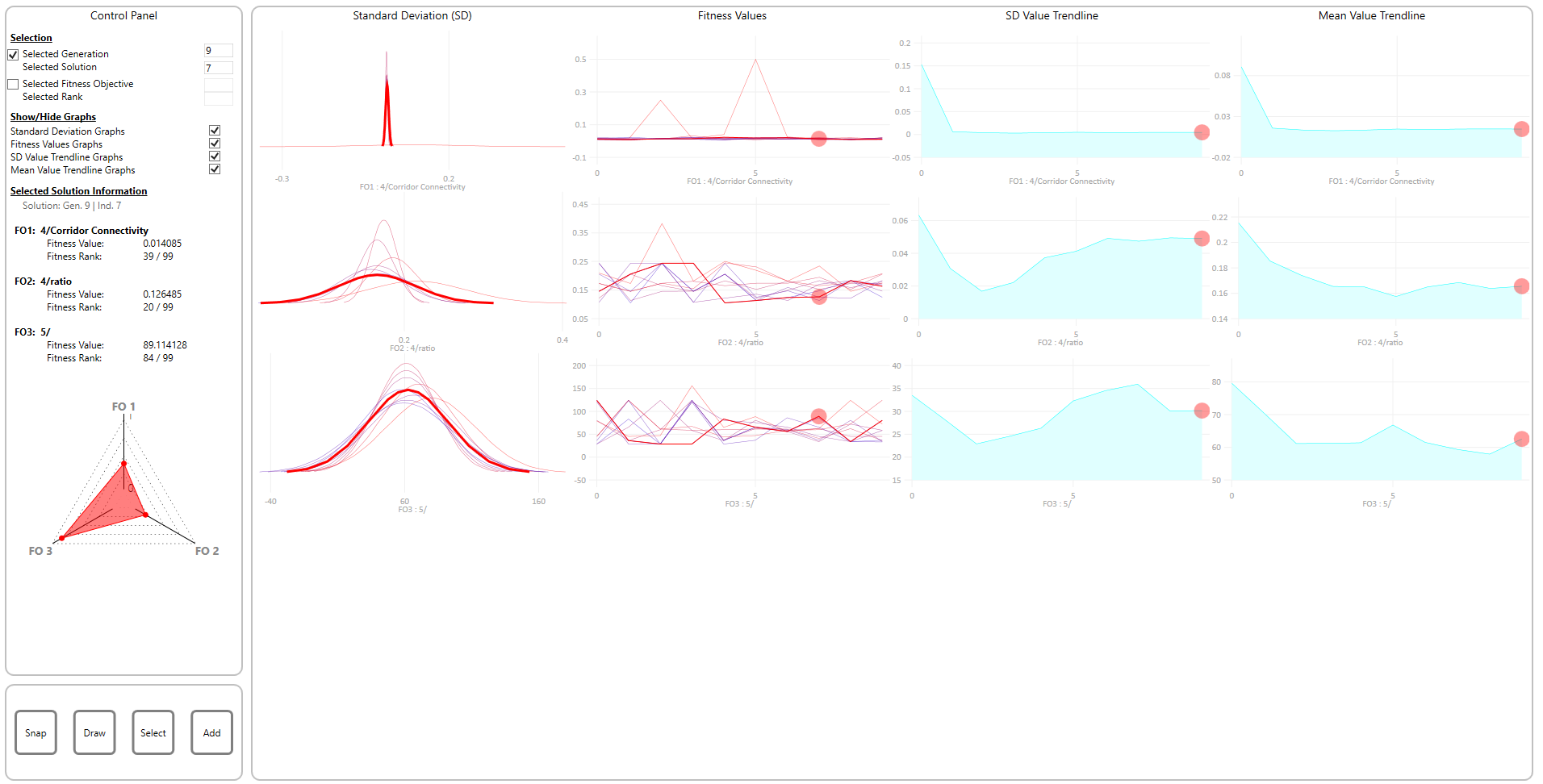
RESULTS OF THE EVOLUTIONARY SIMULATION:
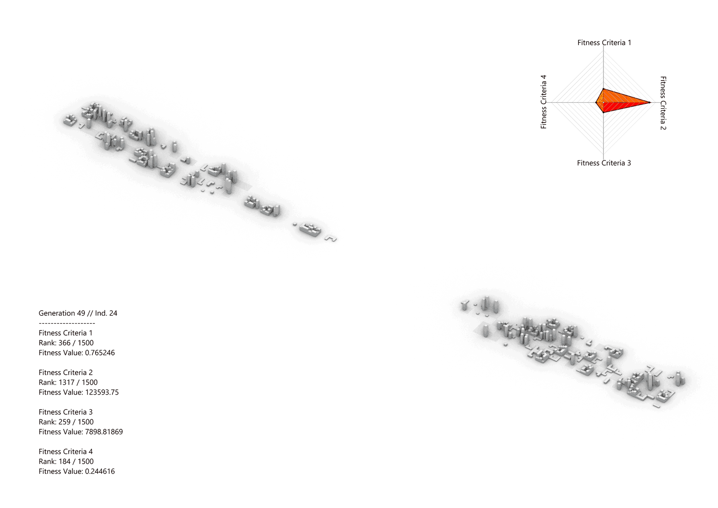
The first simulation is run for a population with a generation size of 50 and a count of 20, giving us 1000 solutions. These solutions were evaluated based on the specified objectives, and the methodology aimed to find a set of solutions that balanced the desired heights, density, and intervention targets effectively.

PARETO FRONT SOLUTIONS
After incorporating the criteria and objectives into the gene pools, the pareto front tab provided us with the most optimal solutions. Through subsequent simulations, it became evident that these solutions fully satisfy the four primary objectives, establishing them as the fittest responses to our design challenge.
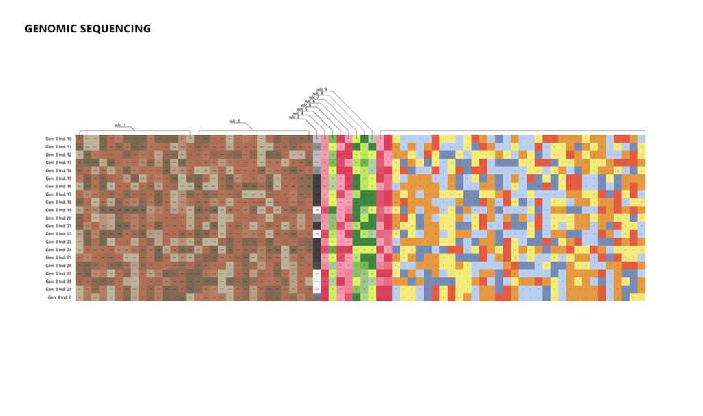
GENOMIC SEQUENCING
Upon observing the conclusion of the sequence, it becomes apparent that the repetition of colors increases, suggesting the emergence of Wallacei and its generation of patterns. These patterns serve as indications that the algorithm is striving to attain the optimal outcome based on the fitness criteria.
The second simulation is run for a population with a generation size of 10 and a count of 20, giving us 200 solutions, having a minor data influences the objectives of the first simulation. By defining the new main objectives, the methodology aimed to further refine the optimization process and achieve a more comprehensive and balanced solution. The connectivity of high-rise buildings and natural connectivity objectives aimed to enhance the overall connectivity and accessibility within the city. The ratio of commercial to residential uses objective aimed to ensure a suitable mix of functions and promote a vibrant urban environment.