

Classifying Urban Food Environments with Graph Neural Networks
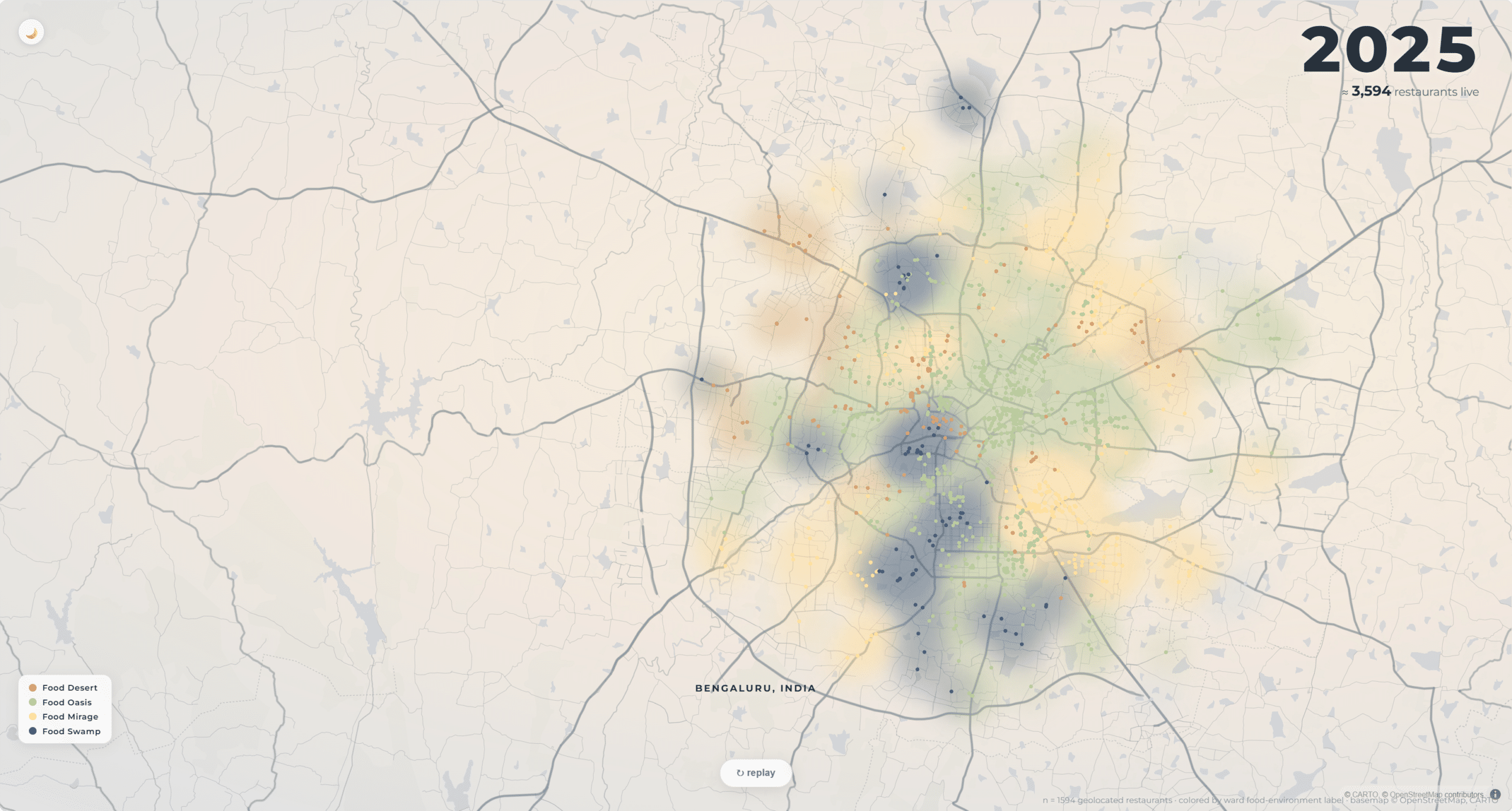
Cities grow faster than the systems that feed them. As populations shift and digital delivery rewrites how people obtain food, the infrastructure of food access rarely keeps pace. The result is a landscape of access that is highly uneven yet difficult to read from conventional maps or census tables. Food insecurity is not a single … Read more
Curbside Intensification
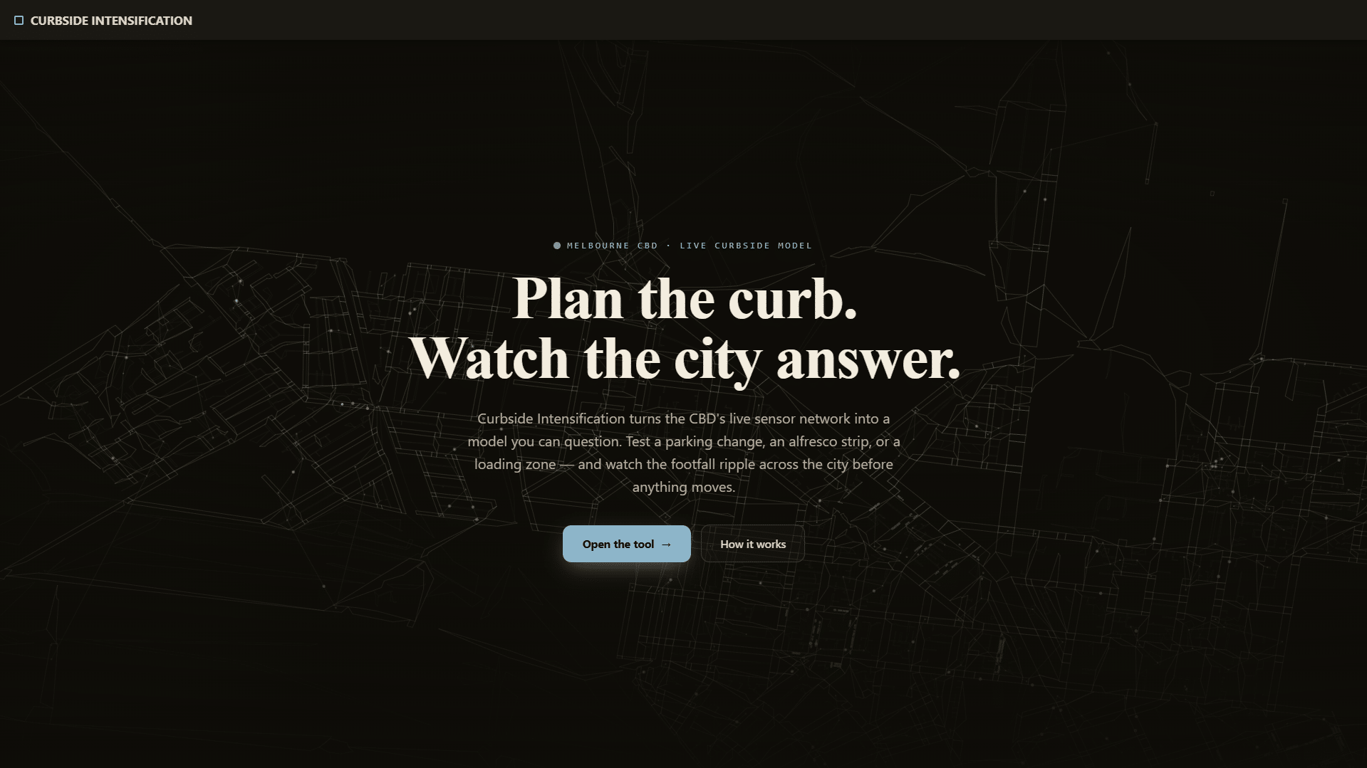
Ertuğrul Akdemir MAAI · Master in AI for Architecture and Business Innovation 25/26 Advisor: Shajay Bhooshan An AI tool that reads how streets behave through the day and tests where the curb could change use, then shows how that change spreads across the city before anything is built. Streets are designed once and rarely questioned. The … Read more
Opening the Black Box: AI, Simondon, and the Conductor
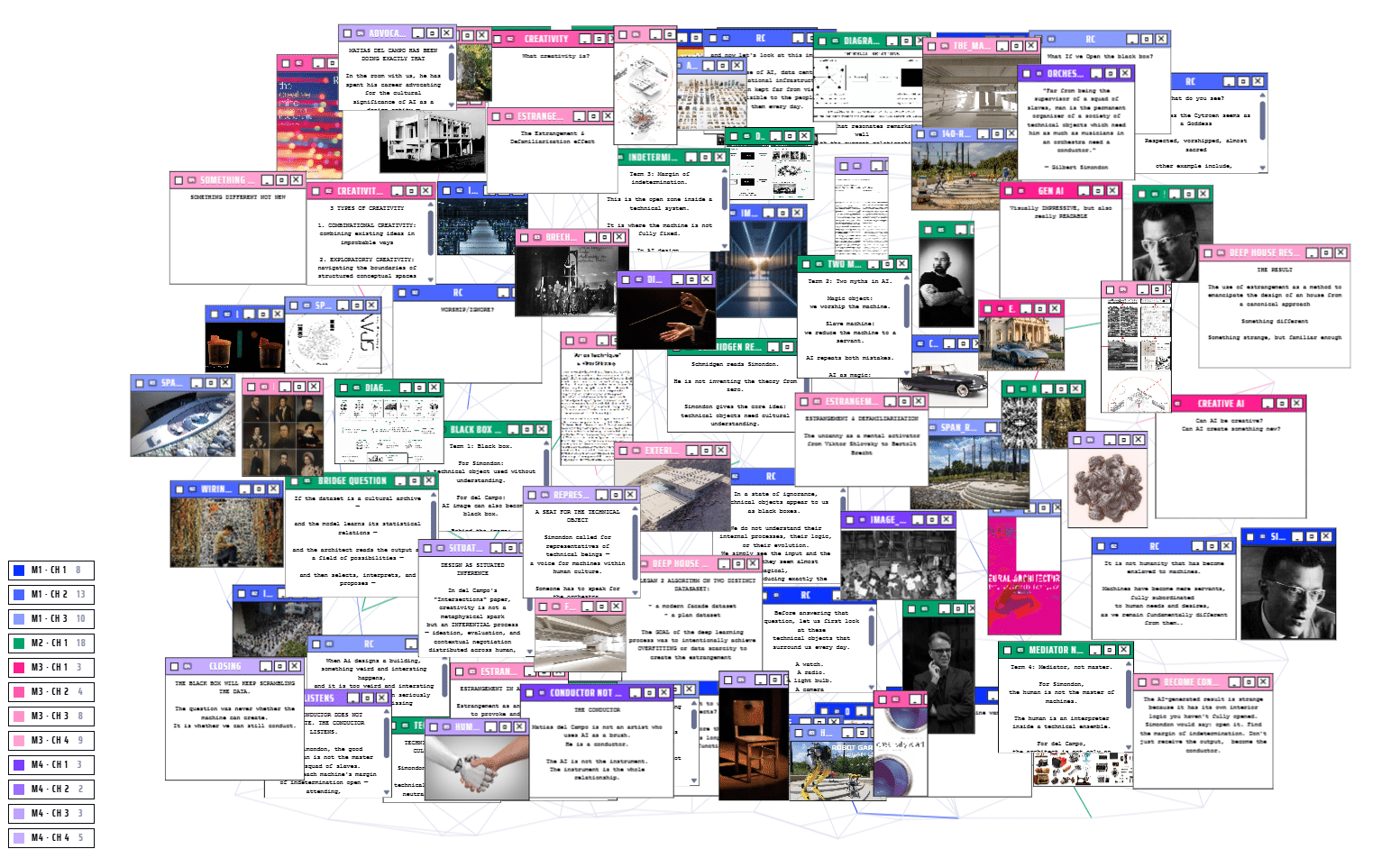
“A theory class on Matias del Campo forced a difficult question: are we using AI, worshipping it, or finally ready to conduct it?“ Part I — The Machine We Do Not See Simondon and the two ways we fail the machine Matias del Campo is an architect, educator, and co-founder of SPAN. His practice sits … Read more
Invest Through Behavior

Invest Through Behaviour reframes how capital decisions are made in social housing impact investment. Today, investment decisions rely on high-level financial and ESG indicators that assume impact rather than demonstrate it, and that obscure the real trade-offs between competing priorities. This project proposes a decision-support approach that treats neighbourhoods across London as a landscape of … Read more
Architecture Intelligence for AI Infrastructure

Toward an AI-Native Framework for Constraint-Orchestrated Data Center Architecture Developed through the working prototype OREXON SYSTEMS. · Nouhaila ELMALOULI · Master in AI for Architecture & Business Innovation (MAAI02), IAAC · 2025/2026 · Advisor: Dr. Wassim Jabi Data centers are the physical substrate of artificial intelligence. Every model we train and every query we run … Read more
inHabit – Rethinking Residential Layout Search with Spatial Intelligence
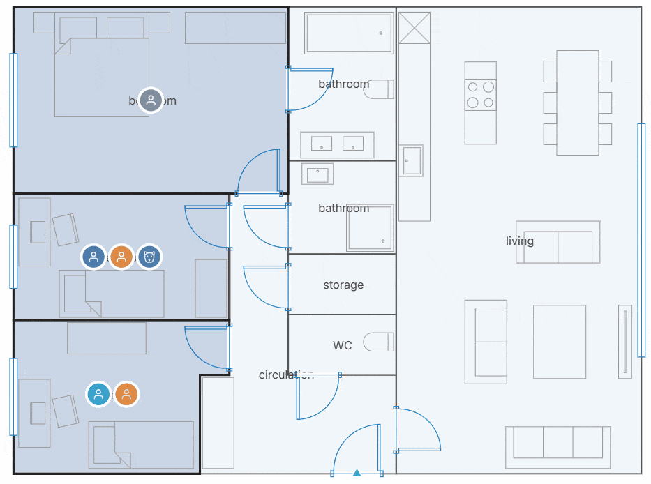
Introduction Finding the right home isn’t just about square meters or the number of bedrooms. A floor plan that works beautifully for one household can be completely unsuitable for another. Parents with young children, remote workers, retirees, or pet owners all experience the same space differently. Yet today’s search tools still rely on simple filters … Read more
Sensi: Making Comfort a Design Layer
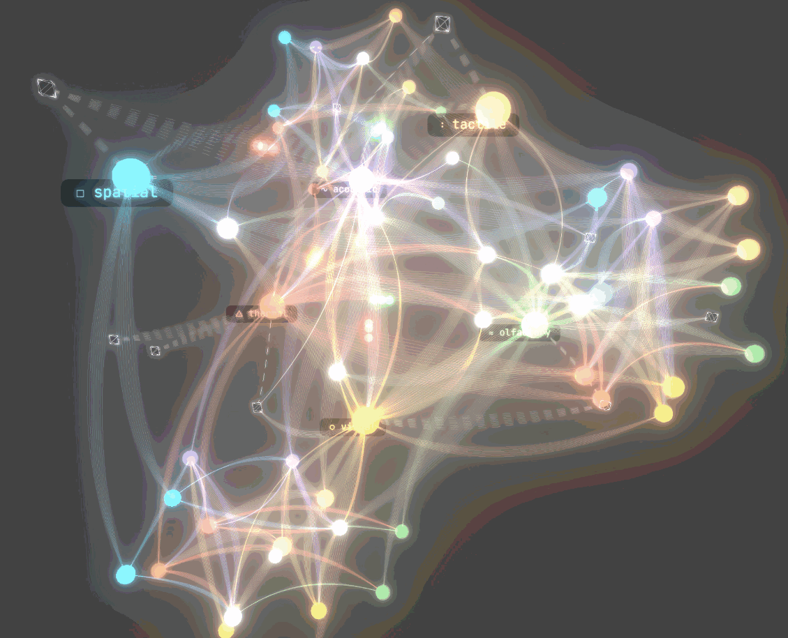
Building Sensi, a sensory copilot for architectural floor plans. In architecture, we model everything. Structure, cost, energy, code compliance. Layer after layer of analysis that makes a building accountable before it’s built. But one thing was missing from the stack: how the space will actually feel. Not feel as in emotion. Feel as in the … Read more
PermanenceOS
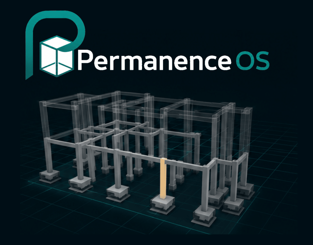
Every design decision has a structure. For the AI studio seminar, we built PermanenceOS , a structural intelligence platform that helps architects understand the consequences of early design decisions, before they get expensive to change. The Core Problem In early design, structural decisions get locked in fast and by the time the engineer is brought … Read more
BANANA MATTERS

Abstract Banana Matters transforms discarded banana pseudostem biomass into carbon-sequestering architectural panels through material research, bio-based binders, and digital fabrication. The project addresses the untapped potential of nearly 525 million tonnes of annual banana waste by developing lightweight, low-carbon composites with acoustic and structural applications. Through iterative material experimentation, heat-press manufacturing, and mechanical and physical … Read more
Cartoonify: Buildings as Political Objects
A fine-tuned AI pipeline that transforms any photograph of a building into a Gado-style satirical editorial cartoon — because every significant structure carries two stories, and architecture photography usually only tells one of them. Why Cartoonify — Buildings Are Political Objects. Photographs Rarely Say So. Architectural photography tends toward the celebratory. The clean angle. The … Read more
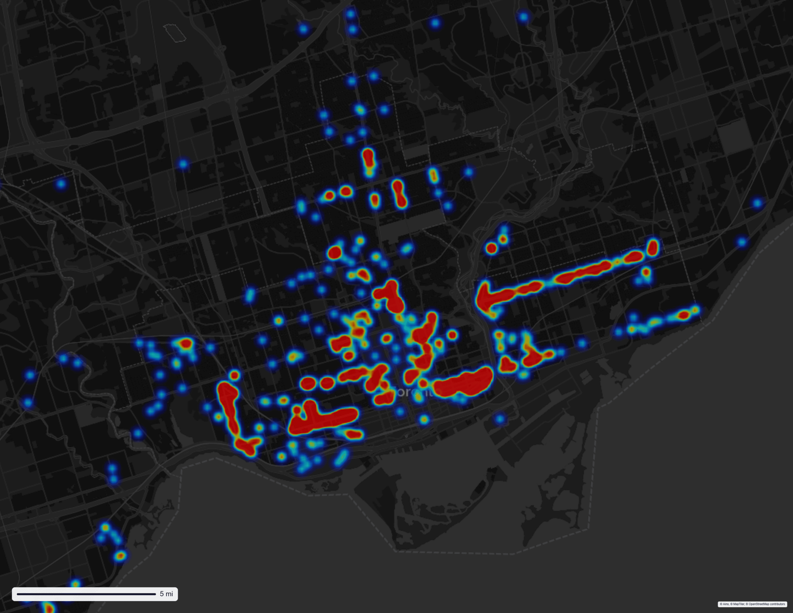
Urban Safety Perception Among Women and Gender- Diverse People
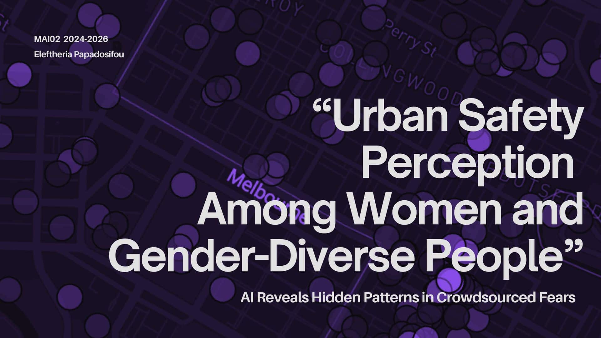
AI Reveals Hidden Patterns in Crowdsourced Fears The Problem According to the International Survey on Sexual Harassment in Public Spaces (L’Oréal Paris & Ipsos, 2023), 92% of young women in Spain have experienced street harassment. The same research states that this number is 80% globally. And yet, as Gardner puts it in Passing By: Gender … Read more
A Systematic Review of Toronto Architectural Heritage Register
Applying CLIP vector embeddings to defensibly evaluate the architectural value of heritage-listed buildings Project Summary Project Presentation
Hardware III: Drift

Human-in-the-Loop: Interactive Systems Faculty: Hamid Peiro + Aleksandra Kraeva Hardware III is a cross-discipline project led by Hamid Peiro and Aleksandra Kraeva (Sasha); between MRAC and MAAI to explore the possibilities of interactive design within and around the boundaries of the worlds of robotics and AI. The project aims to better understand how the human … Read more
Designing for Encounter: How Spatial Analysis Reveals the Social Potential of Circulation Spaces
Introduction When we imagine a corridor in a typical apartment building, we picture a purely functional passageway — a space designed for movement, not for meeting. These circulation zones are often long, narrow, and socially inert. Yet they structure much of our daily experience of housing, shaping how residents encounter one another. Cohousing projects show … Read more
