
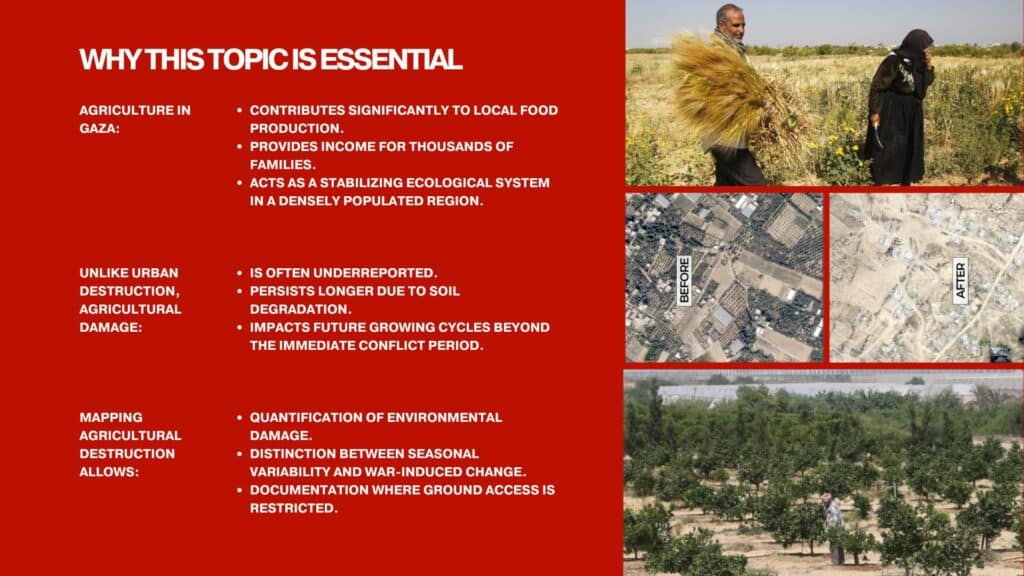
Agricultural landscapes often disappear from visual and political attention during conflict, overshadowed by images of urban destruction.
This project uses satellite imagery to examine agricultural land in Gaza, focusing on the Beit Hanoun belt as an intersection between destruction and food systems. Through vegetation indices and bombing crater detection, the study distinguishes seasonal agricultural cycles from war-induced changes in natural landscapes. This project analyzes agricultural land in Gaza using NDVI (Normalized Difference Vegetation Index) and a dataset of more than 1,000 satellite images collected across multiple years. Mapping from afar allows documentation where ground access is restricted, enabling the quantification of environmental damage that would otherwise remain underreported or underrecognized.
Agricultural damage in the Beit Hanoun Belt can be understood through both direct and indirect mechanisms. Direct damage results from bombardment impacting cultivated fields, producing craters within parcels, burning vegetation, displacing soil layers, and destroying irrigation pipes. These effects immediately disrupt crop growth and alter soil structure. Indirect damage occurs even in areas not directly struck. When farmers are displaced, fields are left unmaintained, leading to abandonment and progressive vegetation loss. At the same time, the destruction of irrigation lines, pumping stations, and access roads interrupts water supply and physical access to farmland, further reducing agricultural productivity. Together, these processes demonstrate that land degradation extends beyond the blast radius, reshaping agricultural systems through both physical destruction and infrastructural and social disruption.
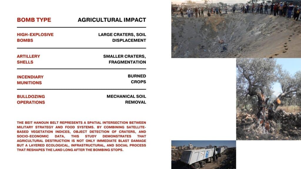
Different forms of military activity generate distinct patterns of agricultural degradation, each altering the land in specific ways. Large-scale detonations reshape field topography and disturb soil structure at a depth that affects future cultivation cycles, while repeated shelling fragments the surface and disrupts planting continuity. Fire-based munitions eliminate perennial crops and damage long-term tree productivity, particularly in orchards where recovery takes years. Mechanical ground operations further transform farmland by stripping or compacting soil layers, removing vegetation cover, and altering drainage patterns. Together, these actions not only interrupt a single harvest but also modify the physical and ecological conditions necessary for sustained agricultural regeneration.
The map indicates a significant reduction in built structures between 2022 and 2025. Large portions of previously developed areas have disappeared, reflecting widespread demolition and destruction across the urban fabric. The dataset used for this is Dynamic World V1 on Google Earth Engine.
Between 2022 and 2025, NDVI values decrease across significant portions of the study area, indicating reduced vegetation density and health. Productive agricultural fields and patches of greenery appear disrupted or absent. This shift suggests landscape degradation and reduced ecological productivity. The dataset used for this is COPERNICUS/S2_SR on Google Earth Engine.
