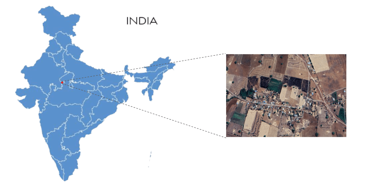
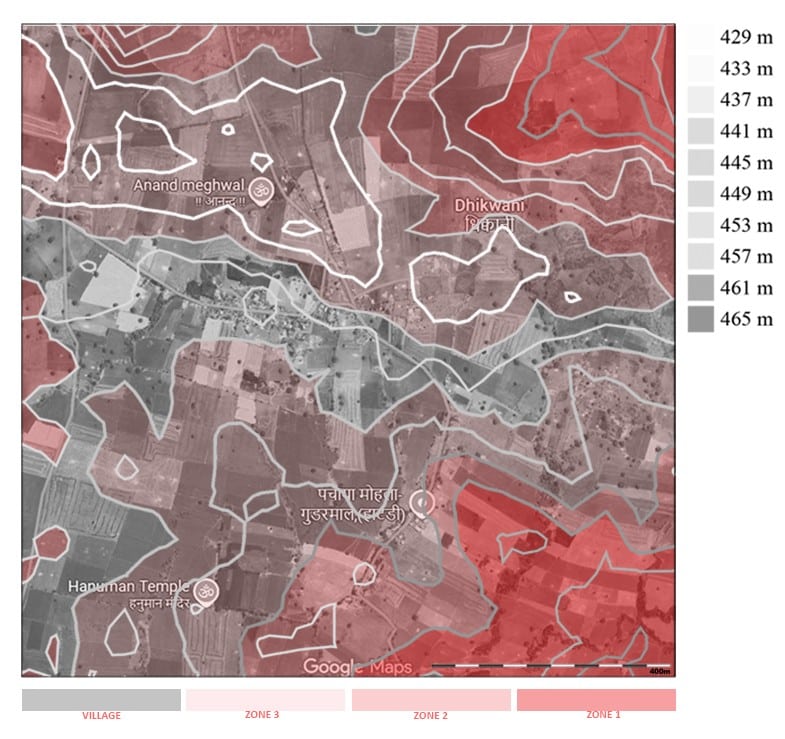
Dhikwani, Rajasthan
Dhikwani is a Village in Shahbad Tehsil in Baran District of Rajasthan State, India. It belongs to Kota Division . It is located 67 KM towards East from District head quarters Baran. 16 KM from Shahbad. 279 KM from State capital Jaipur.
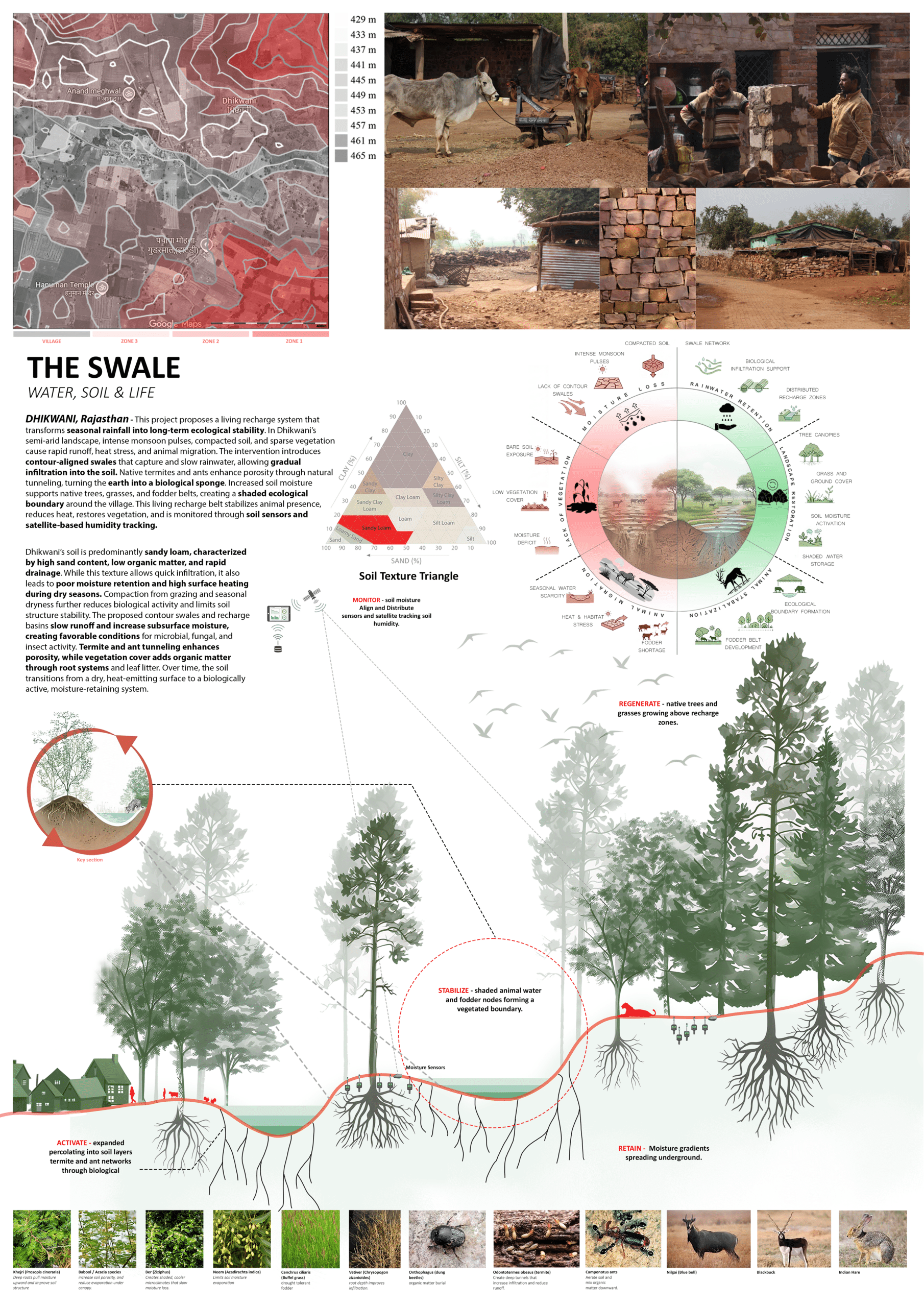
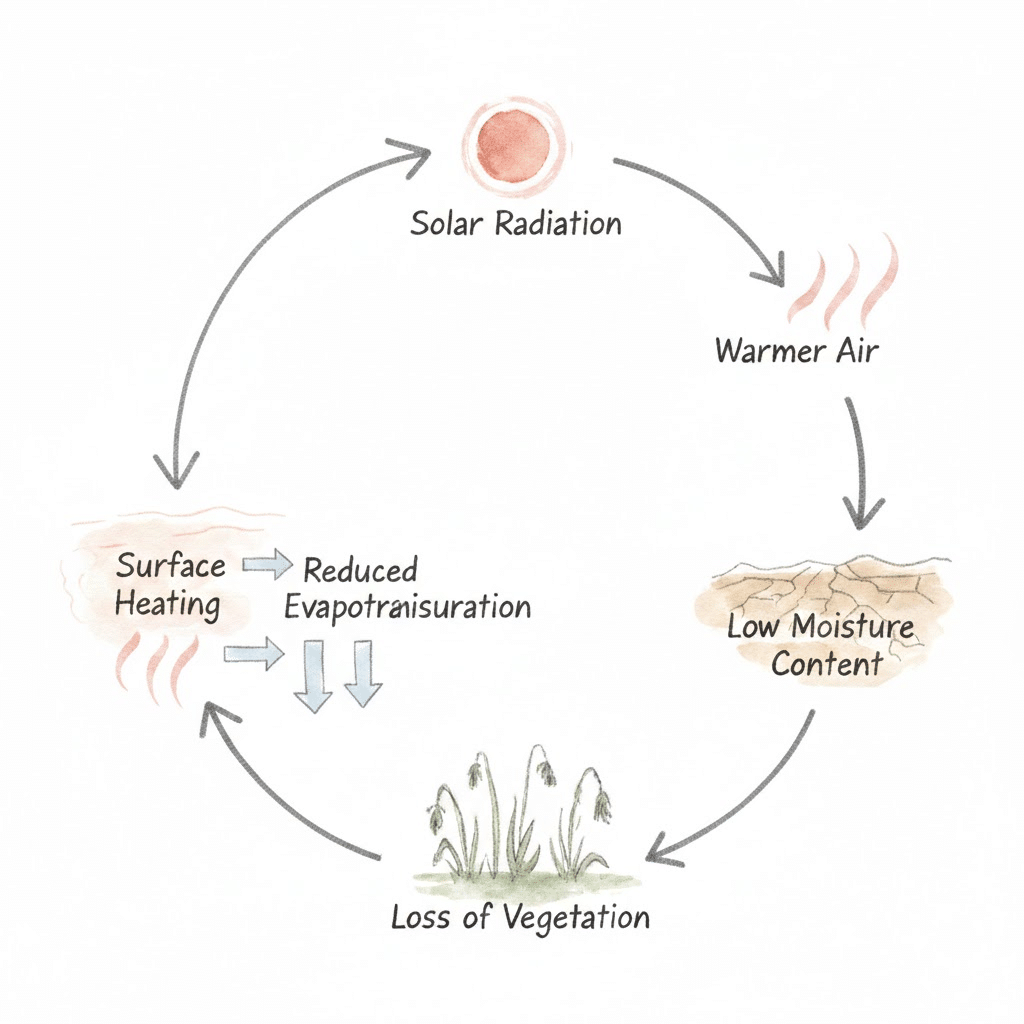
Dhikwani lies in the semi arid region – high solar radiation, low rainfall zone. Soil dries rapidly and emits heat, further reducing moisture.
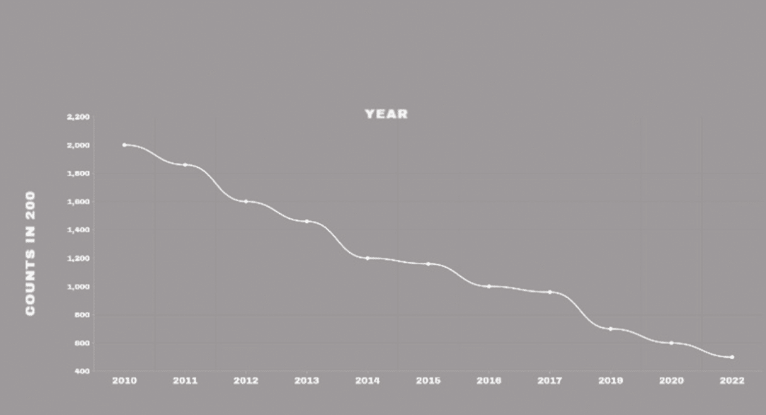
The villagers have been settled here for the past 530 years and they are facing extinction. The community had a population of 1860 as per the 2011 census. At present the population is at around 523 and it is reducing day by day due to the many environmental and economic factors.
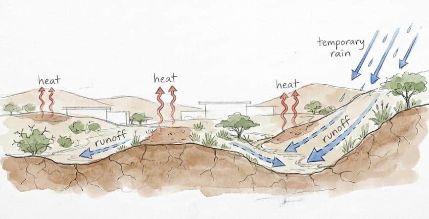
It has gently sloping land with small natural level changes. Rainwater flows slowly across the surface during monsoon.
Because the slopes are mild, water spreads out instead of collecting deeply.
Hydrology
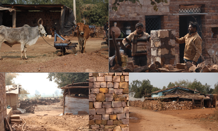
Water in Dhikwani is primarily sourced from groundwater through hand pumps, traditional wells, and tube wells, all of which are highly seasonal and shared by people and animals. During dry months, these sources become scarce, forcing dependence on a few central points. The absence of surface water and recharge systems intensifies pressure on groundwater and increases competition for access.

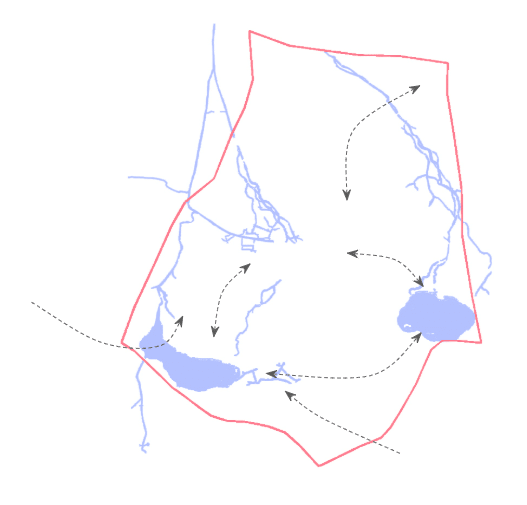
Animal Migration Patterns
As village water sources dry up, animals move outward in search of water and fodder. Cattle, buffaloes, goats, sheep, stray dogs, pigs, Jackals, Wild Boar and blue bulls (nilgai),Indian Leopard are commonly seen entering nearby towns and cities attacking people and causing imbalance.
Environmental drivers
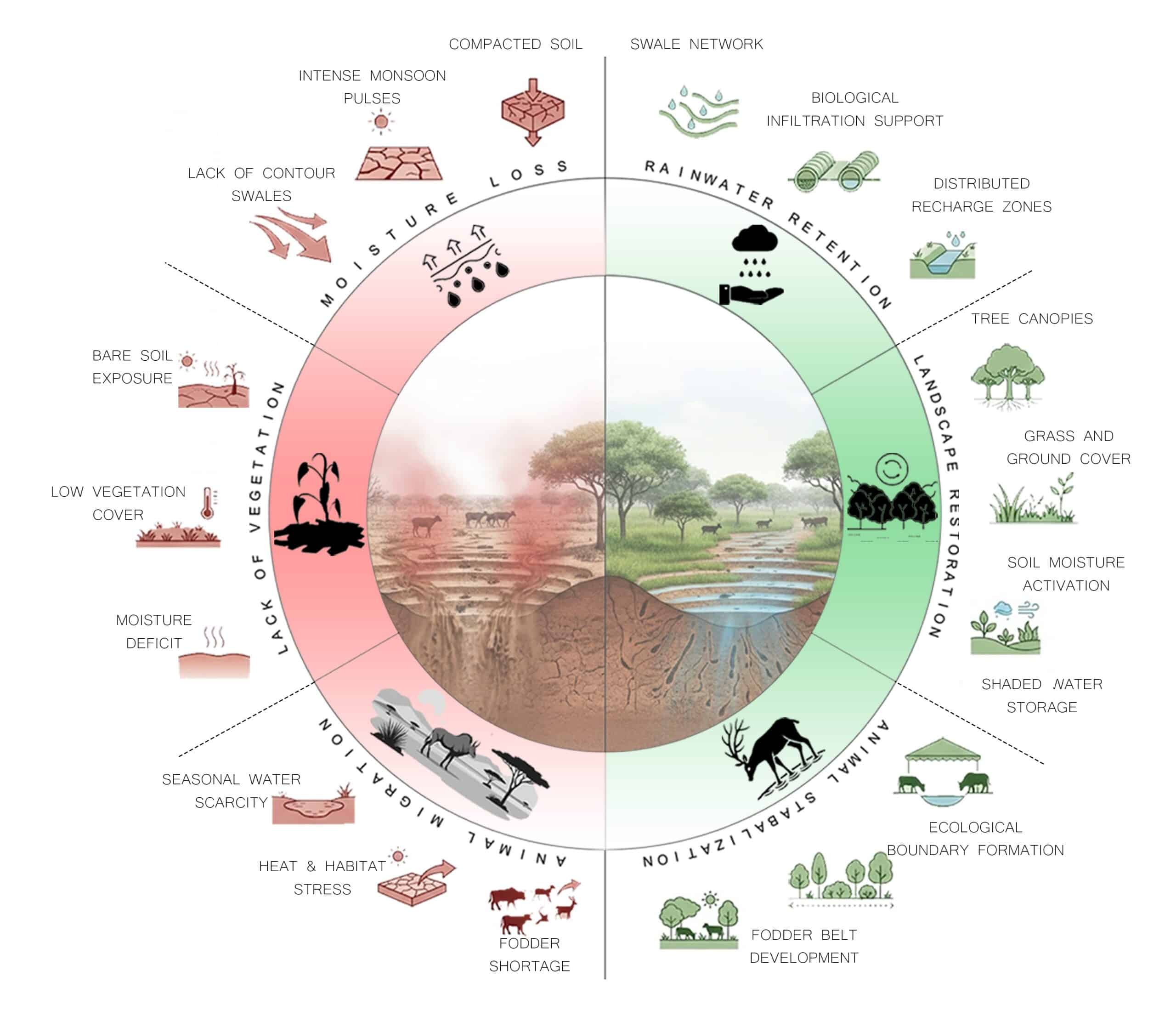
Intense but short monsoon rainfall causes rapid surface runoff instead of groundwater recharge.
Sandy loam soil and high solar radiation accelerate moisture loss and increase surface heat.
Seasonal water scarcity and vegetation decline drive animal migration and ecological instability.
Can biologically activated contour swales transform seasonal monsoon runoff into long-term ecological stability in semi-arid villages?
From Runoff to Regeneration
Our intervention introduces contour-aligned swales that capture and slow monsoon runoff, allowing water to infiltrate into the soil.
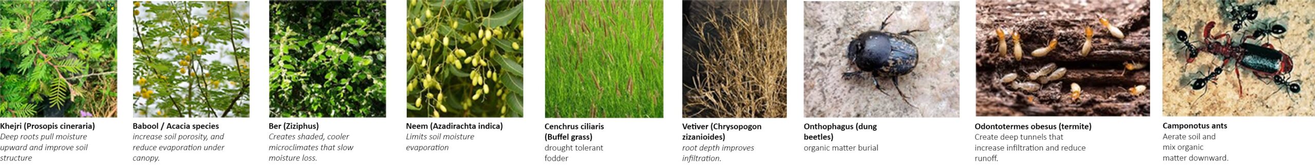
Native soil organisms such as termites, ants, bacteria, and fungi enhance porosity and moisture retention, transforming the soil into a living recharge system.
Stabilized moisture supports vegetation growth, reduces surface heat, and creates a shaded ecological boundary that limits animal migration and restores balance.
“Reframing hydrology through contour swales and biological activation to
restore moisture balance, cool the land, and create a stable ecological boundary“
Nature as Infrastructure
“Local Ecological agents transforming water capture into long-term resilience.”
Biological Chain Reaction
Tiny soil architects tunnel beneath the village, quietly reshaping the land from below.
As moisture returns to the soil, mammals begin to settle within the restored landscape, and the climate finally exhales as heat stress reduces and ecological balance is gradually re-established.
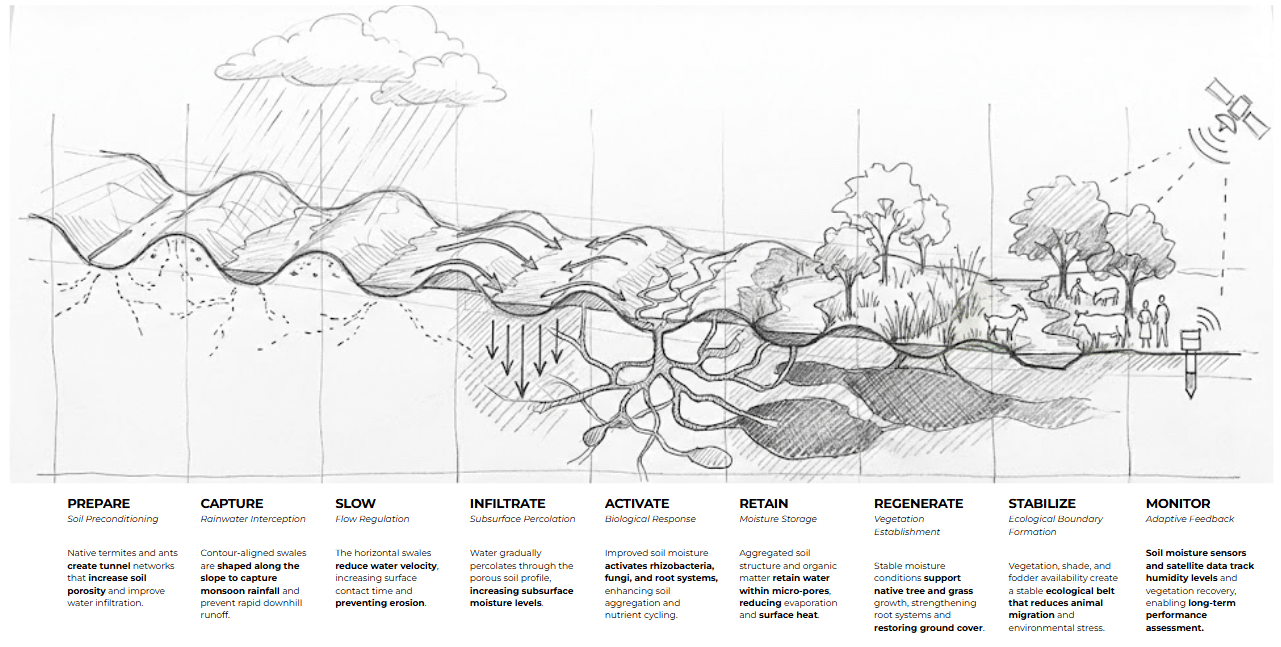
Living Recharge System – Final Visualization
An Integrated Ecological Infrastructure