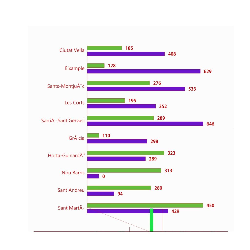
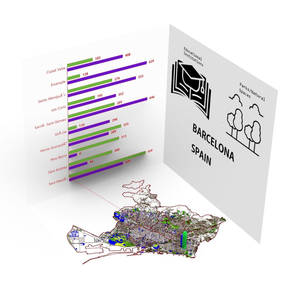
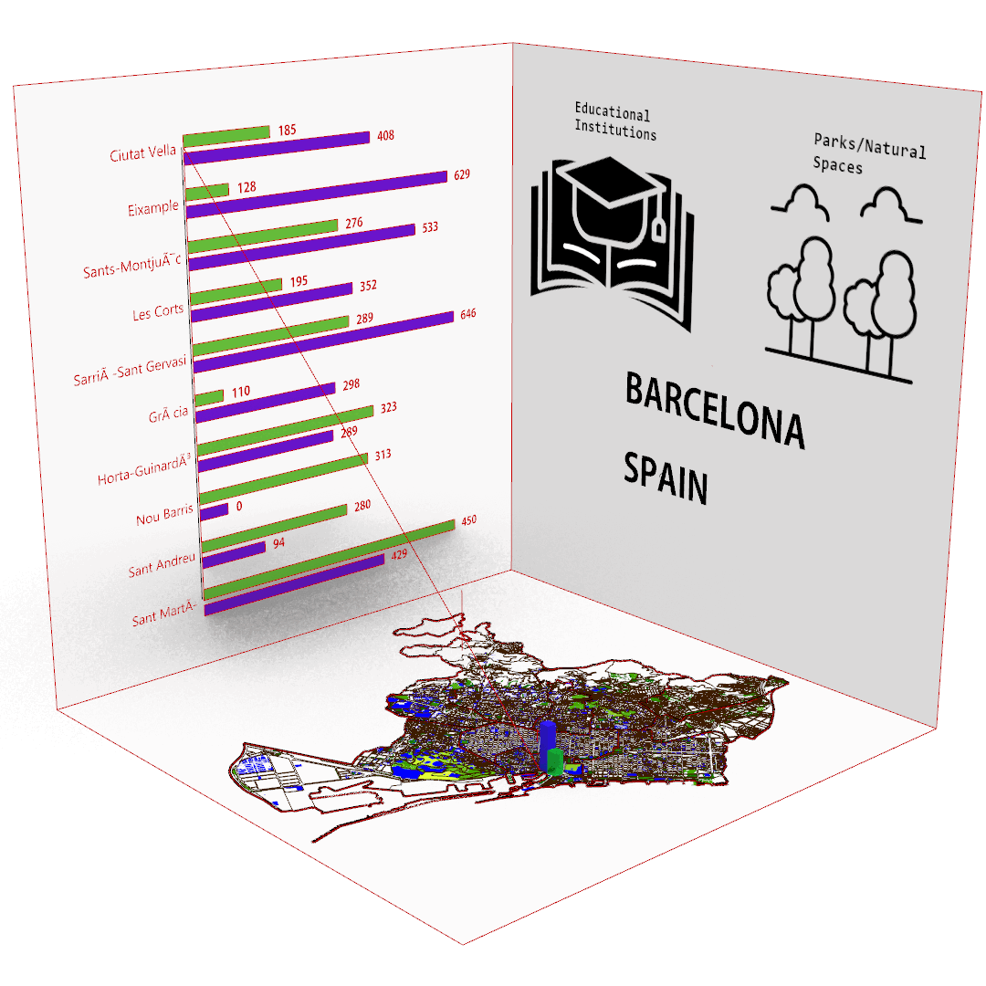
Finding the ratio of natural Green spaces to the Educational institutions in Barcelona city, Spain.
TOOLS USED


INTRODUCTION
Barcelona, like many modern cities, has been actively working on providing open datasets to the public. Open datasets are valuable resources that foster transparency, innovation, and engagement within communities. Barcelona’s open datasets cover a wide range of topics, including urban planning, transportation, public services, environmental data, and more.
The city’s commitment to open data aims to empower citizens, researchers, developers, and businesses to leverage information for various purposes. By making datasets accessible, Barcelona encourages collaboration and the development of applications that can enhance the quality of life for residents. Use cases would involve;
Governance
Planning
Security & Tourism
Utilities management
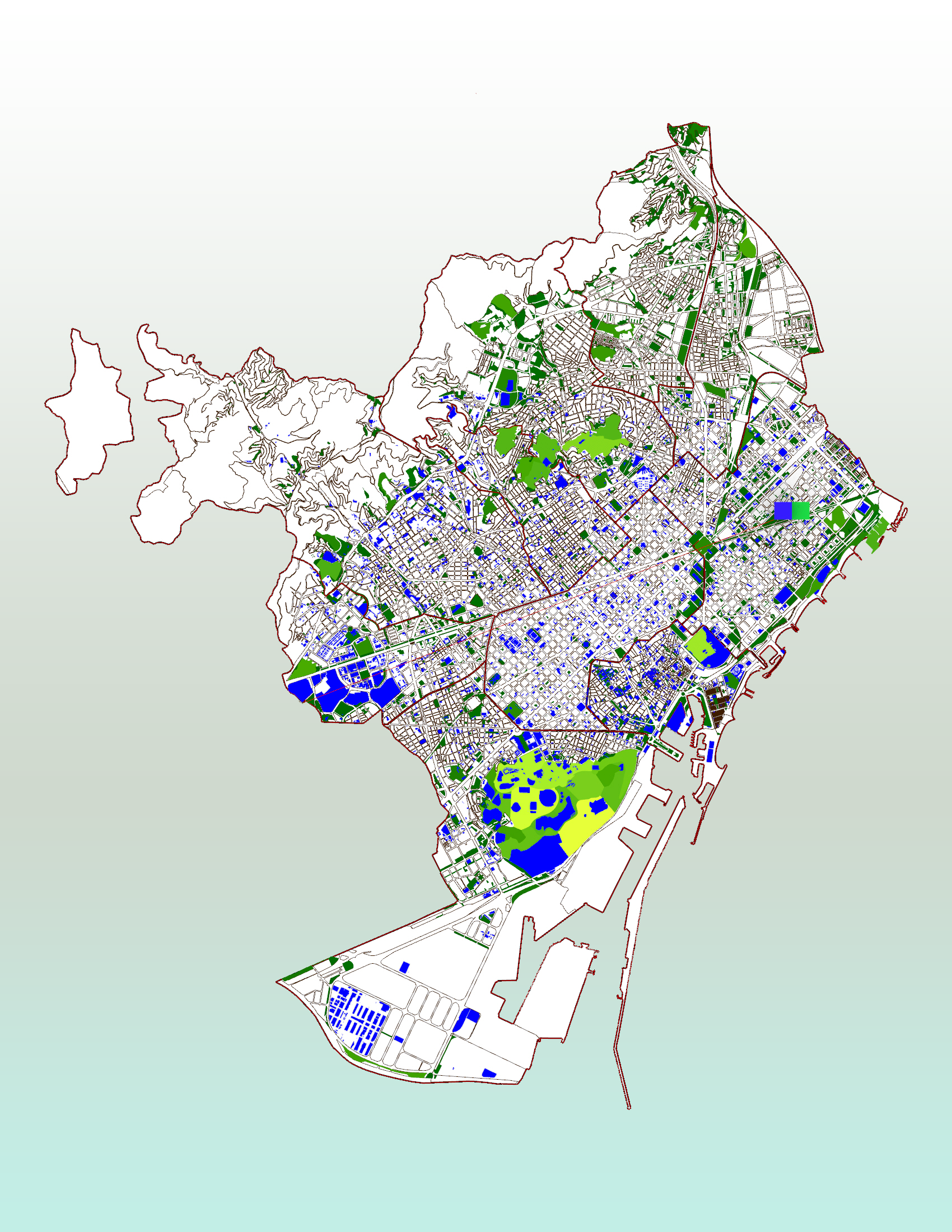
In this case, the SHAPEFILE data from the Barcelona open data source was used; that contained data regarding the District boundaries within the city. The Educational Institutions and the Green open spaces and Natural Parks was also sourced from the same place.
These Shapefiles were then imported into Grasshopper through the ‘URBANO’ plugin.
The different shapefiles were required to interact with each other, as the brief of this project was to display the number of green spaces and institutions within each district of the city respectively.
ANAYSIS