
Urban Quant is a data‑driven urban design tool delivering area and massing analyses for buildings and open spaces. It calculates Built‑Up Area (BUA), Gross Floor Area (GFA), service/core areas and building levels, integrating solar exposure and sun‑hour simulations. The platform converts regulatory, programmatic, contextual inputs into comparable scenarios, visualizations, and reports for architects.
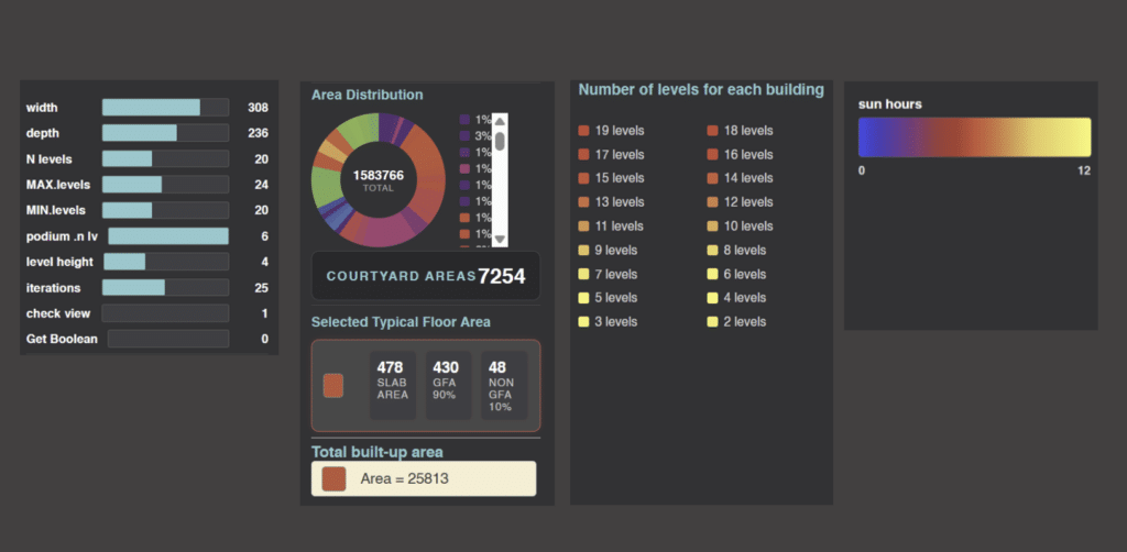
Area distribution calculation
first part of analysis is how to automates the calculation of building area breakdowns by generating a 3D massing model from user‑defined parameters such as width, depth, number of levels, and floor height. Based on the resulting geometry, it computes key metrics including slab area, gross floor area (GFA), non‑GFA spaces, and total built‑up area. The interface also visualizes area distribution across the site and uses color‑coding to highlight variations in built‑up intensity. This allows designers to quickly evaluate density, efficiency, and spatial organization during early‑stage urban planning.
Number of levels
The color‑coded buildings represent the number of levels across the site, allowing quick comparison of height distribution. By automating massing generation and visualizing height variation, the tool supports early‑stage planning decisions related to density, zoning compliance, and spatial organization.
Direct Sun Hours
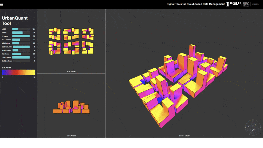
This visualization demonstrates how the tool evaluates sunlight exposure across an urban block by combining parametric massing inputs with solar‑hour analysis. Buildings are color‑coded according to the number of sun hours they receive, allowing designers to quickly identify shaded zones, well‑lit façades, and overall daylight performance. By integrating massing generation with environmental simulation, the tool supports early‑stage decisions related to sustainability, livability, and urban form optimization
Core Components
massing parameters : adjusting inputs such as massing heights, dimensions etc
Area distribution : component where area analysis for selected buildings displayed
N.levels : displays number of level of each building
sun hours :color gradient bar for direct sun hours distribution
How These Analysis Tools Support Smarter Urban Design
These analysis tools help architects and planners quickly test massing options, understand buildable area, evaluate height distribution, and assess sunlight performance. Together, they support faster decision‑making, improve design quality, ensure regulatory compliance, and create more efficient, livable, and environmentally responsive urban developments.
