
How accessible is the city we live in? Beyond iconic landmarks and infrastructure, everyday life is shaped by small but essential places: schools, parks, shops, and services. Urban Amenities Accessibility in Istanbul is a computational design project that explores how these everyday amenities are distributed across Istanbul’s historical center and how easily they can be reached on foot. By combining open urban data with algorithmic tools, the project aims to reveal hidden spatial inequalities and offer a data-driven perspective on walkability and urban equity.
| From Data to Urban Insight
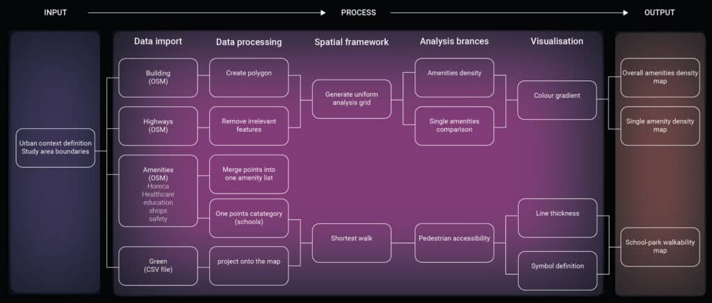
The project was developed using Grasshopper, structuring the analysis through a clear computational workflow. Open datasets were first collected and curated, including building footprints, street networks, and points of interest from OpenStreetMap, alongside green areas and parks sourced from Kaggle. These datasets were then processed to create an analytical grid covering the study area. This grid allowed the project to move beyond individual points and instead describe spatial patterns, densities, and gradients across the city.
| Mapping urban amenities
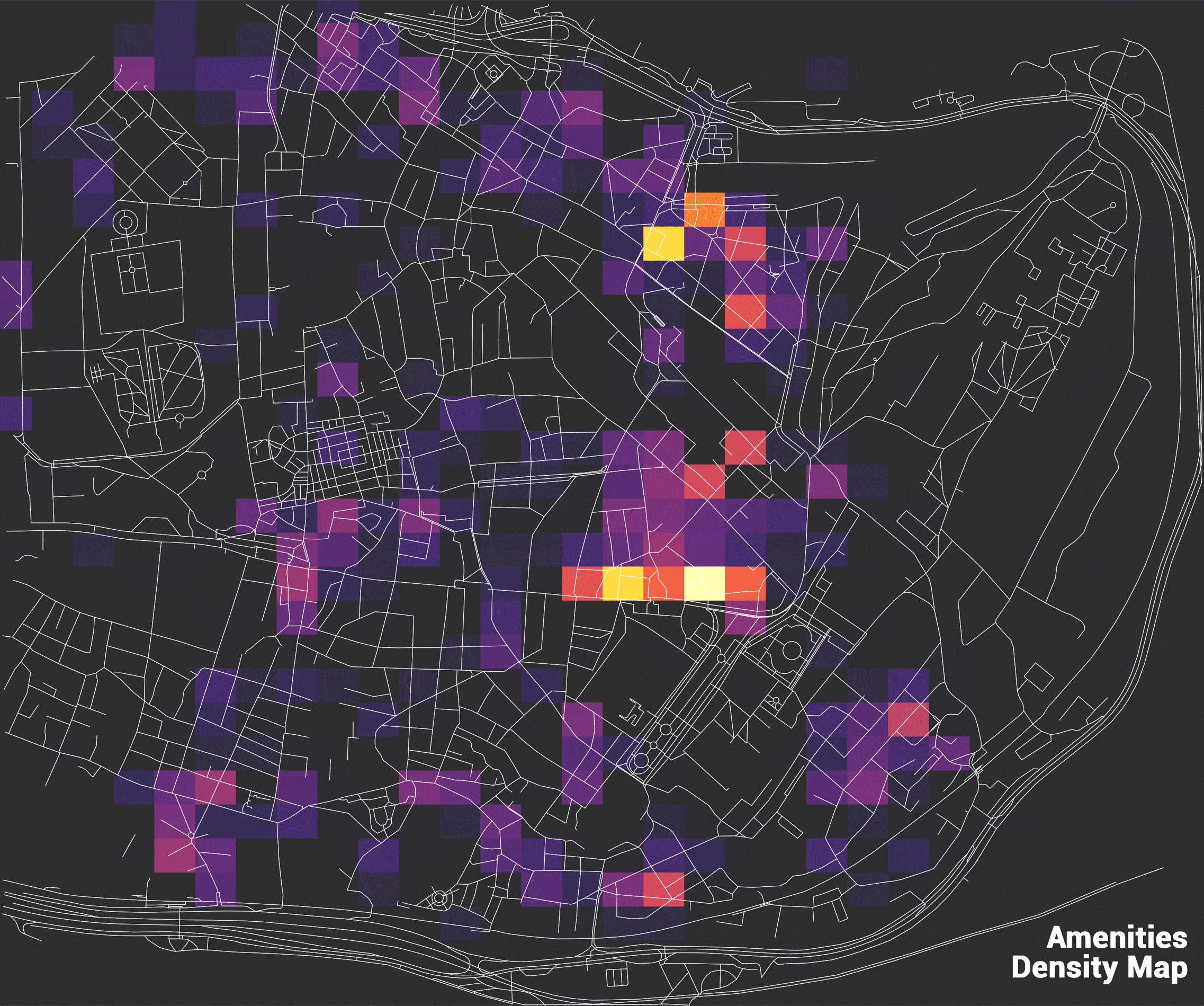
One of the key outputs of the project is an overall amenities density map. Each grid cell is colored according to the number of amenities it contains, producing a gradient that ranges from darker tones (low density) to lighter ones (high density). This visualization makes visible the uneven distribution of services across the city. Areas with a high concentration of amenities emerge clearly, while underserved zones become immediately recognizable, raising questions about spatial equity and access to daily resources.
| Measuring Walkability
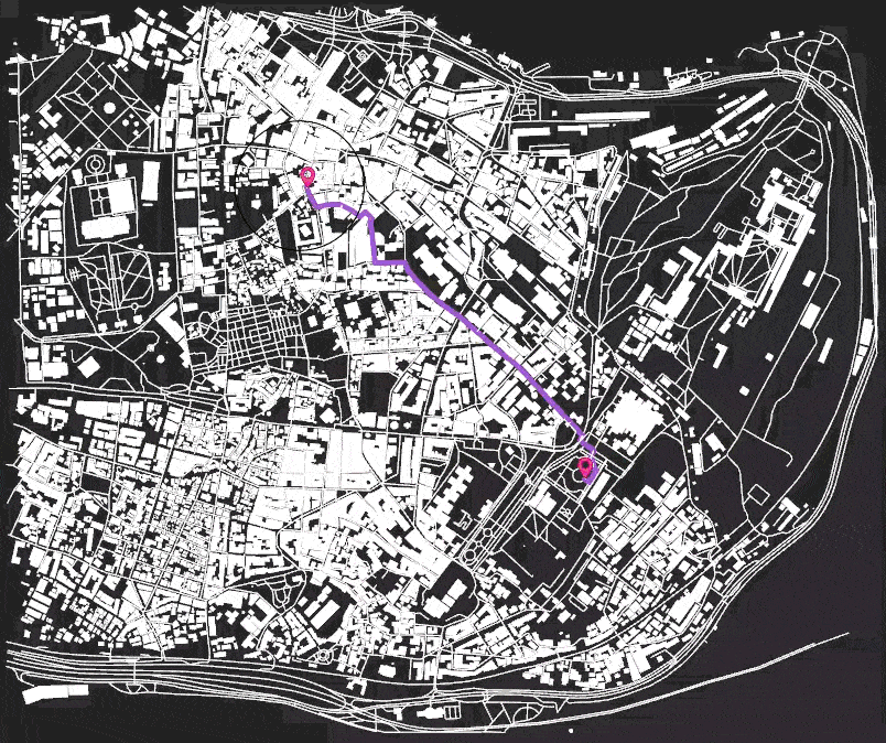
Accessibility is not only about proximity, but also about how people move through the city. To address this, the project focuses on walkability by calculating the shortest pedestrian routes between schools and the nearest parks. Using the existing street network, the system dynamically generates walking paths that adapt to the selected starting point. This approach reflects real pedestrian conditions and allows for a more accurate evaluation of how accessible green spaces are for students in different parts of the city.
| Towards data-informed urban futures
Urban Amenities Accessibility in Istanbul demonstrates how computational design can act as a bridge between raw data and urban understanding. By transforming open datasets into analytical maps, the project offers tools that support critical reflection on accessibility, equity, and everyday urban life. Rather than providing definitive answers, the work opens up new questions: How can planning strategies address underserved areas? How can walkability become a central parameter in urban design? And how can data-driven approaches support more inclusive cities?
