
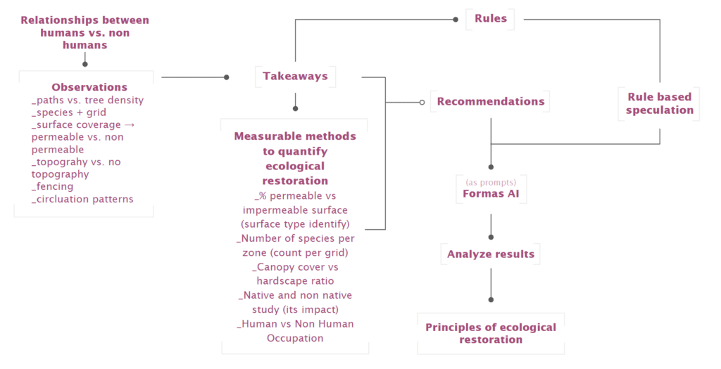
This project investigates Parc del Centre del Poblenou through the lens of Designing for More than Humans. The park, although permeable and vegetated, is spatially structured around human circulation and programmed activity. As a result, human occupation is continuous and dominant, while non-human life remains fragmented and residual.
Through rule-based speculation, the project tests how restructuring circulation, redefining soil conditions, adjusting ground demarcation, and diversifying species distribution could shift the park from diffuse human dominance toward more stable ecological habitats.
How would designed ecologies change if they were designed less for human-centered use, but rather to support and amplify biodiversity and ecological restoration? How must humans occupy the same spaces differently, in order to achieve this?
rfgthyjk,.l
Methodology
Development of the Park
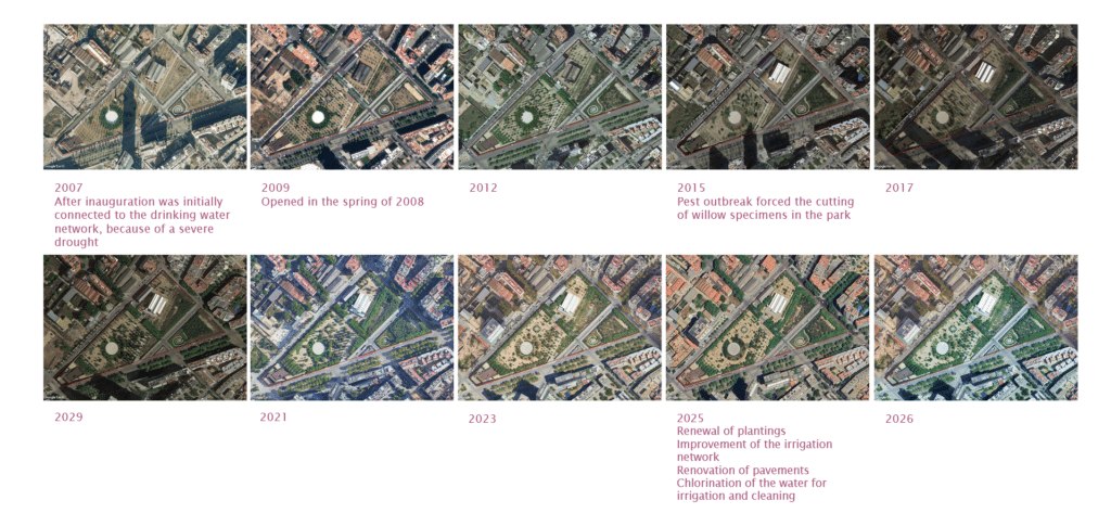
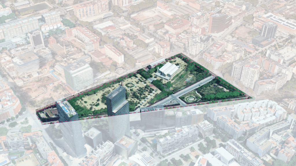
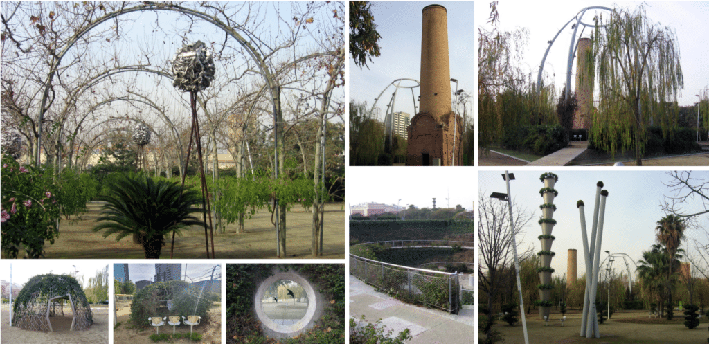
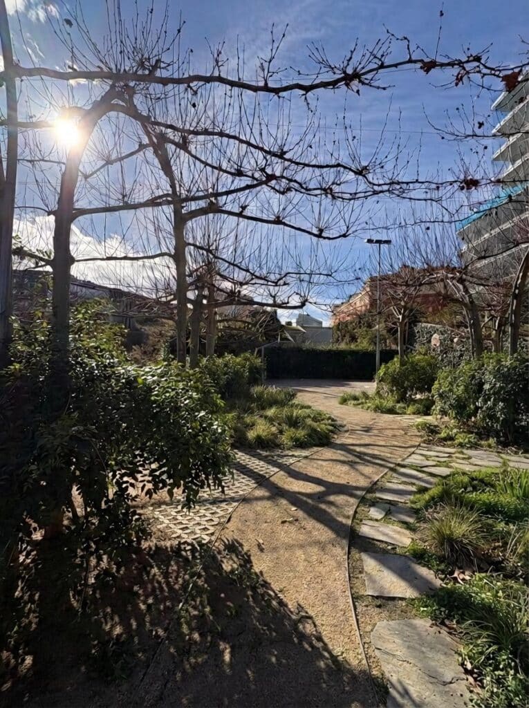
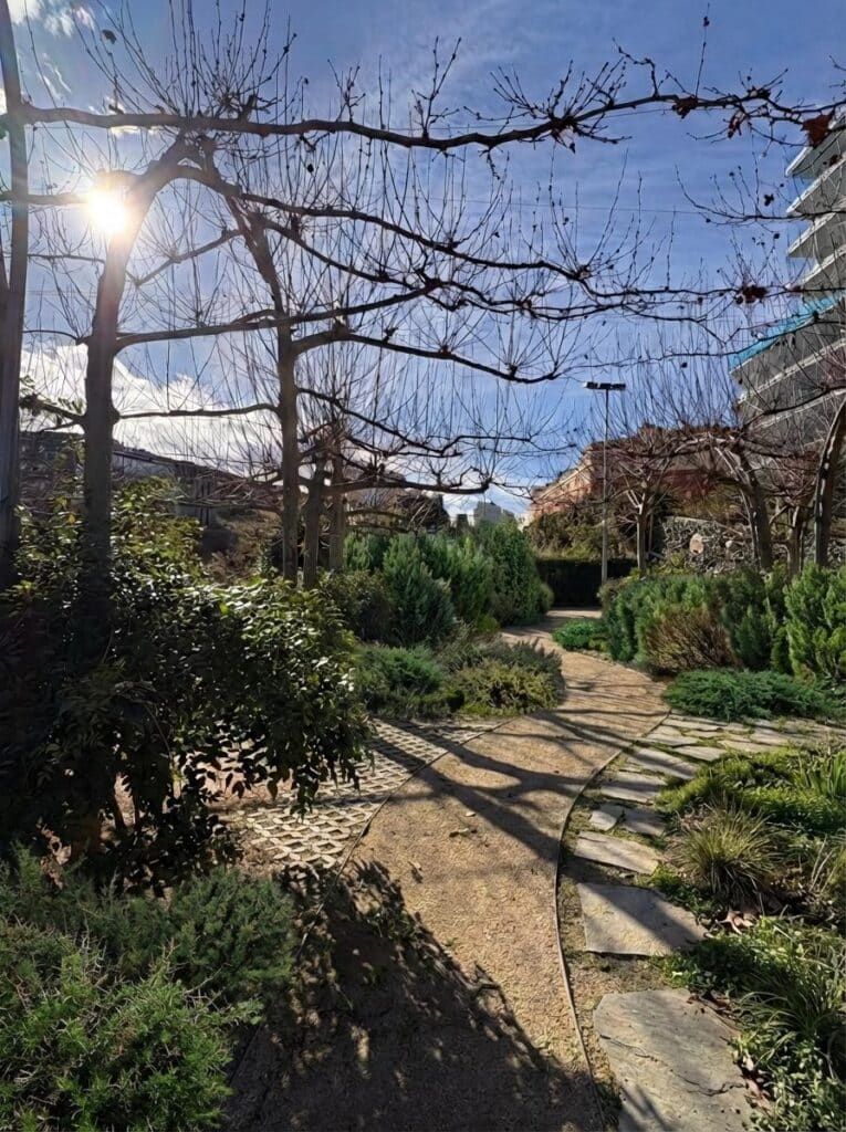
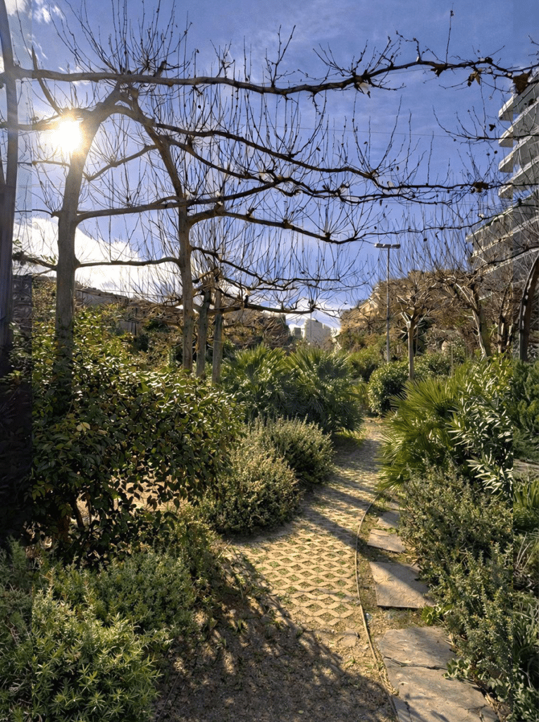
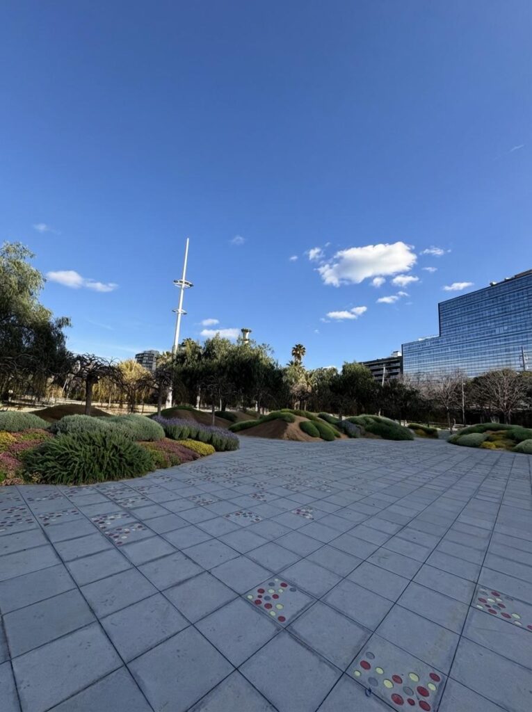
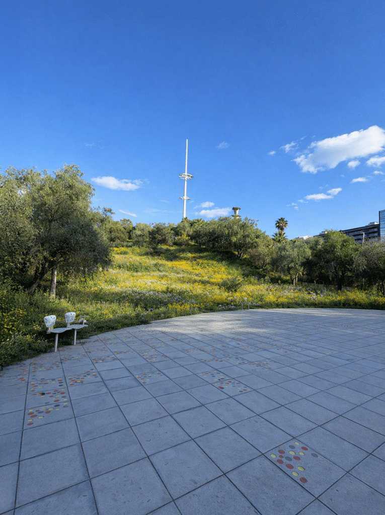
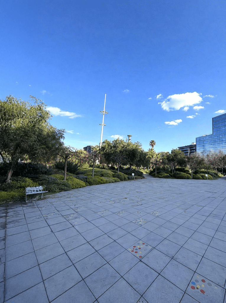
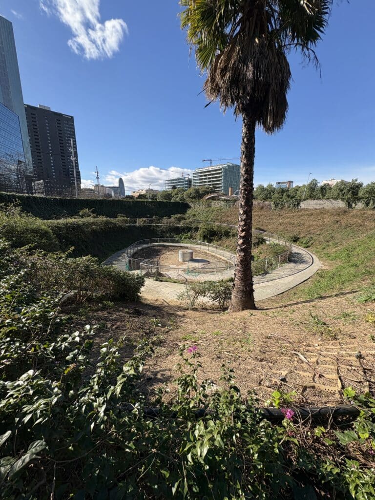
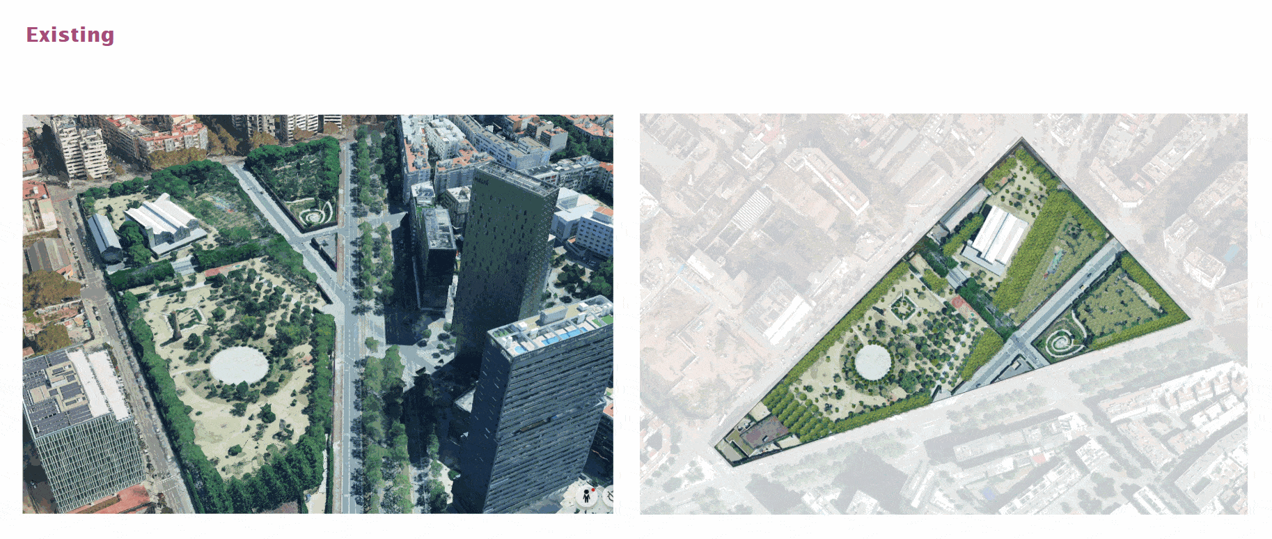
Parc del Centre del Poblenou is located adjacent to the busy Avenue Diagonal in the Provençals del Poblenou area and is surrounded by the newer high-rises of the 22@ District. Designed by Jean Nouvel in 2008, the 5.5-hectare park was built on former tram tracks and industrial grounds.
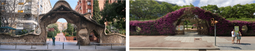
The site is bisected by several roads, dividing it into three main sections; however, its architectural language connects these fragmented islands, most notably where the park continues over the road through arching vines that create a sense of spatial continuity. A large perimeter wall covered in bougainvillea encloses parts of the park, punctured by portal-like windows that allow visual access from the outside. Open daily from approximately 8:30 to 19:00–21:00, the park also integrates environmental considerations such as water conservation in times of drought and the incorporation of a waste collection facility. At the same time, the diverse and sometimes complex species mix has been critiqued for making maintenance challenging.
Site images and map
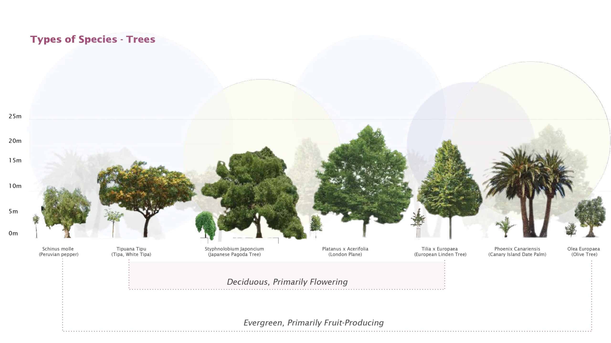
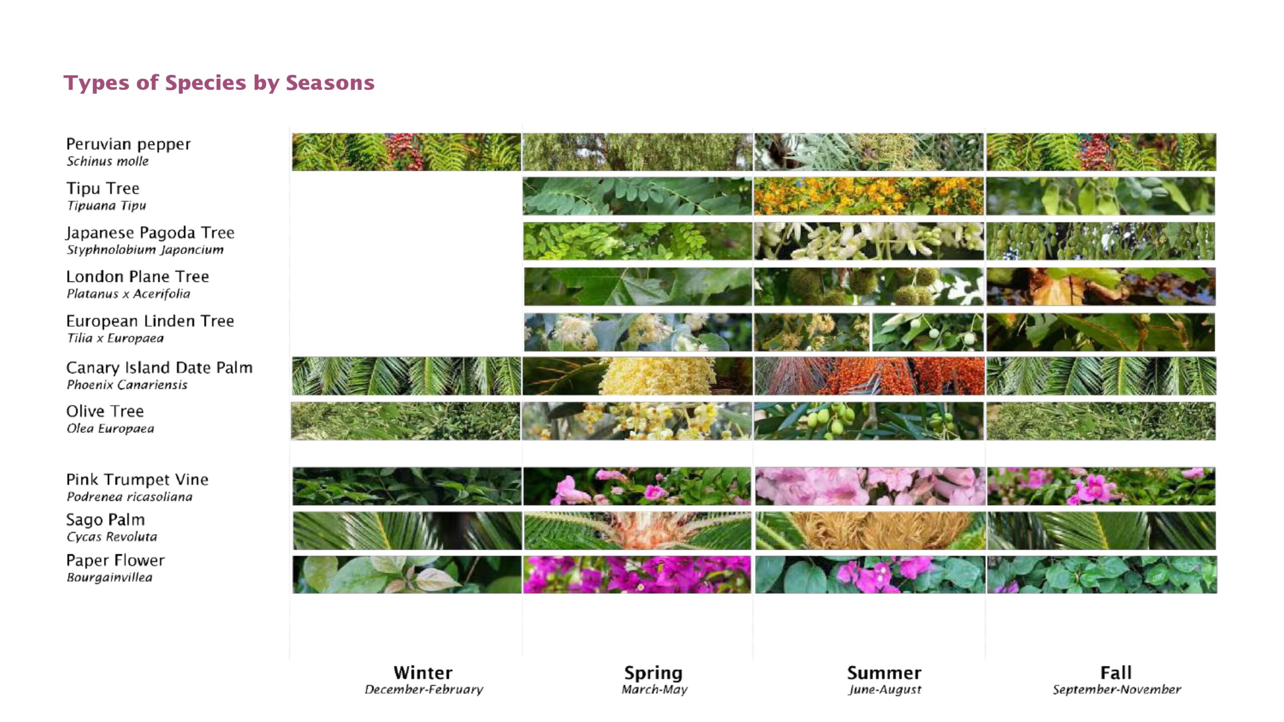
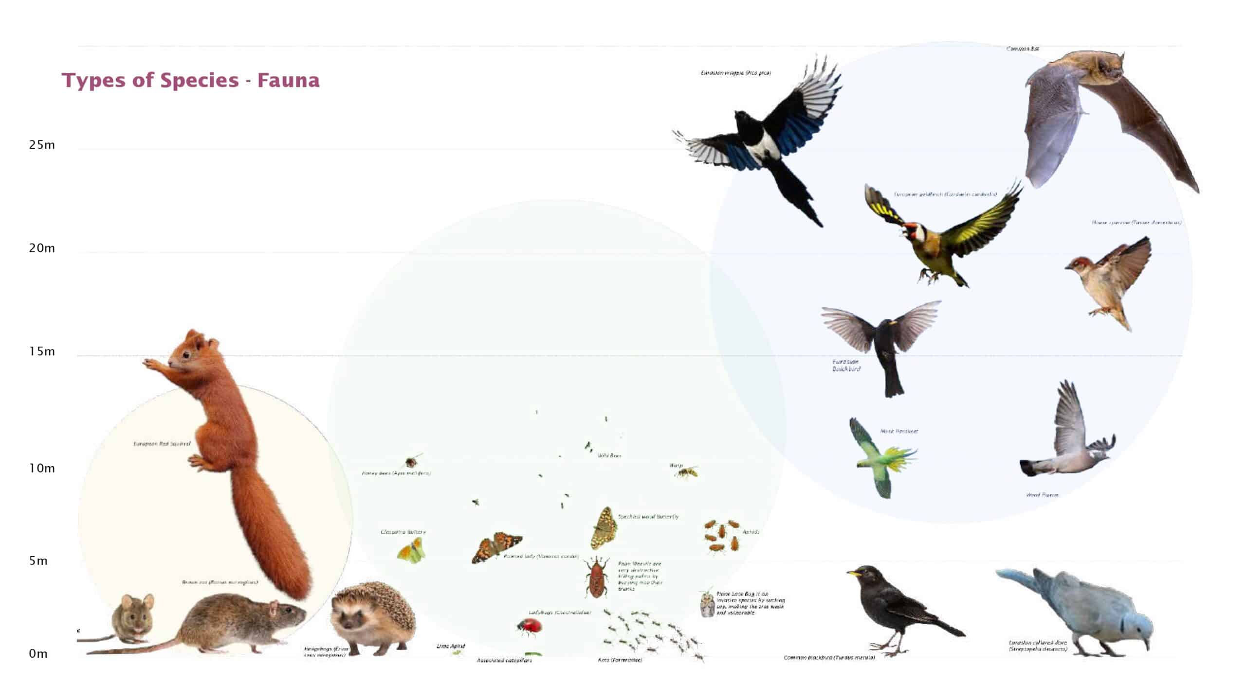
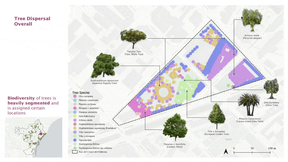
There are 14 different types of species throughout the park, totaling 714 trees. For our project we focused on 7 of the most prominent species to do a deeper analysis of species and their relationships.
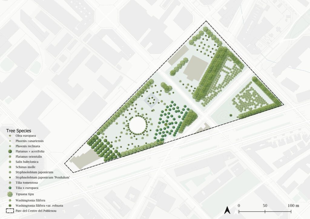
Tree Species
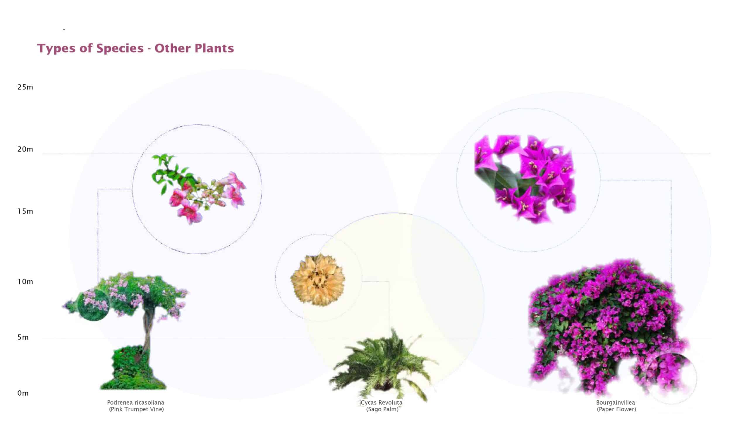
The vegetation in Parc del Centre del Poblenou is a lively mix of species chosen for their adaptability to Barcelona’s Mediterranean climate and urban conditions. While not all are strictly native, many — such as the London plane tree (Platanus × acerifolia) and Tipuana (Tipuana tipu) — are already common in the city’s streets and green spaces and well-adapted to local urban stressors. Platanus × acerifolia is especially prevalent in Barcelona, where it represents one of the most frequently planted shade trees in public areas, valued for its resilience and broad crown. Deciduous and flowering species provide seasonal change, while evergreens like Olive (Olea europaea) and palms such as Canary Island Date Palm (Phoenix canariensis) add year-round structure and fruiting potential. Climbing and flowering plants like Bougainvillea and Podranea ricasoliana contribute dramatic color and vertical greenery, helping to define spaces and attract pollinators
Site Analysis
Observed Design Framework
Spatial Zoning (through grids, impervious surfaces, human circulation points, tree species) | Ground Cover demarcation (Paths of movement defined through surfaces, activity zones demarcated by ground cover) | Architectural Structures (Clearly constructed, designed, and permanent structures to remain) | Quantity of Biodiversity (Many species types, differentiated functional and pollinator types)
rfcvgbh
Location-Specific Analysis
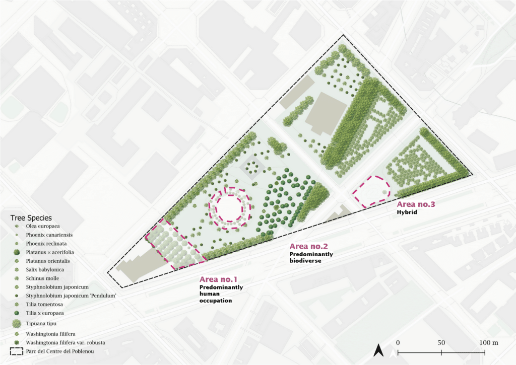
Zones were selected where architectural features appeared to influence biodiversity under three distinct spatial conditions. These areas were then analyzed to evaluate how spatial design shapes ecological patterns and affects non-human occupation.
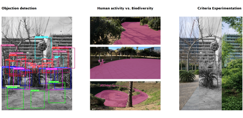
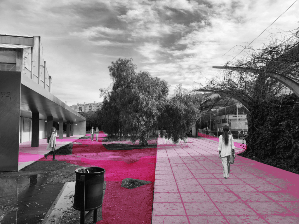
The selected areas were analyzed in relation to existing biodiversity, examining both plant species composition and the presence of human-made elements. The distribution of permeable and impermeable surfaces was evaluated to understand their influence on soil condition, habitat continuity, and patterns of movement.
Based on these observations, conclusions were drawn to formulate guidelines aimed at improving ecological restoration, alongside methods to quantify potential ecological recovery over time.
Rule based speculation
Following the spatial analysis, we used rule-based speculation to reimagine ecological restoration scenarios within the park. The governing rules were extracted from the observed design framework — identifying the park’s intentional logics.
- Rule 01 – Rigid Grid Alignment – All trees and vegetation align to a strict grid
- Rule 02 – Monoculture by Zone – Each grid cell contains a dominant single species.
- Rule 03 – Uncontrolled Circulation through Weak Delineation – Compacted soil extends beyond official paths, allowing informal circulation
- Rule 04 – Pruned Tree Architecture – Trees are shaped to follow a specific ornamental shape
By selectively modifying Rule 03, which invites uncontrolled circulation through compacted soil extending beyond official paths, alternative scenarios were reimagined to evaluate how restructuring movement could influence ecological recovery across different areas of the park.
Problem Statement
jhgkjhg
The park lacks clear distinction between circulation paths and ecological zones, allowing uncontrolled human movement across compacted soil areas. This weak spatial delineation disrupts habitat continuity, reduces soil permeability, and limits the park’s ecological restoration potential.
How can controlled circulation within the existing grid framework restore biodiversity while maintaining human accessibility?
jhgkjhg
jhgkjhg
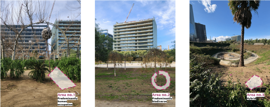
Rule based speculation for: Area no. 1 – Vaults (Predominantly human occupation)
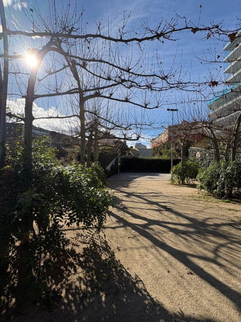
Existing condition: Uncontrolled Circulation through Weak Delineation
Prompt 1: Clear circulation paths with different human pathway materials and approaches vary depending on topography and space use-from enabling vegetation growth in designated areas while still allowing human occupation.
Prompt 2: Restrict human occupation via species height and type. Make sure there is a buffer species between pathways and dense shrubs for more protection of species.
Prompt 3: Native shrubs, pathway material restricted to 2 types, Wherever there is no pathway, there should be vegetation.
Ruled based speculation for: Area no. 2 – Square (Predominantly biodiverse)
Existing condition: Uncontrolled Circulation through Weak Delineation
Prompt 1: Introducing more topographical variation as a soft barrier to reduce human movement. Use only native species and avoid grass, use Barcelona specific, drought friendly ground cover.
Prompt 2: Modify only the softscape and avoid encroaching on hardscape, preserve the infrastructure.
Prompt 3: Reduce the topographical incline, make the mounds species more diverse and for them to be modulating as to produce more interaction between subspecies
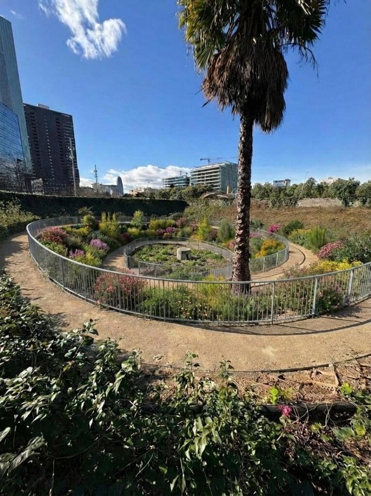
Ruled based speculation for: Area no. 3 – Spiral (Coexistence)
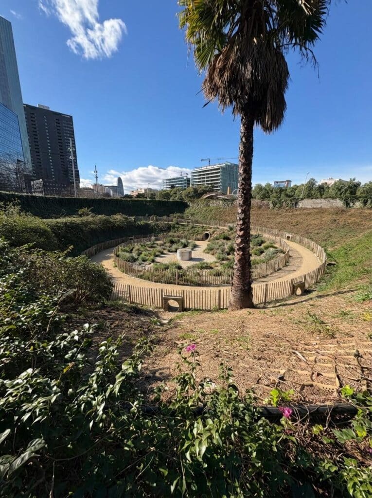
Existing condition: Uncontrolled Circulation through Weak Delineation
Prompt 1: Alter the current circulation path so that it is more defined, but ground surfaces remain accessible but become permeable and boundaries are designed to restrict humans while allowing a few small fauna related passages.
Prompt 2: Show changes that will occur due to restricted human access, if species are introduced then they should be compatible with the existing species and be placed in a structured manner.
Prompt 3: Include changes to biodiversity due to only visual interaction, introduction to compatible native species, keep the pathway permeable and paved
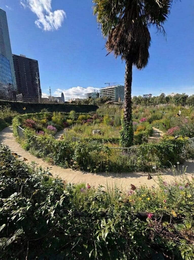
For the rule-based speculation, we reimagined how ecology could be restored in this specific area by restructuring circulation, restricting human access, and increasing scrub density. Comparing the original image to the AI-generated edit, the intervention demonstrates a clear shift in ecological intent.
Improved spatial delineation facilitating habitat continuity, increased soil permeability, and increased potential to ecologically restore the park.
Findings
The qualitative benefits for non-human life primarily emerge through the reduction of disturbance. By concentrating circulation and protecting vegetated zones, the park creates more stable habitat conditions, increasing the potential for pollinators and other species to establish continuous life cycles. Improved soil conditions, supported by initial decompaction and root growth, enhance microbial activity and water infiltration, improving the ecological foundation of the park.
This ecological restoration could also benefit humans. A more clearly structured circulation system produces a directed and legible spatial experience, allowing visitors to intuitively understand where movement is intended. Healthier and more stable vegetation contributes to increased shade and improved microclimatic comfort, demonstrating that prioritizing non-human life can simultaneously enhance human experience.
