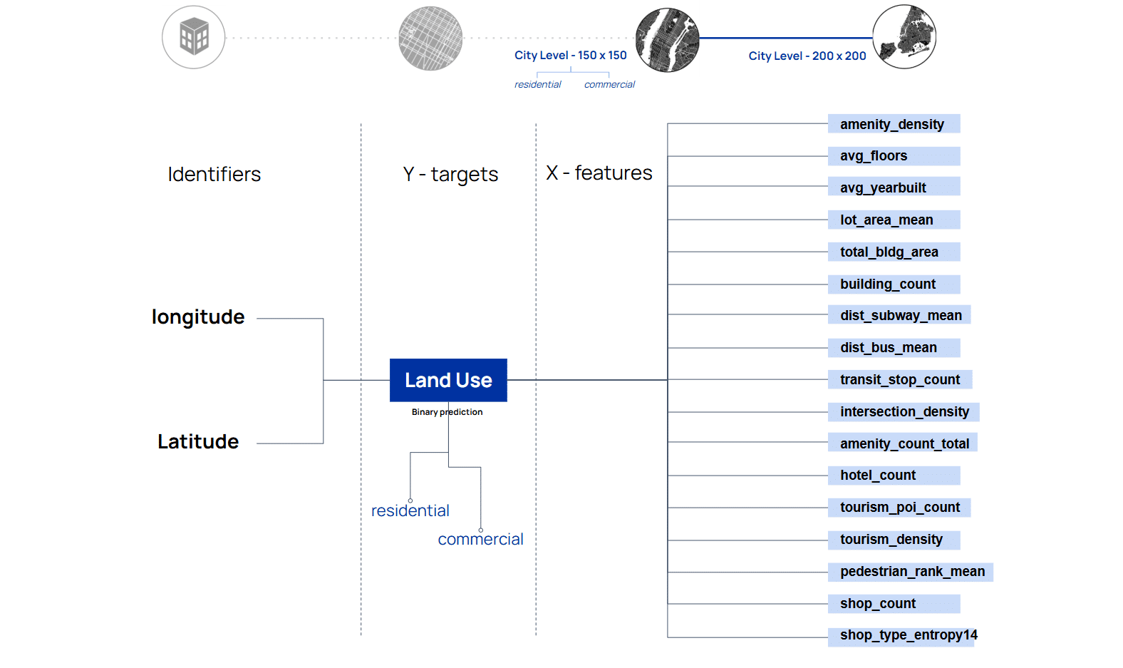
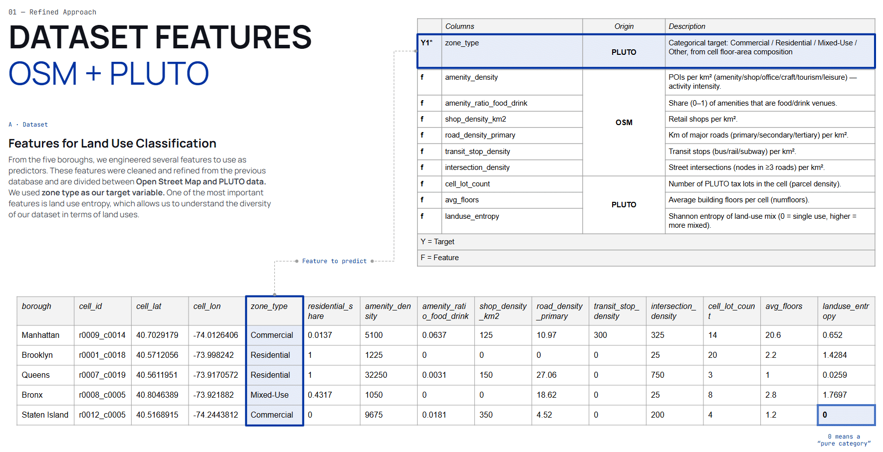
Can we predict what kind of use does a city grid hosts — Commercial vs. Residential — from its built form, morphology, and proximity to other urban features?
“Can we predict the land use of a space based on existing environmental information from official and unofficial sources?”
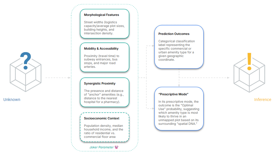

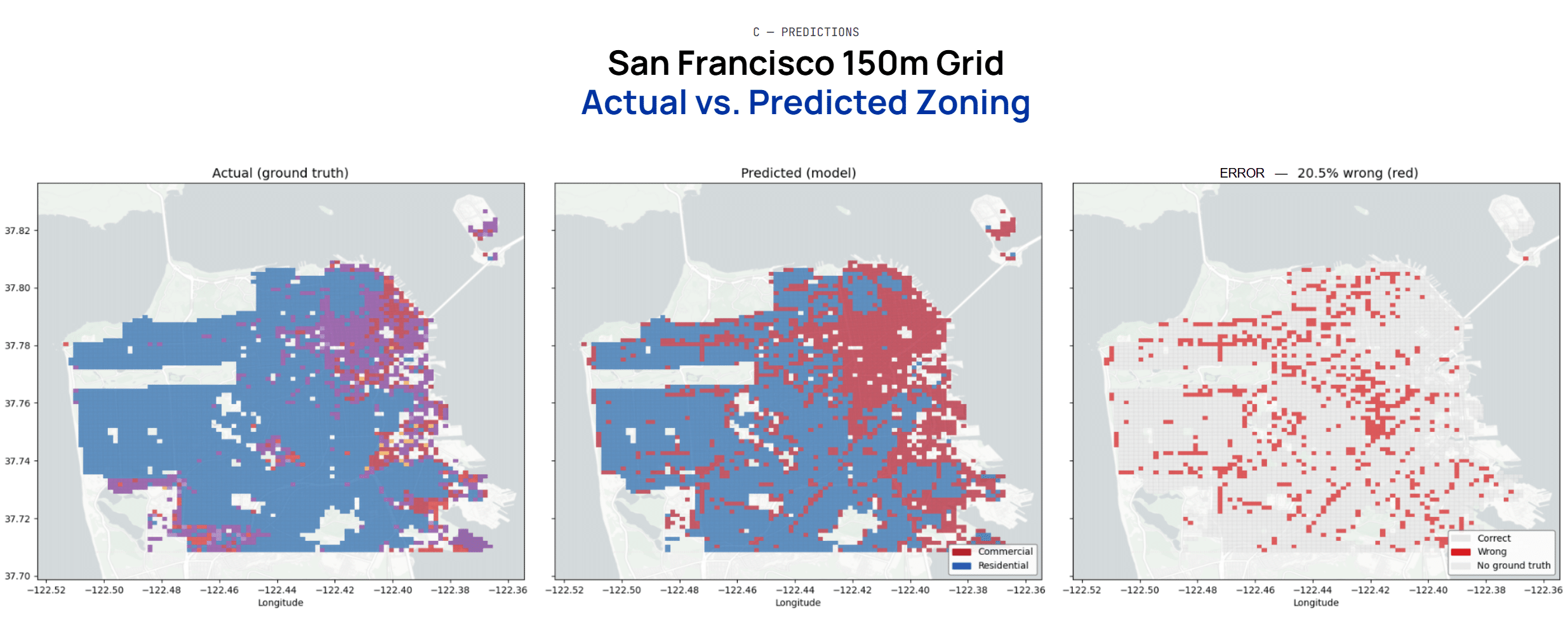
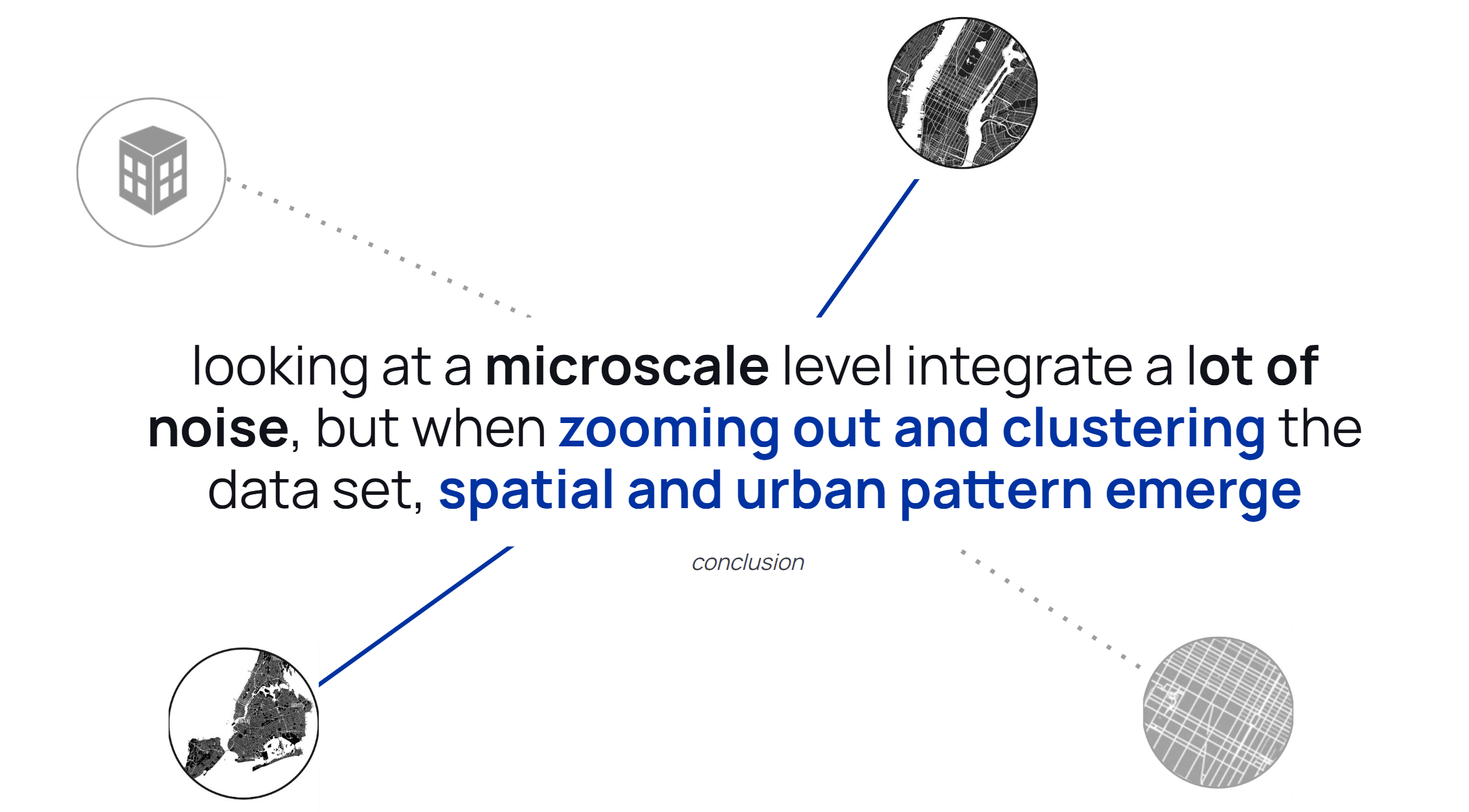
What’s the sweet spot for a Machine Learning to start predict accurately at an urban level ?
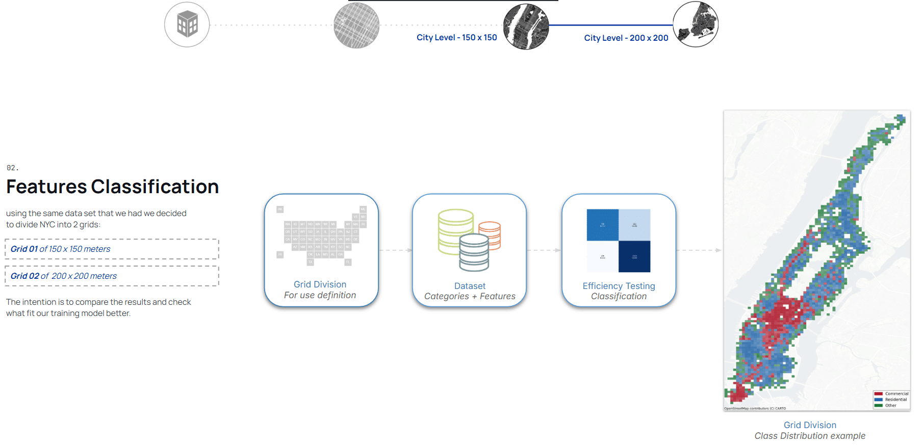
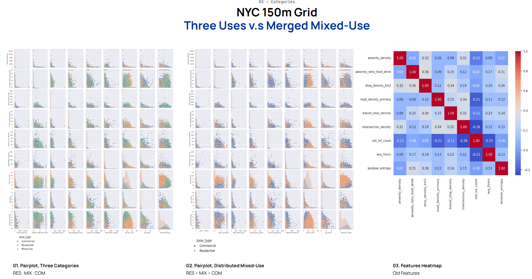
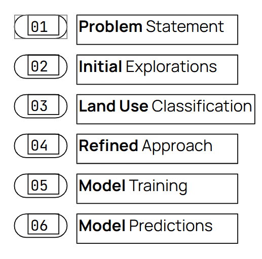
Reframing the Problem
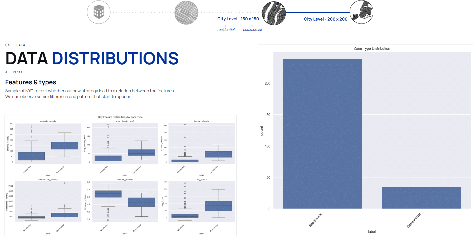
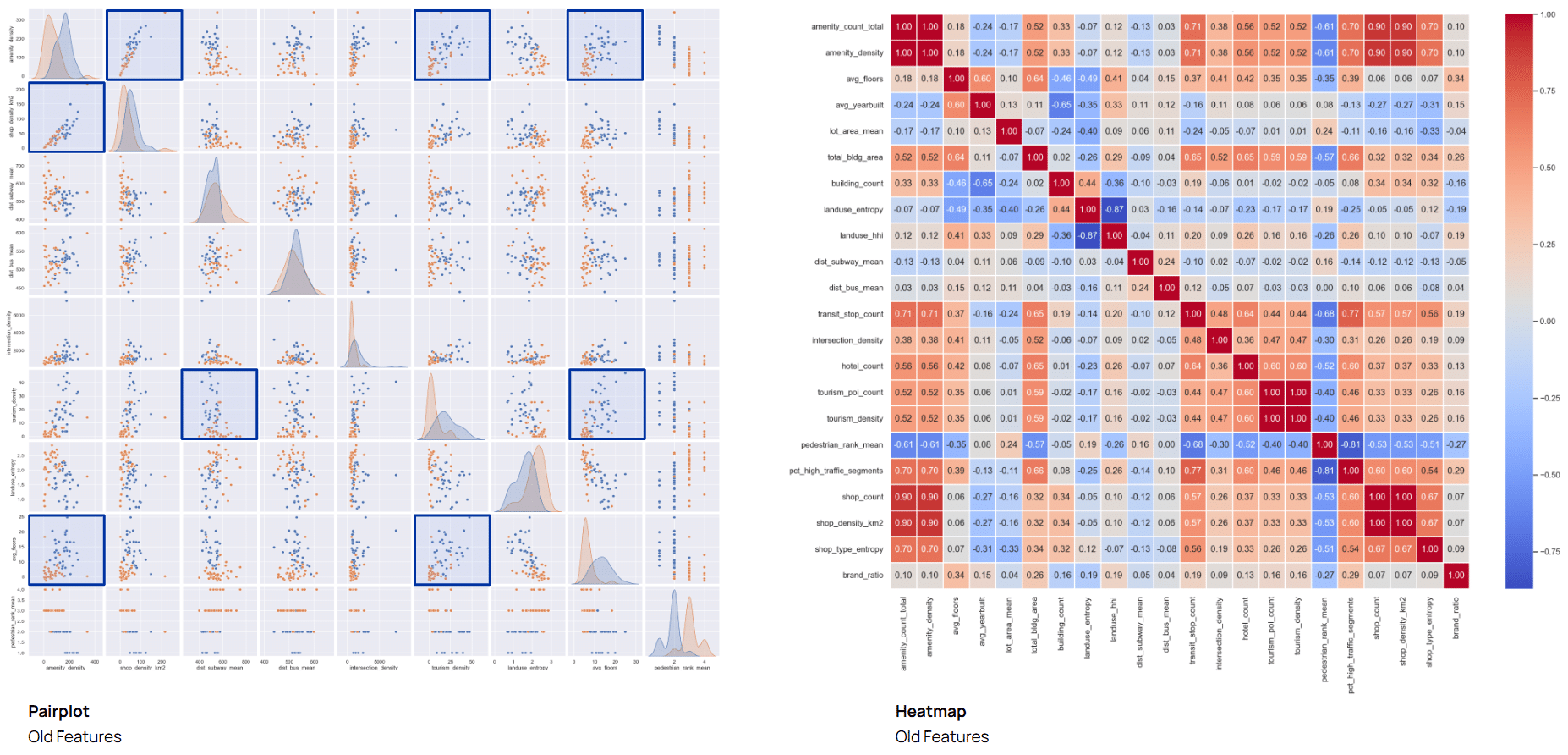
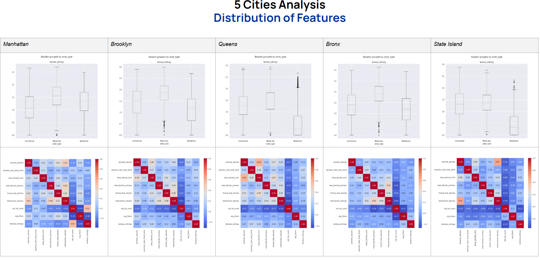
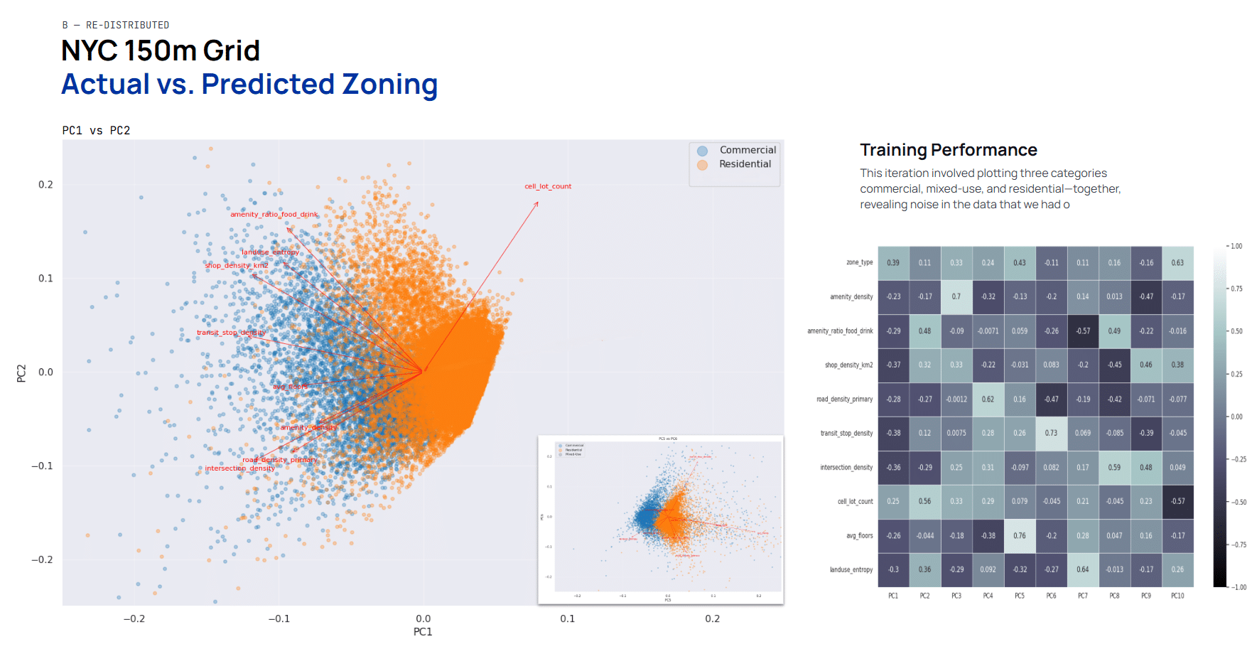
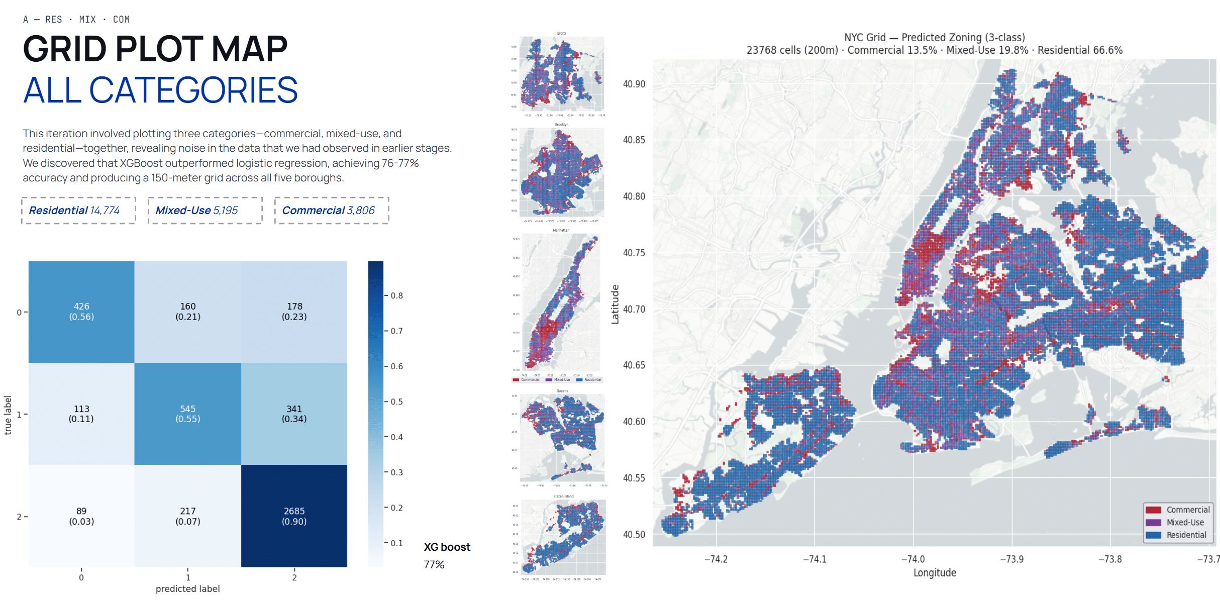
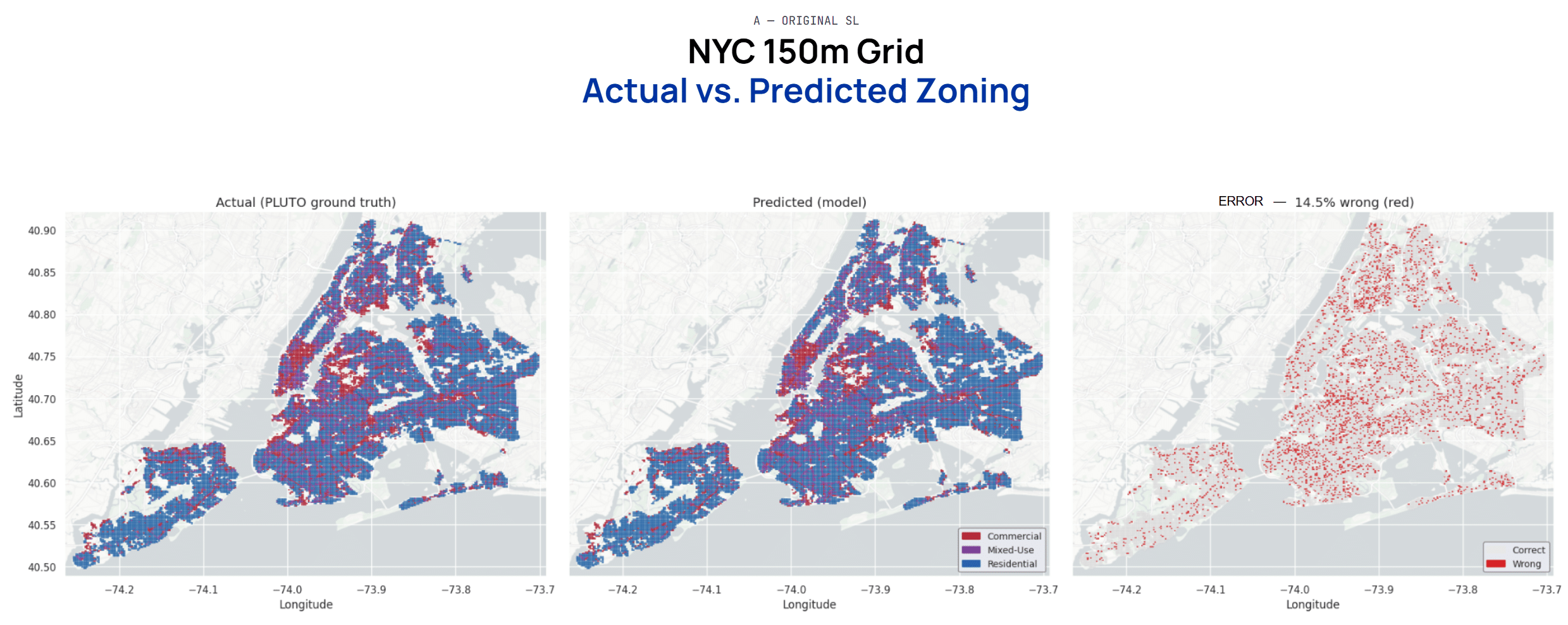
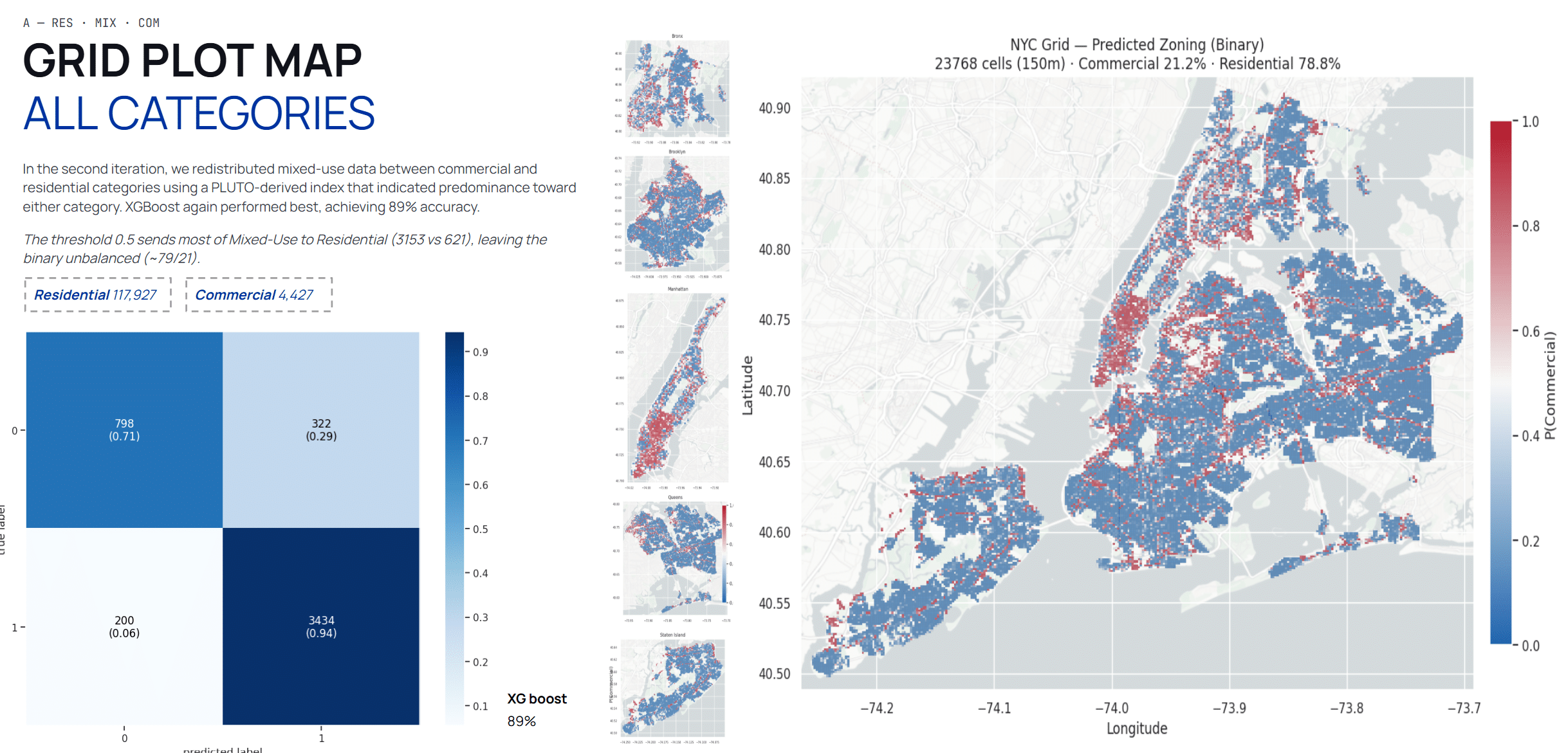
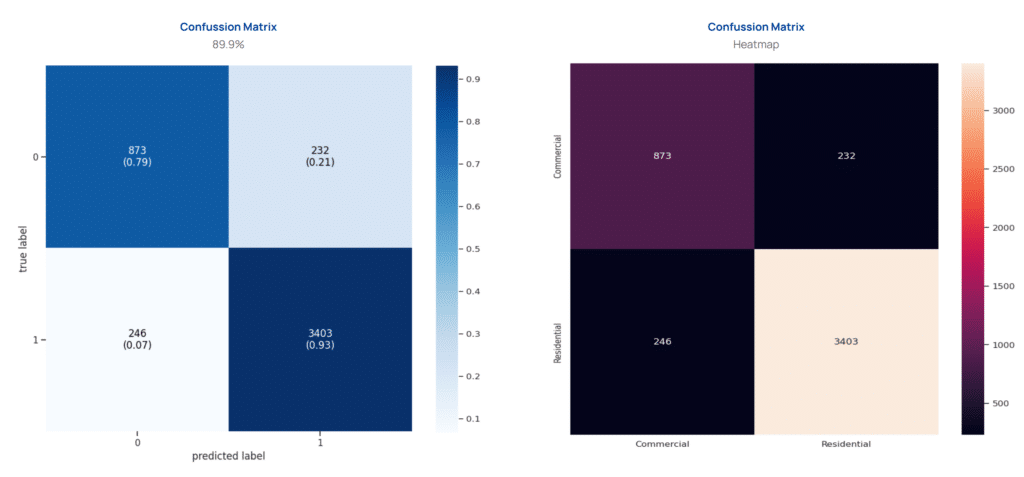
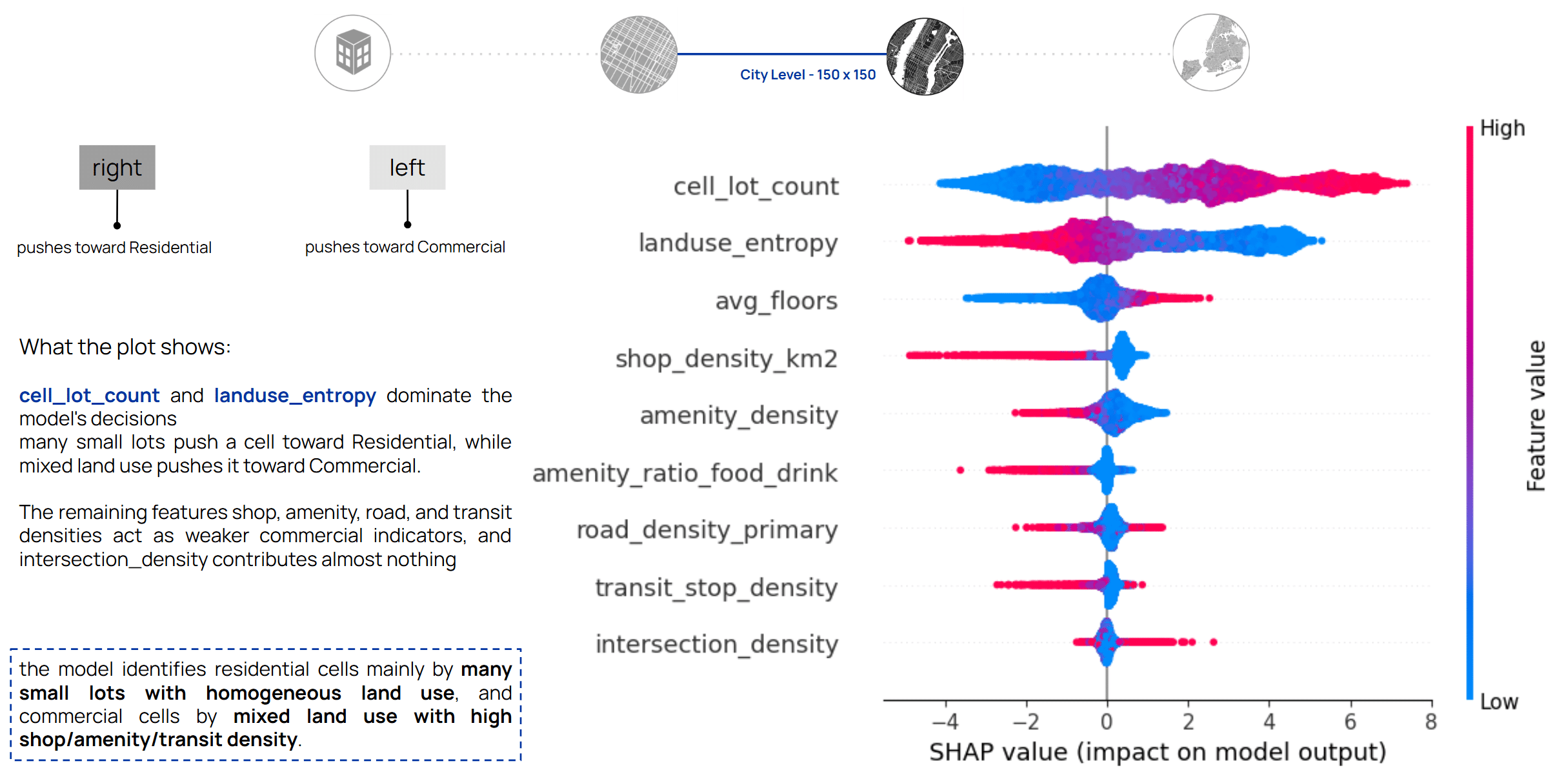
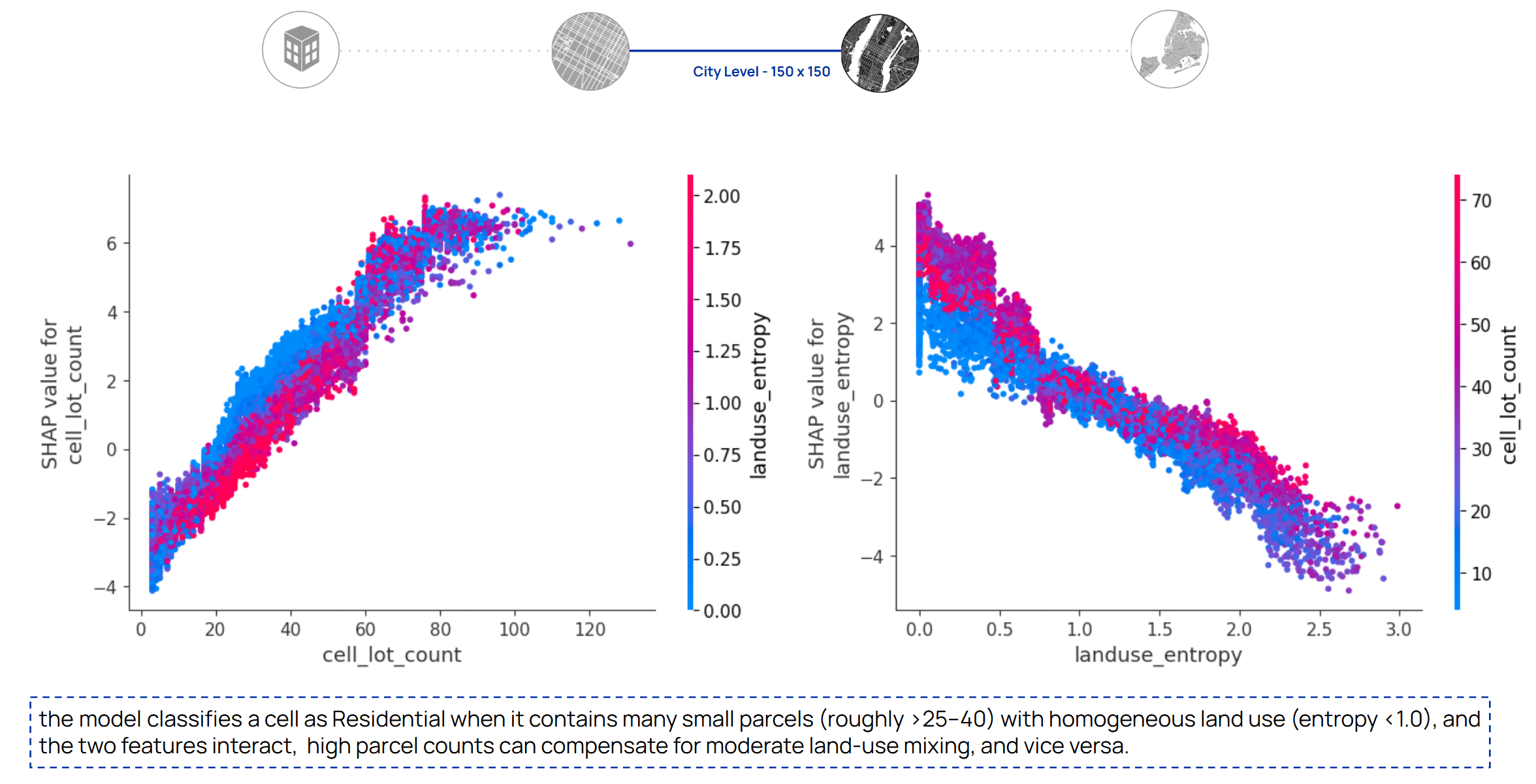
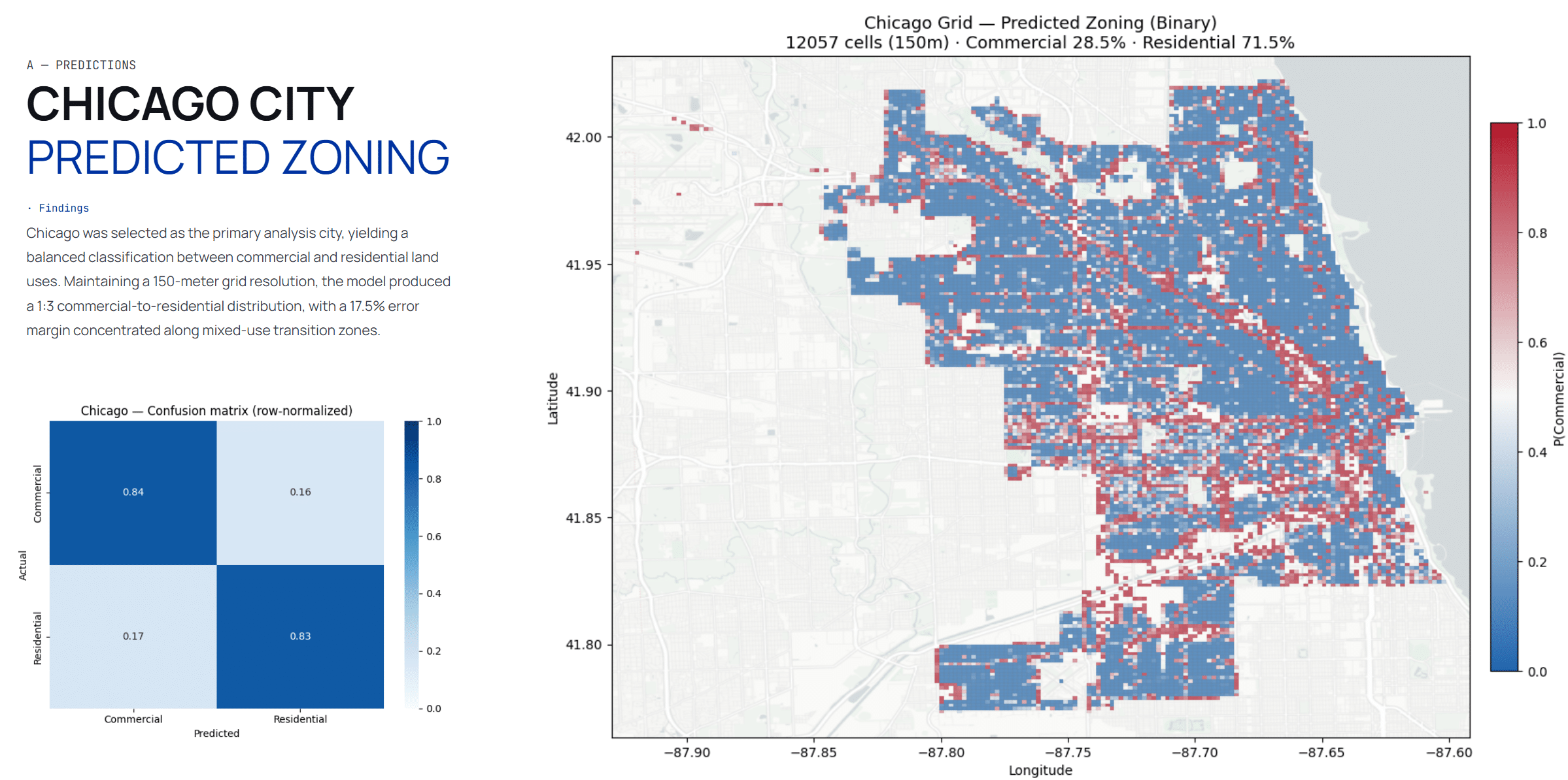
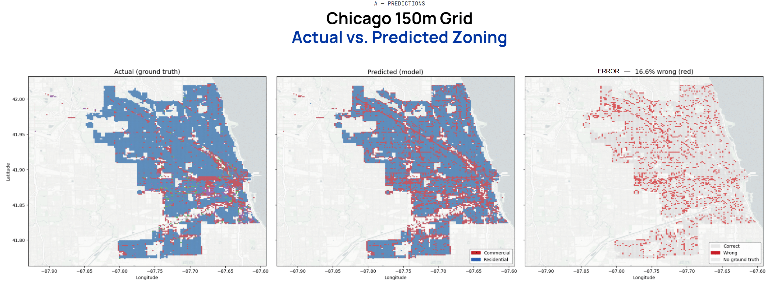
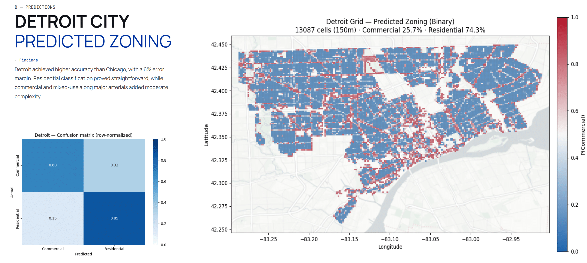
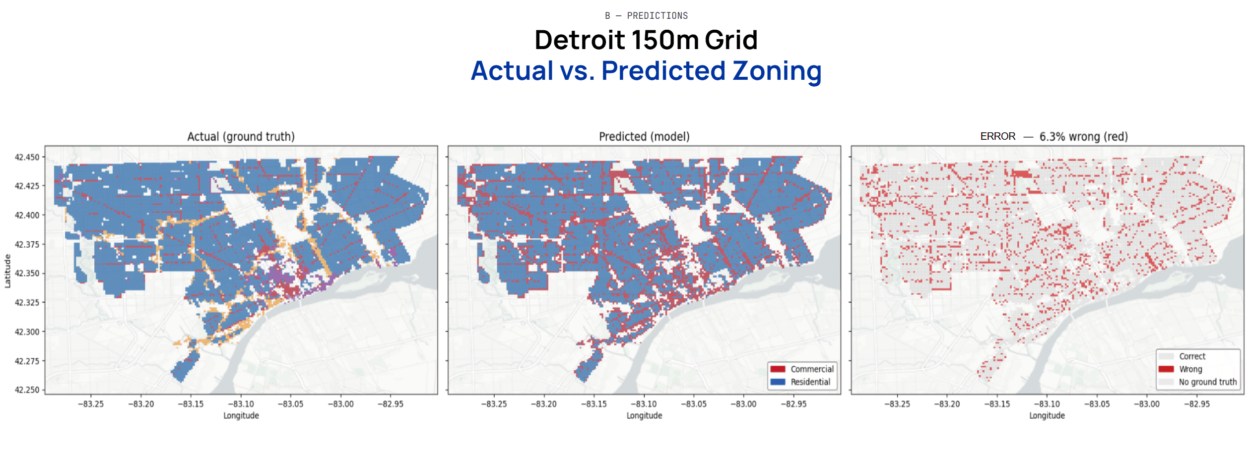
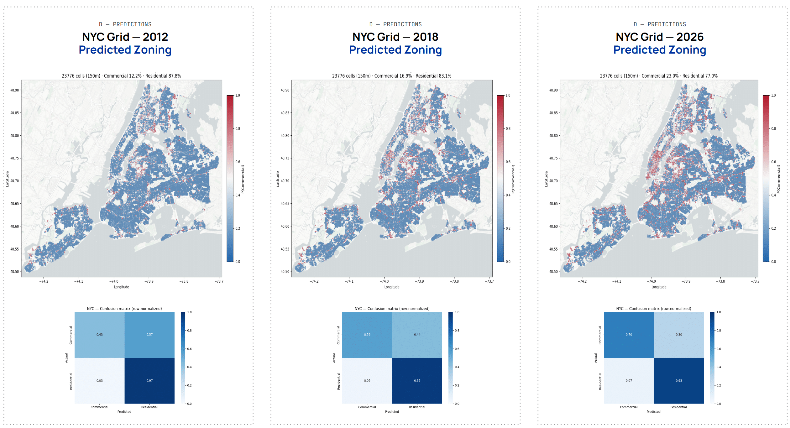
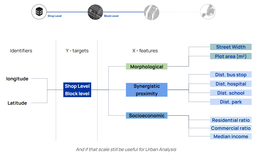
We shifted strategy, from predicting shop types to classifying land use across a spatial grid with expanded features.