Redesigning childrens’ journeys to school in Bosa-Apogeo, Bogota
CONTEXT & CHALLENGES
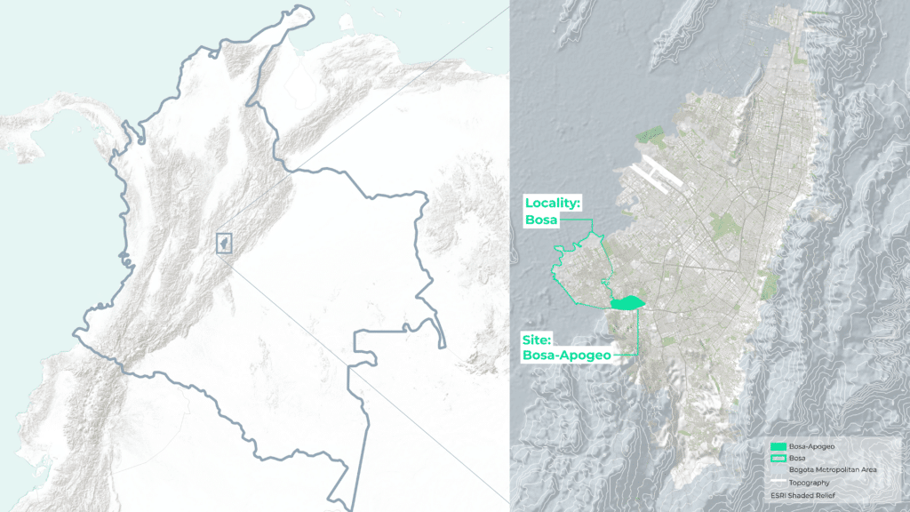
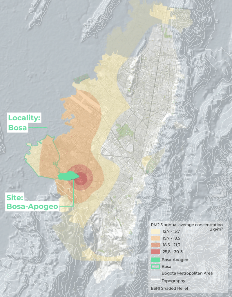
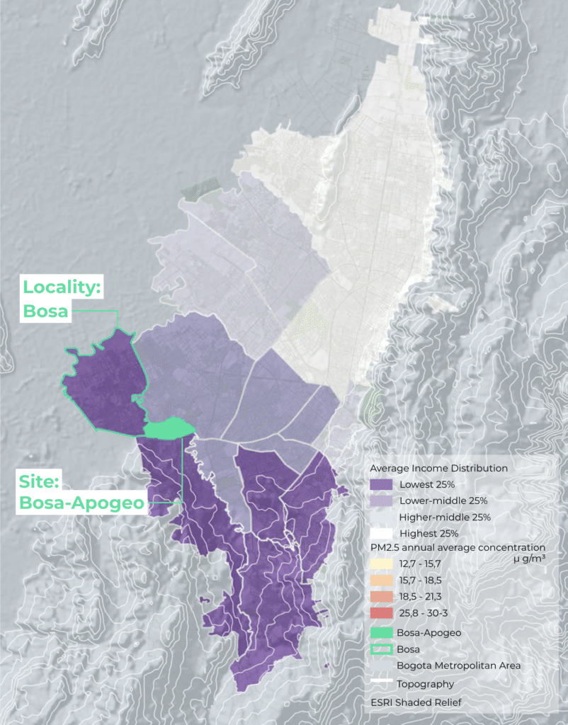
Bosa Apogeo sits at the southwestern edge of Bogotá — a neighbourhood shaped by rapid unplanned urbanisation and carrying a disproportionate share of the city’s pollution burden. Industrial corridors, heavy freight traffic, and unpaved roads converge here, pushing annual PM2.5 concentrations to between two and six times the WHO’s recommended limit of 5 µg/m³. This is not coincidental: across Bogotá, the highest pollution levels map almost exactly onto the lowest incomes. In Bosa Apogeo, that overlap is acute — and its consequences fall hardest on children, whose developing lungs are least equipped to absorb them.
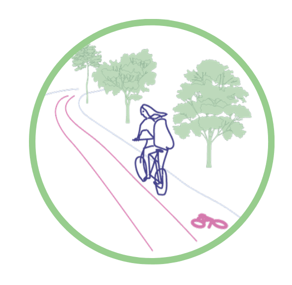
The streets of Bosa Apogeo tell a clear story: broken sidewalks, incomplete crossings, and school frontages without shade or separation from traffic. Yet children are already moving through them — the 2023 SDM mobility survey shows that 75% of school trips in Bosa are made on foot, with cycling accounting for a further 6%. This is not a car-dependent neighbourhood. But the infrastructure has not caught up with how people actually move.
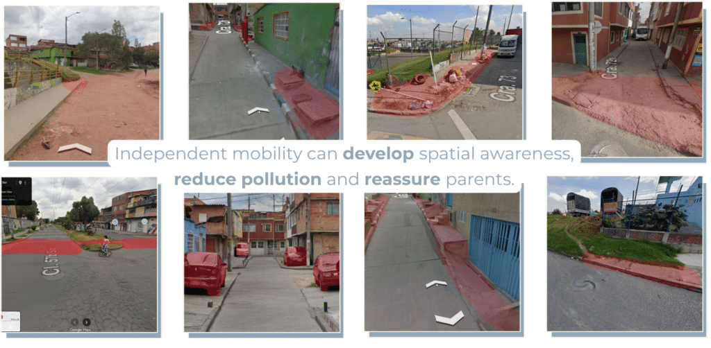
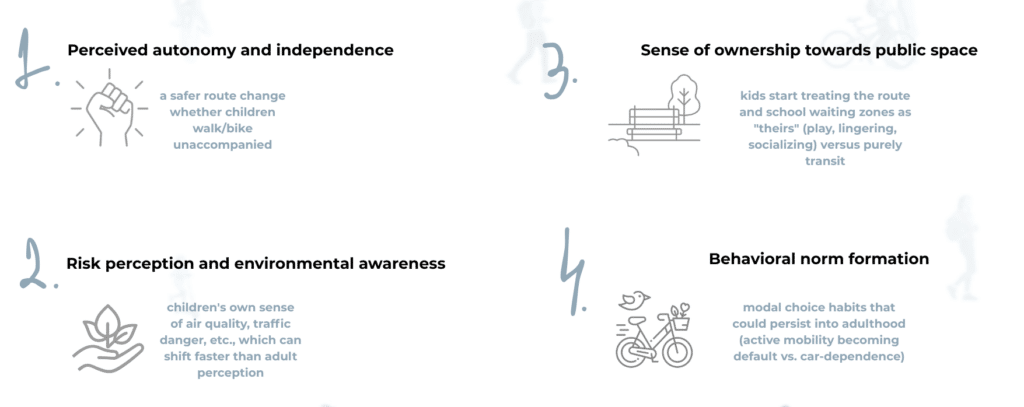
Independent mobility matters beyond convenience. Children who navigate their neighbourhood autonomously develop spatial awareness, risk assessment skills, and physical resilience from an early age. When streets feel unsafe or unfinished, that development is curtailed — and the burden falls on caregivers to fill the gap.
ANALYSIS & PROPOSALS
How can we enable children to become agents of change for better air in Bosa-Apogeo?
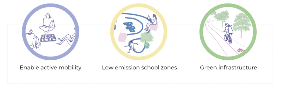
To answer the question, we came up with three strategies: Enable active mobility, low emission school zones and green infrastructure. Our three strategies are built around schools as local nodes, allowing us to reach children where they already are every day. The framework is designed to be replicated across six public schools with the highest pm2.5 exposure and largest number of students. We begin with a pilot at Colegio Nuevo Chile, the largest school with more than 3,000 students and among the highest pollution levels in the neighborhood.
Phase 1: Enabling Active Mobility
Proposal: Behavioral Change
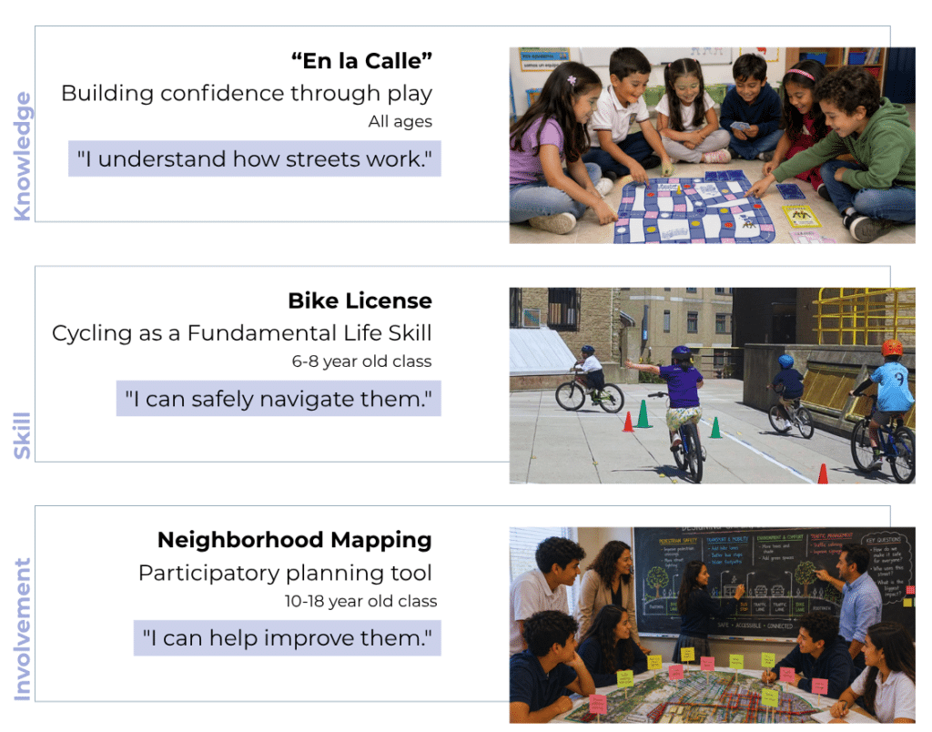
Building knowledge is shown to be more receptive through play, so we designed a street literacy board game called En la calle. It introduces children to common situations they may encounter on their journey to school and encourages them to respond with safe decisions. They can also create their own “danger cards,” drawing or describing hazards they experience in their own neighborhood.
Second, we build practical skills through a cycling licence course for children aged 6 to 8, preparing them for the age when independent mobility begins.
Finally, we invite older children, aged 10 to 18, into the planning process through participatory neighborhood mapping. This helps validate our data while capturing children’s unique perspective of the streets they use every day.
Together, these initiatives respond to the specific needs of each school node and lay the foundation for the next design strategies.
Phase 2: Low Emission Zones
In the second Phase, we will be returning car-centric environment to the kids.
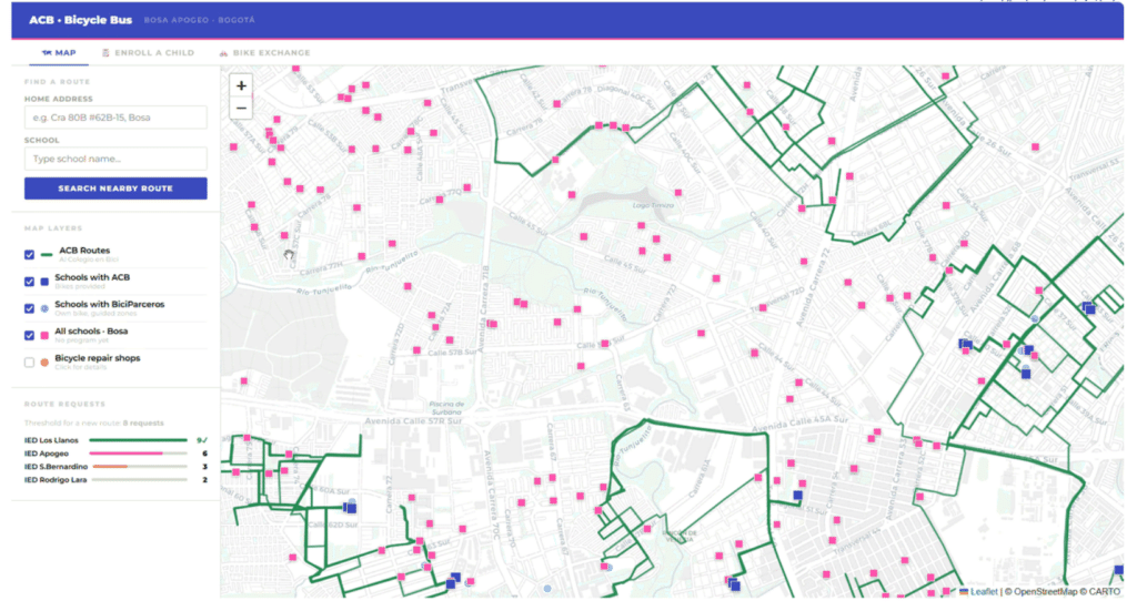
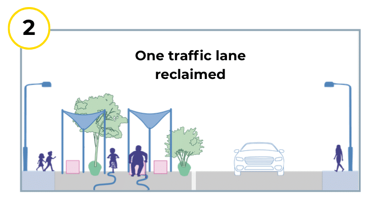
Every day, roughly 3,000 children arrive at school navigating a chaotic, car-dominated environment lacking shade, safety, or proper waiting spaces. To fix this quickly and effectively, we are turning to tactile urbanism—a community-driven approach that uses fast, short-term interventions to pave the way for permanent change. Operating within existing school zone rules, we are reclaiming one entire traffic lane from cars and transforming it into a vibrant, safe walkway and temporary bike route.
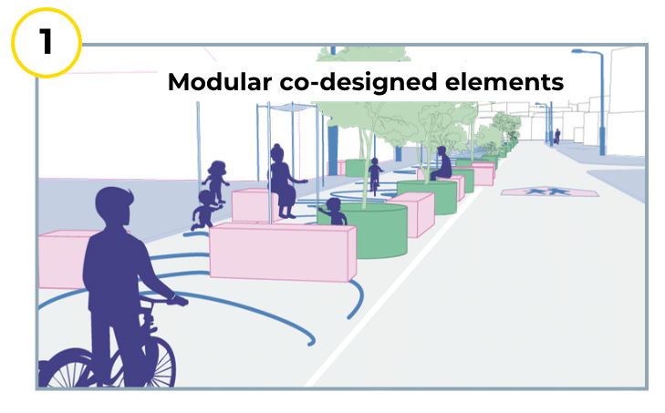
Proposal: Modular Co-Designed Elements
Proposal: One traffic lane reclaimed
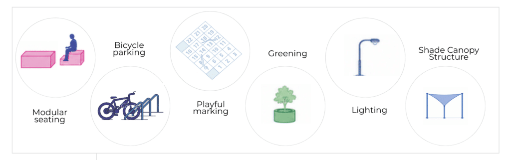
Some of the elements that will be used for the tactile interventions would be: Modular seating so caregivers no longer have to be in the street. Bicycle parking to support our new cycling initiatives and also create a ground for the next phase. Playful markings painted on the ground to give kids a space for joy. Greening and plants to introduce green elements, alongside shade canopy structures and lighting for safety. Together, these elements reduce car traffic, enabling safe independent walking and cycling for children.
Phase 3: Green Infrastructure
finally, our final strategy aims to solidify everything we’ve built so far.
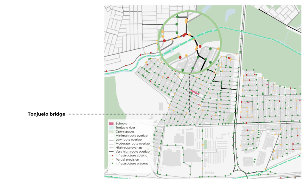
To prioritize interventions, we mapped the shortest routes between residential areas and schools. This obviously represents a potential or ideal scenario rather than the current status quo.
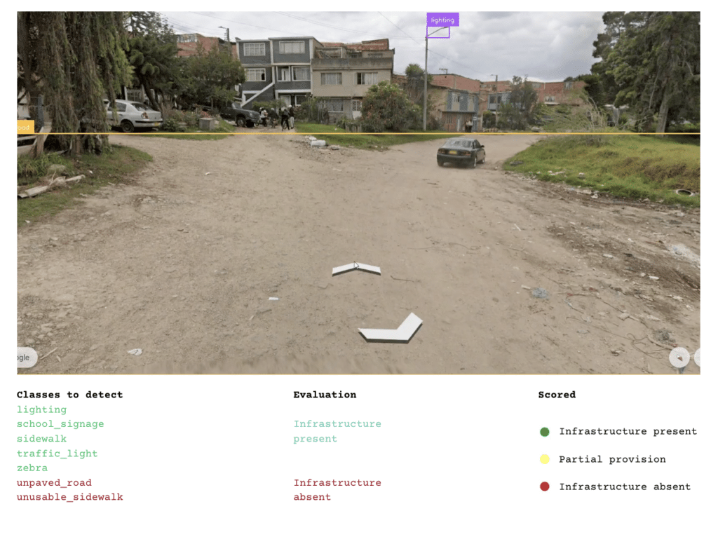
We then conducted a Google Street View analysis of 548 points along these routes to assess lived conditions, identifying the presence or absence of sidewalks, lighting, traffic infrastructure, and road quality.
To evaluate each sampled location, we developed a simple scoring system. Locations where pedestrian infrastructure was detected were classified as infrastructure present. Locations with no infrastructure-related detections were classified as infrastructure absent if at least one instance of an unpaved road or broken sidewalk was detected, the location was classified as partial provision.
The analysis shows that the highest concentration of school-related movement is in the northwestern part of the neighborhood. It also reveals infrastructure gaps along the edges of the neighborhood, with the bridge emerging as a critical high-movement segment with little to no pedestrian or cycling infrastructure. This becomes a key priority for intervention.
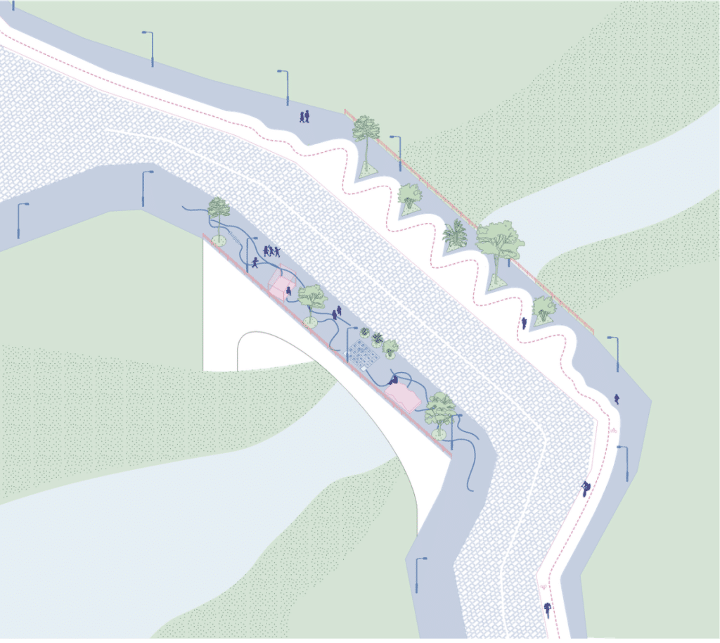
Proposal: Fixing Identified Gaps
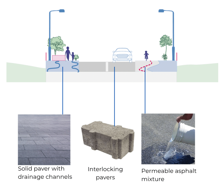
Our proposal for the bridge includes continuous sidewalks, bicycle lanes, street furniture, and street markings that create opportunities for play and social interaction. Paving the street would also eliminate resuspended dust, one of the major local sources of PM2.5. But by solving one problem to not create another – we reviewed the existing material catalogues used by the Bogotá municipality. Since the current Bogotá material catalogue focuses mainly on drainage, we propose expanding it to include criteria such as heat, safety, permeability, and maintenance.
Proposal: Green Corridors
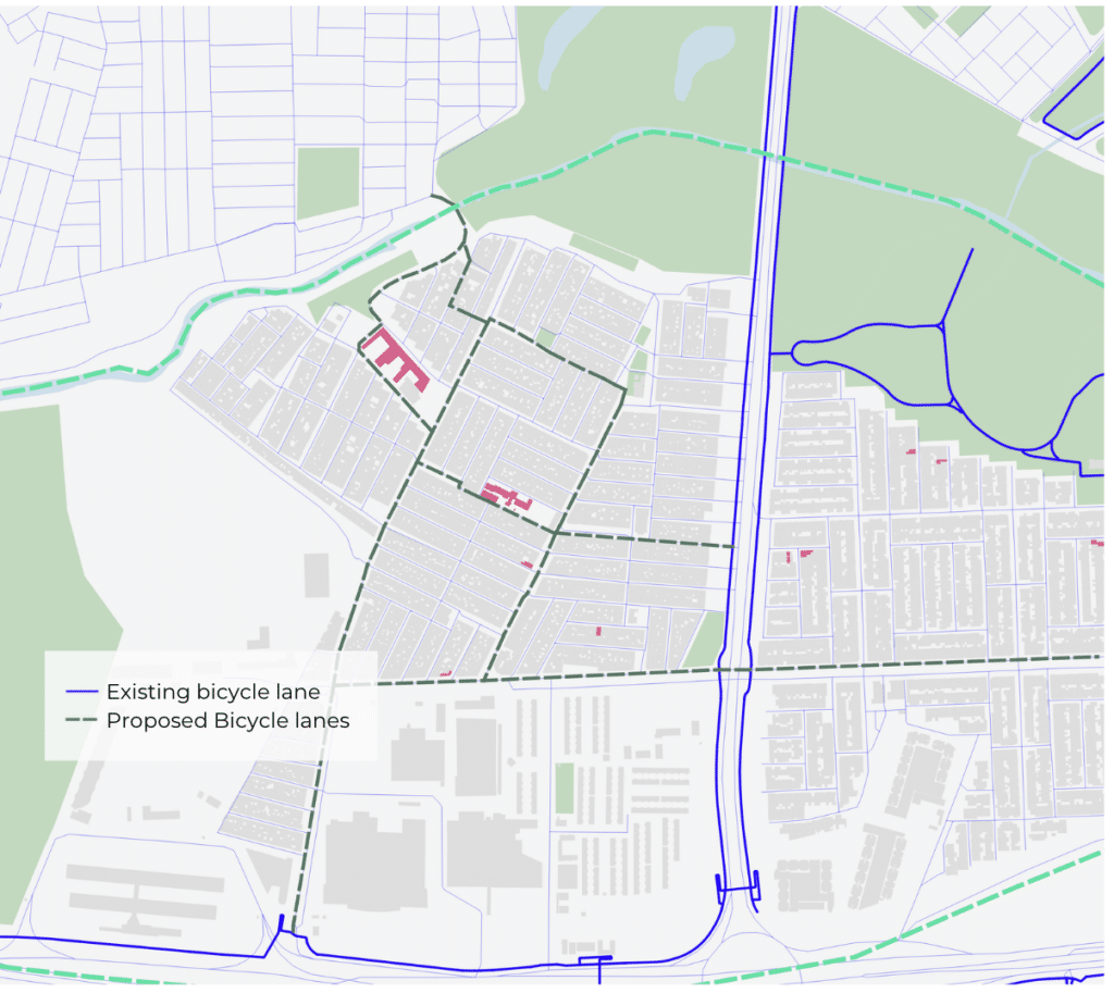
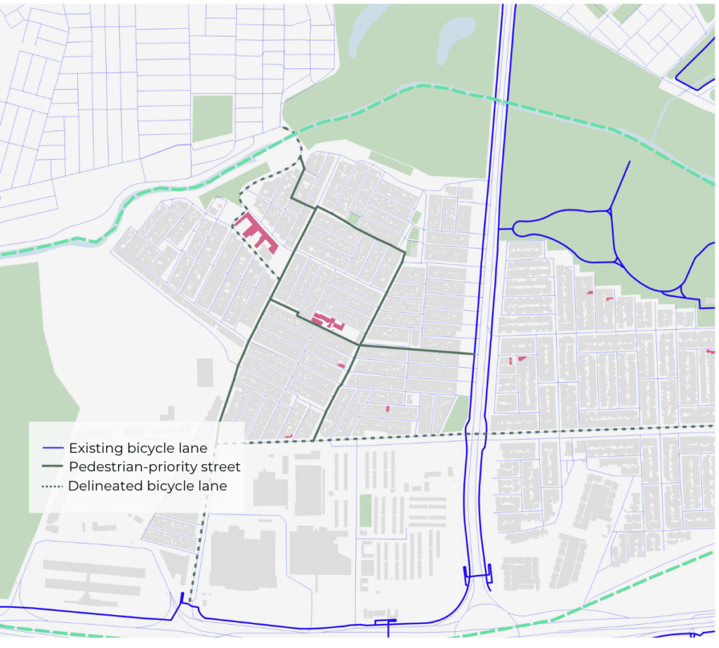
Here we propose new bicycle routes. They follow the shortest-path analysis, prioritizing corridors with high potential school-related movement while also connecting to the existing north-south bicycle axis. To determine how these routes could be accommodated, we looked at existing traffic conditions and street typologies. Bosa-Apogeo is a dense residential neighborhood with narrow streets and low-speed traffic limited to 30 km/h. For most streets, we propose a Vienna-style shared street model that prioritizes pedestrians and cyclists without requiring major traffic rerouting or extensive infrastructural changes. Where street width and traffic conditions allow, dedicated bicycle lanes can be introduced, in some cases by reallocating an existing traffic lane.
PHASING PROCESS & CONCLUSIONS
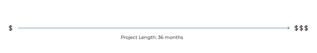
The project is planned over a 36-month period. To account for changes in political leadership and funding uncertainty, we designed it as a phased approach, progressing from low- to high-investment interventions. This means that even if later phases are delayed or not fully funded, the earlier strategies can still generate meaningful behavioural change and lasting benefits for the neighborhood.
KPIs & Stakeholders
Implementation success is measured by introducing performance indicators for each phase. Starting from the first phase we will focus on the number of schools with active bike bus participation and % of children arriving without motorised transport. In the second phase, we will add tactile urbanist success surveys after 2 months of the intervention, and in the last phase, we will automate the count of the bike trips on new/improved lanes, as well as to gather feedback on their condition/satisfaction level after 12 months of the intervention.
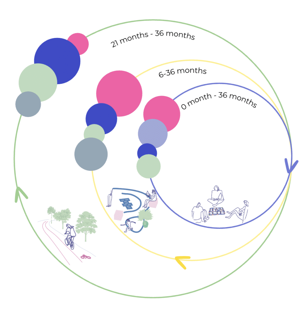
We also mapped out stakeholder engagement for each phase, showing how public and private stakeholders contribute throughout the project. In the first phase, we (the project leads) and local schools and neighborhoods will lead the initial push to kickstart active mobility. Meanwhile, the government and partners like CIEMPIES will provide essential baseline support. In the second phase, during the tactical urbanism workshops, schools and neighborhoods will take the lead to co-design the new street layouts. We will provide strong backing, while the government and implementation partners step up their coordination to prepare for the physical changes. In the final phase, the Government Administration will take the lead on funding and permanent installation. The community will transition into an evaluation role, providing feedback through surveys to help us measure long-term success.

Estimated Impact on PM2.5
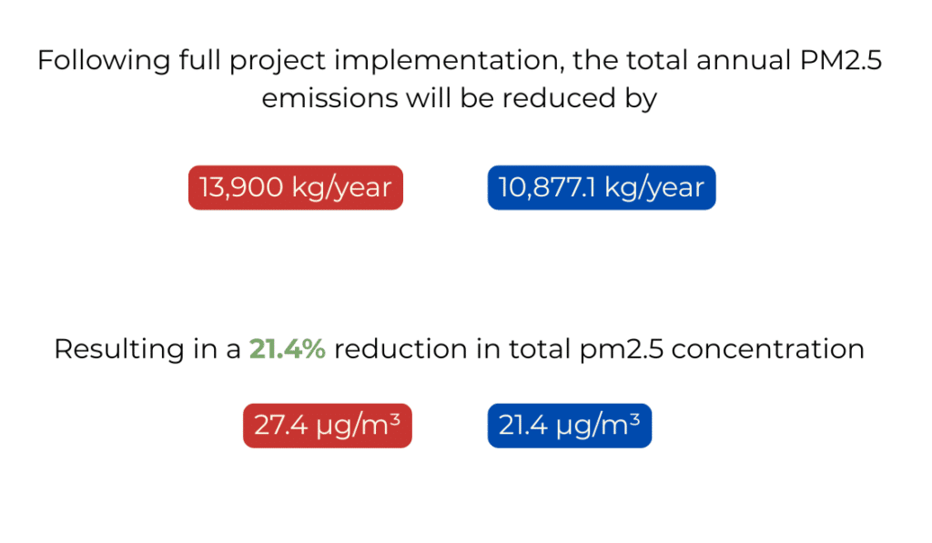
The project’s estimated impact on PM2.5 is impressive. While each phase brings varying levels of emission reductions, the overall result is a 21% decrease in just one year. This drops the average annual PM2.5 concentration from 27 to 21 micrograms per cubic meter, creating healthier streets for our children and future generations.
But it isn’t just about the numbers, how did we enable children to become agents of change?