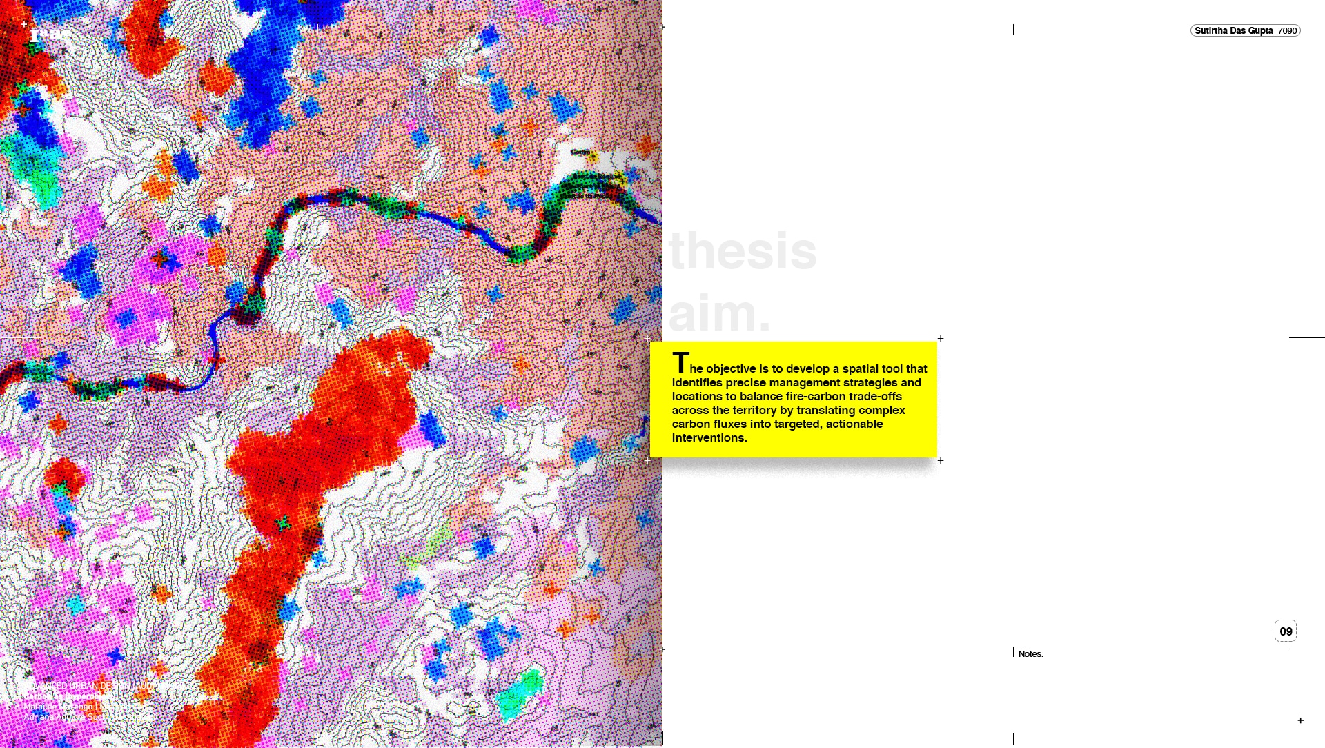
Vulnerability-adjusted carbon sequestration for more [actionable land].
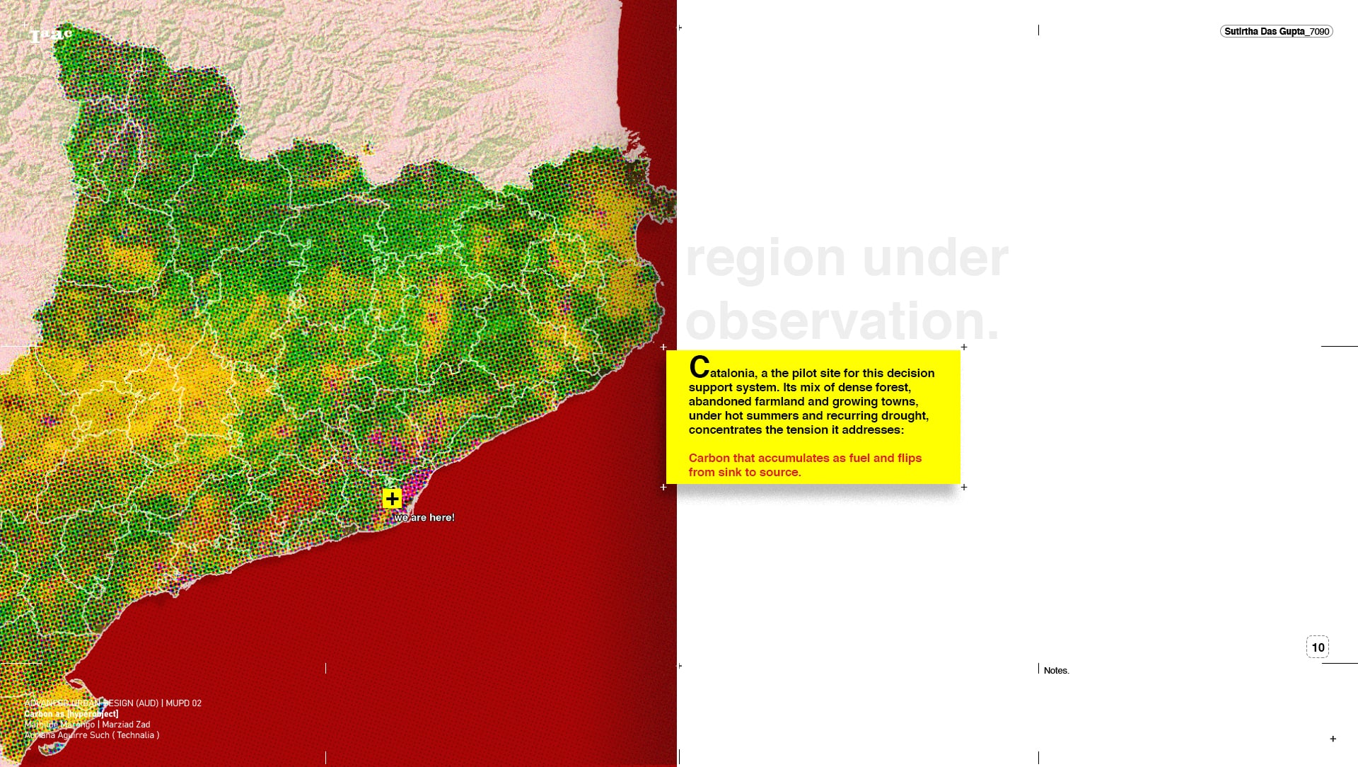
Current climate mitigation treats carbon sequestration as a static stock: it counts the biomass a landscape holds and rewards storing more. Yet under fire and drought, the densest biomass is lost first, turning a carbon sink into a source. This thesis develops vulnerability-adjusted carbon sequestration. Working across a transect of Catalonia, it reads the land in three layers: what it holds, what fire and drought put at risk, and what can be recovered. That risk becomes a concrete plan for human labour, parcel by parcel, delivered via a decision-support system. The result makes land more actionable, helping a farmer secure funding, restore a harvest, or act before a fire. Carbon is no longer only counted but actively kept.
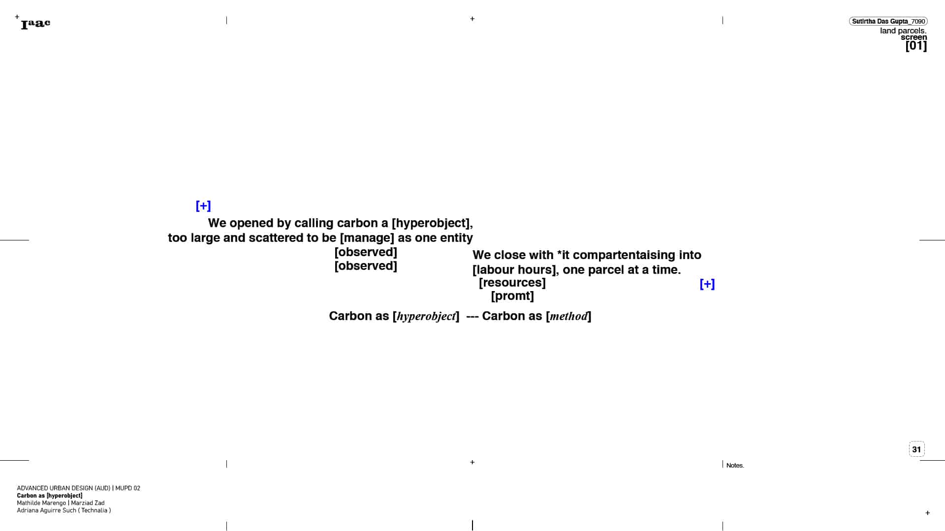
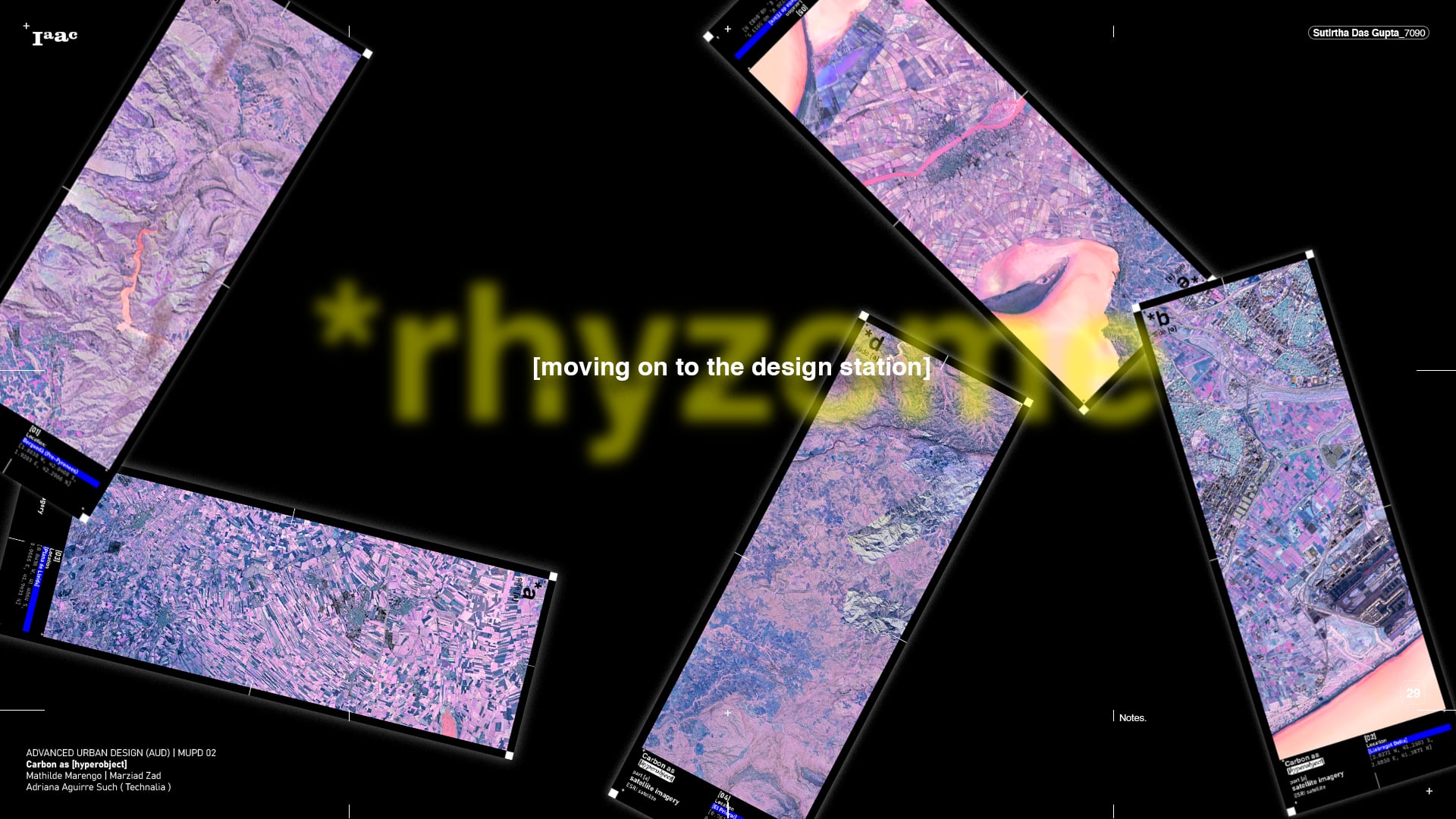
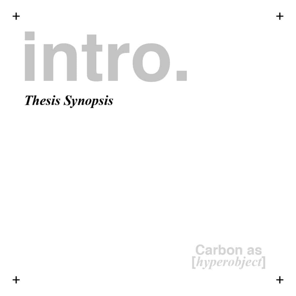
defining a [hyperobject]

def.:
A hyperobject is something so vast and so spread across space and time that no one can see it whole, only its fragments. Carbon is one. It never sits in a single place, moving constantly between air, living tissue, dead matter and soil over seasons and centuries. We meet only its pieces: a tonne on a balance sheet, a credit in a market, a forest, a fire. The thing itself is too large to grasp.
The thesis is built as a kit of parts. Rather than confronting the hyperobject all at once, it breaks the problem into modular layers, each adding its own ecological and computational data to the whole. One part counts the carbon a landscape holds. Another reads the fire and drought that threaten it. Another converts that into hectares, hours and tasks. No single part is the answer; only when they are stacked, layer on layer, does the full complexity of the territory become visible, and then workable. The method mirrors the problem: something too large to grasp as one object, assembled instead from parts small enough to build with.
The story begins in 1997, with the Kyoto Protocol. It was the first treaty to bind nations to cut their greenhouse gases, and to enforce a limit, it first had to measure one. From this need came a particular way of seeing the land. The Protocol created the LULUCF sector, Land Use, Land Use Change and Forestry, which let a country offset its industrial emissions by protecting or planting forests. A growing forest pulls carbon from the air; that carbon can be counted, and the count can be sold as a credit.
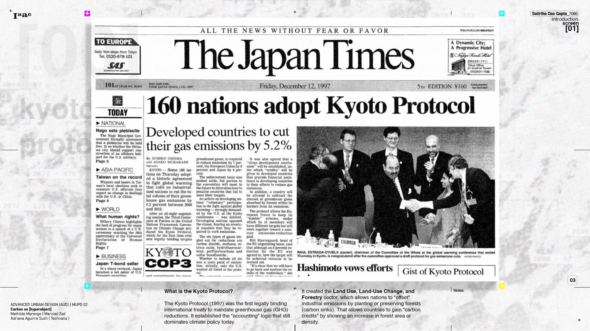
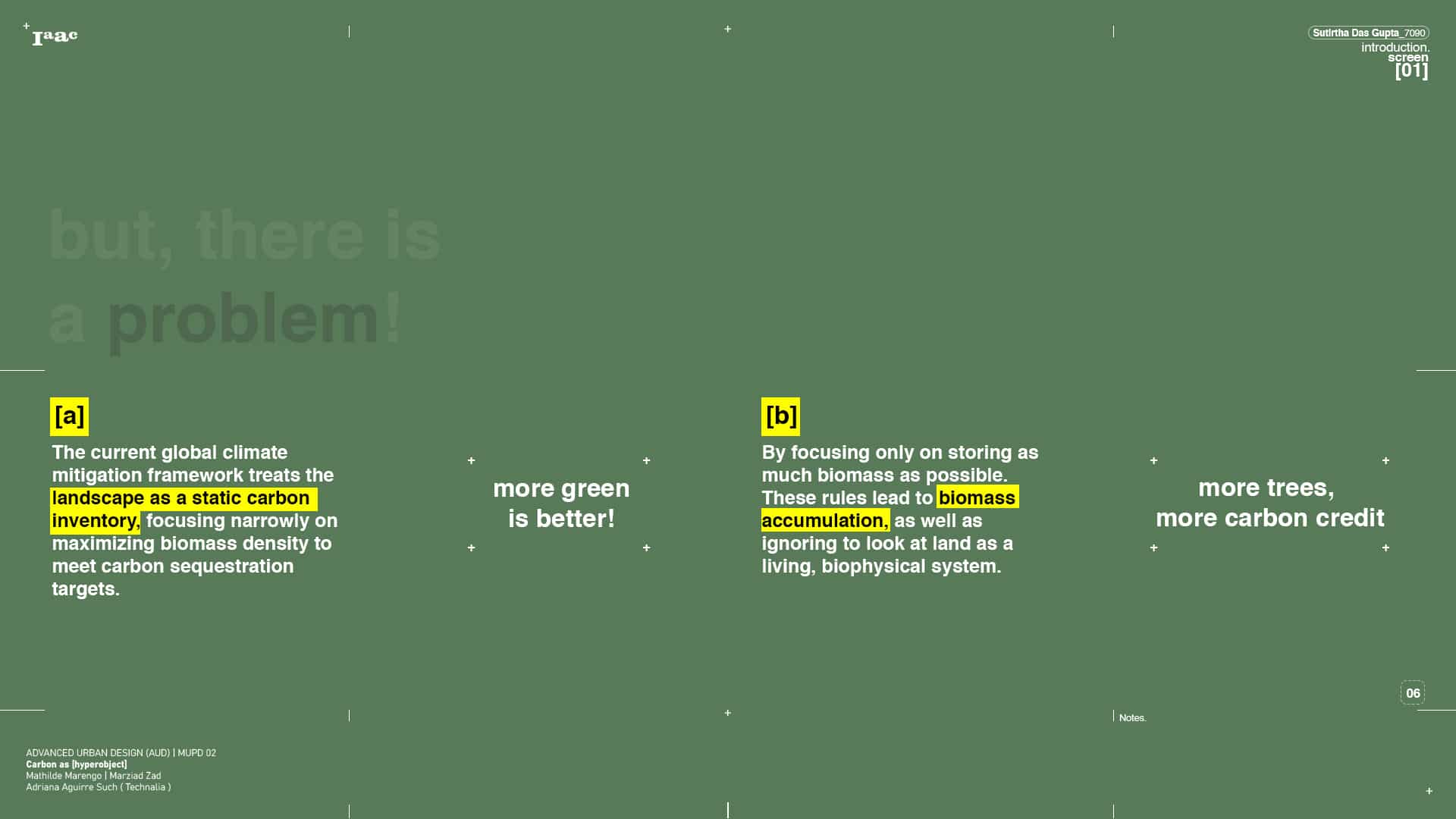
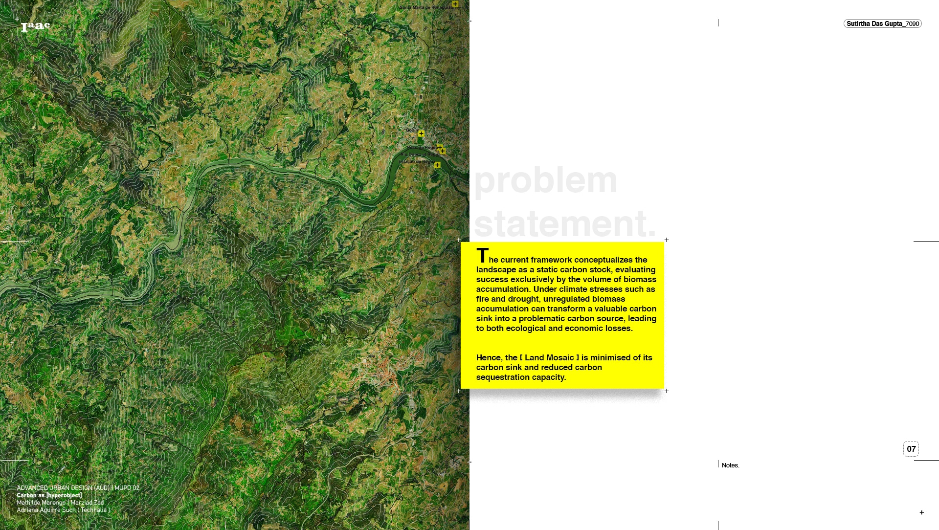
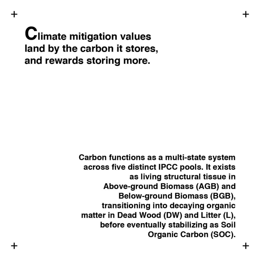
It was an elegant idea, and it carried an idealization with it. LULUCF treats the land as a stable carbon stock: a balance where carbon, once counted, is banked and assumed to stay. Measure the biomass, register the carbon, reward the owner for holding more. The framework pictures a landscape as an account that only grows, and the more it holds, the better. It is a clean, countable, reassuring model. It is also where the trouble begins.
Global forest cover and Kyoto adoption, 1998 to 2014.
Each nation is shaded by its forest as a share of land area, set against the countries that became parties to the Kyoto Protocol. Together, they map where the world’s countable carbon lies, and who agreed to count it. Source: FAO and World Bank.
The carbon accounting pipeline.
A geographic boundary is read through the LULUCF lens and divided into six standard land categories. Each is multiplied by a sequestration rate, summed into a single total biomass, and converted into carbon credits at 3.67 credits per tonne of stored carbon. This is how a forest becomes a financial instrument.
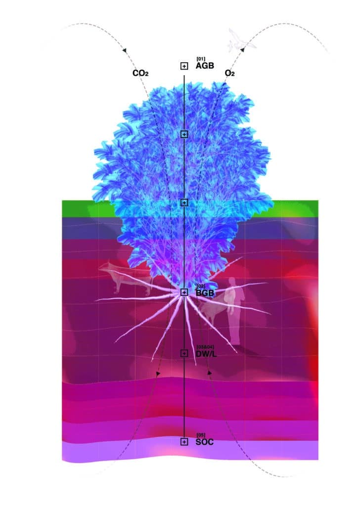
Here is the matrix as readable text, walking the five pools from canopy to soil with all three measures woven in.
Carbon in a landscape is held not in one place but in five distinct pools, and each behaves differently on three measures: how fast it takes carbon in, how fast it cycles it back out, and how exposed it is to disturbance.
Above ground biomass, the visible matter of stems, branches and leaves, captures carbon fastest through rapid photosynthesis. But it also turns it over fastest, and it is the most exposed of all, highly sensitive to land use change and fire.
Below ground biomass, the roots, takes carbon up steadily and cycles it at a moderate rate, yet it stays vulnerable, sensitive to soil temperature and drought.
Dead wood and litter, the fallen logs and leaf cover not yet broken down, receives carbon from living biomass and decays slowly, but it is readily lost to combustion and clearing.
Soil organic carbon, the largest pool of all, is built over decades and held for centuries. It accumulates slowly and is the most stable, recalcitrant and secure, unless the soil is tilled or drained.
The pattern is the point. The pool that stores carbon fastest is the most vulnerable; the pool that holds it most securely is the slowest to build. Speed and safety run in opposite directions, from canopy to soil.
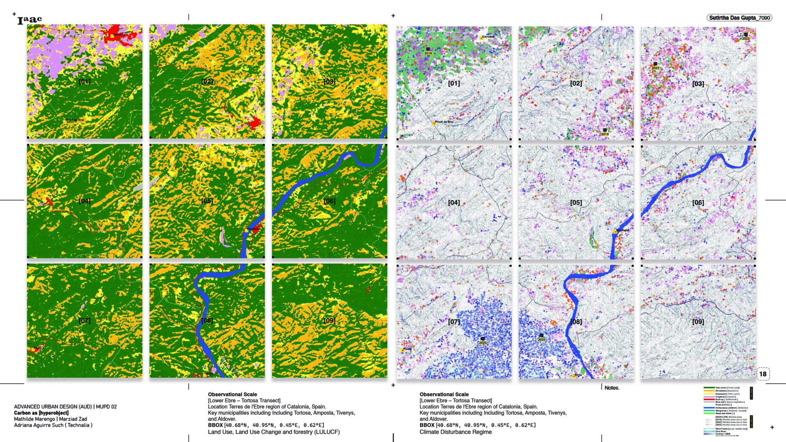
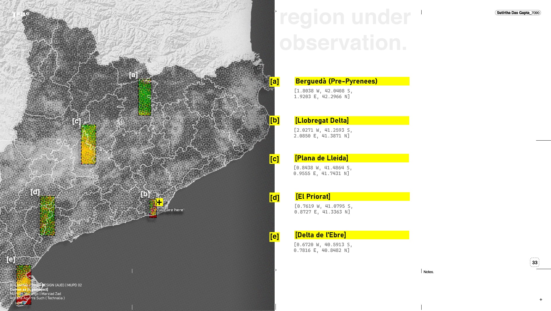
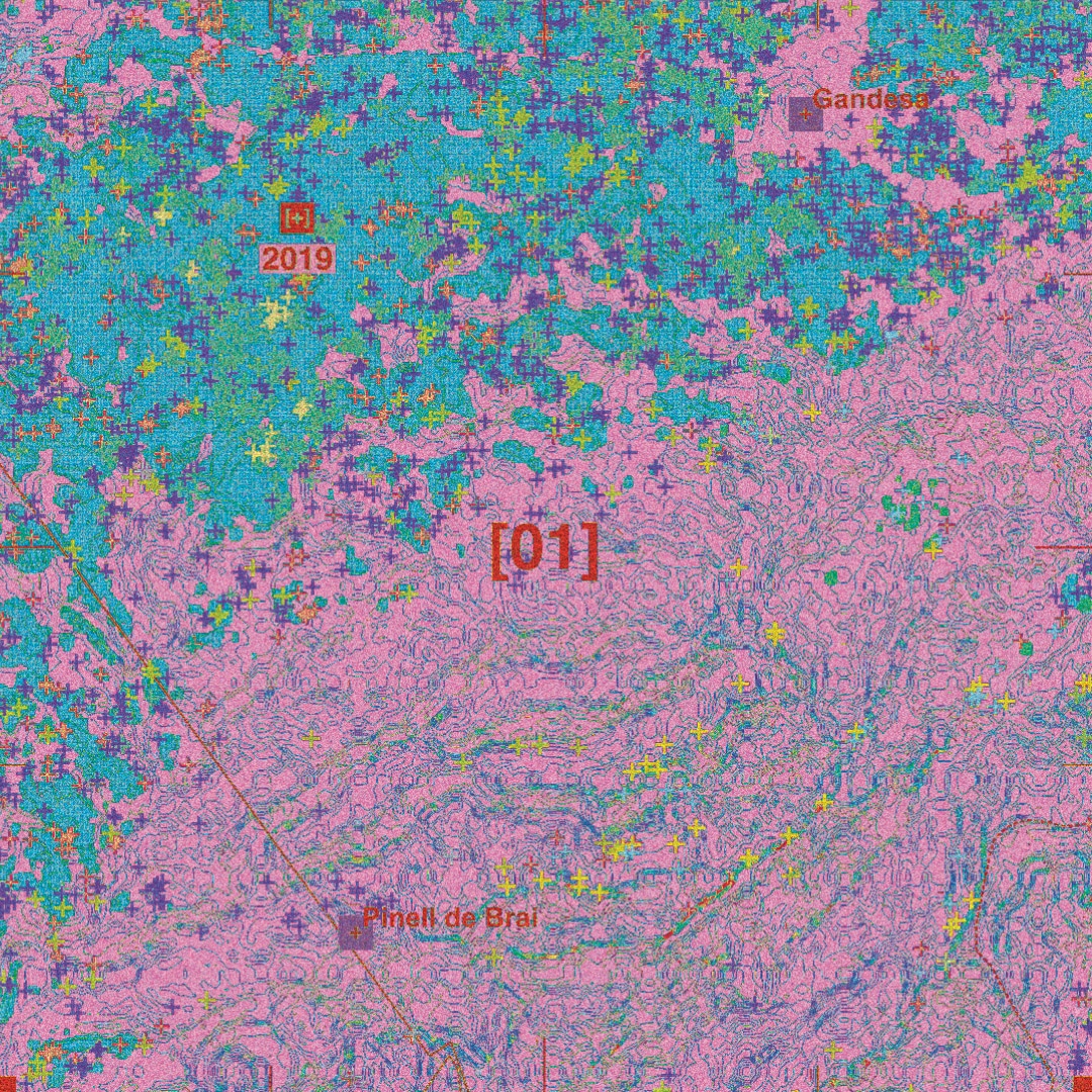
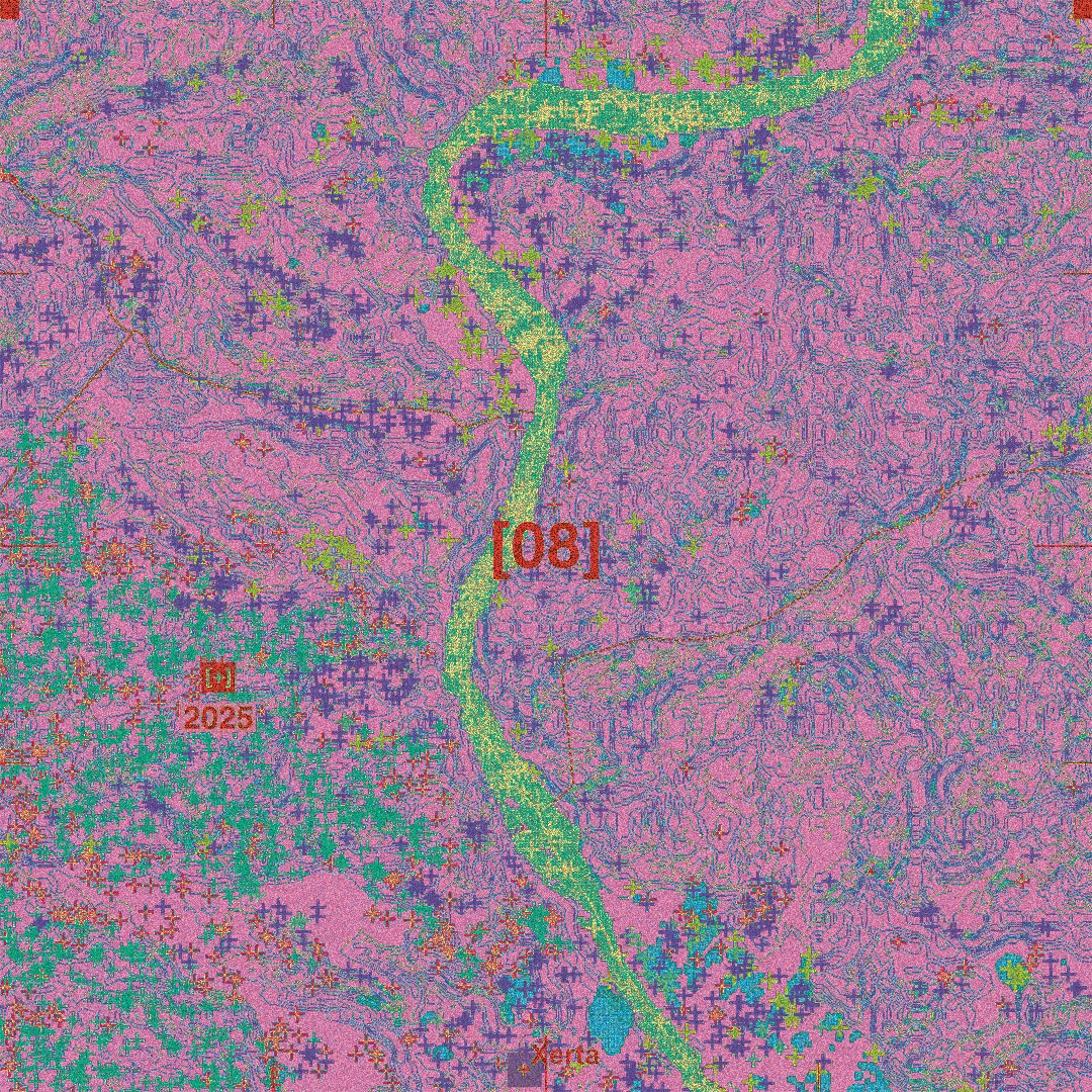
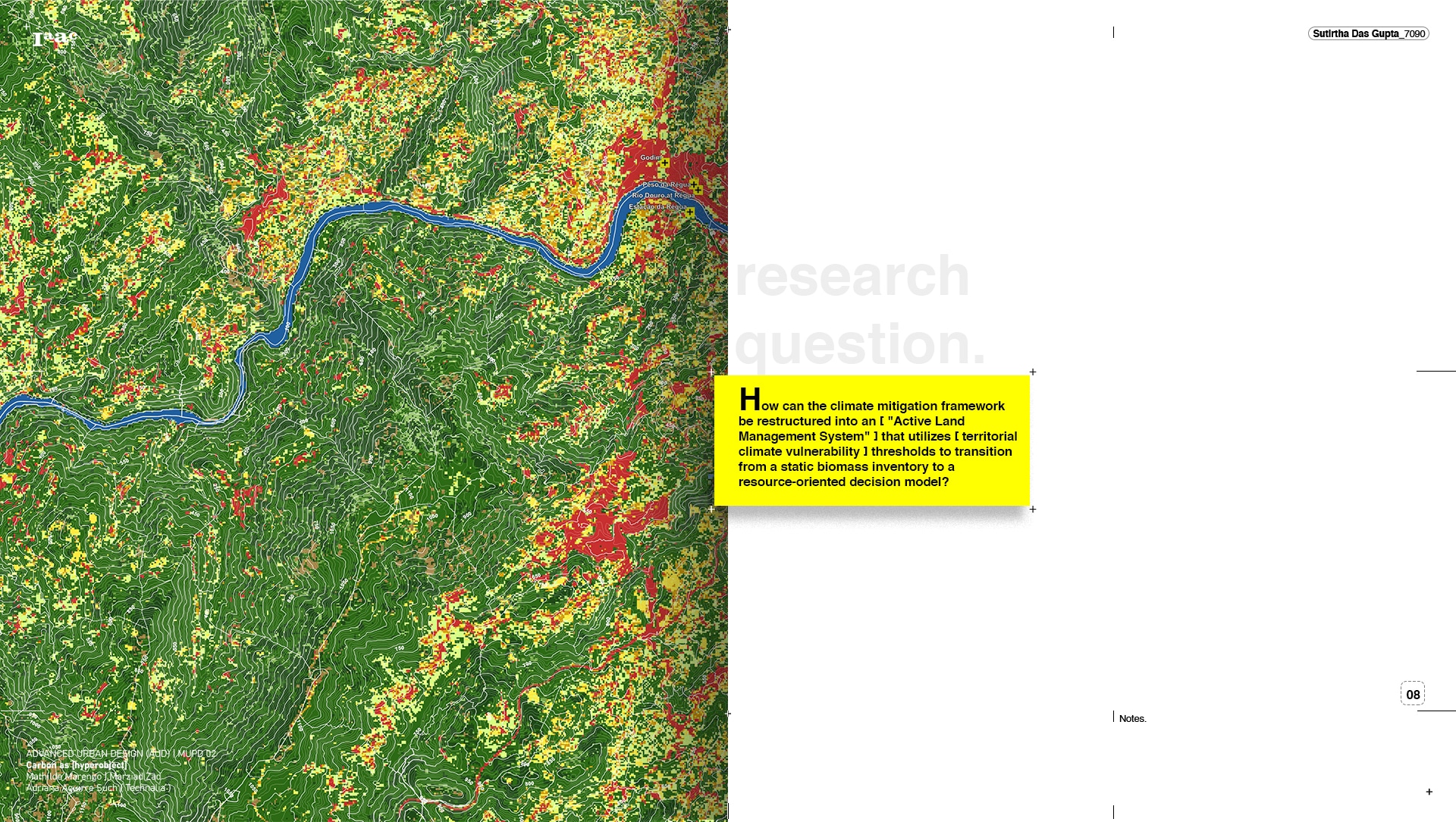
The Lower Ebre, or Tortosa transect, in the Terres de l’Ebre region of Catalonia, reads as two layers across the same nine tiles. On one side, the territory is mapped through the LULUCF lens, sorted into forest, shrubland, grassland, cropland, settlement and bare soil, the cover that holds its carbon. On the other hand, it is mapped as a climate disturbance regime, with each cross marking ground affected by heat across 2019, 2022 and 2025, set against the olive farms, the Ebro River, the contours, and the terrain’s sun exposure. When compared tile by tile, the two layers are strongly and inversely correlated, with r = -0.78. The land cover and the disturbance regime are not independent maps, but two readings of the same ground, and that relationship is what the rest of the work is built on: the disturbance layer can be used to weight the carbon layer, parcel by parcel.
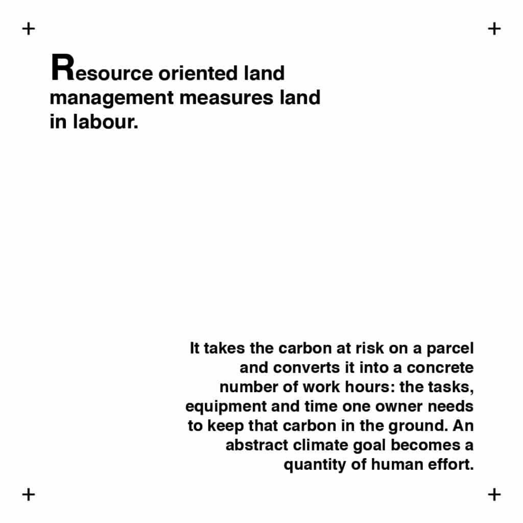
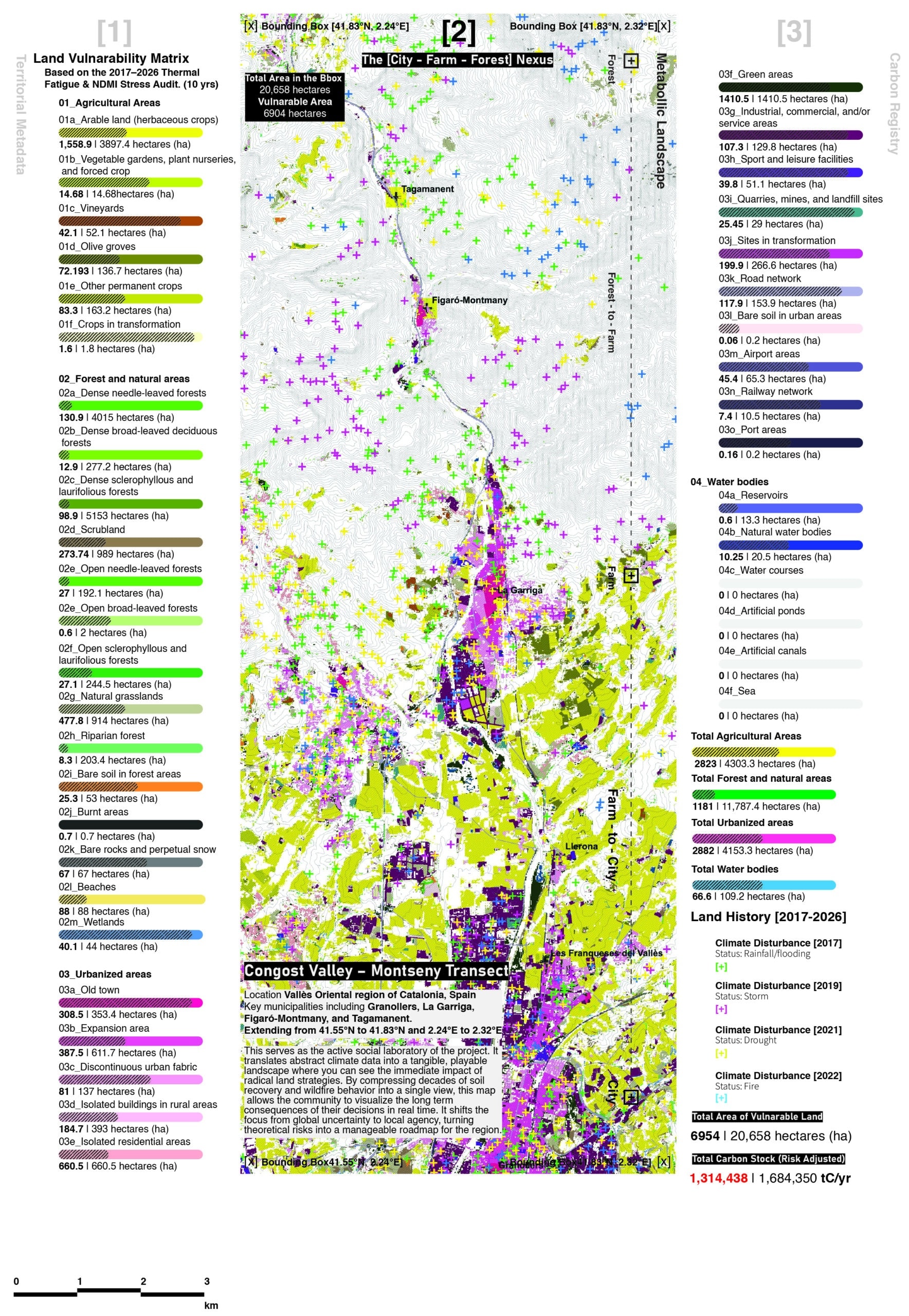
These three layers are not three separate maps. They are one reading of the same ground, taken in sequence. The carbon bank counts what is there. The vulnerability layer weights it by risk. The viridic layer [labour hours] turns that weighted risk into a restoration plan.
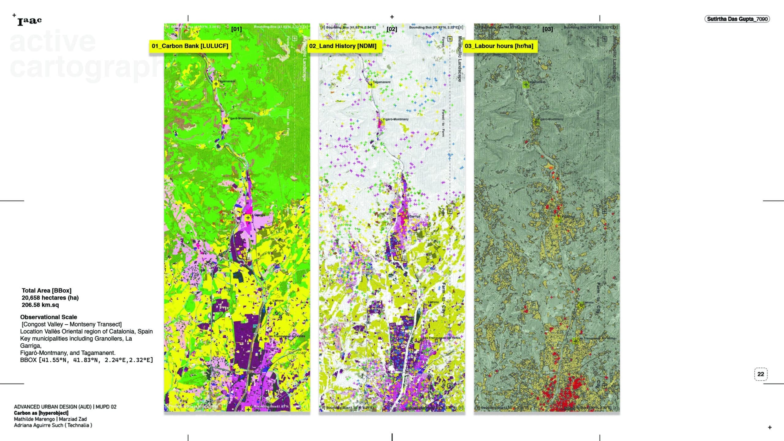
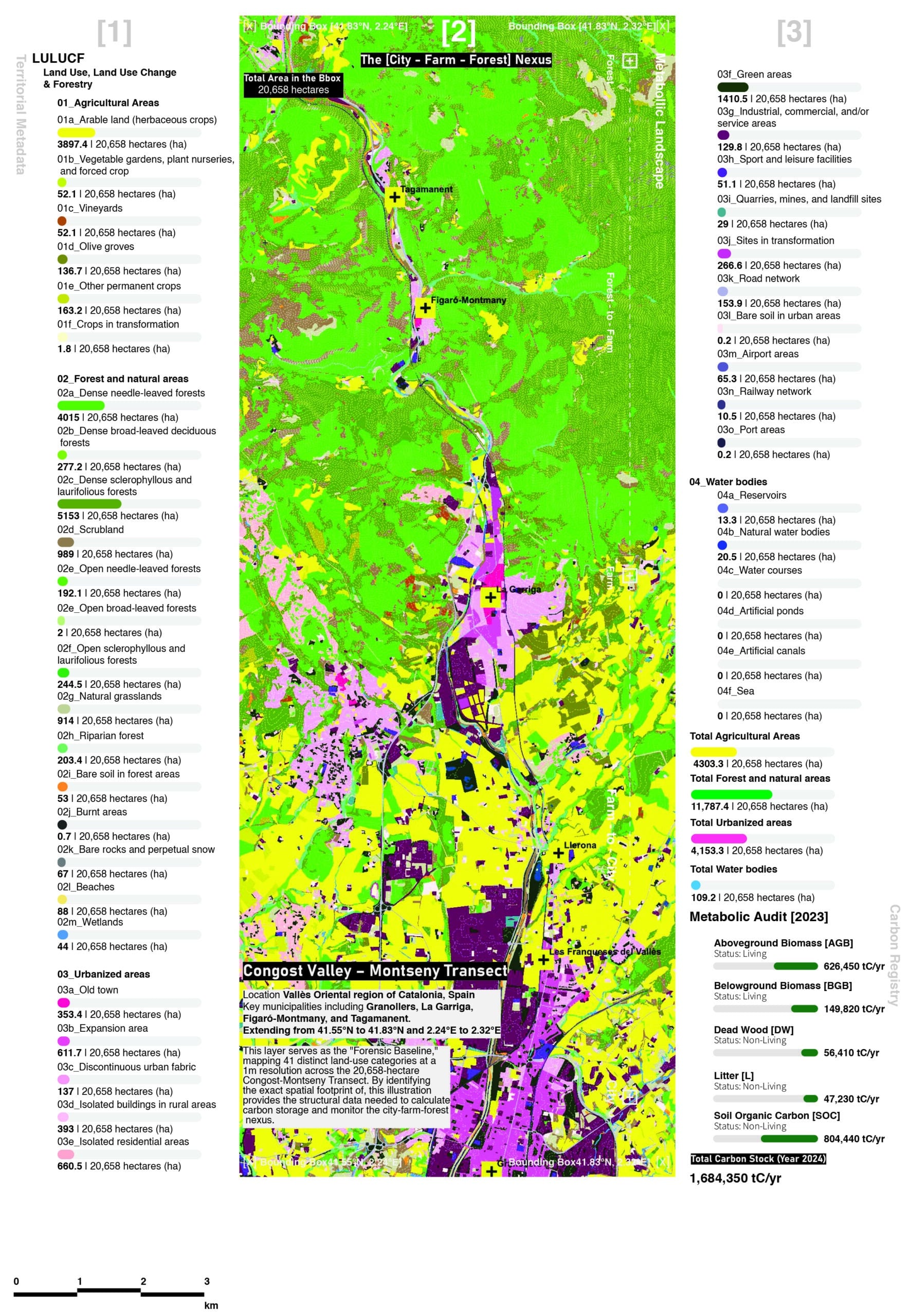
Across the transect, the land holds 1,684,350 tonnes of carbon. Once each parcel is adjusted for its exposure to fire and drought, the figure that matters falls to 1,314,438 tonnes, the carbon that is both present and at risk. That carbon is not spread evenly. It concentrates on 6,954 hectares, the vulnerable ground the work should reach first.
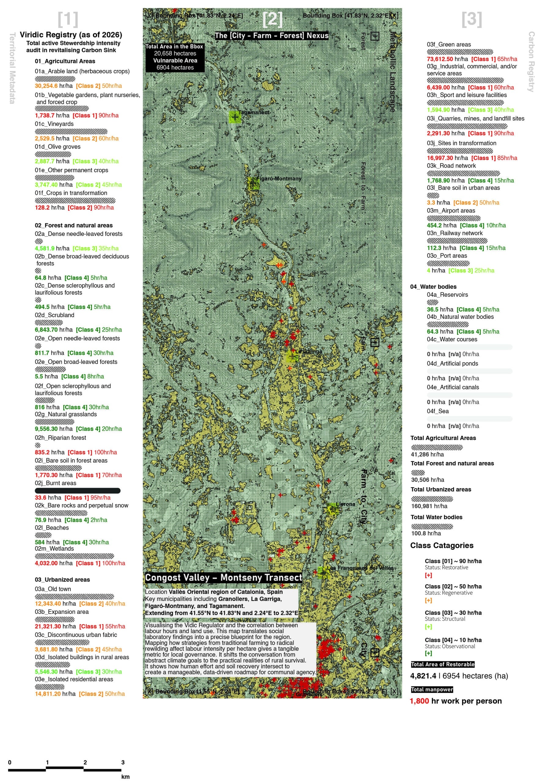
From here the question changes. It is no longer how much carbon is at risk, but what should be done about it, and by whom. Each vulnerable parcel is assigned one of four management classes, and each class carries a measured intensity of work, in hours per hectare. Regenerative land needs the most, at 90 hours. Restorative land needs 60, structural land 30, and observational land only 10, enough to watch and record.
Summed across the transect, this comes to roughly 4,821 hectares of active restoration and about 213,475 hours of human work. The carbon at risk has become a plan of labour, parcel by parcel, that a landowner or a municipality can read, cost and act on.
A looping GIF that fits the whole node-and-wire pipeline, then pans and zooms across the three bands — Carbon Bank → Climate Vulnerability → Classification & Labour , following the flow from LULUCF to the 232,875-hour restoration total.
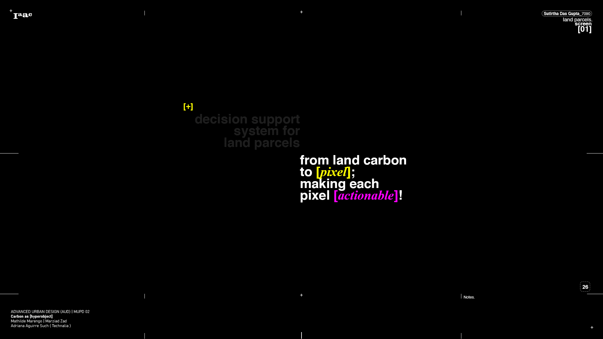
From land carbon to pixel, and from pixel to a plan of work.
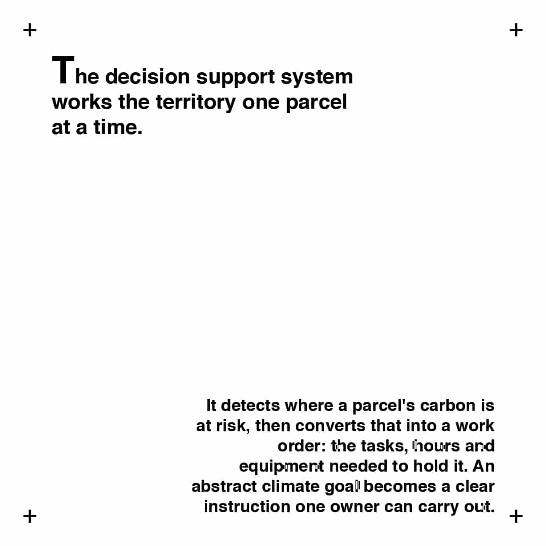
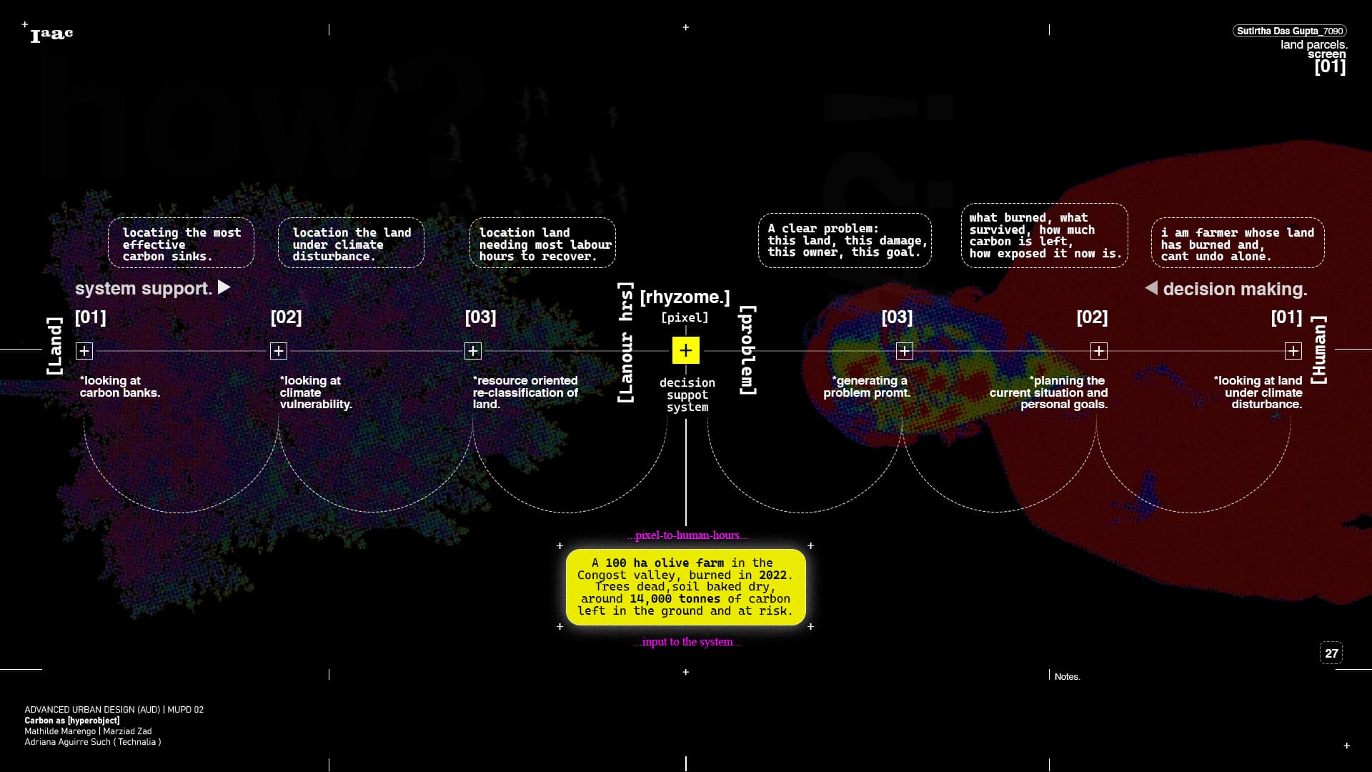
The decision support system sits between two things that rarely meet: the land and the person who has to act on it. From one side it reads the land in three passes, locating the most effective carbon sinks, the ground most exposed to climate disturbance, and the parcels needing the most labour to recover. From the other comes the human side, a farmer whose land has burned and cannot undo it alone, a situation and a goal. The two converge on the pixel, the smallest unit the system works in, where land carbon is converted into human hours.
The worked case at the centre is a 100 hectare olive farm in the Congost valley, burned in 2022, with around 14,000 tonnes of carbon left in the ground and at risk. That is the input. The output is a plan of work, parcel by parcel, that turns a question of damage into a sequence of tasks. This is what it means to make each pixel actionable.
The same system serves the farmer with one burnt field and the officer with a whole drying valley.
Two users sit at either end of the system. On the left is the micro manager, Jordi Busquets, an olive farmer in the Congost Valley whose 100 hectares burned in the summer of 2022, the trees dead and the soil dry as ash. On the right is the macro manager, Marc Rovira, a municipal forestry officer in La Garriga facing a 30 month drought that has baked the soil across the valley into a hard, water repellent crust. The system reads each one’s ground in the same way, returning a single readout of land cover, carbon stock and how that carbon is split across the pools. For Jordi’s parcel that comes to 14,171 tonnes, with the largest share held in the soil.
The comparison is the point. The rhyzome report sets the two personas side by side, Jordi against Marc, on the two measures that matter to the system: the carbon at risk and the labour needed to restore it. It runs across the Congost Valley to Montseny transect, the same ground read at two scales, one square kilometre for the farmer and two for the municipality. The same method that hands one owner a plan for a single burnt grove hands a town a programme for a whole valley, and puts two very different problems in the same terms.
‘pixels to personas‘
What the system does for two land users, it does for many.
The two personas were a test. Here the same engine reads the whole transect at once, an internet of land users, sixteen in all, each pinned to a real place between Aiguafreda and Granollers and each holding a parcel under 100 hectares. Every parcel is read through the same three maps: the carbon bank that stores the carbon, the vulnerability that threatens it, and the viridic layer that counts the labour to restore it. The users can be filtered by the problem they face, four about storing carbon, six exposed to fire, flood or drought, and six in need of water and resource restoration.
Select any one of them and the system writes a brief in their own voice, then returns a plan. Núria, a forest owner in Aiguafreda, asks how to thin her overgrown pine so it stores carbon without becoming fuel, and the system returns a ten year thinning plan for 62 hectares that cuts the fuel load by 30 percent while holding the soil carbon. Elena’s oak, stressed by drought, becomes a resilient mix of species chosen to keep 88 hectares a net sink through 2040. Oriol’s 54 hectares of ploughed fields become a rotation that rebuilds their soil organic carbon in six seasons without turning the soil. One method, sixteen sets of hands, each given the same carbon logic translated into a different job of work.


Everything so far has been building toward one tool. The three maps, and the carbon counted, weighted and turned into hours of labour, all feed a single decision support system. It is called rhyzome, after the underground stem that has no single root, spreads sideways and stores what the plant needs to survive. The system is built the same way: no centre, every parcel connected to the next, all of them read through the same three layers.
What rhyzome does is simple to state. It takes a piece of land, reads it through the carbon bank, the vulnerability layer and the viridic layer, and turns the result into something a person can act on. Carbon becomes pixels, and each pixel becomes a number of working hours. The system then writes the landowner a brief in their own words and returns a plan, parcel by parcel. Here is what that looks like.