
A rich and ongoing history…
Mars exploration missions started in the second half of the 20th century, with the first successful one being NASA’s flyby mission Mariner-Mars in 1964. Since then there has been a steady influx of many other missions throughout the years, from NASA as well as from other space agencies from around the world.
In 1993 NASA launched the Mars Exploration Program (MEP), which would be the main program under which NASA would continue its mars missions with the objective of providing a continuous flow of scientific information on the red planet. The program has had a total of 11 missions, in which 3 different types of vehicles, Orbiters, Landers and Rovers were used to gather data from all across the planet.
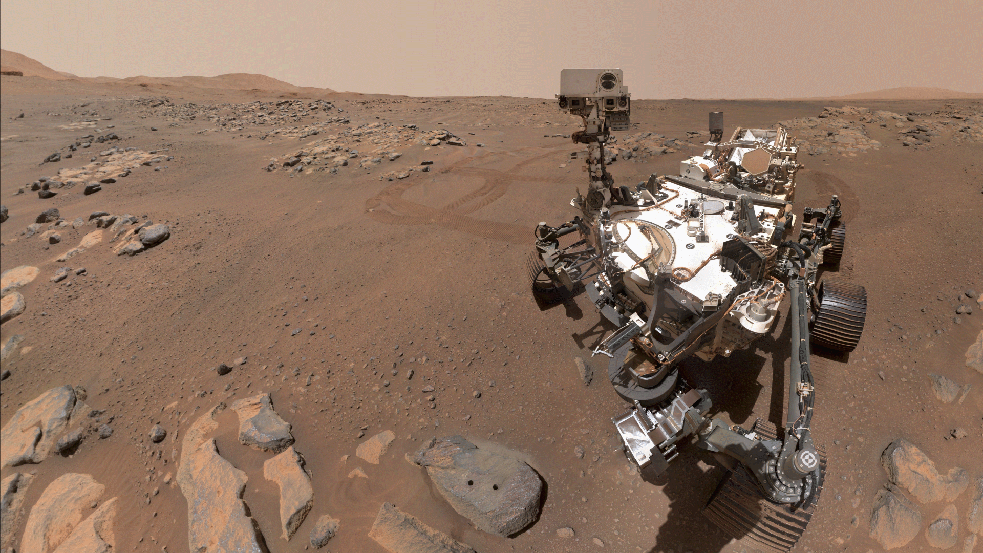
MEPs last mission, called Mars 2020, launched on the 30th of July of 2020 and landed on Mars on the 28th of February. The mission consisted of 2 vehicles, the Perseverance Rover and the Ingenuity Helicopter, they were deployed on the Jezero crater with their main task being to look for signs of ancient life and collect samples of rock and regolith for possible return to Earth. Since its landing the perseverance rover has been active for a total of 986 sols (roughly 1013 Earth days), has travelled a total of 21.28 km and gathered 23 rock samples, all while constantly communicating and sending information to NASA’s control on Earth.
Visualising the journey…
The objective of this project was to create a visualisation that shows in a simple and appealing way some of the public information available about the Mars Exploration Program, and its Perseverance Rover. To accomplish this, the gathered data is plotted on the walls of a hollow isometric cube, where each one of the 3 faces shows a different piece of information.
The left face of the cubed is dedicated to showing all of the missions undertaken by the MEP. A timeline is drawn, on the top of the face, where the start and duration of each mission is plotted, and below it, an orthographic projection of the west and east sides of the red planet is used to locate the landing site of the missions.
The right face of the cube is used exclusively for the Perseverance Rover. A 3d model of the robot is located on the top left corner of the face, and next to it a scatterplot shows the different sizes (Y-axis) of the samples it collected so far and when they were collected (X-axis). Right in the middle of the face 3 plots show how the roll, pitch and yaw of the rover changes throughout its journey, and below them 2 other graphs are placed, one that shows the total distance travelled, and another that plots the elevation changes during the rover exploration of mars.

Lastly the bottom face is used to show a 3d version of Mars, where at first the landing zones of previous MEP missions are shown in 3 dimensional space, but then the models zooms in towards the Perseverance landing zone to show the route the rover has travelled so far and where the rock samples that it gatherer were dug out.
