
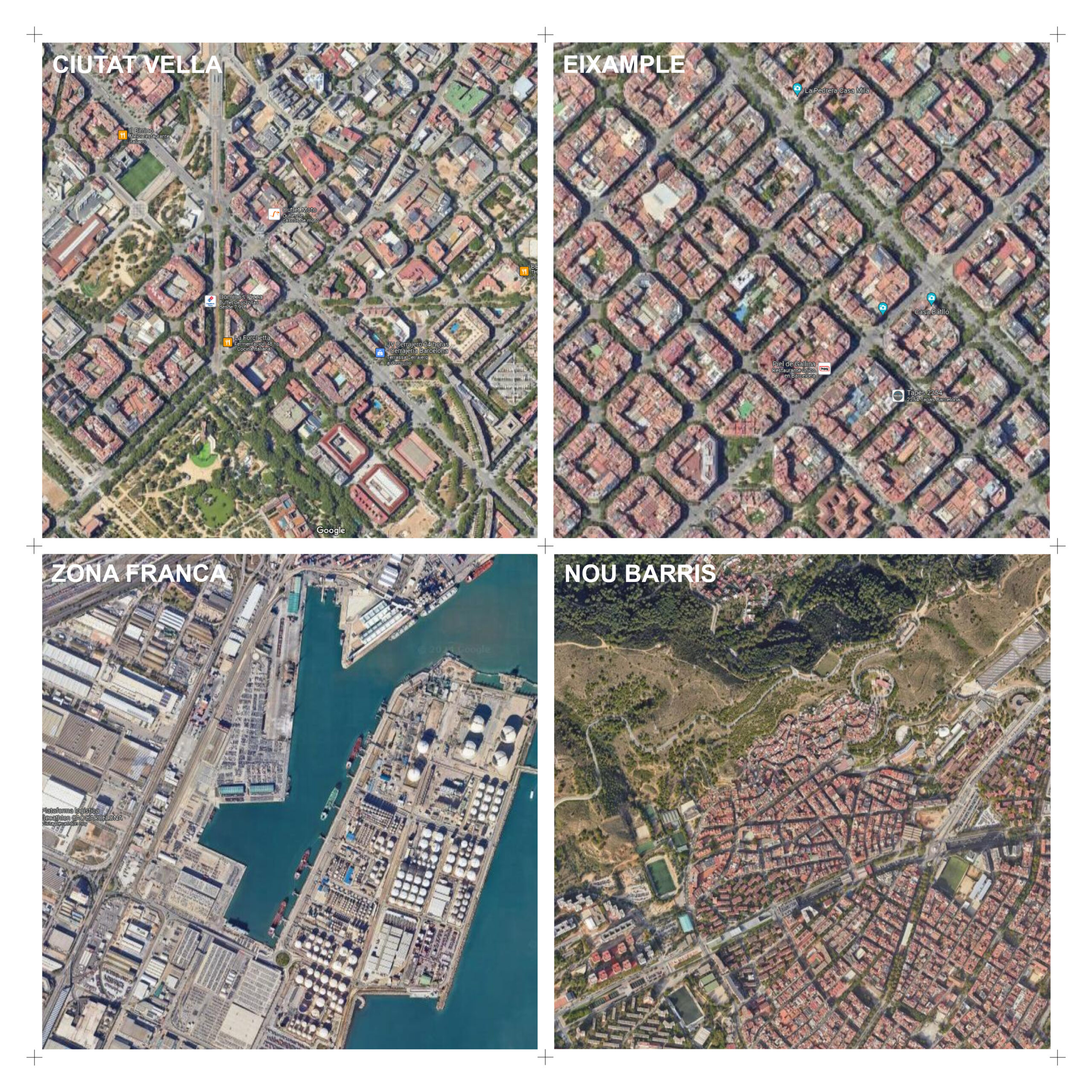

Espacios vacantes en la Ciudad Próxima
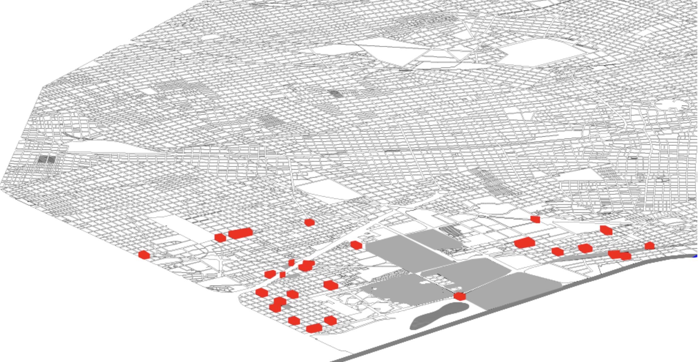
A partir del avance tecnológico y las nuevas formas de movilidad, la ciudad se encuentra disponibilizando espacios que quedarán vacantes en el corto, mediano y largo plazo. Ejemplos de estos son las estaciones de servicio, cajeros automáticos, garajes comerciales, shopping malls, kioscos de diarios y revistas, entre otros. Con este contexto, el interrogante que surge … Read more
Urban Impact Analyzer
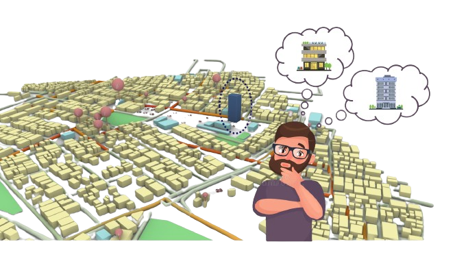
In the dynamic landscape of urbanization, migration towards cities is an undeniable trend. With this migration comes a myriad of challenges, notably the exponential rise in land costs and the often haphazard nature of urban development. As cities expand, there’s a pressing need for thoughtful and strategic construction that not only addresses the demands of … Read more
MUNICIPIO DE MASAYA/ TERRITORIO SOCIO- PRODUCTIVO. Bioeconomía, Paisaje productivo y Gobernanza multinivel.
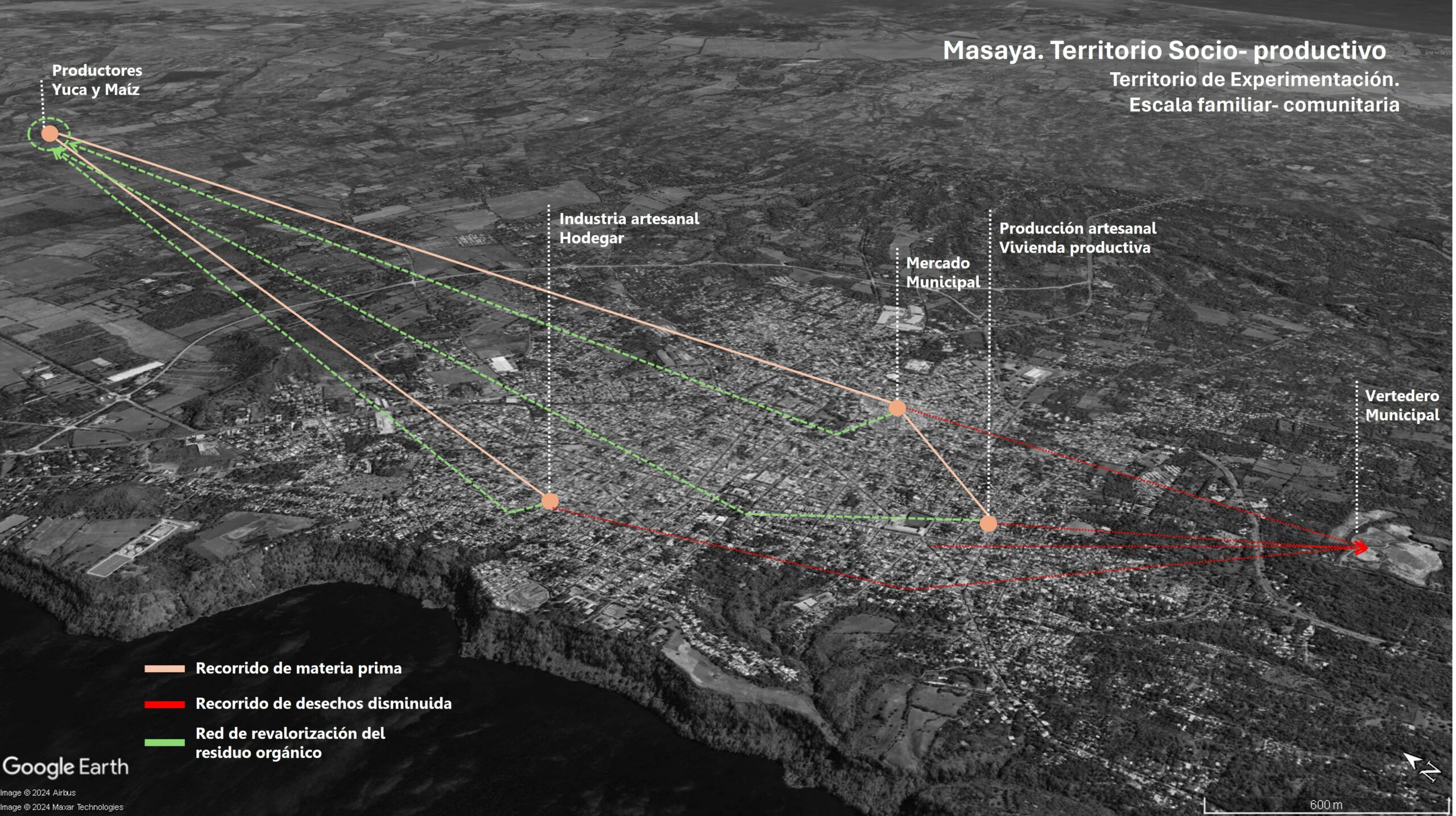
Nicaragua, considerado uno de los países más pobres de América Latina, basa su pequeña economía en la industria liviana, los servicios y la agricultura; beneficiándose de la inversión extranjera directa y las remesas. Se contabiliza entonces que el 64.5% de la población trabaja en agricultura y la contribución al PIB de dicho sector es del … Read more
Theories of the Urban_II
Questioning the rhetoric. The brief In the epoch of the Anthropocene, characterized by humanity’s profound impact on the Earth’s geology and ecosystems, the discourse surrounding resilience to climate change has become increasingly prominent. As societies grapple with the consequences of human-induced environmental transformations, there is a growing recognition of the need to question and analyze … Read more
Aquamines
Translating Point Clouds into BIM Geometry For the first settlers on Mars, we have envisioned a colony of Aqua-Miners with the primary task of harvesting water as a resource from the ice beneath Mars’ surface, storing it and recycling it for sustainable use. Our approach to this problem has been exceptionally data-driven. Our idea is … Read more
EVALUATE
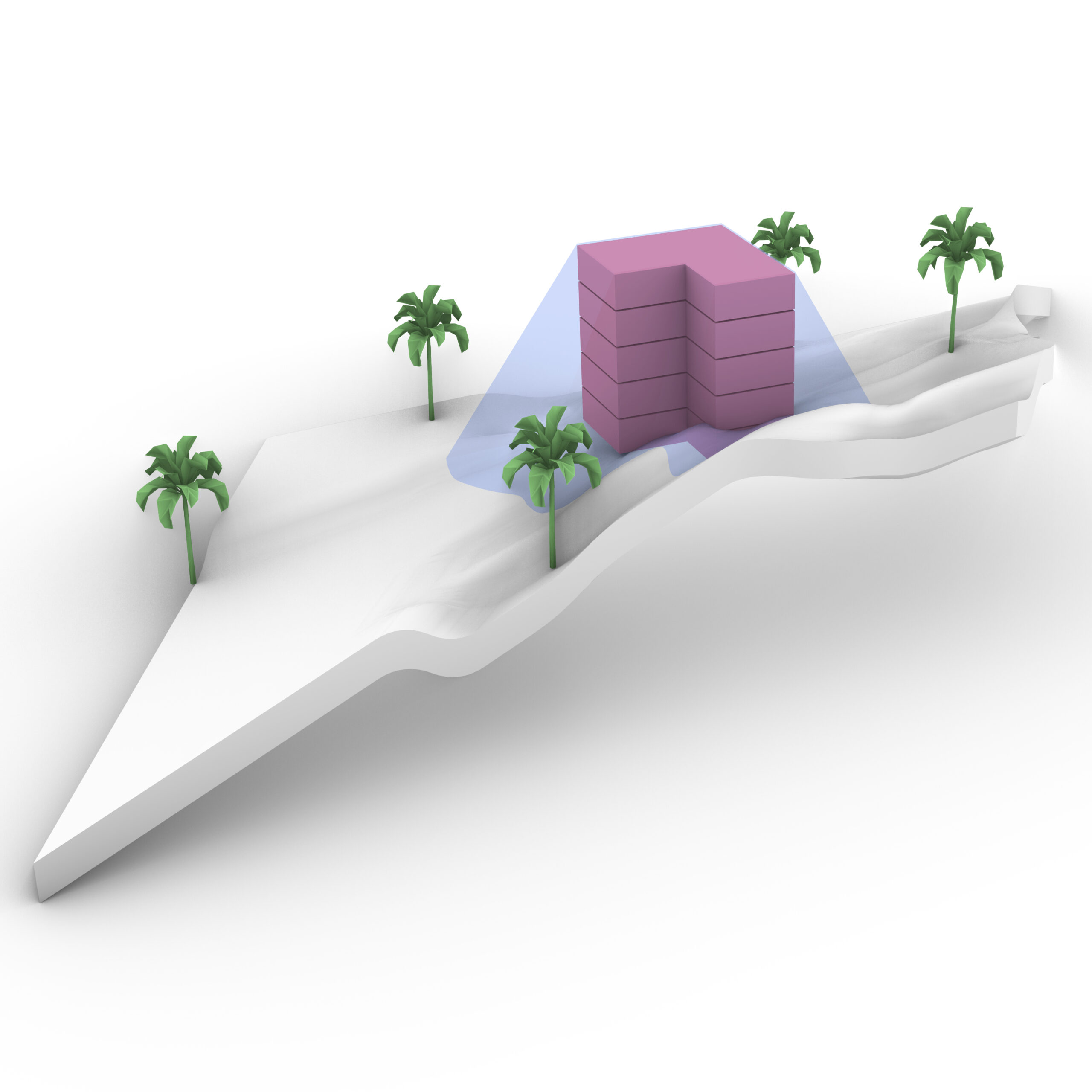
Evaluate is an App that helps Investors and Planers to position their building on an uploaded Terrain, and visualize its Setbacks and Feasibility in terms of cost and total floor area. By automating this simple process, one can evaluate any building Plot simply by having its terrain, instantly and without bothering with checking specific Area … Read more
Darien: Closing the data Gap
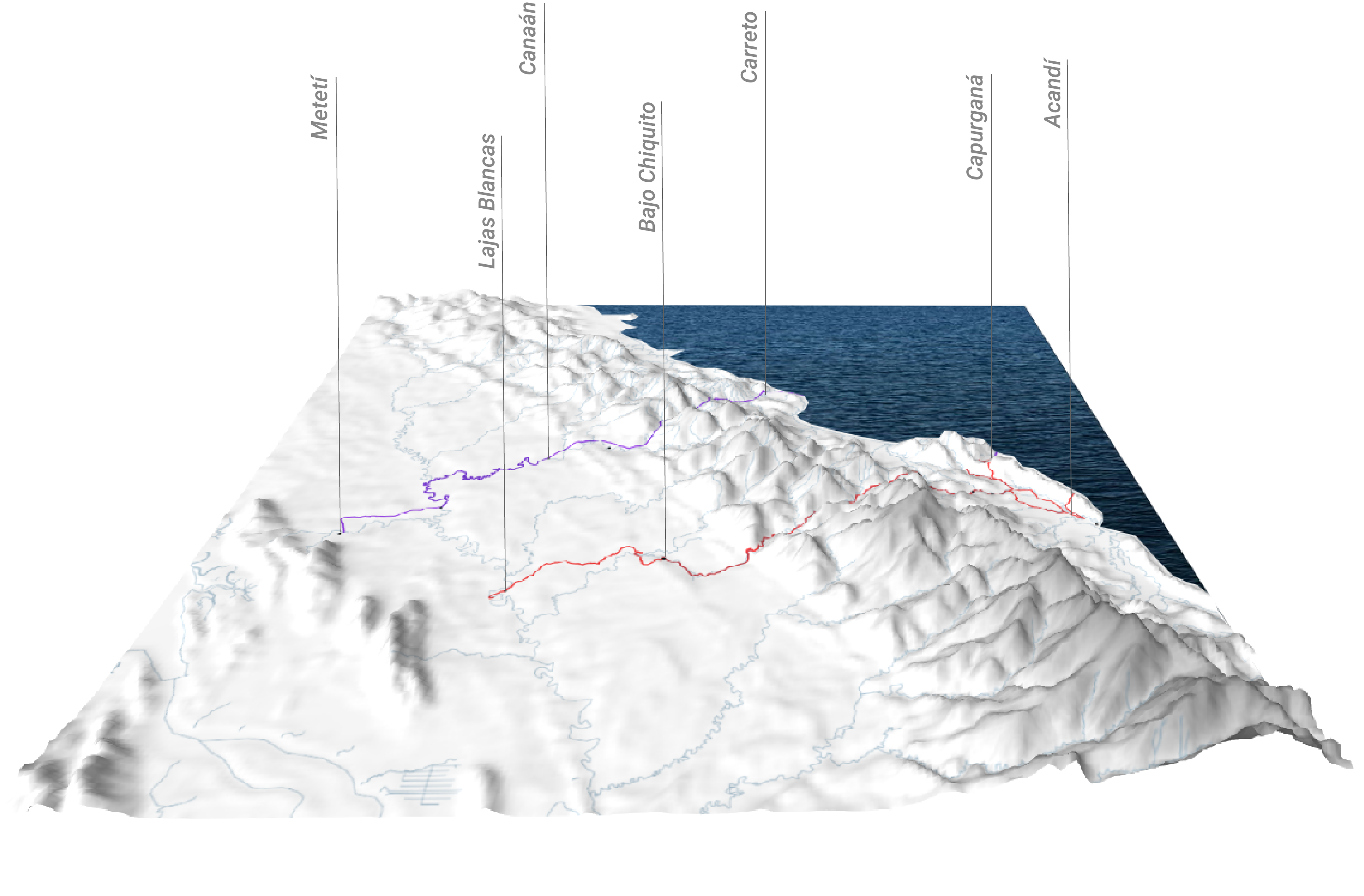
Imagine a massive highway stretching from Alaska all the way down to the tip of Argentina. That’s almost possible through the Pan-American Highway, except for one crucial interruption: the Darien Gap. The Darien Gap is a sprawling, dense jungle separating Panama and Colombia, an obstacle that breaks the otherwise continuous highway. But the Gap isn’t … Read more
Zero Waste Project | Metabolic Building System: Energy
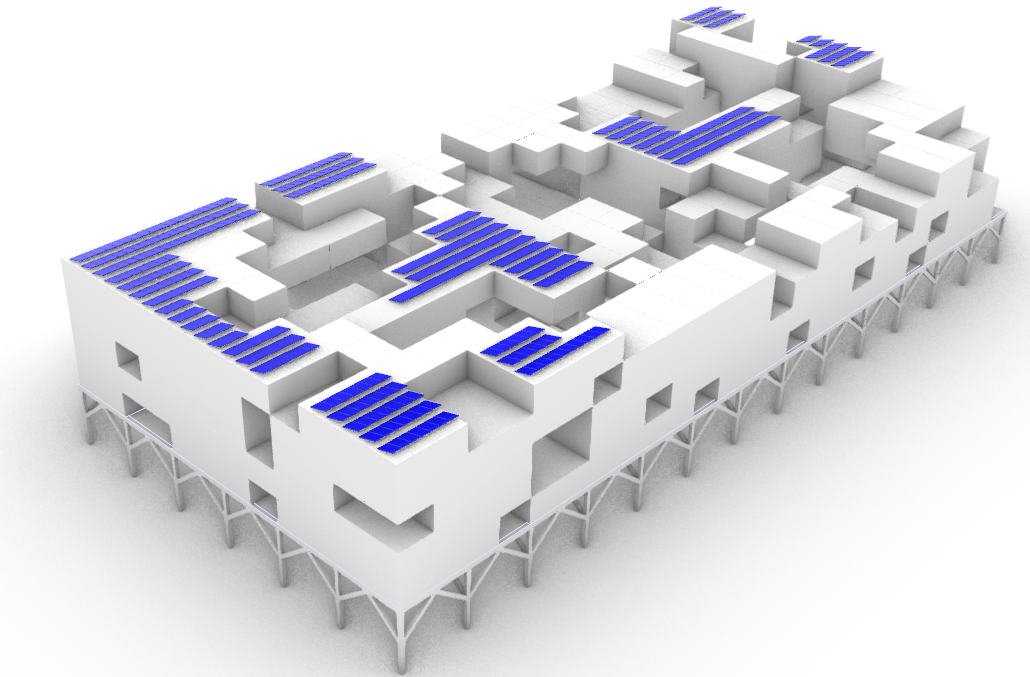
This module emphasized understanding and optimizing energy consumption and generation by building and utilizing various strategies. Calculating energy and power consumption per function per unit area for our projects was the first task of the course. In accordance with this mandate, we submitted suggestions on Sunny Design to assist in designing rooftop solar panels in … Read more
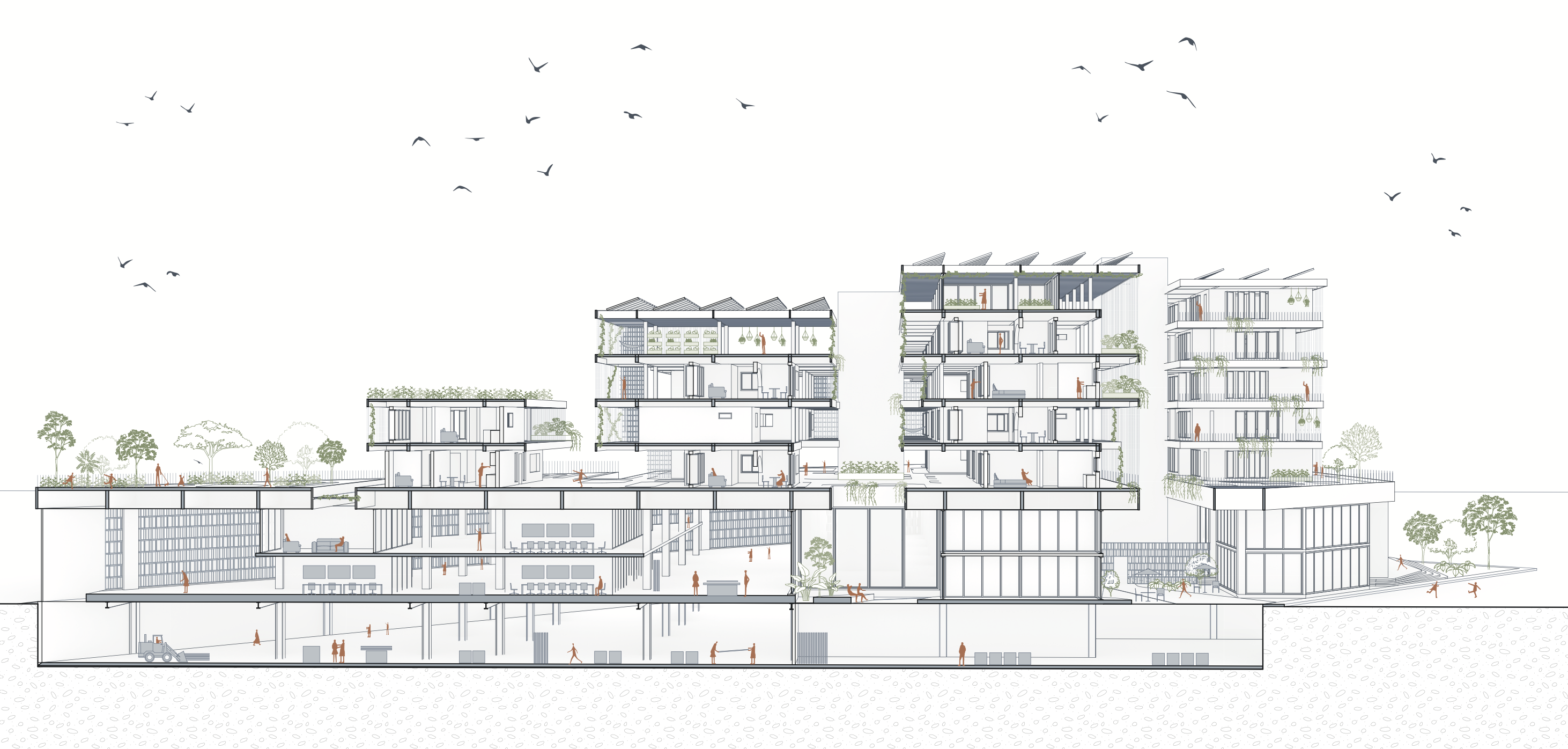
Proximity Food: Thermodynamic Strategies
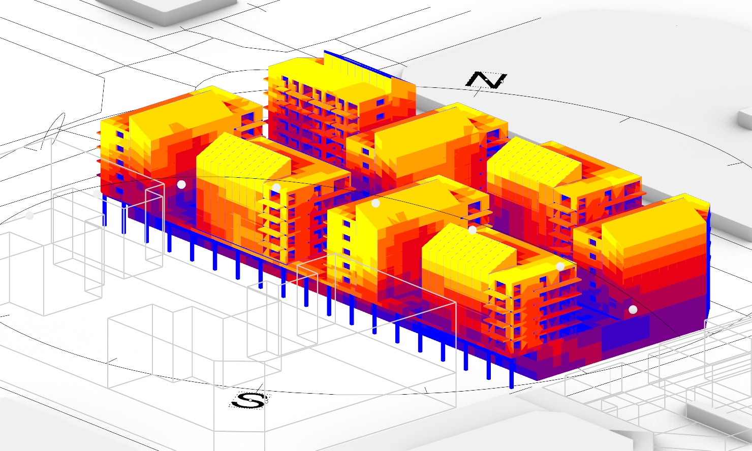
Our site is located in St. Adria De Besós, a district nestled in the northeastern part of Barcelona’s urban area, positioned at the mouth of the Besós River. It lies between the cities of Barcelona, Badalona, and Saint Coloma de Gramanet. Barcelona has a Mediterranean climate with mild, relatively rainy winters and hot, sunny summers.The … Read more
Urban Alliance – Project Media

In the realm of architectural design and presentation, visualization plays a pivotal role in conveying ideas, concepts, and designs to clients and stakeholders. With advancements in technology, architectural visualization has evolved tremendously, offering architects and designers a multitude of tools and techniques to bring their visions to life. Among these tools, Lumion stands out as … Read more
STATE OF CLIMATEACTION 2023: POWER: Ecological Thinking
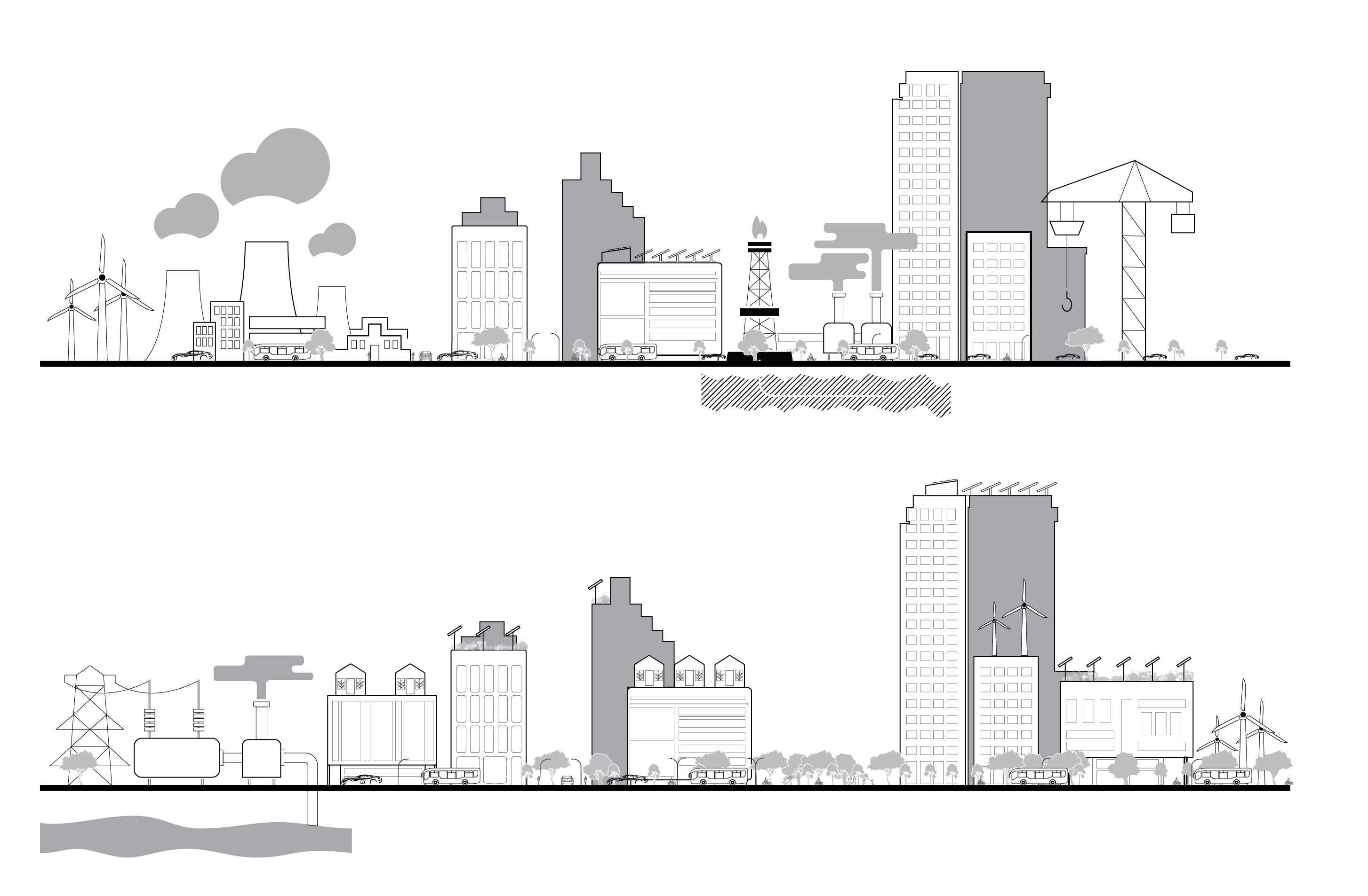
This blog summarizes section 2 (Power) of the book State of Climate Action 2023 with an illustration. The graphic illustrates the energy transitions required to achieve the immense task of preventing global warming beyond the 1.5-degree mark as called for in the Paris Agreement. We have represented the imaginary city of 2050, having reached the … Read more
Urban Alliance – Urban Synthesis
The “Urban Alliance” is a mixed-use architectural design seamlessly integrating Industry 4.0 principles, featuring advanced photovoltaic production units. This visionary space harmoniously combines sustainable energy practices with residential and commercial areas, embodying a forward-thinking urban landscape that fosters eco-friendly living and innovative business practices. It exemplifies a holistic and tech-driven approach to urban planning. The project is … Read more
Visualizing Geo-Political Power dynamics through Spatial & Statistical Data

The Question: How far does the recent decline of US FDI (Foreign Direct Investment) into China, play a role in China getting more insecure and expanding its global reach of power. The World and all countries alike have been increasingly more susceptible to events and developments in the geo-political theatre. It is not surprising that … Read more
Ecología Urbana en la Represa Guarapiranga: Recuperación Sostenible de los Manantiales en São Paulo

Con más de la mitad de la población brasileña viviendo en áreas urbanas, la necesidad de integrar la naturaleza en la vida cotidiana se vuelve crucial. La urbanización desordenada alrededor de ríos y manantiales, como ocurre en la Represa Guarapiranga en São Paulo, compromete la cobertura vegetal, causando polución y amenazando la oferta de servicios … Read more
