Project Concept
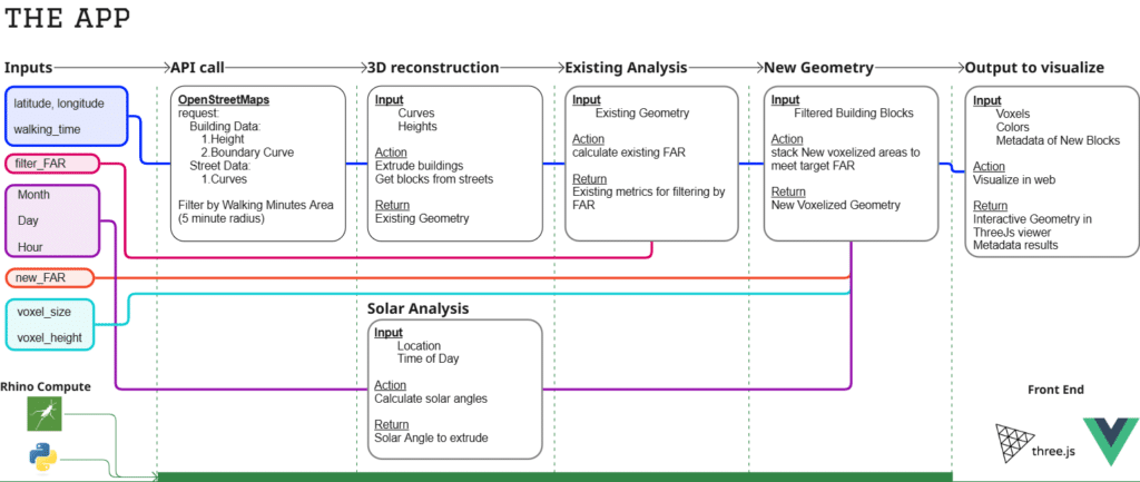
This tool uses open source data to estimate a site’s Floor Area Ratio (FAR) and allows users to explore different volumetric configurations. It leverages modular units based on CLT Mass Timber for a flexible structural framework and incorporates solar angle data to optimize designs for sustainability and contextual responsiveness.
Who is the End User of this App?
- Primary Users: Architects, sustainable design consultants, and developers working on residential and urban projects.
The Algorithm
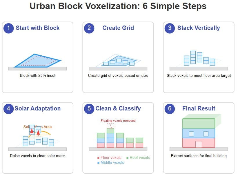
By using grasshopper we are able to calculate the solar angle for a specific time of the year at a specific location. Following this process we can take the generated geometry and apply the solar angles to computationally carve out the mass necessary to allow the sun to penetrate the street level. The main inputs are the city blocks and a target area for which the algorithm will proceed to modify a set of voxels until it meets the solar constraint and target area. The advantage of using computation for this process is to be able to visualize this process and understand what can be modified by the user to achieve a certain goal.
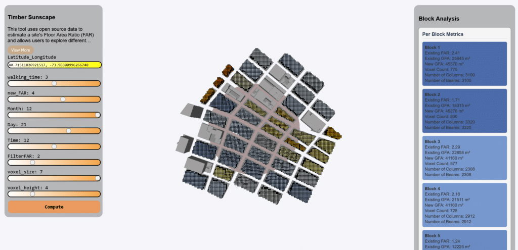
The UI
The User interface is organized in 3 sections. On the left side we have a set of parameters that are inputs for the computation. The middle is the 3D viewer using ThreeJS for the geometry. The right side is the Analysis panel that shows the meta data for each block that was generated in the site. You can select the block and it will automatically zoom into it to verify the 3D geometry. The blocks are color by their total area where Blue is highest area and red is lowest.

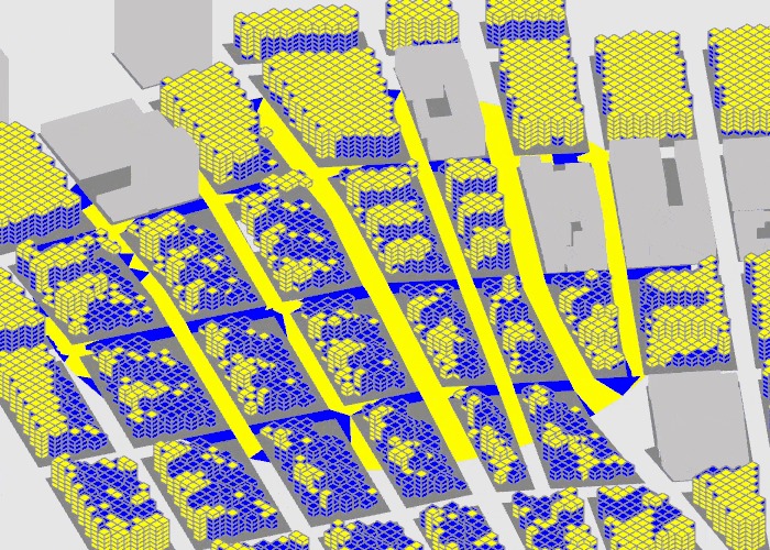
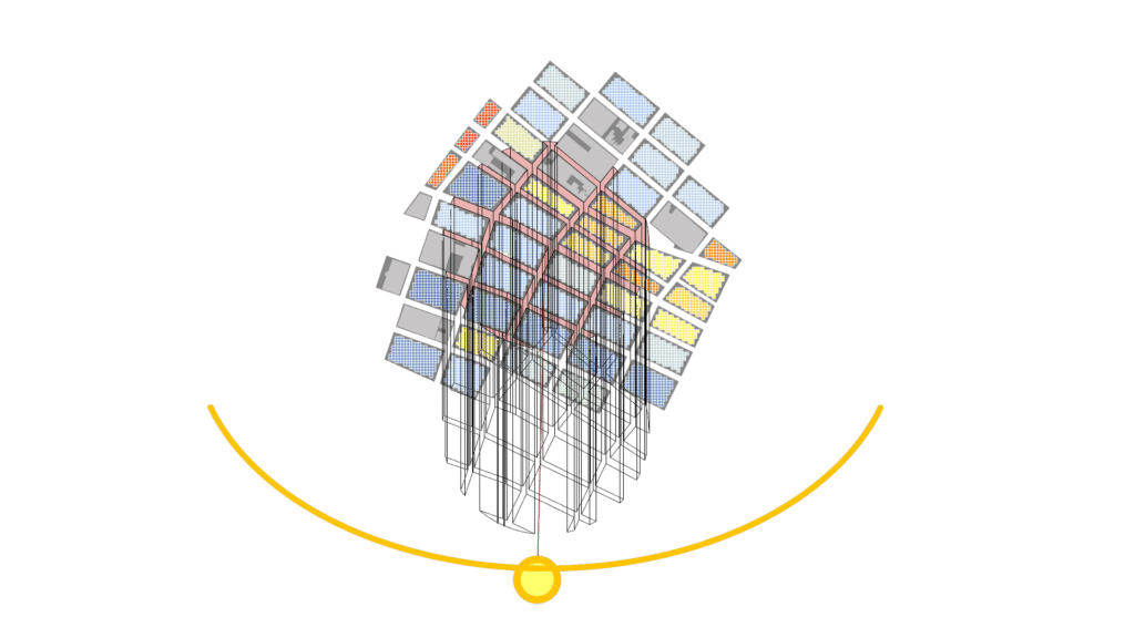
The Geometric computation
The following images display the computation visually being down in the backend in grasshopper as rhino.compute is called. We first show a red circle that is based on the walking distance radius based on minutes. This area will be used to generate a solid geometry extruded in vector direction from the sun calculated from the latitude and longitude and time of the year. Once we have calculated this solar mass we can use it as a way to slice the building masses to always allow the sun to penetrate the street at that time of the year.
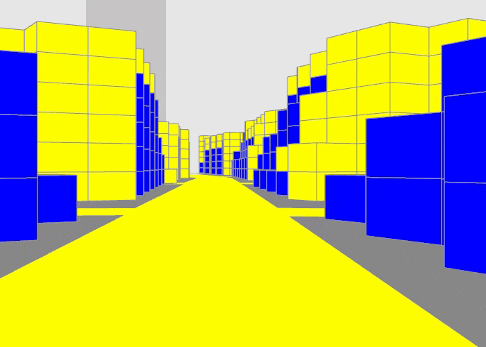
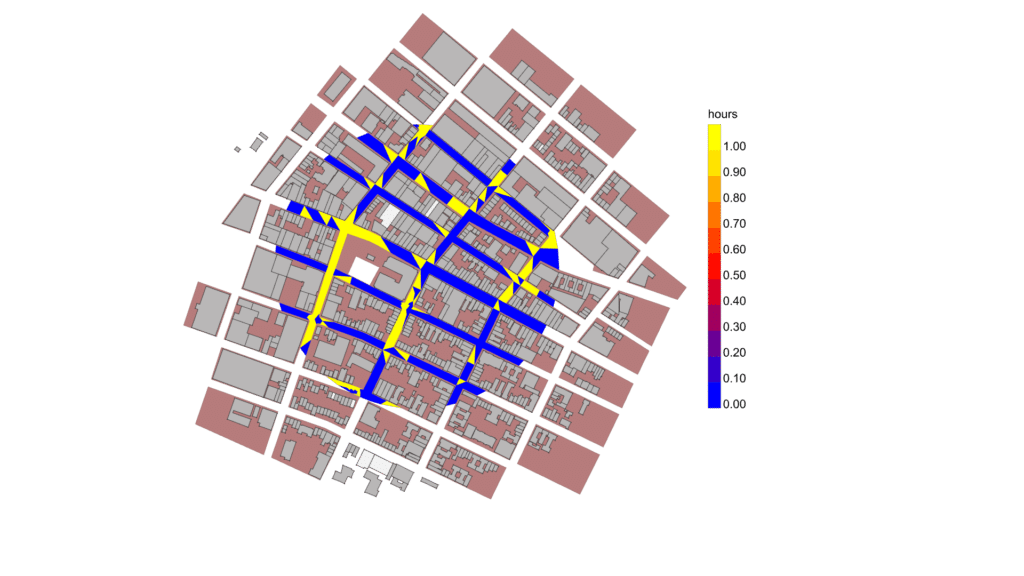
Solar Effect
In these diagrams we can see the effect of the solar slicing. Here on the left we see the existing context for December 21 at 12pm compare with the new geometry on the right. We can see the improvement of the sunlight hours on the street.
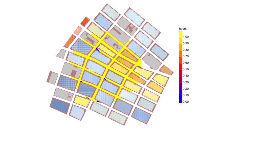
The slicing is showing in the following animation. We can see the extruded street geometry in the direction of the solar angle vector. The top left view shows the extruded geometry slice. The other views show the effect as measured by the solar daylight hours.