

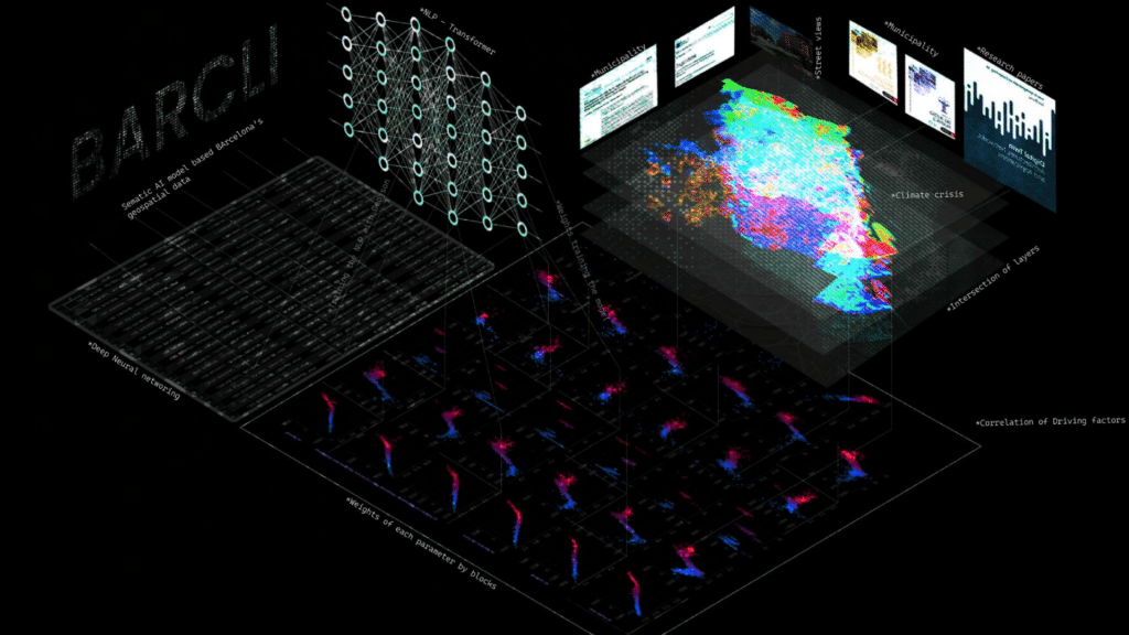
This thesis investigates how the semantic content of urban climate policy can be computationally coupled with high-resolution geospatial data to anticipate the climate consequences those policies set in motion. The work is situated in the metropolitan area of Barcelona, and the central proposition is that policy text far from being inert prescriptive language is itself an actionable dataset, provided we have a model capable of reading it.
Context
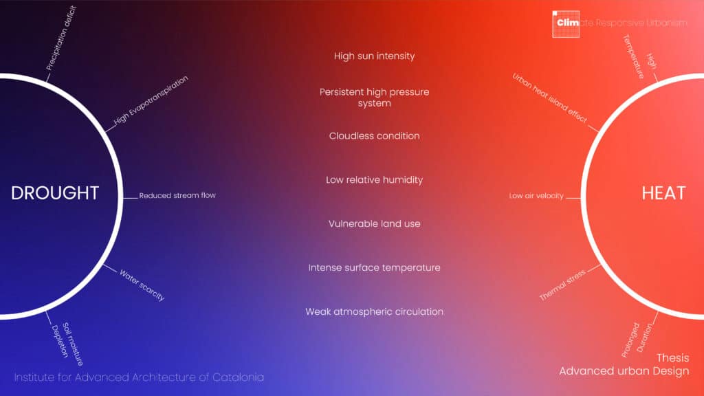
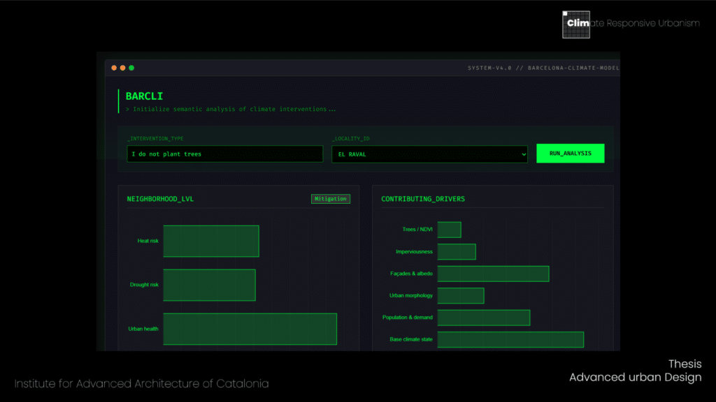
Contextualized in the metropolitan area of Barcelona, explores extreme climate conditions in dense urban environments and reading through policies and planning proposals. Specifically, the aim is to map how the city responds to these climate policies.
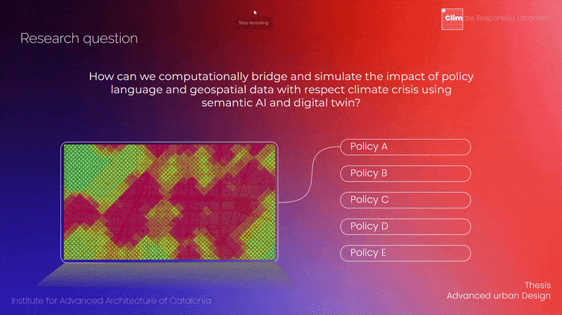
Research Question
Framework
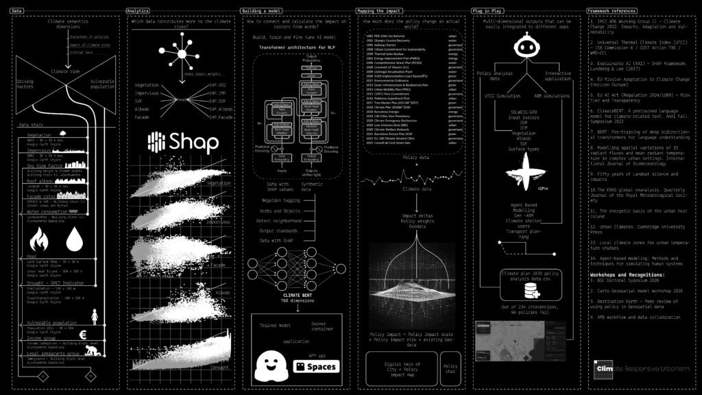
Data stack
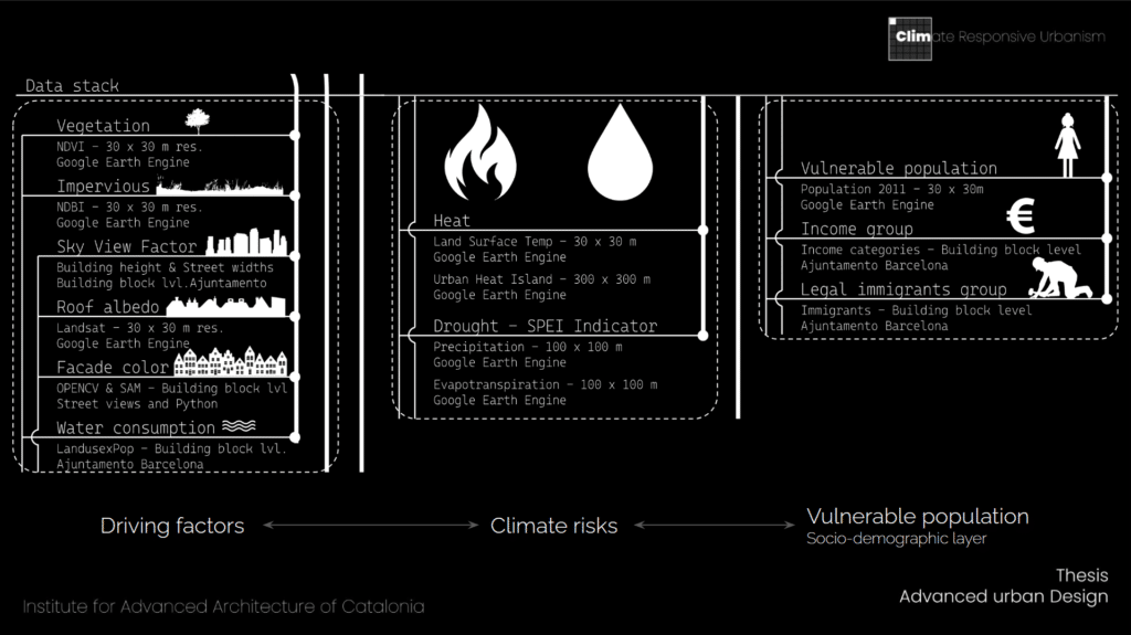
Computer Vision – Heat score for facades of Barcelona
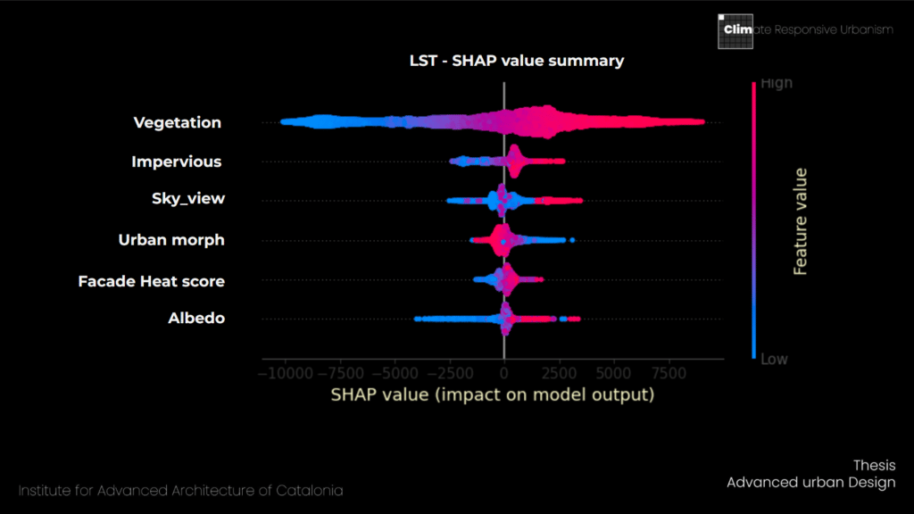
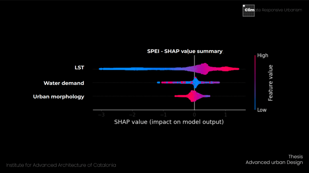
SHAP – Dependency weights
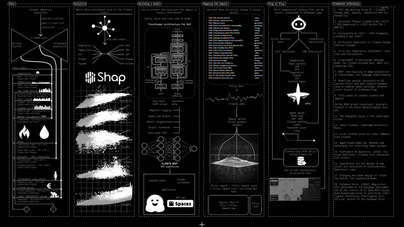
Building a Semantic AI model
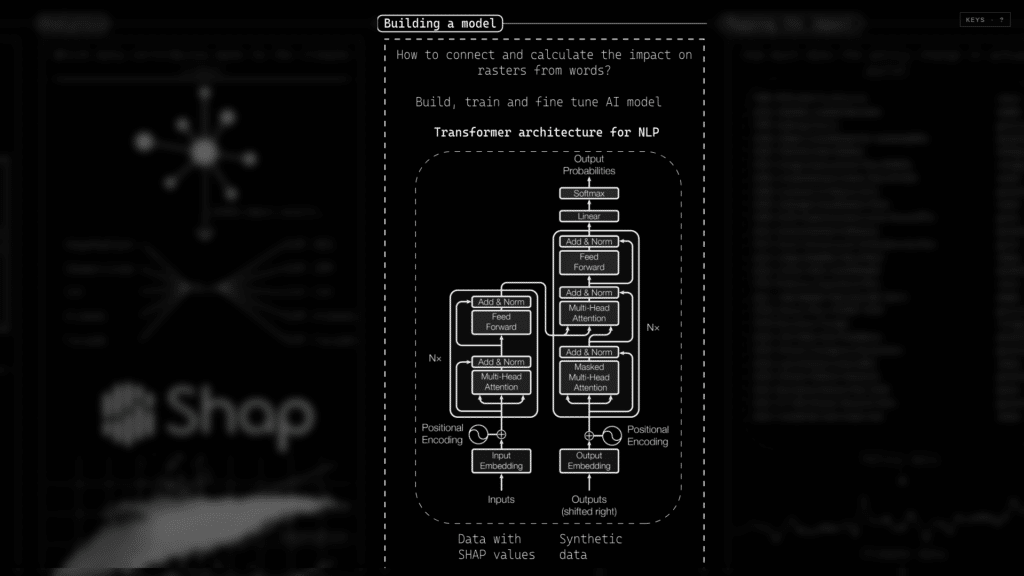

Training and Fine Tune
Negation tagging:
FUNCTION_NEGATORS = {‘not’, ‘no’, “n’t”, ‘never’, ‘neither’, ‘nor’, ‘without’}
SEMANTIC_NEGATORS = {‘absence’, ‘lack’, ‘removal’, ‘loss’}
Verb and objects parsing:
“Cutting down trees to increase more view points for visitors”
Views, visitors – object, cutting trees – verb
Detect neighborhood:
detect_neighborhoods:
“We need more trees in Gracia”
“El Raval has high urban heat”
Quantities:
verbs:
‘Increase’,’add’,’expand’,’install’,’instal’
‘reduce’,’remove’,’cut’,’decrease’,’eliminate’,’clear’,’limit’,
Direction and impact mask:
direction=1 | impact=[-0.45, -0.02, -0.76] | sentence=blocks with car mobilization in horta
direction=0 | impact=[0.0, 0.13, 0.78] | sentence=the city is trying HARM_reducing HARM_asphalt HARM_surfaces around vila de gràci
