Ertuğrul Akdemir MAAI · Master in AI for Architecture and Business Innovation 25/26 Advisor: Shajay Bhooshan
An AI tool that reads how streets behave through the day and tests where the curb could change use, then shows how that change spreads across the city before anything is built.
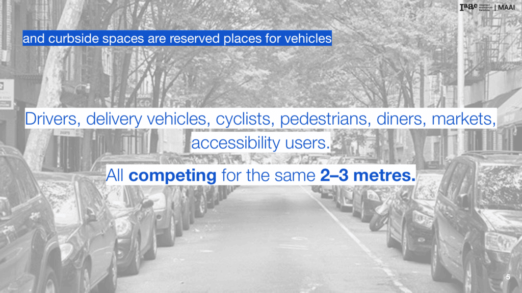
Streets are designed once and rarely questioned. The curb is poured into place and stays fixed for decades. But the way people use a street keeps shifting through the day. Drivers, delivery vans, cyclists, pedestrians, diners, market stalls and accessibility users all want the same two or three metres of curb, and most of that space stays reserved for parked cars no matter what is actually happening on the street.
What if the curb could be planned the way the street is actually lived, by the hour, not by the decade?
Some cities have started to try this. New York’s Dynamic Curb Management and Seattle’s Flex Zones both treat the curb as flexible space that can serve more than one purpose. But both rely on people watching the street, political input and small pilots rather than data analysis.
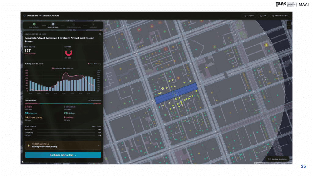
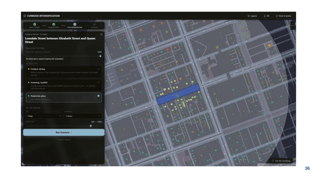
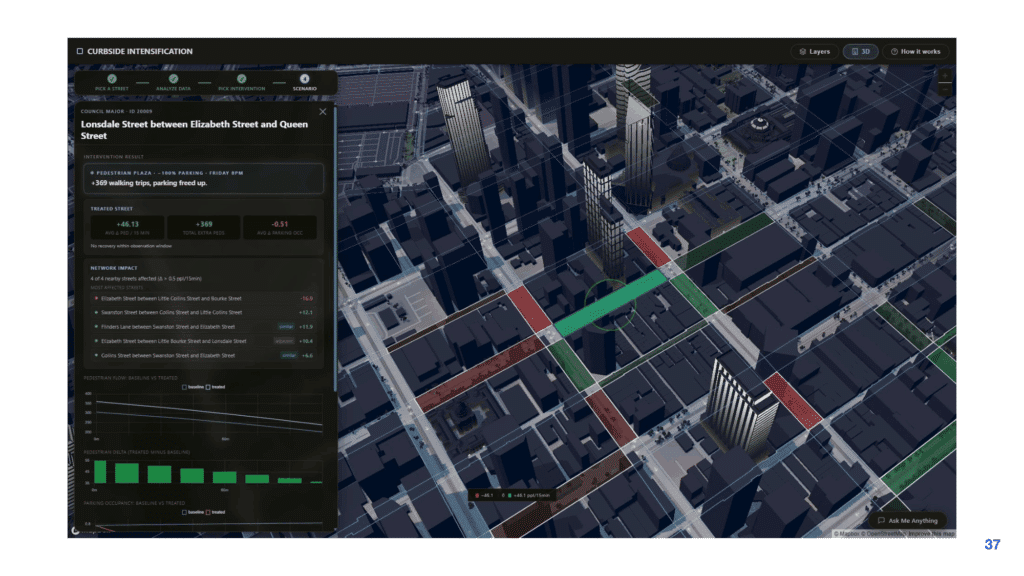
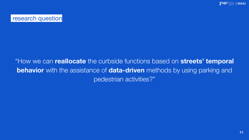
Curbside Intensification asks a different question: can this decision be made from data, and can the side effects be predicted before anything is moved?
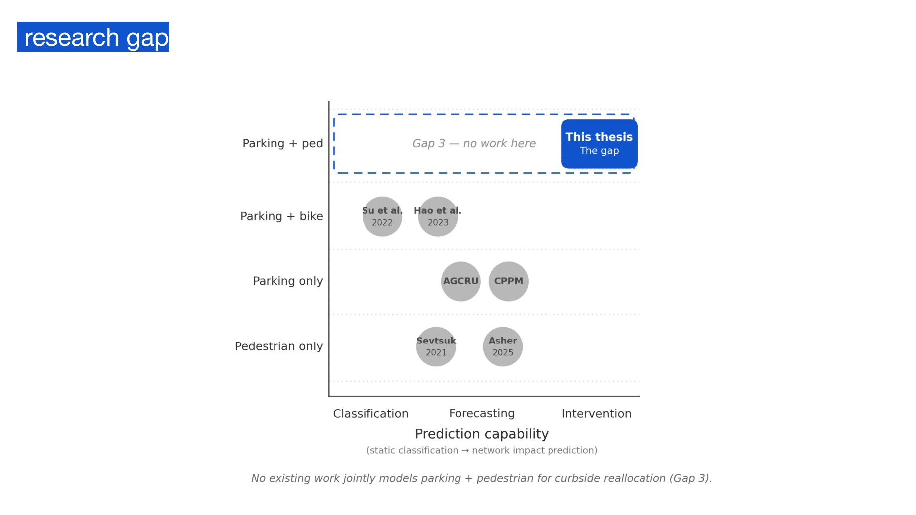
Nobody had modelled parking and pedestrians together
That main question splits into three:
Which streets have quiet windows in the day that make a curb change workable?
What drives the pattern of activity on a street?
How does a change on one street spread to the streets around it?
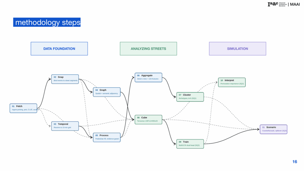
The solution:
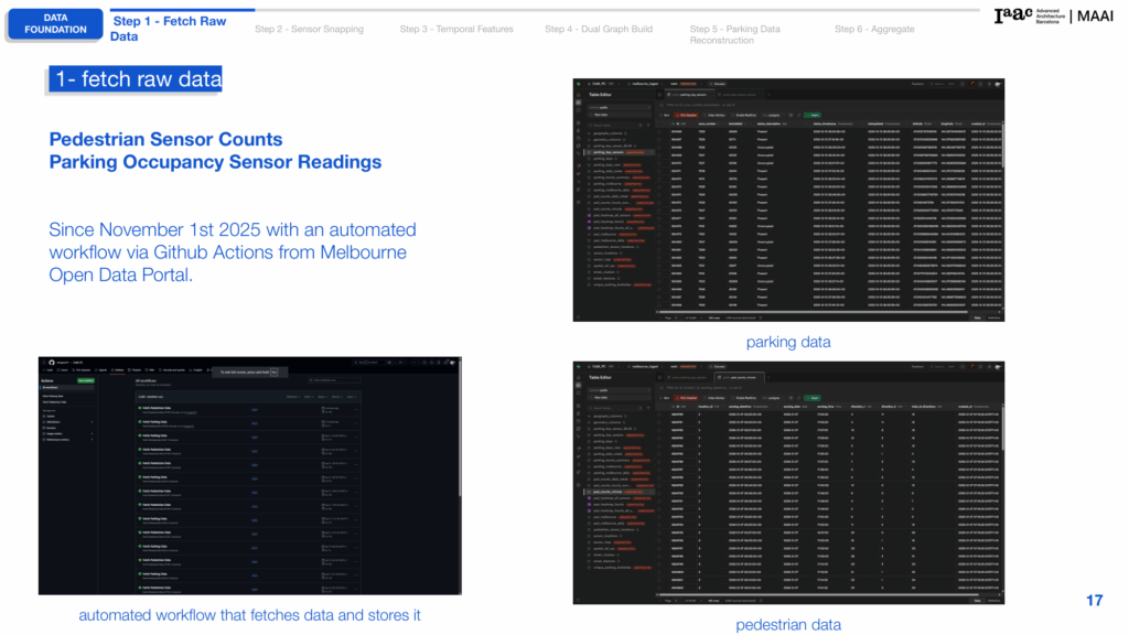
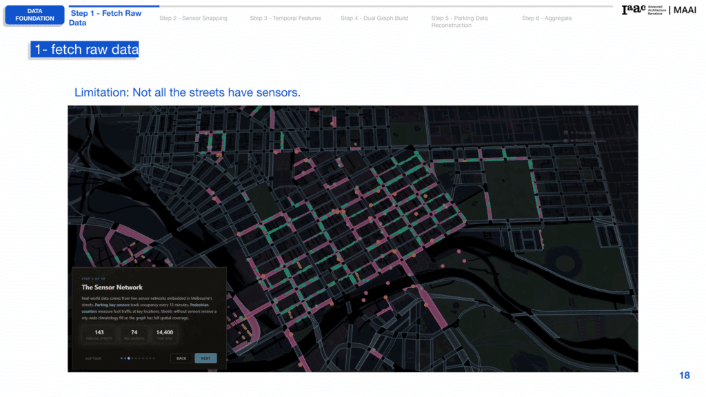
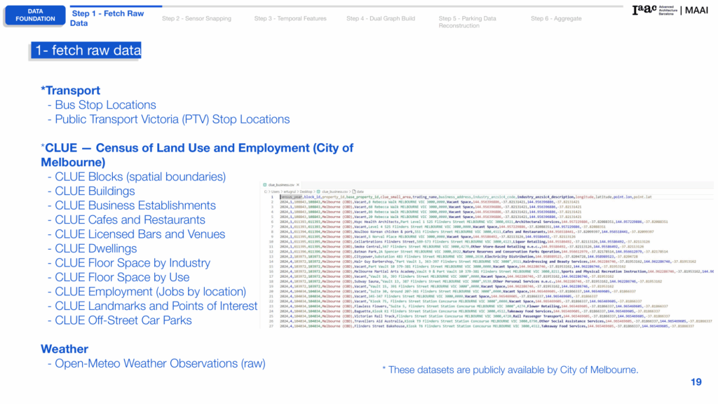
an AI-driven framework that analyses parking occupancy and pedestrian activity across a joint spatiotemporal street network to identify curbside reallocation opportunities and simulate their network-wide impact.