Developed as part of a Workshop hosted by IAAC and conducted by Buro Happold representatives, the project envisions the transformation of Barcelona’s Zona Franca waterfront into a mobility-driven, mixed-use district that balances industry, nature, and urban life.
The master plan prioritizes seamless connectivity, enhancing public transport, pedestrian networks, and micromobility infrastructure to overcome the area’s current isolation. By repurposing industrial spaces, integrating mixed-use housing, a sports center, and green corridors, the project redefines the waterfront as a dynamic, accessible, and sustainable urban hub, bridging logistics, mobility, and public space in a future-ready model for Barcelona.
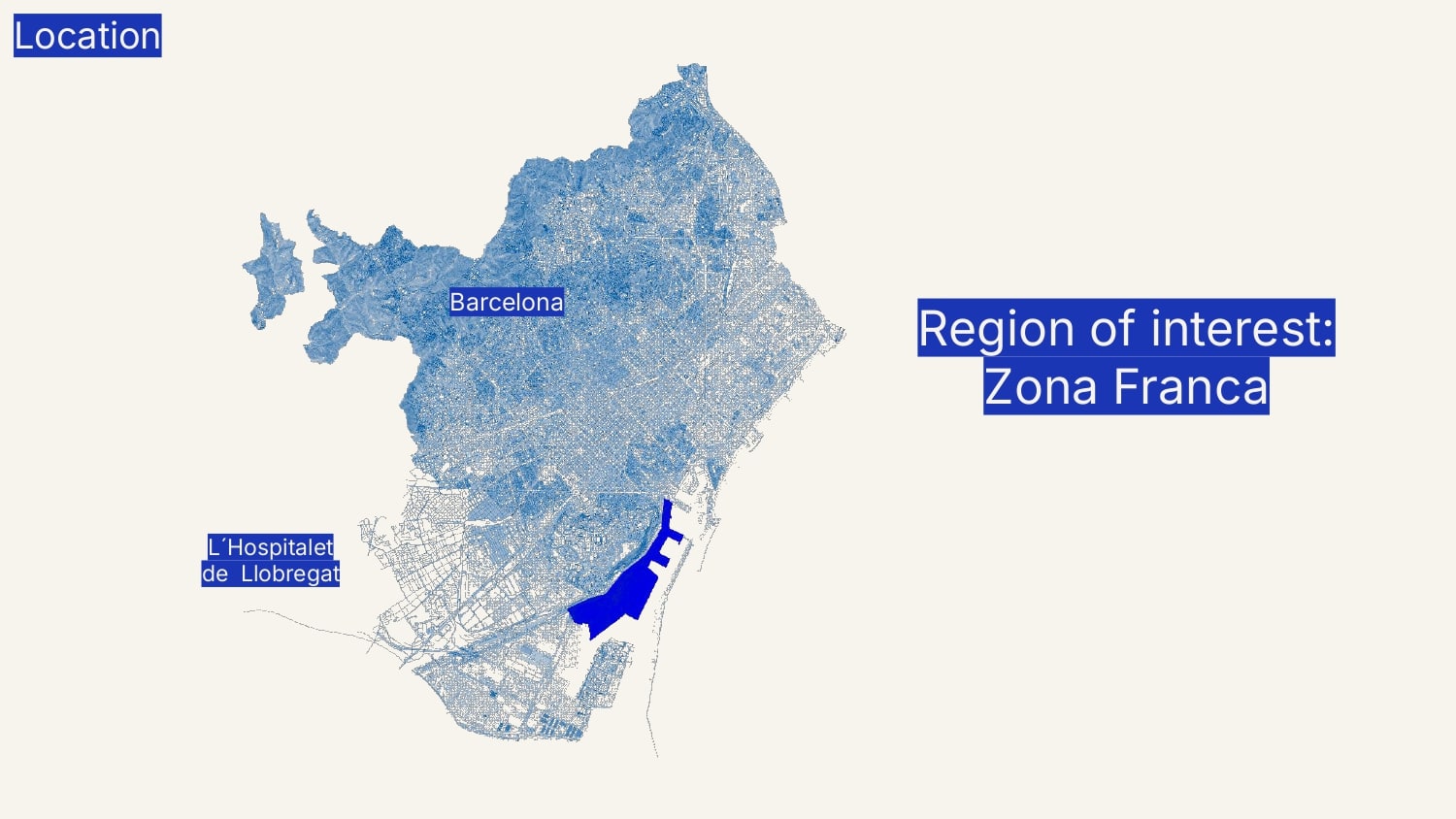
Location
The project’s brief we received explores a hypothetical transformation of Barcelona’s Zona Franca waterfront. With the city considering the relocation of its container port, vast industrial land could be repurposed into a new mixed-use neighborhood, addressing housing needs and urban growth.
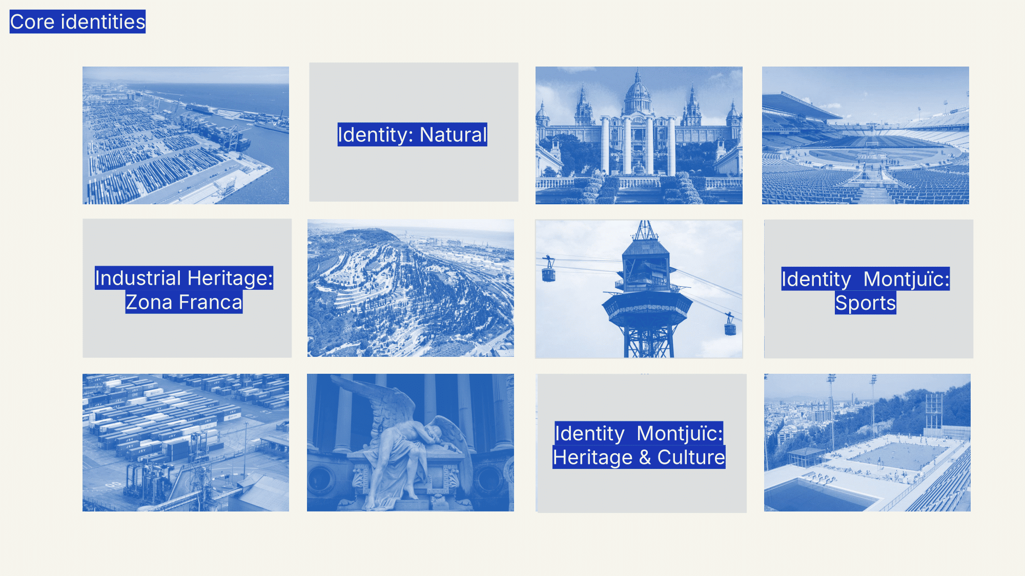
District’s identity
Zona Franca’s waterfront today remains an industrial and logistics hub, shaped by large-scale infrastructure and limited public access. While it plays a key economic role, it lacks integration with the city, underutilizing its waterfront potential and offering minimal residential or recreational spaces. Despite its proximity to Montjuïc—Barcelona’s natural and sports landmark—there are few connections between the district and its green, active identity. At the same time, Barcelona faces a growing demand for both private and social housing, yet this area remains largely excluded from addressing the city’s pressing residential needs.
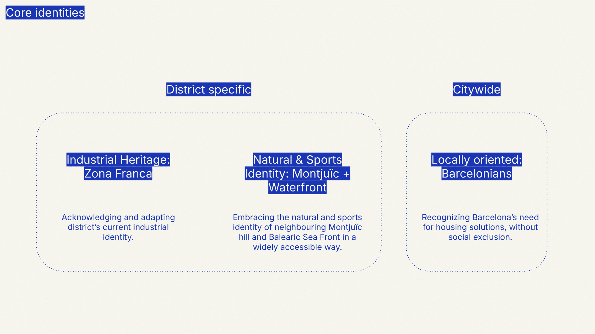
Currently, the land use mix is dominated by industrial zones, with warehouses, factories, and logistics infrastructure defining the area. However, there is an opportunity to bridge Montjuïc’s green and sports-oriented identity with the waterfront, creating stronger ecological and recreational links while maintaining the district’s economic relevance
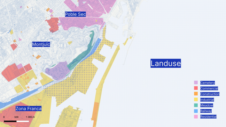
Despite its industrial character, the area has untapped potential. Sitting along the waterfront and in close proximity to Montjuïc’s green spaces and sports facilities, it holds an opportunity to become more than just a place for goods and transport—it could be a place for people. The challenge lies in finding a balance: preserving its economic role while introducing new ways for the district to connect with the city, nature, and daily life. The infrastructure is already here; the question is how to adapt it to create a more open, accessible, and livable space.
Connectivity & Accessibility Analysis
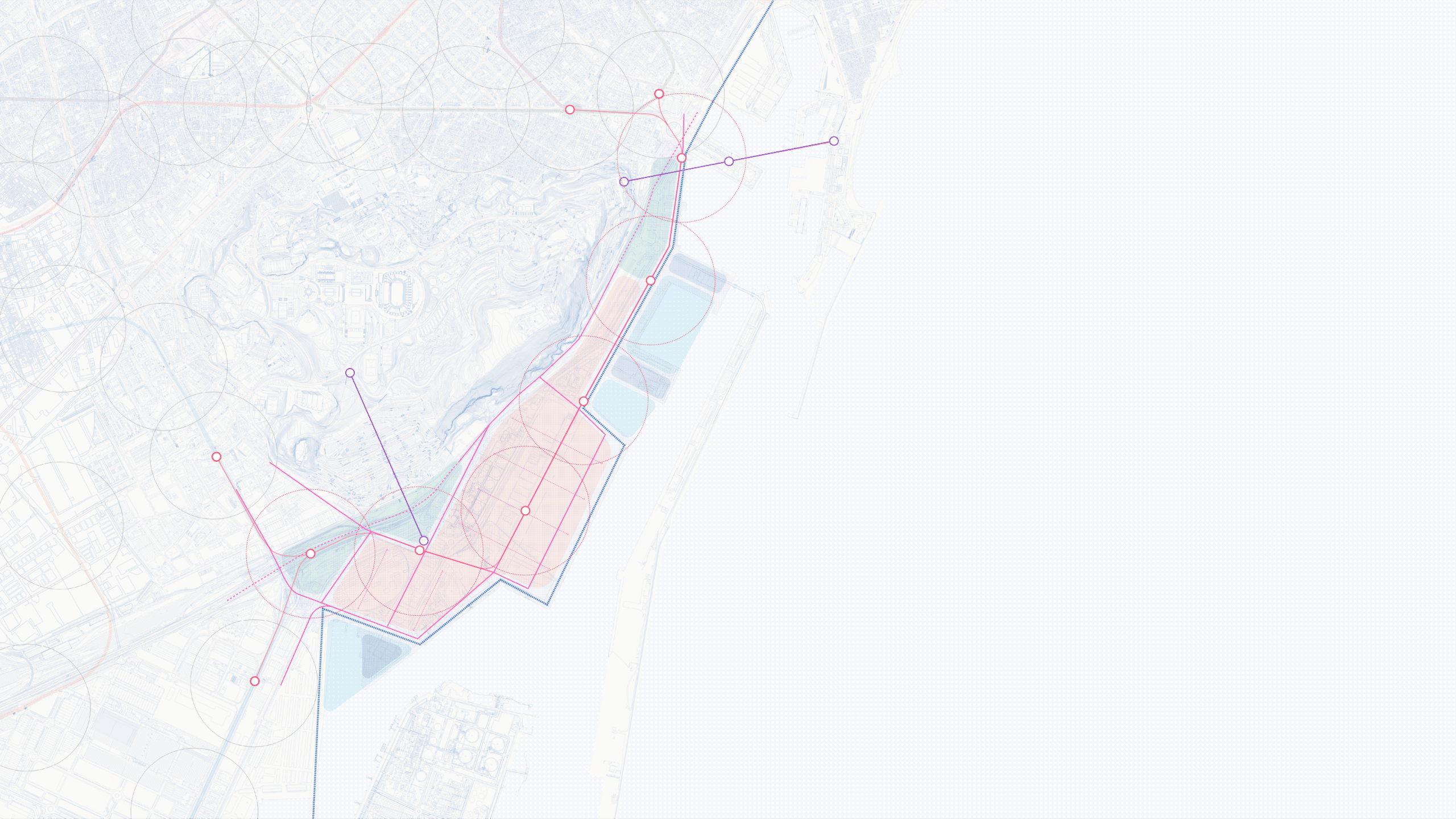
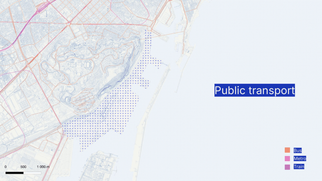
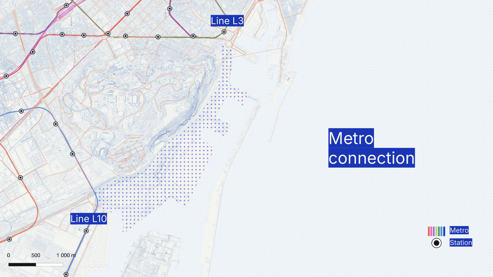
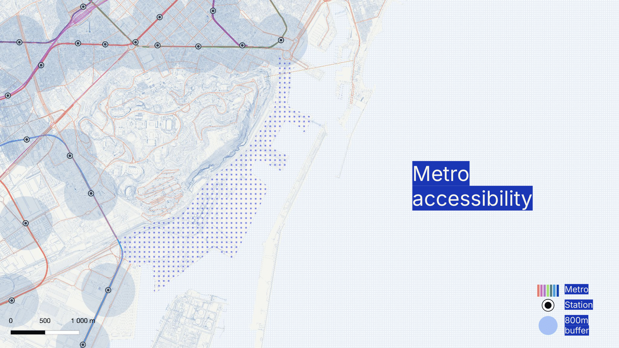
As part of the project, we conducted a connectivity analysis to assess how well the site is integrated into Barcelona’s transport network and to identify key mobility challenges. While two metro lines, L3 and L10, have stations near the area, their catchment areas do not extend into the district, meaning future residents and visitors would need to walk significant distances to access high-capacity transit. This lack of direct metro access limits the site’s integration with the broader city network.
Beyond the metro, the area has a cable car connection to Montjuïc, which offers a unique link to the hill’s recreational and sports facilities but serves more as a tourist attraction than a practical daily transport option. Additionally, only one bus line runs through the district, further emphasizing the limited public transport coverage and lack of multimodal mobility options.
The current transport infrastructure primarily supports industrial and logistical functions, rather than a walkable, transit-oriented urban environment. These findings highlight the urgent need for improved public transport connections, pedestrian-friendly infrastructure, and alternative mobility solutions. As the district transitions into a mixed-use neighborhood, expanding access to metro, bus, and active mobility networks will be crucial to its success as a well-connected, sustainable urban hub.
Proposal
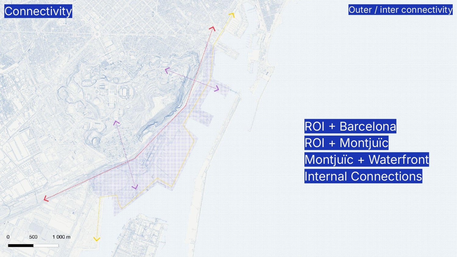
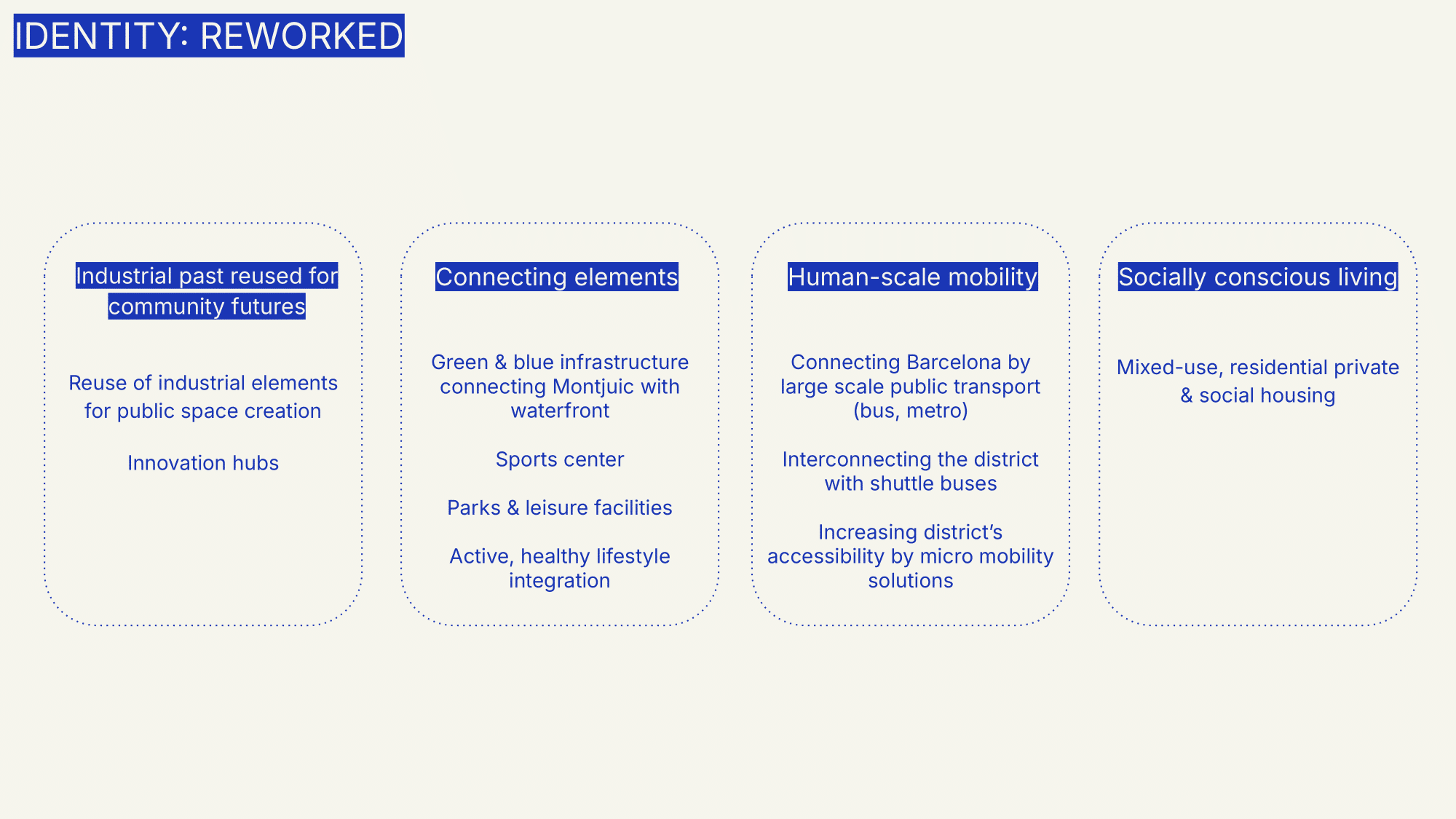
The proposal envisions a multi-layered intervention to enhance connectivity. It aims to link Ciutat Vella with Zona Franca and Hospitalet de Llobregat through two primary longitudinal connections: one along the coastline, aligned with the city’s coastal development plan, and another along the Montjuïc edge, reconfiguring the existing highway to create a less intrusive divide. Additionally, it seeks to bridge Montjuïc and the waterfront, integrating the water features with Montjuïc’s existing facilities to strengthen the relationship between these spaces. At a finer scale, the project focuses on integrating the new neighborhood through a network of localized, pedestrian-friendly connections.
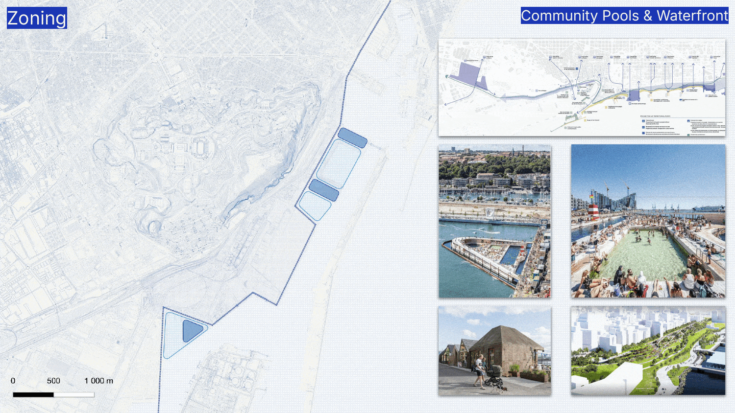
By creating sports zones with a strong aquatic character, as well as other sports facilities, the project seeks to establish a connection with Montjuïc’s existing identity. New attraction points of this nature will be strategically placed and linked through the redesigned coastal edge. While Barcelona’s coastline is lined with beaches that provide public access to the sea, this new area will offer a similar experience, not through traditional beaches, but through a network of public seawater pools, extending coastal accessibility to Hospitalet’s neighboughrs.
At both ends of the intervention, green spaces will be created to connect Montjuïc with the new neighborhood. The highway will be lowered to allow for a continuous green corridor between the hillside and the urban fabric, integrating these new parks seamlessly.
Finally, a mixed-use residential zone will be developed, featuring buildings of varying heights and densities to activate and populate the new district. Commercial areas will be concentrated along the main streets, creating dynamic corridors, while inner streets will foster a quieter, more residential atmosphere.
The highway is sunken to facilitate street-level connections to Montjuïc. Additionally, the highway would be reduced in lanes, allowing pedestrians to cross at certain points even where it is not sunken. This ensures that the remaining industrial areas of Zona Franca and Hospitalet remain accessible by foot. This would also connect people from Hospitalet to the coast line, which is not very accesible for them nowadays.
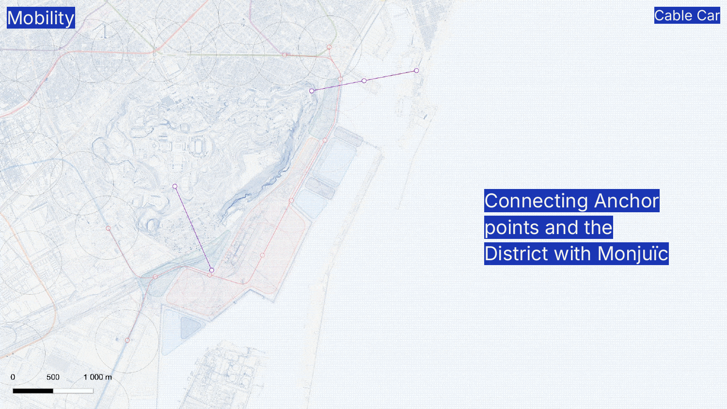
An additional cable car would be built to connect Montjuïc with Zona Franca. It would be located at a metro and bus stop to enhance intermodal mobility within the district.
The existing metro lines would be extended, with the new station centrally located in the district to serve a larger number of people. Additionally, two other roads along the same axis would be created—one above the metro and another closer to the coastline—to facilitate bus connections. Microbuses would operate along the tertiary streets leading toward the coastline.
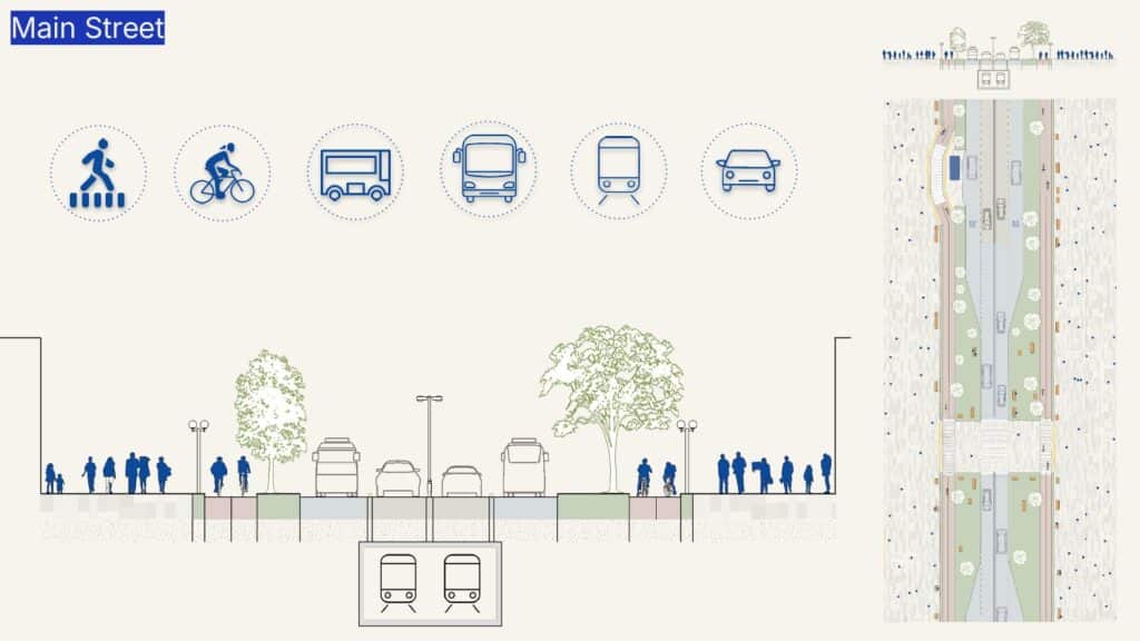
The Main Street would have only four lanes, two in each direction. It would feature a double bike lane on each side, allowing people to ride next to a friend, pass others easily when needed, or accommodate larger bikes and mobility alternatives that require more space. The materials and colors of the ground would be key in defining which space belongs to whom, as well as the use of bumps to slow down motor mobility The narrowing of the street should allow pedestrians to cross without needing to wait for a traffic light to turn red.
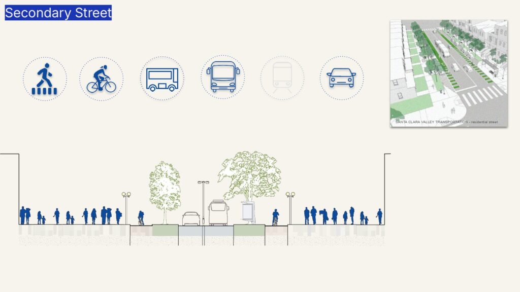
The Secondary Road would provide even more space for pedestrians. Street space would be reduced. It would have two lanes shared by cars and buses, while the double bike lanes would remain the same.

The Tertiary Streets would be mainly for pedestrians, bikes and some microbuses. The goal is to make the street feel more like a room, where cars must find their way through vegetation and other elements. When the vegetation makes the street particularly narrow, it would remain low enough for a truck to pass through easily in case of emergencies, while making it more difficult for a regular car.