
Introduction
This project is a short visual story, trying to portray the opportunities and problematics of poor landscapes.
It quickly touches upon a little fragment of precision farming- natural vegetation index (ndvi)- that focuses on plant
health estimation remotely, from satellite. Ndvi has become the most commonly used vegetation index in remote
sensing, especially with the recent advancements in earth observation and drone technologies, helping
to reduce the environmental impacts of agriculture and farming practices, thus contributing to the
sustainability of land.
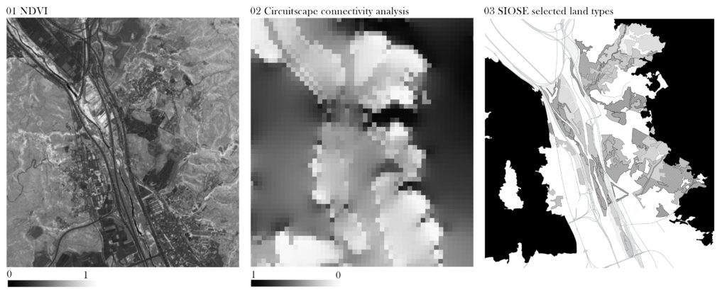
The project focuses on a peri-urban area of Barcelona that is in between two forest patches separated
with anthropogenic interventions. By using computational design, the visual presents a need to reconnect
this fragmented landscape.
Used data
Several steps have been made in order to create the illustration, which:
– Identifies key land types where vegetation cover could be improved (SIOSE land cover data);
– Diagnoses the health of plants (NDVI generated from Sentinel-2 satellite image, 2022 September);
– Extracts terrain of the area (using Google Earth Engine’s DEM layer);
– Finds the best natural connectivity area (Circuitscape analysis);
– In that area, it reveals places where the actions of vegetation improvement should be carried out first
(lowest ndvi values inside Circuitscape analysis corridor).
