
“Start the machine” …was the first operation in mind when asked to perform a task with Python script.

One of the motivations to learn Python as an urban designer is to organize geospatial data with accuracy and legibility. Before we dive into the digital wilderness, of data trees and data frames, it’s important to note the artistry, precision, and patience of traditional map-making. However, traditional cartography was, a craft that once relied on pen, ink, and parchment to tell stories of landscapes and journeys. Fast forward to the age of information, and the synergy of spatial layers in digital maps can now communicate depth that transforms maps into more than just visual representations.
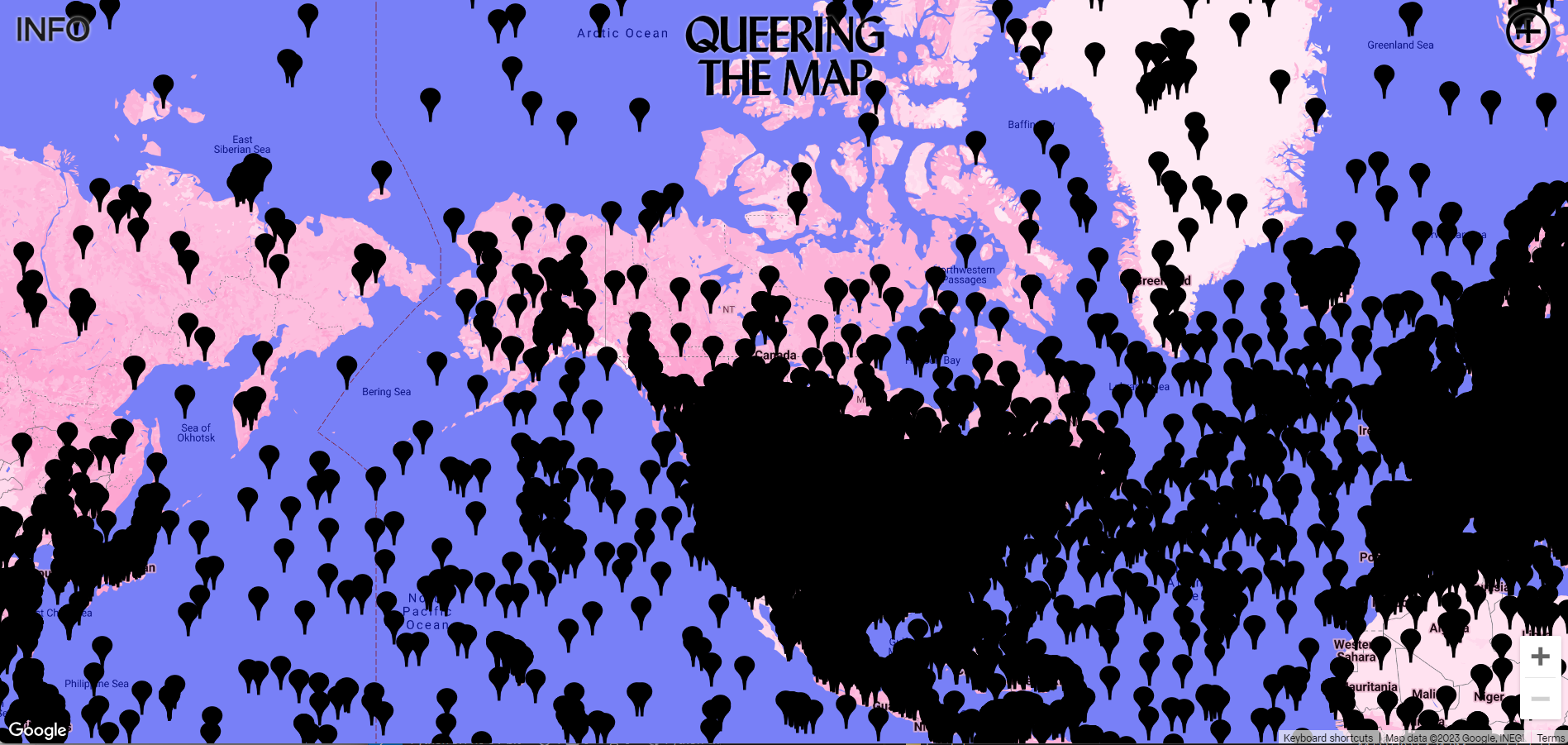
Digital cartography and geospatial data have the capacity for interactivity, expression of narratives, to be dynamic, on a microcosmic or planetary scale, and updated almost instantly. This also leaves room for map making to be an iterative, participatory process. One example to share is Queering the Map, a project founded by Lucas LaRochelle, who developed the map as a ‘community-based online collaborative and counter-mapping platform on which users submit their personal queer experiences to specific locations on a single collective map’. With the map as a digital platform for freedom of expression, there have been over 200,000 posts and translated in 23 languages.
Through digital mapping and a dash of creativity, cartography has the potentiality to become a place of collaboration. This project use of OpenStreetMap, a collaborative mapping project, harnesses crowd-sourced data. Python scripts can interact with OSM data, providing real-time information.
The evolution of data science and widespread digitization of the lived experience in our age requires that we use our generative tools with intentionality. When navigating the forest of data to create maps, the tools of Python and GeoPandas can be instrumental in communicating geospatial data. Some of the Key advancements in 21st Century cartography include:
- Spatial Data Handling: GeoPandas excels at managing and manipulating spatial data within the Python environment.
- Integration with Data Science: Python’s extensive ecosystem, including libraries like NumPy and Matplotlib, allows for sophisticated spatial analysis and visualization.
- Automation and Efficiency: Python scripts and GeoPandas enable the automation of complex spatial processes, improving efficiency in map production.

On the future of mapping, we can explore the compatibility with machine learning libraries like Scikit-Learn enables the development of predictive mapping models, anticipating changes in landscapes and planning toward more responsive cities. Map making has evolved from hand-drawn representations to the dynamic and predictive maps we have today. The integration of GeoPandas with Python tools represents a pinnacle in this evolution, empowering mapmakers and data scientists to create intricate, automated, and highly interactive spatial narratives that were once beyond imagination. These imaginaries may then take form as urban settings that engage and empower citizens, foster connectivity, and evolve to the needs of residents.
