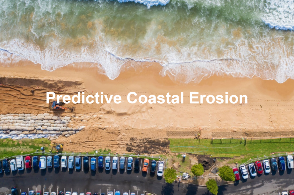
Why?
Coastal erosion is a dynamic and complex process influenced by both natural factors and human activities. Natural causes such as wave action, tidal patterns, weather events, and rising sea levels due to global warming significantly contribute to the gradual wearing away of coastlines. Additionally, human interventions like coastal construction, sand mining, and deforestation exacerbate the erosion process, leading to accelerated rates of shoreline retreat.
The implications of coastal erosion are far-reaching, impacting environmental integrity, economic stability, and human safety. Environmental concerns arise from the loss of natural habitats and biodiversity, while economically, the degradation of coastlines affects infrastructure, real estate, and tourism. Safety is also a critical issue, as sudden erosion events can lead to the destruction of property and even loss of life. In the face of climate change, understanding and mitigating coastal erosion is essential for developing effective coastal management strategies.
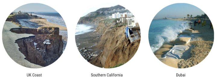
Precedents
Where?
Erosion of Permafrost coastal edges in Yukon releases massive amount of embedded carbon dioxide, leading to a warmer planet! This makes it an ideal place to study the relation between permafrost erosion and carbon dioxide production.
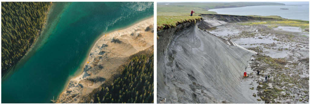
Permafrost holds huge stores of carbon — it’s made up of layers of compounded plant and animal matter that’s been encased in the ice-sediment mix for thousands of years.
In a frozen state, this carbon-rich matter doesn’t decay to create carbon dioxide. but as permafrost meets warmer temperatures and crashing waves, a thaw follows, allowing carbon dioxide to be produced!
Data
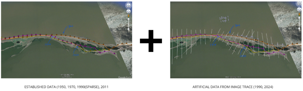
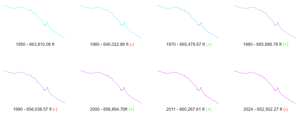
The data sets we used for this project consisted of two different parts that we used together in our notebooks. First, we collected established GIS data of different years to establish baseline knowledge of a section within the Yukon shoreline.
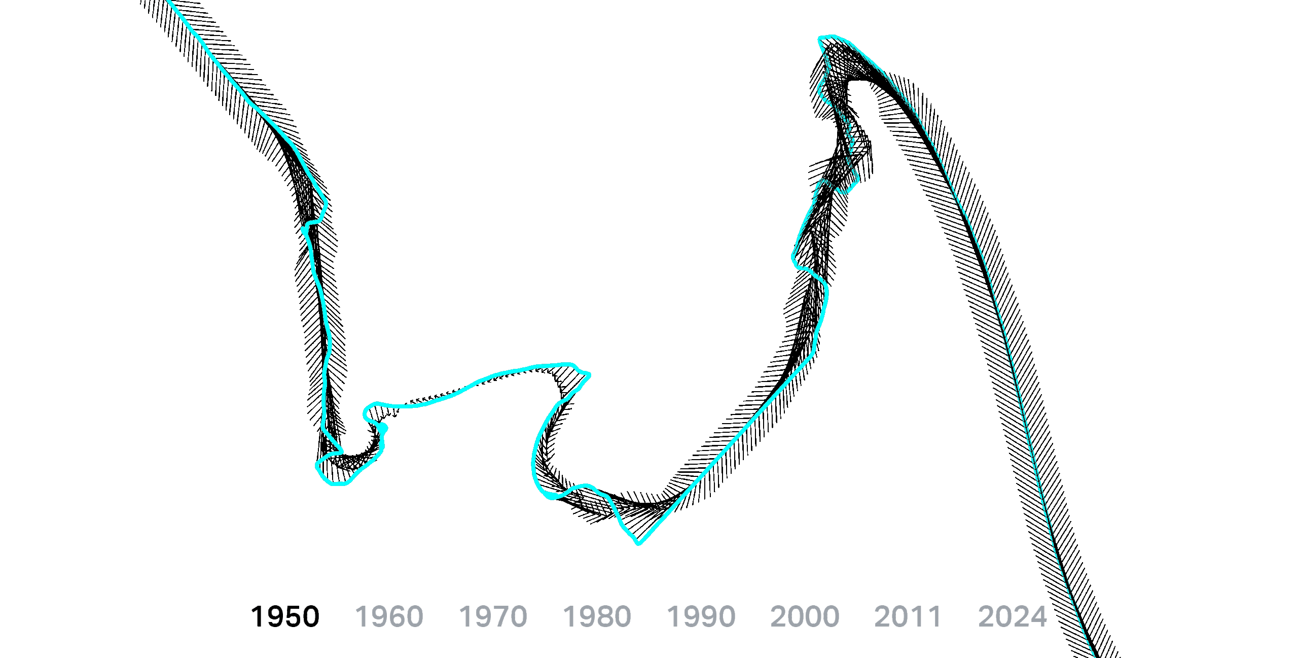
This data consisted of Latitude and Longitude information for the years 1950, 1970, 1990, and 2011. Because this information had some sparse data within the 1990 section, as well as being 20 years apart, we used grasshopper to plot these curves, and then used a custom written definition with the Heron Plug-in to interpret the “tween” curves to establish data for every 10 years, as well as fill in the missing 1990 information.
Process
With a complete data set of shoreline latitudes and longitudes, we were able to then begin calculating important shoreline features to be used in training our model.
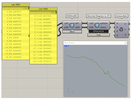
First, we are able to translate Decimal Degree coordinates into XY values to visualize the curves. This is to ensure they are not only correctly plotted, but we are using information from the same location in the Yukon.
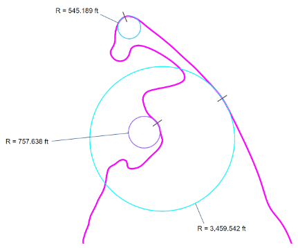
Once we have all of the curves plotted within grasshopper, we can Calculate 3 important features to be used along with exported coordinates:
The vector distance is calculated between each year to the next along with the transect difference between the years, and finally, the curvature @ each transect point on the shorelines
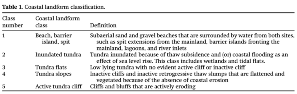
After generating data via Grasshopper, the last feature added is classification for types of coastlines. With this information creating a complete data set, we are able to move onto training our model.
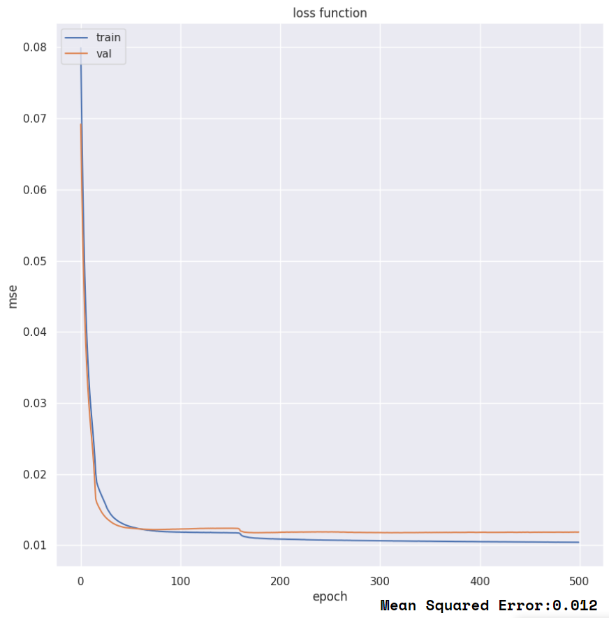
Model Training
Next Steps
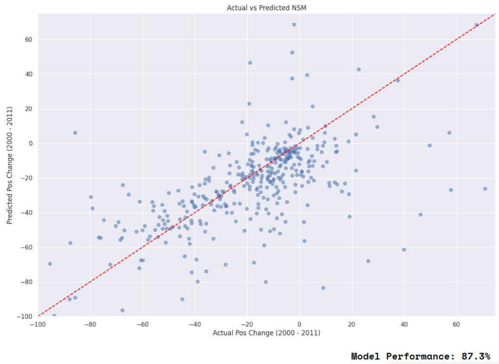
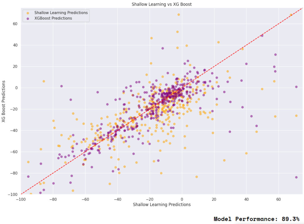
Reflecting on the entire process, we achieved success in using machine learning to predict coastline erosion based on consistent historical data. However, we observed a reduction in model performance when incorporating the 2024 data. This drop in performance is likely due to changes in the data gathering process between the earlier dataset and the 2024 data.
For next steps, we are interested in analyzing the extent of coastline erosion impact on the urban environment. Additionally, we aim to use these models to predict erosion patterns further into the future, potentially improving our understanding and mitigation strategies for urban planning and environmental conservation.