Ark{Check} – A Machine Learning Approach to Architectural Documentation Review
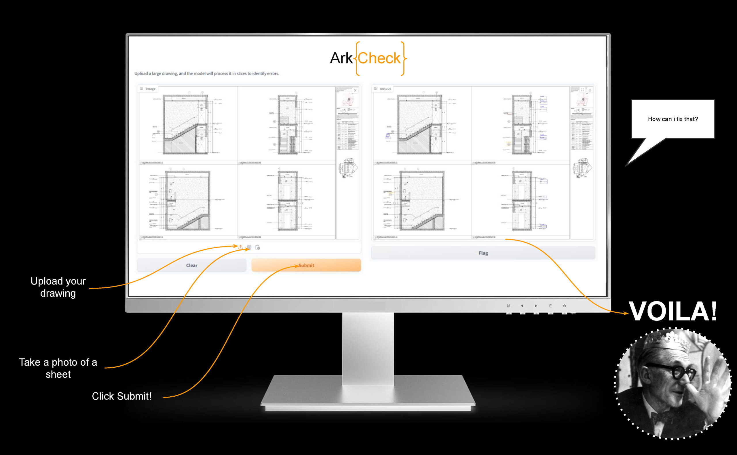
Abstract Architectural drawings and construction documentation are critical in the construction industry, serving as the main means of communication between different disciplines and acts as a blueprint on guiding the construction of the built environment. However, errors in these drawings are quite common and often leads to significant delays, cost overruns, and structural issues. This … Read more