The MaCAD is a unique online programme training a new generation of architects, engineers and designers ready to develop skills into the latest softwares, computational tools, BIM technologies and AI towards innovation for the Architecture, Engineering and Construction (AEC) industry.

Filters

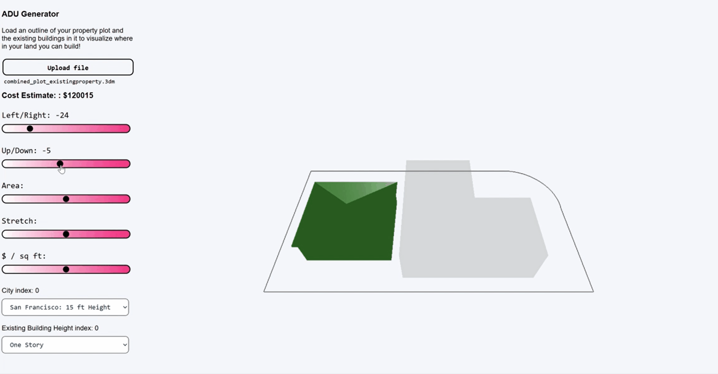
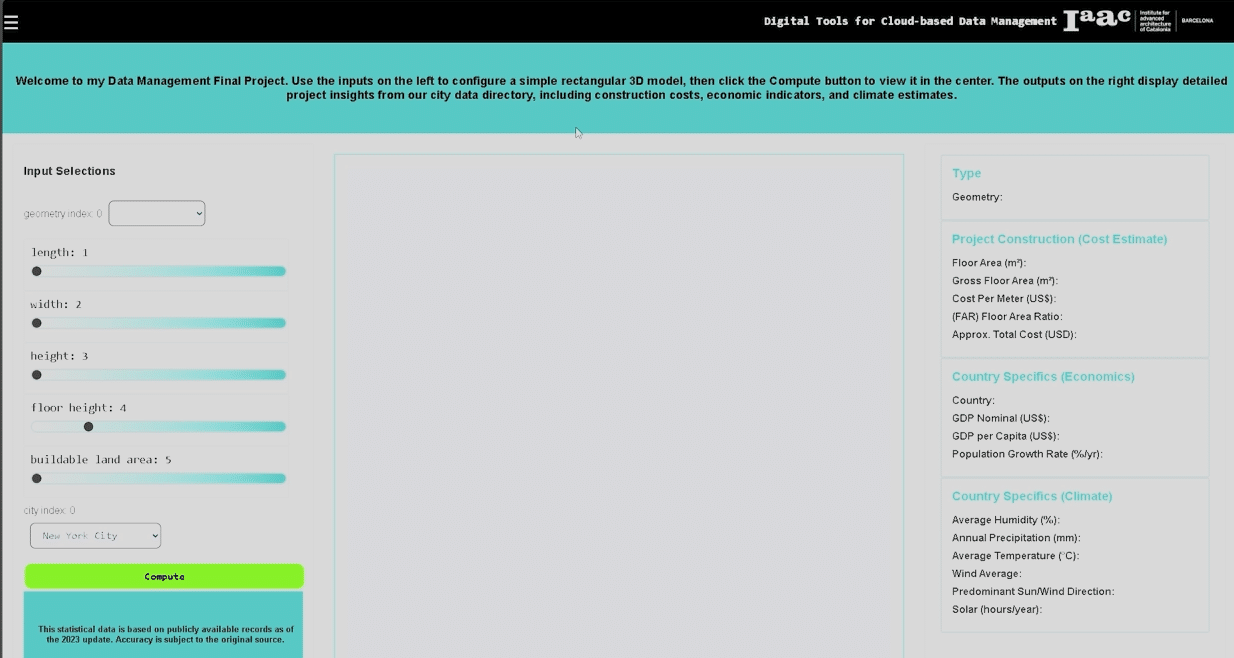
BIMSC Studio: Hyperbuilding-B Data Team

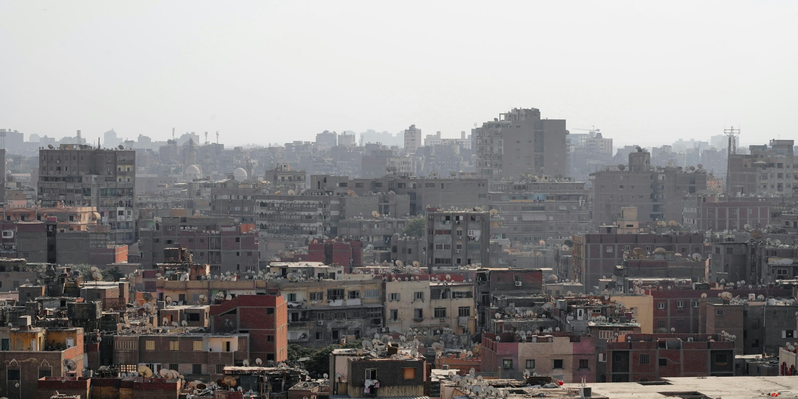
A Brief Introduction The site for Hyperbuilding-B is immediately adjacent to that of Hyperbuilding-A, which is nestled in the Minato Ward of the Tokyo Metropolitan Area. Minato is one of Tokyo’s 23 special wards and is known for being a major business, diplomatic and residential hub. It is heavily urbanised, with approximately 14,000 people per … Read more

Harnessing Data-Driven Design: A Collaborative Look at Hyper B’s Industrial Team Vision for Urban Farming

Industrial team dedicated to rethinking how we approach urban farming, renewable energy, and multifunctional infrastructure, is leading the charge. Their integrated workflow uses parametric modeling, automated data exchange, and business intelligence (Power BI dashboard) to optimize space usage and resource allocation in urban environments. In this post, we dive into a series of visuals that … Read more

ADU Generator

Intuitive app that let’s you visualize in real time the location, size, and cost estimate of an ADU in your plot. General Description: ADU stands for Accessory Dwelling Unit. ADUs are becoming very popular in the United States, as a way for homeowners to build an additional(s) living unit in plots zoned for single-family use. … Read more

City Brief App

CBDM 25 A configurable application that generates simple rectangular architectural mass while simultaneously providing regional economic and climate insights for a chosen country/city from the top 50 cities around the world. The tool allows users to adjust base dimensions, total building height, and per-floor height, then quickly see how costs, climate data, and massing possibilities … Read more

Alfafa Colony: BIM & Smart Construction

Project Concept Establishing a Martian food colony around a Mohole, designed based on growth morphology of alfalfa for efficient organization and development using L-systems. These terminologies are further explained below. Moholes Moholes on Mars are massive cylindrical excavations in the regolith, reaching up to 1 km in diameter and 7 km in depth. With temperatures … Read more

Integrative Ant Hill Colony

Our group project is Ant Hill Colony on Mars, which has both above/below ground elements and underground heart, tunnels and pods. The project concept derived from “learning from ant colony,” therefore, the geometry shapes were more organic and natural. Originally, we recreated this by starting with LiDAR technology to identify the soil characteristics, then applying … Read more

Aquamines

Inhabiting Ice Cavities under the Martian Surface Introduction – The Idea For the first settlers on Mars, we have envisioned a colony of Aqua-Miners with the primary task of harvesting water as a resource from the ice beneath Mars’ surface, storing it and recycling it for sustainable use. Our approach to this problem has been … Read more

Well-Nest

Sculpting on Mars Martian Environment – Human Habitat – Water Production “Well-Nest” is a Mars colony primarily dedicated to water mining and accommodation.We advocate for the development of a comprehensive system aimed at extracting, storing, and circulating water throughout the colony. Low Terrain Slope; Min Risk of Excavation Challenge; Expose to Solar radiation – Gaining … Read more

Genius Loci

View some of the collected data here: Street Types and Property Information Genius Loci was inspired by the work the of Sarah Williams in her book ‘Data action – Using data for public good’. In today’s data-driven world, the use of data has become increasingly pervasive, shaping various aspects of our lives from policymaking to … Read more

UrbanCanvas

UrbanCanvas is an innovative web application designed to provide comprehensive and detailed data for urban areas, empowering users with precise information about plot boundaries, buildings, 3D structures, roads, land usage, and empty plots within a city. This platform seamlessly integrates advanced mapping technologies, data visualization, and analytics tools to facilitate urban planning, real estate development, … Read more

Automated Construction Through the Integration of BIM and Digital Twins

Digital twins or “digital replica” refer to a highly detailed virtual model of a physical building or infrastructure project, and through real-time monitoring the delivery of continuously updated data about systems and construction processes can be recorded within BIM. In a “House of Digital Twin”, the foundation of the house is Building Information Modeling (BIM), … Read more

Urban Impact Analyzer

In the dynamic landscape of urbanization, migration towards cities is an undeniable trend. With this migration comes a myriad of challenges, notably the exponential rise in land costs and the often haphazard nature of urban development. As cities expand, there’s a pressing need for thoughtful and strategic construction that not only addresses the demands of … Read more

EVALUATE

Evaluate is an App that helps Investors and Planers to position their building on an uploaded Terrain, and visualize its Setbacks and Feasibility in terms of cost and total floor area. By automating this simple process, one can evaluate any building Plot simply by having its terrain, instantly and without bothering with checking specific Area … Read more

BIM and the Sustainable development of affordable communities for informal settlements in Egypt

Abstract Informal settlements across all of Egypt are characterized by complex socio-economic situations aggravated by the immense size of the population and its rapid growth. As a result of lack of building regulations, extreme poverty and continuous need for expansion, the rise of uncontrolled informal settlements remains a significant challenge for Egypt. Our research explores … Read more

fumbrella

Harvesting water and sunlight Imagine if we could solve both a water and energy crisis using urban installations. Take a funnel to collect water and merge this with an umbrella. What do you get? A fumbrella of course! In this module we created a custom web app using JavaScript and Vue components. This web application … Read more

Mars Medical Center

Introduction For the BIMSC studio project, the class designed a human colony initially capable of accommodating 50 inhabitants, with the potential to expand to 300 inhabitants. Working together, the class settled on the Jezero Crater as the site for the colony and developed a masterplan consisting of thirteen distinct zones. Each group selected one zone … Read more