Urban Grid Transition: Mobility Strategies for Tourists and Locals’ Coexistence
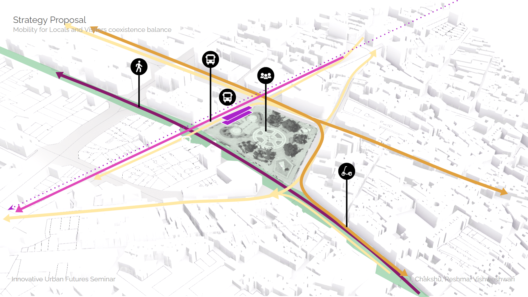
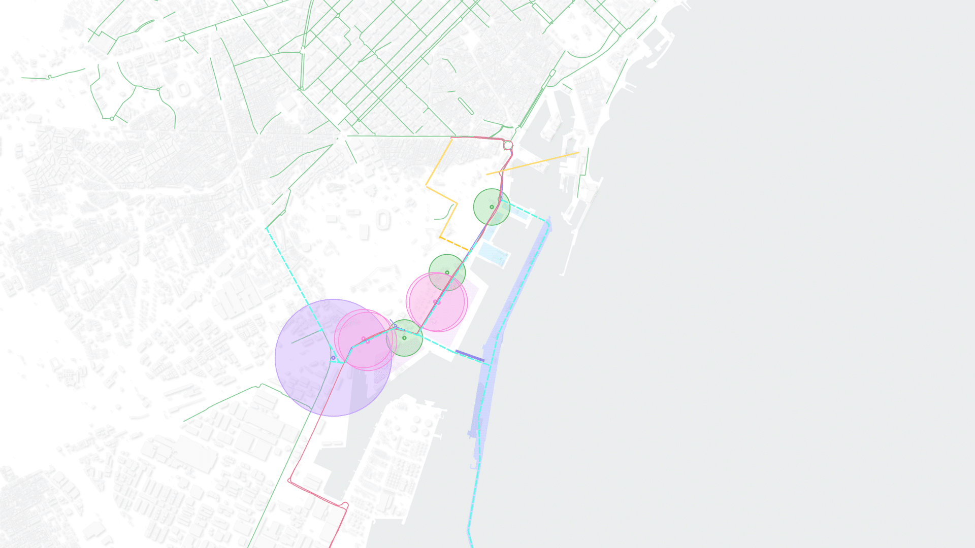
Mobility when Tourism outgrows the City Barcelona is the 10th most visited city in the world. In 2024, it received approximately 15.6 million tourists – nearly nine times its resident population of 1.7 million. The issue is not tourism itself. Barcelona’s economy depends on it, and the city’s cultural richness is inseparable from its global … Read more