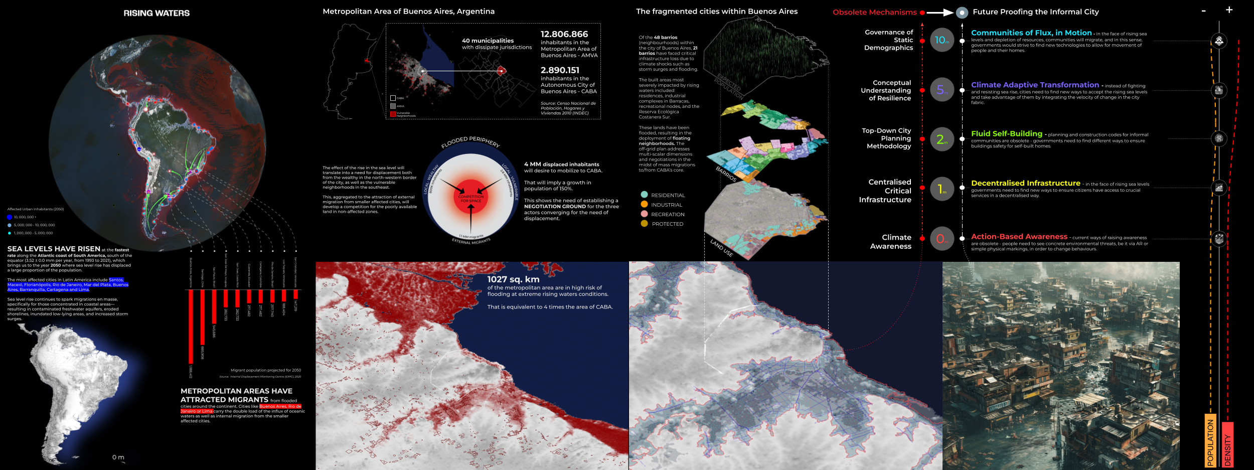
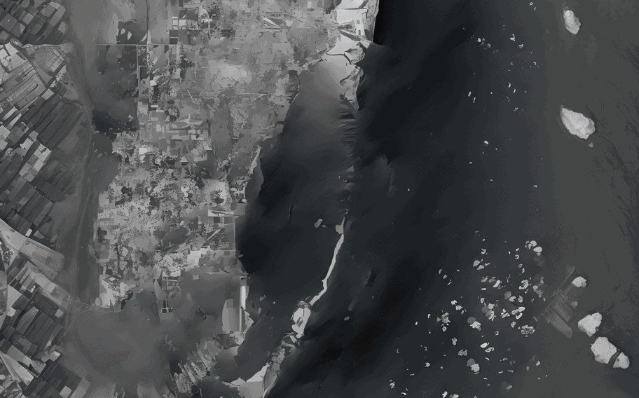
The Master in City & Technology’s academic structure is based on IAAC’s innovative, learn-by-doing and design-through-research methodology which focuses on the development of interdisciplinary skills. During the Master in City & Technology students will have the opportunity to be part of a highly international group, including faculty members, researchers, and lecturers, in which they are encouraged to develop collective decision-making processes and materialize their project ideas.

Travelling Paris

Paris, often hailed as the world’s most popular tourist destination, beckons millions of visitors each year with its unparalleled blend of history, culture, gastronomy, and romance. At its heart stands the iconic Eiffel Tower, symbolizing the city’s architectural finesse and innovative spirit. The Louvre Museum, home to countless masterpieces, invites art aficionados to meander through … Read more

Mapping Airbnb data in San Francisco

Since its launch in 2007, Airbnb has revolutionized the hosting industry: By providing a simple and intuitive online platform, it connects millions of hosts and visitors worldwide. Born in The Bay, the app has changed the dynamics of the whole area, impacting sectors that extend from tourism to the housing market. Through the analysis of … Read more

Understanding the City through Data, Maps & Code

Finding the ratio of natural Green spaces to the Educational institutions in Barcelona city, Spain. TOOLS USED INTRODUCTION Barcelona, like many modern cities, has been actively working on providing open datasets to the public. Open datasets are valuable resources that foster transparency, innovation, and engagement within communities. Barcelona’s open datasets cover a wide range of topics, including urban … Read more

Worldwide cityscapes spatial analysis using OpenStreetMap Data

Introduction OpenStreetMap (OSM) stands as a testament to the power of collaborative mapping, where a community of volunteers comes together to create a detailed and constantly updated geographic database. This free and open resource is not just a map; it’s a versatile tool used for everything from navigation and humanitarian aid to data visualization. OpenStreetMap … Read more

Roving the Red Planet

Roving the Red Planet - Animated Infographic

A rich and ongoing history… Mars exploration missions started in the second half of the 20th century, with the first successful one being NASA’s flyby mission Mariner-Mars in 1964. Since then there has been a steady influx of many other missions throughout the years, from NASA as well as from other space agencies from around … Read more

Promised Land

Mesh representation of MIDI

Mapping America’s Genrescape Promised Land, Chuck Berry’s early representation of modern rock and roll, blurs racialized difference in genre origin, fueling the hybridization of genre categorizes, resulting in America’s current rich music tapestry. MIDI data correlated to synaesthetic representations of color is crystalized and in a dense three-dimensional mesh and place qualities are correlated to … Read more

Counting and displaying geographical information

Introduction Grasshopper, renowned for its prowess in visualization, presents a unique landscape of opportunities for those eager to dive deep into the realm of geographical information. This blog post presents the start of my journey with Grasshopper, highlighting its potential as well as the challenges and learning curves it presents. Objective: Gaining Confidence with Grasshopper … Read more

Visualization of Complex Innovation Data using Python

Innovation is a buzzword these days, and everyone seems to be talking about it. However, truly understanding it is a different ball game. Take the Global Innovation Index by the World Intellectual Property Organization (WIPO), for example. It’s a massive framework that pulls data from top-tier organizations worldwide, scoring countries on 100+ indicators. It’s a … Read more

Cities in Motion

Bogota Public Transport from GTFS

The General Transit Feed Specification (GTFS) is a standardized format designed for the distribution of public transport information globally. This format facilitates the integration of public transportation systems in cities worldwide with popular route planning platforms like Citymapper, Waze, or Moovit. By doing so, it enables users to access information on transport availability and plan … Read more

Can inequality of opportunity be mapped?

An exercise in visually corelating data. Introduction The Swedish educational system is based on merit. Students have to compete for places by means of their average grades. The competition is fierce, especially in large cities such as Stockholm. This project forms an attempt to showcase a possible correlation between the median acceptance grades of schools … Read more

Potential Building Stock in need of Renovation or Demolition

The BCN Building Stock project aims to assess the condition of the building stock in Barcelona (BCN) and identify potential buildings that require renovation or demolition. This analysis is crucial for urban planning and sustainable development initiatives, as it provides insights into the state of the city’s building stock. By leveraging data analysis techniques and … Read more

SKYWARD CONNECTIONS

A Data-driven Approach of redefining the Accessibility of the Dispersed Urbanity of the Aegean Archipelago Accessibility is a multifaceted concept that expresses the case of access between two points in space. In the context of islands, accessibility is of utmost importance due to their inherent characteristics of isolation and small size. The Aegean Archipelago in … Read more

Construction & Demolition Waste Transportation Improvements, Barcelona

22@, an ongoing project in Poblenou, Barcelona aims to promote sustainable development and enhance the quality of life for its residents. However, one of the current challenges faced by the project is the significant noise and air pollution caused by the transportation of construction and demolition waste (CDW) from construction sites to landfills, which adversely … Read more

GENDERED GEOGRAPHIES

Navigating Urban Realities through Women’s Perception of Safety Cities all over the world are being quantified and rated in terms of their livability and life quality for better understanding of citizen satisfaction.  Safety, including both the tangible aspects and the subjective perception of safety, is a critical component in assessing urban life quality. According to … Read more

The 3-30-300 Rule

TRANSFORMING CITIES INTO URBAN FORESTS This principle, proposed by Cecil Konijnendijk, highlights the significant role played by urban forests and other forms of urban nature in promoting our health, well-being, and resilience to climate change. It acknowledges the need to consider various aspects of urban forests to achieve success. It also emphasizes the importance of … Read more