The intensification of human activities has transformed river basins, characterized by the loss of natural floodplains, an increase in impermeable surfaces, and the escalation of surface runoff. This thesis explores the importance of tailoring flood prevention strategies to upstream conditions to aid in flood risk management for downstream urban areas. Specifically, it presents an incentive-based, win-win strategy of diverting excess water upstream for agricultural purposes, thereby reducing runoff and mitigating flood risks downstream. A platform is designed to facilitate this approach, integrating crowdsourcing and an interactive space that allows stakeholders to collaboratively develop effective solutions. This framework highlights the potential for transboundary collaboration in enhancing flood resilience in urban environments.
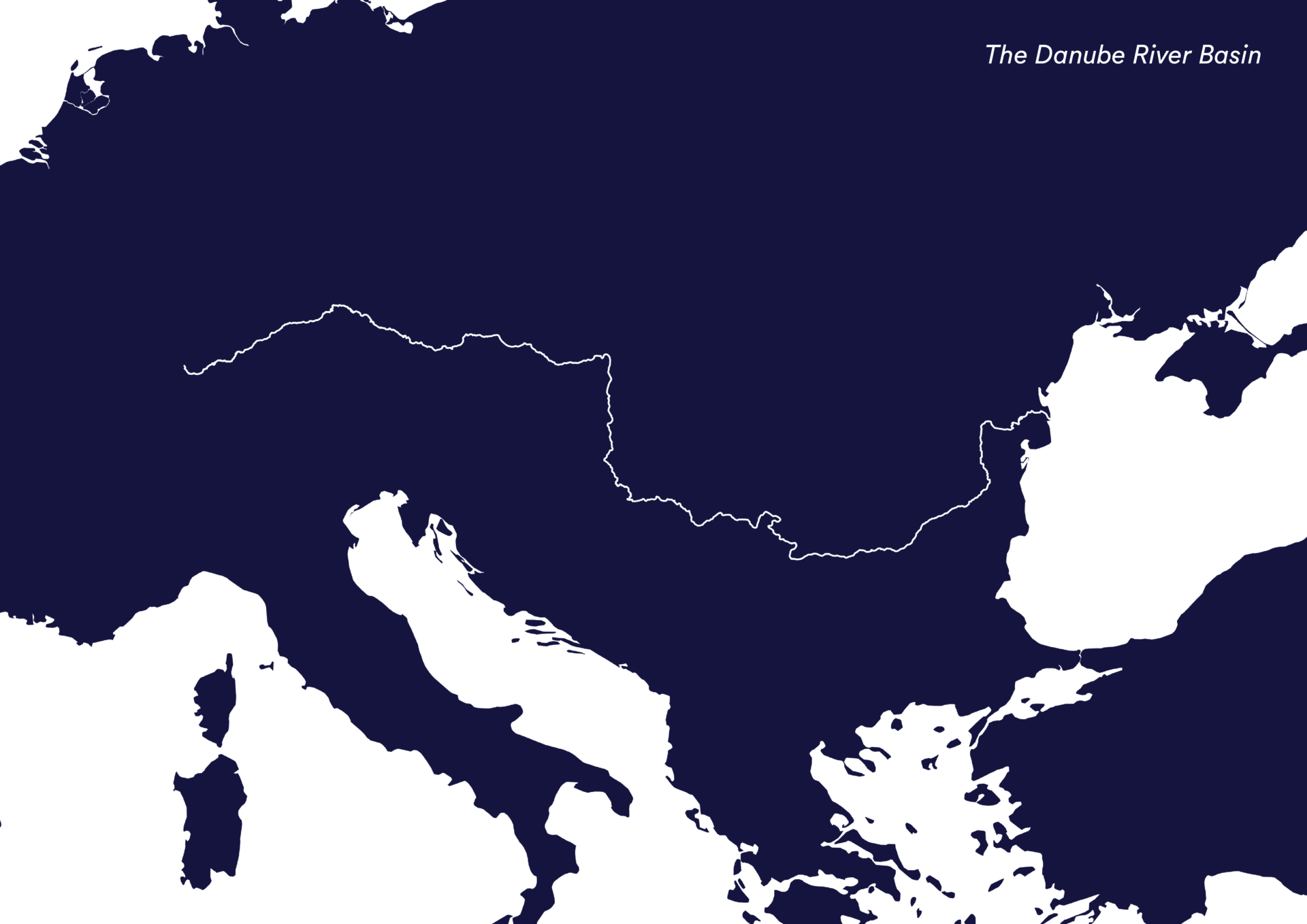
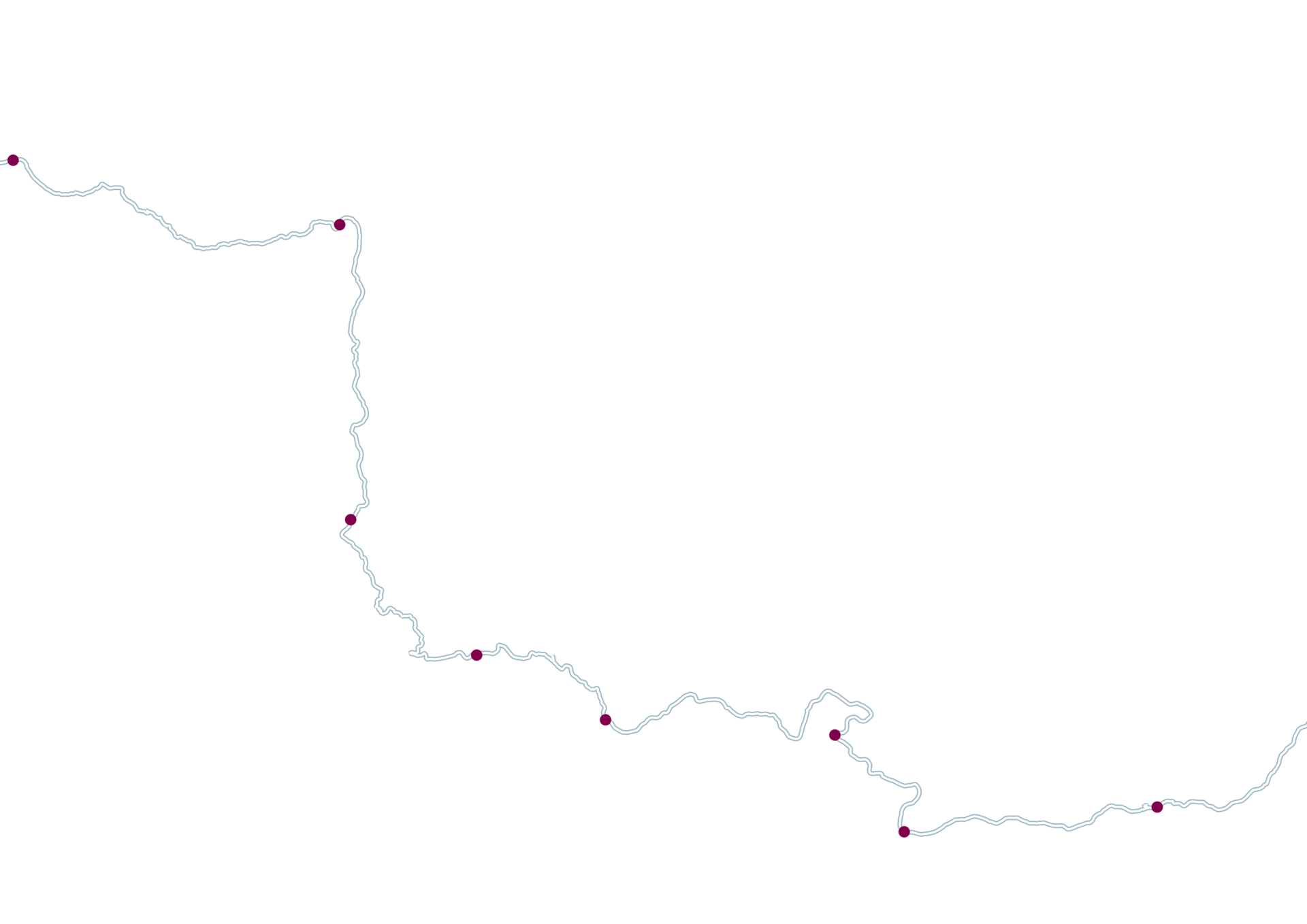
The Danube river is approximately 2,850 kilometres long and passes through 10 countries – starting from Germany and eventually flowing into the Black Sea.
It is one of the most significant river systems in Europe, and is crucial for the region’s ecological and economic well-being. However, it faces frequent flooding challenges due to its extensive network of tributaries and the diverse climatic conditions across its catchment area.
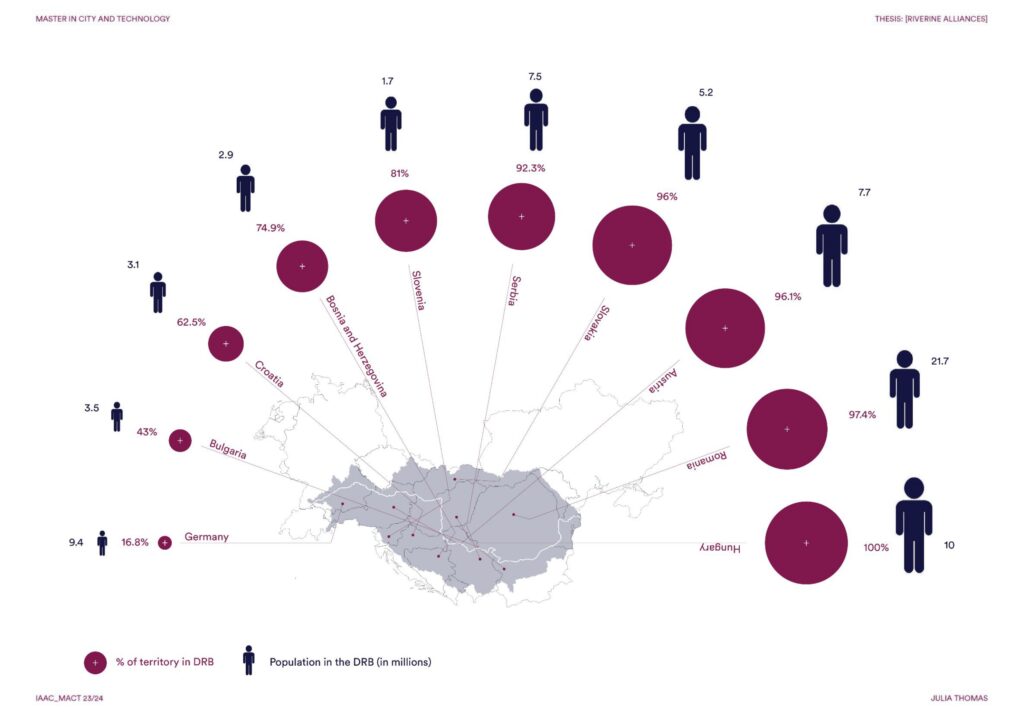
This diagram illustrates the percentage of territory of each country within the Danube River Basin, alongside the population residing in these areas. It highlights the transnational nature of the basin, emphasizing the need for coordinated flood management efforts.
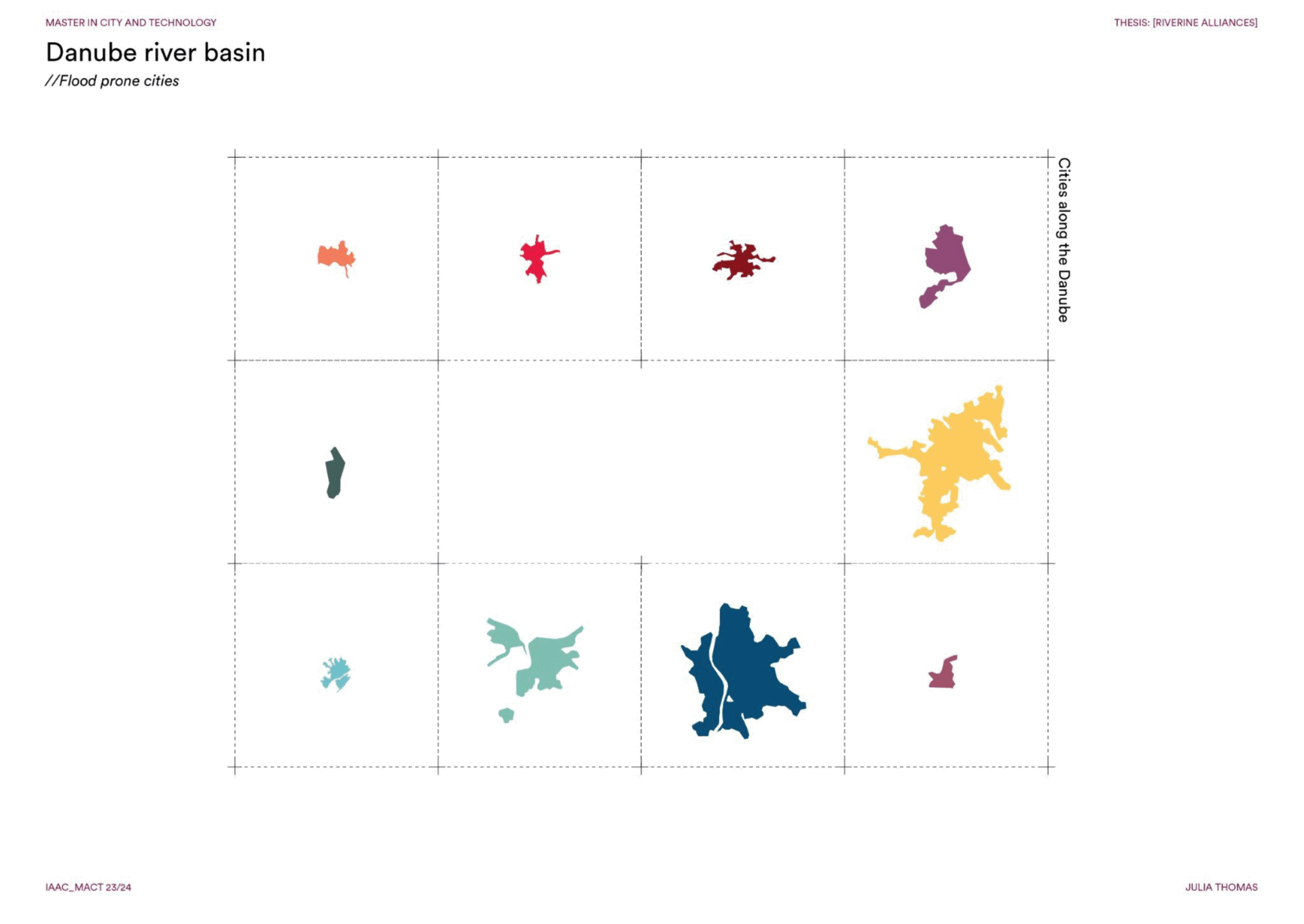
The widespread impact of flooding across different urban areas along the river, demonstrates the recurring and severe nature of the problem. From Ulm in Germany to Braila in Romania, these cities have faced extensive damage, affecting infrastructure, local economies, and communities.
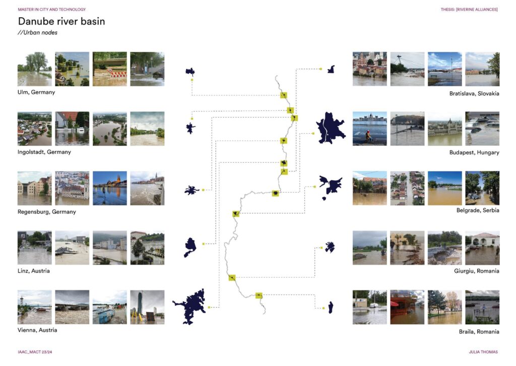
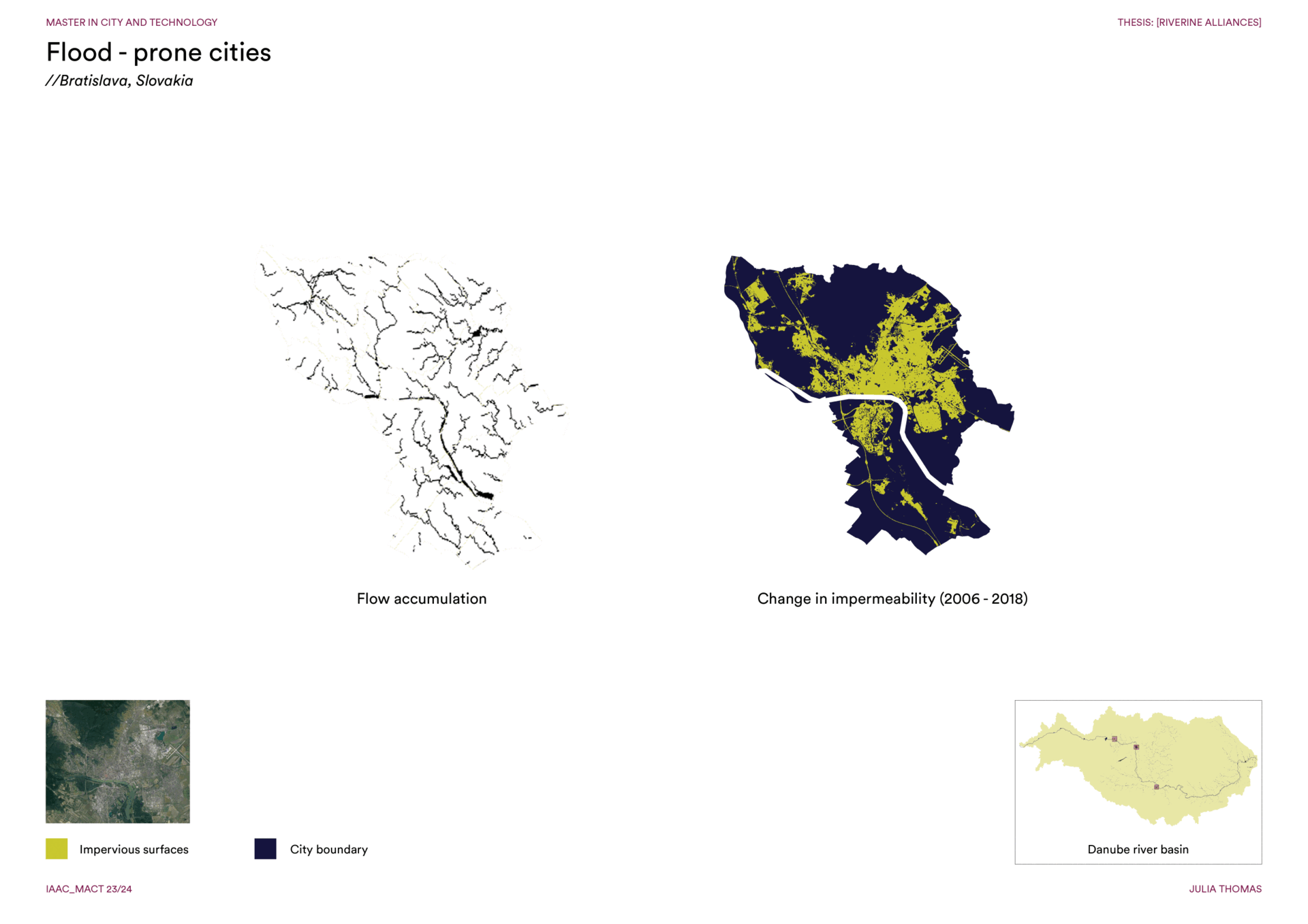
The three example cities situated in these high-risk areas – Bratislava, Slovakia, Budapest, Hungary and Belgrade, Serbia, which are prone to significant water accumulation during flood events, emphasize the correlation between low elevation and increased flood risk within the basin.
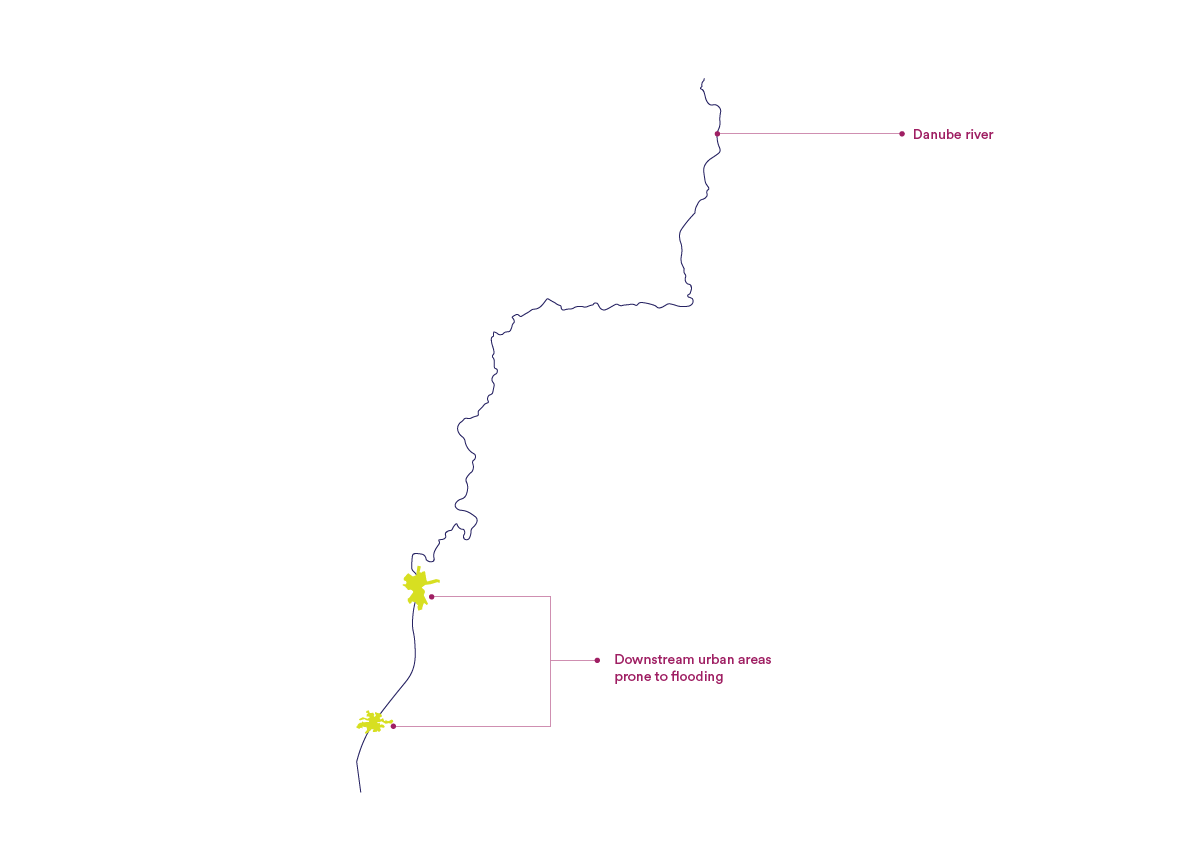
While city-specific flood adaptation measures are crucial, it’s imperative to also consider the entire river basin. By zooming out and looking at the basin as a whole, we can understand the interconnectedness of these cities and the cumulative impact of their flood management efforts. This broader perspective ensures that flood adaptation strategies are not only effective at the local level but also harmonized across the entire basin, preventing adverse effects in one area from impacting another. This holistic approach is essential for a comprehensive flood risk management. While looking through a wider lens, we can see that a transboundary collaboration along the river basin is crucial in flood risk management. This approach emphasizes the importance of managing surface runoff at its source. By intervening in upstream areas, we can significantly reduce the volume and speed of water flow during heavy rainfall events, thereby decreasing the risk of floods downstream. Given the river’s extensive reach across multiple national borders, it is crucial for these nations to work together.
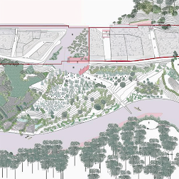
This project emphasizes a strategy to divert excess water from the river upstream during increase in water levels. It focuses on managing water flow at the source, particularly during periods of heavy rainfall or snowmelt, to prevent overwhelming the river system further downstream.
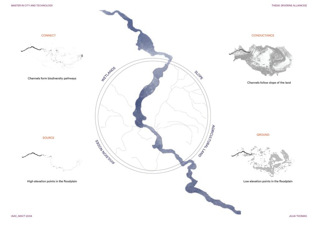
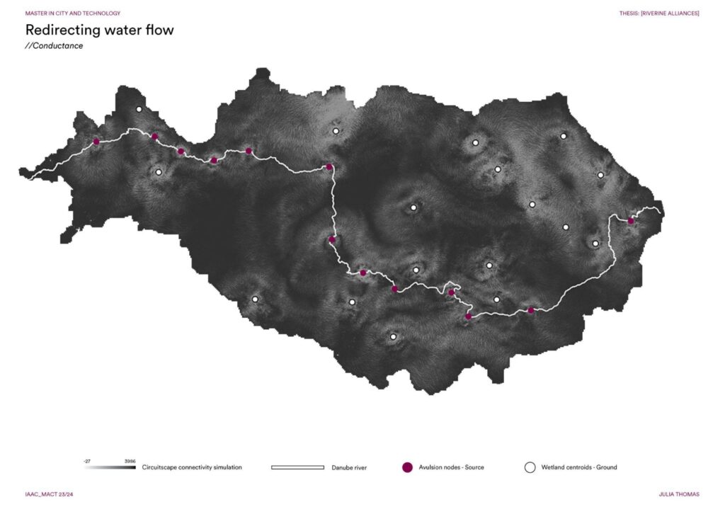
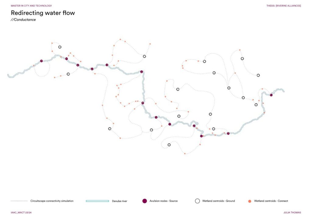
In order to create a strategy to redirect the increasing water levels, a methodology was developed which considers the four factors – the source, connect, network/conductance and the ground which is the end point. The idea is to create a win-win situation where the water is redirected towards agricultural land as irrigation channels which in turn prevents surface run-off to downstream urban areas. The source/ the avulsion nodes were selected based on the highest points along the river floodplain, and the ground was selected based on the lowest elevation points . The connecting points are the wetlands which as an added advantage will create biodiversity pathways and the conductance/ the network is based on the natural slope of the terrain.
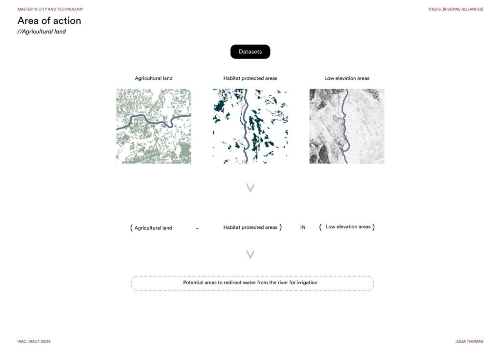
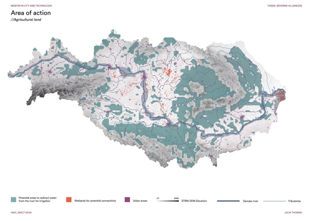
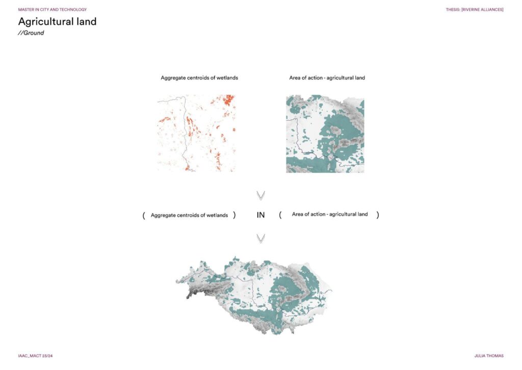
The area of action was narrowed down by considering the agricultural land that lies within the low elevation areas within the river basin but also removing the habitat protected areas.
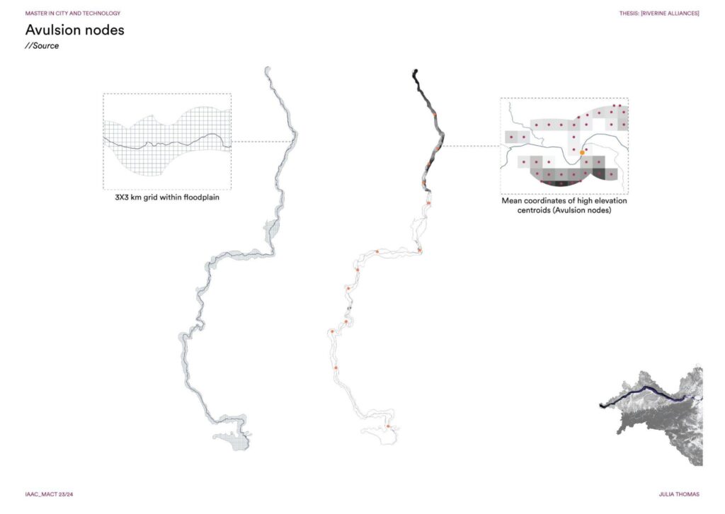
The source/avulsion nodes were identified by considering the high elevation points that lie within the floodplain of the river. A 3x3km grid was used to transfer the STRM DEM values onto after which the centroids of the grid were considered to locate the mean coordinates of those points. These points were snapped to the river segment, deriving avulsion nodes. The methodology utilizes gravity as a means of water redirection, ergo high elevation points along the river.
The wetlands/connecting points were derived by considering those that lie in low elevation areas and outside high concentration of urban areas. The density of these wetlands were then visualized in order to locate aggregate centroids of wetlands that emerged as connecting points.
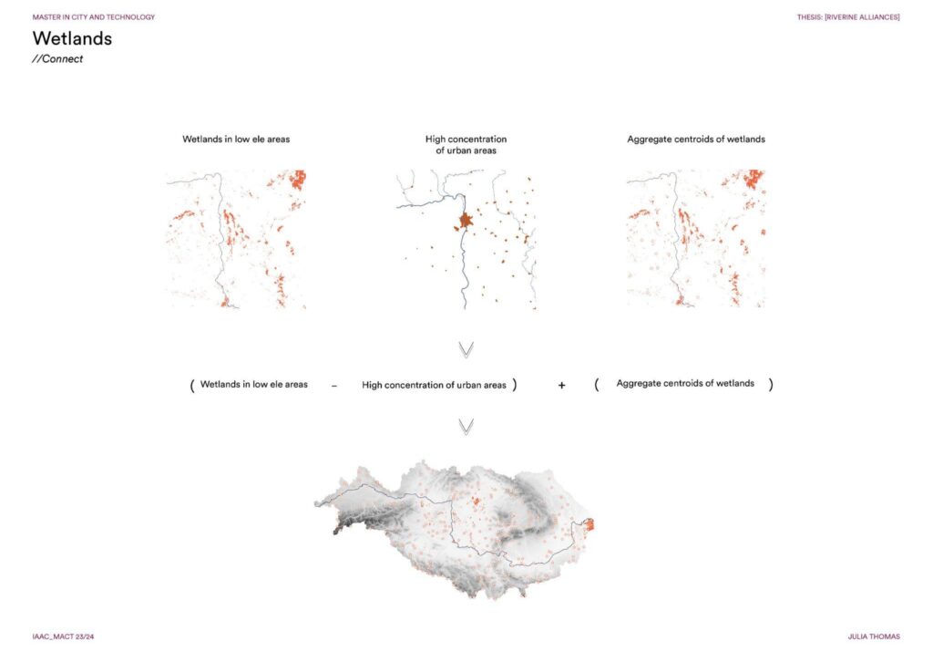
The end points/ground were the aggregate centroids that within the area of action – the agricultural land where water is diverted to.
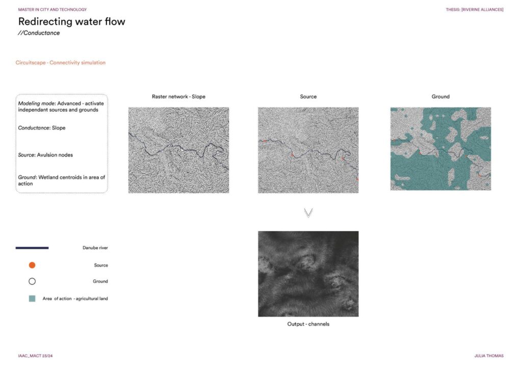
The conductance/network through which the water flows was derived using the slope of the river basin. Circuitscape, an ecological connectivity simulation tool was utilized with the inputs of source and ground points.
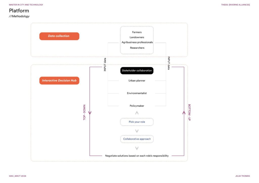
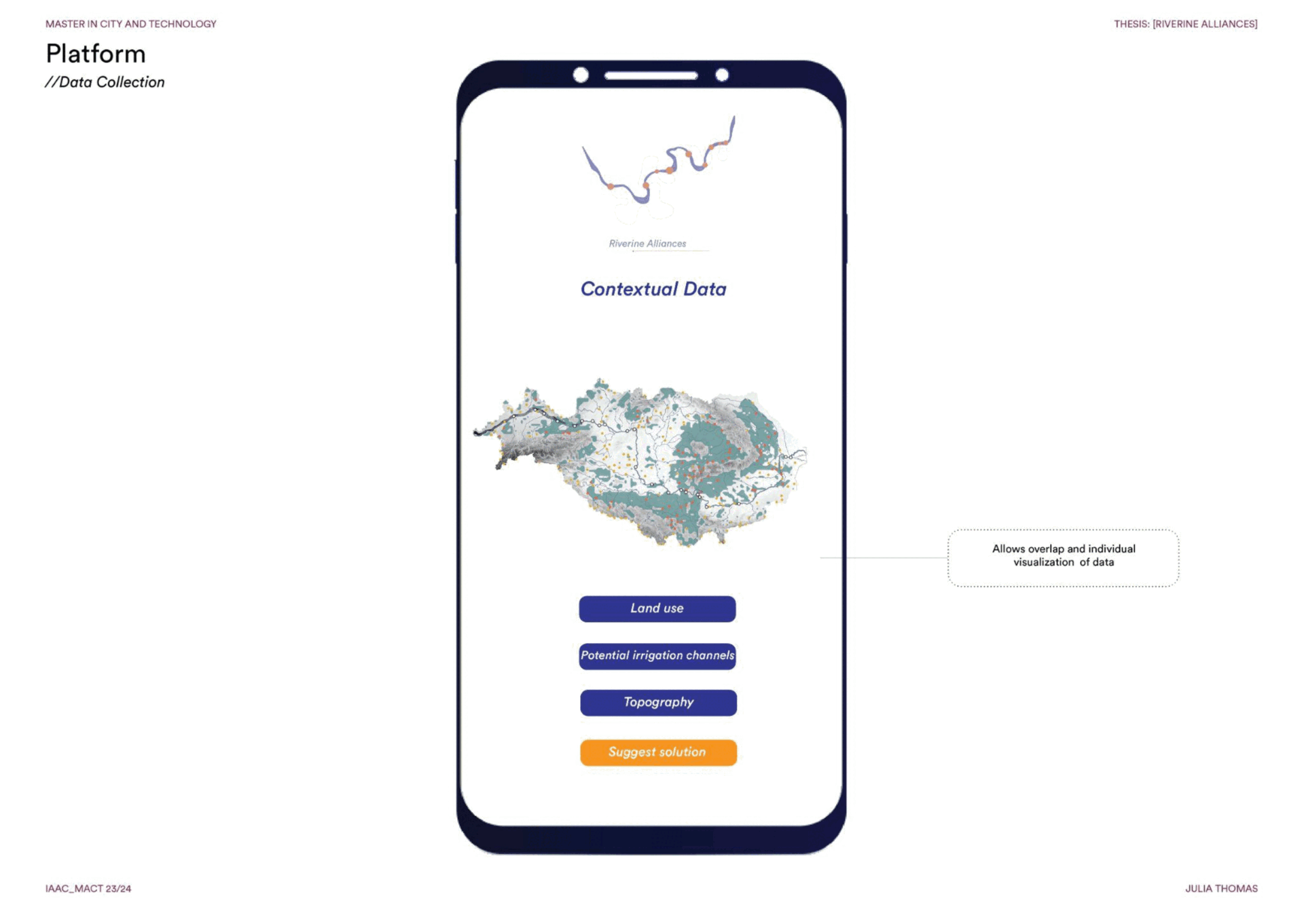
In order to utilize these redirected irrigation channels effectively, it is important to consider the nuances of the land and the water requirements of the agricultural land. Therefore, a strategy for a platform was developed which served as a space for the farmers, landowners, agricultural professionals and researchers to voice their issues, which would then also be utilized by the concerned stakeholders to address each issue through an interactive decision hub.
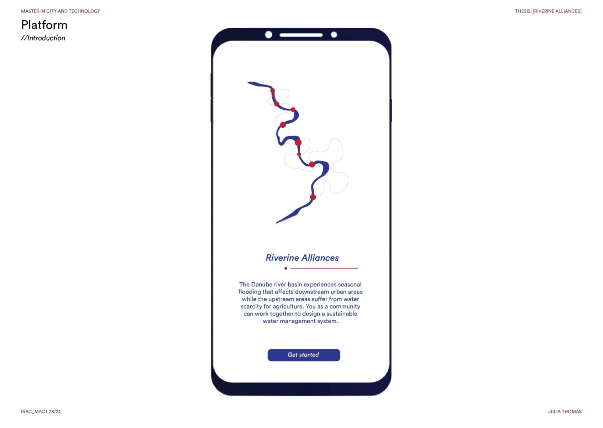
It also provides information of land use, topography and the derived irrigation channels within the river basin in order to visualize the context, which would enhance their understanding of the land and empower them to take part in suggesting solutions for their concerns. The potential irrigation channels as derived from the analysis would allow them to suggest the most feasible irrigation channel for their property, which would lead to a micro-level pathway design of the irrigation channels based on each individual requirements of the agricultural property.
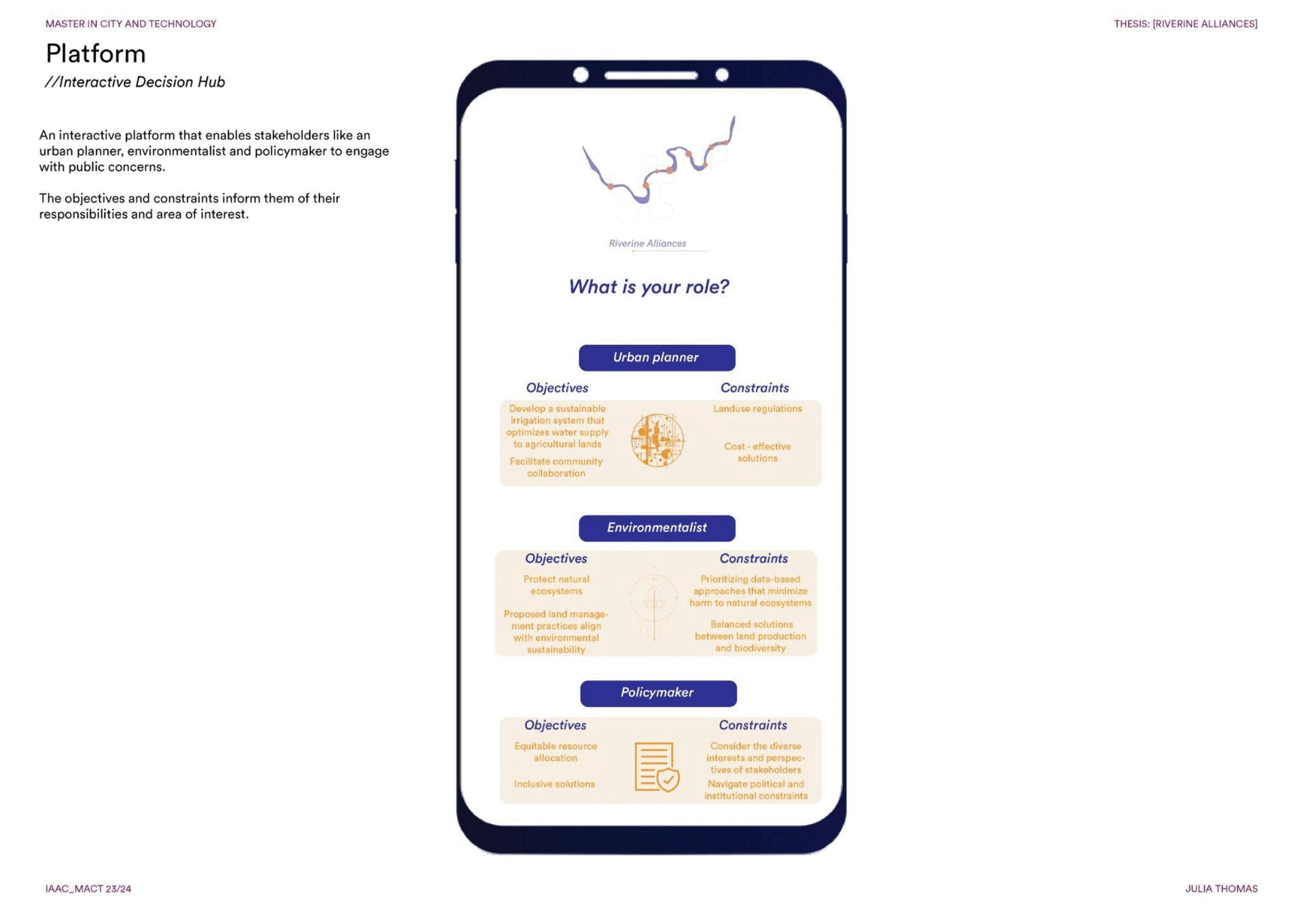
The second part of the platform – the Interactive Decision Hub, enrolls the concerned stakeholders, namely, the urban planner, environmentalist and policymaker to negotiate solutions for potential conflicts that could arise in the micro-level planning of the irrigation channel design. The stakeholders are informed of their objectives and constraints regarding the matter.
For instance, picture a scenario where there is a dispute in two adjacent properties in terms of the channel pathway design due to blockage of water supply to Property02 as a result of the design suggested by the landowner of Property01. This concern is addressed by the three stakeholders. The urban planner suggests diverting the channel around towards the direction of the Property02 based on its water requirements, thus sharing the resource.
This is then passed onto the environmentalist who points out that the on of the channels is passing through a plot with rare plant species that need to be protected. Hence they adjust the channel design to work around this plot.
After which, the policymaker determines whether this micro-level design of the irrigation channel requires planning a regulation in water supply (continuous or periodic) for both properties by analysing the elaborate description of the landowner’s issue. They also ensure a balance in agricultural productivity and environmental concern. This is then passed on to the urban planner and environmentalist to approve the changes/negotiated solution.
The implementation of new irrigation channels diverting excess water to upstream agricultural lands not only meets irrigation needs but also mitigates surface runoff and reduces flood risks downstream in urban areas. This holistic approach empowers the Danube River to sustainably support both agricultural livelihoods and urban resilience.