
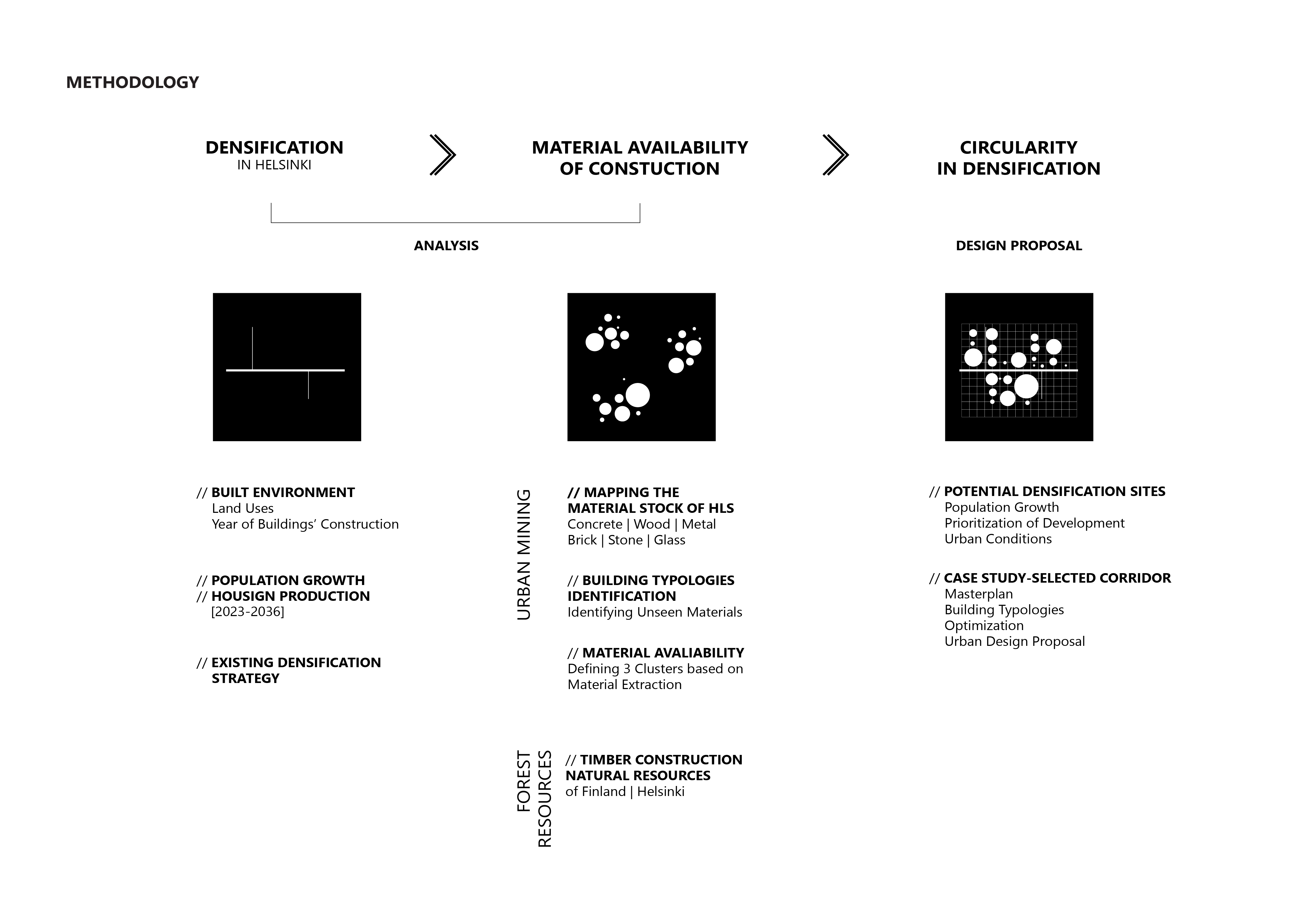
The Boulevard Method utilizes big data analytics and multi-objective optimization processes to map the existing materials building stock and propose a
data-driven urban strategy for the future densification of the city of Helsinki.

By making the hypothesis that certain roadways will become obsolete in the future due to the transformation of urban mobility, this study analyzed diverse datasets to identify these potential roadways, and develop a protocol for their transformation through urban mining maximizing land use efficiency without over-occupying existing forest patches in the city
Helsinki experienced a significant surge in urbanization during the 1970s, marking the beginning of its rapid growth as a city. This relatively recent expansion is a key factor in why the Finnish people maintain such a strong connection to nature.
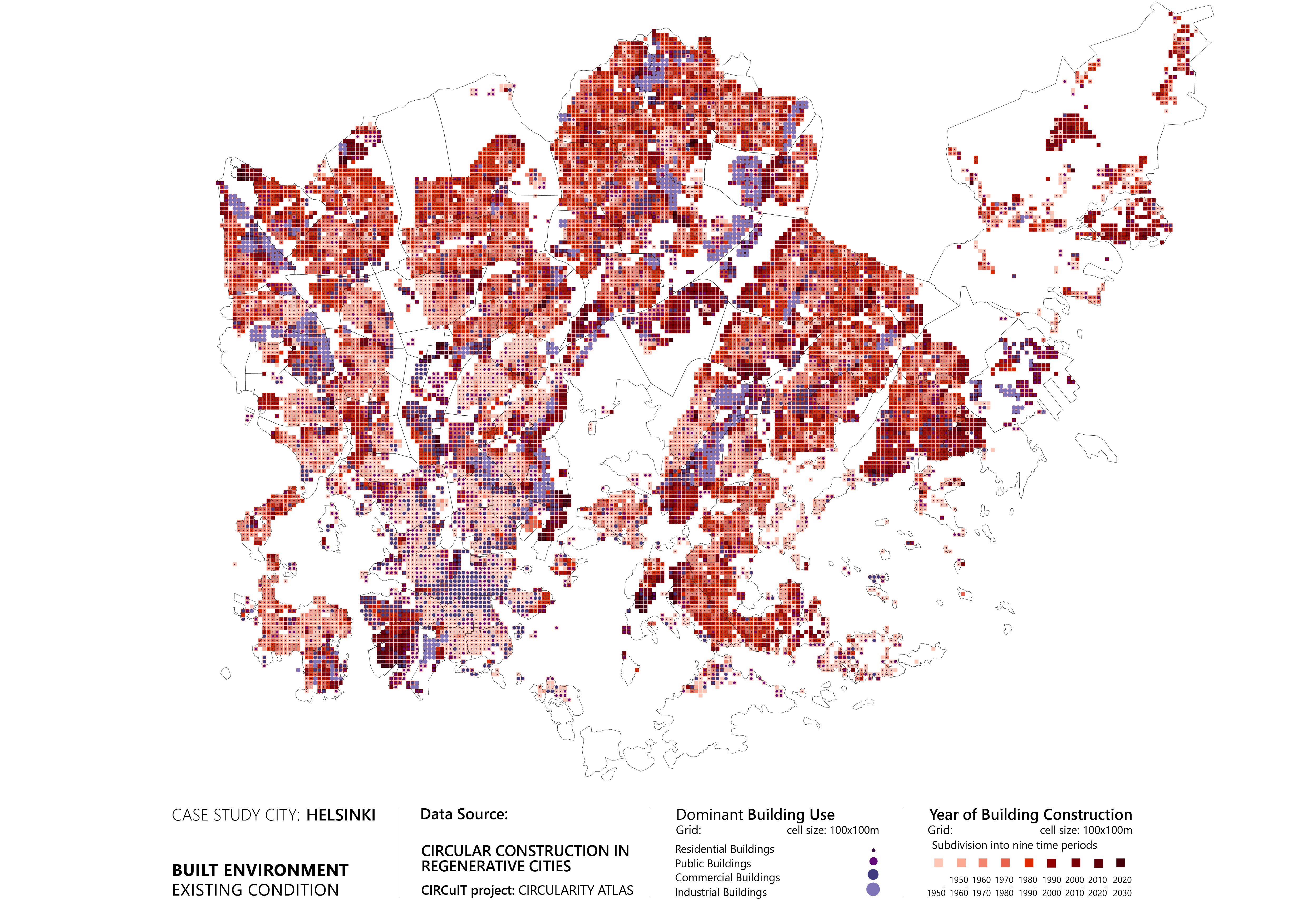
The primary construction of the historical city center primarily took place prior to the 1960s, and subsequent decades witnessed the radial spread of urban development into the surrounding suburban areas. Notably, from 2010 onwards, there has been a noticeable revitalization and regeneration of the coastal regions. Approximately two-thirds of Helsinki is comprised of residential areas, with commercial and public activities primarily concentrated in the city center. Throughout the suburban regions, scattered clusters of industrial buildings can be found, showcasing the diverse nature of Helsinki’s urban landscape.
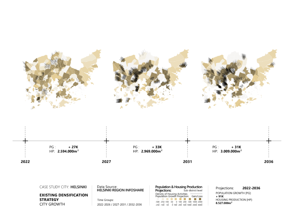
Looking towards the future, an analysis was conducted using Helsinki’s official datasets to examine both construction and population forecasts for the next 15 years across different regions. These forecasts served as a guide to identify the areas with the highest potential for optimal densification. Building upon the observations from the previous steps, it became evident that there is a significant emphasis on establishing a robust connection that bridges the gap between the city center and the outskirts. This indicates a strategic focus on enhancing connectivity and cohesion throughout the city.
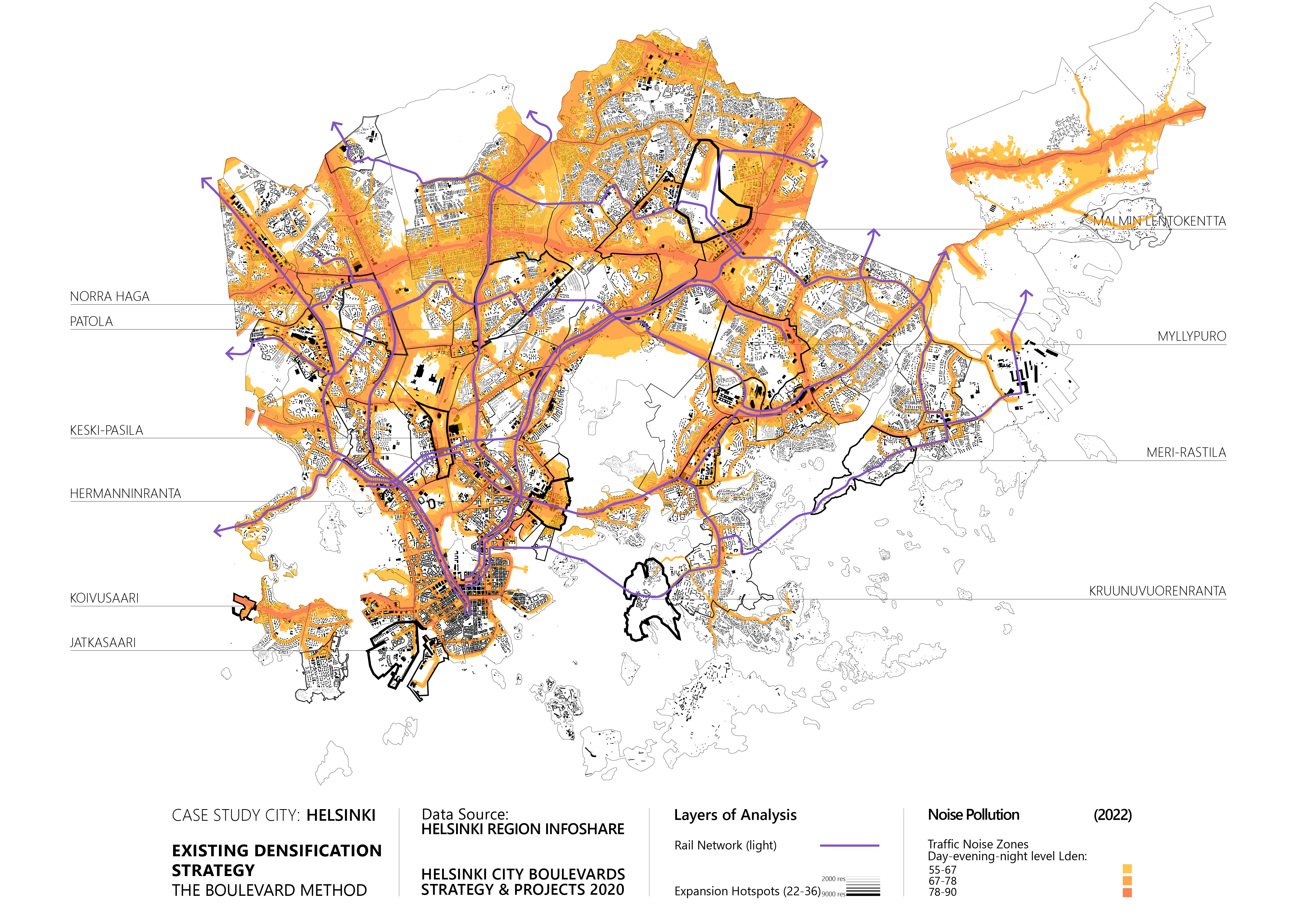
Until now, the city has grown based on a car-centric model, that with the help of large road infrastructures, allowed the circulation and mobility of the population. In and out. This brought, among other things, high levels of noise pollution and drastic land fragmentation.
The future ahead lies on a new and more sustainable transportation plan. The city aims to deploy an extensive network of light railway trains that will connect the city not only north-south direction, but also, transversally.
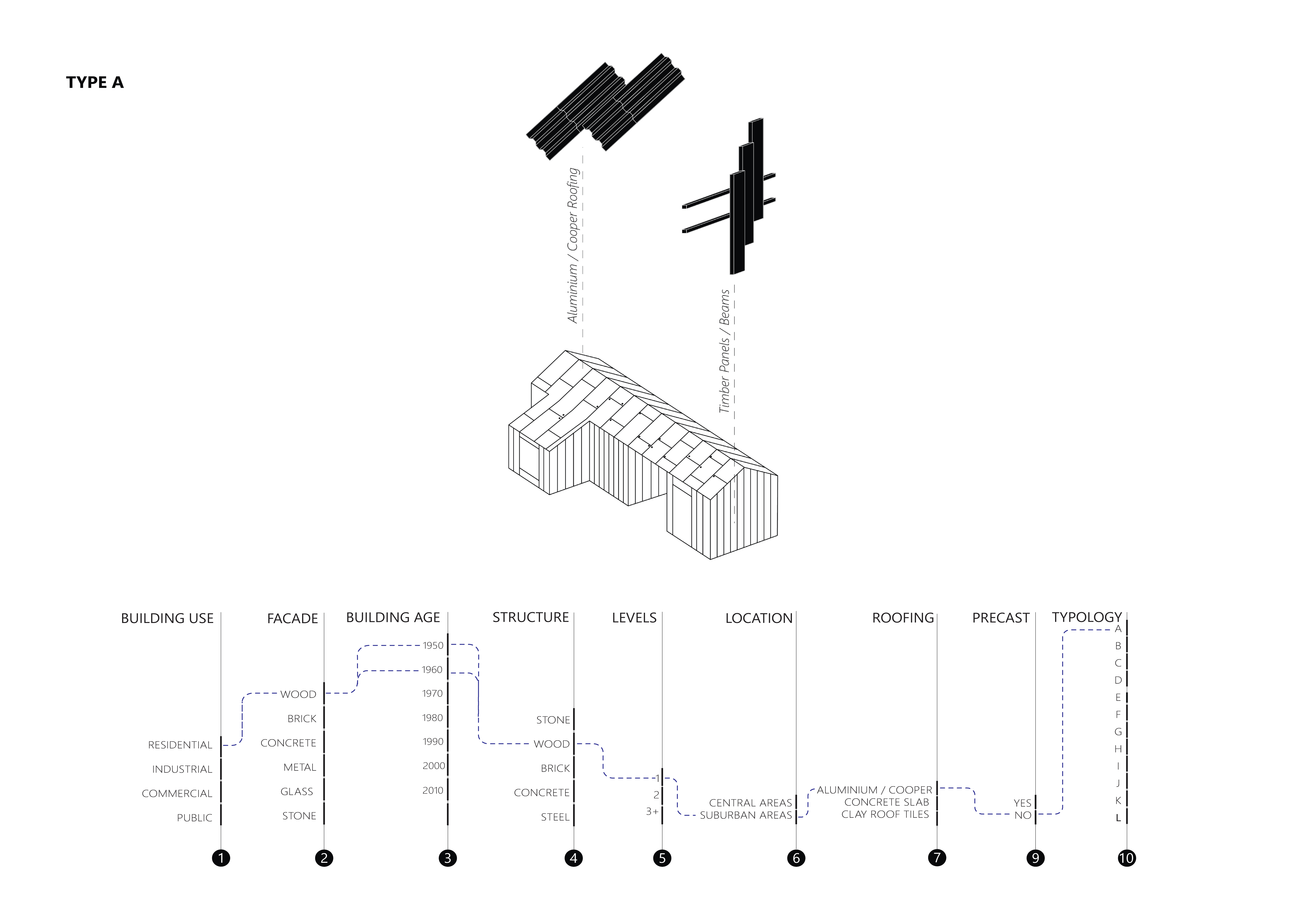
Comprehensive data on over 50,000 buildings in Helsinki has been gathered and processed. “The Boulevard Method” study encompasses two main datasets, namely the “Circular Construction in regenerative cities” dataset from the Circuit European Project and the “City Library App” dataset provided by the Institute for Advanced Architecture. . These datasets provide valuable details on building usage, age, height, structure, and façade / structure materiality. By collecting relevant literature and applying rule-based logic for the features of our dataset, the unseen materials of the building were identified such as roofing materials, structural as well as precast concrete.
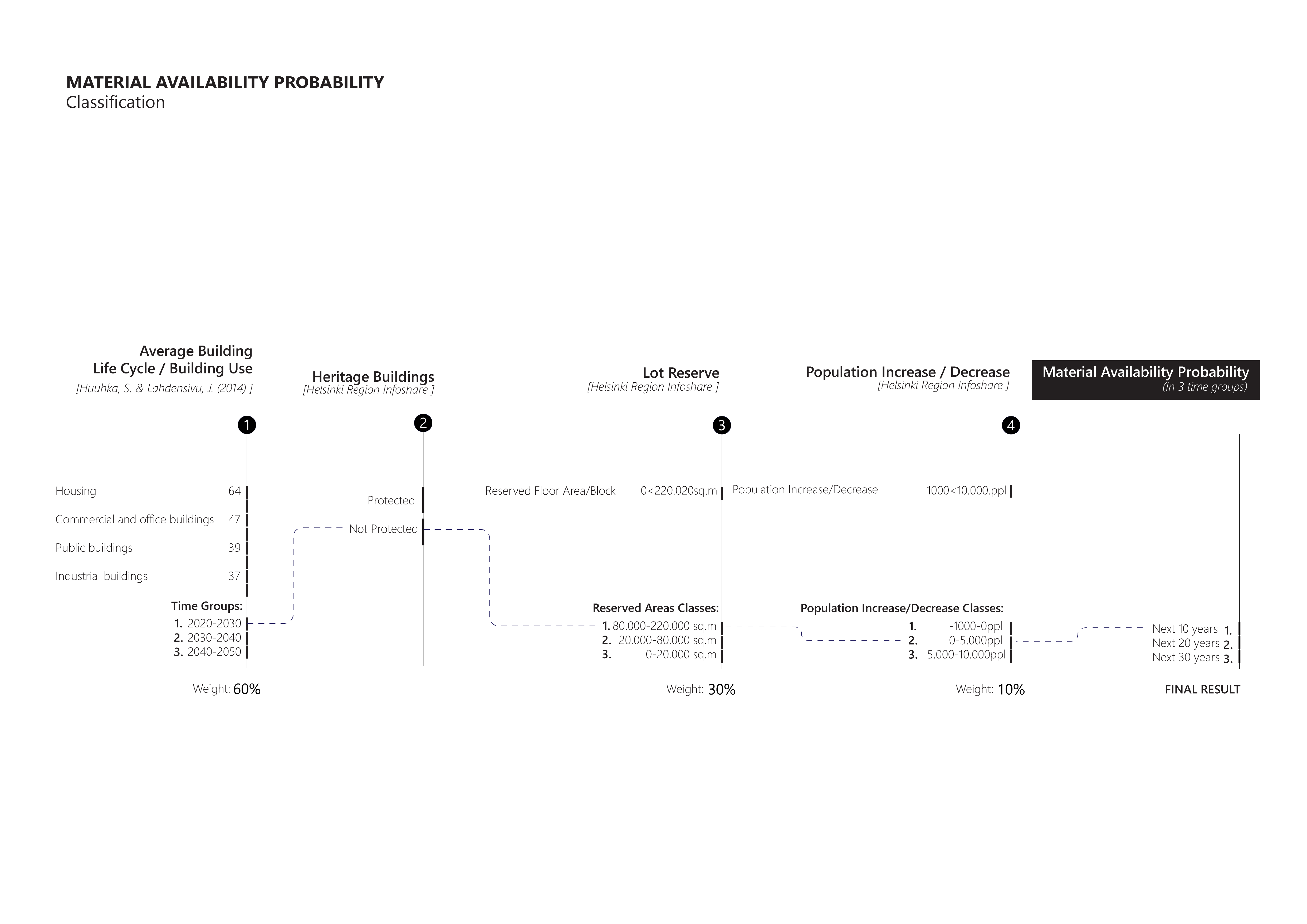
Having a better knowledge of the city’s of Helsinki materiality, a comprehensive analysis was conducted to map the future availability of these materials. This involved studying the average life cycle of buildings in Finland, identifying the protected heritage buildings within our dataset, and determining the overlap between these buildings and the reserved areas designated for future housing production. Additionally, the city’s future population projection was taken into account. The result of this process was a classification that indicates the chances of a building being available for urban mining within three periods of the next 10, 20, and 30 years.
- In the first period (2020-2030), concrete and wood emerge as the prevailing materials, while typologies B and G dominate the architectural landscape. Analyzing the map reveals that concrete clusters are primarily located in proximity to the city center, whereas wood structures are evenly distributed throughout the suburban areas. The length of the lines on the map represents the quantity of available materials, determined by multiplying the perimeter of the buildings with their respective heights.
- Moving on to the second period (2030-2040), it closely resembles the first, except for a notable change in the concentration of available materials, which now gravitate towards the northern and eastern regions of the city.
- Transitioning to the third period (2040-2050), clusters of brick and wood structures become the prevailing architectural elements in the northern section of the city.
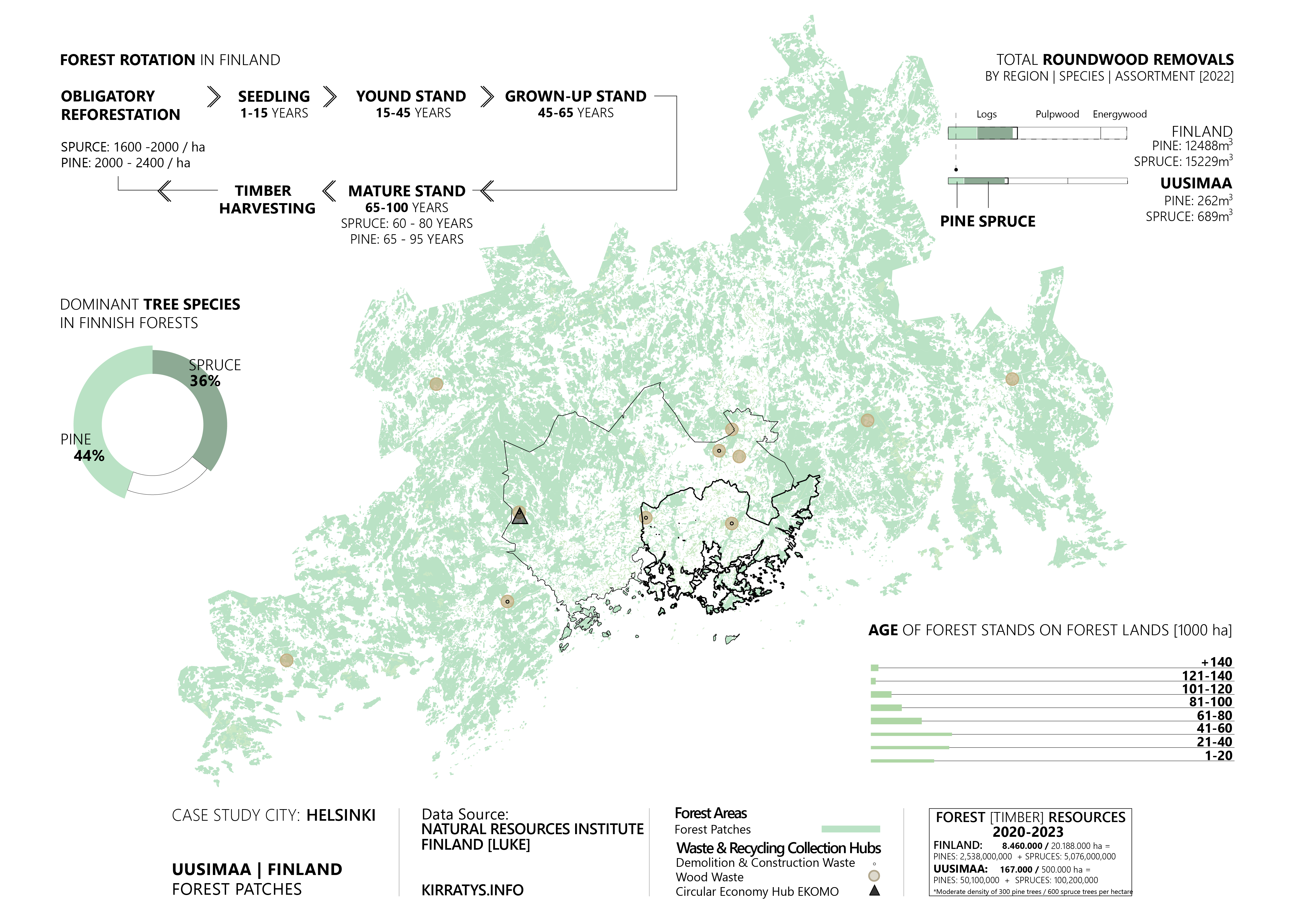
The project proposes a densification strategy that leverages the utilization of wood, capitalizing on available forest resources. By integrating urban mining processes, the goal is to create a harmonious synergy between the extraction of materials from the urban environment and the utilization of wood as the primary material.
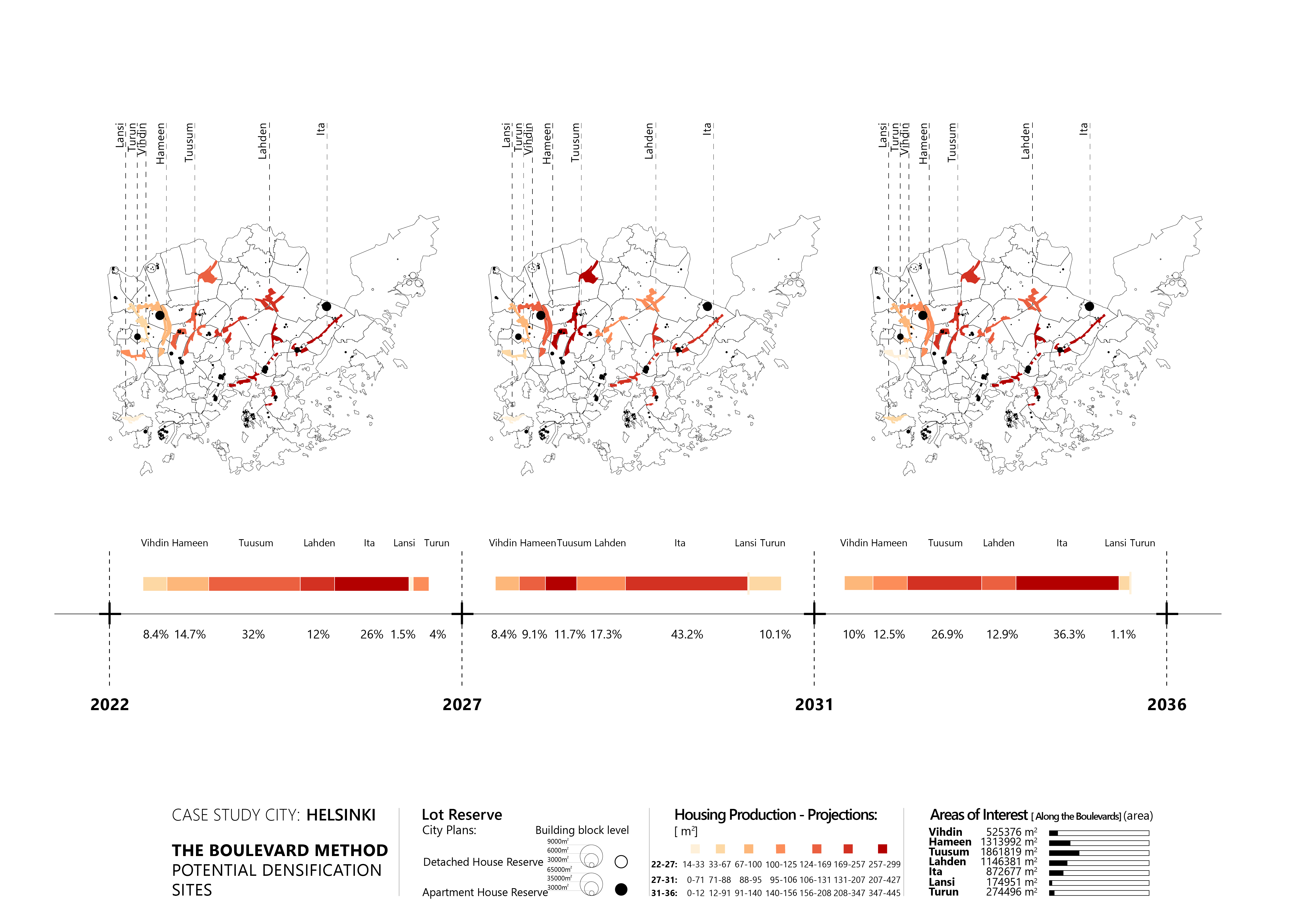
Based on the existing expansion strategy, 7 clusters of potential densification areas can be identified. Thought-out the fifteen years timeframe, the boulevard areas are classified differently based on the priority in terms of the amount of housing production and the availability of the lot reserve areas.
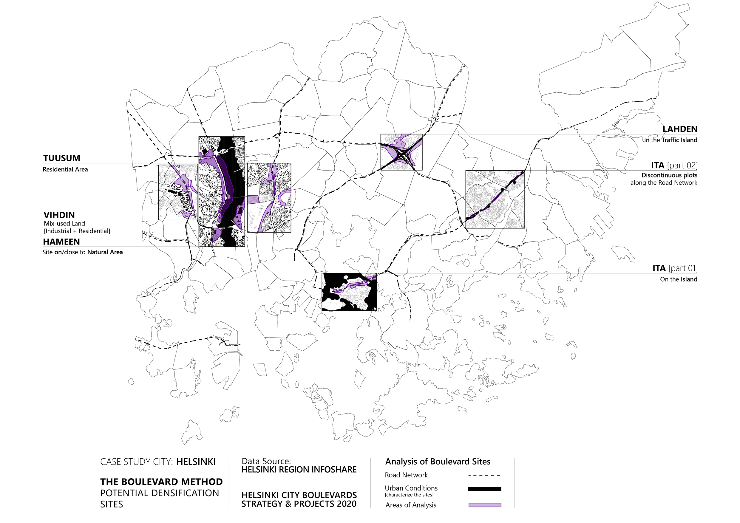
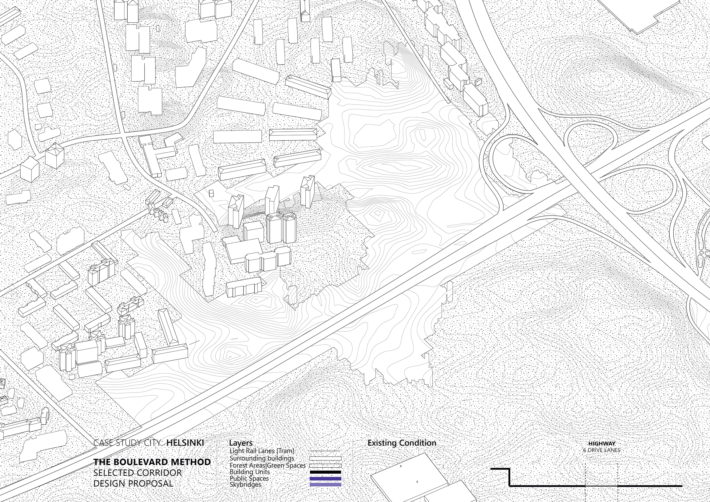
Through the examination of various factors, including land uses, proximity to natural areas, and arrangement along highways, diverse urban conditions of boulevards are were identified. Among them, the HAMEEN boulevard site is chosen, distinguished by its advantageous position near both the highway and Helsinki’s linear central park, which also occupies a portion of the site.
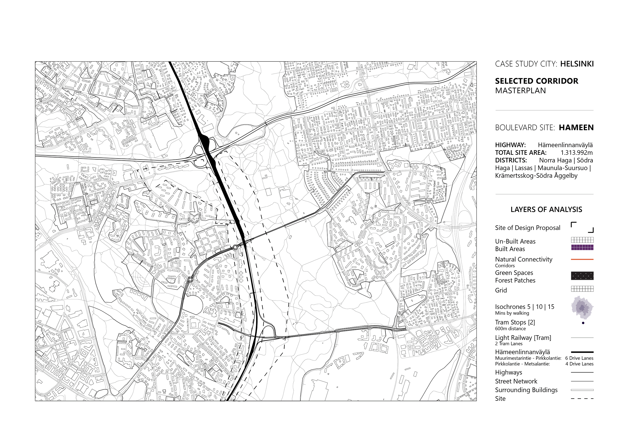
In terms of the urban design strategy, the initial step involves transforming a 4 to 6-lane highway into a light railway network consisting of 2 tram lanes positioned in the middle of the corridor. To facilitate convenient connectivity, tram stops are placed every 600 meters, aiming to establish an ideal condition where the entire densified area can be reached within a 15-minute walking distance, fostering the development of mixed-use neighborhoods. A key consideration in this intervention is the natural connectivity between existing forest patches, which occurs through three primary corridors. The available spaces for densification are indicated within a 24-meter grid. Our focus primarily lies along the road, while we have extended the intervention to selected areas with lower vegetation cover. The densification of this selected area is categorized into zones with different densities, determined by their proximity to the corridor. This means that the farther a zone is from the corridor, the less it will be occupied by natural area cover. Conversely, areas closer to the corridor will have higher land occupation. Based on it, the densification process consists of three main building typologies:
(1) High-rise residential buildings | (2) Mixed-use building complexes, | (3) Detached buildings.
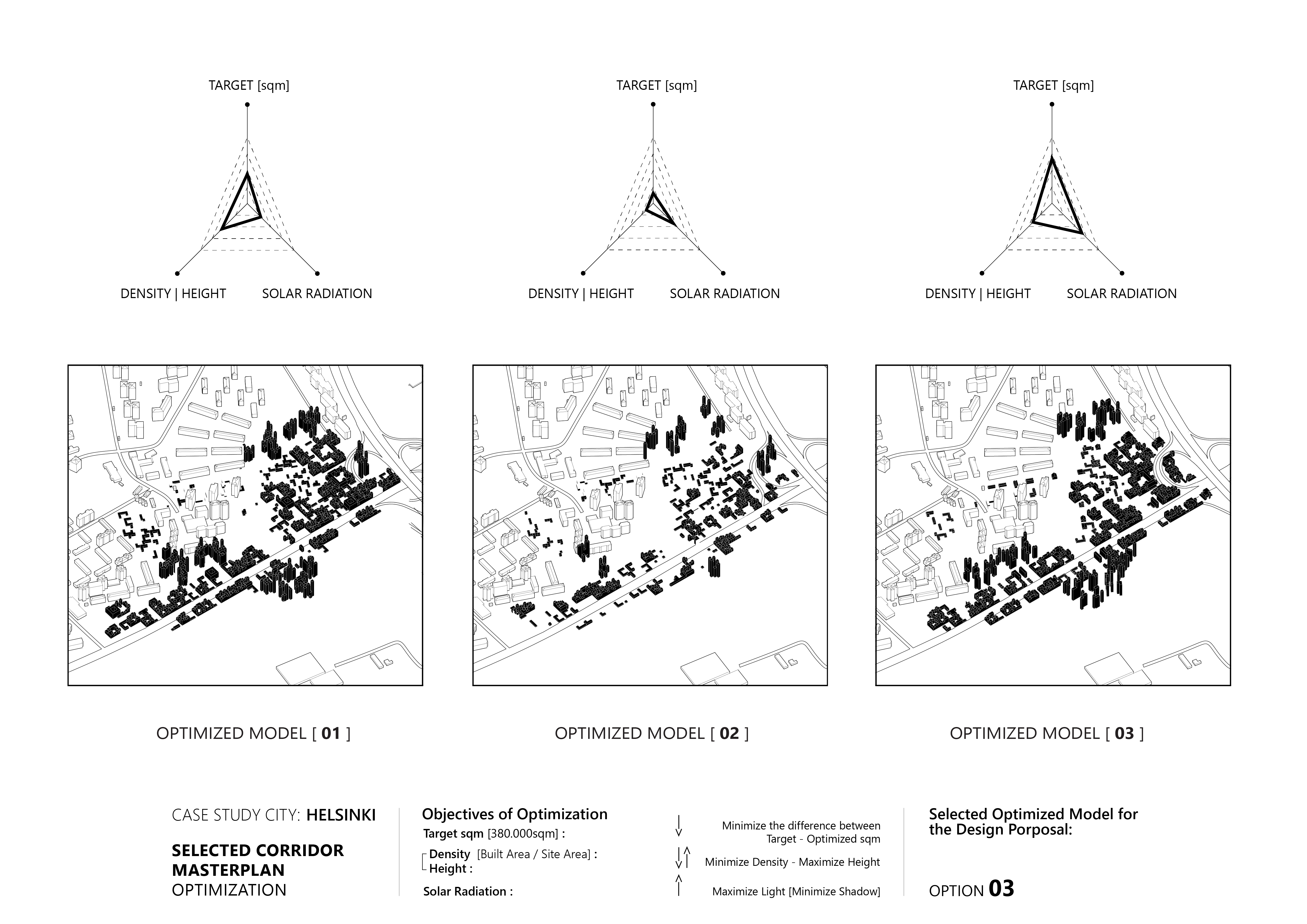
The exploration of the neighborhood’s volumetry involved conducting experiments with various optimizations, with three primary objectives in mind: estimating the targeted square meters of housing production set by the city for this district, determining the density relative to building height, and maximizing solar radiation gain. Following the evaluation of the optimized models, the best-performing option, namely optimized model number 3, was selected.
The overall densification strategy spans three distinct periods, each lasting five years, from 2022 to 2036.
- In the initial five-year period, a suggestion is made to reduce the road lanes and commence the construction of a tram lane in the middle. Approximately 30% of the total intervention area would be dedicated to building space, determined based on population projections. The purple spaces signify public areas for social and commercial activities, with mixed-use building units surrounding them.
- During the subsequent phase, the intervention would be expanded to cover 60% of the total square meters, primarily focused along the road. This step would involve the transformation of portions of the old road infrastructure into public open spaces.
- The third and final stage of the intervention involves completing the necessary construction of the required built space while eliminating the driving lanes from the corridor.
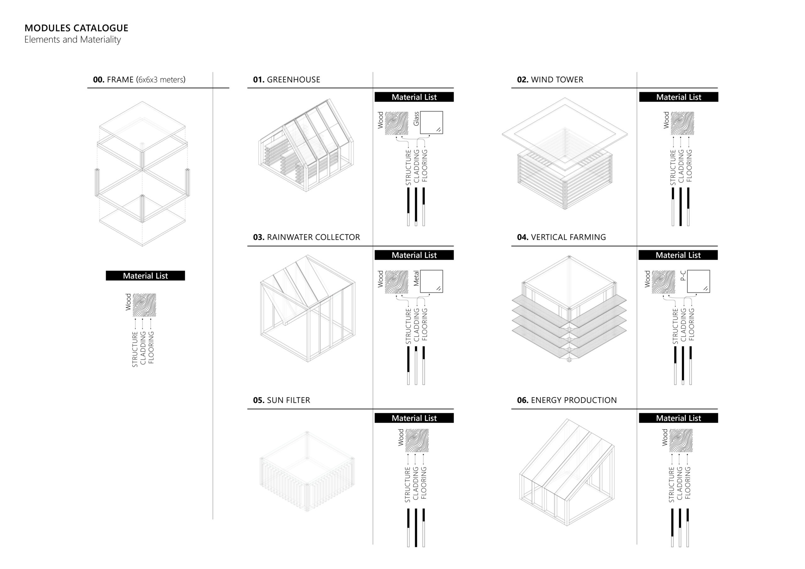
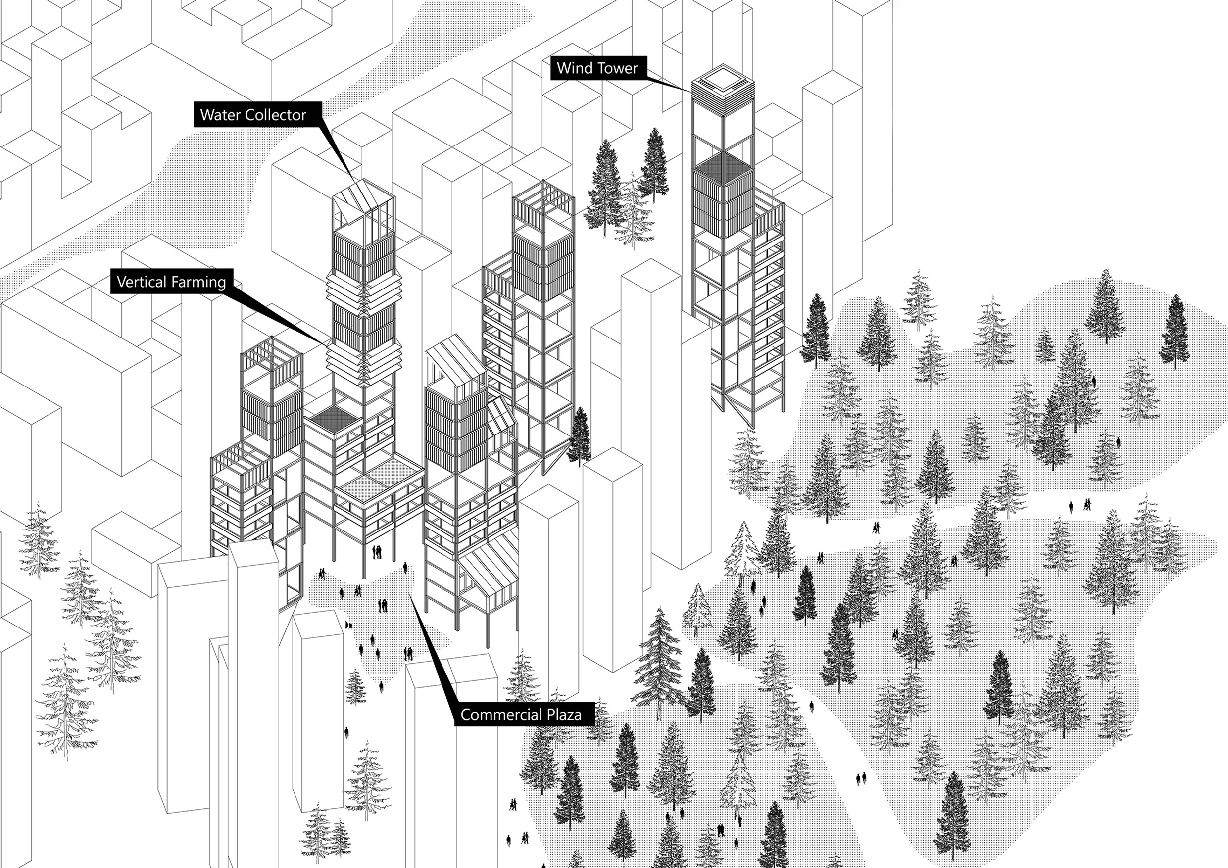
The project introduces a timber-framed structure for the boulevard, offering versatile modules that can serve various functions such as a greenhouse, rainwater collector, wind tower, or vertical farm. The design catalogue prioritizes the use of wood sourced from urban mining and regional forests for structural elements and flooring. This approach reflects a sustainable mindset and the utilization of local resources.
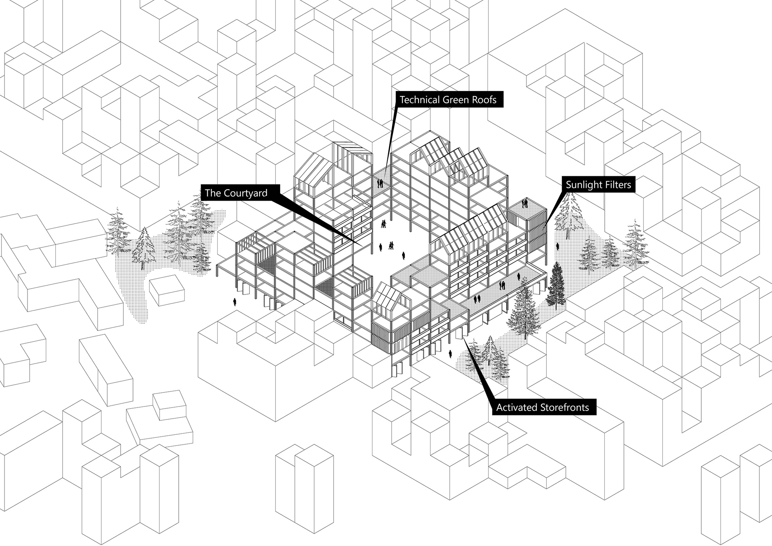
SHARED COURTYARDS
The area is inspired by the blocks located in the city center of Helsinki. A shared and open courtyard can reinforce a sense of security and increase the sense of community throughout the block while serving as common living rooms for the residents.
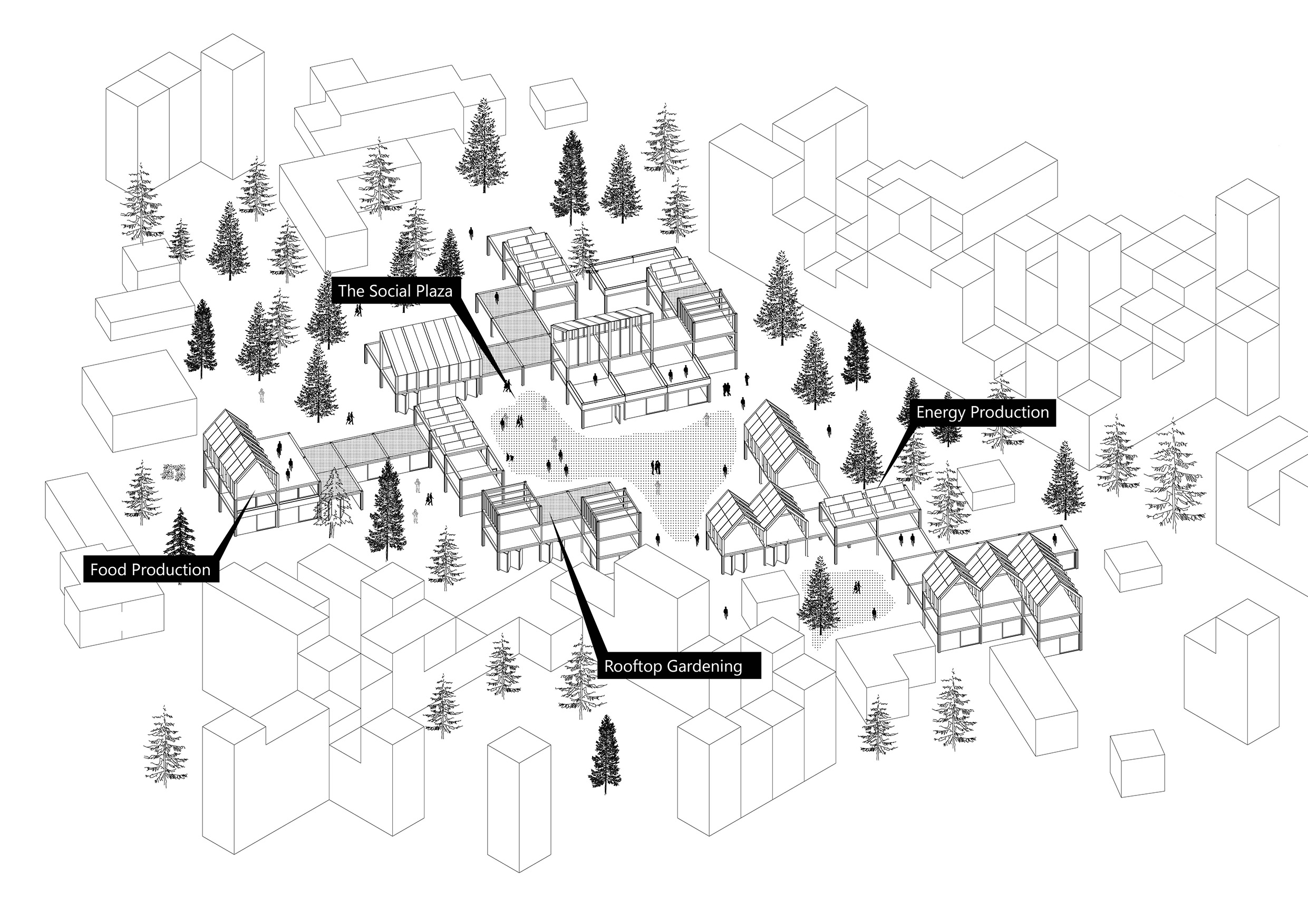
URBAN VILLAGE
“Urban Village” neighborhood typology creates the atmosphere of low-rise developments, very much characteristic of Helsinki’s suburban growth. In contrast to the existing, here the project aims at bringing mixed-uses, to create a lively and self-sufficient neighborhood.
VERTICAL INFRASTRUCTURES
The high-rise typology is strategically located within the boulevard, mainly in areas where the built footprint wants to be minimized due to proximity to natural resources. A highly mixed-use program is developed by optimizing housing together with vertical farming, viewing decks, water collectors and a vibrant public space at street level.
