A multidimensional and multiscalar exploration of the emerging Vertical Urban Transportation landscape.
[A] INTRODUCTION
“Advanced Air Mobility (AAM) is a rapidly-emerging, new sector of the aerospace industry which aims to safely and efficiently integrate highly automated aircraft into the NAS. AAM is not a single technology, but rather a collection of new and emerging technologies being applied to the aviation transportation system, particularly in new aircraft types (eVTOL, eCTOL, sUAS, UAVs). The AAM ecosystem is designed to transport people and things to locations not traditionally served by current modes of air transportation, including both rural and the more challenging and complex urban environments. It introduces two main subsets: Regional Air Mobility (RAM) and Urban Air Mobility (UAM).”
This is the technical definition of the AAM concept. However, in the framework of this urban design thesis, we are trying to read it through a multiplicity of standpoints as AAM is fundamentally a speculative question – there is no clear or singular technical answer – because it is not a static field; rather, it is in development, making it a very elastic concept. At the same time, it is a complex question that intersects with questions of urbanization, questions of technologies, infrastructures, and networks, but also questions around the environmental degradation. Mostly, what we are trying to do is to structure a methodology that allows us to deal with this question in a nuanced way, as opposed to a straightforward manner.
We are imagining the thesis as a constellation of elements, assuming that through this approach, there is the potential to codify answers to the question of AAM. There are three main volumes and nine documents in total, and the reason for separating things into layers is to have the possibility of approaching the concept from multiple perspectives, but also with different methods of representation in order to grasp specific dynamics. Each of those documents has a specific kind of exercise and offers a different answer to the AAM question. Consequently, the thesis can be understood as a toolbox where the documents can be organized and reorganized in various ways, forming discursive, archival, technical, analytical, speculative, and design-oriented clusters.
[B] MAIN BODY
VOL. I – DECONSTRUCTING URBAN VERTICALITY
Volume I is the literature review and the initial exploration of the AAM question. It consists of three main documents ([1] URBAN VERTICALITY, [2] TECHNOLOGIES IN CIRCULATION, [3] ENVIRONMENTAL CATASTROPHE) and helped us formulate the questions that would guide us in the next volumes and explore concepts that allow us to position the AAM concept today.
01. URBAN VERTICALITY – CONCEPTUAL AXIS
In the first axis, the literature review is converted into a visual glossary of 16 satellite concepts derived from four different disciplines: Architecture, Urban Studies, Urban Transportation, and Geography. For each of those concepts, a definition was constructed based on the extraction of keywords and quotations from multiple academic literatures along with a visual representation and metadata.
The timeline of the glossary reveals that, while cities began embracing the vertical dimension in the late 19th century and gradually became more vertical and complex, much of urban research has been dominated by a bias towards ‘horizontalism’ and the normalization of a cartographic, top-down aerial gaze as the default representation of cities. Only recently have researchers started adapting their conceptualizations of cities to understand and analyze the vertical characteristics of urbanization. This ‘vertical turn’ of the last two decades originated within the discipline of geography.

By analyzing concepts based on conceptual affinity, we observe a significant variety. There are concepts more closely related to the process of urbanization, others more tied to the discipline of urbanism, and still more connected to the city itself as the primary device through which we can conceptualize verticality, particularly considering the skyscraper as the main artifact. Adding an extra layer to how the urban is perceived based on spatial dimensions, these concepts can be categorized into three clusters: the first tends to counterpose the vertical against the horizontal; the second views the urban as the intersection of verticality and horizontalism; and the third adopts a more volumetric, three-dimensional perspective.
Urban transportation is undergoing a transition from distinct approaches of vertical or horizontal circulation to a more volumetric approach, aiming to support the complexities of today’s urban life.
02. VERTICAL TECHNOLOGIES IN CIRCULATION – TECHNICAL AXIS
The second axis is hybrid, organized chronologically in the form of a spatial taxonomy. Its purpose is to excavate the invention of real artifacts of mobility, with a specific focus on vertical technologies in circulation over the last hundred and fifty years, and to compare them with the imaginaries of mobility presented in urban sci-fi.
Exploring the altitude and range of operation throughout the timeline, it appears that since 2010, we have entered an experimental period leading to the third flight revolution. This revolution is based on reimagining existing, well-established, or underused artifacts by minimizing their scale, converting them into aircraft with low environmental impact through significant changes to engines and fuels, and introducing them into intra and inter-city commuting.
Through the analysis of the scale of infrastructure (in terms of aircraft) and the urban systems associated with other technologies, it becomes evident that there is a shift towards space-efficient artifacts or those with low-impact infrastructure that aim to replace or redefine existing that are characterized by rigid, high-environmental-impact structures, such as the highways.
A second layer of this analysis explores the relationship between the artifacts and their urban infrastructures in both cases. Among them, two key moments are the invention of (delivery) drones and the vertical highway from science fiction. This comparison aims to highlight the contrast and demonstrate how reality has advanced or been prefigured in science fiction. Conversely, it also examines how science fiction can impact the understanding of the field, specifically in urban vertical circulation.
- The drone, an emerging artifact of circulation, is transforming the way goods are delivered in cities. Characterized by the remoteness of the technology itself, in its experimental stage, it seems to be somewhat detached from its field—the urban setting.
- Sci-fi movies showcase artifacts fully embedded into their urban context. For instance, the movie Minority Report prompts us to consider how these vertical complex technologies will impact the urban fabric. It depicts buildings affected, albeit with exaggeration, highlighting that these mobilities are not in a blank stage -they interact with the urban infrastructure.
HYPOTHESIS 2: Advanced Air Mobility will change the morphology of the urban fabric where existing buildings will emerge as an integral extension of mobility.
RESEARCH QUESTIONS: – How will the relationship between AAM artifacts and urban fabric mutually influence the design, form, materiality and technology of both the artifacts themselves and the urban components? – What implications arise for buildings and mobility infrastructure as it transitions into a decentralized system?
03. ENVIRONMENTAL CATASTROPHE – CONTEXTUAL AXIS
The third axis is constructed through sequential timeline charts, based on my engagement with two books, The Future is Degrowth: A guide to a World beyond Capitalism and Mobility Justice: The Politics of movement in an age of anxiety.
A narrative is created about the three parallel crises: mobility, climate, and urbanization. highlighting key concepts such a material growth, fossil capitalism, the (de)coupling of growth and emissions, carbon-based urbanization and fossil-fuel based transportation. We aim to challenge and question the concept of Advanced Air Mobility as a future scenario to transform automobility while simultaneously opening up new possibilities.
HYPOTHESIS 3: Urban Mobility in megacities requires an alternative approach to decarbonization, shifting from localized strategies on a smaller scale to broader systemic visions.
RESEARCH QUESTIONS: – What is the potential of AAM to transition from private (auto)-mobility hegemony to a collective form of transportation? – How would the challenges posed by the limited opportunities for expanding ground transportation infrastructure in overstretched urban landscapes be overcome?
VOL. II – TOWARDS AERIAL TECHNO-INFRASTRUCTURES
All the explorations that we did in VOL. I, in terms of concepts and discourses, are now grounded in a specific context which is New York and in VOL II the question of design enters more forcefully into the equation at a more analytical level. Starting reading the question of AAM from the perspective of design, we can identify two extremes of understanding. The first involves artifacts or spatial technologies, while the second perspective considers AAM at the scale of systems or networks, with a more territorial-urban approach. As a result, the work of VOL II oscillates between these two poles, consisting of three documents ([4] PAST MOBILITY IMAGINARIES IN NEW YORK, [5] AERIAL TECHNO-INFRASTRUCTURES, [6] EXISTING MOBILITY DYNAMICS IN NEW YORK). Moreover, VOL II can be visualized through a loop diagram depicting the past, present, and future of vertical urban mobility in New York. The past and present are represented by the work of the three documents in VOL .II, laying the foundations for VOL III.
04. MOBILITY IMAGINARIES IN NEW YORK – PAST SECTION
The past section corresponds to the understanding of AAM based on spatial technologies orientation.
A three-dimensional archive is constructed to excavate the histories of nine radical vertical mobility imaginaries–roads not taken. These imaginaries belong to three main spatial typologies: the airport, the highway, and the skyway.
The archival material is converted into volumetric representations, a rationalization process that enables comparisons in terms of scale and specificities. All of them, share a common notion, the megastructure, a concept that holds significant weight in the history of urban proposals and is applicable in the case of AAM. By representing the proposals in the same style and giving them certain uniformity, a new database is built that enables the revisiting of some proposals still relevant from today’s perspective.
05. AERIAL TECHNO-INFRASTRUCTURES – PRESENT SECTION
The present section focuses on exploring the concept of AAM at the intersection of infrastructures and systems (in two ways) and it consist of two parts.
In the first part, infographics are utilized as the primary method of representation to understand and unpack the different components and infrastructures of aerial mobility systems. The function of an infographic is to convey a large amount of technical information or data from an abstract perspective and to relate it within a single graphic element. Five main aerial infrastructural typologies can be identified, related to specific artifacts analyzed in VOL. I (document 2), and the analysis is presented through a series of segments that map technical information sourced from reports/advisories of the FEDERAL AVIATION ADMINISTRATION.
Starting from the more well-established to the more speculative aerial infrastructures, progressing from the territorial scale towards the regional and urban scales, this block of work analyzes aerial infrastructures based on their facilities, components, and various typologies. It introduces the new emerging infrastructures of AAM, specifically the VERTIPORT and DRONEPORT. Finally, It is emphasized that it’s important to understand that all these infrastructural components belong to a general air transportation system with a hub-and-spoke structure.
06. EXISTING MOBILITY DYNAMICS IN NEW YORK – PRESENT SECTION
In the second part, the focus sheds light on the territorial implications of the existing aerial and general mobility infrastructural systems in the New York Metropolitan Area. The primary method for unpacking the various layers of analysis involves a series of diagrammatic maps. These maps serve as a tool to analyze the mobility systems and understand how the networks are articulated, their efficiencies, and the possibilities for.
The New York Metropolitan Area encompasses three states: New York, New Jersey, and Connecticut. New York City, located at its center, boasts the highest population and building density within this area. It has a massive air transportation network, including 4 international airports, 42 underutilized regional airports, and numerous heliports and seaplane bases, presenting an opportunity to leverage existing infrastructure.
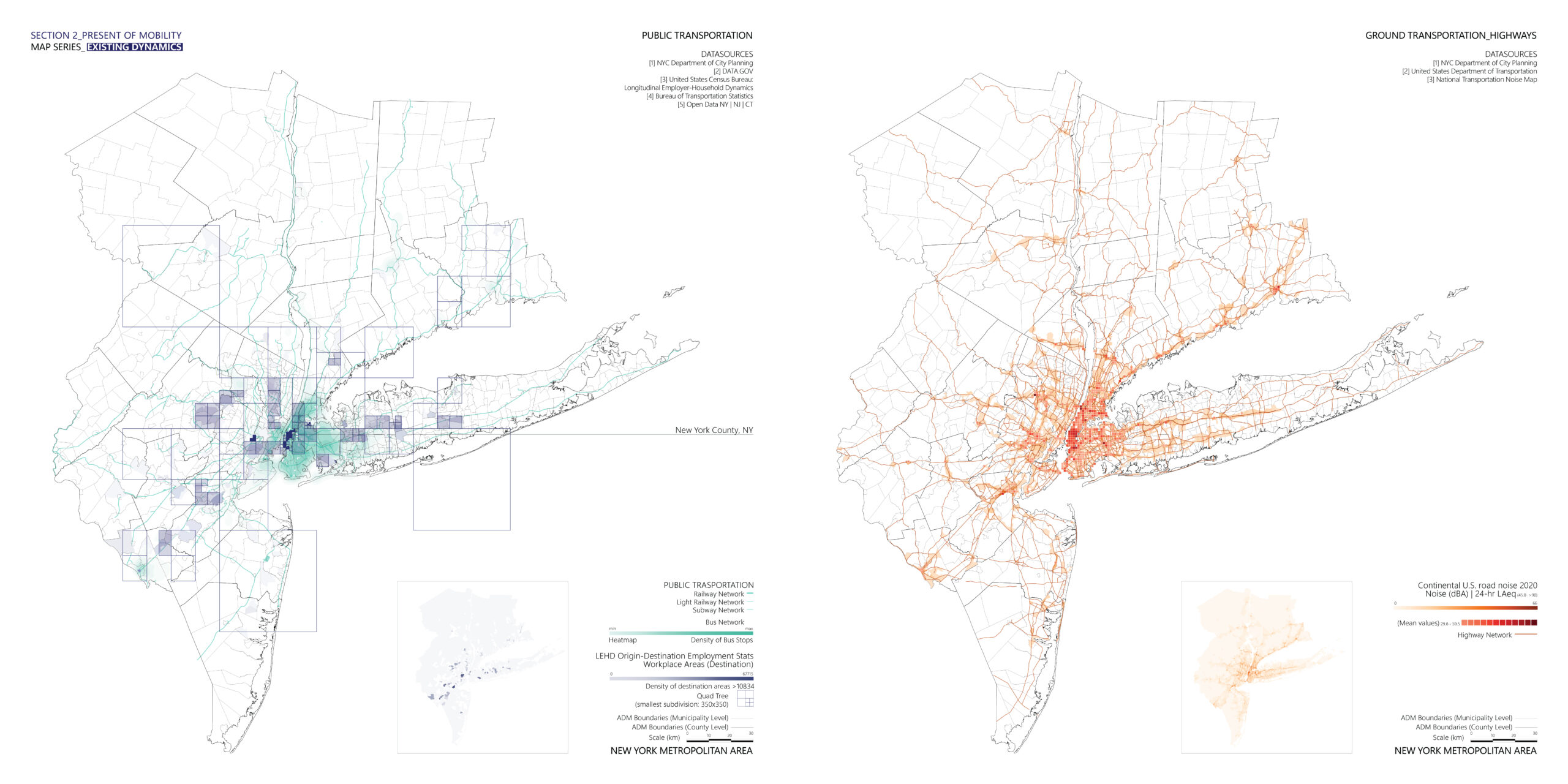
By analyzing the origin-destination employment statistics, a new dataset is generated that allow us to identify the residence areas Additionally, by conducting an isochrones analysis from each existing airport, the potential for better integration of the area through the AAM concept is revealed by reactivating some regional airports. On the other hand, the workplace areas, the destinations of commuting exhibit a different spatial distribution pattern, mainly centered around NY city. While there is a well-integrated public transportation network is one of the most congested traffic urban areas.
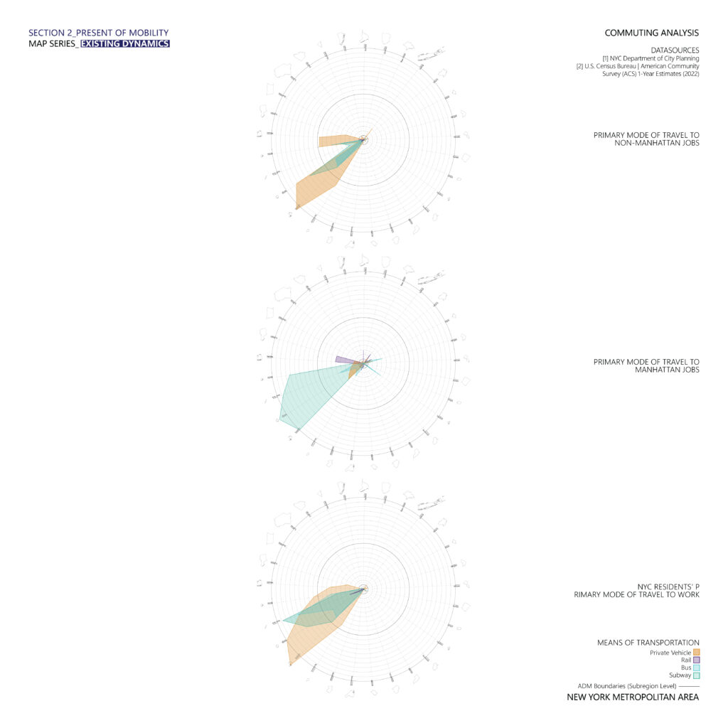
Seeking to understand commuting dynamics based on available data, a radar diagram was generated to analyze the primary mode of transportation at the county level across three cases.
- In the first case, commuting to Manhattan jobs, the vast majority of commuters use public transportation, specifically the subway.
- Conversely, commuting to non-Manhattan jobs, necessitates the use of private vehicles.
- In the last case, involving NYC residents traveling to work, a combination of public and private mobility options exists, showcasing different spatial patterns. Closer to Manhattan, the primary mode is subway, while at a regional level, private vehicle usage predominates.ç
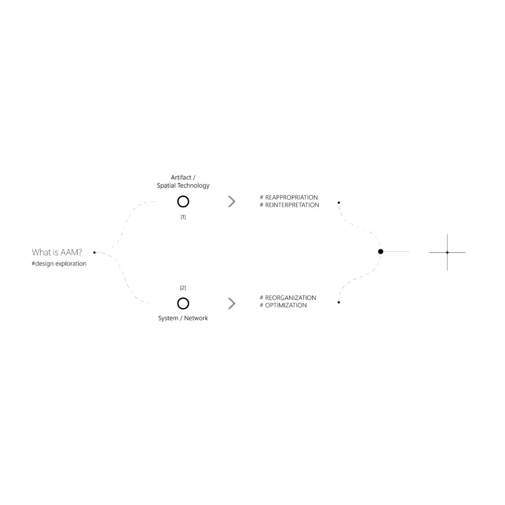
Based on the analysis in VOL II, we are in a position to define a keyword to guide the design exploration for each of the two poles AAM is oscillating between: #reappreciation for the artifact and spatial technology part, and #optimization for the reading of the system/network, imagining a condition that keeps these two extremes alive.
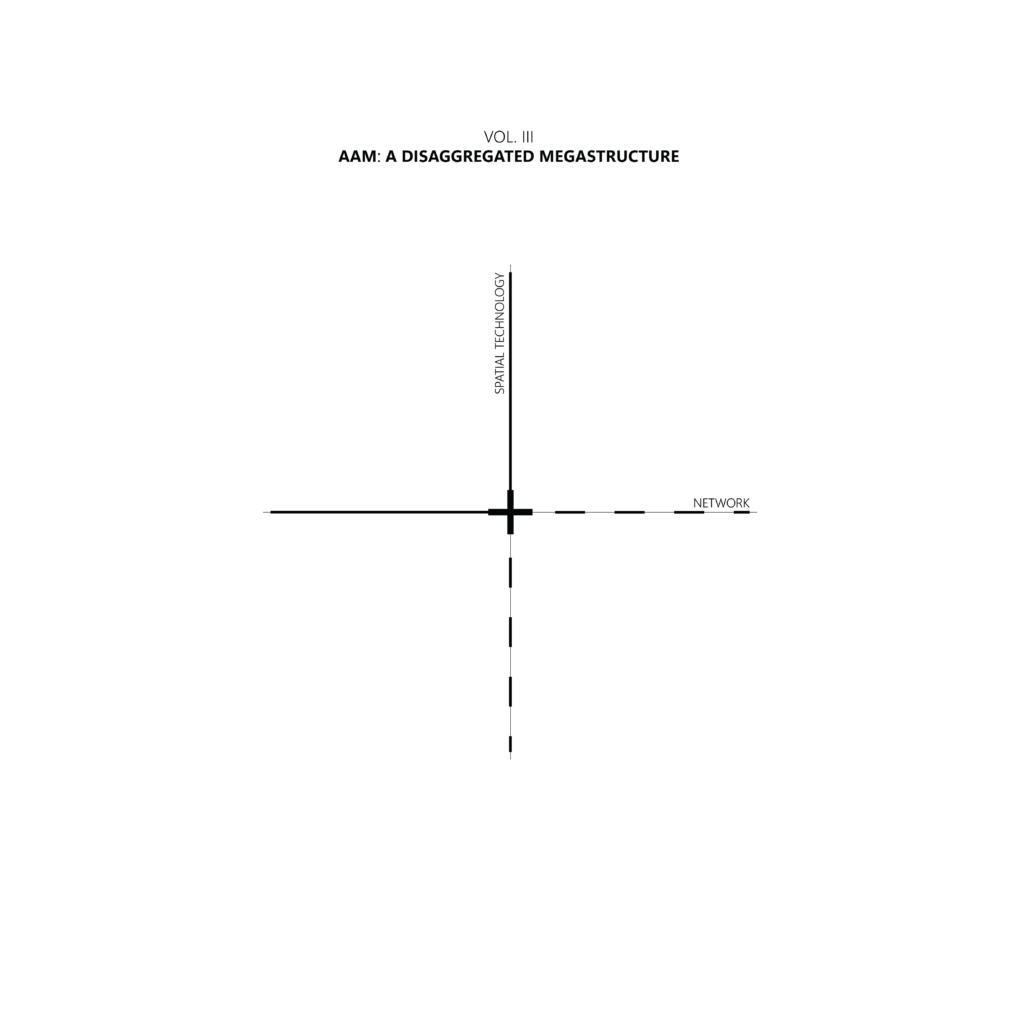
VOL. III – AAM: A DISAGGREGATED MEGASTRUCTURE
In VOL. III – the design exploration part– Advanced Air Mobility is introduced as a disaggregated megastructure, a constellation of distributed technologies operating at multiple spatial and temporal scales, converging not directly in space but as a system through a network.
07. SPATIAL TECHNOLOGY: THE CASE OF VERTIPORT – POLE 1
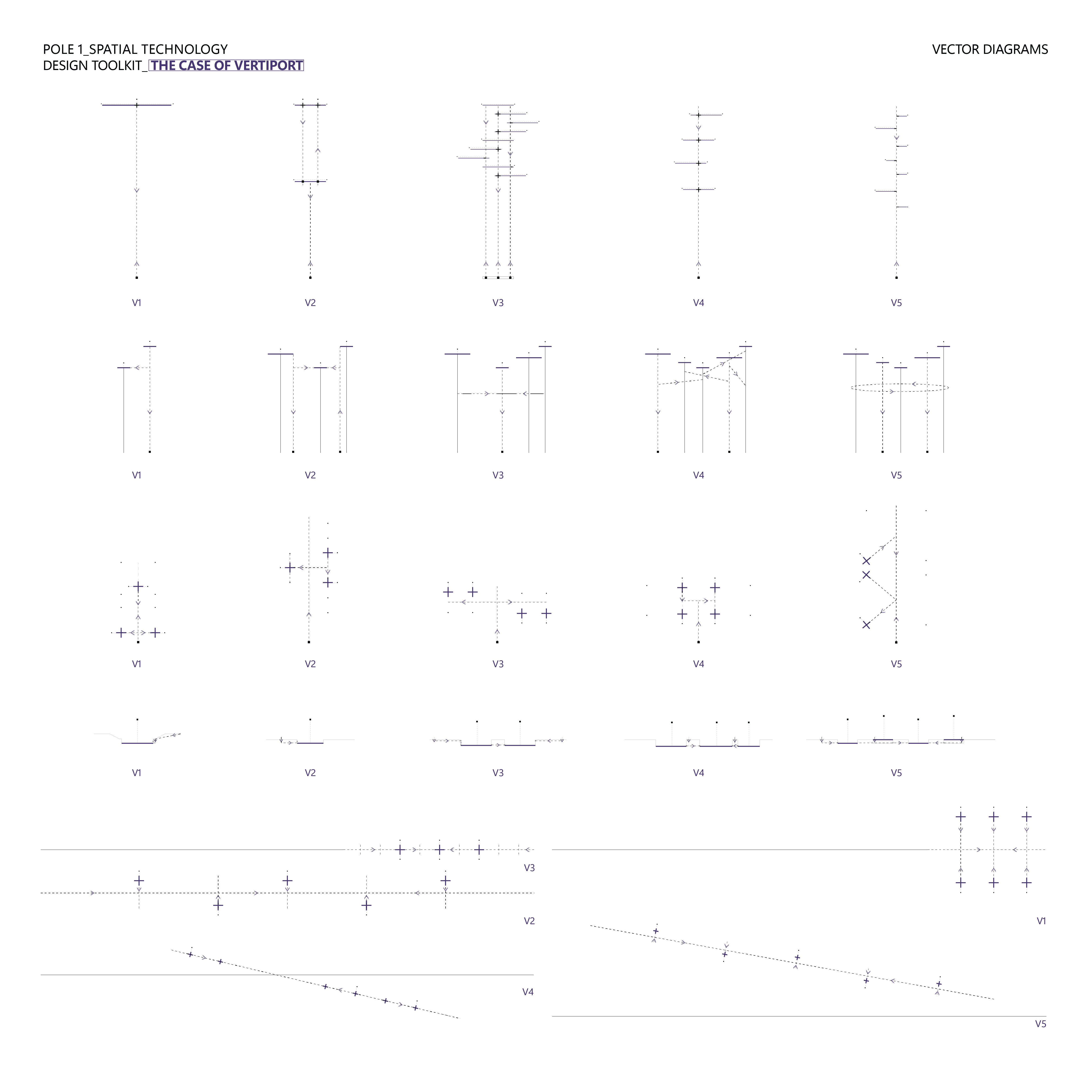
The initial interpretation of AAM focuses on spatial technologies explored through the construction of a design toolkit that opens up the possibilities of Vertiport design. The general category of Vertiport is translated into five main infrastructural typologies : the Verti(cal)(air)port, the Vertinexus, the Aerialport, the Vertisub, and the Aquavert, that are based on the reappropriation of past mobility imaginaries and follow existing guidelines for vertiport design.
The design toolkit provides metadata and typological characteristics for each, aiding in understanding differences such as scale, infrastructure type, and facilities, among others. Additionally, spatial parameters are provided to identify potential locations. These five infrastructures are categorized into urban and regional types. As illustrated in the diagram, the process becomes more challenging as it moves towards the urban scale. Finally, the toolkit specifies generative requirements for each case, including ranges for the size of infrastructural buildings, number and size of landing platforms, connection points, and types. Following these guidelines, five different morphological variations for each case are generated and are visualized through abstract volumetric drawings, vector diagrams of circulation, and AI-generated images.
Verti[cal][air]port
#ascension
The first urban typology, named Vertiport, refers to the super-tall skyscraper that functions as a vertical conduit of movement. It features distinct levels for passenger facilities and zones for the landing, take-off, maintenance, and control of eVTOL aircraft. This typology represents the larger scale of infrastructure (vertihub). Based on the functional possibilities for airside facilities, different morphological variations are generated, providing a vision of 21st-century urban airport.
Verti[port]nexus
#integration
Vertinexus refers to a cluster of ‘pop-up pads’ atop existing skyscrapers, utilizing parasitic surfaces for the landing, takeoff, and parking of eVTOL aircraft. This dispersed infrastructural component is explored through various integration systems possibilities, including skybridges, urban elevators, escalators, or entire systems of aerial circulation.
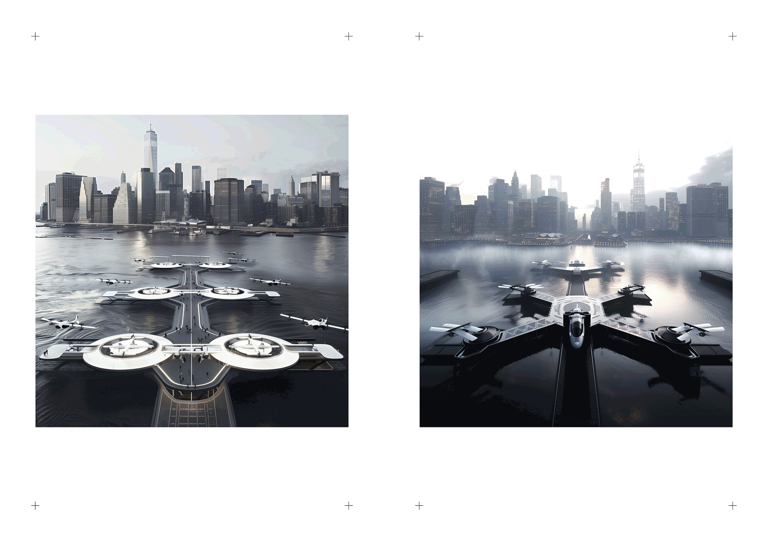
Aquavert
#assemblage
Aquavert is a system of modular floating platforms for airside operations, assembled as prosthetic infrastructure adjacent to existing harbor facilities. The morphological variations depend on the possibilities for structural expansion over time and in response to traffic demand.
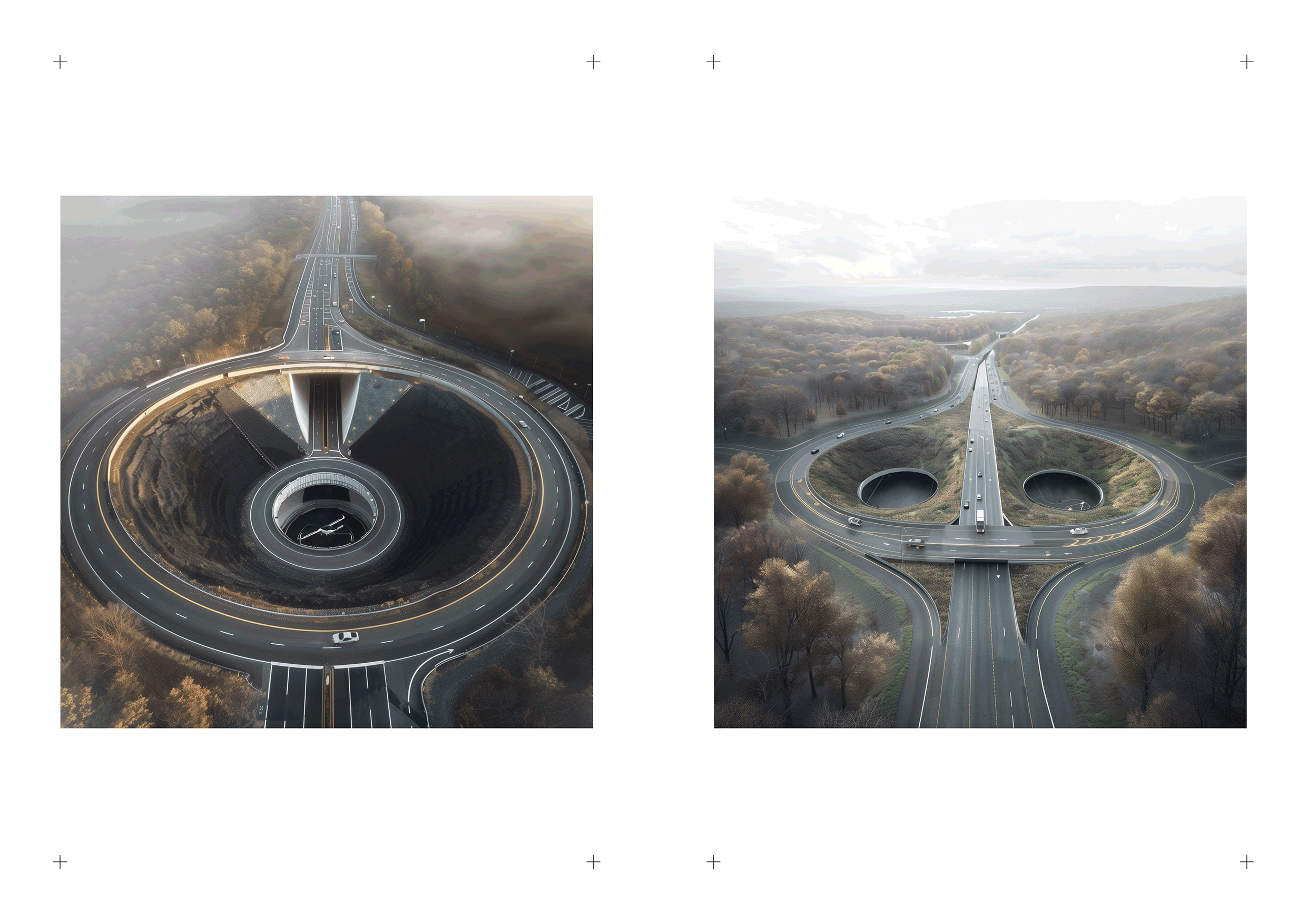
Vertisub[terranean]
#subtraction
The Vertisub typology is introduced as minimal infrastructure insertions in highway cloverleafs, converting residual spaces into transportation nodes with underground facilities for passengers and eVTOL aircraft, topped with an open roof to create a protected, nest-like environment. The morphological variations depend on the morphology of the highway cloverleaf and the underground connection system.
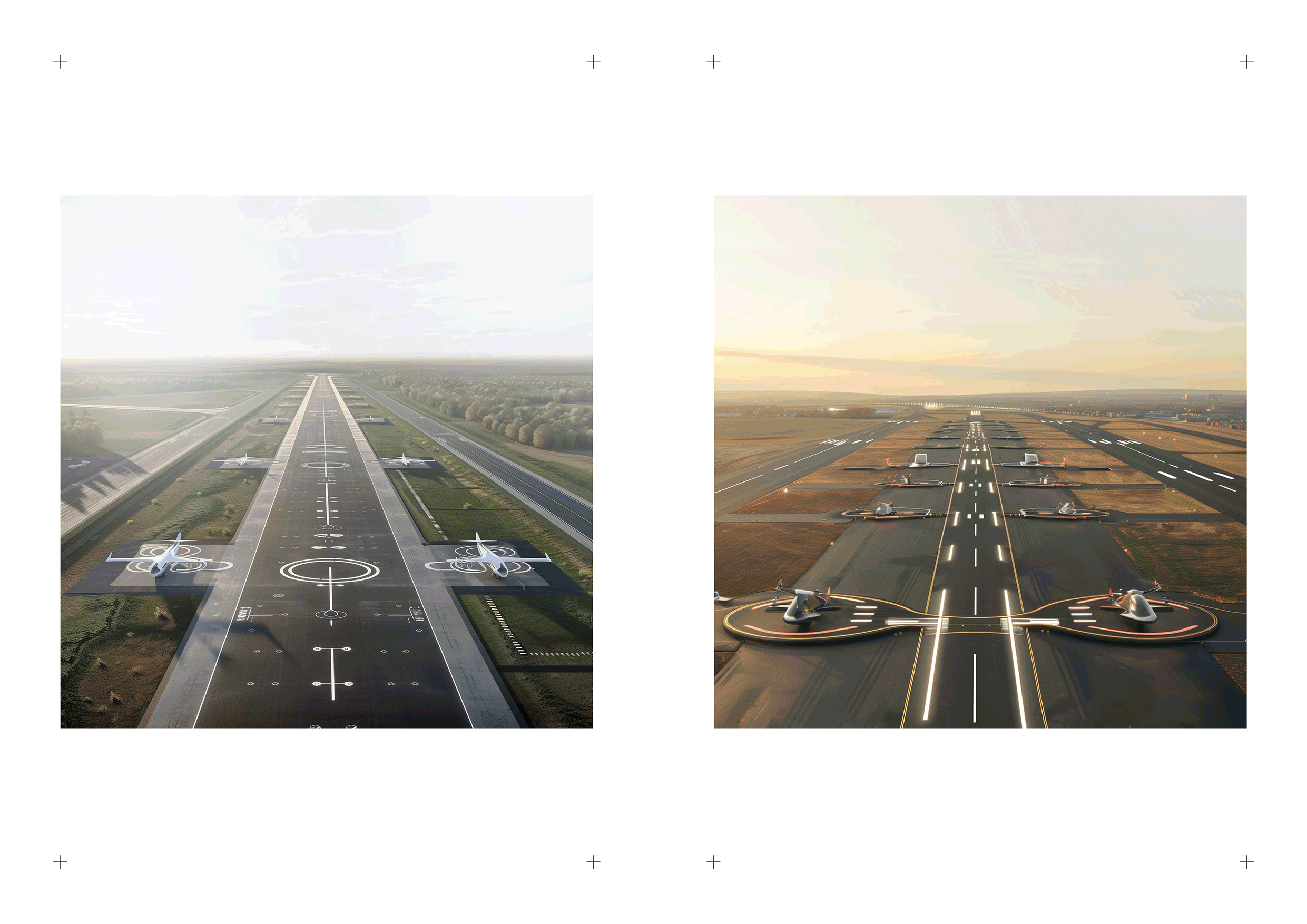
Aerialport
#extension
The last typology is the Aerialport, a hybrid port for eVTOL and eCTOL aircraft that leverages the operational synergy between both. It presents the potential to revitalize underutilized regional airports by integrating prosthetic components into the airside facilities, envisioning a future runway designed to accommodate a variety of aircraft.
When considered together, the circulation system in each case is analyzed through plan or section vector drawings, emphasizing the principle that, in these infrastructural buildings, form follows function.
08. THE NEW AERIAL TECHNO-SYSTEM – POLE 2
The second extreme of the AAM concept, the systemic approach, presents a computational design methodology for optimizing AAM networks. It is grounded in a technical literature review, defines the challenge of building a well-distributed ground infrastructure for eVTOL operations as the design problem, and concludes with the optimization process.
The proposed methodology adds value to the existing bibliography by addressing the importance of integrating AAM into the existing public transportation network.
The methodology can be divided into 5 main steps:
- Identification of constant variables.
- Selection of new infrastructure locations.
- Definition of the AAM network topology.
- Generation of the new public transportation network.
- Multi-objective optimization.
The process starts with the identification of candidate locations through geospatial analysis, and prioritizes them based on their accessibility via public transport. This step informs the selection of several locations from predefined ranges, either individually or as part of a holistic network. In the network topology phase, connections between new nodes are defined to achieve a hub-and-spoke structure, while also maintaining a point-to-point connection system on an urban scale. If air operations are not feasible due to the close proximity of selected pairs of locations, the process returns to the selection phase. Based on this, the first objective is defined as achieving a hierarchy in terms of the importance of the AAM nodes.
The second objective aims to decentralize the new public transportation system. Initially, this involves abstracting the existing public transportation by identifying major hubs and reconfiguring their network. Following a similar approach, the AAM network is abstracted and integrated into the existing system, forming new connections between nodes based on proximity.
Finally, the methodology addresses the geospatial dimension of travel demand by identifying origin-destination clusters for commuting. The goal is to enhance connectivity between these clusters and achieve holistic area integration, which defines the last two objectives.
Wallacei X, a multi-objective optimization engine in Grasshopper 3d , was selected for its capability to handle conflicting objectives (such as the 1st and 2nd) and leverage complementary ones (like the 3rd and 4th), while also effectively filtering and selecting the most optimal results. Based on this capability, we evaluated 9 configurations according to their performance relative to the 4 objectives. These configurations are aligned with various visions for the NY Metropolitan area.
[C] CONCLUSIONS
09. AAM COMPENDIUM
This is the overall ecology of materials explored through the three volumes and eight documents in this thesis, allowing us to finally arrive at a provisional yet systematic definition of the AAM concept.
AAM is woven from a constellation of concepts belonging to the multidimensional, expansive, and increasingly volumetric spatial domain of urban verticality. It is filled with a spectrum of artifacts, its materialization intersecting with the emergence of eVTOL aircraft. In this thesis, AAM focuses exclusively on human mobility. However, this consideration does not exclude the problematic aspects of non-human agents. The concept is envisioned through urban sci-fi, where the skies teem with flying cars. While today it forms one of the complex technologies, hence questions around (geo)politics, power, and capitalism are part of this problematic, although the thesis looks at the AAM question from a different angle. In the context of NY, AAM is configured by certain histories, with their future scenario evolving into the emerging typology of vertiports, being envisioned as part of the multimodal public transportation system in megacities. And finally -conceptually speaking-, AAM redefines the 20th-century notion of megastructure, being introduced as an array of different infrastructural components that converge as a system through a network, thereby forming a disaggregated megastructure.