

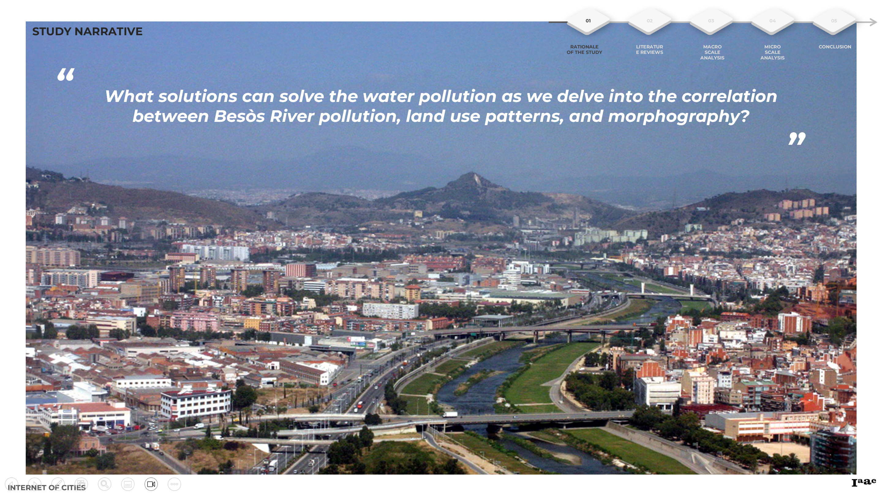
The Besòs River, an integral water source for Barcelona, encapsulates a narrative marked by both significance and environmental challenges. Since the 1970s, its crucial role has been overshadowed by persistent contamination, exacerbated by the rapid urban and industrial developments along its course.
This study delves into the intricate correlation between Besòs River pollution, evolving land use patterns, and the distinctive morphography that defines its trajectory. Through a methodical exploration of the Rationale of the Study, Literature Reviews, and Macro to Micro Scale Analyses, our aim is to unravel the complex interplay of factors influencing the river’s health.
1. RATIONALE OF THE STUDY
Barcelona heavily relies on limited surface water sources, and the Besòs River plays a crucial role in supplying water to the city and supporting its natural ecosystems. However, since the 1970s, Besòs has been recognized as one of the most contaminated rivers in European countries. Despite various improvement efforts, persistent contamination, especially in urban and industrial areas, raises the question: How can we address water pollution by understanding the correlation between Besòs River pollution, land use patterns, and morphography?
2. LITERATURE REVIEWS
The literature review is a compass navigating through three crucial realms: understanding the correlation between land use and water quality, delving into detailed studies on Besòs River, and exploring nature-based solutions for water pollution. By tracing the historical trajectory of pollution patterns, the study establishes a robust foundation for devising comprehensive strategies to tackle the multifaceted challenges posed by Besòs River.

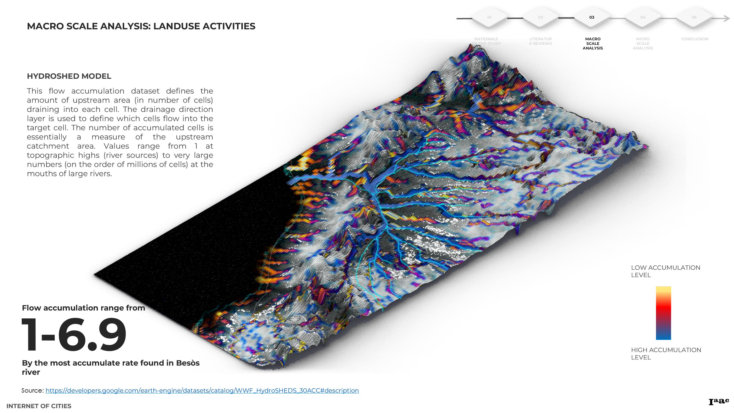
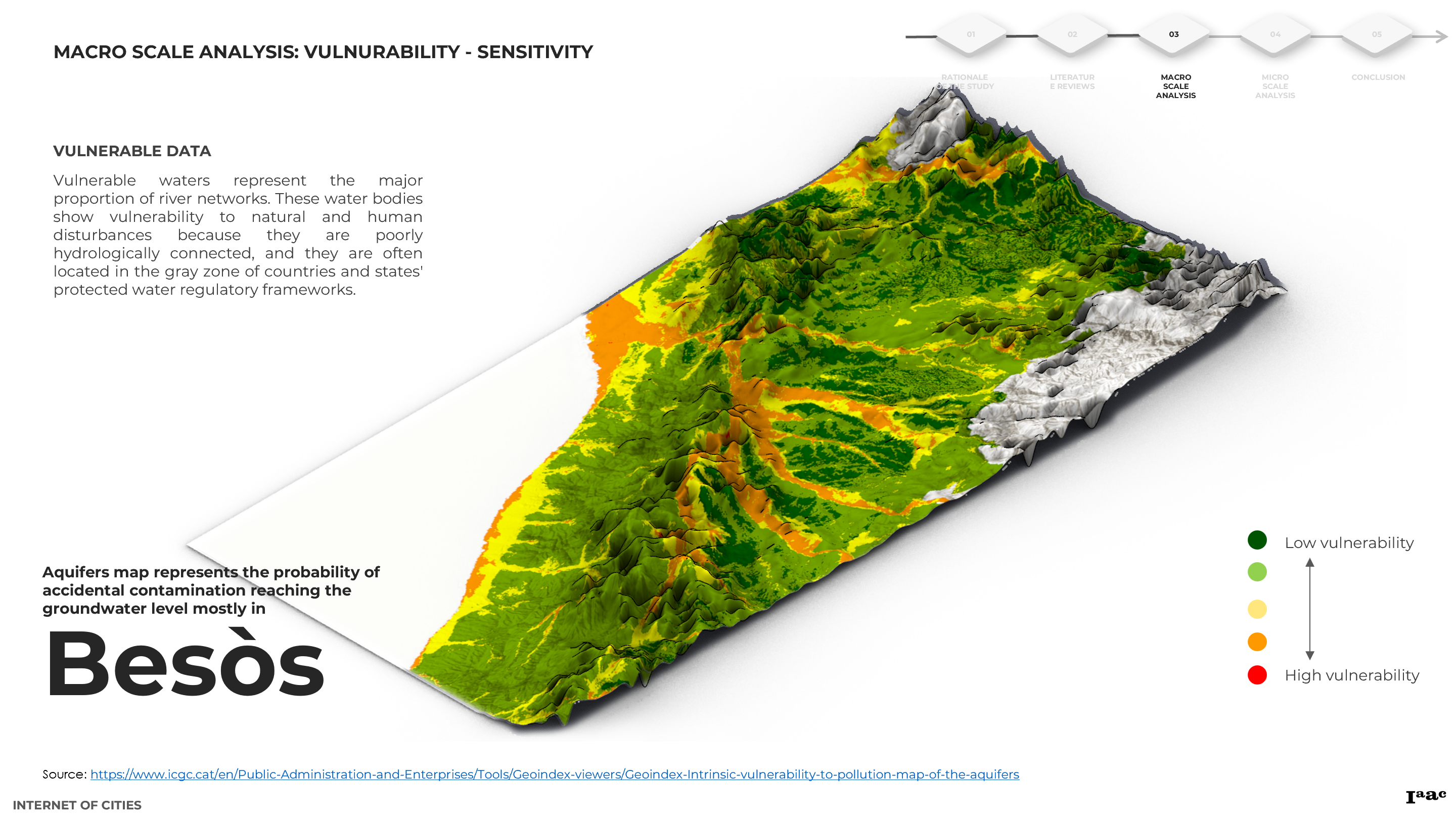
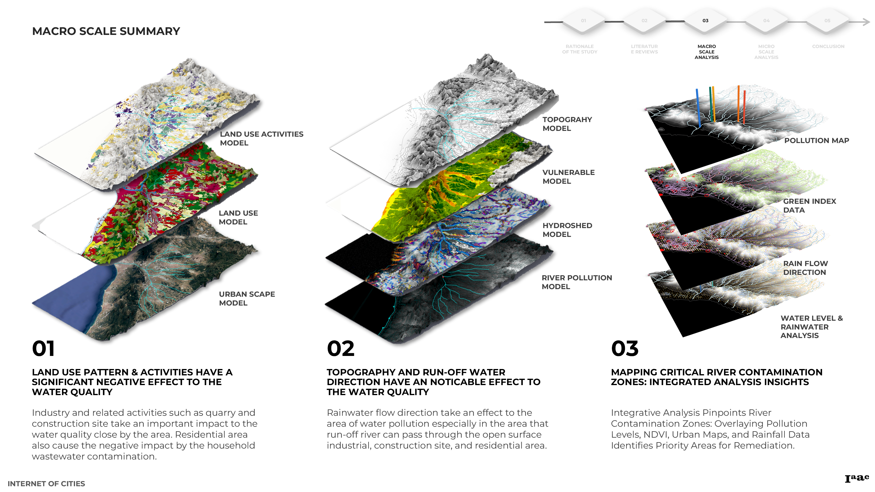
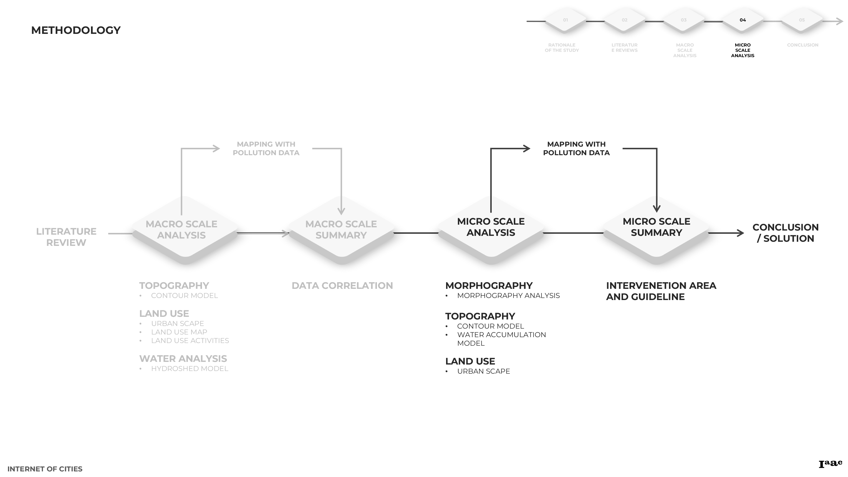
3. MACRO SCALE ANALYSIS
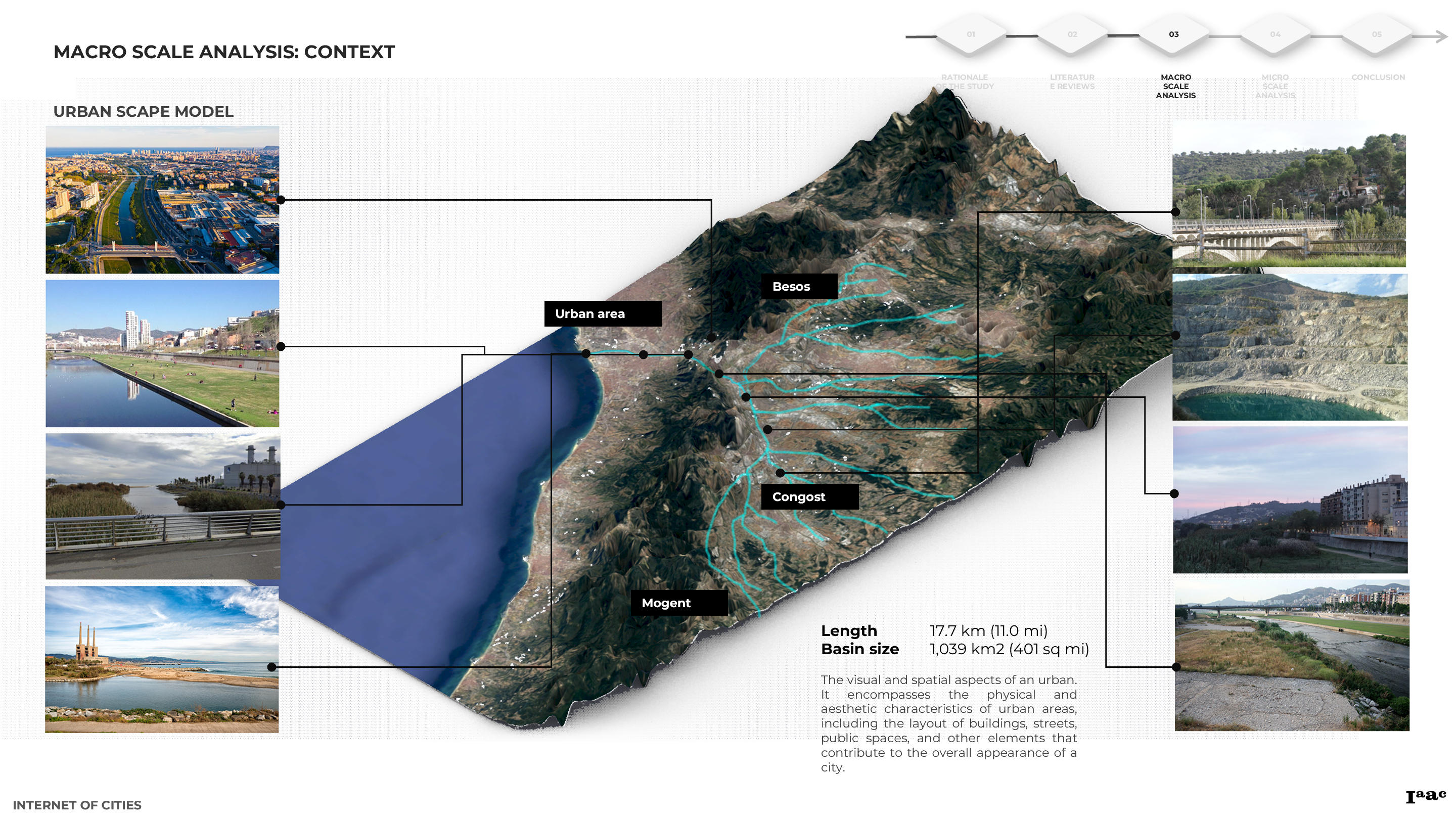
Embarking on a macro scale analysis, the study scrutinizes various factors influencing water quality. This includes a nuanced examination of land use patterns, topography, morphography, historical developments, hydroshed models, and factors like rainwater analyses.

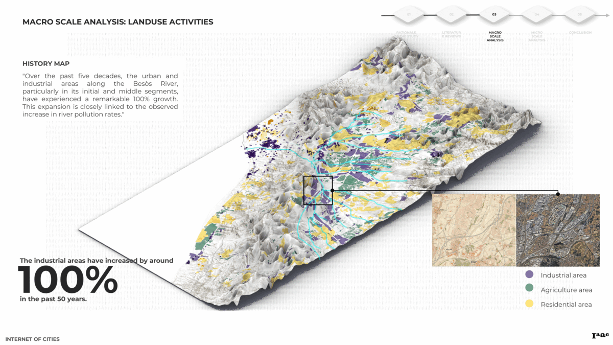
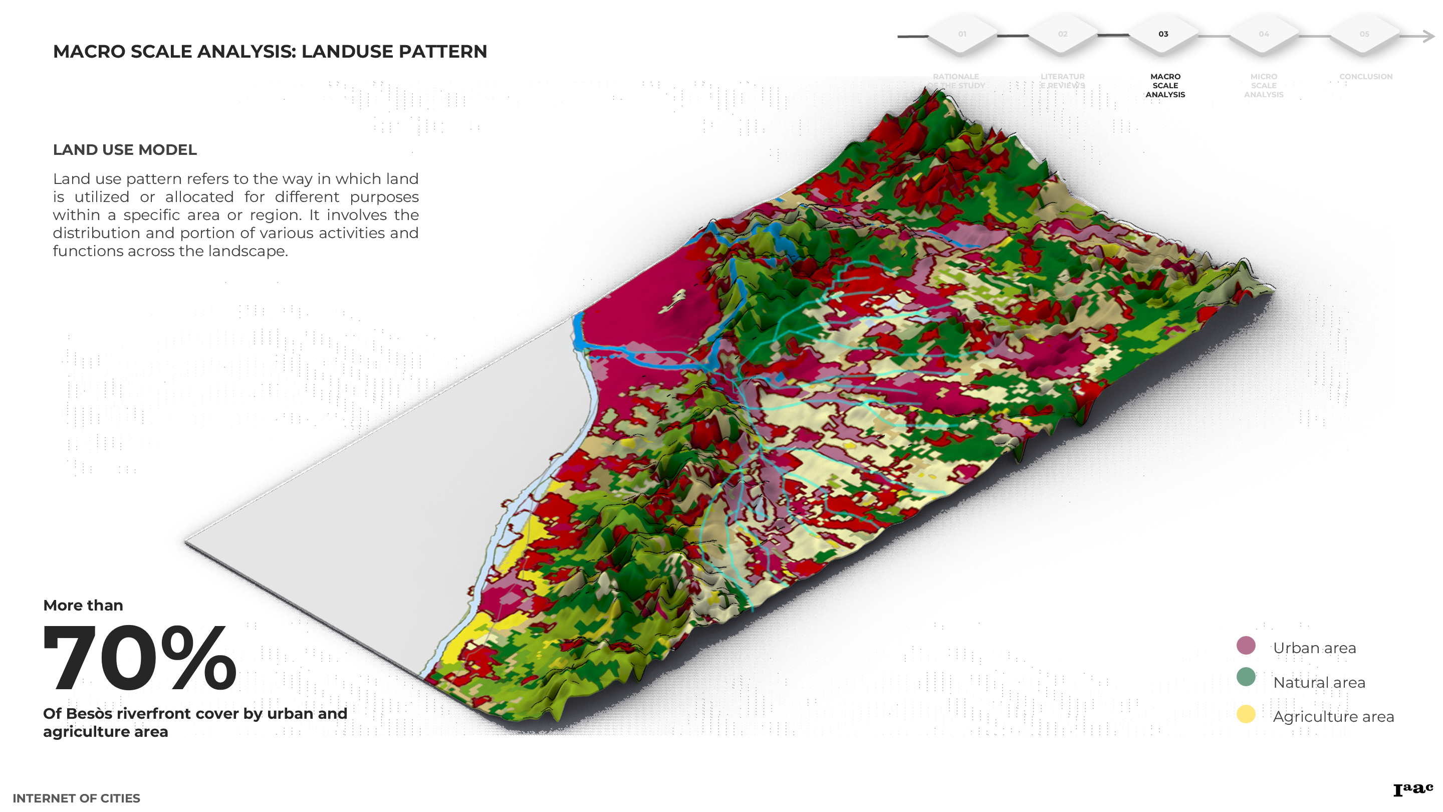
Imagine a dynamic map overlaying land use activities with vulnerable and pollution indices, providing a visual narrative of the correlation between the rise of urban and industrial areas and their discernible impact on water quality. Simultaneously, this holistic approach illuminates the positive roles played by public and natural spaces in mitigating pollution effects.
Through a meticulous analysis, a correlation table was constructed, examining the intricate interplay between land use patterns, topography, and pollution data along Besòs River. This empirical investigation sought to unveil nuanced insights into the relationship dynamics, particularly focusing on the impact of burgeoning urban and industrial areas on water quality. The objective was to discern how these anthropogenic expansions contribute to adverse effects on water quality. Concurrently, the study aimed to elucidate the mitigating role played by public spaces and natural environments, presenting a positive influence amid the prevailing challenges.
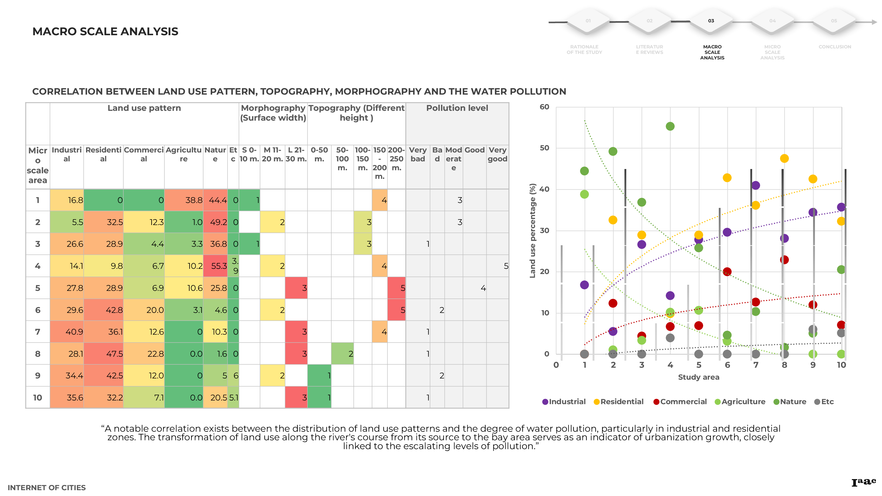
The process involved methodically organizing and scrutinizing data sets related to land use patterns, topographical features, and pollution indices. By employing statistical analyses and mapping techniques, the correlation table sought to distill meaningful patterns and associations within the dataset. The emphasis was placed on discerning patterns that could shed light on the adverse effects of urban and industrial proliferation on water quality, juxtaposed against the ameliorative impact attributed to public spaces and natural expanses.
4. MICRO SCALE ANALYSIS
Zooming in on a micro scale, the analysis narrows down to specific areas along Besòs River, akin to using a microscope to uncover hidden details. Consider visualizing river sections, each with unique morphographic characteristics, from natural to manmade. By mapping building settlements, land use activities, and employing satellite imagery, potential zones for design interventions emerge like undiscovered canvases awaiting artistic transformations. This micro-scale analysis lays the groundwork for establishing comprehensive design guidelines, envisioning bespoke solutions for each specific area.
Examining Besòs River’s morphography reveals varied sections, each with distinct surface water, basin features, and dimensions. Some areas showcase natural attributes, while others display human-made alterations impacting water flow and pollution accumulation. This analysis employs geomorphological principles to contribute insights into riverine ecosystems’ vulnerability to anthropogenic influences.

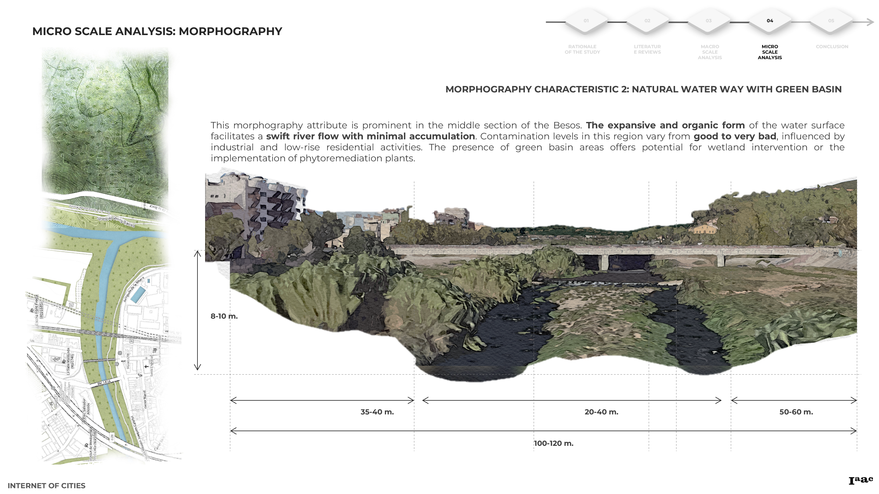
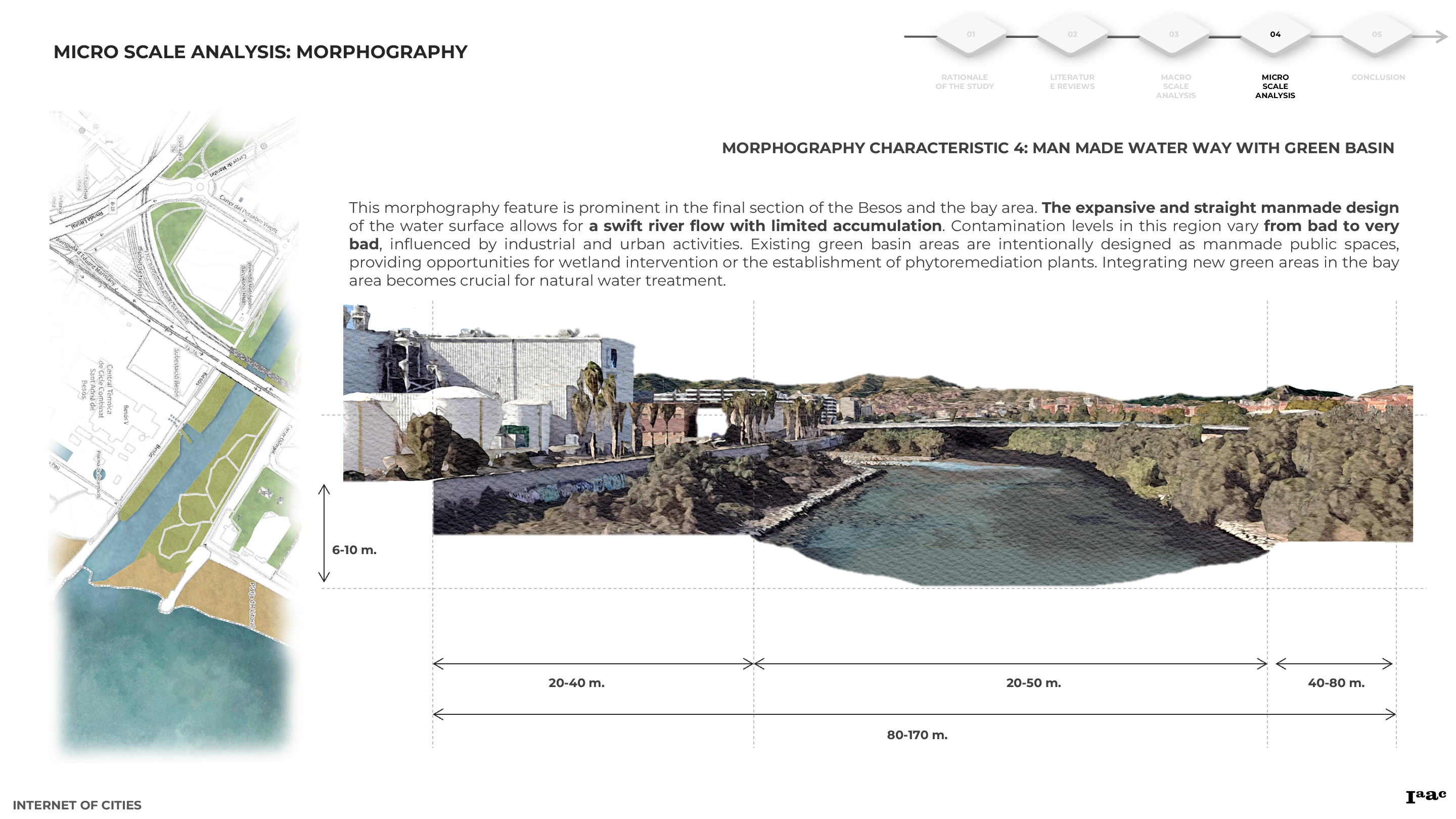
A comprehensive analysis of topography and land use along the Besòs River involves segmenting the area into three distinct zones: the origin part, central part, and bay area. Each zone exhibits unique characteristics. Employing geospatial modeling, we examine topographical features, building settlements, and land use activities. Integration with satellite imagery facilitates the identification of accumulation zones. This examination seeks to determine the actual spatial conditions depicted in satellite imagery and explores opportunities for intervention or enhancement to establish areas dedicated to water treatment before discharge into the Besòs River.
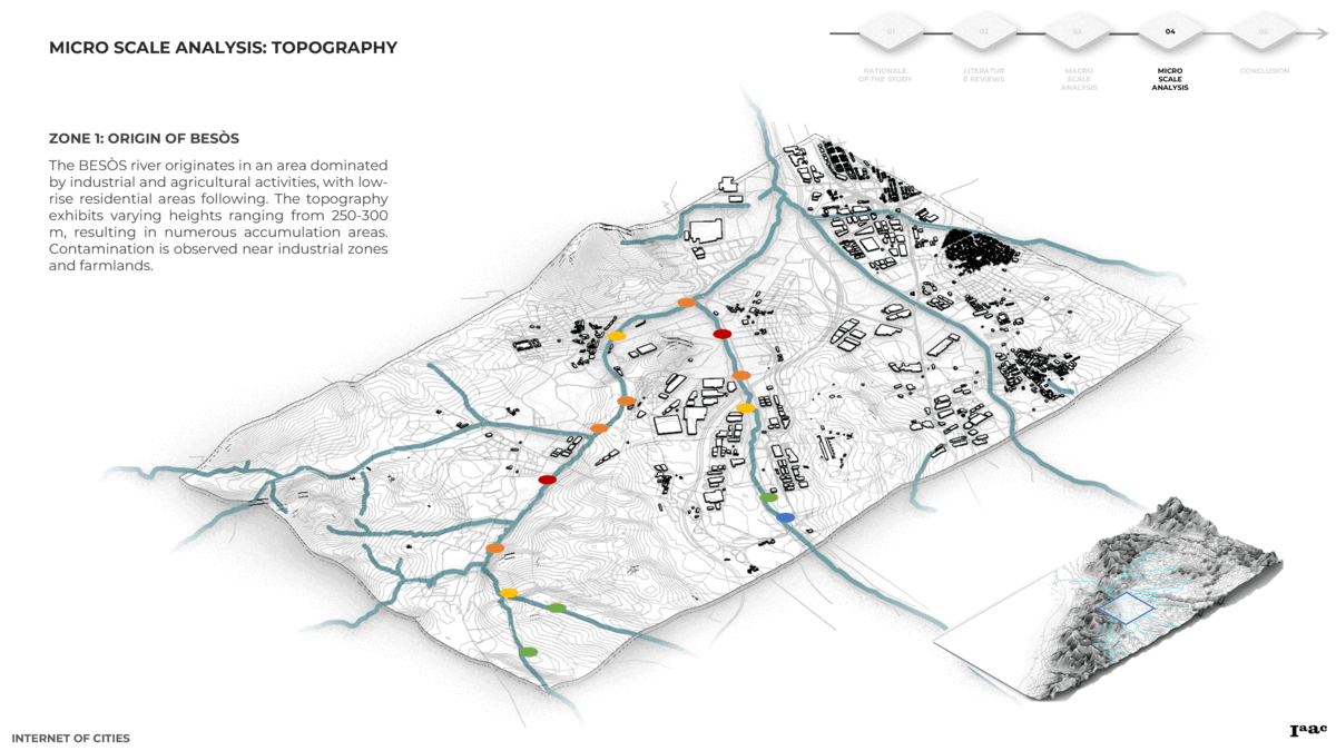

As an example of zone 1, picture a stretch of the river characterized by natural morphology. Here, porous paving in gardens, bioswales, and strategically placed basin areas create a picturesque landscape that not only enhances the aesthetic appeal but also serves as a functional ecosystem to treat water effectively.
The synthesis of findings underscores the imperative of urban space and activity redesign as a fundamental measure for efficacious pollution resolution. Additionally, a critical aspect emerges concerning the indispensable role of basin area redesign in contributing to the overarching solution of mitigating environmental challenges. This recognition highlights the vital importance of strategically reconfiguring both urban spaces and basin areas, signifying not only a resolution to extant pollution issues but also a proactive approach to addressing environmental concerns at their source.
5. CONCLUSION
At the micro scale, the study proposes an integration of nature-based solutions, especially emphasizing the efficacy of phytoremediation techniques. Envision implementing these techniques at the very micro scale in urban areas, akin to an artist delicately crafting a masterpiece.
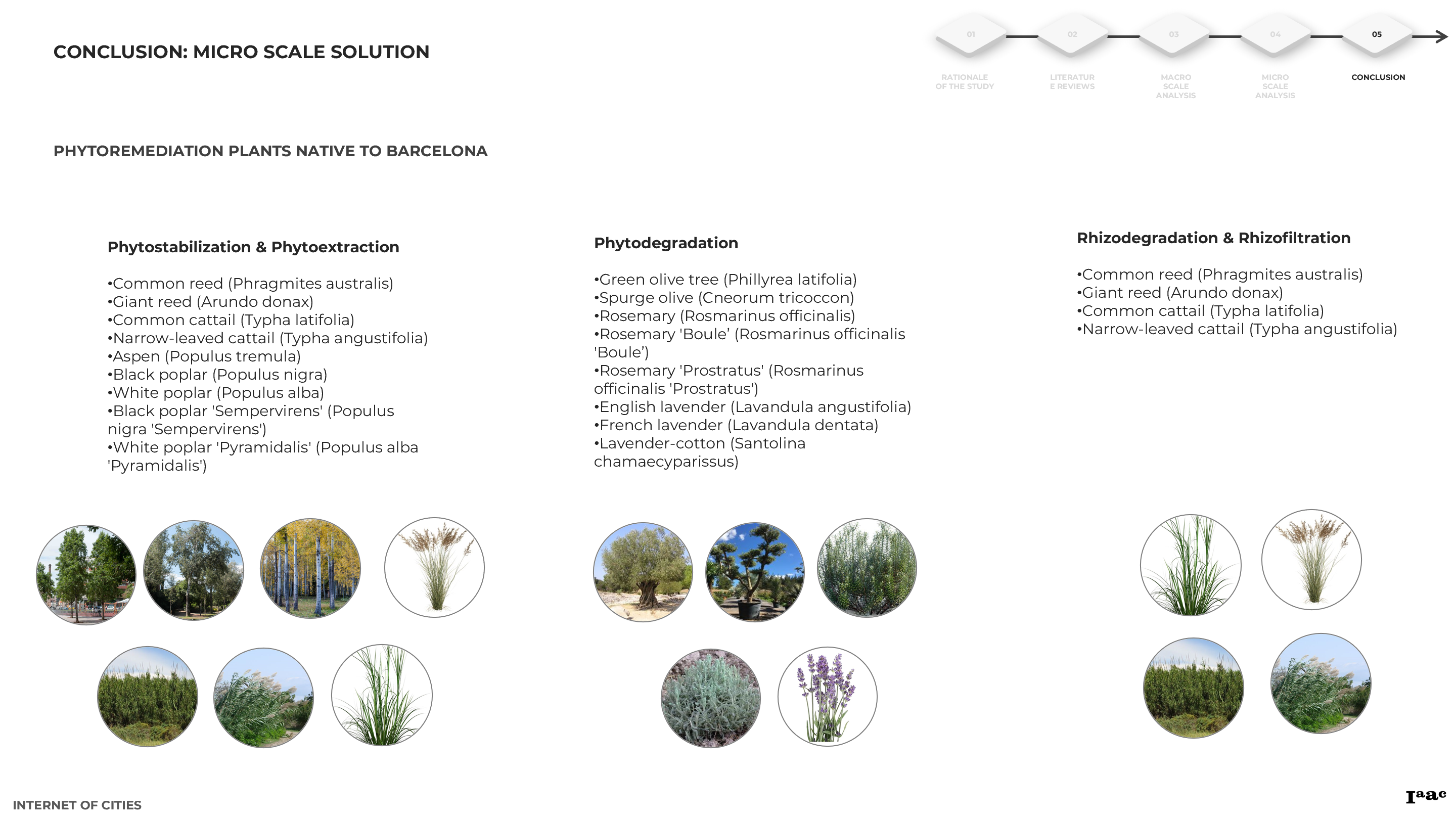
Picture porous paving in gardens, bioswales seamlessly integrated into streetscapes, and basin areas resembling natural artworks. This technique extends to mountainous areas, where innovative designs could harness the power of nature to revive the river.
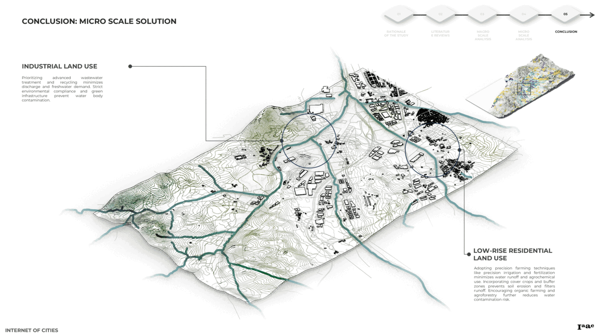
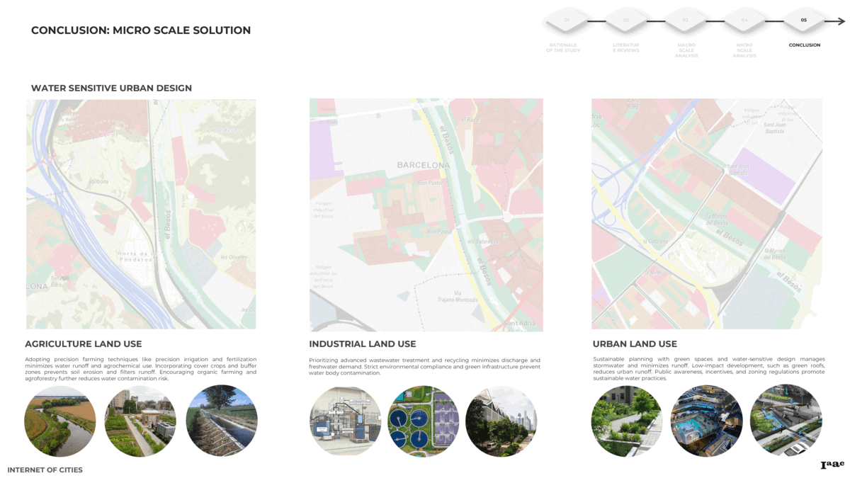
In the middle zone, encompassing industrial and agricultural areas, envision wastewater treatment plants seamlessly blending with wetlands and phytoremediation zones, akin to an orchestrated symphony of technological and natural elements working in harmony to treat water contaminated by industrial processes and agricultural fertilization.
In urban areas, characterized by dense populations and complex structures, envision redesigning basin areas into contours and wetlands, reducing the speed of polluted runoff. Picture urban landscapes transformed with porous pavings and bioswales, turning hardscapes into vibrant, water-retaining public spaces. Beachfront areas could undergo a metamorphosis, transitioning into softscapes that absorb water before it reaches the ocean.
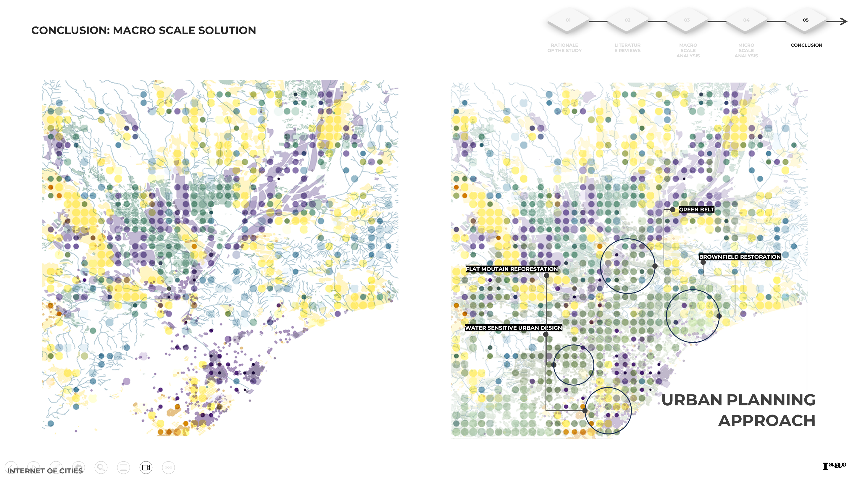
At the macro scale, envision urban planning transforming vacant or non-useable urban areas into green havens, reminiscent of an expansive canvas painted with lush green strokes. Imagine reforesting natural areas, creating blue and green infrastructures, and establishing green corridors as protective shields against pollution.
On the policy front, envision stringent regulations and management systems, much like the artist’s precision in creating intricate details. Picture a regulatory canvas where the rights of water and biodiversity are protected, and technological innovations such as DEWATS, advanced oxidation processes, and wastewater credit systems are seamlessly integrated.
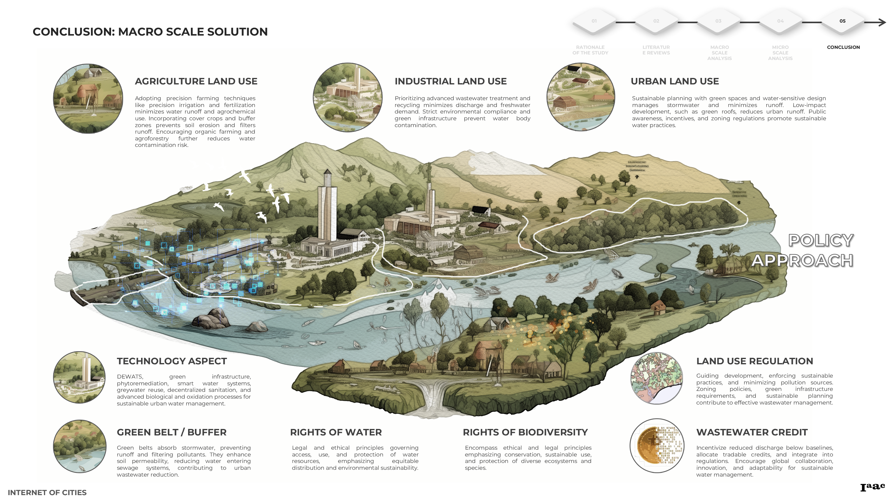
In conclusion, this comprehensive project envisions creating space for the city to improve existing conditions through nature-based solutions and green strategies. By employing a variety of tools—from strategically placing phytoremediation plants in wetlands, basin areas, and green corridors to applying different techniques in industrial, agricultural, and urban zones—this initiative aspires to revive the Besòs River. The overarching goal is to transform it into a zero-waste water river, ensuring a sustainable future for generations to come and preserving the natural integrity of the ecosystem, much like an evolving masterpiece that stands the test of time.
