
Santa Coloma de Gramenet, located to the north of Barcelona, is bordered by the Besòs River on the west and the Marina Mountain Range on the north. The city’s terrain features an irregular relief that rises to 303 meters at Mount Castellar, its highest point, a topographical character also visible within Parc dels Pins.
The selected site lies in District 5, within the Raval neighbourhood, an area known for its dense urban fabric and multicultural community. As part of a municipal initiative, our class was invited to develop design concepts for the Park. Through visits to the Centre Cívic Els Pins, we gained deeper insights into the neighbourhood’s social and cultural fabric.
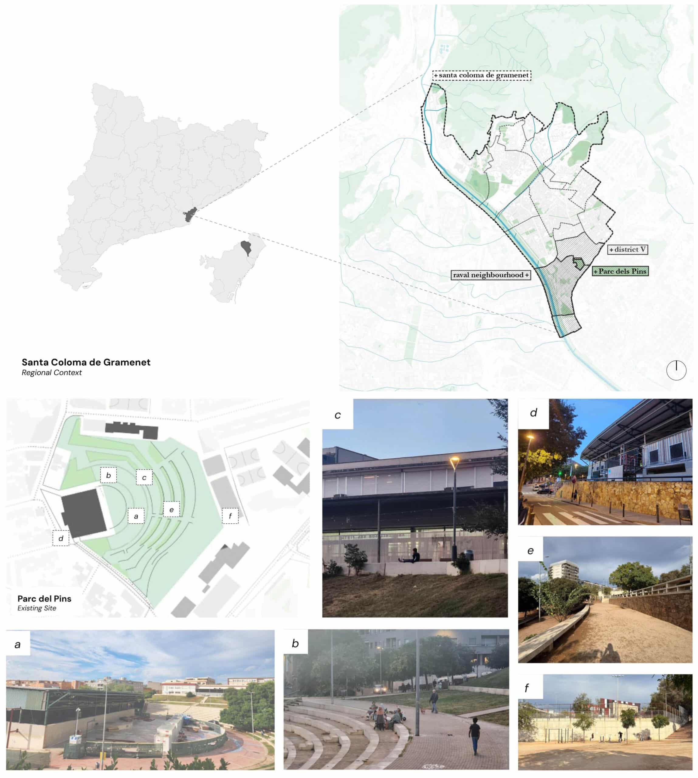
About the site context
a) Top View of the central area and steps with the Pavelló del Raval in the background
b) A group of woman sitting on the top of the steps watching their kids play, a man walking his dog and a boy casually walking.
c) The backyard of the community center
d) The entrance of the Pavelló del Raval
e) Picture of one of the higher level platforms
f) School backyard and basketball courts
Site Analysis
Following interviews with municipal leaders that provided valuable context and qualitative insights, we conducted a quantitative analysis using local and national census data. This analysis led us to out focus demographic group.
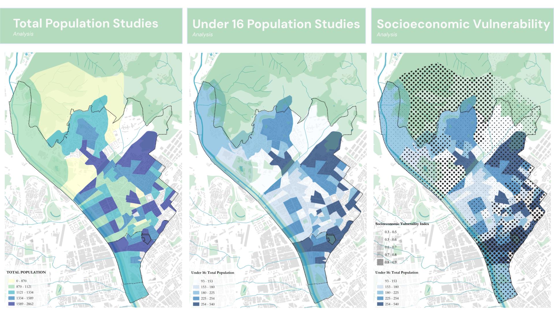
Stakeholders emphasized the area’s large population of children, noting that the park borders four schools serving students from kindergarten through secondary levels. Building on this observation, we analyzed population data to understand the distribution of residents under 16, alongside the local socioeconomic vulnerability index. Our findings matched that of the stakeholders commentary, there was a very large youth population that likely came from homes that could be considered socioeconomically “vulnerable.”
________In Raval, there are about 81 elderly people (65+) for every 100 children under 16, amongst the lowest in Santa Coloma, Whereas in Can Calvet, there are 253 elderly people for every 100 children under 16________
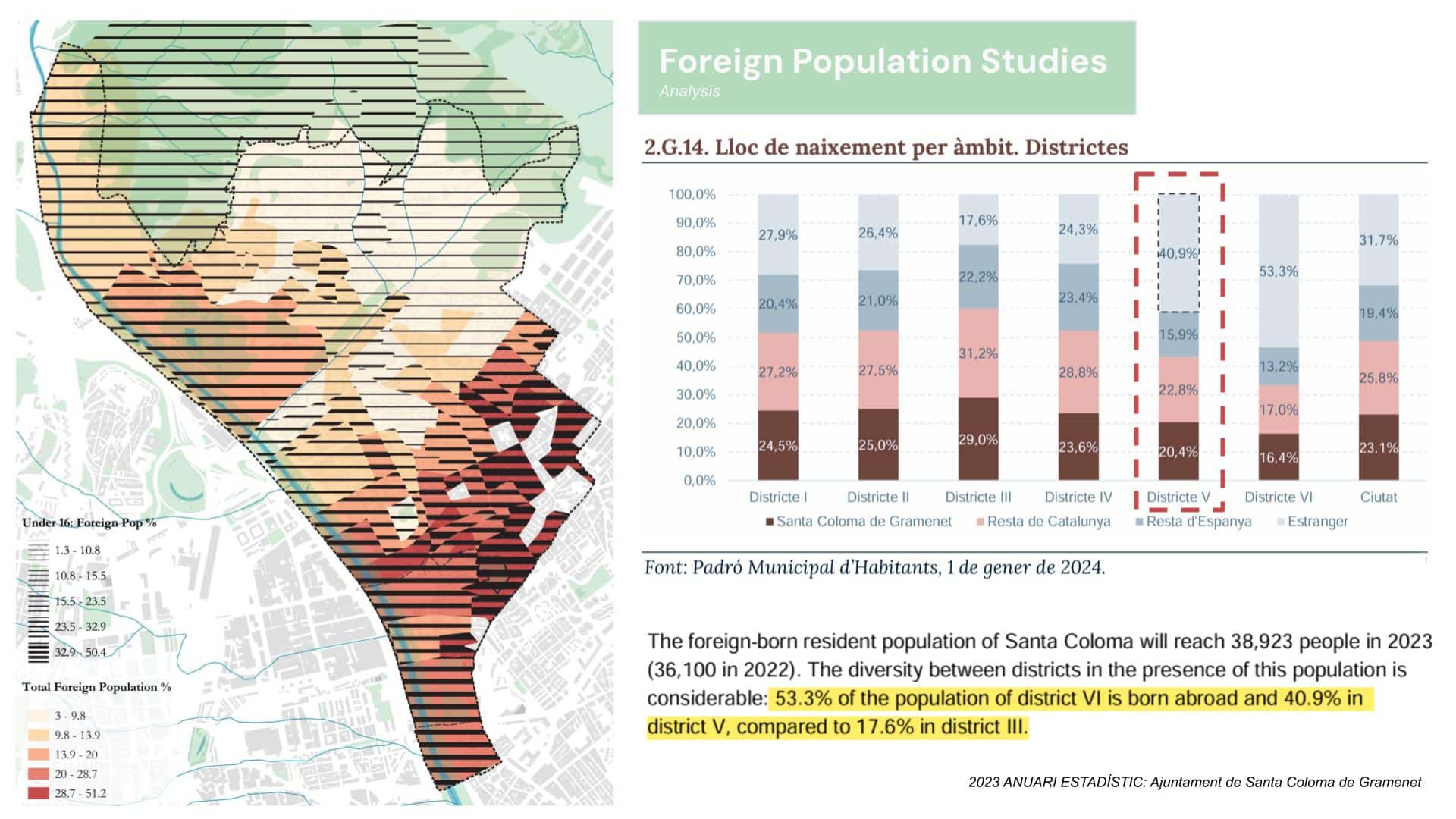
Our neighbourhood has one of the highest proportions of foreign residents. The population under 16 is also notably large, highlighting a strong youth presence shaped by diverse ethnicities, cultures, and complex social backgrounds.
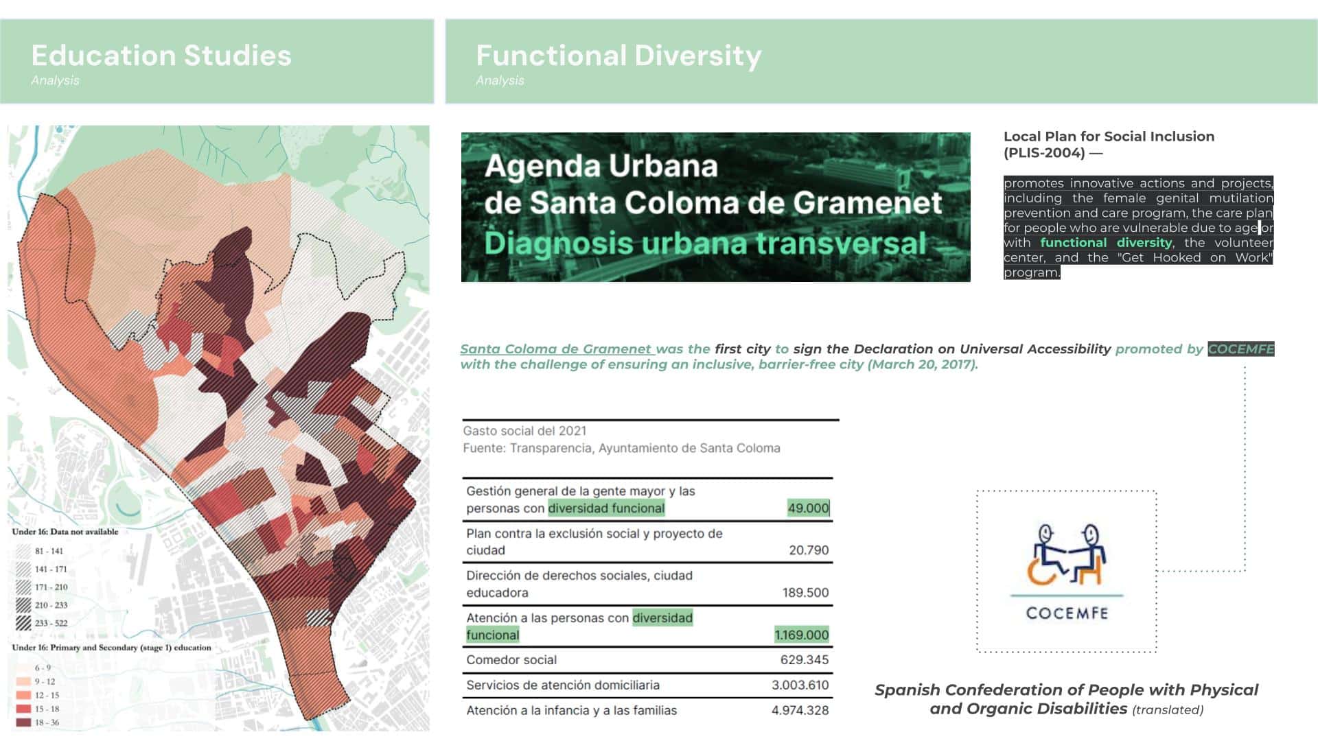
The Urban Agenda of Santa Coloma de Gramenet highlights the Local Plan for Social Inclusion, which promotes initiatives aimed at supporting vulnerable groups, including people with functional diversity. For our project, this community became one of the central aim to our design focus—both to foster inclusivity within the park and to align with the municipality’s ongoing efforts toward social equity and accessibility.
Site Map
Built in the mid-1980s, Parc del Pins is surrounded by many child-oriented facilities, including schools, playgrounds, and libraries. The park spans steep terrain, resulting in a distinct, terraced landscape formed by multiple levels accommodating the slope. However, its design reflects the era of its construction—numerous staircases but limited accessibility features such as ramps, railings, or intuitive wayfinding. With seven entrances located at different elevations, the park’s internal pathways also serve as convenient shortcuts connecting surrounding neighborhoods.
Urban Design Strategies
Circulation Study – Connecting Spaces – Overlapping Paths – Central Node
At each of the seven entrances, we observed that there was little signage or infrastructure indicating or enticing visitors into the park. We then studied the circulation from these entry points and how users can cross over the pathways to reach the surrounding areas. We identified that there is a design opportunity to expand the plazas beyond the boundaries of the park into the surrounding intersections to draw users in, and as they follow their paths through the park, a central node of connectivity naturally emerges.
Proposed Zoning Plan
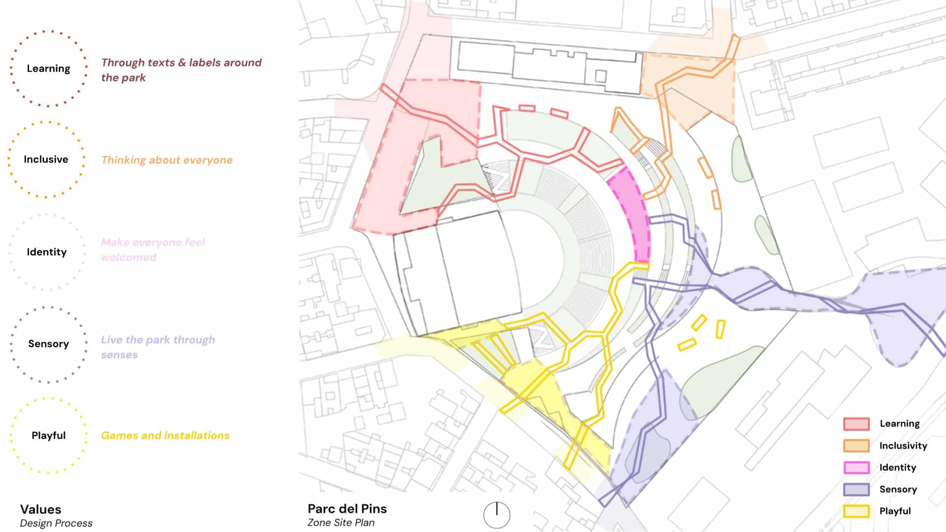
Zone Programming and Interventions
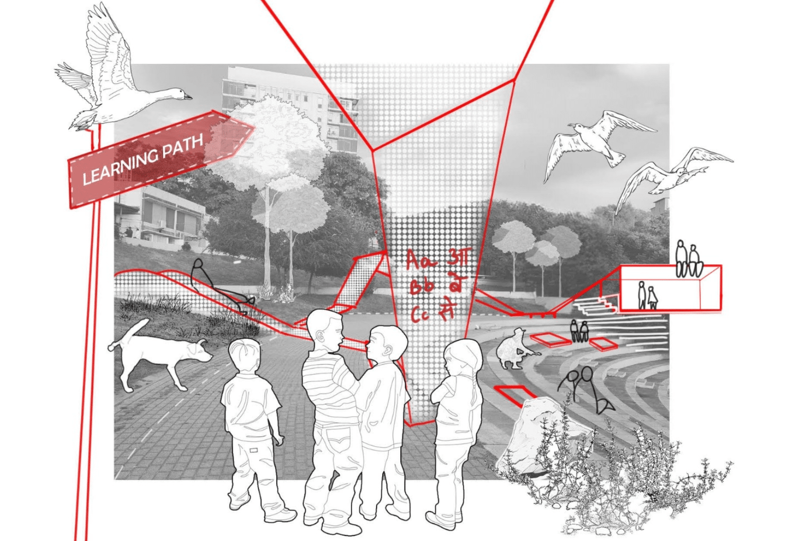
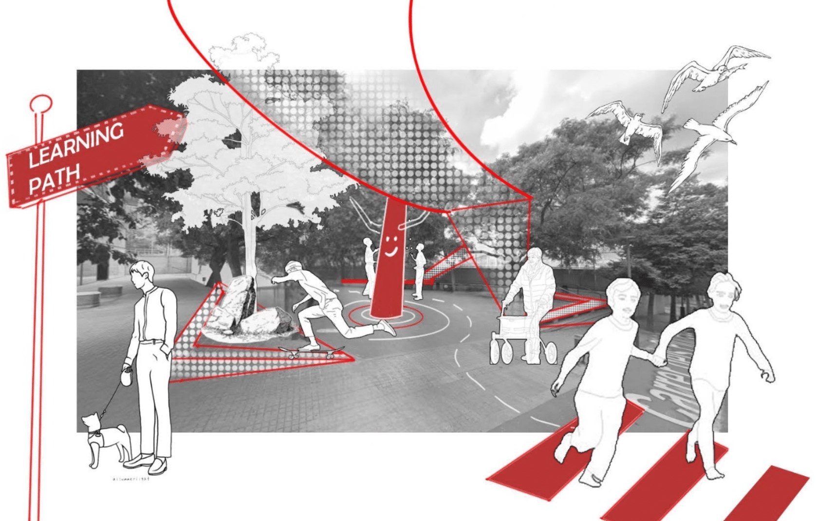
Visual Representation
Our design proposes a continuous “ribbon” that weaves through Parc del Pins, representing key community values—each expressed through a distinct color that guides users along their journey. As it moves through the park, the ribbon transforms, taking on different forms such as shading structures, seating elements, planter retaining walls, or wayfinding crosswalks. Importantly, the ribbon extends beyond the park’s boundaries into adjacent streets and intersections through smaller visual interventions, symbolizing that this community space transcends its physical limits and connects to the broader neighborhood.
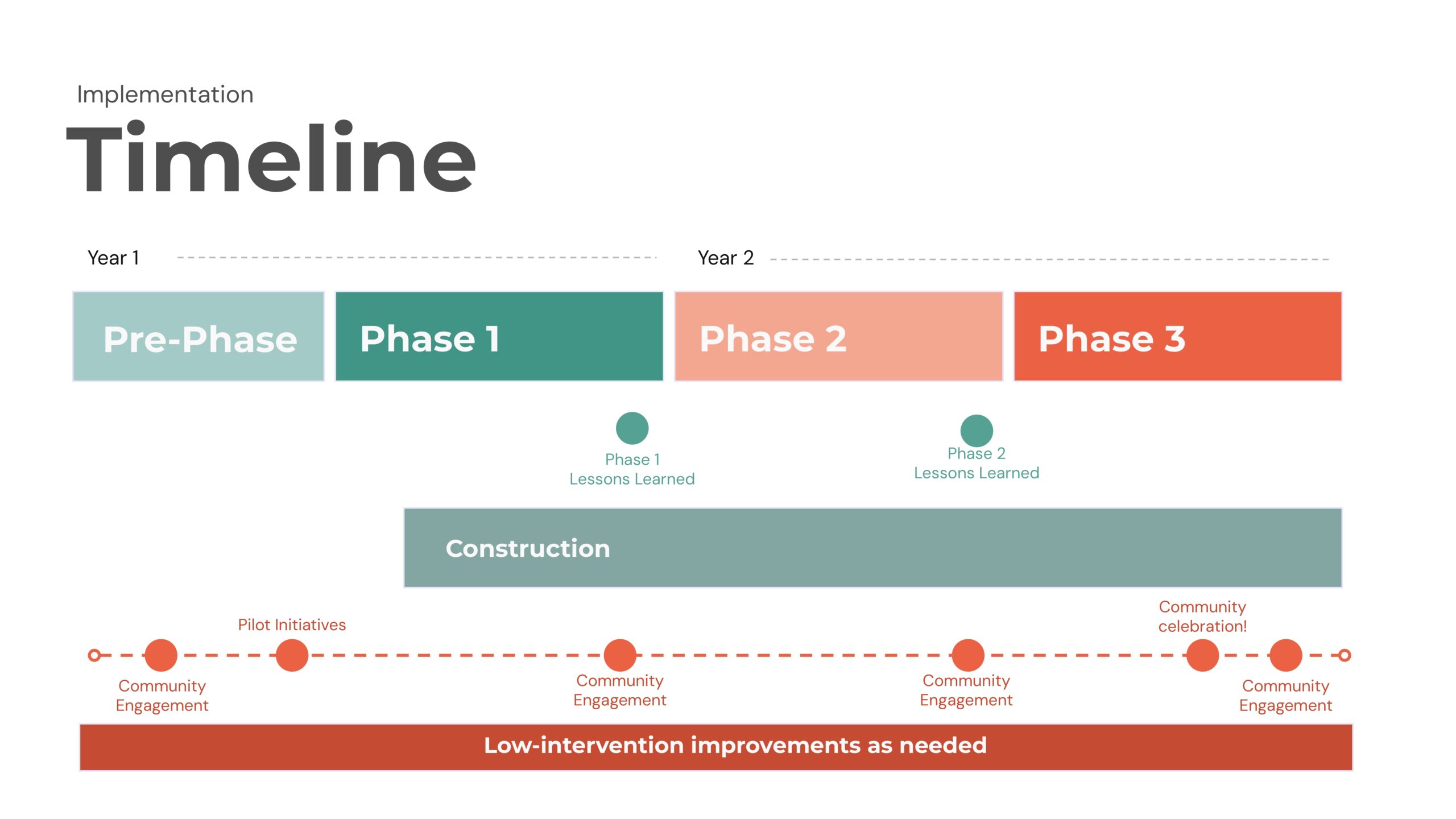
Implementation
Looking towards the future, we outlined a basic timeline and framework for implementation. As this a very important public space for the community, taking the entire park offline is not an option; instead, phasing portions of construction to be completed alongside community engagement and feedback sessions creates a more sustainable process.
The “connexió” proposal was created as a way to strengthen the intercultural community currently living in Santa Coloma de Gramenet. This will be achieved through the aforementioned implementations with the help of the municipality, working hand in hand with the community, where everyone’s participation is essential. We are faced with a blank canvas with great potential to turn this park into an urban landmark that will strengthen the environment that is currently inhabited.
