
Introduction
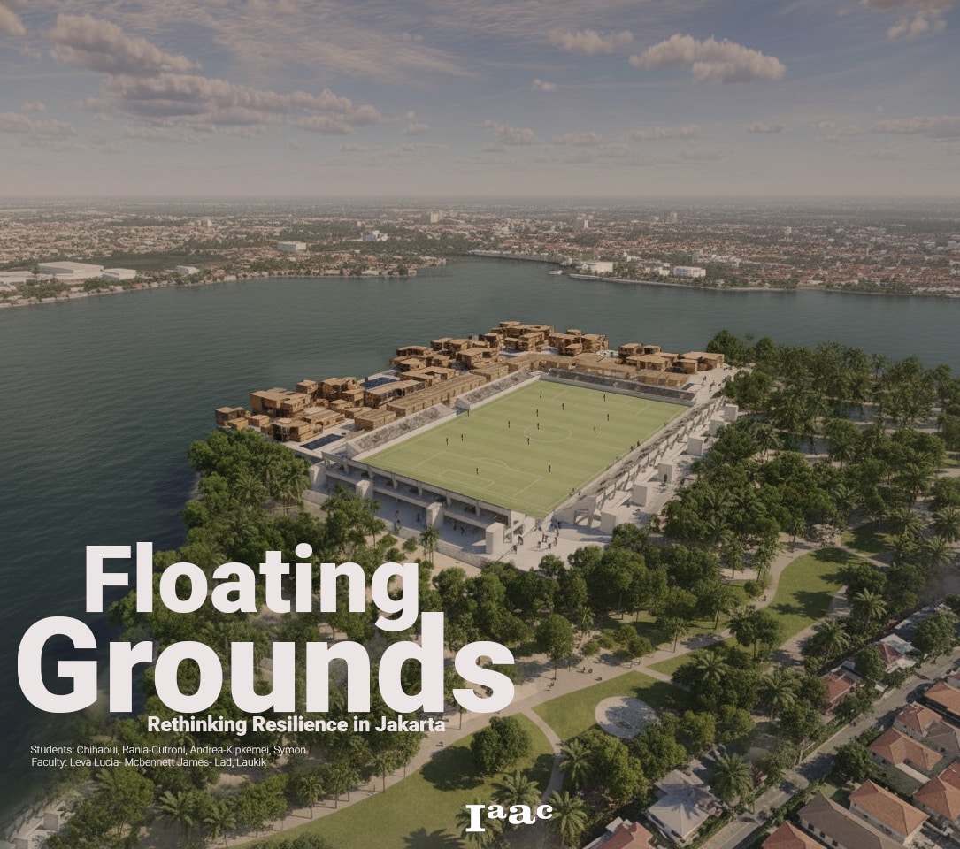
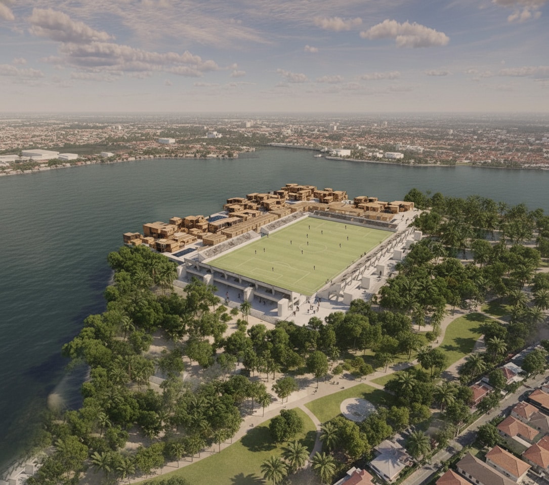
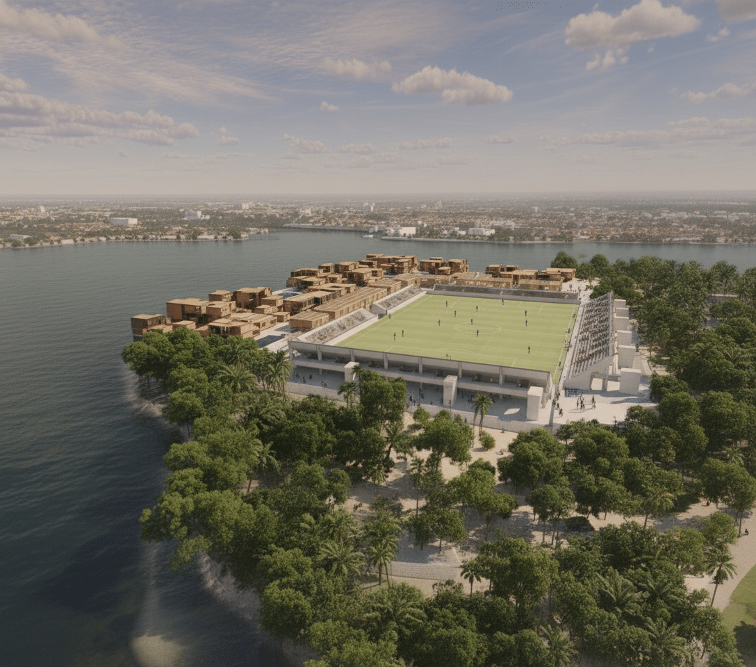
Floating Grounds proposes a flood-resilient urban model for Jakarta that merges housing, public programs, and a stadium into a single floating system. Instead of resisting water, the project accepts it as a permanent condition and uses it as an organizing element. The work explores how large-scale infrastructure can support community life while addressing land subsidence, flooding, and environmental stress through modular, floating architecture.
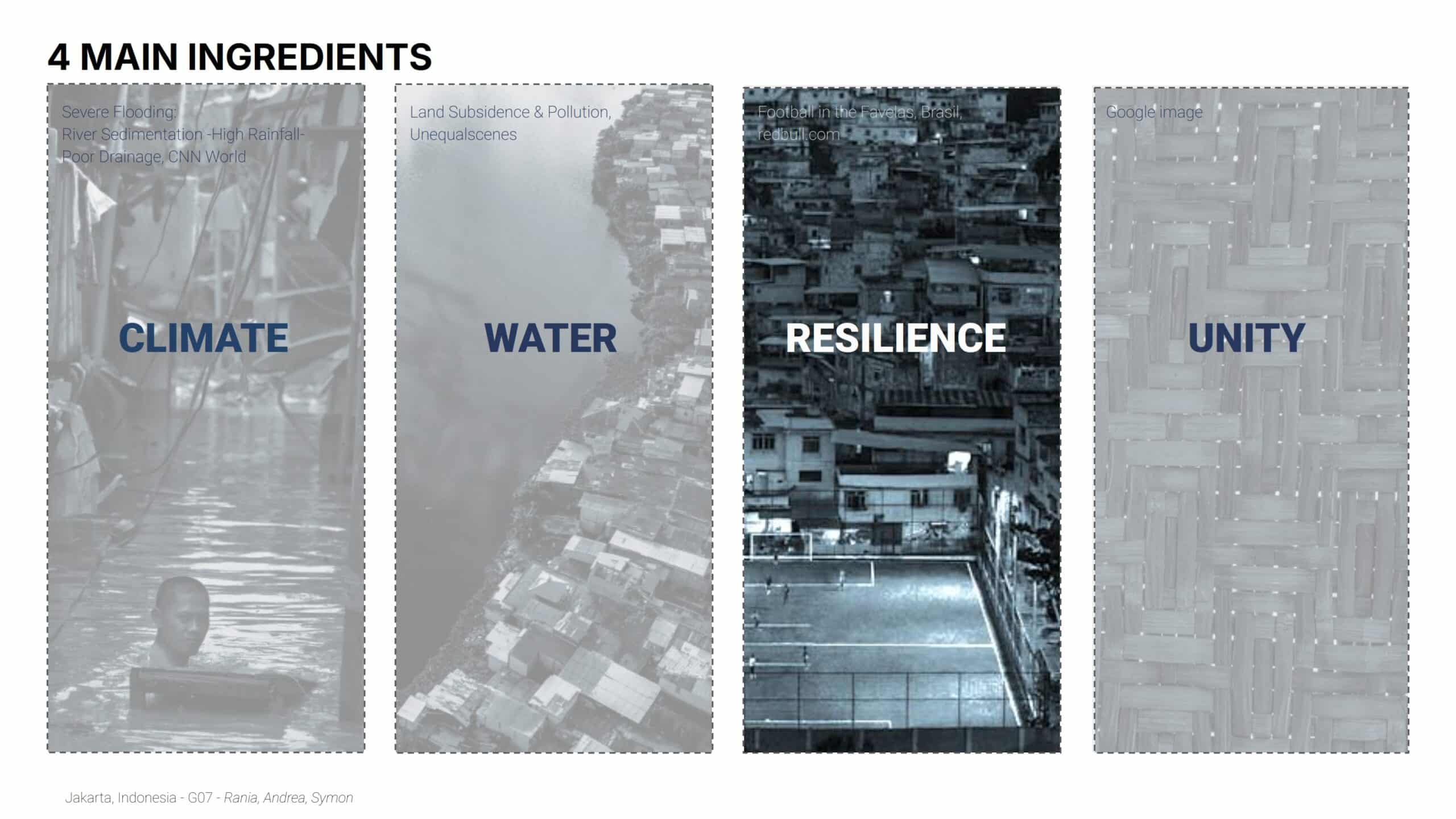
Social Climate and Urban Background
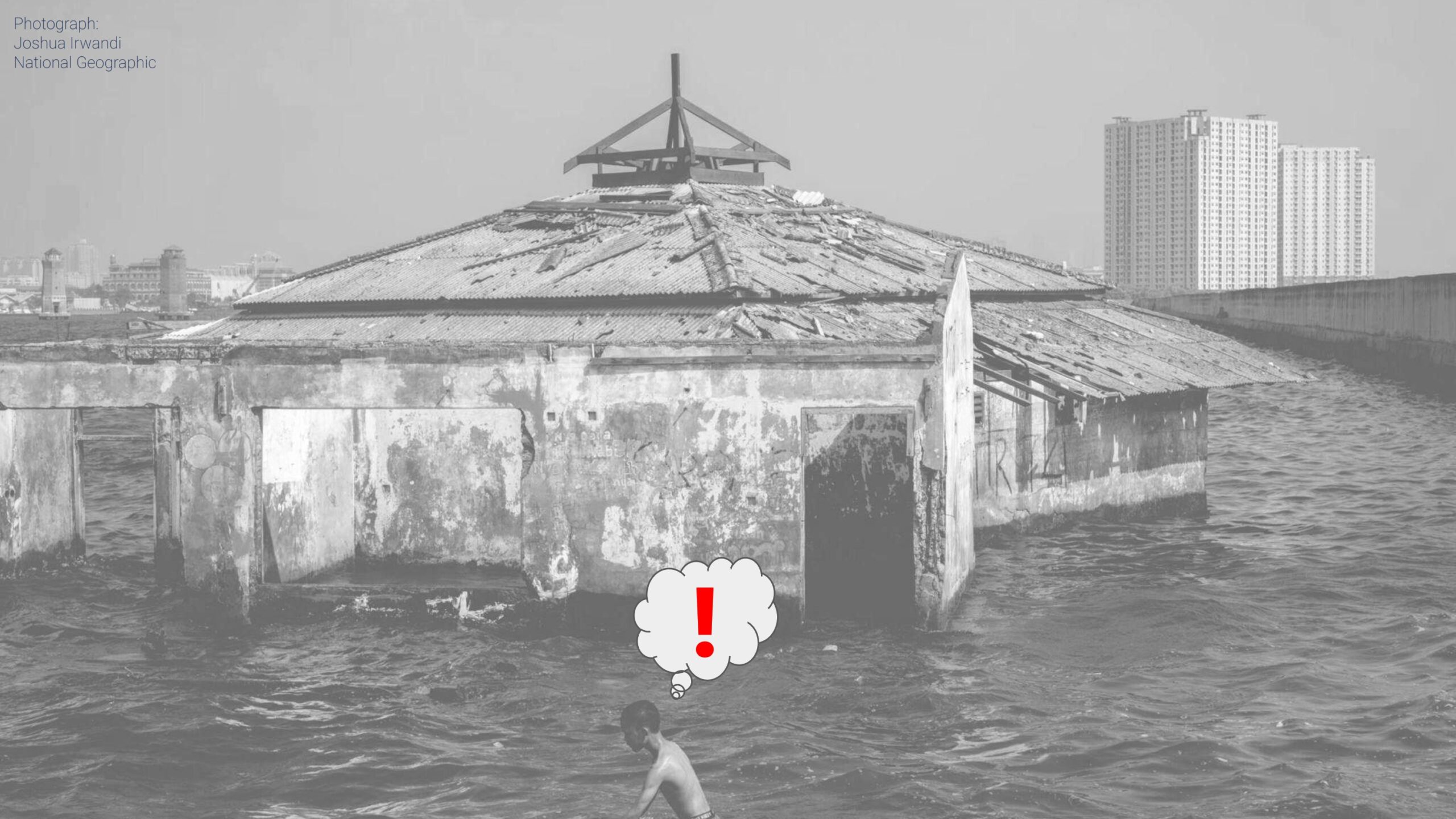
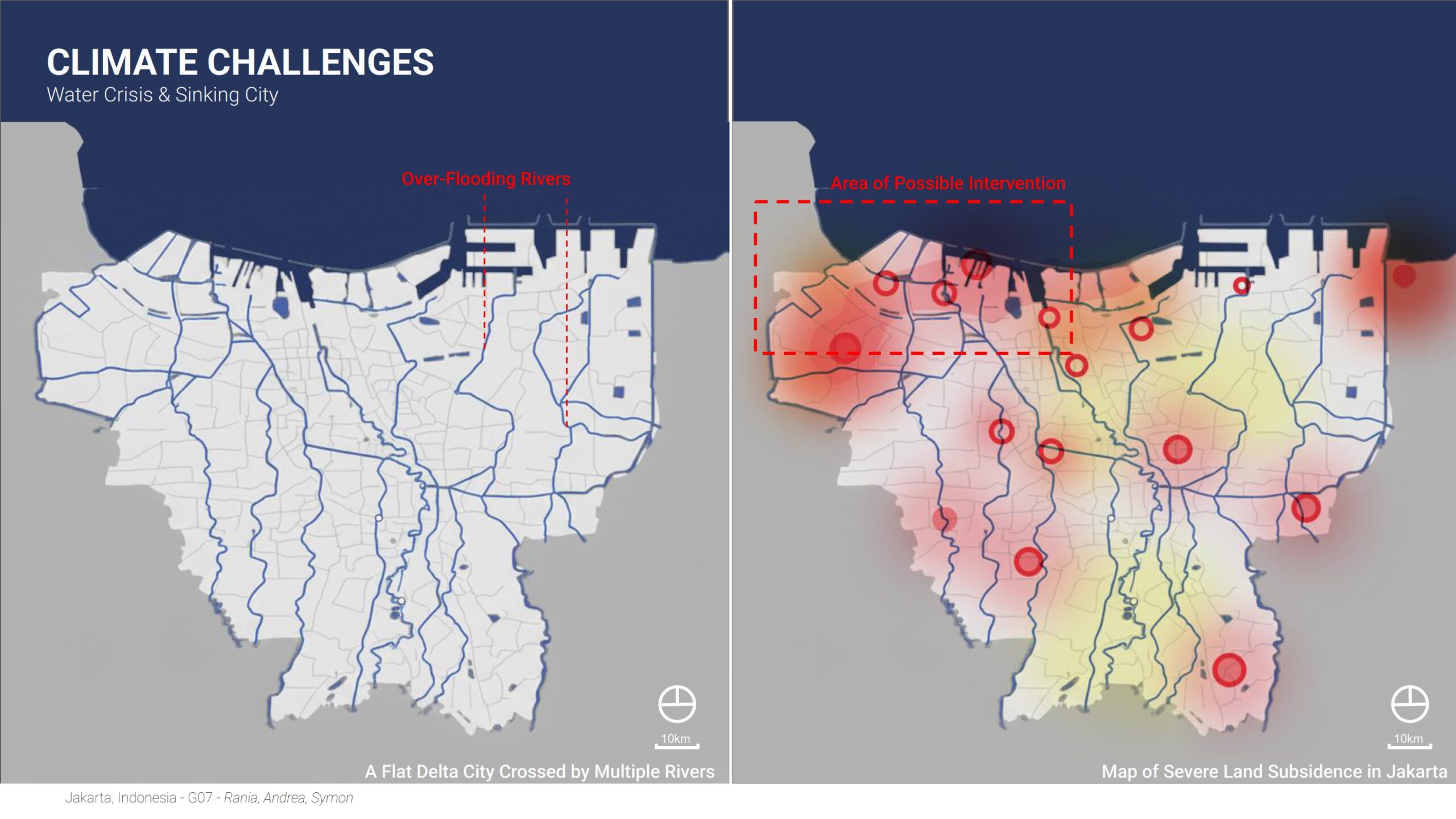
Jakarta is a dense delta city facing severe flooding, land subsidence, and water scarcity caused by groundwater extraction. Informal waterfront settlements are among the most exposed, while mega-projects often ignore local communities. Public space is limited, housing is vulnerable, and climate pressure is increasing. The project responds to this imbalance by placing community programs directly within flood-prone areas, turning risk zones into active urban spaces.
Workflow
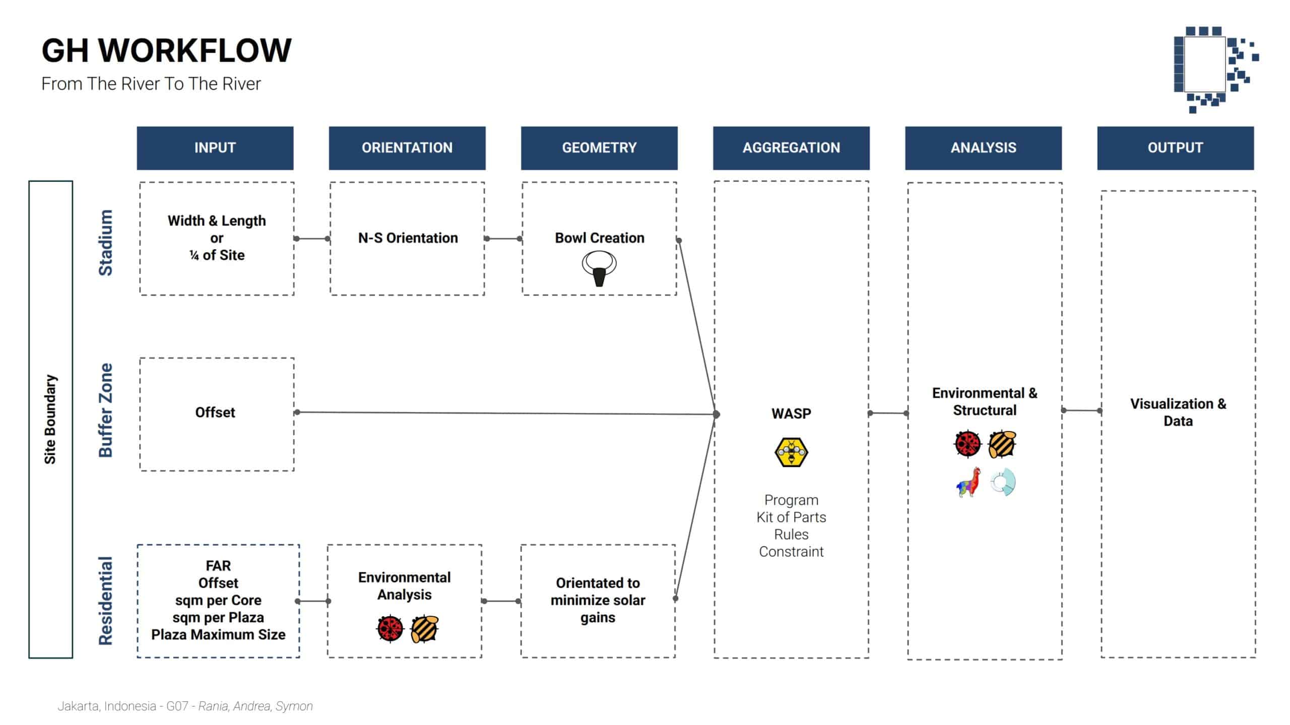
The project follows a parametric and data-driven workflow using Grasshopper. Urban constraints, environmental inputs, and programmatic requirements are translated into rules that guide form, aggregation, and optimization. The workflow allows rapid iteration, performance testing, and adaptation to different sites while maintaining spatial and structural coherence.
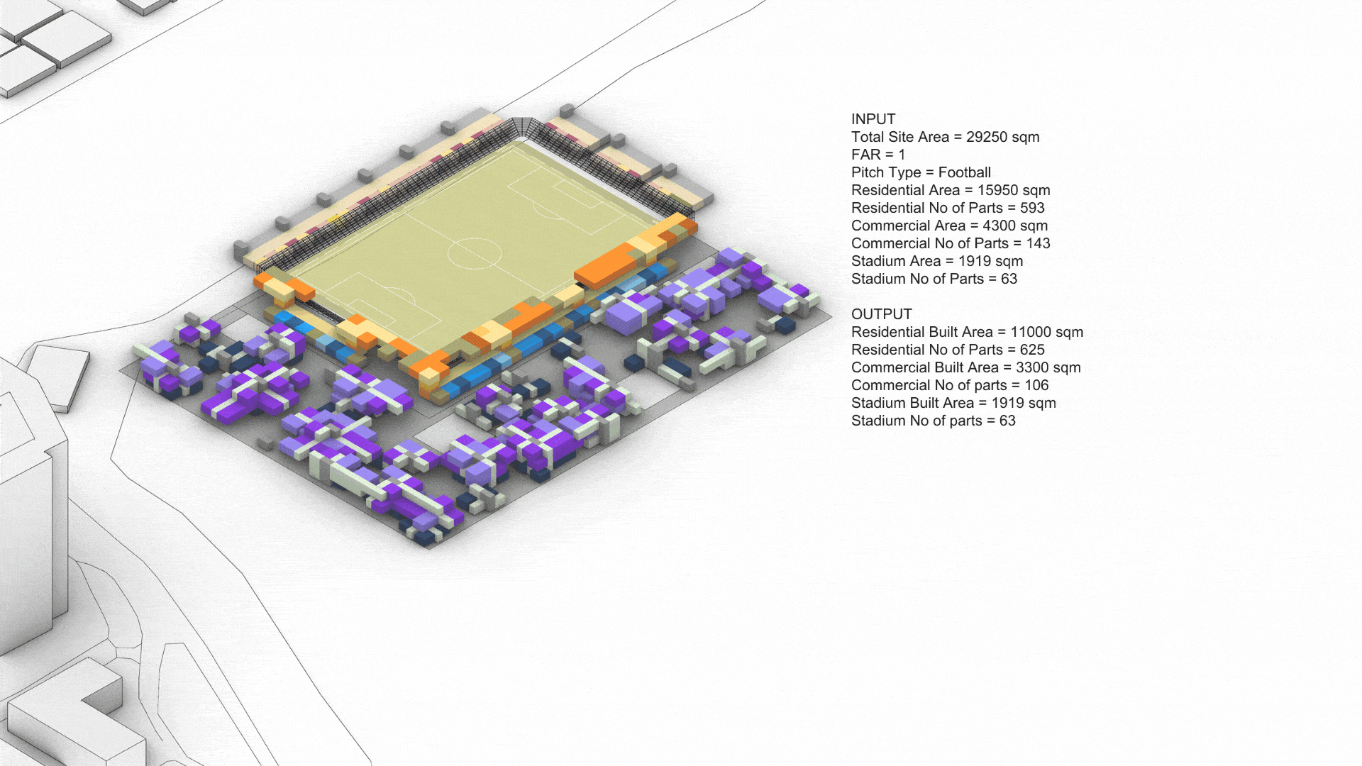
Program Definition
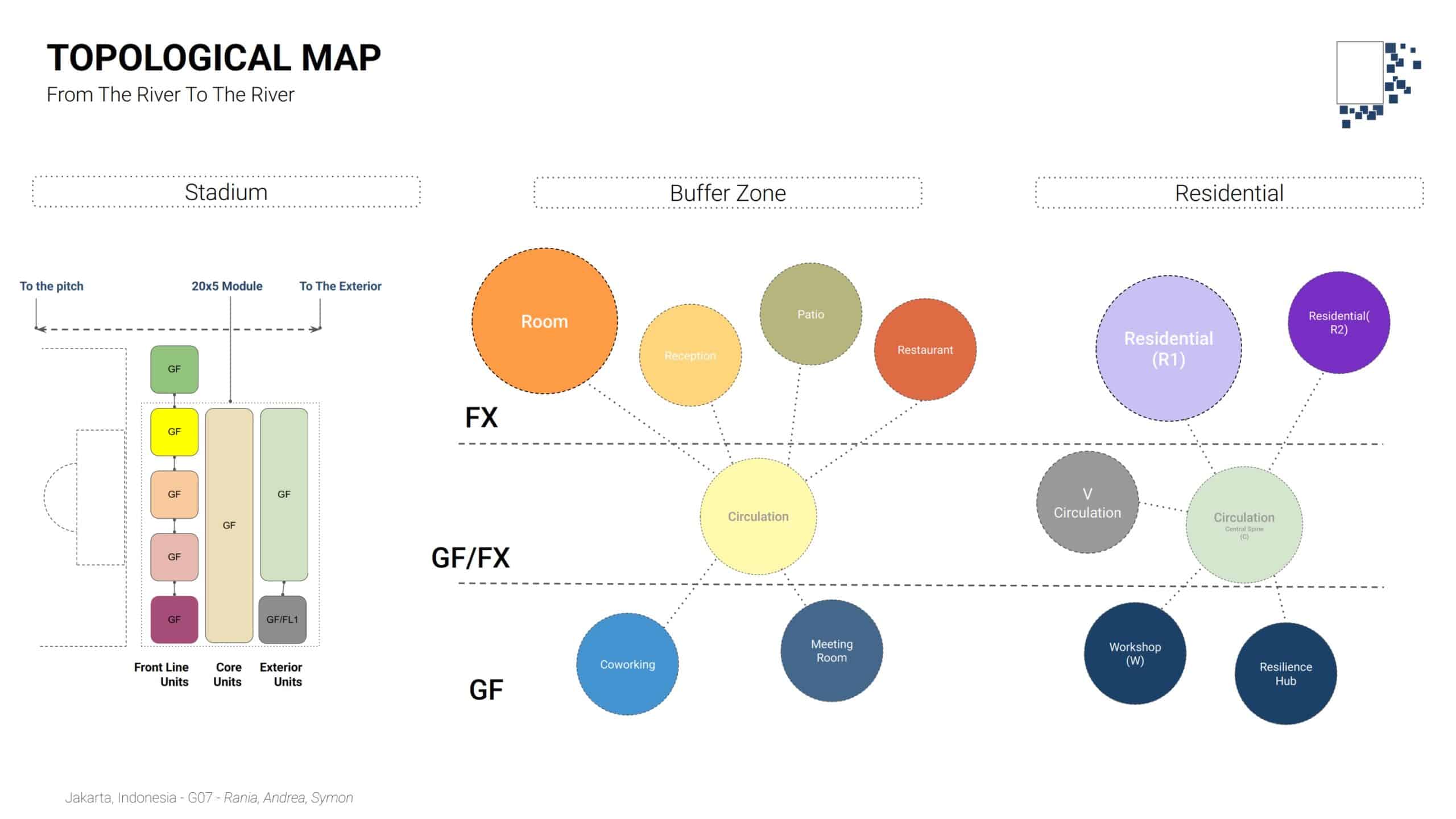
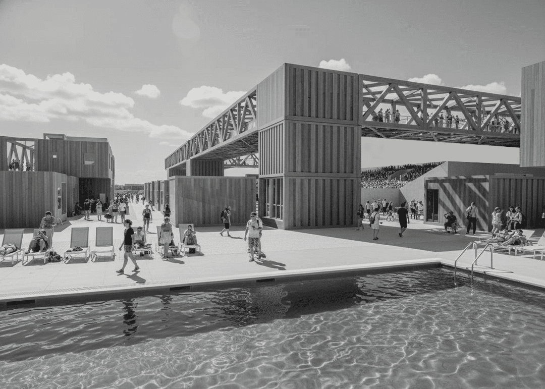
The project combines three main programs: residential housing, a stadium, and a buffer zone with public and commercial uses. Housing supports long-term community presence, the stadium acts as a large civic attractor, and the buffer zone mediates between everyday life and event-based intensity. Together, they form a resilience hub rather than isolated functions.
Modular Unit Definition
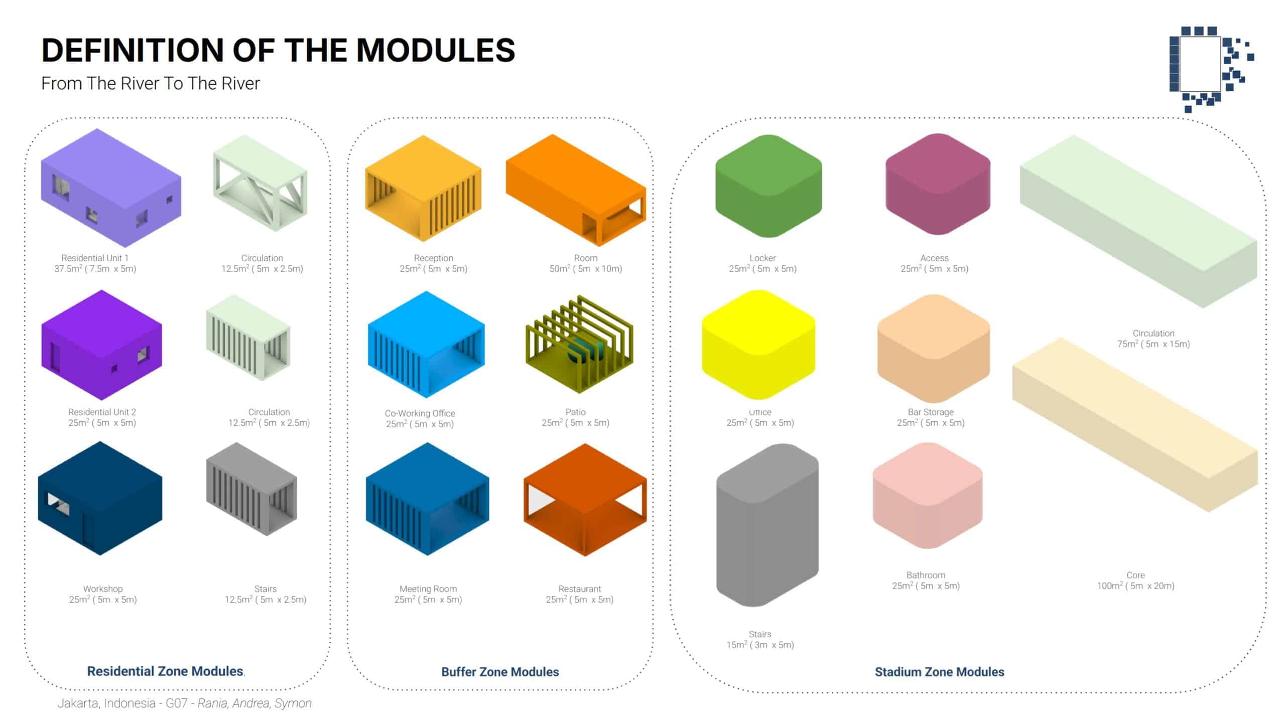
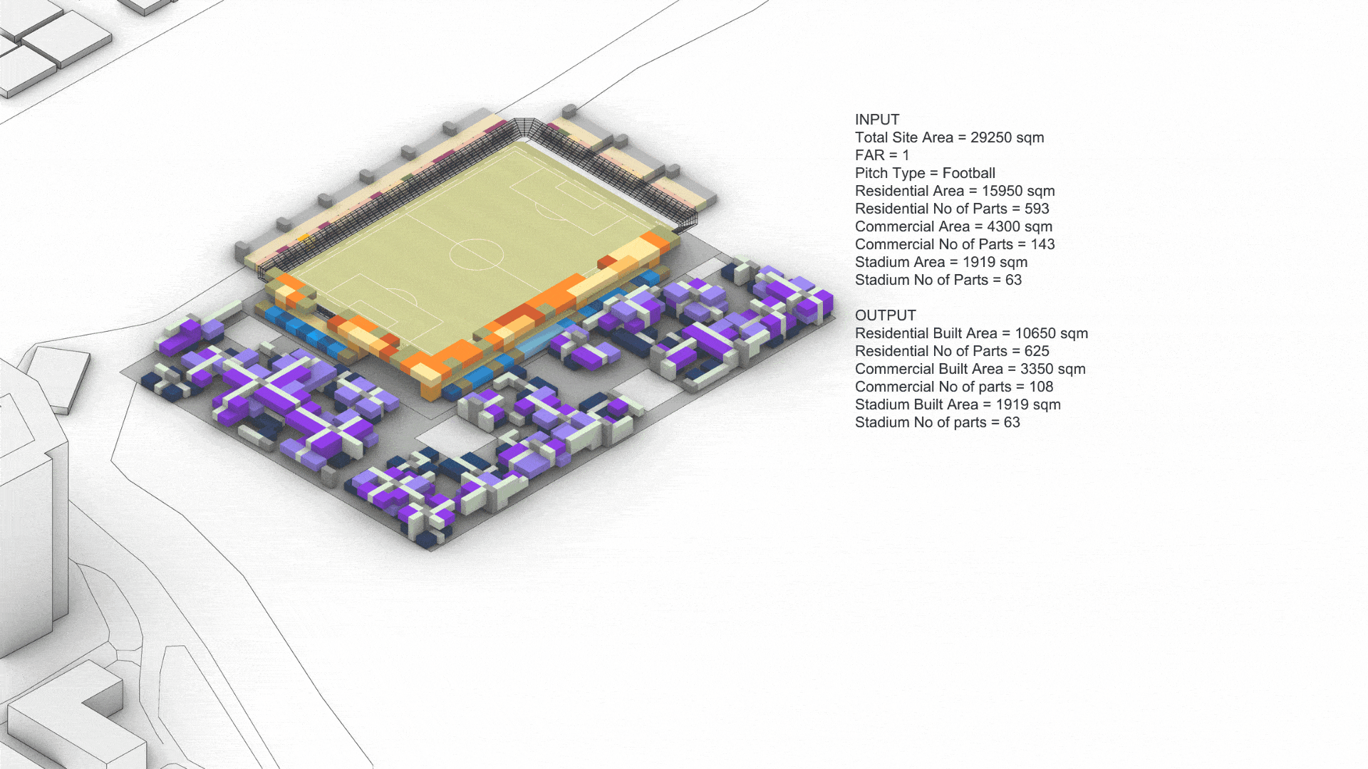
All programs are built from a standardized modular system based on a 5 × 5 m grid. Modules include residential units, circulation, cores, workshops, coworking spaces, and service areas. This kit of parts ensures construction efficiency, adaptability, and scalability across different site conditions.
Modular Unit Aggregation
Modules are aggregated through rule-based logic that controls adjacency, access, vertical circulation, and open space creation. Residential units cluster around cores and patios, while public functions align with primary circulation paths. Aggregation creates porosity, cross-ventilation, and shared spaces rather than monolithic blocks.
This Morphological Step by Step summarize the workflow logic.
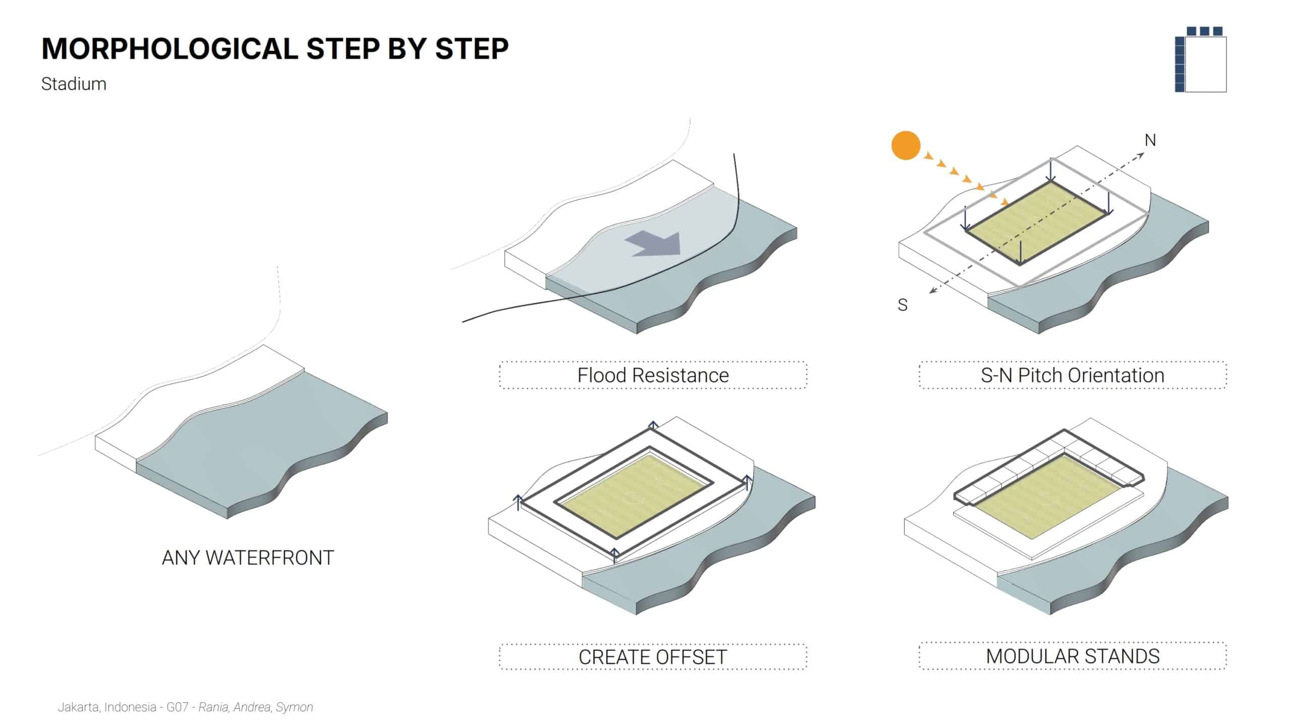
1. Stadium Logic: Site & Orientation
The first phase focuses on the fundamental environmental constraints of a waterfront location.
- Flood Resistance & Positioning: The process begins by selecting a generic waterfront site. The design logic prioritizes flood resistance, placing the primary structure on an elevated or protected platform.
- Solar & Pitch Orientation: The pitch is aligned on a South-North axis to optimize natural lighting for the turf while managing solar glare for players and spectators.
- Structural Offsets: Modular offsets are created around the pitch to establish the footprint for seating and infrastructure.
- Modular Assembly: The stands are not monolithic but are presented as modular units, allowing for flexibility in construction and potential future expansion.
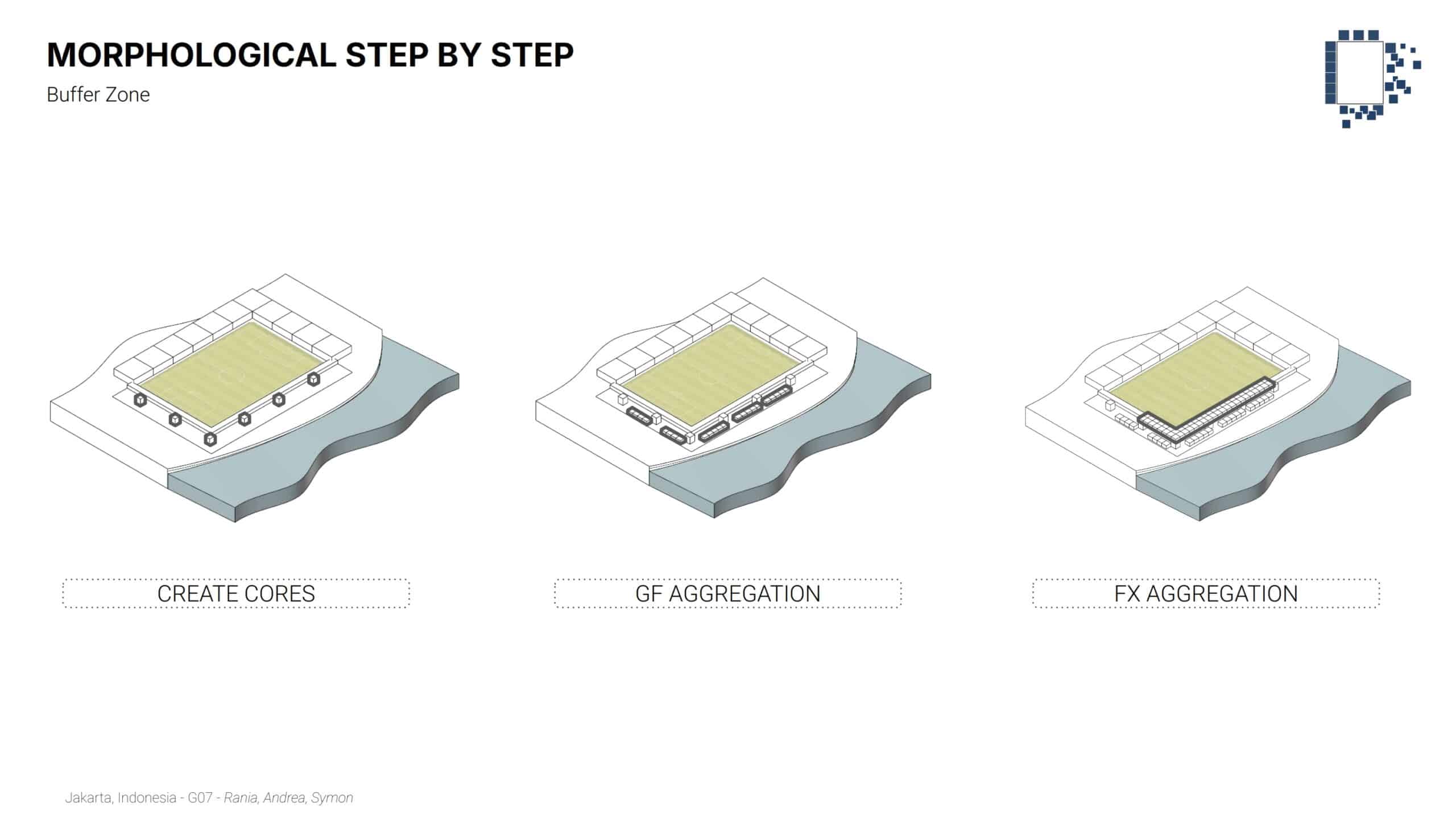
2. Buffer Zone Logic: Programmatic Transition:
The second phase introduces the “Buffer Zone,” which acts as the connective tissue between the sports infrastructure and the residential community.
- Create Cores: Vertical circulation and structural “cores” are established at intervals around the stadium perimeter.
- Ground Floor (GF) Aggregation: Small-scale modular units aggregate at the base. This likely represents commercial or public-facing functions that activate the street level.
- Functional (FX) Aggregation: A second layer of aggregation (FX) builds upon the ground floor, creating a denser, multi-layered transition zone that shields the residential area from the stadium’s noise and activity.
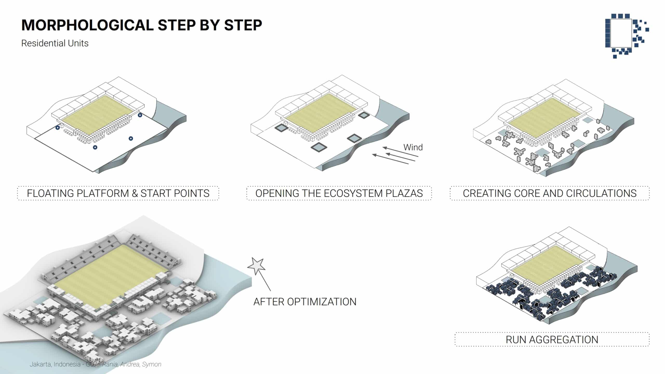
3. Residential Logic: Environmental Optimization:
The final phase demonstrates a generative aggregation workflow for the residential units, driven by environmental data.
- Floating Platforms & Ecosystem Plazas: The residential units sit on floating platforms. Voids are intentionally carved out to create “Ecosystem Plazas.”
- Wind-Driven Permeability: The placement of these plazas is dictated by wind patterns to ensure natural ventilation through the dense urban fabric, a critical factor in Jakarta’s humid climate.
- Algorithmic Aggregation: * Start Points: Specific nodes are identified for growth.
- Core & Circulation: Primary vertical and horizontal paths are established.
- Run Aggregation: A generative algorithm “runs” the growth of the modular units, filling the available space while respecting the previously defined wind corridors.
- Post-Optimization: The final step shows the “After Optimization” state, where the density is refined to balance living space with light, air, and views of the water.
Environmental Optimization and Challenges
Key challenges include balancing density with openness, ensuring structural stability on water, minimizing solar gains in a hot climate, and maintaining clear circulation between mixed programs. Conflicts between program size, environmental performance, and buoyancy required iterative adjustment.
Optimization focuses on orientation, window-to-wall ratios, spacing between blocks, and plaza sizes. Environmental analysis guided rotations and offsets to reduce cooling loads. Structural and buoyancy constraints informed maximum heights and module distribution, resulting in a compact yet permeable layout.
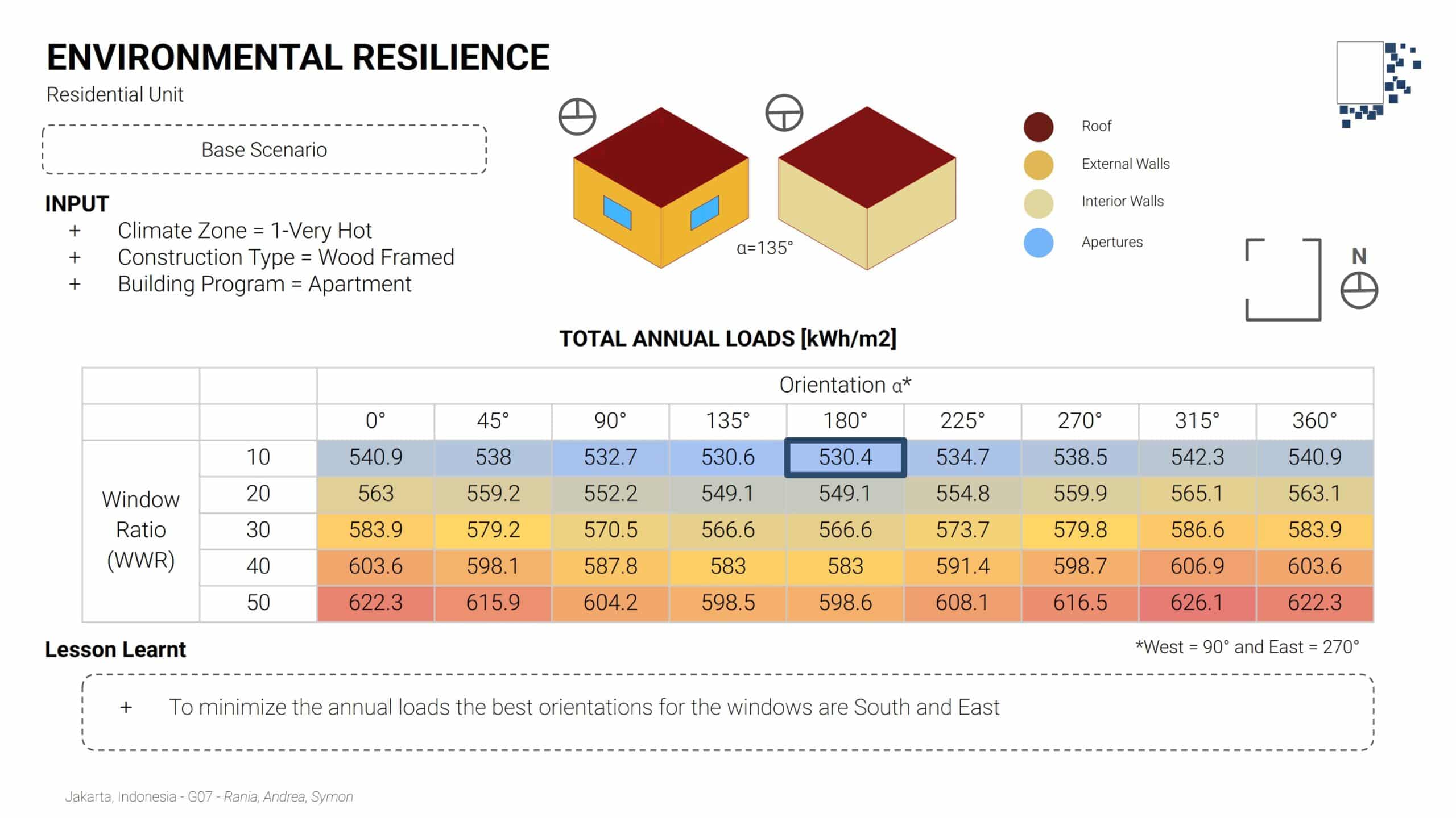
Orientation and Envelope Studies
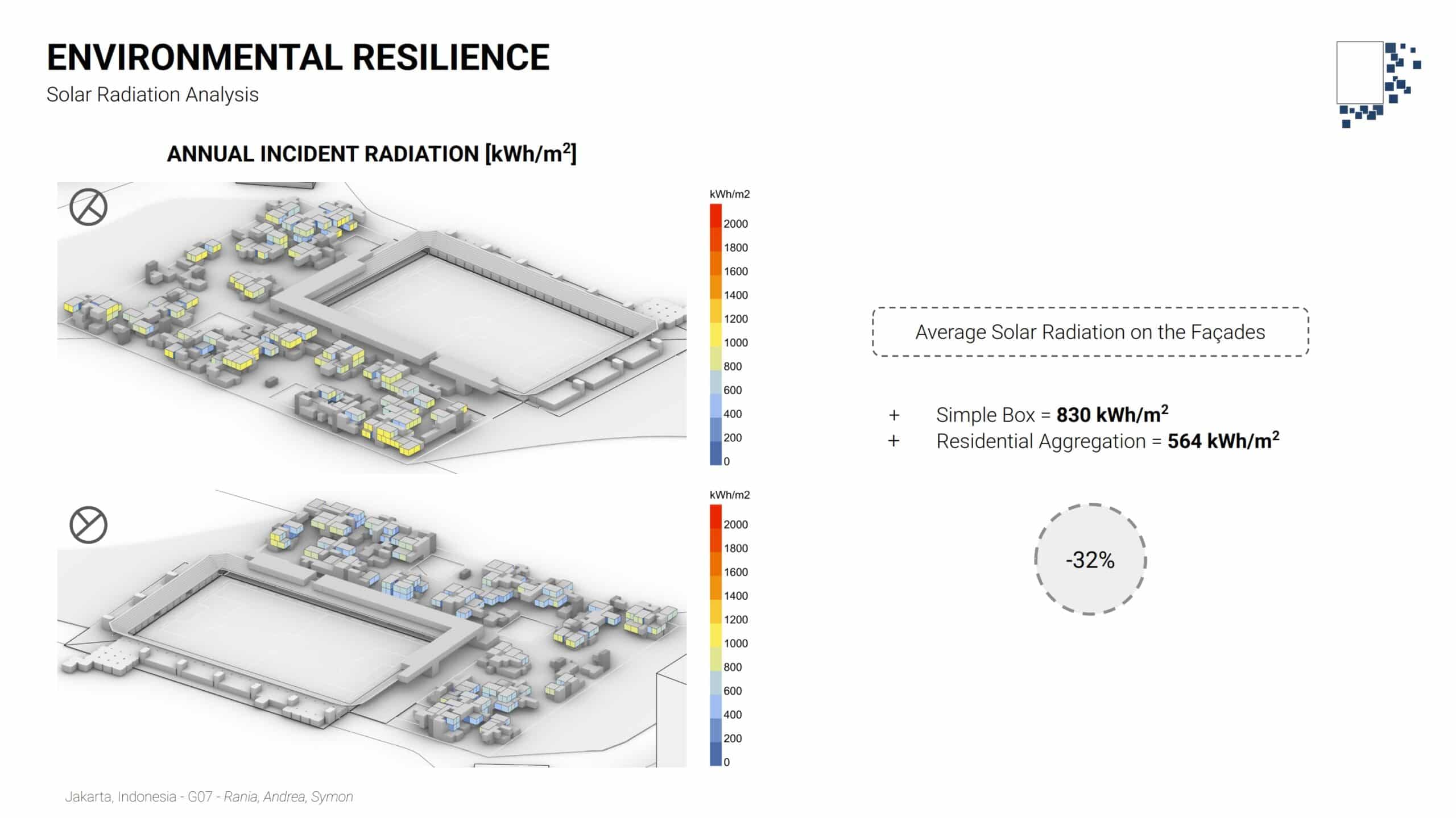
The study revealed that South and East orientations, combined with low window ratios, minimize annual energy loads. These findings directly informed the placement and orientation of the residential aggregation around the pitch.
Residential Energy Demand
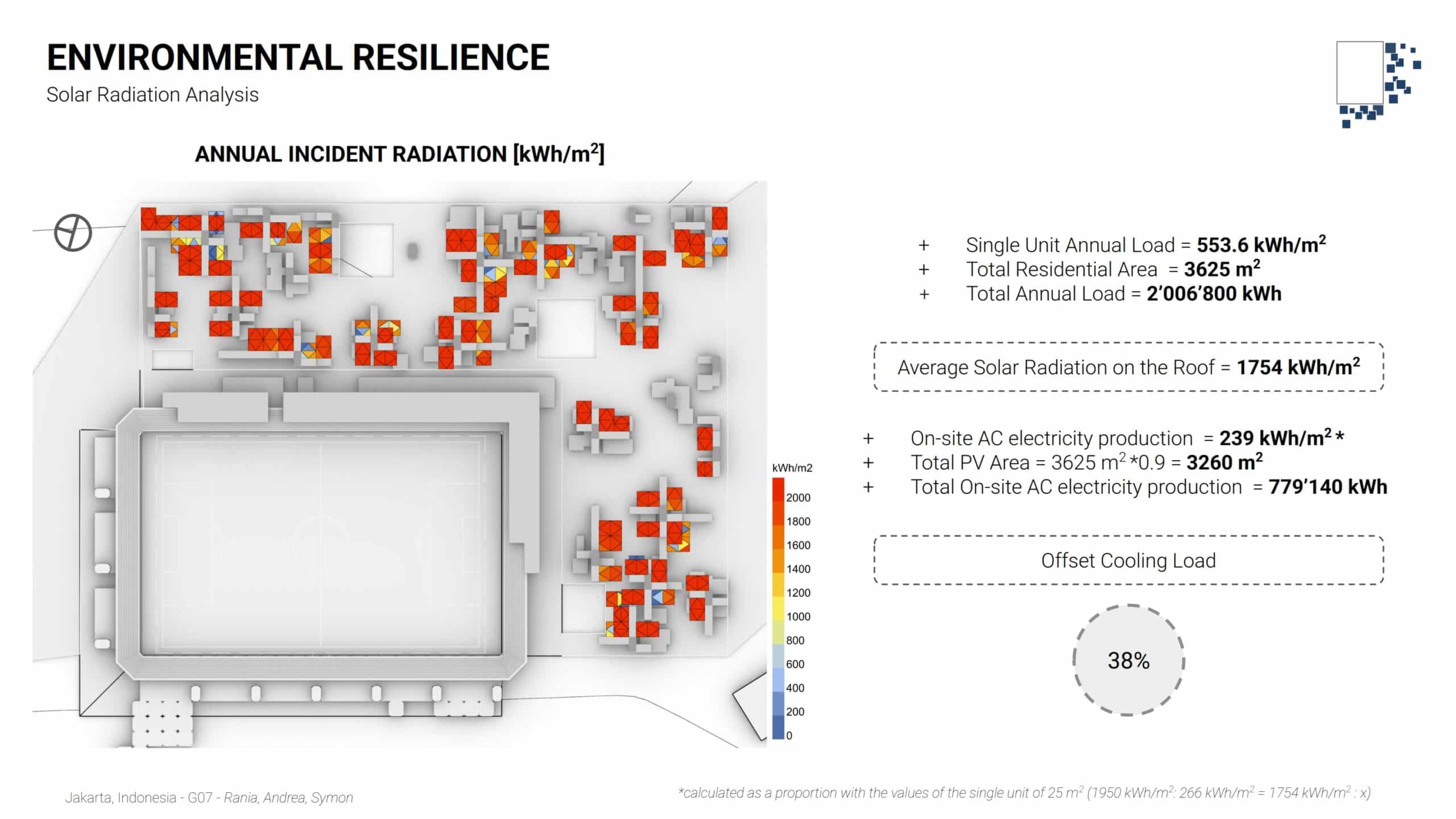
The annual energy demand for a residential unit was calculated at 550 kWh/m², with cooling identified as the dominant load throughout the year.
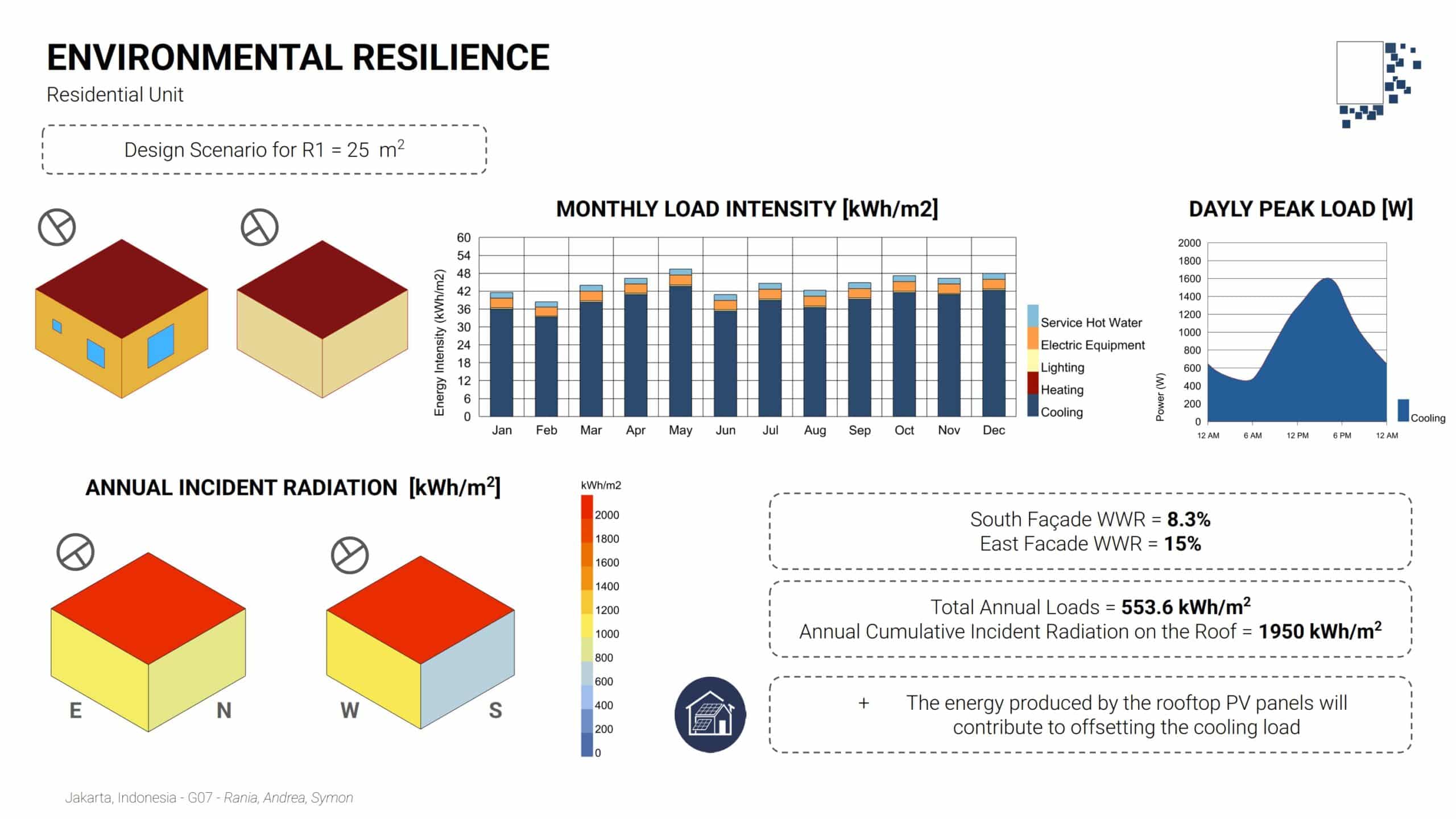
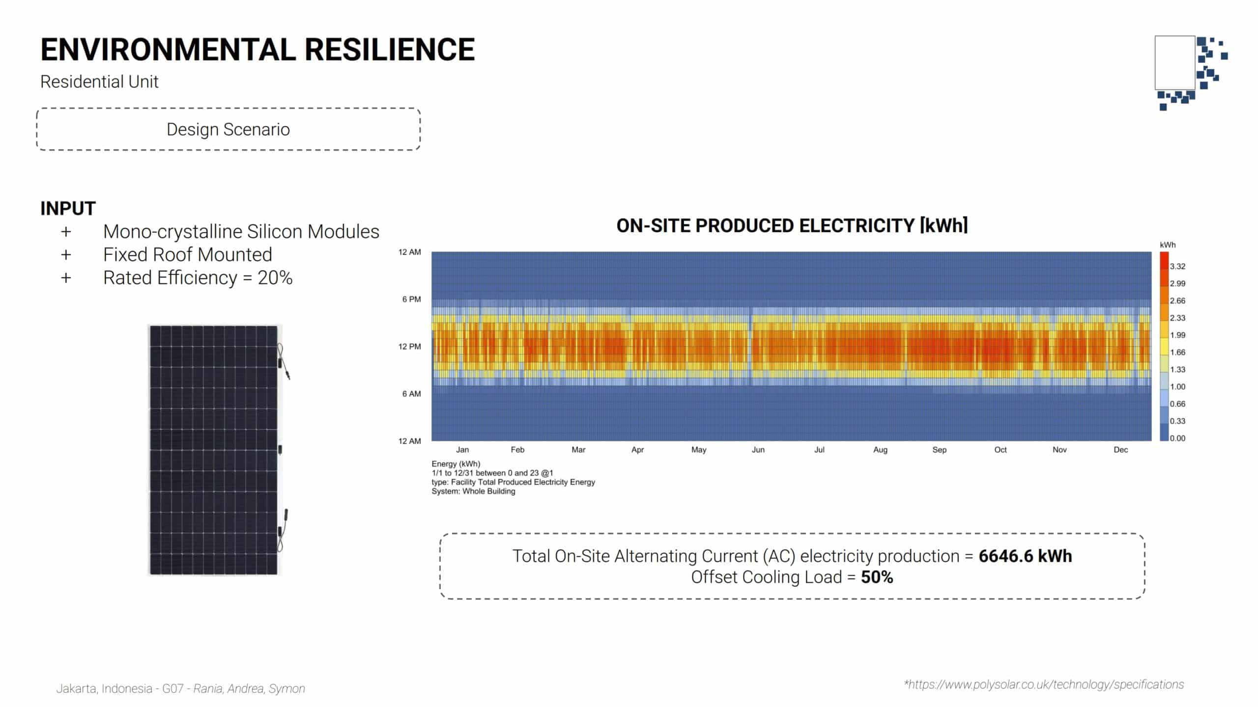
On-site Energy Production
To offset cooling demand, mono-crystalline photovoltaic panels were installed on the roofs. When extended to the entire aggregation:
- Total on-site electricity production ≈ 780,000 kWh/year
- Offsets nearly 40% of the total cooling load
Additionally, façade solar radiation analysis shows a reduction of over 30% compared to a simple box, validating the environmental strategy.
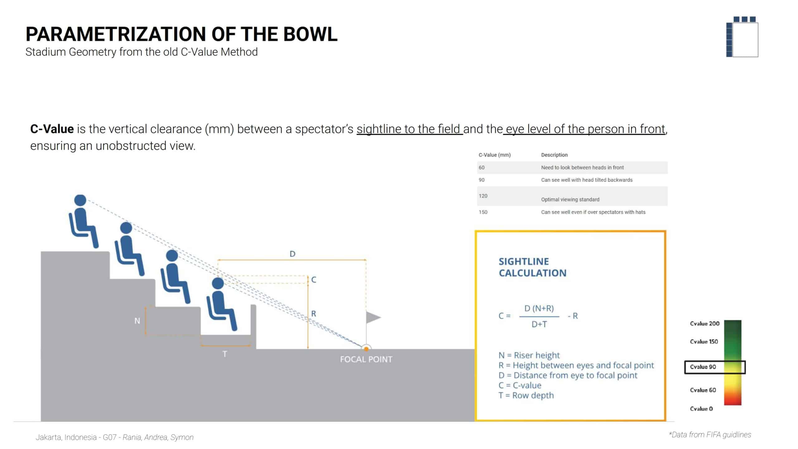
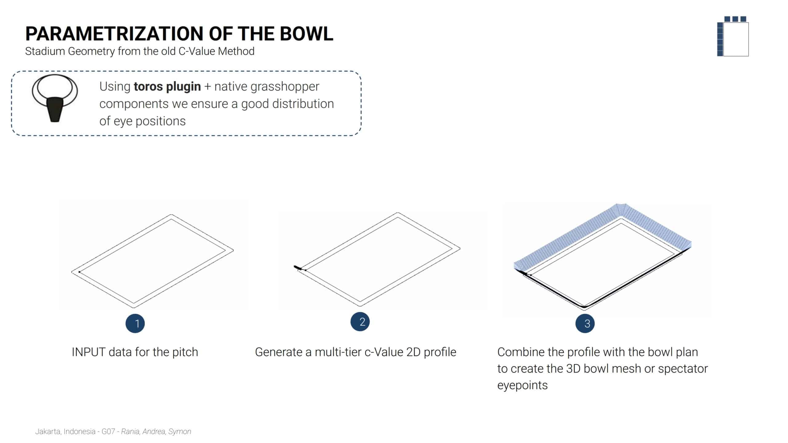
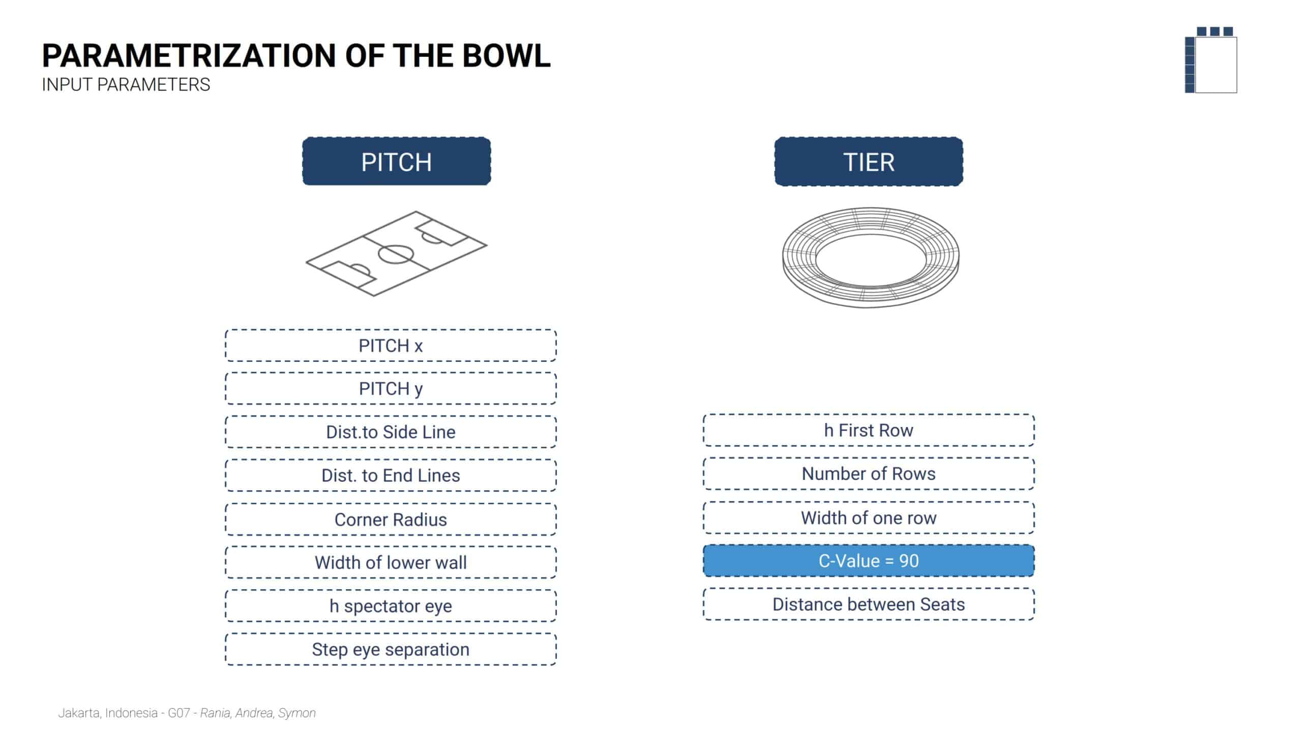
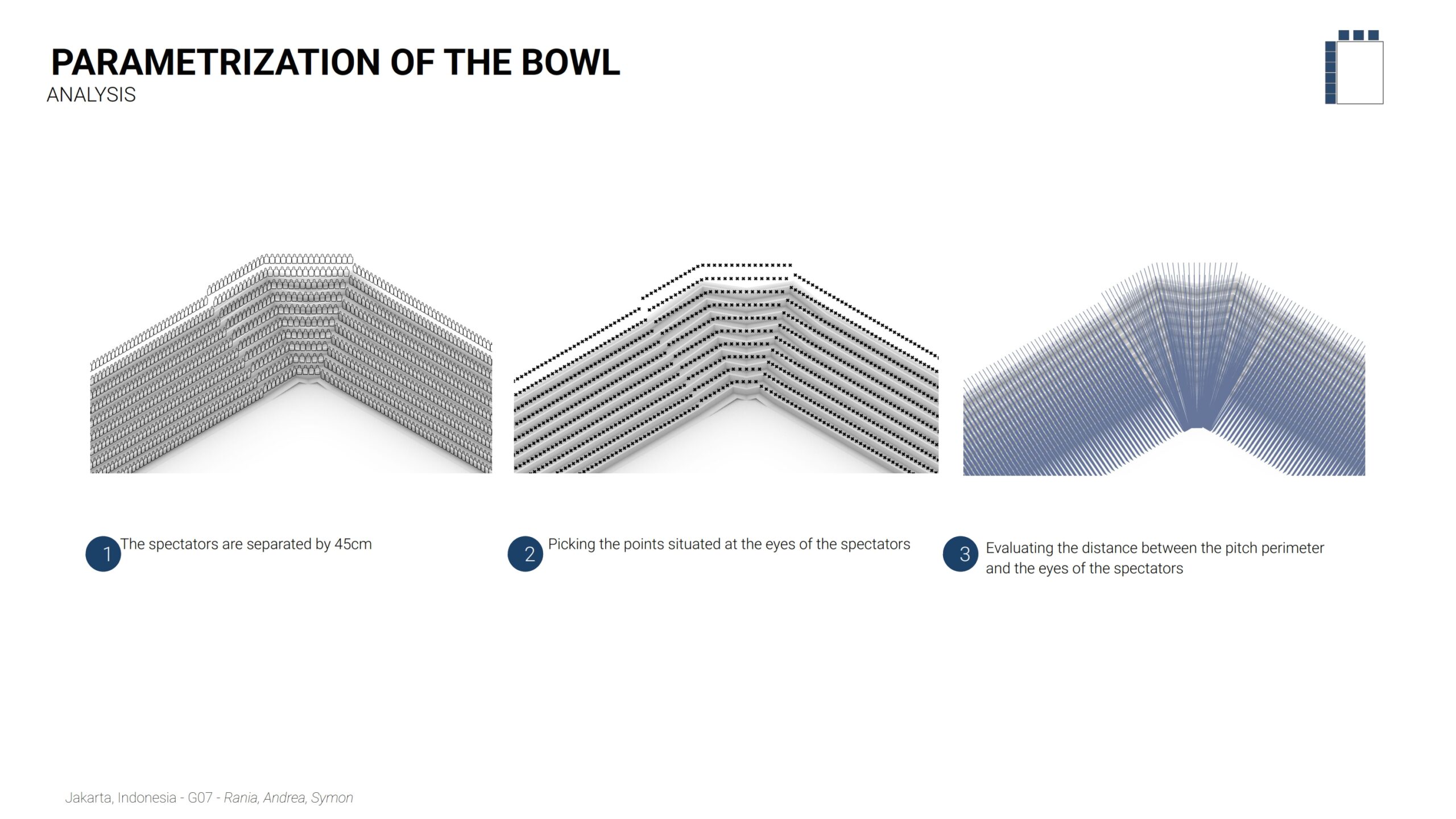
Bowl Optimization
The Parametrization of the Bowl utilizes the C-Value method, the vertical clearance between a spectator’s sightline and the eye level of the person in front, to ensure unobstructed views. Using a target C-Value of 90, the workflow integrates pitch dimensions and tier parameters (such as riser height and row depth) through the toros plugin in Grasshopper. This process generates a precise 3D spectator mesh where every seat is analyzed to validate distance and visibility relative to the pitch perimeter.
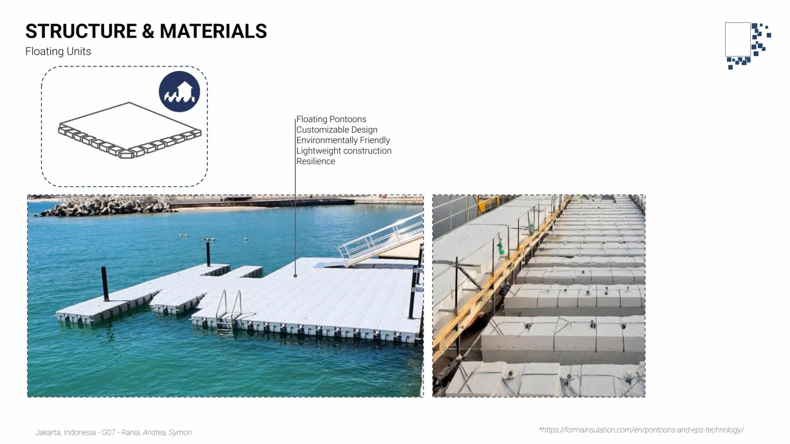
Structural System
For the floating components, floating pontoons were selected as the primary support system.
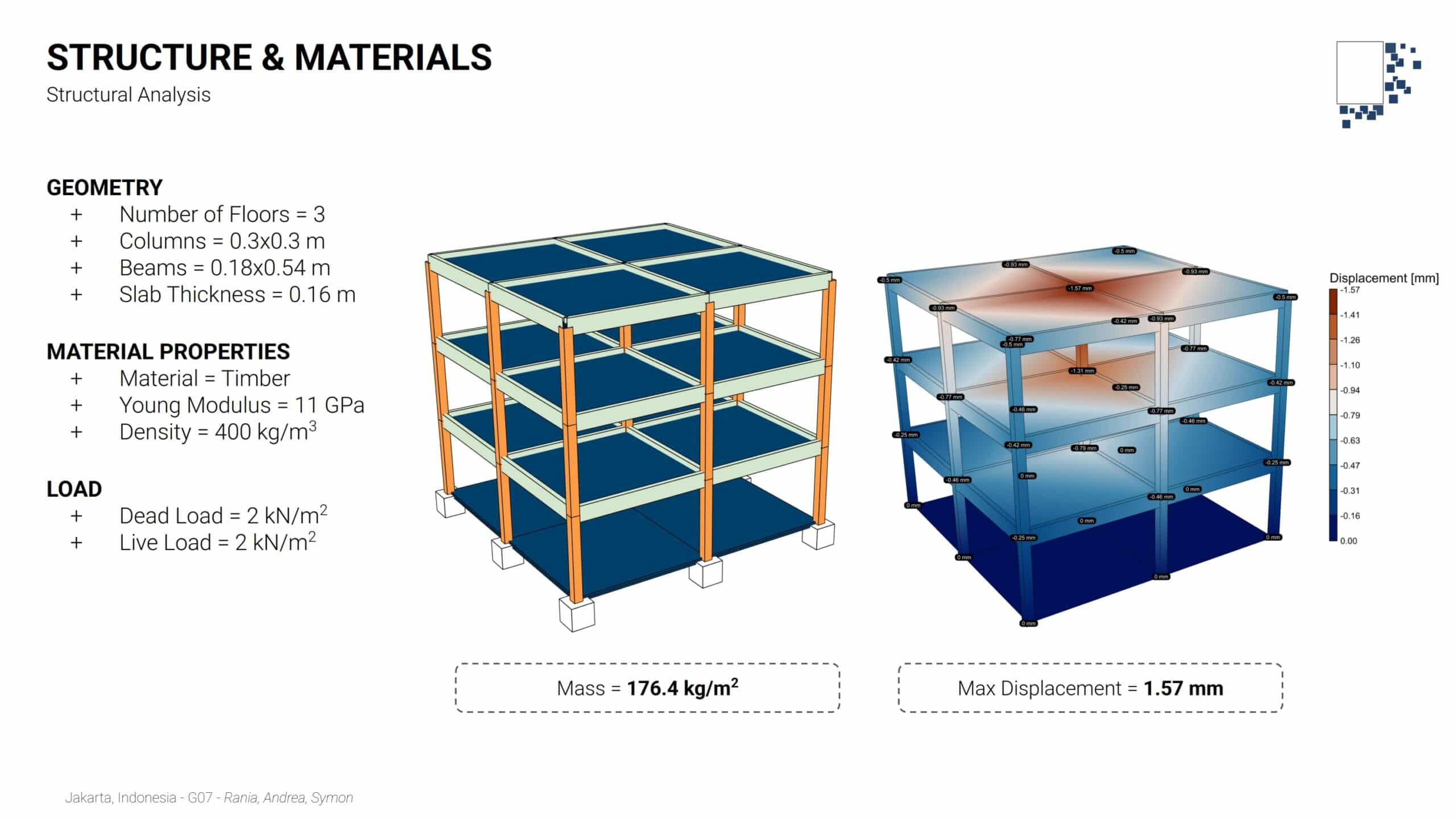
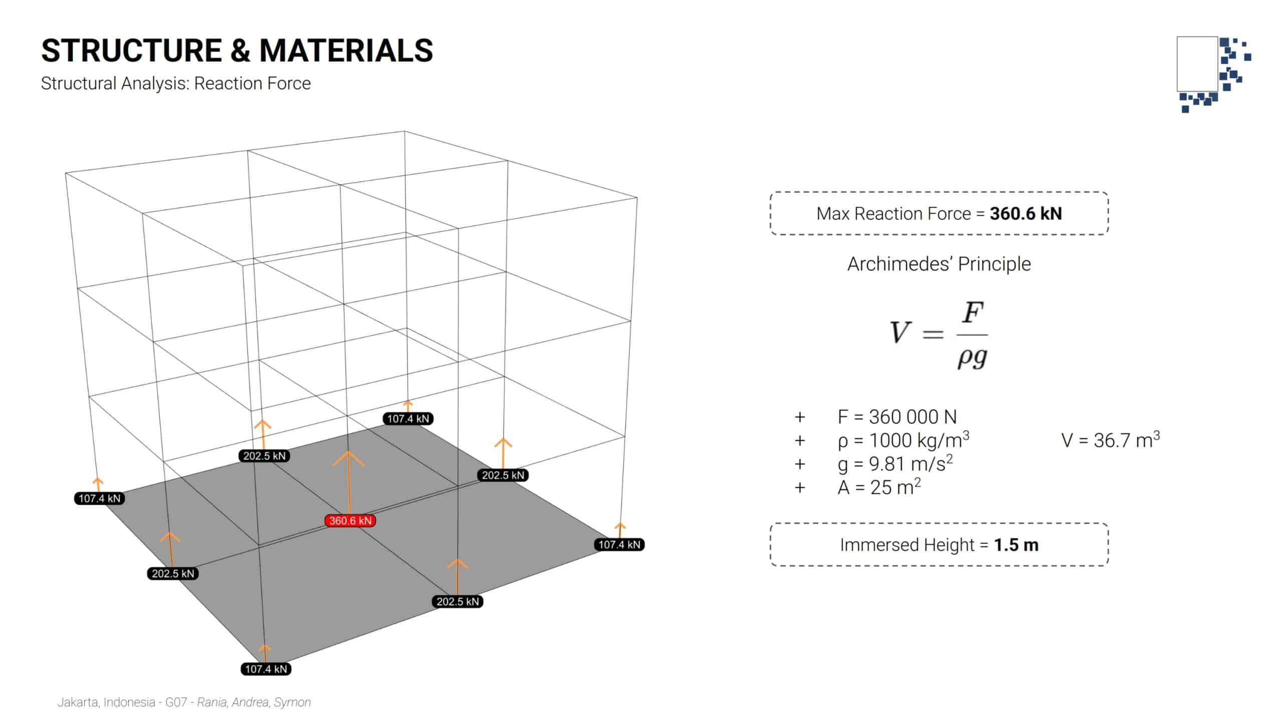
A portion of the timber structure was analyzed under vertical loads to determine:
- Total structural mass
- Maximum displacement
The resulting reaction force under the central column was then used in conjunction with Archimedes’ Principle to estimate the required immersed height of the pontoons, calculated to be approximately 1.5 meters.
Outputs
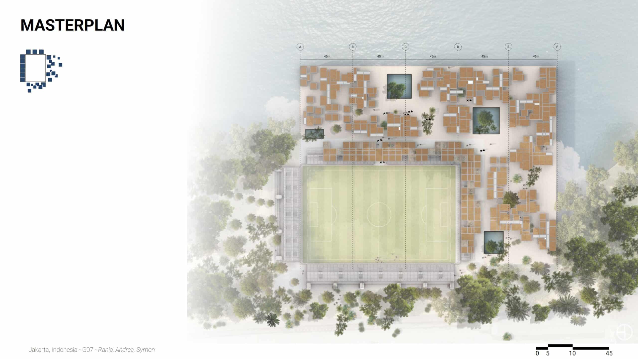
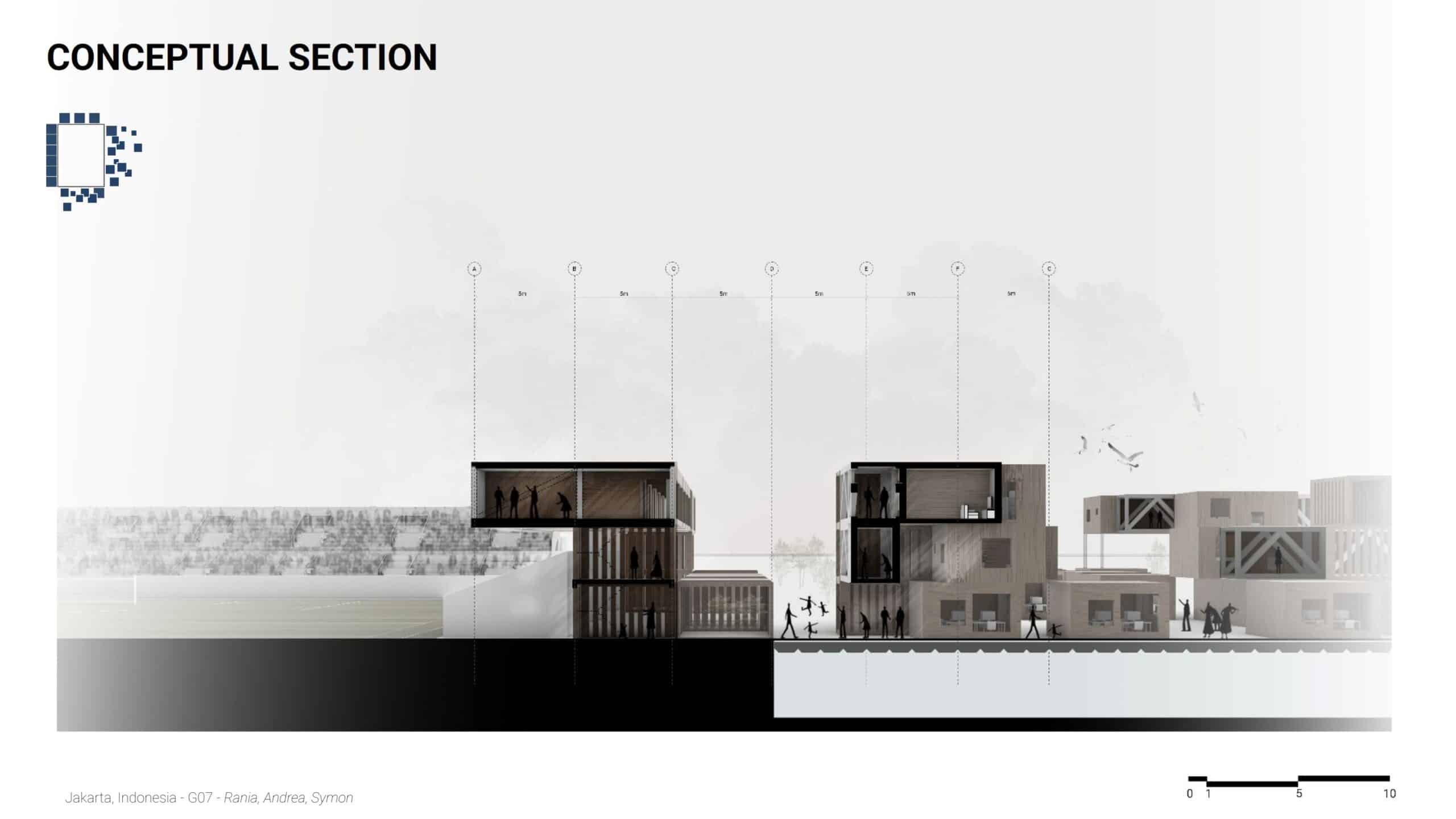
The project delivers a masterplan, modular aggregation diagrams, environmental and structural analyses, building plans, sections, and visualizations. Parametric definitions allow the system to be replicated or adapted to other flood-prone sites.
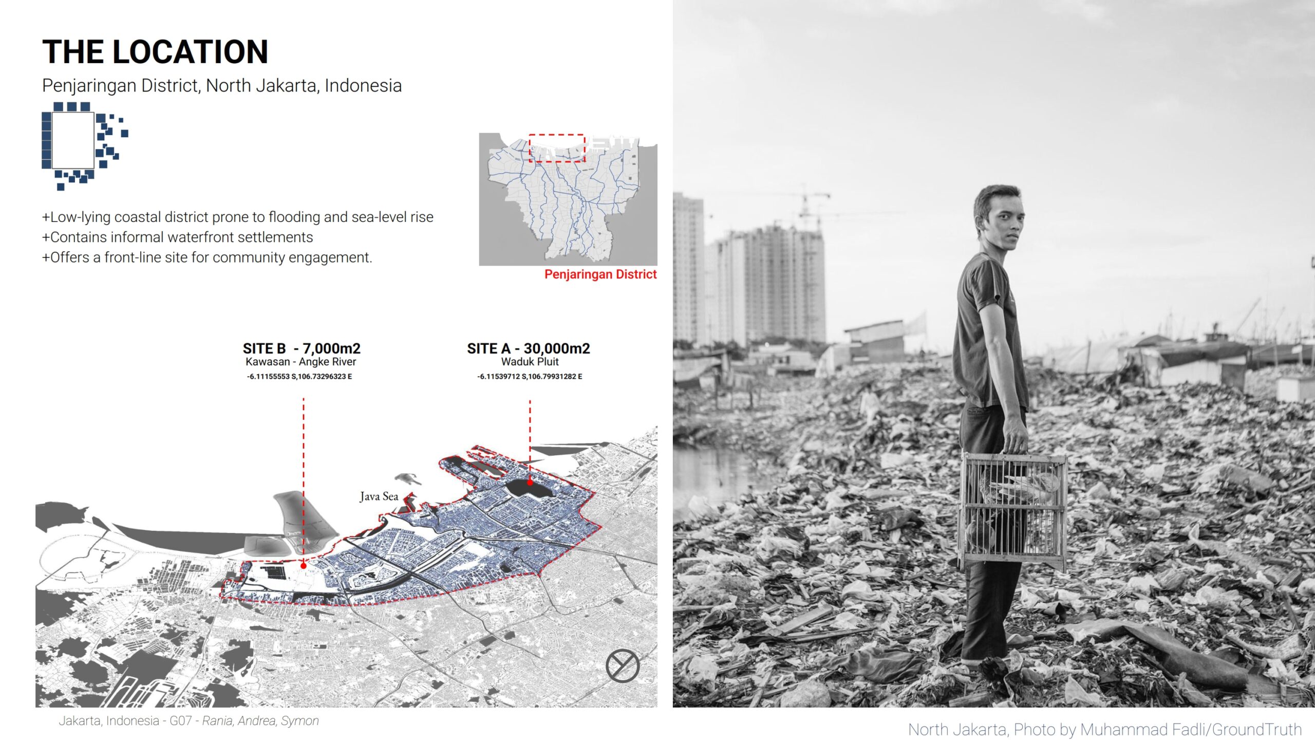
Building Instance
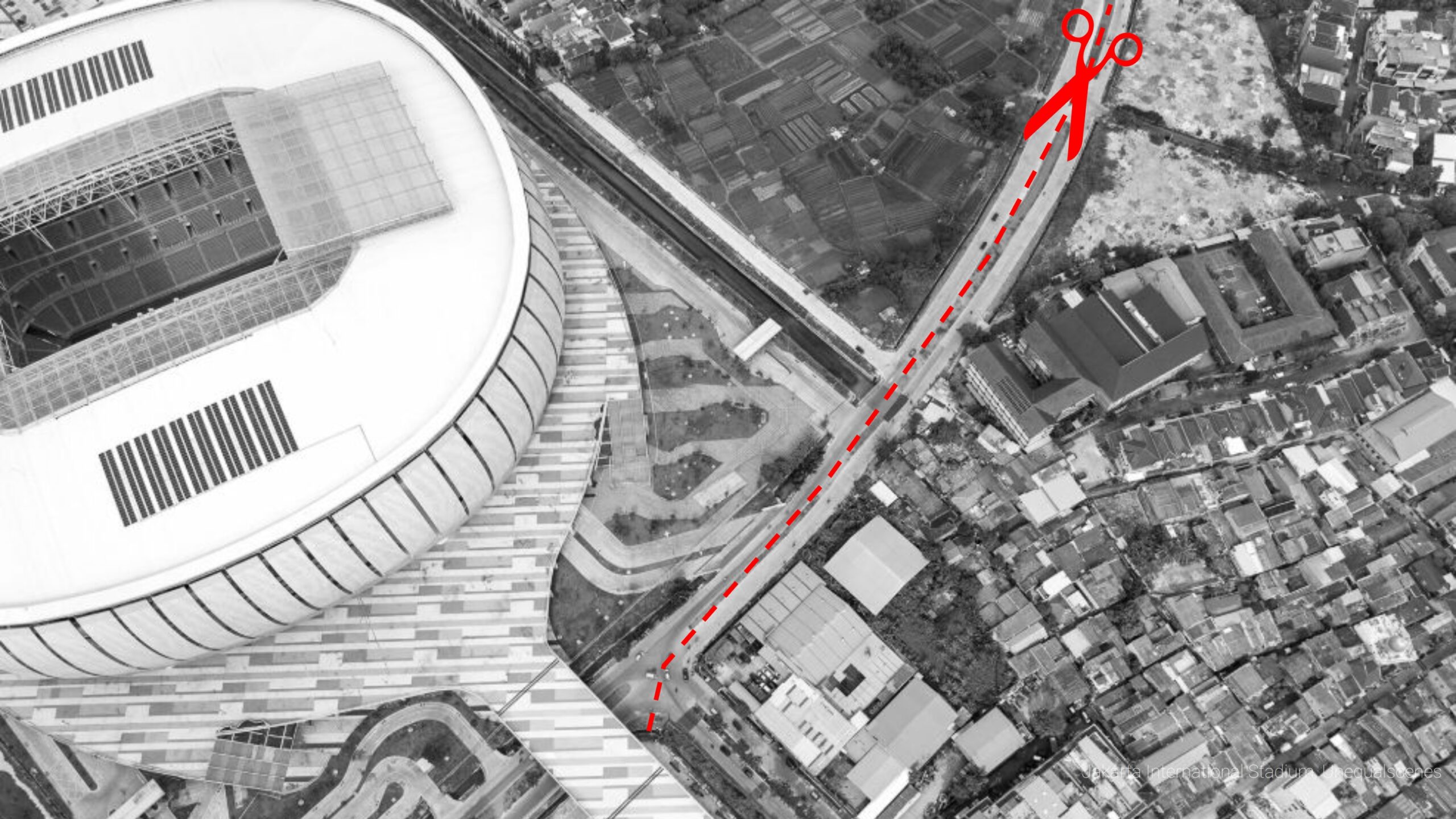
The main building instance is located in Penjaringan, North Jakarta, a low-lying coastal district. The floating complex occupies approximately 30,000 m² and integrates housing, public amenities, and a stadium into a continuous water-based urban fabric.
Colour Code Plans
Plans are organized by program clarity and circulation efficiency. Ground levels prioritize public access and services, upper levels accommodate housing and workspaces, and green patios provide shared outdoor space. Color-coded plans distinguish residential, commercial, service, and circulation areas.
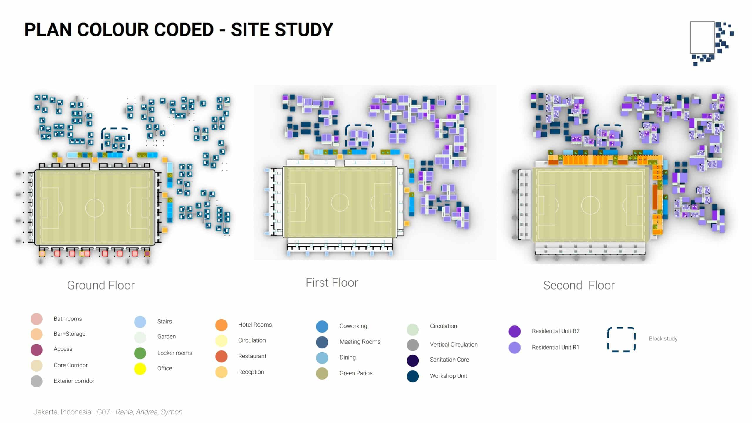
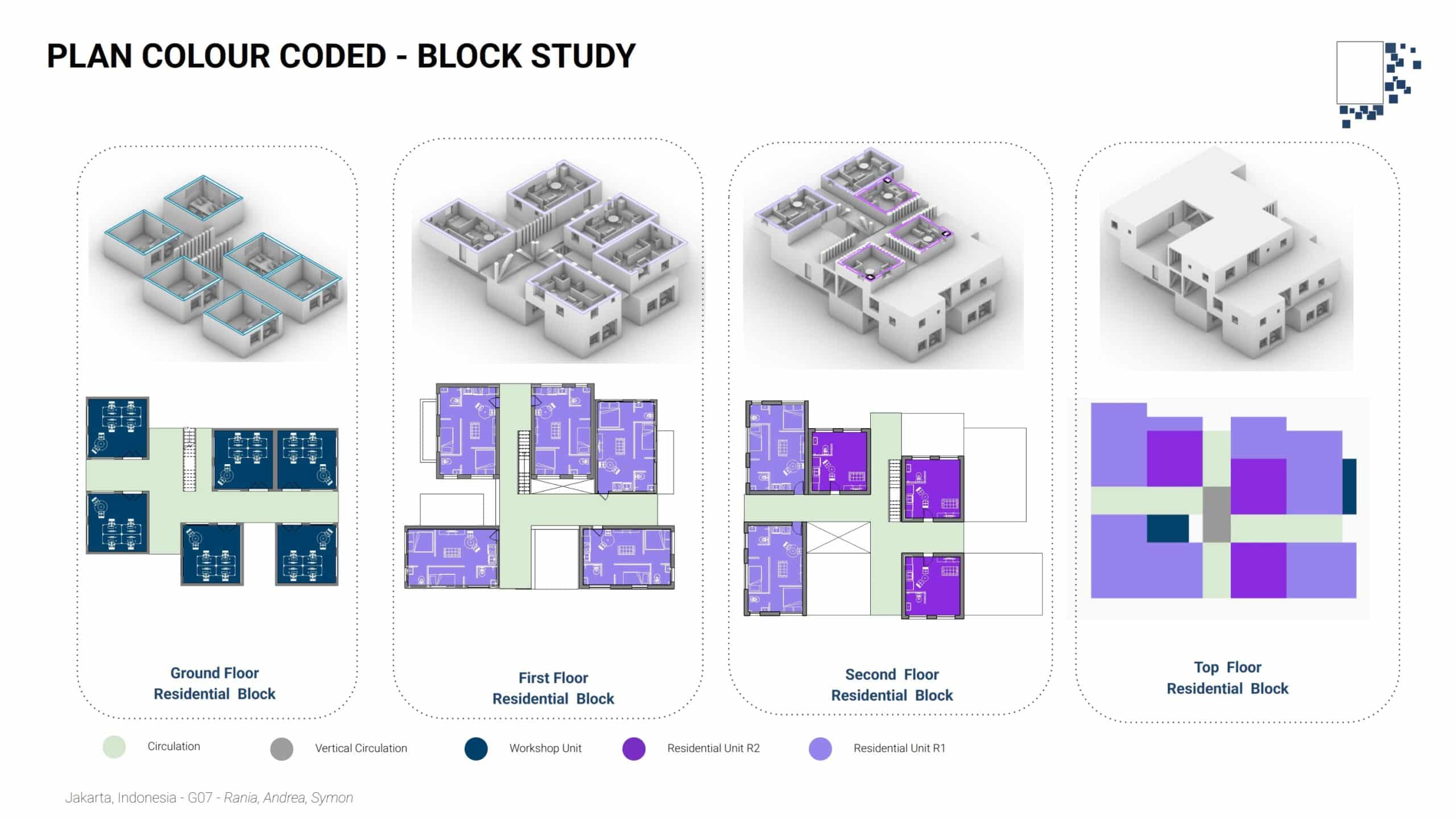
Entails studies on how a block functions. Key considerations are, creating wind tunnels on all levels to allow for wind to flash out stale air. Overhangs to ensure that the spaces are continuously shaded against the midday sun. Openings on at least two sides of a facade
Building Plans
Plans are organized by program clarity and circulation efficiency. Ground levels prioritize public access and services, upper levels accommodate housing and workspaces, and green patios provide shared outdoor space. Color-coded plans distinguish residential, commercial, service, and circulation areas.
Iterations
Multiple aggregation and program scenarios were tested to evaluate density, environmental performance, and spatial quality. Iterations refined module distribution, circulation logic, and open space configuration, leading to a balanced solution that aligns resilience, community use, and large-scale infrastructure.
The aggregation is now limited to rectangular pitches, but we’re confident that this could be extended to more complex shapes.
Conclusion: Bridging Infrastructure and Community Resilience
is project proposes a shift from isolated infrastructure to community-integrated design in Jakarta. By addressing environmental and social vulnerabilities, the proposal transforms urban challenges into multi-functional opportunities.
Key Takeaways
- Community Integration: Merges mega-projects with local communities to prevent social isolation.
- Innovative Infrastructure: Repurposes flood resilience barriers as land for stadium construction to combat land subsidence.
- Environmental Expansion: Utilizes flood resilience areas to extend much-needed park space.
- Adaptive Living: Implements efficient floating housing models to protect residents from frequent flooding.
