The MaCAD is a unique online programme training a new generation of architects, engineers and designers ready to develop skills into the latest softwares, computational tools, BIM technologies and AI towards innovation for the Architecture, Engineering and Construction (AEC) industry.

Filters
Course

BIM and the Sustainable development of affordable communities for informal settlements in Egypt

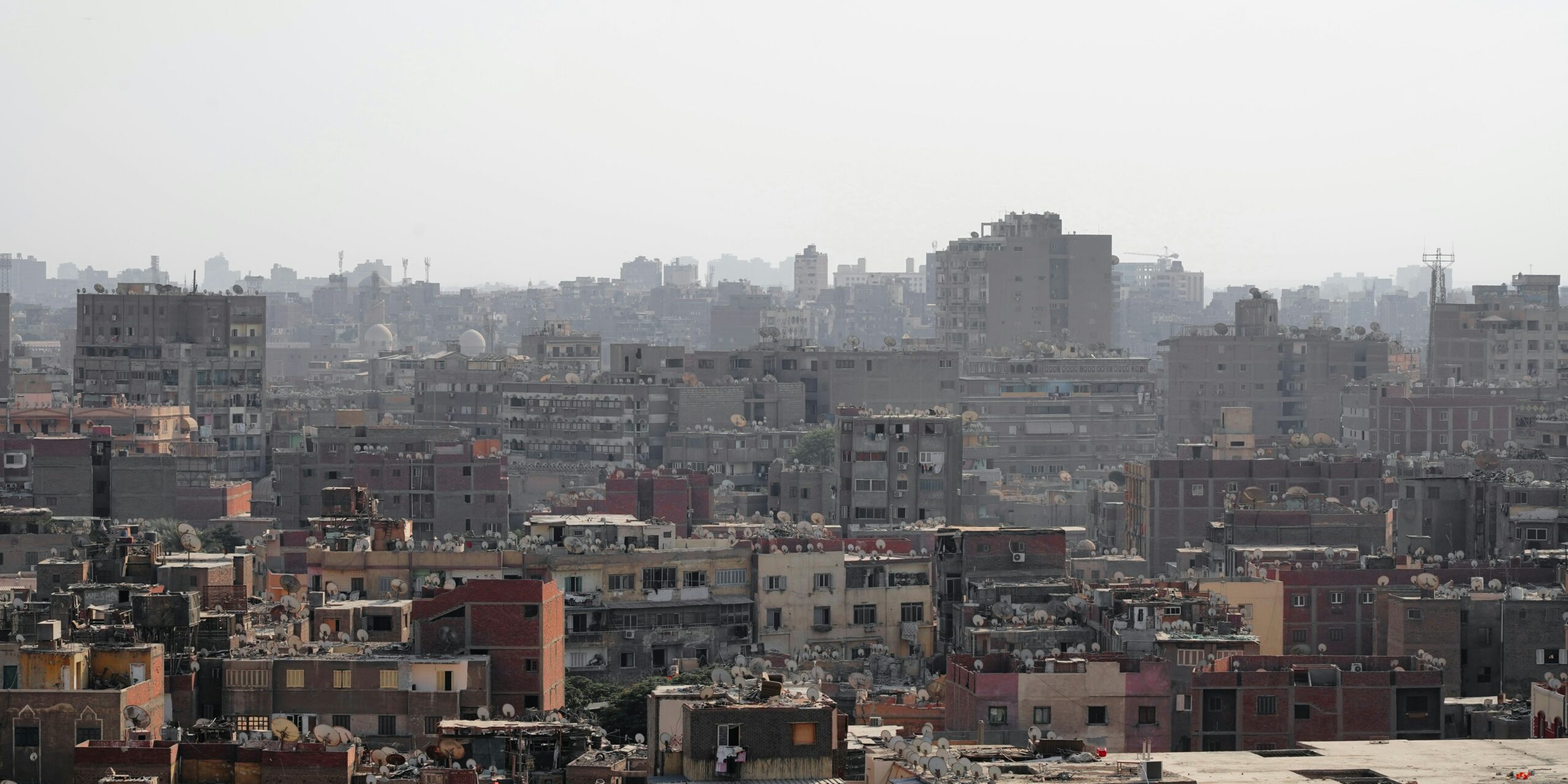
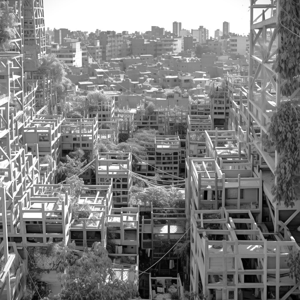
Abstract Informal settlements across all of Egypt are characterized by complex socio-economic situations aggravated by the immense size of the population and its rapid growth. As a result of lack of building regulations, extreme poverty and continuous need for expansion, the rise of uncontrolled informal settlements remains a significant challenge for Egypt. Our research explores … Read more

Frihamns Navet Port HUB. Multilevel Timber-skeletons… at work 

This project, approached as a demonstrative project, was elaborated by Group 8, Anna Irene Del Monaco and Athanasios Vagias and worked on multilevel Timber structure.  We started investigating precedents on timber skeleton structure. Our initial interest fell on the Maggie’s center by Foster and partners for the masterful creation of a refined structural node in … Read more

Simulating Heritage: Computational insights into Yazd’s Vernacular

Yazd, formerly known as Yezd, is the capital of Yazd province in Iran. located 270 kilometers (170 miles) southeast of Isfahan, this ancient city is situated in the heart of the central Iranian desert. Having survived through multiple generations in an environment defined by scorching hot and dry summers, juxtaposed with bone-chilling winters, the cities … Read more

Interspecies city: A Co-Creative Model for Sustainable Urban Growth

INTRODUCTIONWhat is the difference between writing in ink and writing in pencil? Pencil can be easily deleted and re-written, while ink is permanent. In the realm of construction, the choice between writing in ink and pencil becomes a metaphor for permanence versus adaptability. Our cities face the urgent need for transformation in the face of … Read more

Reversing Ecosystem Degradation

MaCAD 23/24 // ACESD Theory Existing State of Urban Design In order to understand how to strive for successful ecological design practices, designers must first understand the problems that currently exist in the process of urban design. The current state of design tends to create distinct enclosures between both natural ecosystems and humans, with the … Read more

GRAPH MACHINE LEARNING TOWARDS ADAPTIVE CITIES: A data-driven approach to sea level rise problematics

Abstract This thesis explores experimental approaches when addressing sea level rise challenges , the impacts of land loss due to sea rise and population growth. It delves into considerations associated with innovative approaches while emphasizing the integration of urban syntax and graph machine learning. Drawing upon case studies and open data, underscoring the importance of … Read more

Superblock BCN

A Multidimensional Study of the Superilla My research starts from observing human behaviour. Often when we face a change in our lives, especially when it wasn’t planned, we feel resistance and it takes time before we accept and embrace it.  As you probably know Barcelona in the last few years lived some changes in its … Read more

WEB GRAPH MACHINE LEARNING

Our project website can be accessed at bit.ly/graphml Introduction Our research focused on hosting a machine learning model on the web that accesses Rhino.Compute. It receives an input of a polyline drawn on a Leaflet.js map by a user to indicate the central corridor spine of a building and returns a graph of that building … Read more

FireFly

Harnessing the power of drone-based photogrammetry and artificial intelligence to create a low-cost urban wildfire diagnostic tool. In recent years, the global community has witnessed a significant upsurge in the frequency and intensity of wildfires. Driven by a combination of climate change, urban expansion, and land-use practices, these fires have not only devastated vast natural … Read more

Wildlife Corridors

Our project focuses on modeling and predicting habitat fragmentation avoidance mechanisms using graphs. We investigate wildlife corridors in Australia, leveraging graph-based approaches to create coherent passages and connect forest areas. By analyzing satellite images, road data, and other metrics, we construct and evaluate graph models that incorporate forest containment, node characteristics, and connectivity. Our goal … Read more

4sight

Insightful Predictions for Your City’s Future. The purpose of Foresight is to leverage the capabilities of machine learning to anticipate the potential effects of novel urban infrastructure on the city’s fabric and the value of city blocks. Foresight aims to serve as a preliminary design tool, with the ability to swiftly process vast amounts of … Read more