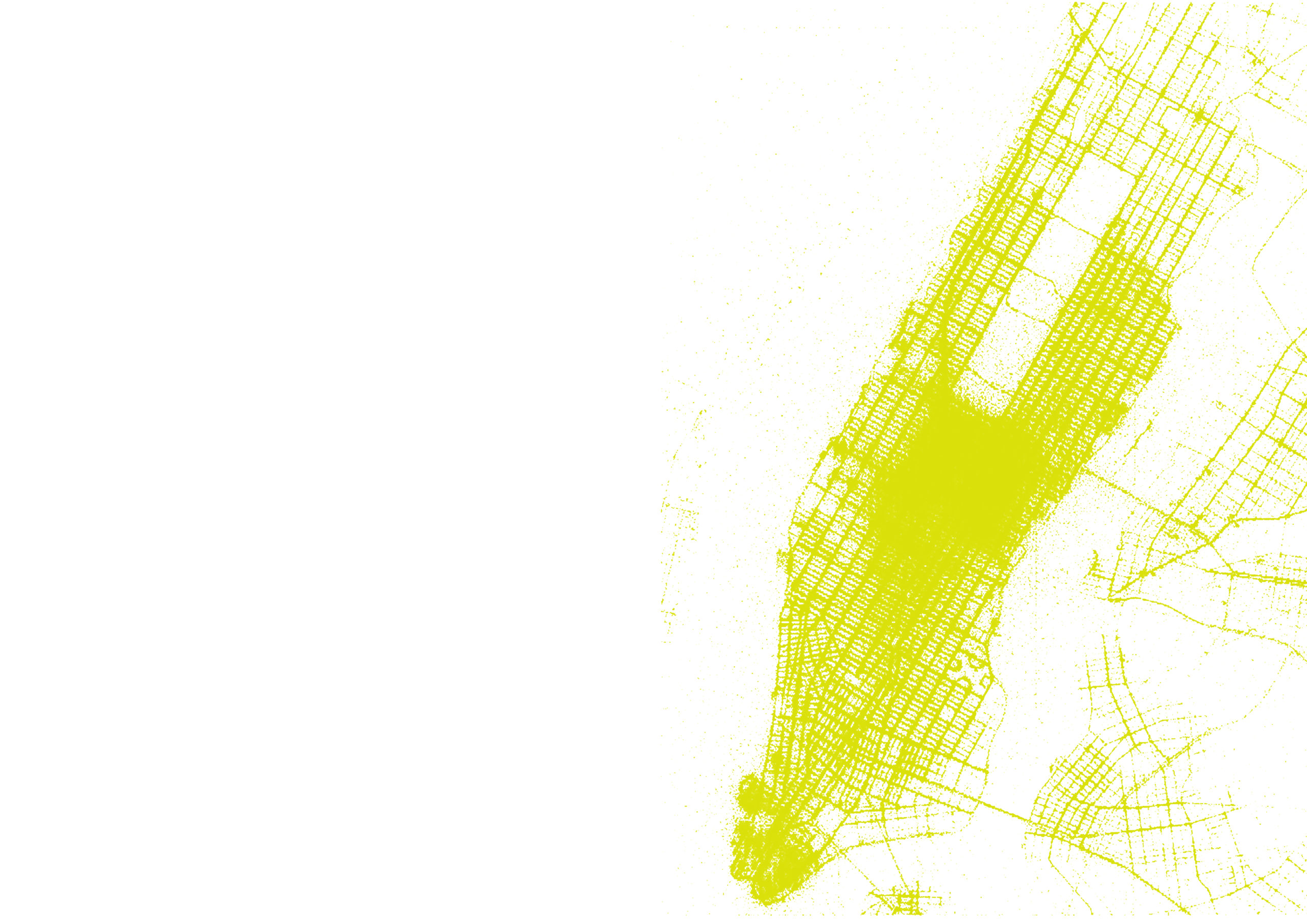
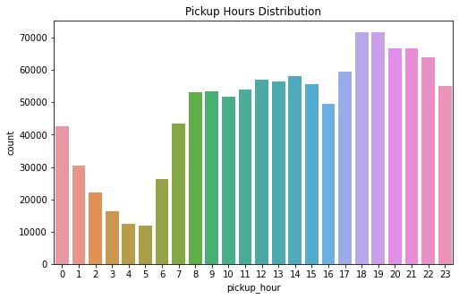
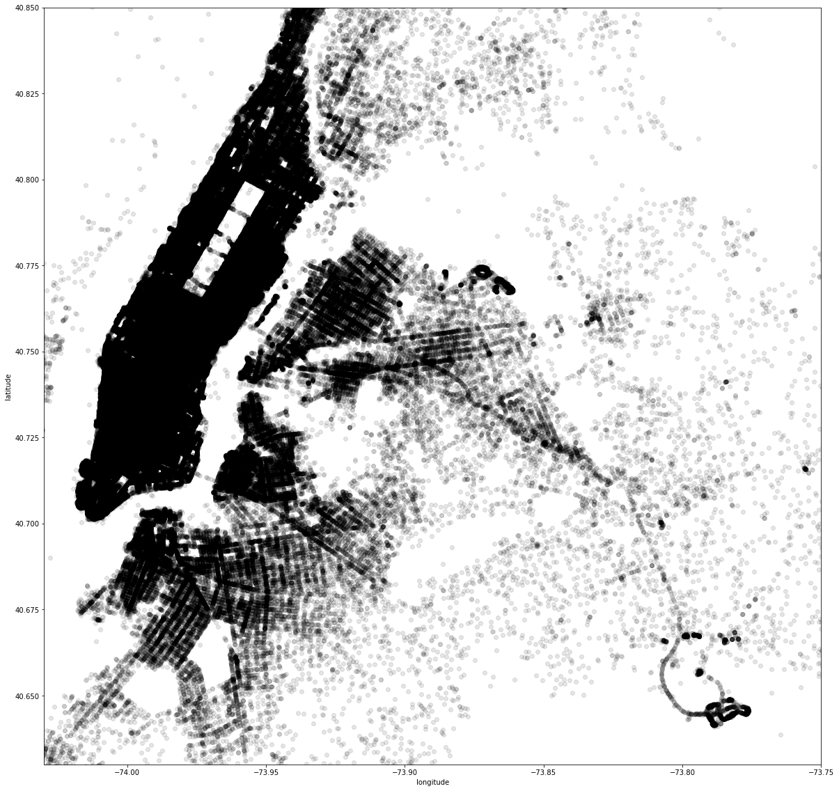
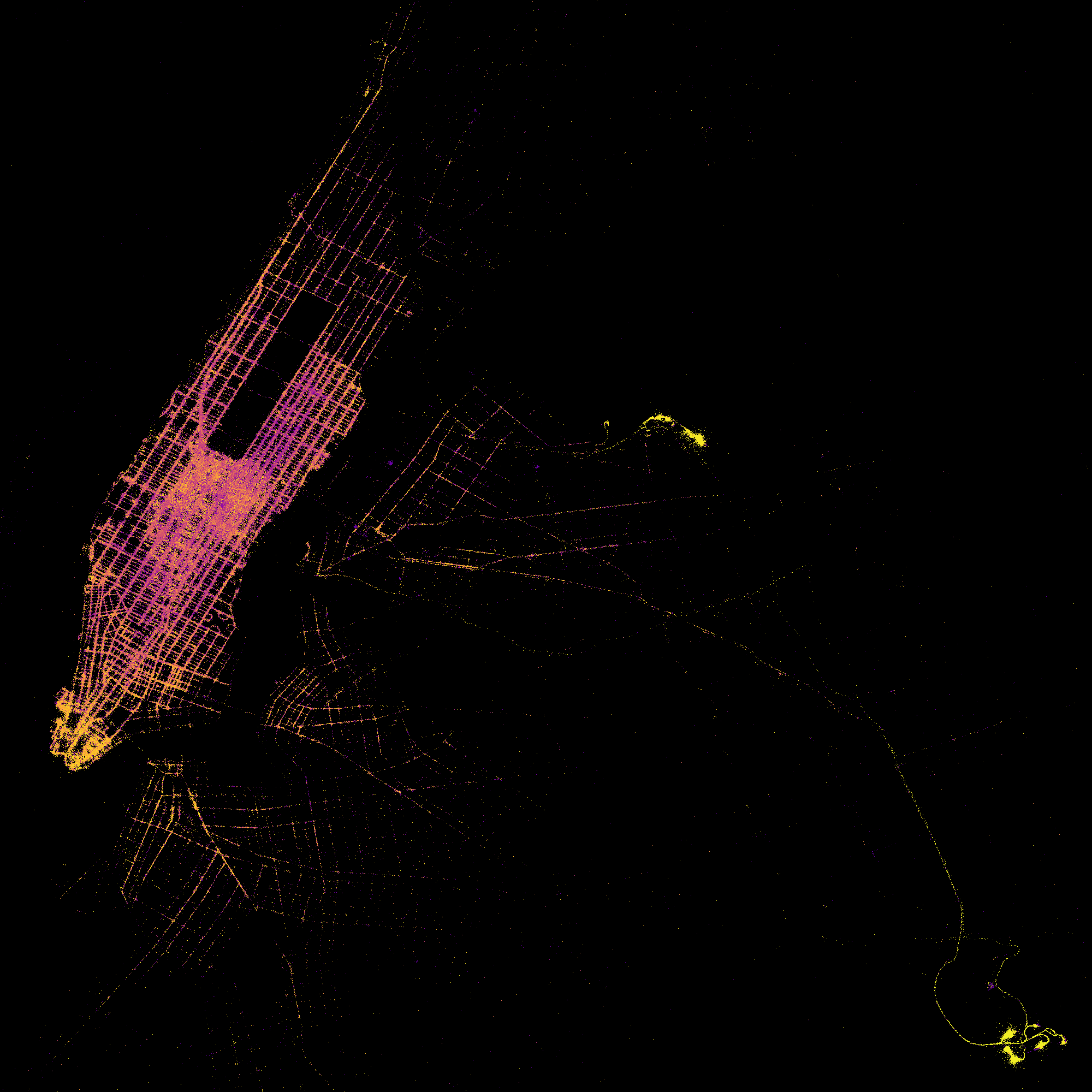
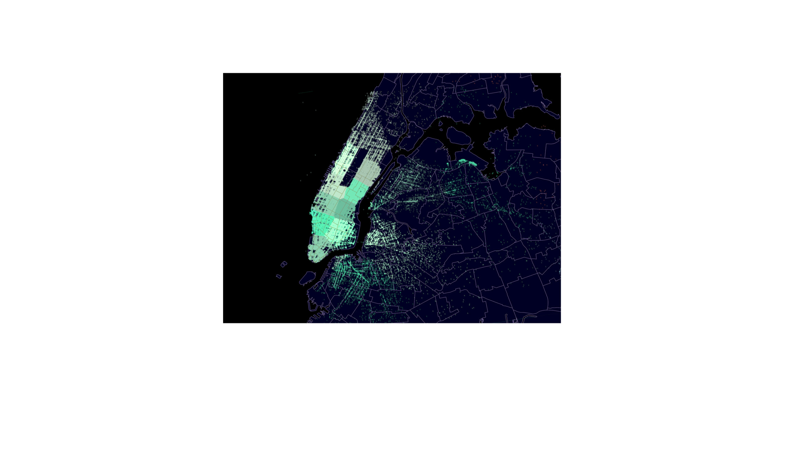
IAAC’s Master in City & Technology (1 or 2-year program) is a unique program oriented towards redefining the analysis, planning, and design of twenty-first-century cities and beyond. The program offers expertise in the design of digitally enhanced, ecological and human-centered urban environments by intersecting the disciplines of urbanism and data science. Taking place in Barcelona, the capital of urbanism, the Master in City & Technology is training the professionals that city administrations, governments, industries, and communities need, to transform the urban environment in the era of big data.


Filters
Course

A Policy for Digital Carbon Footprint, Barcelona

Every single search query, every streamed song or video and every email sent, billions of times over all around the world – it all adds up to an ever-increasing global demand for electricity, and to rising CO2 emissions too. Our increasing reliance on digital tools has an environmental impact that’s becoming increasingly harder to ignore. … Read more

Urban Loneliness in FAST-GROWING Cities

Austin, a Lonely City Context Over the last decade, Austin’s status as a state-of-art technology hub along with its high concentration of venture apital, warm climate and vibrant cultural offerings has set the Texan city as the 2nd faster-growing U.S. city in 2022, only after San Francisco. But paradoxically , urban loneliness reflects as one … Read more

Decarbonization of Housing Stock in EU

Buildings are an intrinsic part of our lives, where we spend most of our time and unfold as human beings. However, through its different forms, the built environment is responsible for the majority of our energy consumption (around 40 %) and a primary source of greenhouse emissions GHG (around 36 %) (Anderson et al., 2015).  … Read more

The Air we Breathe

An analysis of the correlation between population and air quality in the districts of Barcelona. The air quality in urban areas have rapidly declined over the years. In the process of economic development, air pollution has become a significant health hazard. This project analyses the relationship between population density and air quality levels in Barcelona. … Read more

The Wild Deal

ABSTRACT Urban Rights is a term which has been coined by the philosopher Henri Lefebvre (Lefebvre, 1967)  and further explored by David Harvey (Harvey, 2003). It is a concept of a collective right to change the city and shape the process of urbanization. Thus, the right to the city does not merely address what the … Read more

Deaths from air pollution in Central Europe

Air pollution- the combination of outdoor and indoor particulate matter, and ozone– causes more than 7 million deaths each year (World Health Organisation) and it is considered to be one of the world’s largest health and environmental problems. The same data shows that 99% of the world population currently live in places with air quality … Read more

Healthcare BCN

Understanding and analysing the existing Healthcare system of Barcelona with the help of open datasets available. This further helps us to understand the robustness, need and requirement to fill the gaps in the system if any with respect to their typologies and location as per districts Step 1: Documenting the distribution of different types of … Read more

Diagnosing land health

Introduction This project is a short visual story, trying to portray the opportunities and problematics of poor landscapes. It quickly touches upon a little fragment of precision farming- natural vegetation index (ndvi)- that focuses on plant health estimation remotely, from satellite. Ndvi has become the most commonly used vegetation index in remote sensing, especially with … Read more

Birds and weather connectivity

This project was carried out to support research on the relationship between bird populations and natural conditions in the province of Barcelona, Catalonia. In conclusion, the most frequently observed migratory bird Cattle Egret in the province of Barcelona was identified and the rainiest time of the year is spring (month – April) when its migrating … Read more

Global scale data visualization

This project aims to explore the possibilities of mapping global scale data onto an 3D globe – in this case the CO2 emissions per country in Megatons. The project reveals the five biggest contributors to CO2 Emissions in 2019 – China, USA, Russia, Indian & Japan and also shows how little CO2 is emitted by … Read more

Big Data Analytics in the Airline Industry

The case of Greece The air connections constitute critical components of the entire transportation industry in Greece. The geopolitical position of the country as well as its geographical features (mountainous landscape, islands and sea) make the air transport industry essential not only to the regional development and the growth of tourist activity, that comprises a … Read more

Curated Art Walk, BCN

Located in northeastern Spain, on the shores of the Mediterranean, Barcelona has long been hailed as a European cultural capital. From its thriving art scene to its incredible architecture and world-famous gastronomy, here’s why an art and culture lover will fall head over heels for Barcelona. The intent of the whole project is to identify … Read more

Correlation of real estate prices and income in USA

There are over 40,000 ZIP codes in the United States. Categorization by states and ZIP codes in order to compare data, find distinctive features and intercorrelations, and put data on map. VIsualization performed by Python, Plotly Express, Folium. In order to simplify tasks the dataset of 12 North East states is used.