
Almost every day, we are confronted with dramatic images of communities and environments in
crisis . Flash floods have recently become one of Greece’s most common natural occurrences
after wildfires. Flooding occurs due to rapid rainfall and heavy storms, from rising river levels
or melting snow.
Deforestation, poor soil quality and rapid urbanization significantly contribute to the genesis of floods.
Deforestation, also related to soil erosion, is a major issue in Greece. Nowadays, only 18% of the
territory of Greece is covered by forests, whereas at the beginning of the 19th century it was
more than 40%.
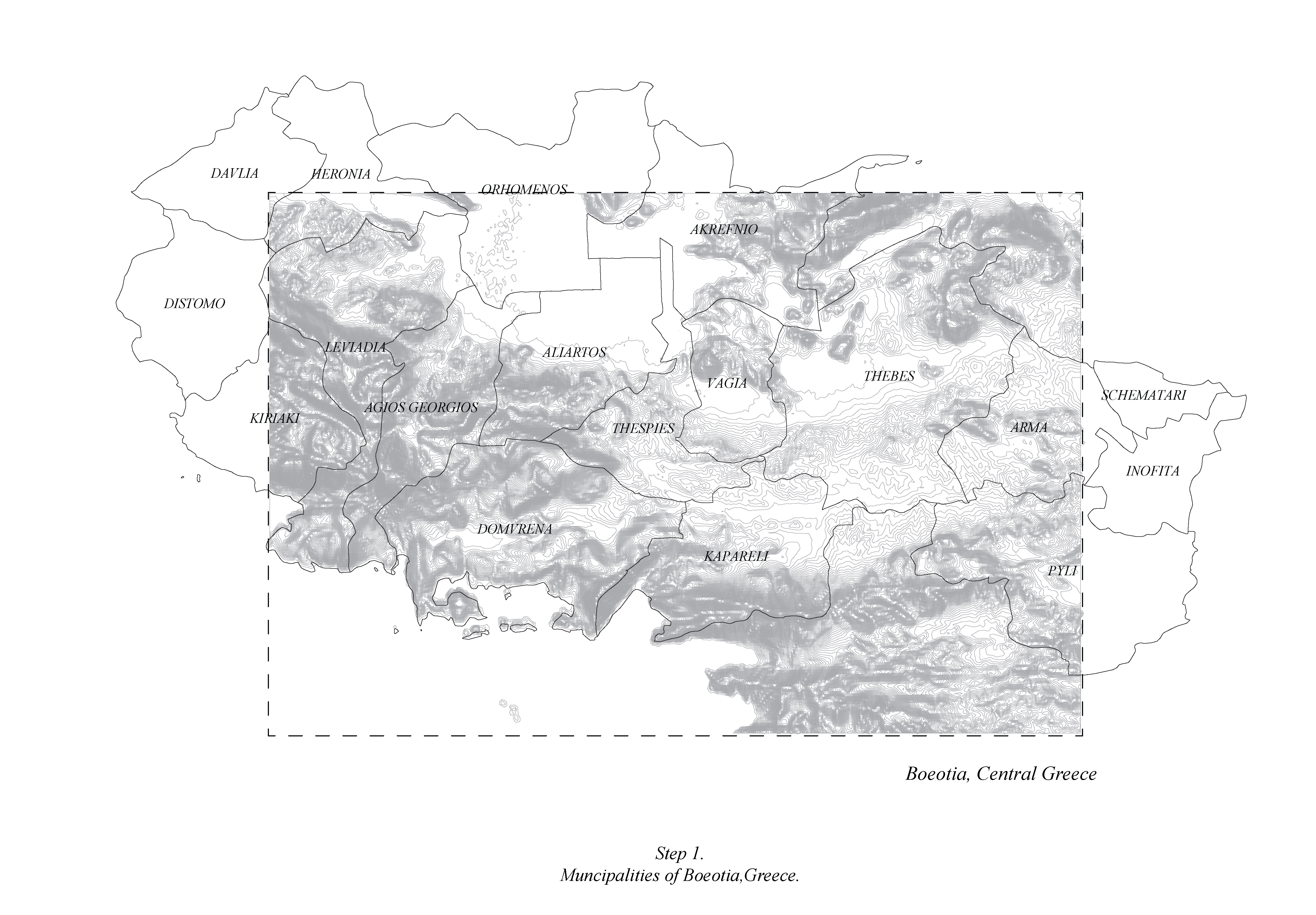
This study uses computational design tools through open databases to locate potential conflicts
related to flood phenomena within the agricultural and urbanized areas of Boeotia Region,
Greece. The plain of Boeotia is one of the most productive agricultural regions of Greece.
This analysis uses open data information to construct the topography (Jarvis Et al., 2008) , to
locate the hydrographic network (Lehner Et al., 2008) and to identify the soil quality (Hengl Et
al., 2021) within the area of study. The clustering of the potential flooded areas are visualized
geometrically according to the proximity of the endpoints of rainfall analysis to their closest
water bodies with the lowest soil quality. In fact, floods are complex phenomena linked to many
other parameters such as forest volumetry of the area, sea level, infrastructure etc. Thus this
project will emphasize on the datasets above to provide a simplified yet replicable model that has
the potential to include further complexity.
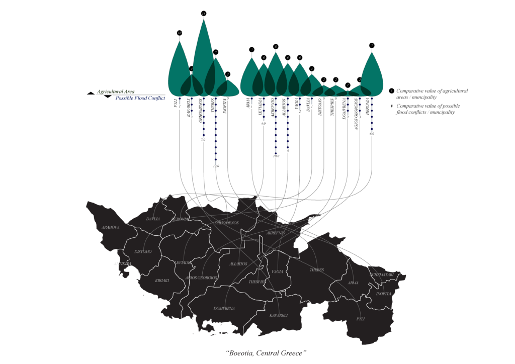
The scope of this project is to identify highly urbanized and agricultural areas with potential
flooding phenomena in order to provide a general basis for urban and rural planning, aiming at
reinforcing local communities’ resilience towards crisis management.
Citation:
?Jarvis, A., H.I. Reuter, A. Nelson, E. Guevara. 2008. Hole-filled SRTM for the globe Version 4,
available from the CGIAR-CSI SRTM 90m Database: https://srtm.csi.cgiar.org.
? Lehner, B., Verdin, K., Jarvis, A. (2008): New global hydrography derived from spaceborne
elevation data. Eos, Transactions, AGU, 89(10): 93-94.
? Hengl, T., Miller, M.A.E., Križan, J., et al. African soil properties and nutrients mapped at 30 m
spatial resolution using two-scale ensemble machine learning. Sci Rep 11, 6130 (2021).
doi:10.1038/s41598-021-85639-y
