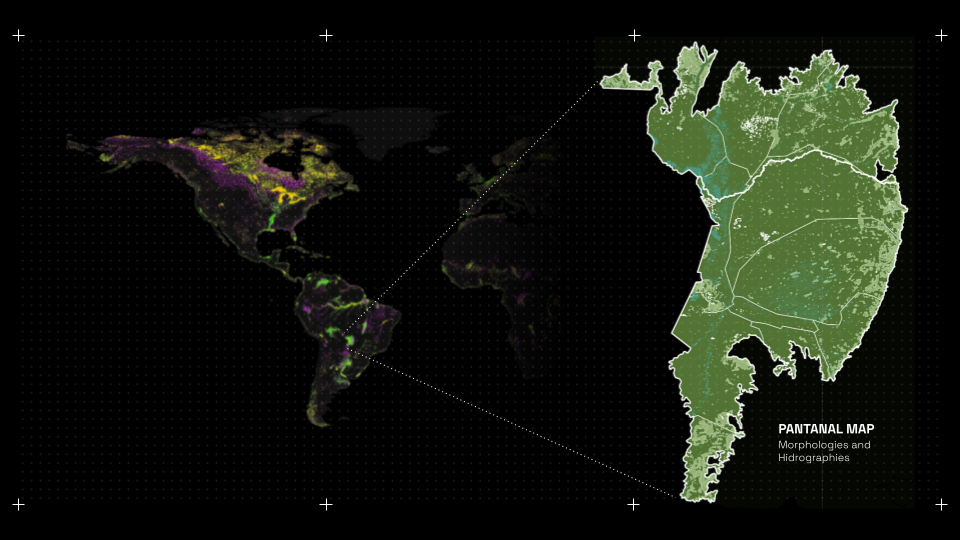
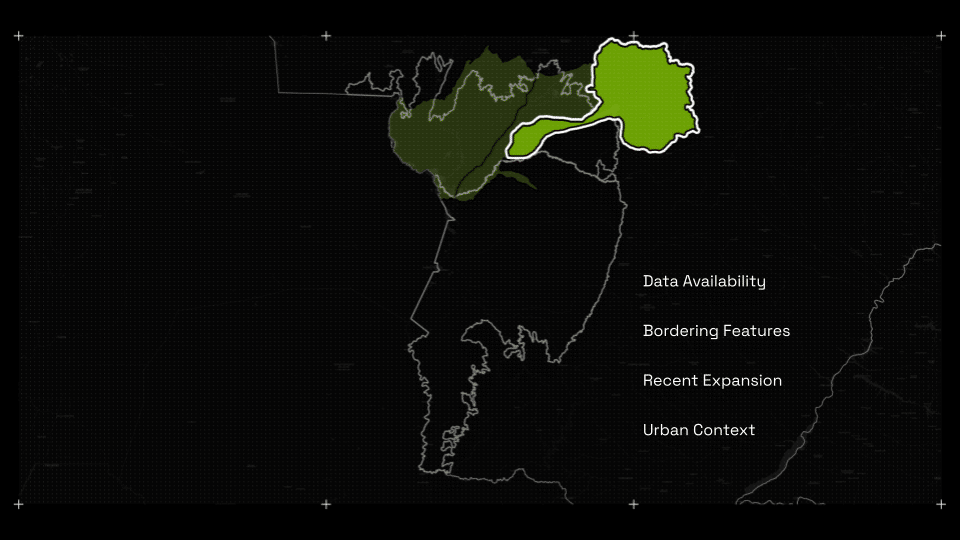
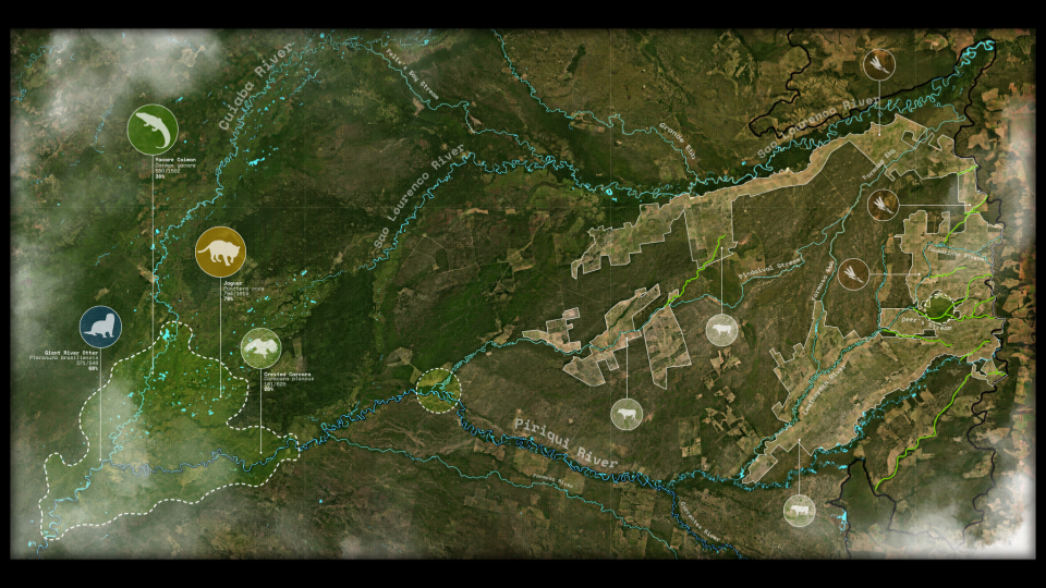
The Pantanal is the worlds largest wetland. A huge biom in the central depression of South America. Its morphology follows its geology, that due to recent continental drift movements, creates highlands closer to the continental edges, conducting the water towards its centre before flowing downwards.That creates the perfect hotspot for thousands of species, creating one of the most biodiverse regions in the planet. There is a Local saying that goes by: ‘The Pantanal is not one, but many.’ That is because the Pantanal – comparable in area to the United Kingdom – is not one singular static biome, but rather, composed by many alternating patches of landscape. Each one of them presenting singular and particular dynamics.The Upper Paraguay River network: tributaries descending from surrounding highlands (e.g., the Mato Grosso Plateau) converge into a broad, low-relief depression where channel hydraulics and floodplain storage govern seasonal inundation (Hamilton 2002; Rodriguez-Iturbe and Rinaldo 1997). In this setting, the spatial configuration of rivers, lakes, and capillary channels delineates wetland boundaries and mediates the flood-pulse regime that transfers water, sediments, and nutrients laterally across backswamps and riparian forests and vertically into soils and groundwaterThe São Lourenço is one such feeder, whose hydrograph and connectivity are conditioned by the topology of the basin’s fluvial network; alterations in timing or magnitude of flows propagate as changes in inundation extent, habitat mosaics, and corridor permeability at landscape scale. Chosen due to several factors. Of which, it is key to highlight: The Bordering features that arise from the Recent Expansion through Fronteer Effect that grows from the Urban Context, going through highly intensive cropland cultures reaching patches of Pristine Nature by its westernmost regions. All these phenomena have been registered consistently for the extent of roughly 4 decades and allows for the assessment of information required for dynamic analysis of the landscape.
DYNAMICS
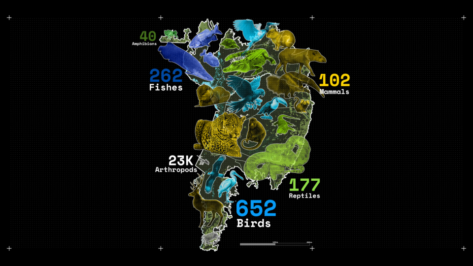
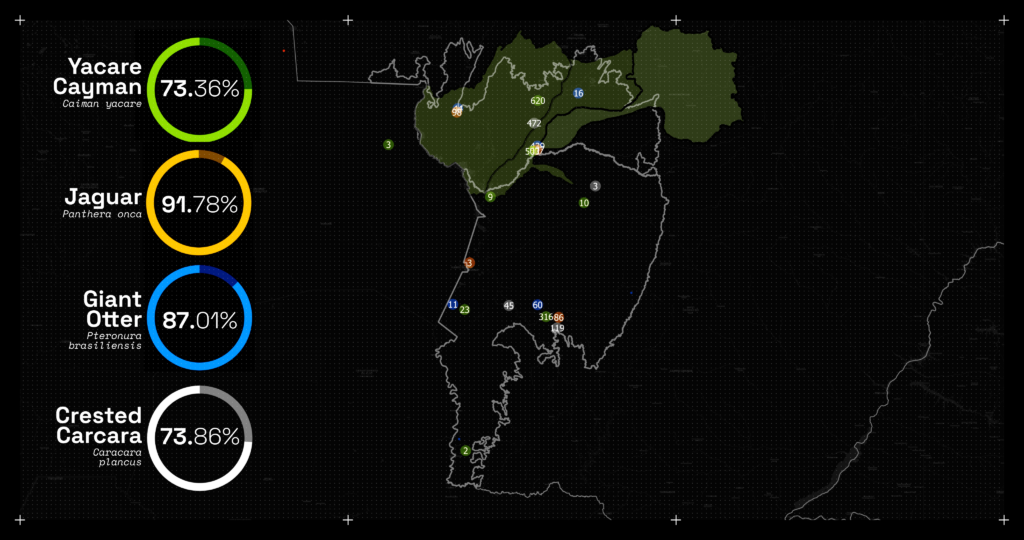
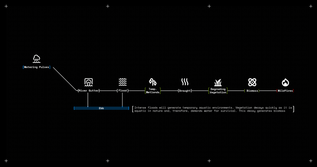
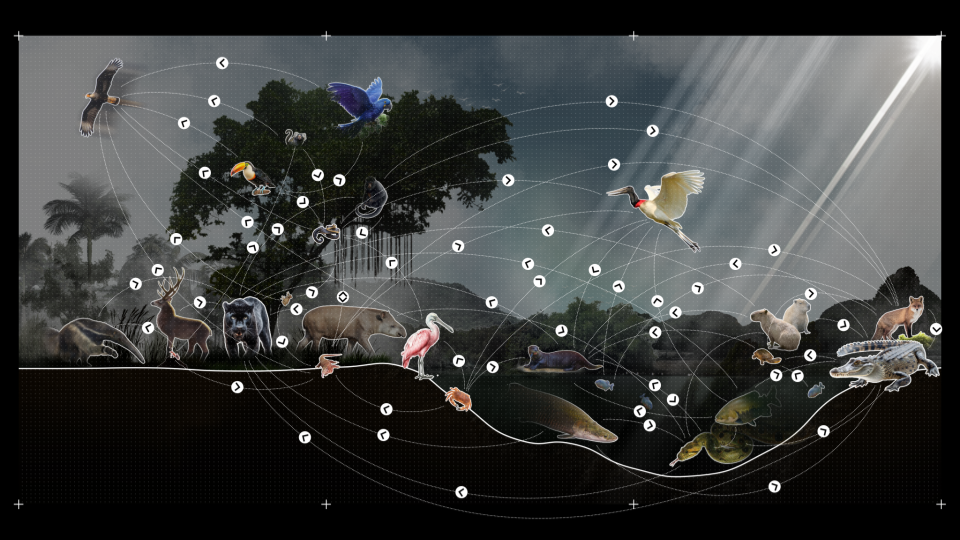
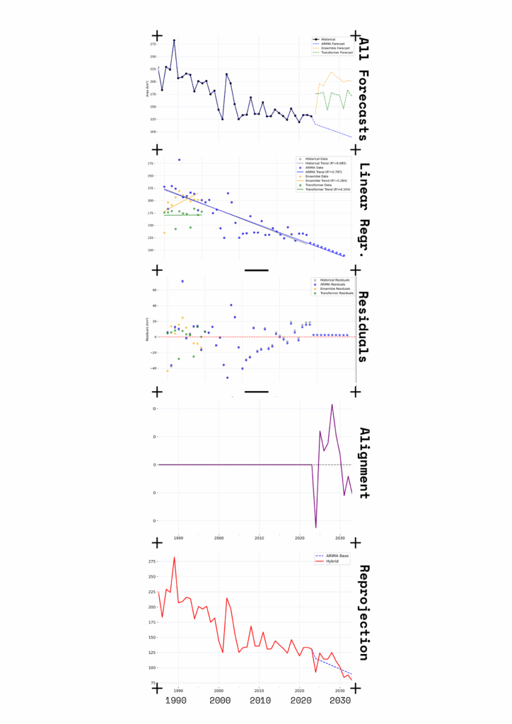
The most important dynamic in the pantanal – in terms of its geology and morphological alterations to a natural level – is the flood pulse dynamics. A fundamental hydrological process that drives the ecology of river-floodplain systems, defined by seasonal inundation. During floods, river water connects with the floodplain, providing water, nutrients, and new habitats that support organisms’ interactions. This dynamic creates high productivity in the aquatic-terrestrial transition zone and influences the distribution and diversity of organisms, which adapt their life cycles to utilize resources during different phases of the flood pulse. However, due to recent imbalance, water pulses are not consistent anymore; resulting in longer draughts and more intense floods. This imbalance in itself literally fuels one of the growing problematics for the region: Wildfires. Floods create temporary aquatic environments. The plants in such, grow very fast given the ammount of resources available from the pairing of large quantities of water and biomaterial that floats on it. However – such plants also dry very fast and the result is that, with longer draughts, those plants quickly convert to biomass: highly flamable.Within such temporary aquatic environments many animals find their habitats in much varying dynamics – establishing diverse levels of Ecological Interactions with one another. This thesis takes inspiration in the rewilding strategy named 3Cs: Cores Corridores and Carnivores, that refers to apex predators as indicator species for healthy environments, asuming that, once they are at the apex level of their respective food chains, stable and healthy populations of these species are indicatives for landscape quality. The expansion of large-scale, mechanized agriculture, especially for soybeans, pushes cattle ranching out of the surrounding Cerrado plateau and into the Pantanal floodplain. The Cerrado is Brazil’s last agricultural frontier and a hotspot for agribusiness. While, within the wetland: cattle ranching is a culturally and historically significant practice. However, increasing market pressures are leading to more intensive ranching. This involves replacing native grasses with high-yield, non-native species, which requires clearing existing native vegetation. In other words: Cattle comes before in order to pave the way for monocultural croplands
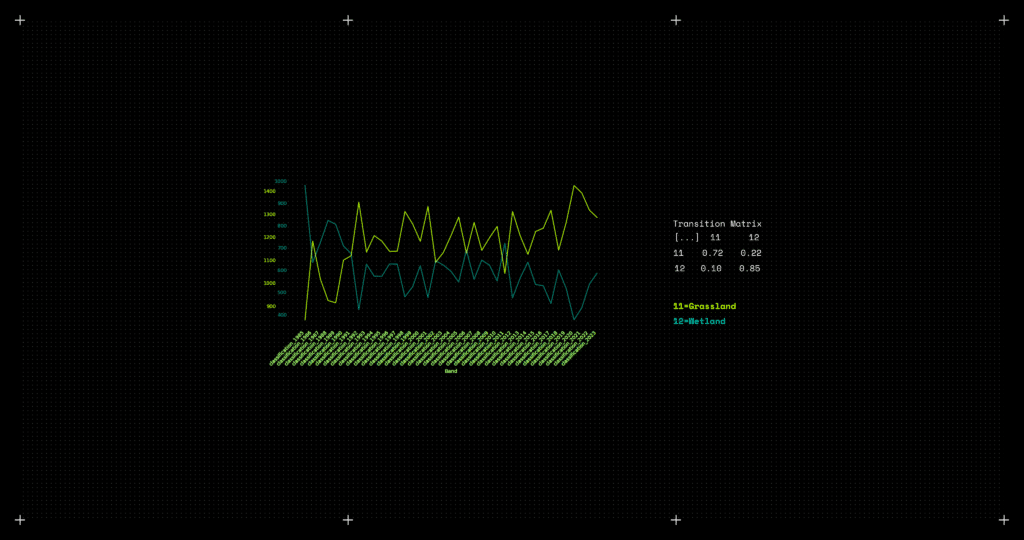
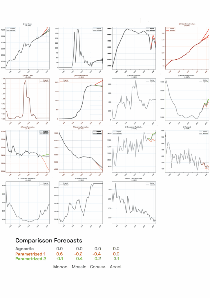
Several vegetable formations present show mirrored behavior. Such is the case for the classes Wetland and Grassland that – not only show similar behavior numerically – but spatially as well: competing for the same spaces – directly impacted by water quantities and location
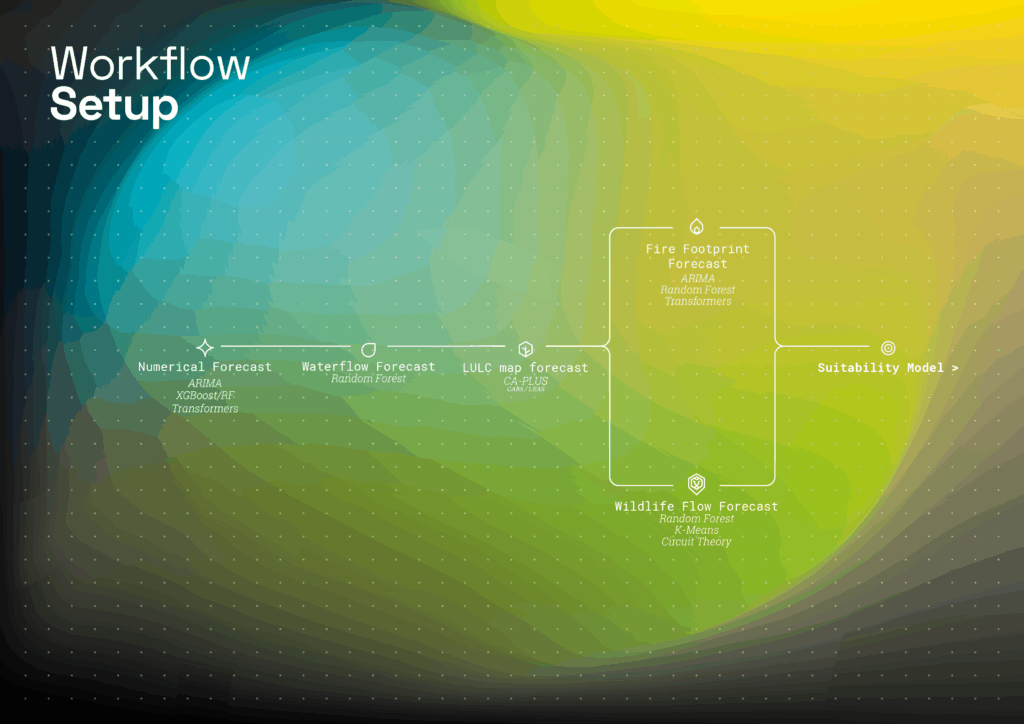
METHODOLOGY
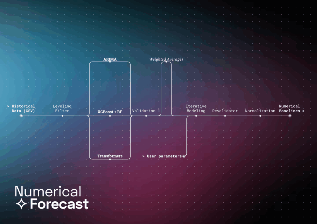
Example for itterative modeling for the numerical baseline model.
Example usage for the User-Inputs that influence the forecasting of values
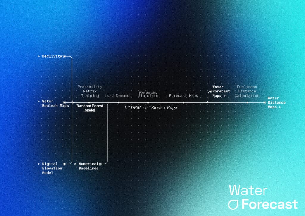
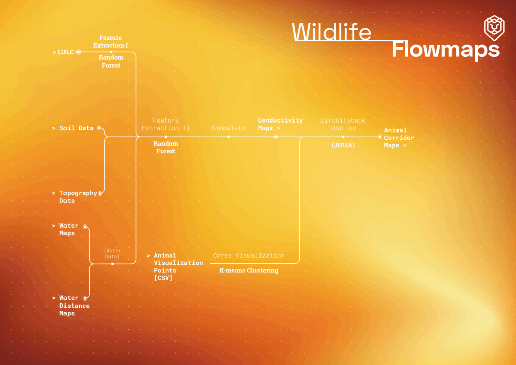
Water proximity maps are generated from euclidian distance evaluation from both generated and original watermaps – following the same process as in road network proximity but keeping its focus on the wildlife behavior and relationship to the landscape.
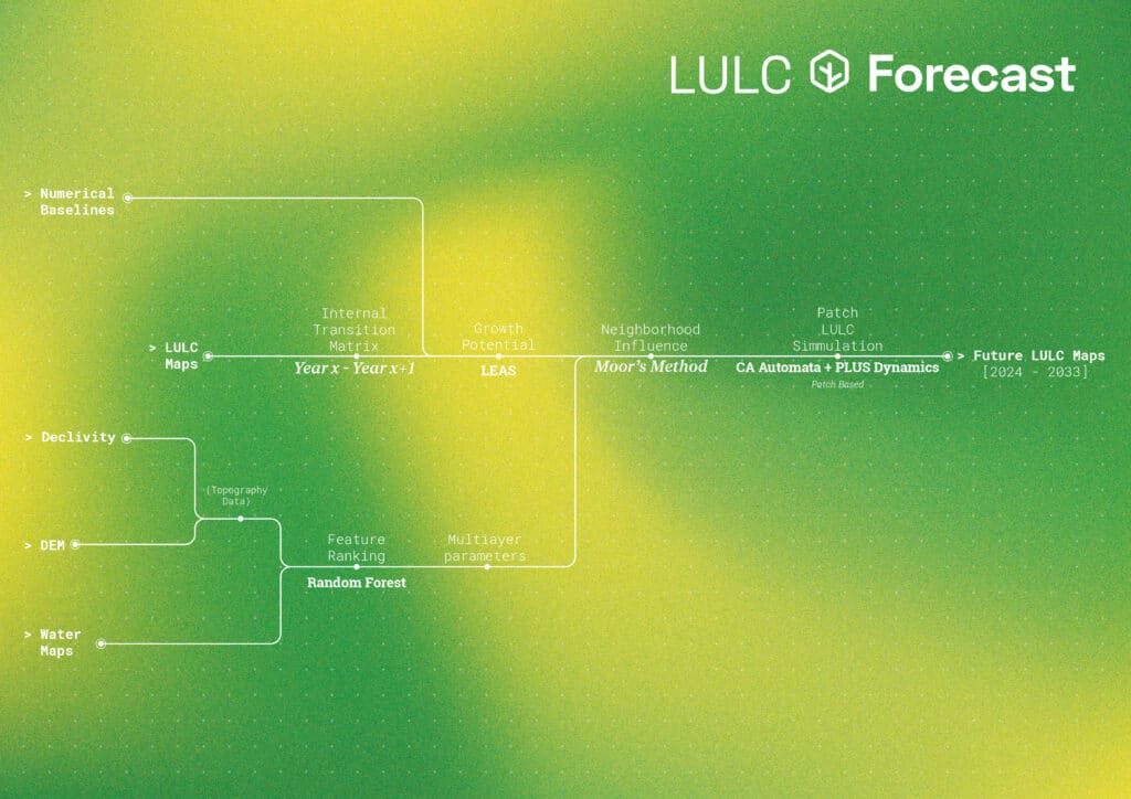
Growth potential maps for each class generated by LEAS sampling of datasets intercrossed with Transition Matrices.
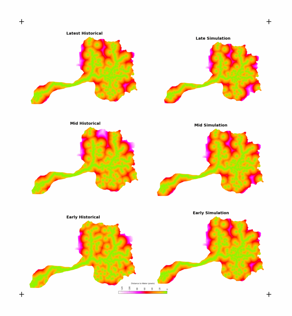
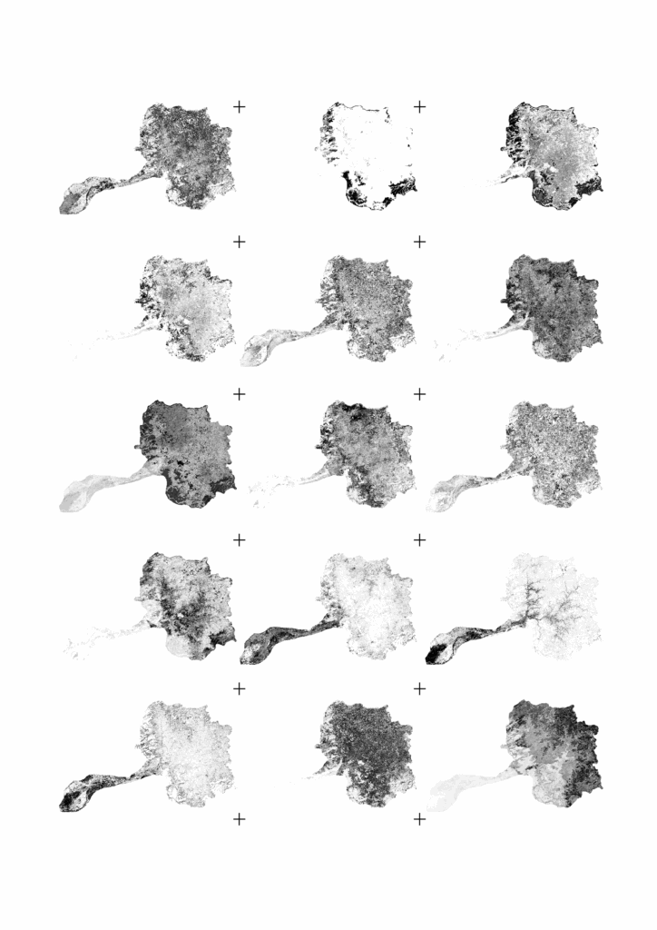
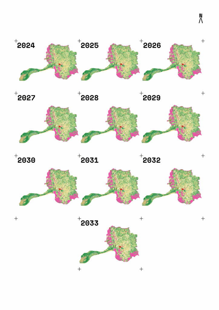
Landscape evolution for the São Lourenço Watershed (agnostic)
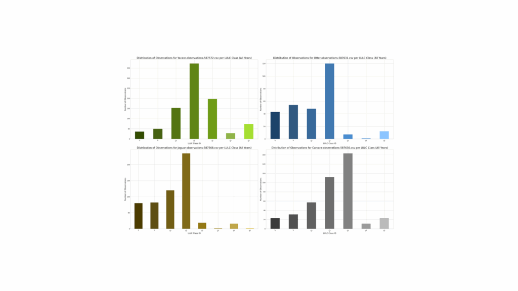
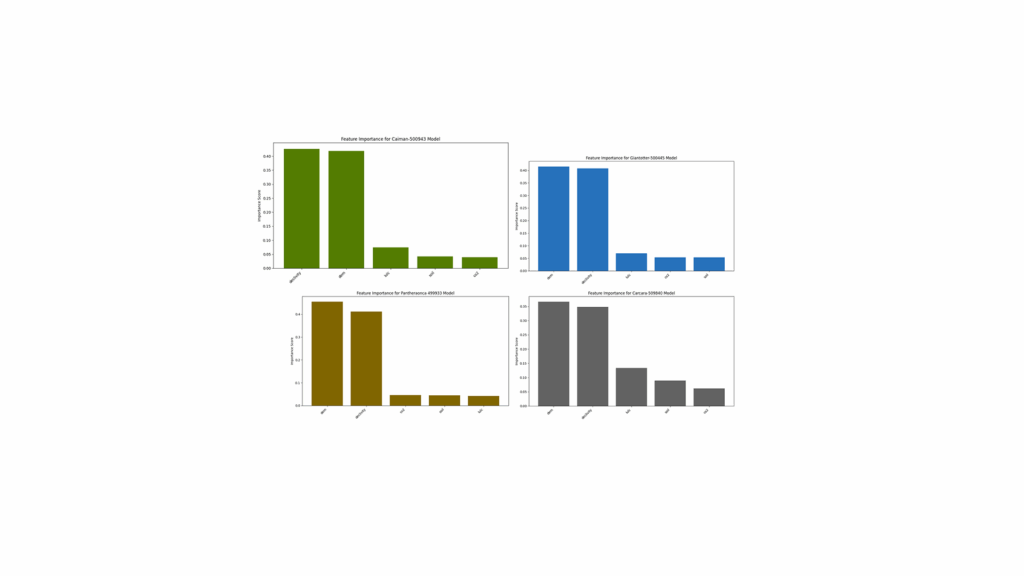
Class feature extractor (I) results for each keystone species (yacare in green, otter in blue, jaguar in yellow and carcara in gray)Feature extractor (II) results for each dataset for each keystone species (yacare in green, otter in blue, jaguar in yellow and carcara in gray)
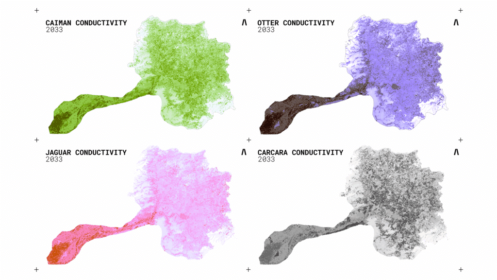
Conductivity maps for the year 2033 for each keystone species.
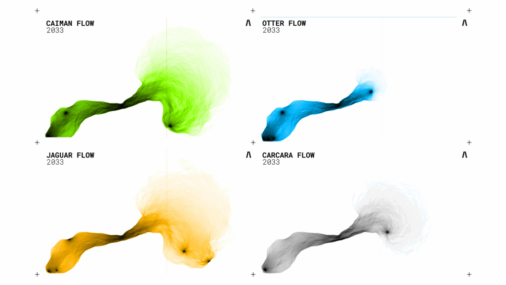
Circuitscape symmulations for each species for the year 2033 (agnostic forecast)
ANALYSIS
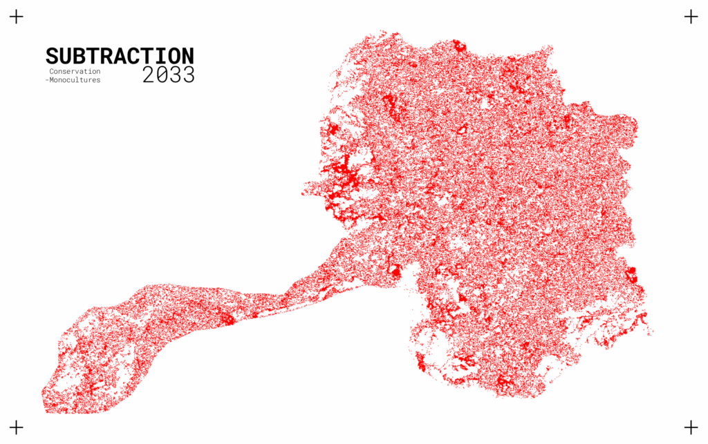
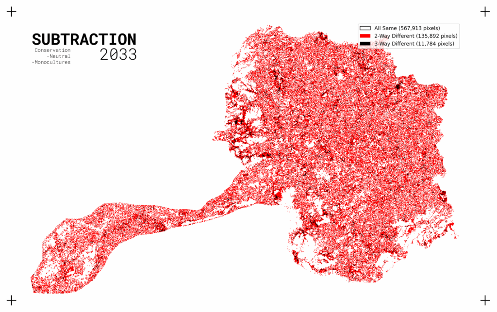
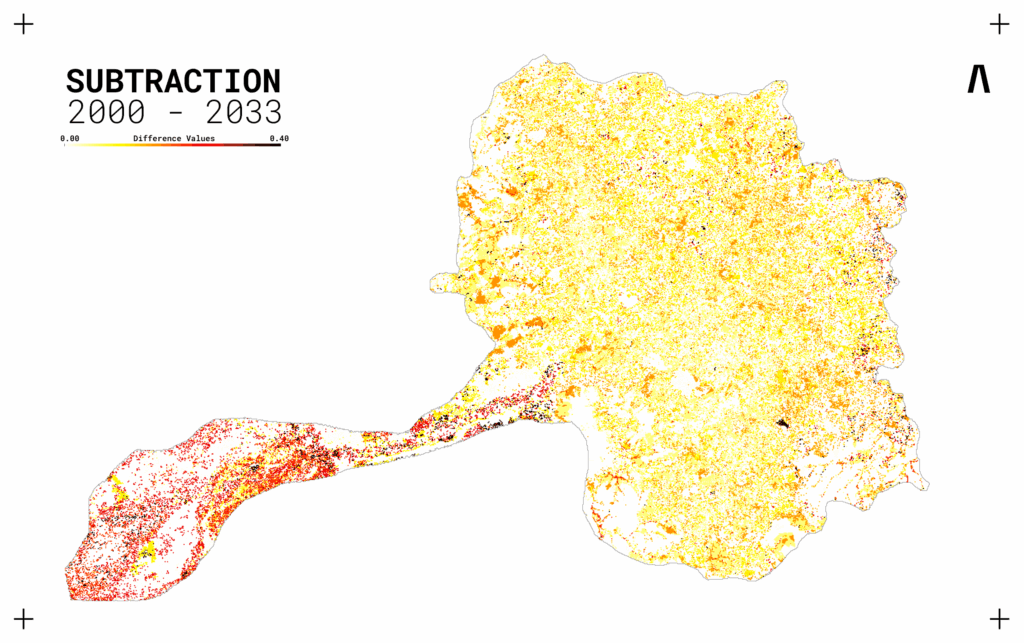
By subtracting different scenarios from one another: The differences start to become clear as to what areas areconsisently lost vs what areas are inconsistently lost. The latter being the one where planners and ecologists should focus their efforts the most if aiming to potentialize action.
The figure becomes even clearer when adding a third layer to the subtraction that integrates an agnostic forecast for the same year. By comparing rasters and observing the patterns, one can better pinpoint the key hotspots that suffer the most from the least ammount of alteration – optimizing ecological action.
Post-conductivity analytical subtraction is also viable and allows for the identification of specific changes regarding macrozones in the landscape that are oriented specifically towards a chosen species or group of species.
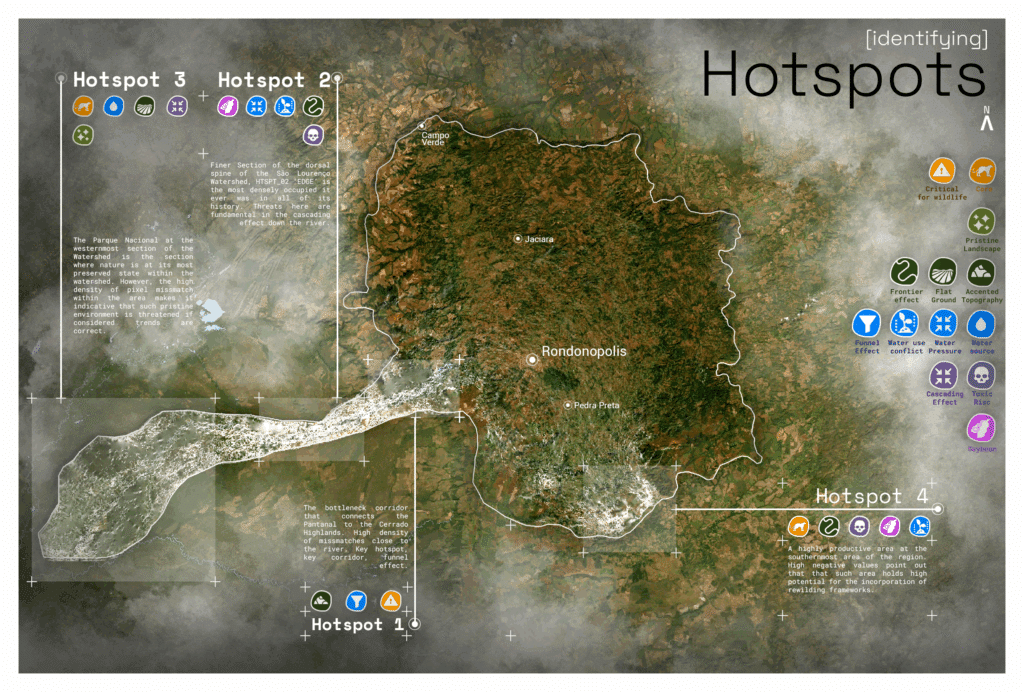
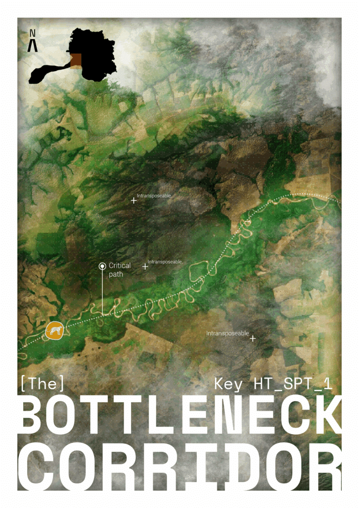
The first of the hotspots lies at the entrance: right after the São Lourenço leaves Rondonópolis and flows toward the Paraguay River, a border environment where geological formations shift over short distances and the river incises through them. Functionally, this creates a corridor-like bottleneck—a gate between biomes—guiding movement along the watershed’s central axis and concentrating connectivity across terrain transitions. Disturbance here would not only reduce already diminishing mosaics of native Cerrado – Pantanal vegetation; it risks disconnecting the system’s backbone itself, fragmenting flows between the two and forcing behavioral readaptation by fauna
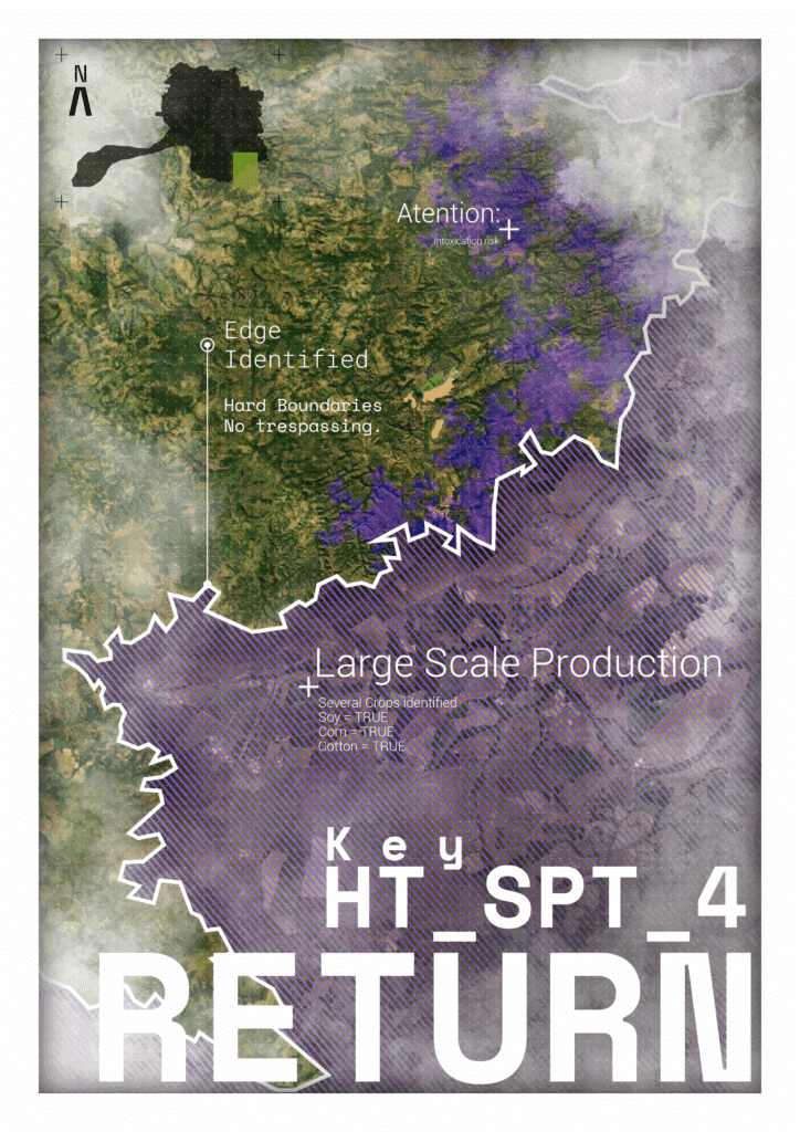
Croplands surround the river from both sides, artificially choking it out from its natural riparian patterns. This easily becomes a problem within the more recent years, as local floods become more intense every year. Furthermore, monocultures of low investment use extensive practices in managing crops – and often don’t spend extra to get the right treatment to residues. Parallel to this, the Mato Grosso state is a hot place, hotter every year, in fact. Raising temperatures, extended draughts and growing market demands make it so that every year more water is needed, because there is less water available.
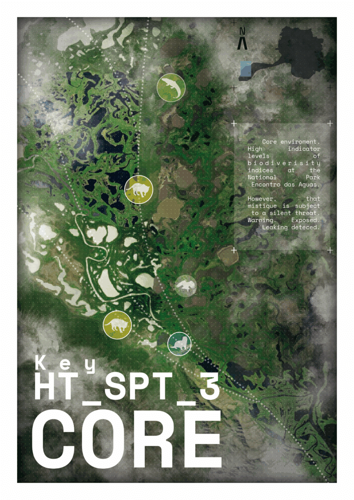
The third hotspot spans the lowermost São Lourenço: at the Encontro das Águas State Park. It functions as a protected area, yet—as across the Pantanal—its condition is ultimately governed by river hydrodynamics. Rivers move materials. Those, cause impacts downstream. Thus, pressures originating upstream—urban effluents, agro-industrial expansion, heat and drought intensification—propagate to this “pristine” confluence zone. In movement terms, jaguar spaceuse responds to terrain, hydrology, and human factors, so upstream alterations cascade into connectivity changes detected by the model’s class-to-class relationships
When analyzing the maps for the Conductivity of the Jaguar, 4 hotspots become identifiable. Each of them contains an important insight about how rewilding techiniques emerge naturally from the analysis. While three hotspots reinforce the well documented pressures such as bottleneck corridors, edge environment degradation and downstream pollution cores, the fourth suggests an emergent restoration frontier where rewilding interventions seem to be directed. In this sense, the methodology not only diagnoses threats but also, almost inadvertedly, begins to outline possibilities for recovery.
Collectively, these insights indicate that AI systems—when informed by ecological logic and designed to incorporate landscape constraints— can move beyond abstract optimization to provide actionable foresight for multispecies coexistence.