
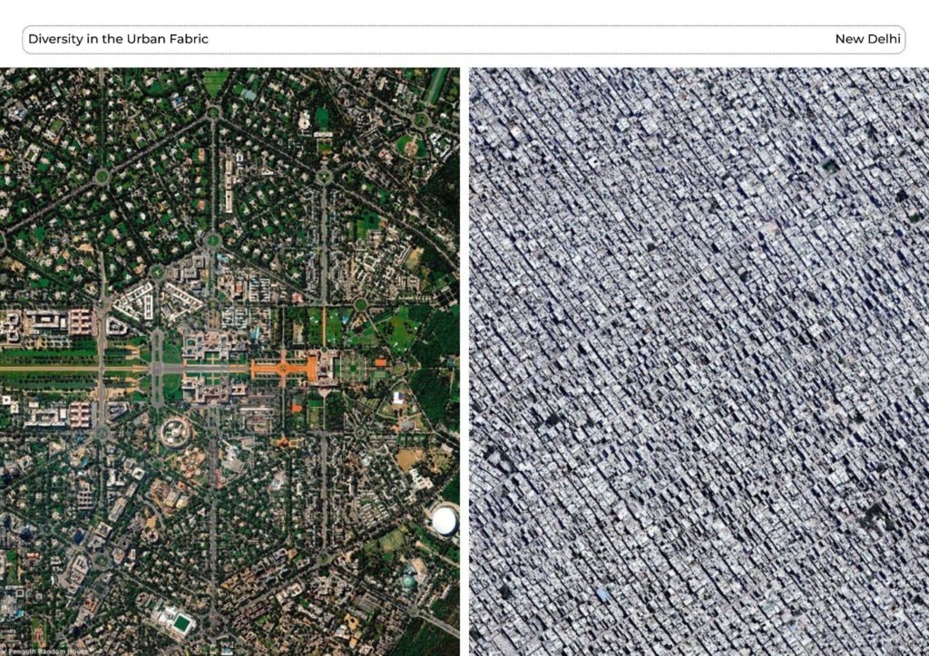
The New Delhi Material Repository and Urban Mining project focuses on the city’s sustainable development by implementing the principles of urban mining and establishing a material repository. As the capital city of India, New Delhi holds significant historical and governmental importance, with its urban fabric comprising a combination of planned and unplanned elements. However, with the city’s population growth, there is an increasing need for sustainable practices. Urban mining and the circular flow of construction materials play a vital role in this context, enabling the recycling and repurposing of construction and demolition waste. By embracing these principles, the project aims to foster a more sustainable and resilient urban environment in New Delhi, where resources are efficiently utilized and environmental impact is minimized.
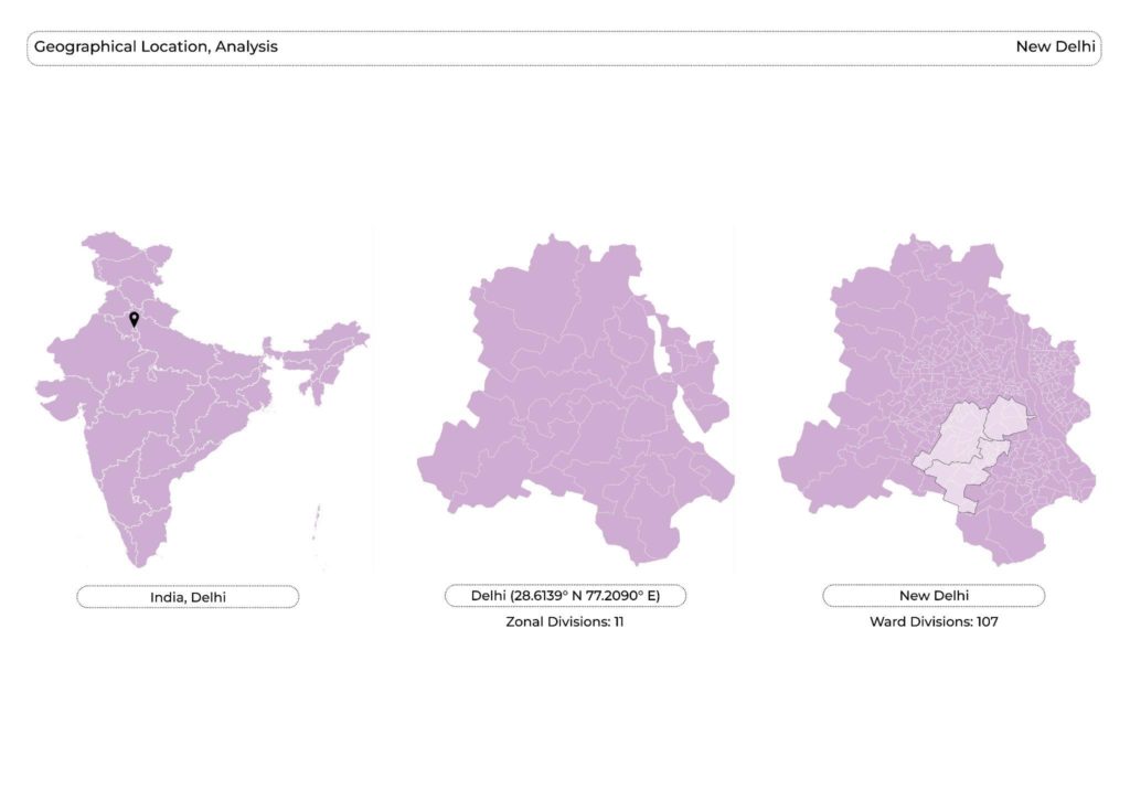
New Delhi is geographically divided into 11 zones and further subdivided into 107 wards. This administrative structure allows for efficient governance and the management of the city’s various sectors and services. As the capital city, New Delhi holds immense significance as it houses the headquarters of all three branches of the Government of India: the executive, legislative, and judiciary. This concentration of power and decision-making in a single location emphasizes the city’s role as the epicenter of national governance and policymaking.
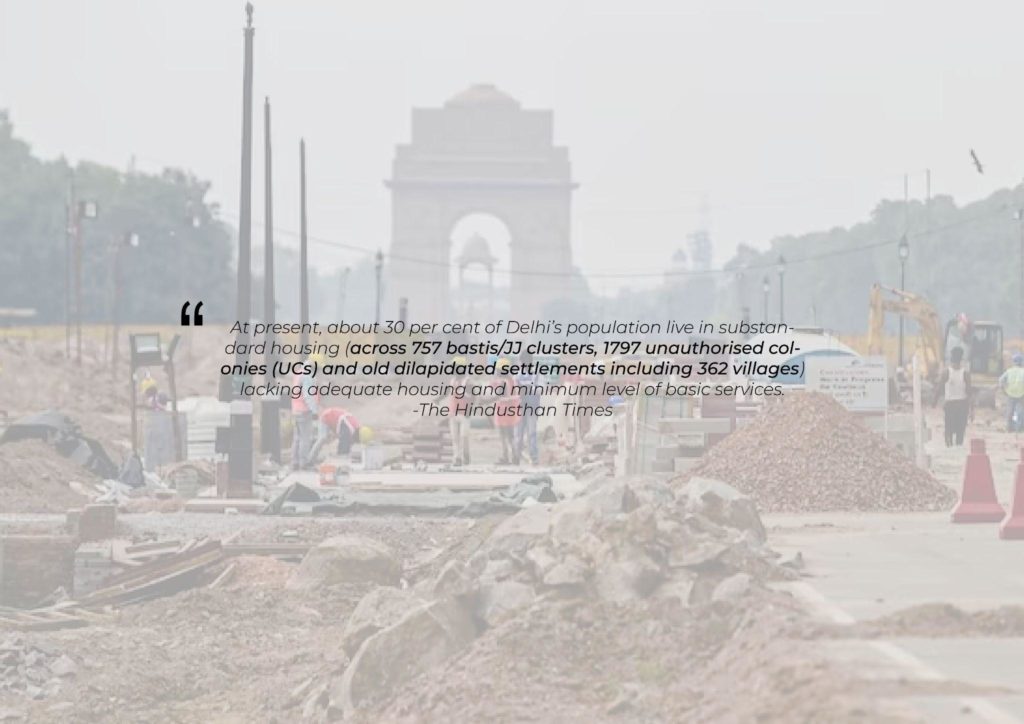
With a rapidly expanding population and urbanization, ensuring adequate and affordable housing has become a critical challenge. In this context, the implementation of the urban mining project in New Delhi holds great relevance. By establishing a circular flow of materials, particularly in the realm of construction and demolition (C&D) waste, the city can effectively manage and utilize these resources instead of allowing them to go to waste. Such an approach is not only important but also crucial for addressing the material flow requirements in the coming years, as it promotes sustainability, resource conservation, and the creation of a more resilient urban environment. By embracing urban mining and its principles, New Delhi can make significant strides towards resolving its housing crisis and fostering a more sustainable future.
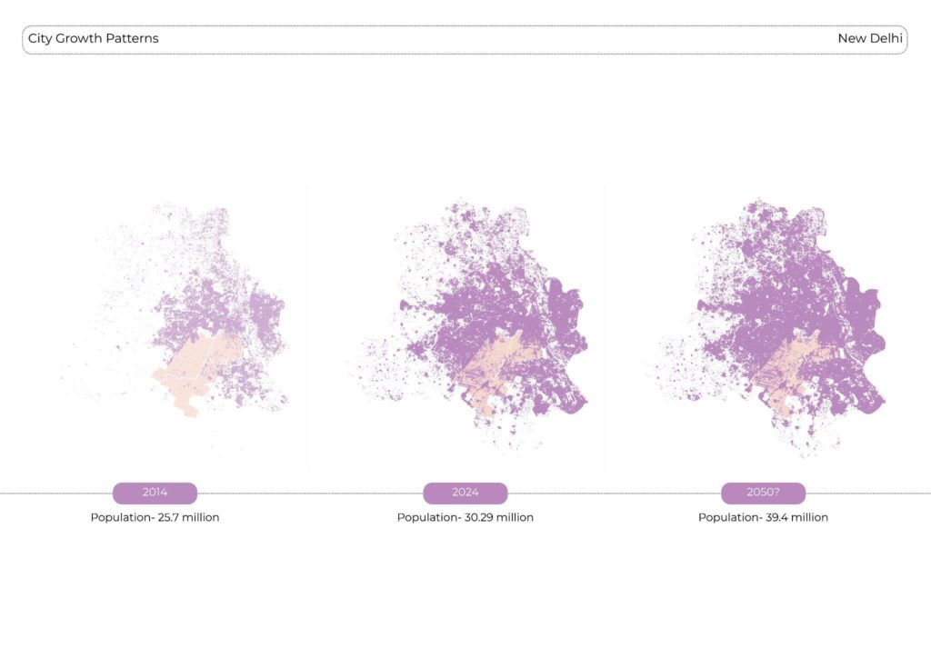
The growth patterns of Delhi are clearly evident when examining the map, showcasing the expansion and development of the city over time. Looking ahead to the projected population of 2050, it becomes apparent that there will be a greater need for increased built density in the coming years. With the population expected to rise significantly, accommodating this growth within limited land resources will require maximizing the utilization of available space through efficient urban planning and development. Enhancing built density can help address the growing demand for housing, infrastructure, and services while minimizing urban sprawl and preserving valuable land. It highlights the importance of compact and sustainable urban design to ensure a livable and functional city for the future.
CHAPTER 1
Data collection and analysis
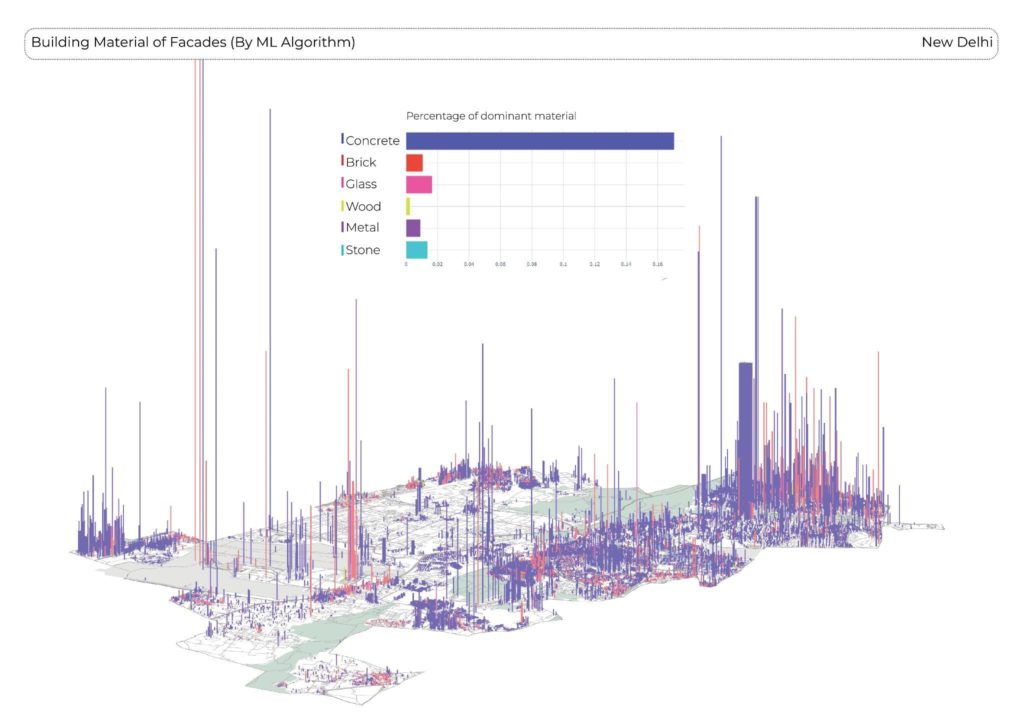
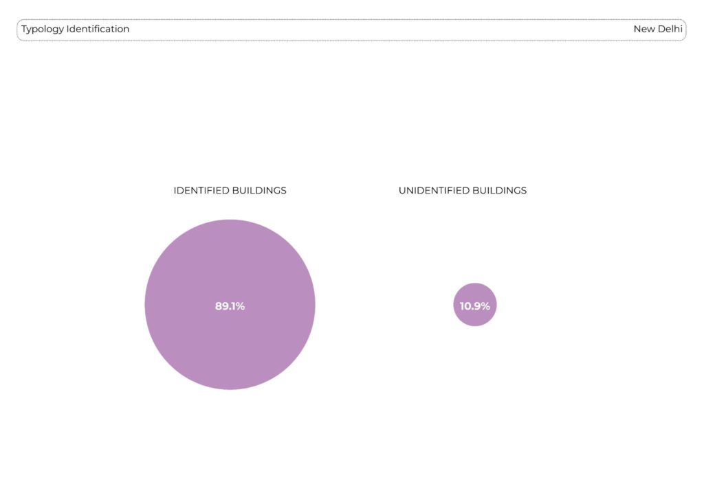
The ongoing research conducted by IAAC utilizes a machine learning algorithm to identify the building materials used in the facades of structures. The accompanying diagram illustrates the predominant materials found in the buildings of New Delhi based on their volume. Notably, the analysis reveals that concrete holds the highest percentage among the various building materials utilized in most constructed structures. This observation emphasizes the extensive use of concrete in the city’s architecture, showcasing its significance as a primary construction material in New Delhi’s urban landscape.
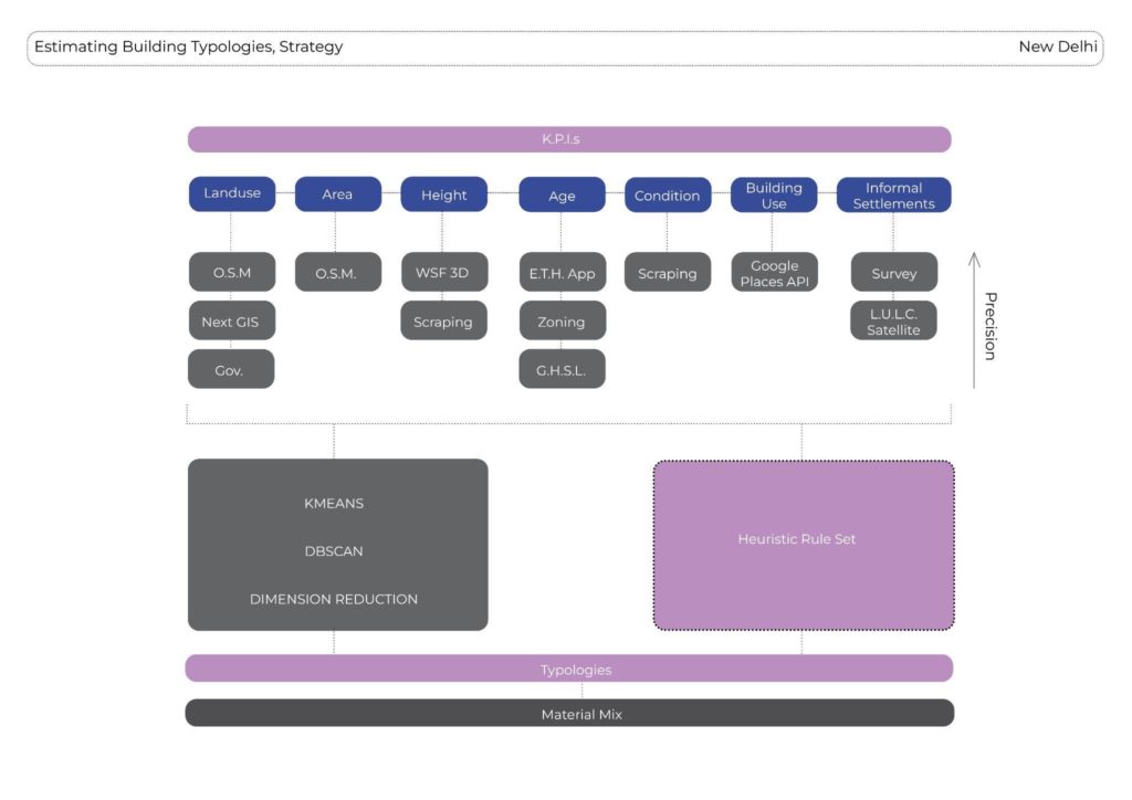
The development strategy for the machine learning algorithm involved identifying key performance indicators (KPIs) such as land use, building area, building heights, floors, age, condition, building use, and informal settlements. To gather the necessary data for each KPI, information was collected from a diverse range of sources. This comprehensive approach ensured that the algorithm could analyze multiple factors that contribute to the understanding of building materials in New Delhi’s facades, enabling more accurate predictions and insights into the city’s built environment.
The collected data is subjected to analysis using various techniques such as K-means clustering, DBSCAN, and dimension reduction methods. These methodologies assist in determining the material mix present in the facades of buildings. Additionally, a heuristic rule set approach is employed to create typologies and estimate the material composition. By combining these analytical methods, the research aims to provide a comprehensive understanding of the distribution and composition of building materials in New Delhi. The upcoming slides will showcase maps illustrating the data collection process and its spatial representation.

New Delhi’s land use exhibits significant distributions, notably in the military zone and the governmental Lutyen’s zone. The World Settlement Footprint data provided valuable insights into building characteristics such as height, number of floors, and building use. Through web scraping of the Magicbricks platform, we obtained information on the height, number of floors, and age of buildings. The global human settlement data from the Google Earth Engine allowed us to gather data specifically related to the age of buildings. The Delhi Master Plan 2021 served as a crucial source for information regarding building condition and the presence of informal settlements. Overlaying the previous data with Landuse Landcover ML data revealed further details on the informal settlements, including the identification of additional informal clusters known as JJ clusters, as surveyed by the Delhi Shelter Board.

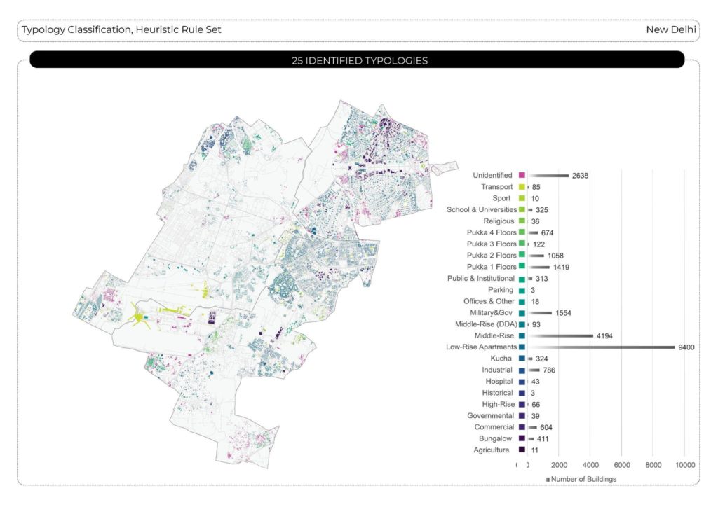
After collecting data from the aforementioned sources, a k-means clustering analysis was conducted, resulting in the identification of 18 typologies. Subsequently, a principle component analysis (PCA) was performed, yielding 17 clusters. Further analysis using the DBSCAN algorithm led to approximately 229 clusters, providing relatively accurate results. Combining DBSCAN with PCA resulted in 163 clusters. In conclusion, the DBSCAN algorithm demonstrated greater accuracy in generating matching typologies from its clusters compared to the other techniques employed in the analysis.
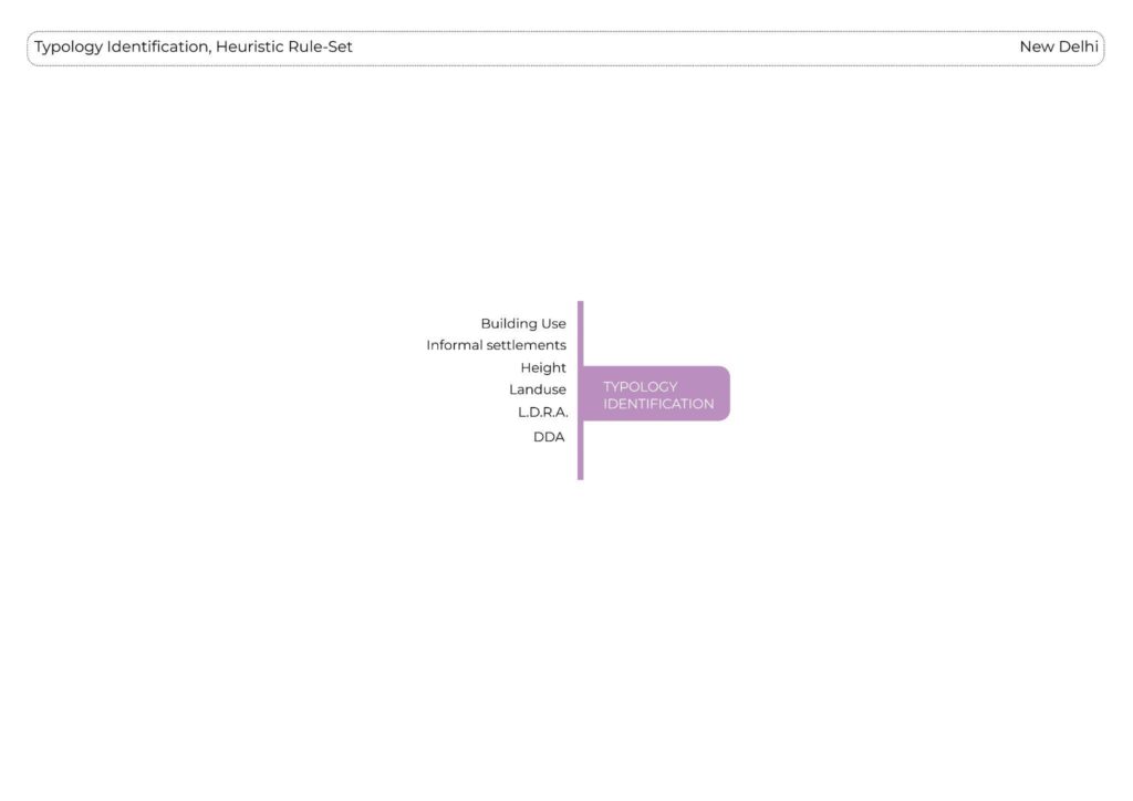
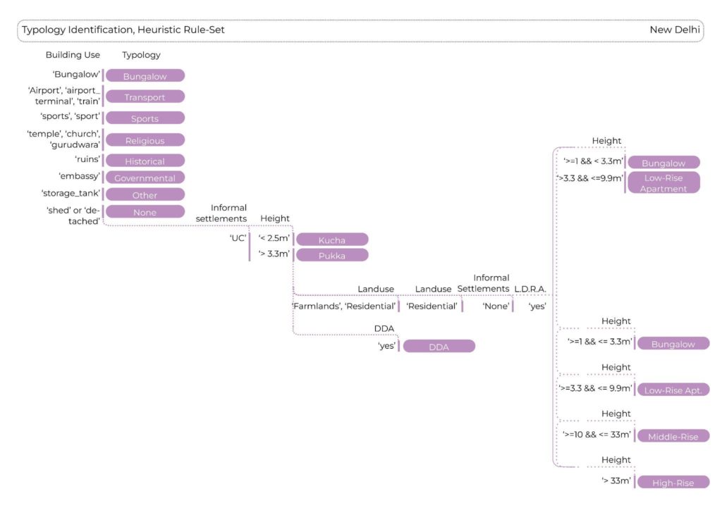
Even if the prediction of typologies with DBSCAN and PCA showed good results, the amound of resulting typologies led us to try a more simple approach, a heuristic rule-set of If-clauses, based on only few but effective KPI’s. We kept using building use (if available), landuse, height, the residential structure identifying unauthorized settlements and zoning data to assign typologies.
CHAPTER 2
Insights from Masterplan 2041
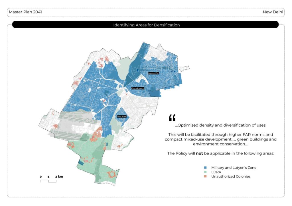
Upon reviewing the Master Plan 2041, it is observed that the densification policy does not apply to two specific areas: the Lutyens Zone, characterized primarily by historical and governmental structures, and the military zone. Consequently, our intervention will primarily focus on the remaining areas not subject to this limitation. By zooming in on these areas, it becomes evident that the majority of buildings are residential in nature. Furthermore, considering the availability of data, our decision is to concentrate our efforts on analyzing and addressing the residential aspect of the urban fabric.
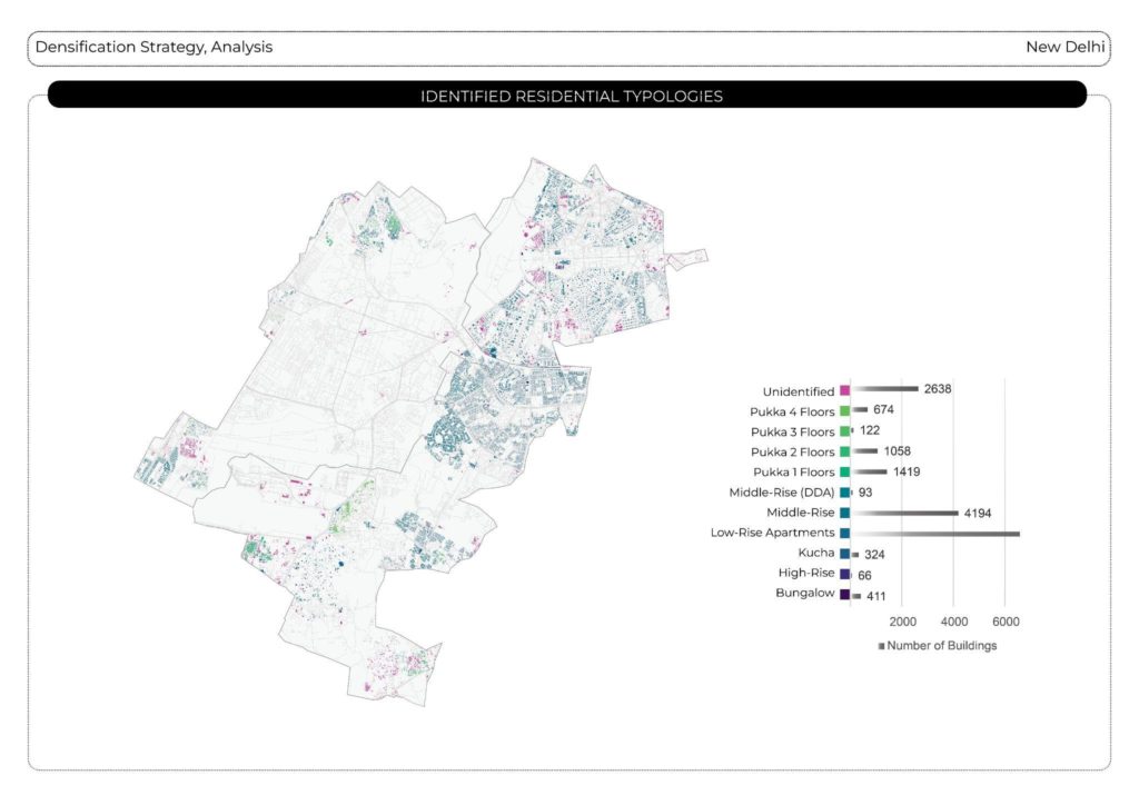
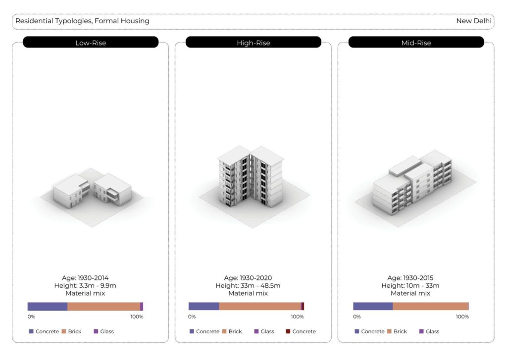
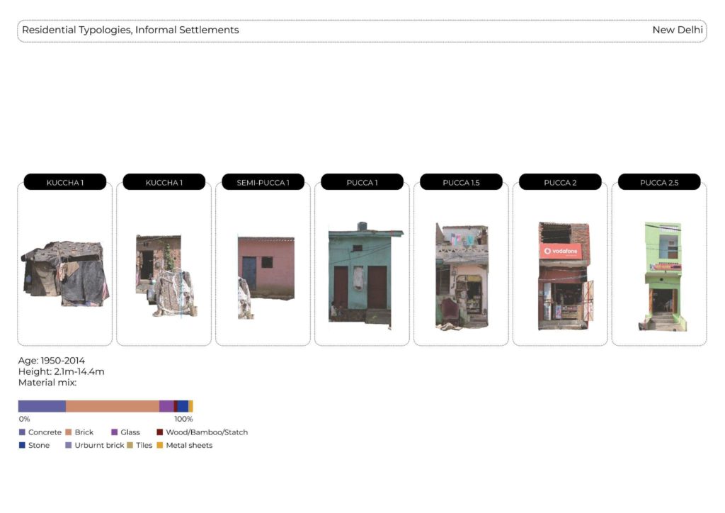
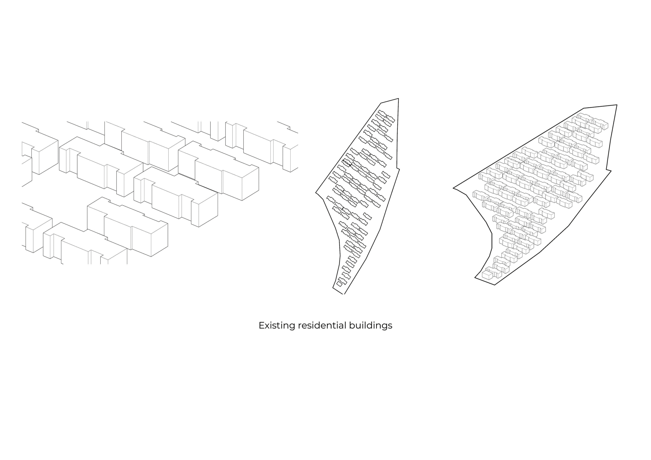
The main residential typology in our urban area are three formal housing typologies and informal typologies.
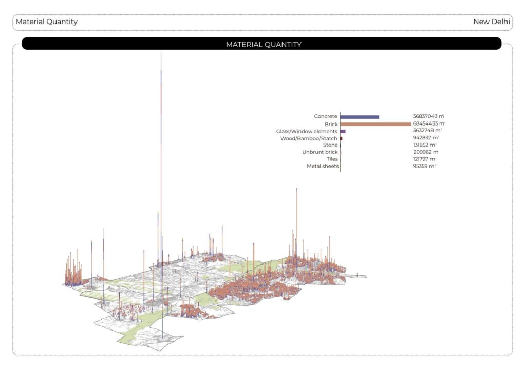
Brick and concrete constitute the predominant material stock in New Delhi. However, it is noteworthy that informal settlements exhibit a more diverse range of material compositions. These compositions encompass materials such as wood, bamboo, thatch, stone, unburnt brick, and metal sheets, among others.
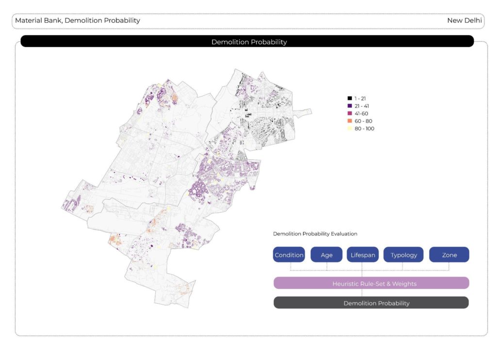
Base on the data we have collected, and by comparing the Masterplan 2021 and Masterplan 2041, we identified the demolition probability for the residential buildings. The numbers represents the percentage of probability of getting demolished in recent years.
CHAPTER 3
Urban redensification intervention

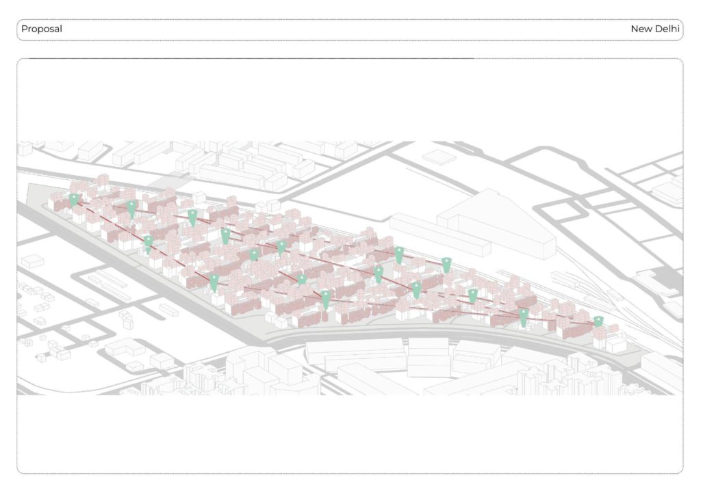
The demolition probability map guided us to a village called “Shahabad Muhammadpur”. It is a small village located in an area where an airport extension is planned. This village primarily comprises unauthorized settlements and a few community buildings. It functions as a material bank. In terms of potential redevelopment within the existing urban fabric, we have identified the nearby “Salaria Officers Enclave”. It is a gated community established in 2010, intended for military personnel and their families. However, this enclave is known to have structural damages despite its relatively recent construction.
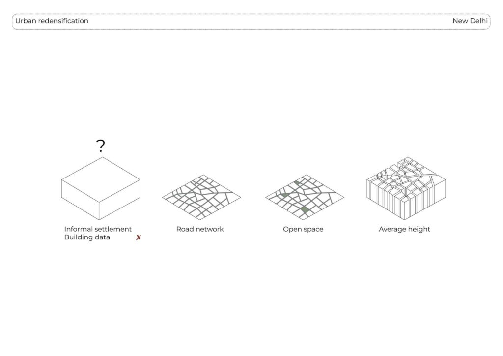
Due to the limited data available on the urban fabric of unauthorized settlements, we had to devise a strategy to estimate the existing building mass and available materials. To accomplish this, we employed an offset based on the street network, subtracting the buildings for which we had information, as well as the known green areas. Additionally, we assigned a mean height to the remaining structures, which was obtained from the WSF 3D dataset.
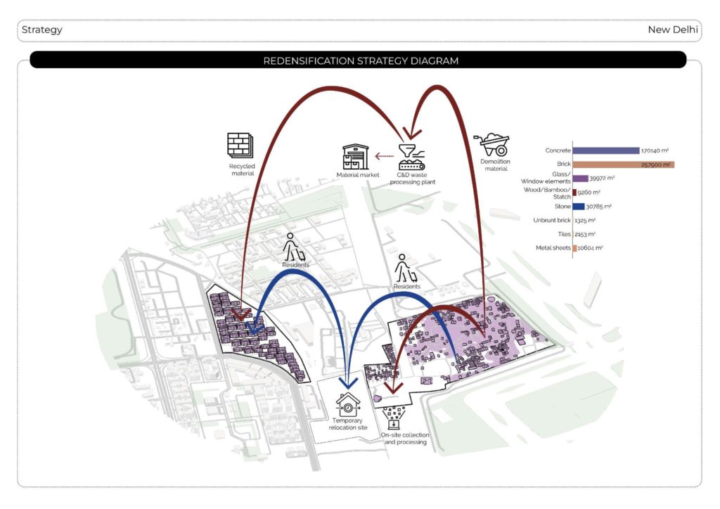
The initial phase involves the temporary relocation of residents from the unauthorized colony to a designated common site. This relocation can occur in small steps, ensuring a smooth transition for the inhabitants. The first step involves finding a temporary relocation site for the inhabitants. Subsequently, the raw materials collected on-site are processed, with some materials being sent to a construction and demolition waste processing plant. At the processing plant, a portion of the materials is recycled and then transported back to the construction site for reuse. The remaining processed materials are directed towards the rehabilitation site, where they contribute to the rebuilding and restoration efforts.
Densification Strategy
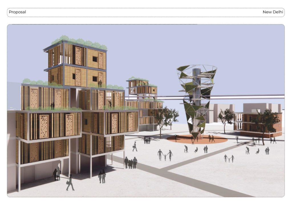
In our study, we determine that certain buildings need to be demolished due to their poor quality. To utilize the space effectively, circulation towers are introduced, covering the buildings within a 30-meter radius to allow access to planned rooftop extensions. To enhance the community experience, the vertical circulation green towers are strategically placed to not only provide vertical circulation but also serve as communal spaces for the community to interact and engage with each other and as vertical farming. Rooftop extensions for the relocated former inhabitants of the “Shahabad Muhammadpur” village are placed carefully, based on a modular system, that also works for the horizontal extensions of the existing buildings, providing additional space for the inhabitants of the “Salaria Enclave”.
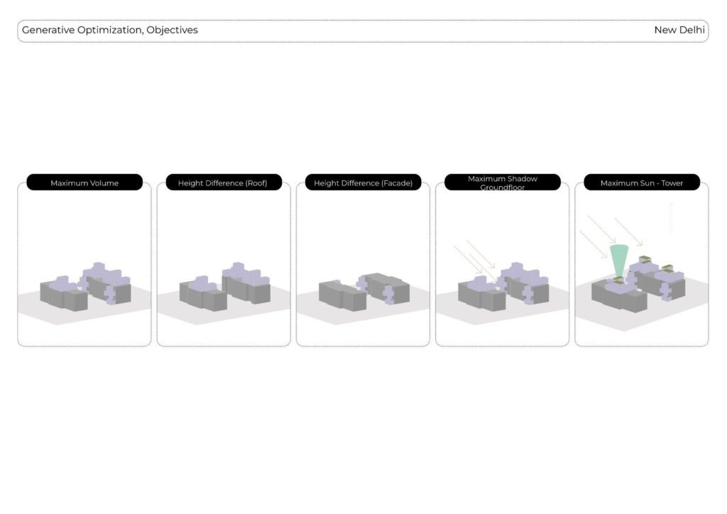
We used the generative algorithm “Wallacei” to optimize the densification strategies regarding to maximum volume, playful extrusion differences aswell as sun-radiation optimation for the groundfloor and the vertical farming towers.
As our optimization objectives are naturally contradicting, we choose the best average performing design generated by Wallacei.
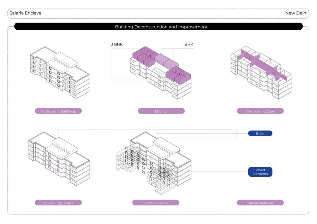
For a more in depth analysis of the existing building stock of the “Salaria Enclave”, we analysed the given structures, the social qualities of the gated community and the unauthorized settlement, and the possible material gained during the densification process.
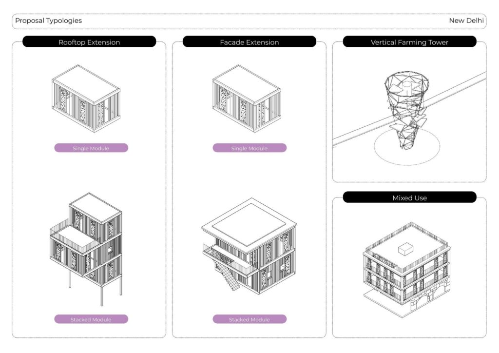
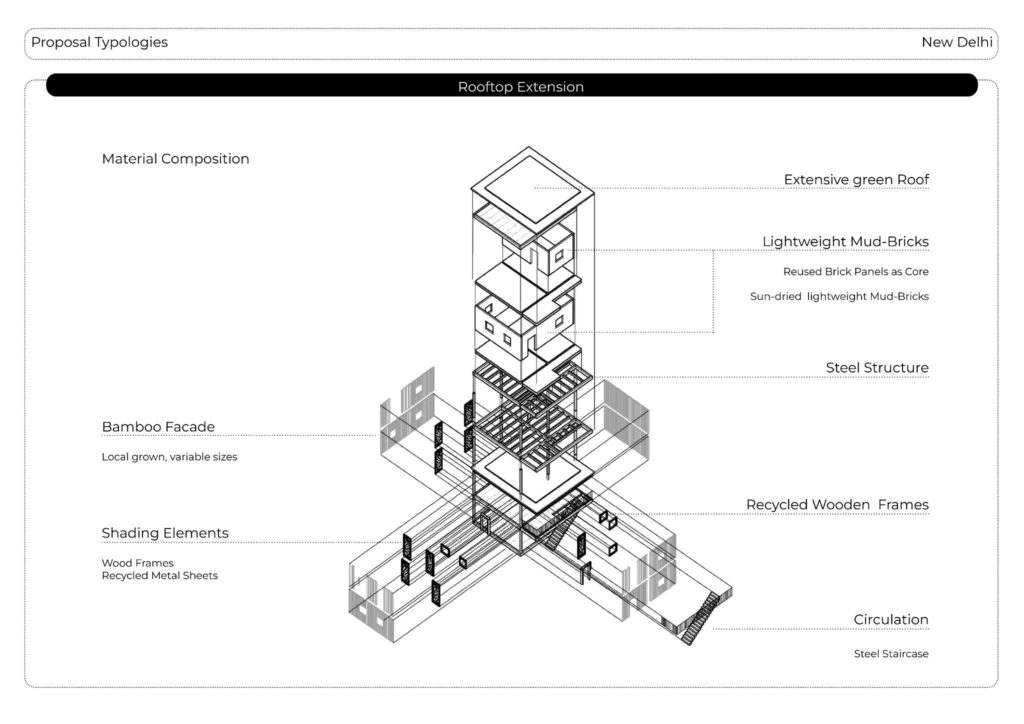
Our proposed typologies for densifying rooftops and facades revolve around a versatile single module that can be stacked or grouped together. These modules rely on a core steel structure and incorporate recycled brick panels and upcycled lightweight mud bricks. To enhance aesthetics and sustainability, the modules are adorned with a locally grown bamboo facade. Within the vertical farming towers, circulation is facilitated by brick tower-staircases, complemented by additional steel structures to accommodate community and farming spaces. The new community plazas surrounding each tower not only create areas for mixed-use buildings constructed from recycled brick panels but also employ recycled crushed bricks as pavement to provide cooling effects.
CHAPTER 4
Potential replicability
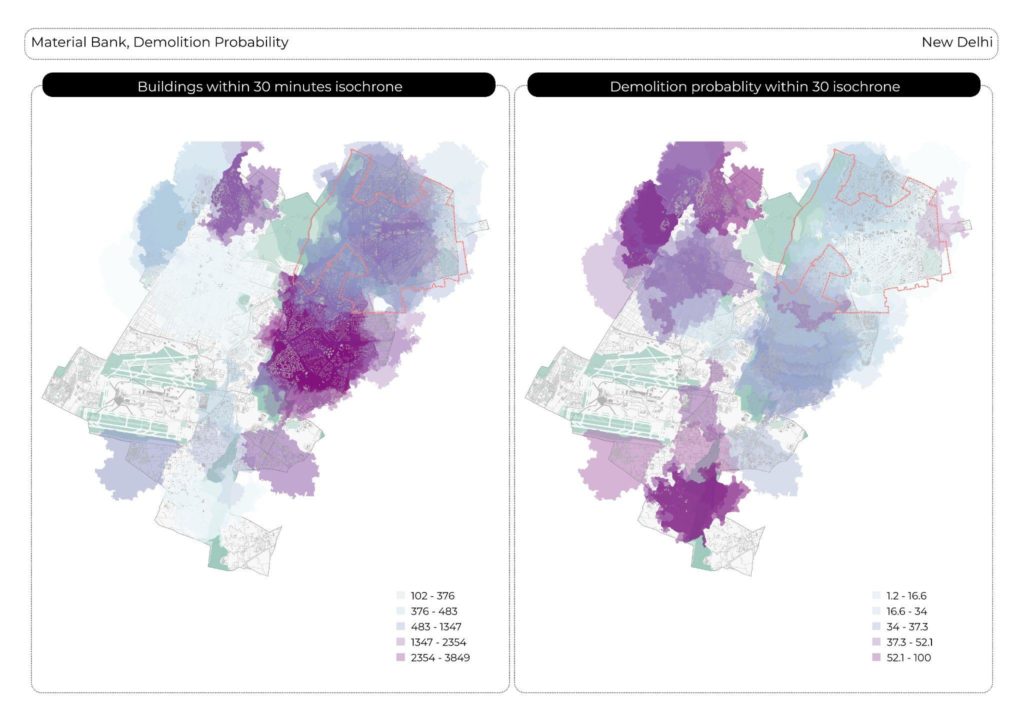
In order to address the issue of settlement relocation within New Delhi on a larger scale, a strategic approach was employed. The objective was to identify a 30-minute walking distance isochrone from the settlements that needs to relocate and assess the availability of buildings within their proximity, along with the index of redevelopment probability. By adopting this method, it became possible to determine suitable areas nearby where residents could be relocated without significant displacement. This approach aimed to ensure that individuals could be relocated in close proximity, thereby minimizing the need for distant relocations.
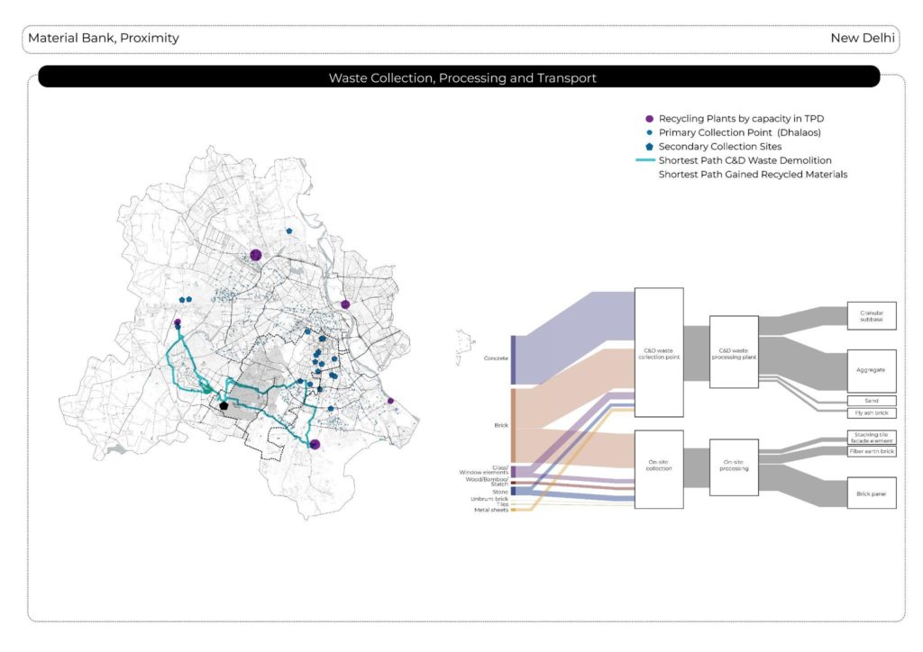
Regarding the aspect of material proximity, our proposal entails the collection of materials that can be processed and reused on-site, with a primary focus on maximizing on-site collection. Any remaining materials would be directed to a Construction and Demolition (C&D) waste processing facility. By leveraging existing collection points and processing facilities, we can establish an optimized pathway for each site within the processing cycle. This approach aims to reduce environmental impact and enhancing overall efficiency.
