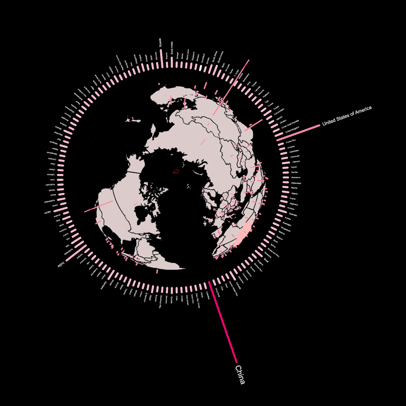
The Geography of Substance Use.

A Visual Story by: According to World Health Organization, 1/5 adolescents engage in some form of substance use. The Question of 100 School Phycologists: How planning could contribute towards the understanding of geographic patterns of substance use in order to distribute human resources all around the country? This visual story, seeks to explore the geographical … Read more

Internet of ME

The data we engage with everyday is growing rapidly, and our digital footprint is increasing! With the cyber-physical convergence and the fast expansion of the Internet, Volume of information created, copied, captured, and consumed worldwide went form 33 zettabytes in 2018 to an expected 175 zettabytes in 2051! That’s close 500% increase in 5 years. … Read more

DIGISCAPES ver 1.0

DIGISCAPES ver 1.0 is a project of IAAC, Institute for Advanced Architecture of Catalonia developed in the Master in Advanced Architecture 02 – by the student: Preetam Prabhakar and Research Thesis Advisor: David Andres Leon during the course MAA02 22/23 Thesis under the Algorithmic Design research thesis cluster.

The Air we Breathe

An analysis of the correlation between population and air quality in the districts of Barcelona. The air quality in urban areas have rapidly declined over the years. In the process of economic development, air pollution has become a significant health hazard. This project analyses the relationship between population density and air quality levels in Barcelona. … Read more

The Wild Deal

ABSTRACT Urban Rights is a term which has been coined by the philosopher Henri Lefebvre (Lefebvre, 1967)  and further explored by David Harvey (Harvey, 2003). It is a concept of a collective right to change the city and shape the process of urbanization. Thus, the right to the city does not merely address what the … Read more

Healthcare BCN

Understanding and analysing the existing Healthcare system of Barcelona with the help of open datasets available. This further helps us to understand the robustness, need and requirement to fill the gaps in the system if any with respect to their typologies and location as per districts Step 1: Documenting the distribution of different types of … Read more

Safer City Streets: Urban Mobility in Barcelona

Introduction As of 2021, the city of Barcelona has around 3.8 million vehicles (from cars to buses, cars, vans, etc.) circulating on its streets. Despite the efforts of the city council to better balance the motor urban mobility with the pedestrian flow throughout an urbanism model that puts people at the center, street accidents continue … Read more

Diagnosing land health

Introduction This project is a short visual story, trying to portray the opportunities and problematics of poor landscapes. It quickly touches upon a little fragment of precision farming- natural vegetation index (ndvi)- that focuses on plant health estimation remotely, from satellite. Ndvi has become the most commonly used vegetation index in remote sensing, especially with … Read more

Birds and weather connectivity

This project was carried out to support research on the relationship between bird populations and natural conditions in the province of Barcelona, Catalonia. In conclusion, the most frequently observed migratory bird Cattle Egret in the province of Barcelona was identified and the rainiest time of the year is spring (month – April) when its migrating … Read more