INTRODUCTION
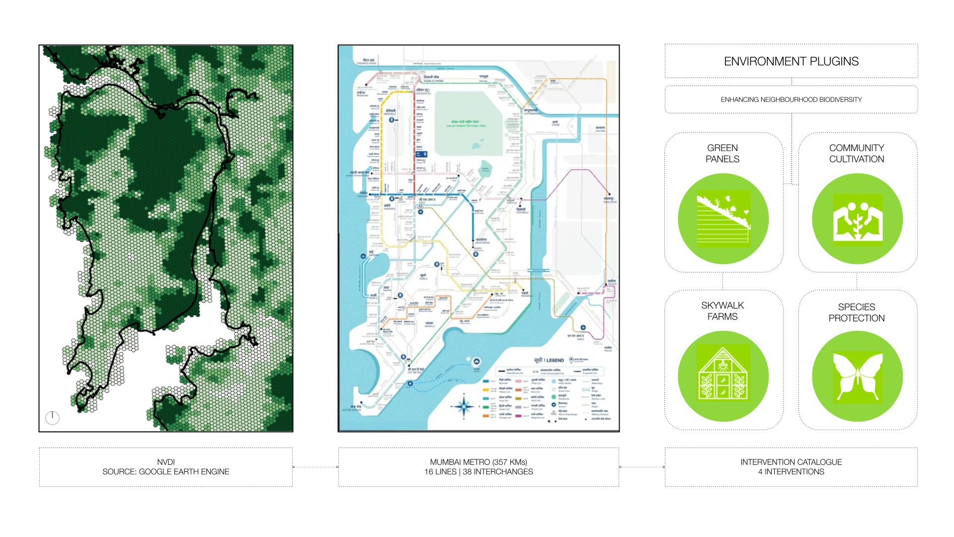
Urbanization poses escalating threats to ecological systems, necessitating the creation of urban ecological commons. This exercise focuses on Mumbai’s metro network, comprising 357 kilometres, 16 lines, and 38 interchanges, as a context for enhancing neighbourhood biodiversity through strategic environment plugins. By leveraging NDVI mapping from Google Earth Engine, areas with high ecological threats and untapped opportunities can be identified, guiding the integration of nature-based elements into the urban fabric. This academic exploration emphasizes the significance of ecological interventions in urban planning, aiming to inspire discourse and advocate for sustainable and resilient urban ecosystems.
METHODLOGY
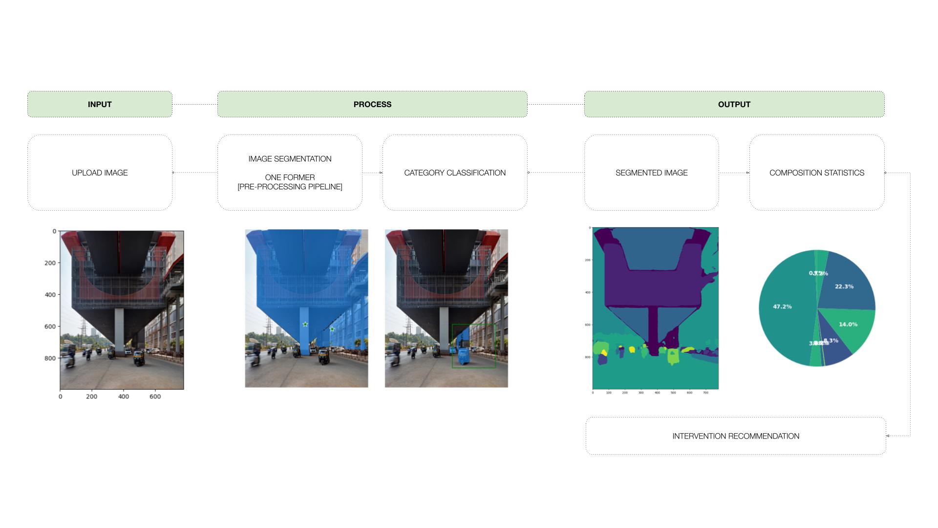
To analyse the potential for enhancing neighbourhood biodiversity, the metro network’s NDVI mapping is analysed. This comprehensive study identifies key areas within and around the metro lines that could benefit from ecological interventions. Image segmentation models are applied to Google Street View images to understand the proportions and materiality of streets. This data-driven approach provides valuable insights into the spatial distribution and composition of various elements, such as buildings, roads, vegetation, and public spaces. By quantifying and visualizing the proportions of these elements, stakeholders gain a comprehensive overview of their neighbourhoods, facilitating the identification of effective ecological interventions.
SOLUTION
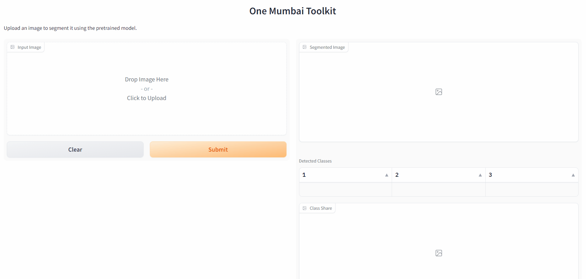
The integration of AI techniques, specifically image segmentation, enables objective and scalable analysis of street composition. The project’s findings inform strategies for sustainable development, including the promotion of green infrastructure, creation of pedestrian-friendly environments, and optimization of land use patterns. The results are integrated into the One Mumbai Citizen Tool, empowering users to identify elements within their neighbourhoods that support proposed ecological interventions. This citizen-centric approach fosters engagement, facilitates informed discussions, and enables data visualization to drive neighbourhood transformation. The project demonstrates the potential of AI and image segmentation in urbanism, providing a pathway to a more sustainable and inclusive approach to urban planning and ecological interventions, aligned with the One Mumbai initiative.
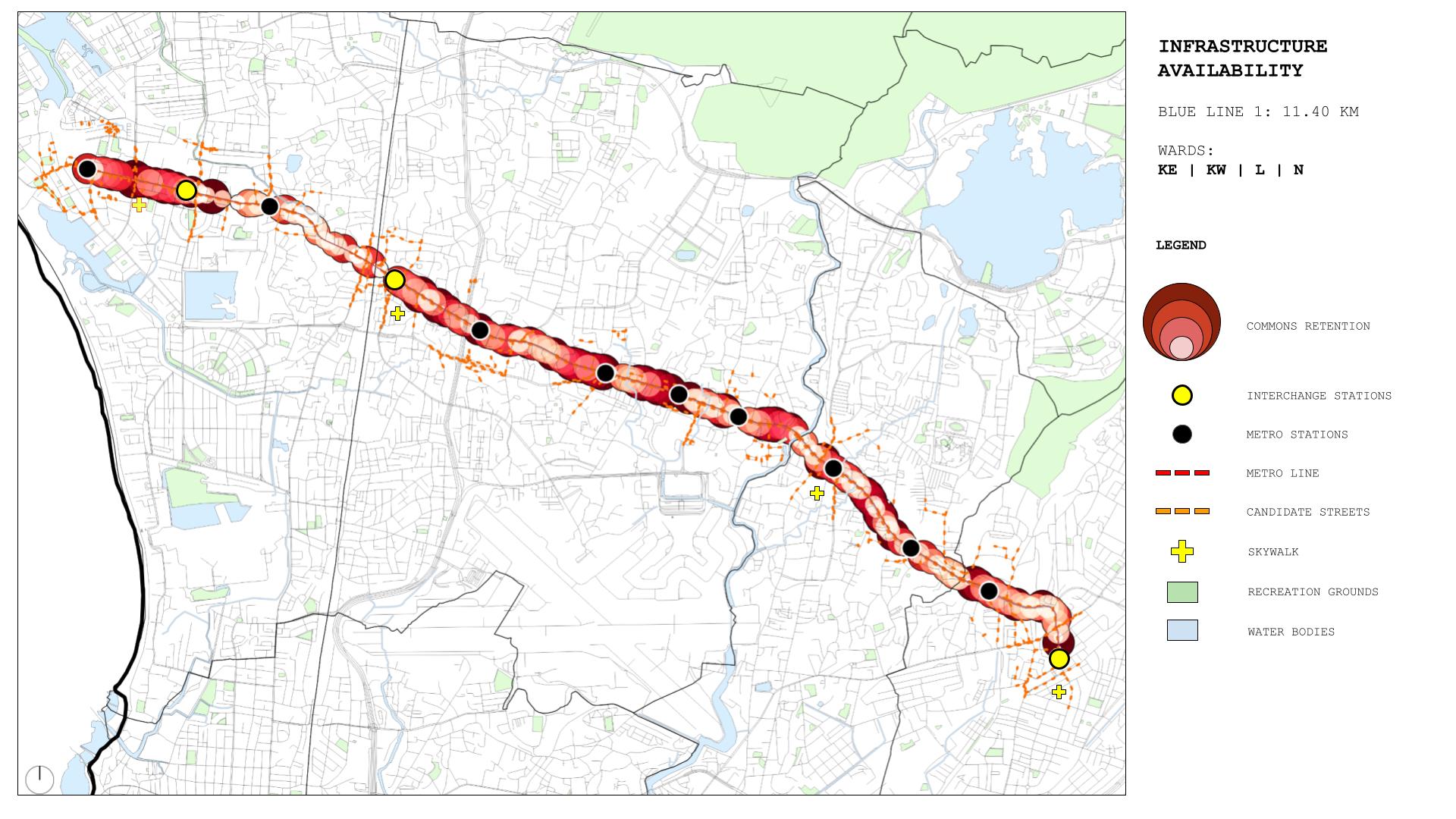
Road Network Mapping: Image Segmentation Insights
Using the same image segmentation technique, we further developed a map that illustrates the percentage of the road network as the proportion of street width along one line of the Mumbai Metro. By analyzing the Google Street View images, we applied image segmentation models to identify and classify the elements within the street, including buildings, roads, and other features. By quantifying the width of the roads and comparing it to the overall street width, we were able to calculate the percentage of the road network in relation to the entire street. This map provides valuable insights into the distribution and composition of road infrastructure along the Mumbai Metro line, enabling a better understanding of the urban fabric and informing future planning decisions related to transportation and urban design