WHAT IS ADVANCED AIR MOBILITY?
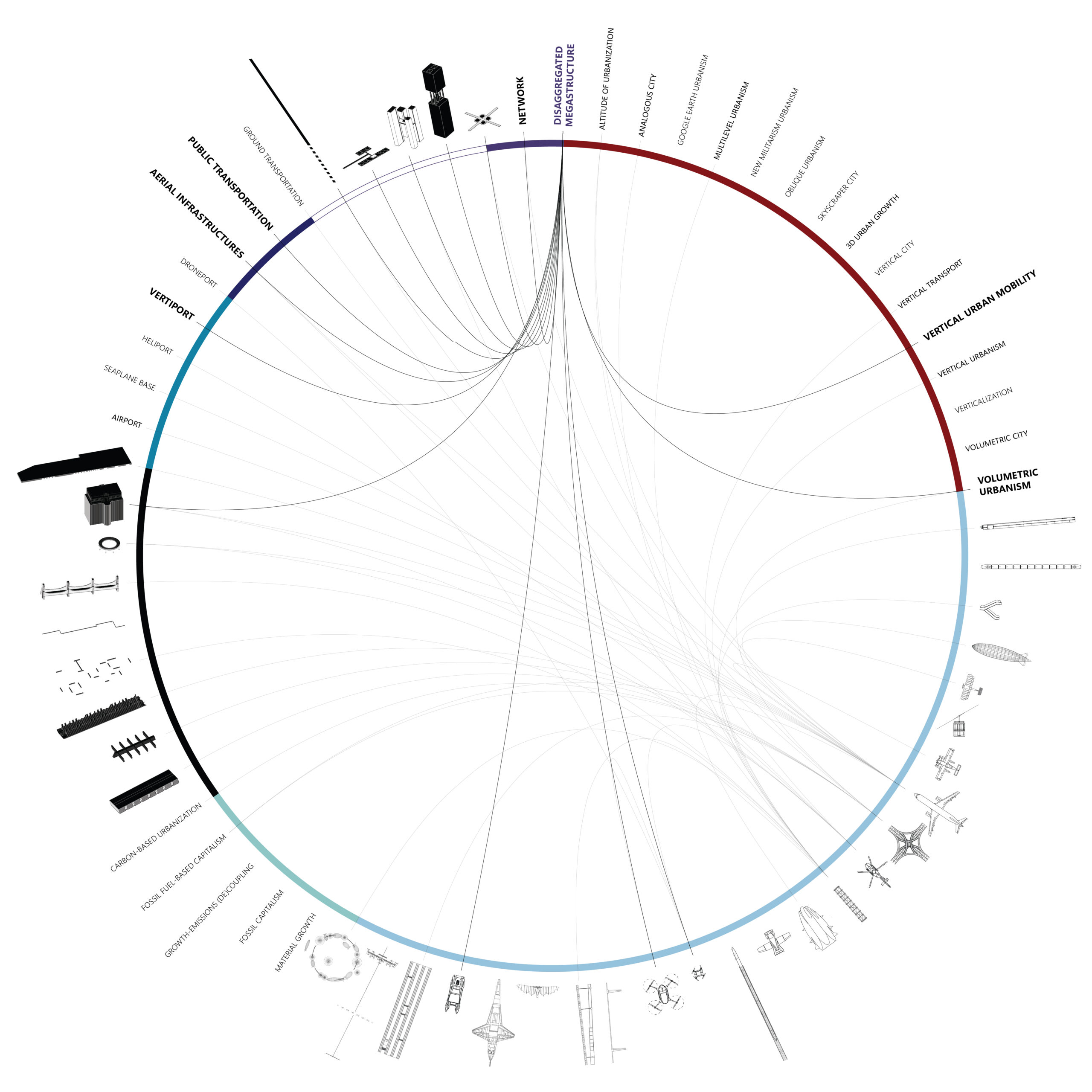
A multidimensional and multiscalar exploration of the emerging Vertical Urban Transportation landscape. [A] INTRODUCTION “Advanced Air Mobility (AAM) is a rapidly-emerging, new sector of the aerospace industry which aims to safely and efficiently integrate highly automated aircraft into the NAS. AAM is not a single technology, but rather a collection of new and emerging technologies … Read more