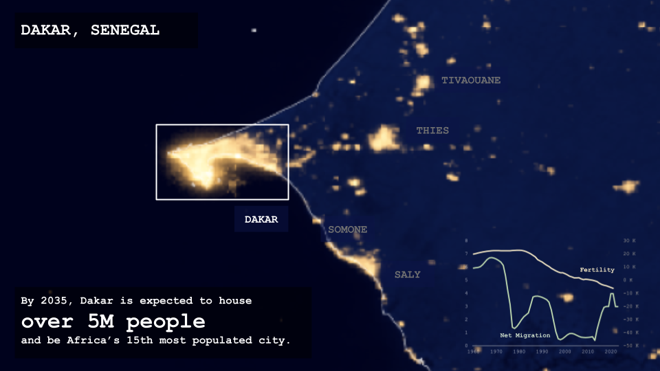
Panoramic Vision: Computational Streetscape Analysis
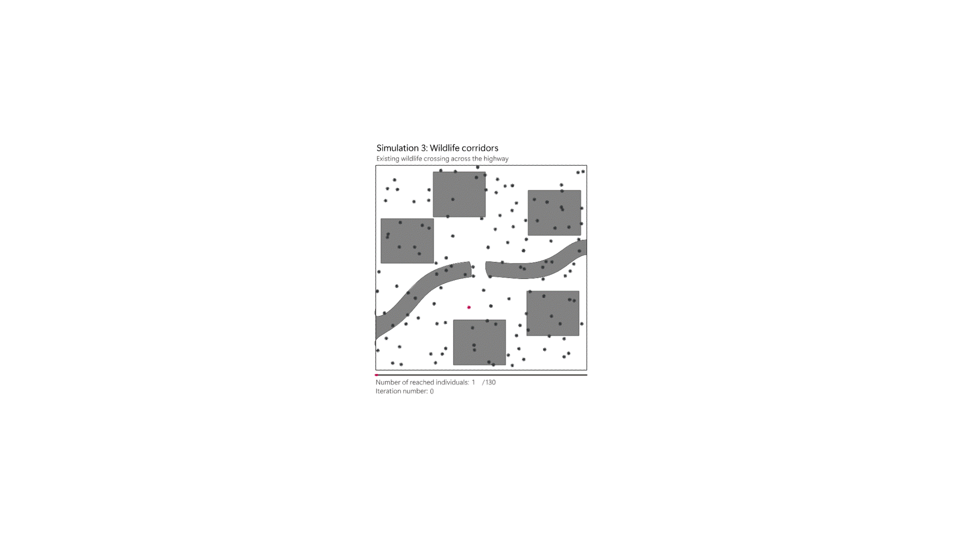
“Can we understand urban environments and street characteristics from Google Street View panorama images using Machine Learning and Stable Diffusion techniques?” Project OverviewThis computational design project aims to develop a pipeline utilizing Grasshopper and Python to visualize clusters of panoramic streetscape images. The project leverages t-Distributed Stochastic Neighbor Embedding (t-SNE) for dimensionality reduction, facilitating the … Read more