A Methodological Approach to Urban Growth and Hybrid Energy Systems in the Global South
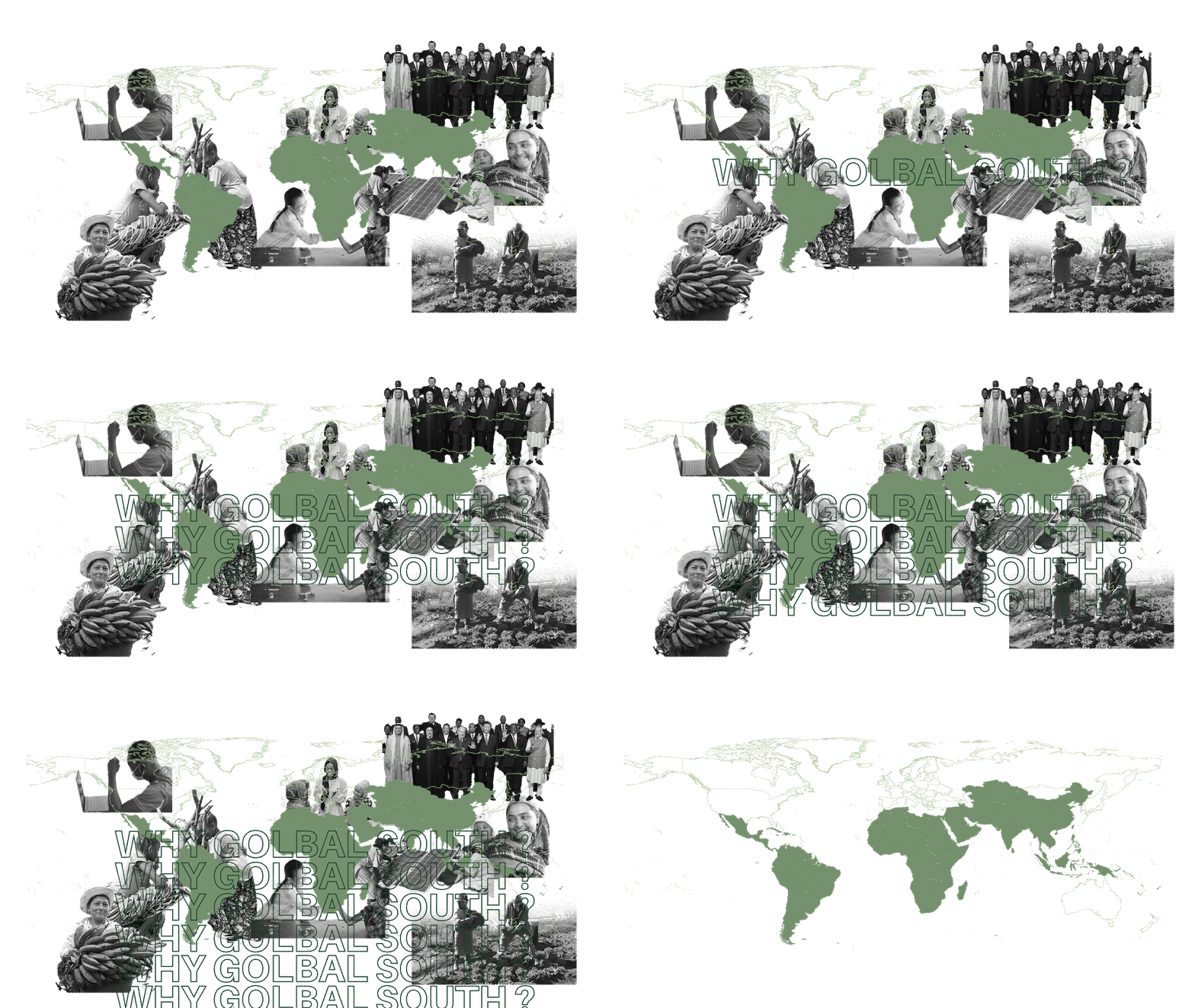
Why Global South ?
- Urban Growth:
- “The Global South is projected to account for nearly 90% of the world’s urban population growth by 2050.”
- Slum Population:
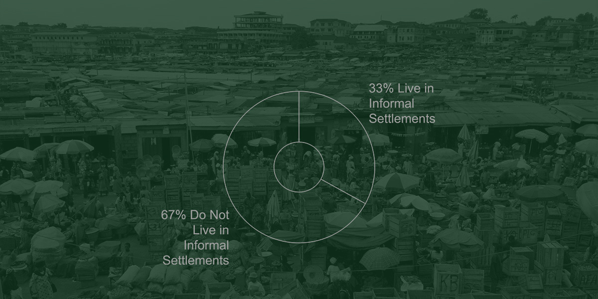
- “Approximately 1 in 3 urban residents in the Global South live in informal settlements or slums.”
- Energy Inequality:
- “Over 50% of the population in the Global South lacks access to reliable electricity, hindering development and quality of life.”
- Infrastructure Deficits:
- “60% of cities in the Global South face severe infrastructure limitations, including energy, transportation, and water systems.”
- Sustainability Challenges:
- “Urban areas in the Global South produce 70% of global CO₂ emissions, yet they are most vulnerable to climate change impacts.”
- Population Density:
- “Cities in the Global South experience some of the highest population densities, leading to overcrowded living conditions and limited resources.”
- Economic Disparities:
- “80% of the world’s poor live in Global South countries, where access to basic services remains a critical challenge.”

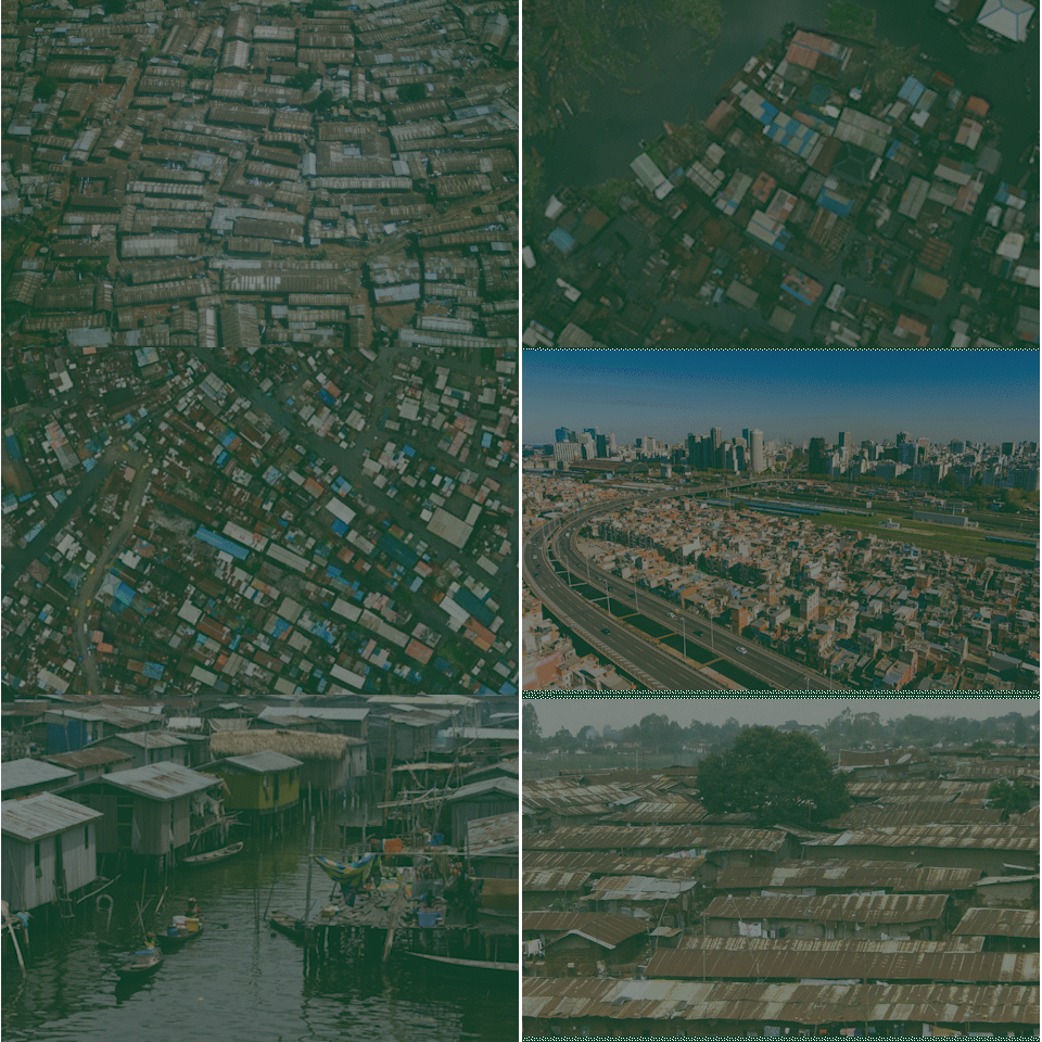
Urbanization in the Global South is a defining trend of the 21st century, with over 90% of urban growth expected to occur in low- and middle-income countries by 2050. This rapid expansion has led to a surge in informal settlements, or slums, as cities struggle to provide adequate infrastructure, services, and housing. Slums are significant because they embody both the challenges and opportunities of urbanization, highlighting issues such as poverty, energy access, and environmental resilience. Addressing slum development is critical to ensuring equitable and sustainable urban futures in the Global South.


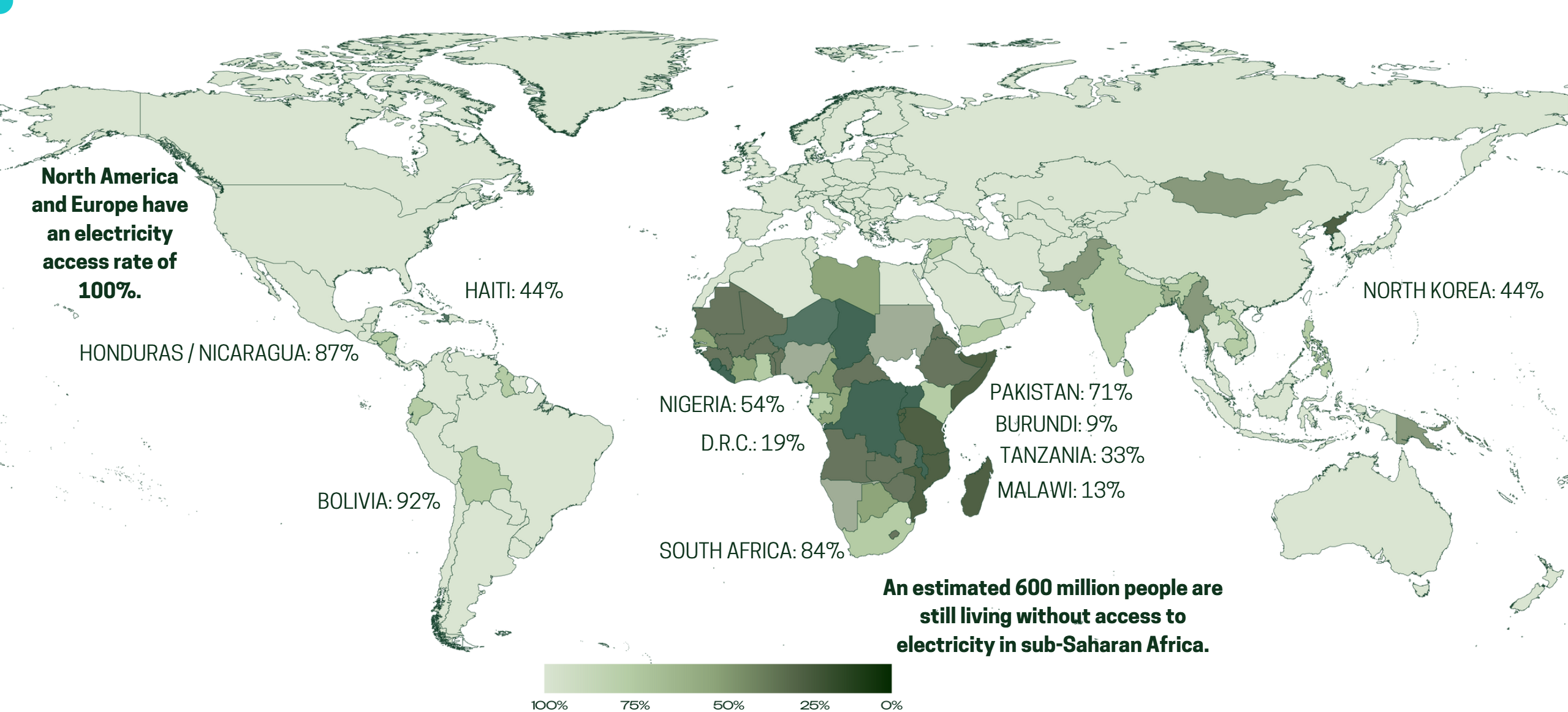
Global Access to Electricity:
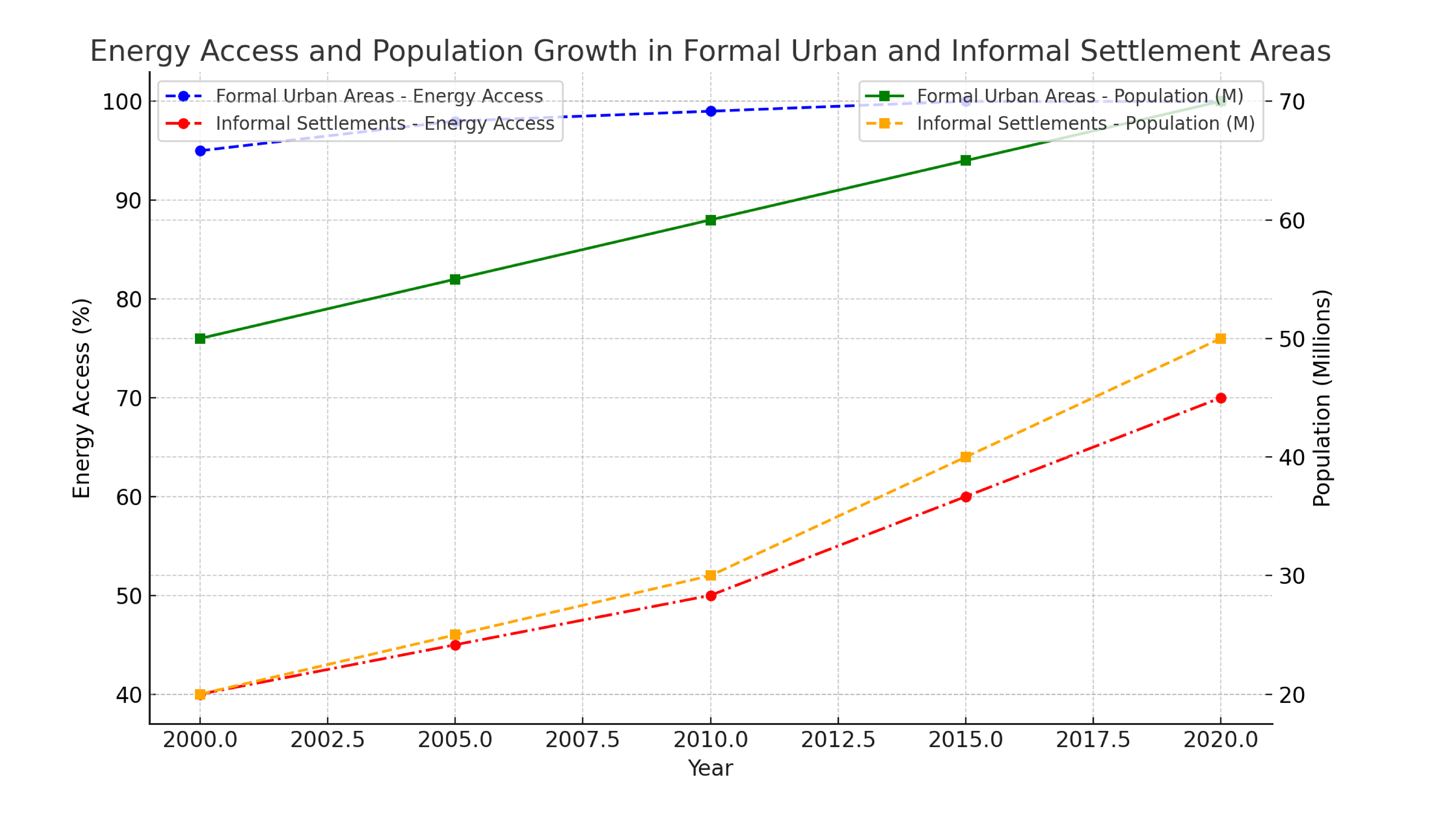
The chart above compares energy access rates and population growth over time between formal urban areas and informal settlements.
- Energy Access: It shows that formal urban areas have nearly 100% access to energy by 2025, while informal settlements still lag behind, reaching only 70% energy access by the same time.
- Population Growth: The population in both formal and informal areas increases, but informal settlements grow much faster, with their population surpassing formal urban areas by 2025.
This combination of energy access and population growth highlights the disparity in energy justice between these two types of urban fabrics, offering a clear visual for discussing energy inequality and the challenges faced by informal settlements.
High Electricity Costs in the Global South:
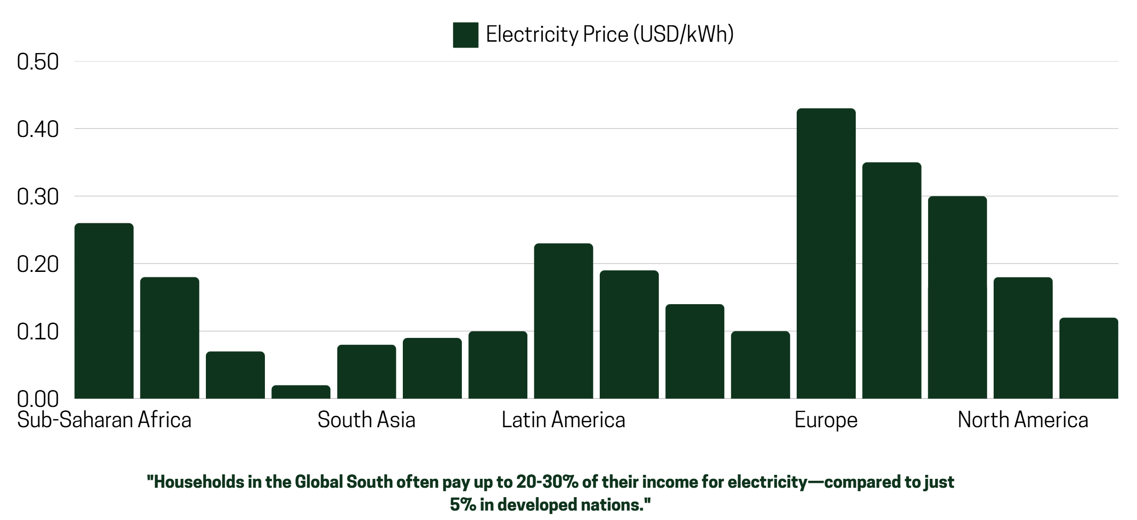
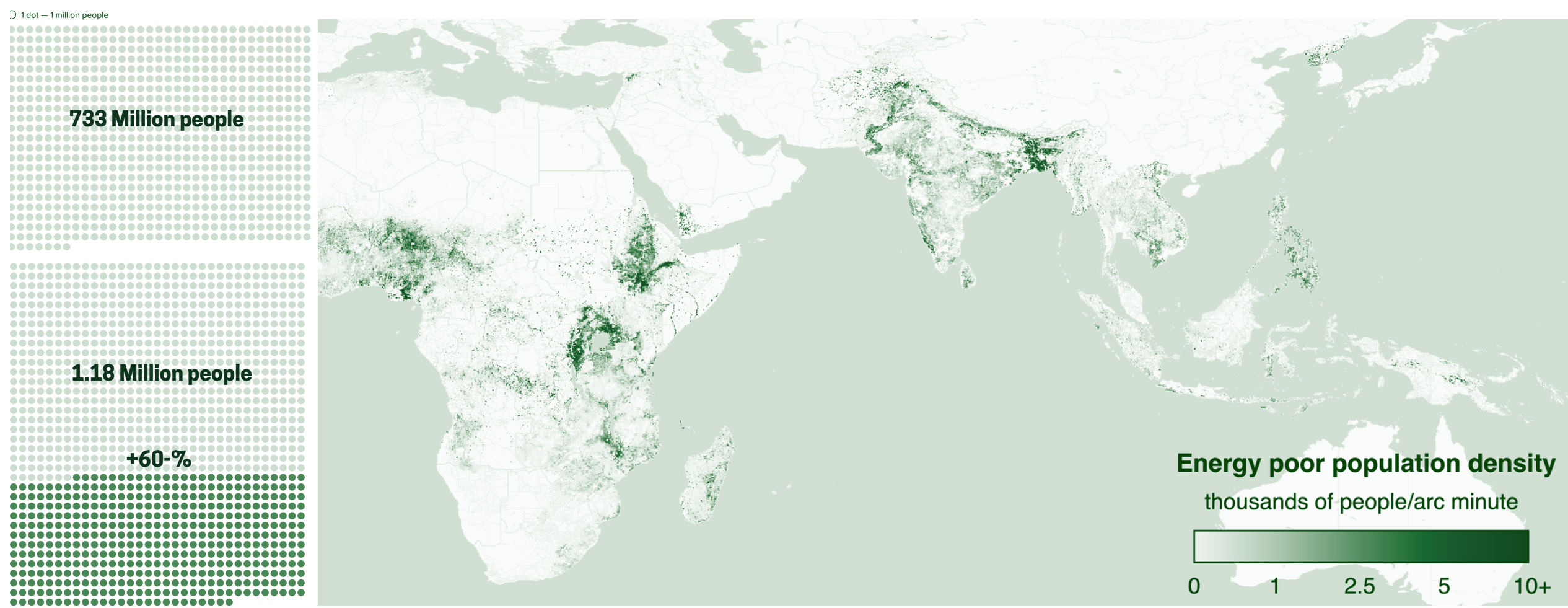
Beyond Access: 1.18 billion in Energy Poverty :
Energy poverty remains a global challenge, with 1.18 billion people lacking access to reliable energy services. This issue is most severe in regions like Sub-Saharan Africa and parts of South Asia, where power outages, high costs, and limited infrastructure disproportionately affect vulnerable communities. In these areas, access to affordable, sustainable energy is not just an economic concern but a critical factor for improving education, healthcare, and livelihoods. Addressing energy poverty through equitable policies and investments in renewable energy can drive meaningful progress toward global development goals.
Beyond Energy: The Health Crisis of Energy Poverty:

- Around 3.2 million people die annually due to indoor air pollution caused by cooking with solid fuels like wood, charcoal, and kerosene.
- In Sub-Saharan Africa and South Asia, nearly 2.4 billion people still rely on these unsafe cooking methods, leading to respiratory illnesses, heart disease, and other severe health problems.
- Traditional biomass (wood and charcoal) accounts for 60-80% of energy use in many energy-poor regions, contributing to deforestation and increasing carbon emissions.
- Inefficient energy systems release up to 25% more emissions compared to cleaner, modern energy sources.
Energy poverty not only limits access to electricity but also exacerbates health challenges, particularly in the Global South. Lack of clean energy sources leads to the reliance on harmful alternatives like kerosene lamps and biomass for cooking, contributing to indoor air pollution. This significantly increases respiratory illnesses, cardiovascular diseases, and even premature deaths. Furthermore, energy scarcity in healthcare facilities affects the delivery of essential services, including refrigeration for vaccines and medical equipment. Addressing energy poverty is thus critical for improving public health outcomes and reducing preventable diseases.
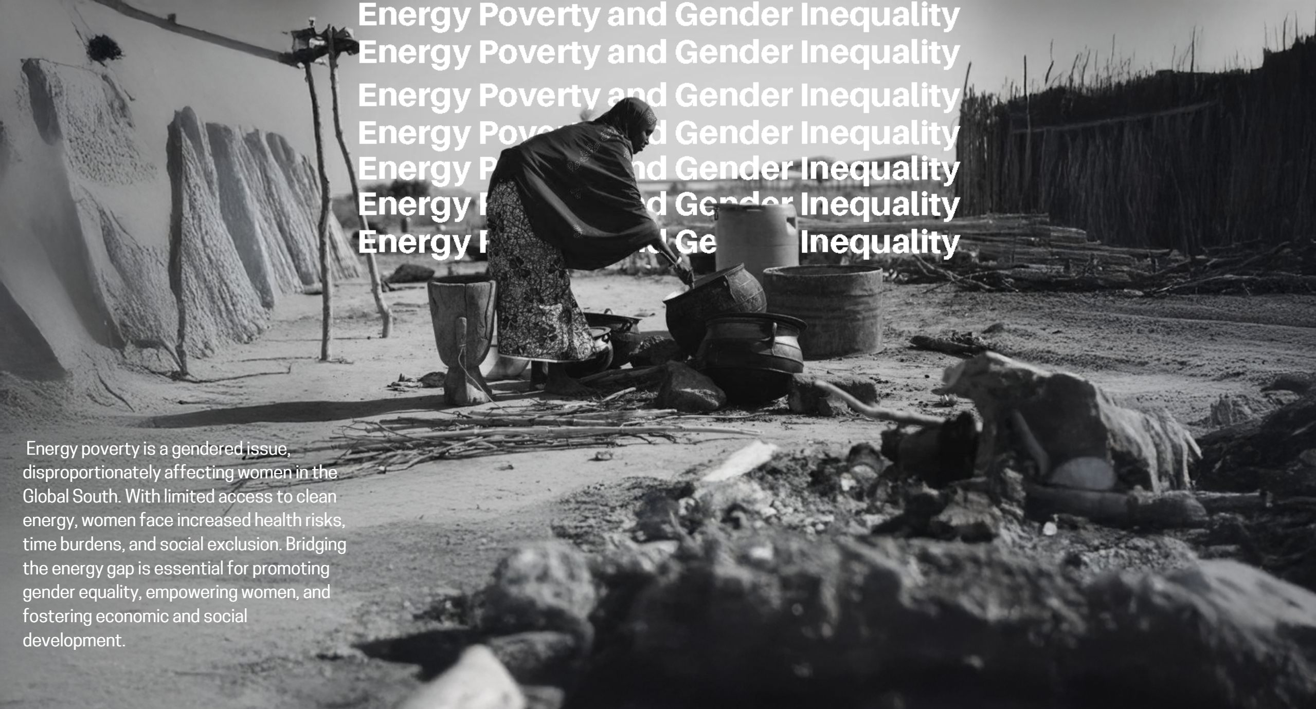
Energy Poverty and Gender Inequality :
Research Hypothesis:
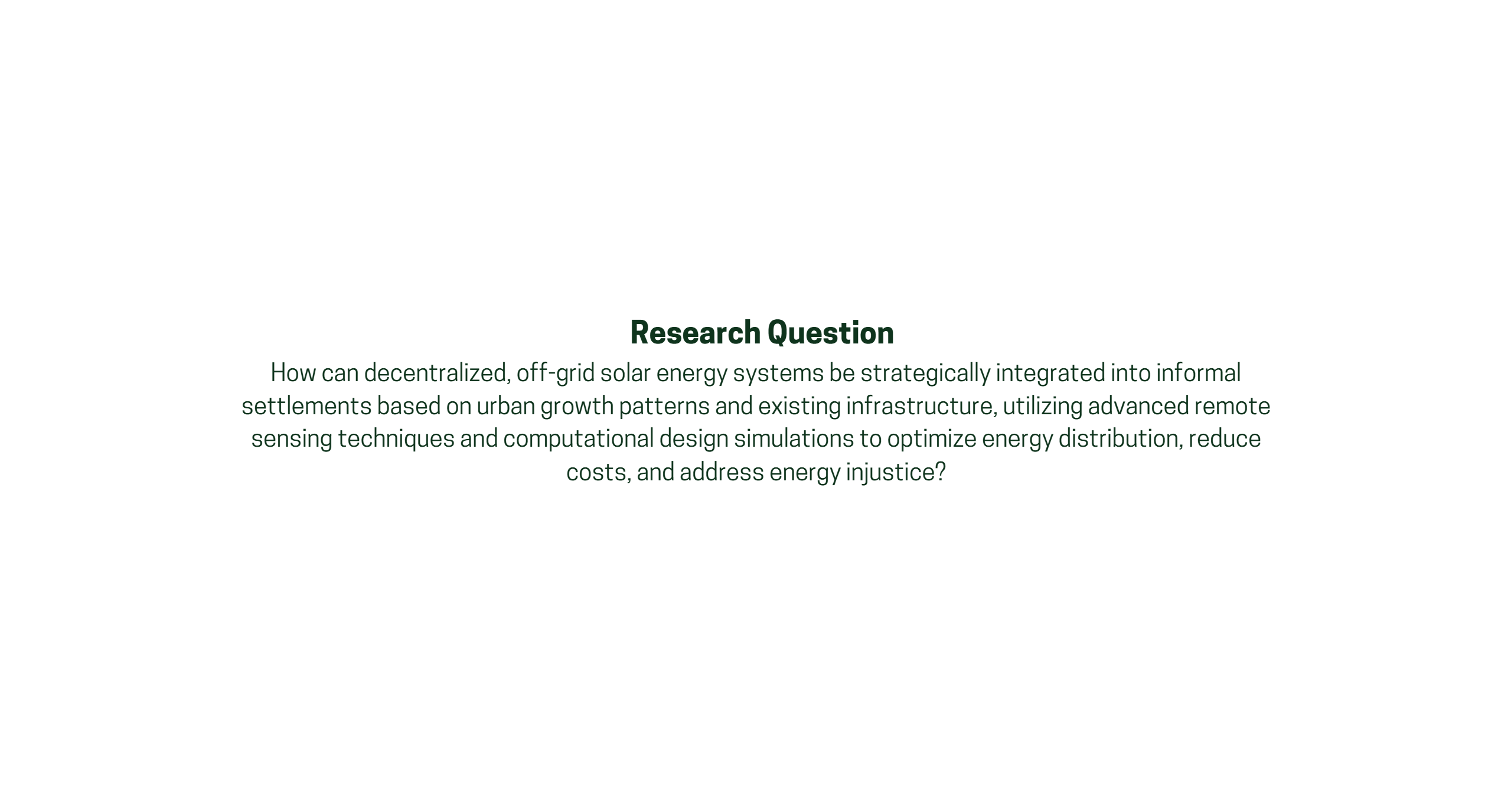
By mapping urban growth patterns and identifying infrastructural ‘hot spots’ through advanced remote sensing and computational design, this research aims to strategically implement decentralized solar systems to improve energy access and affordability while reducing energy injustice in informal settlements. The study will leverage the unique geospatial location of each settlement to assess its potential for solar energy integration, emphasizing the key role solar energy can play in providing sustainable and equitable energy solutions

Primary Objective:
To develop a framework for integrating decentralized solar energy systems into informal settlements by leveraging computational tools and remote sensing strategies.
Secondary Objectives:
- Map and analyze urban growth patterns in selected informal settlements using advanced remote sensing techniques.
- Identify infrastructural hot spots and energy-deficient zones within these settlements.
- Explore the relationship between existing infrastructure and the potential for integrating small-scale solar systems.
- Simulate energy distribution models using computational and algorithmic tools to optimize solar implementation.
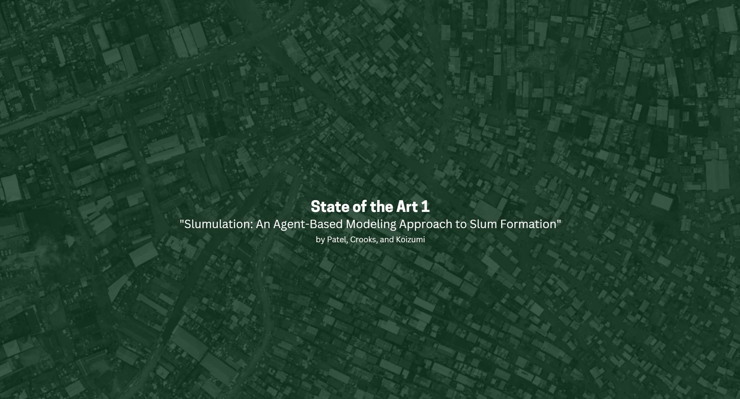
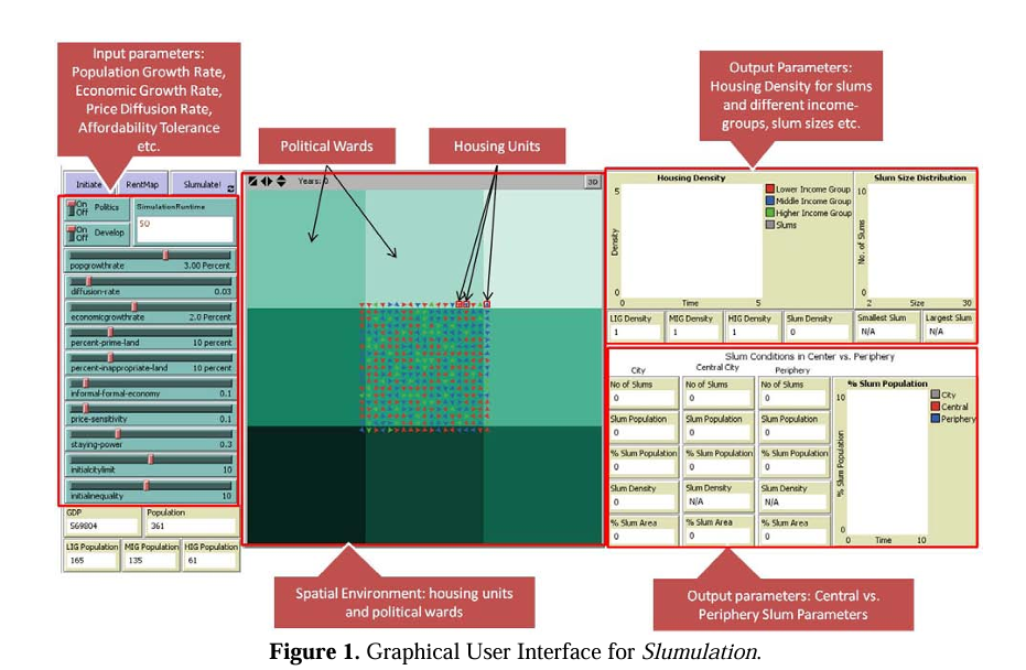
Introduction to Slumulation:
Key Points:
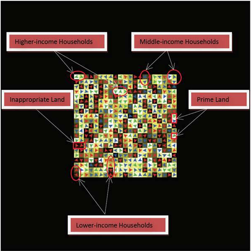
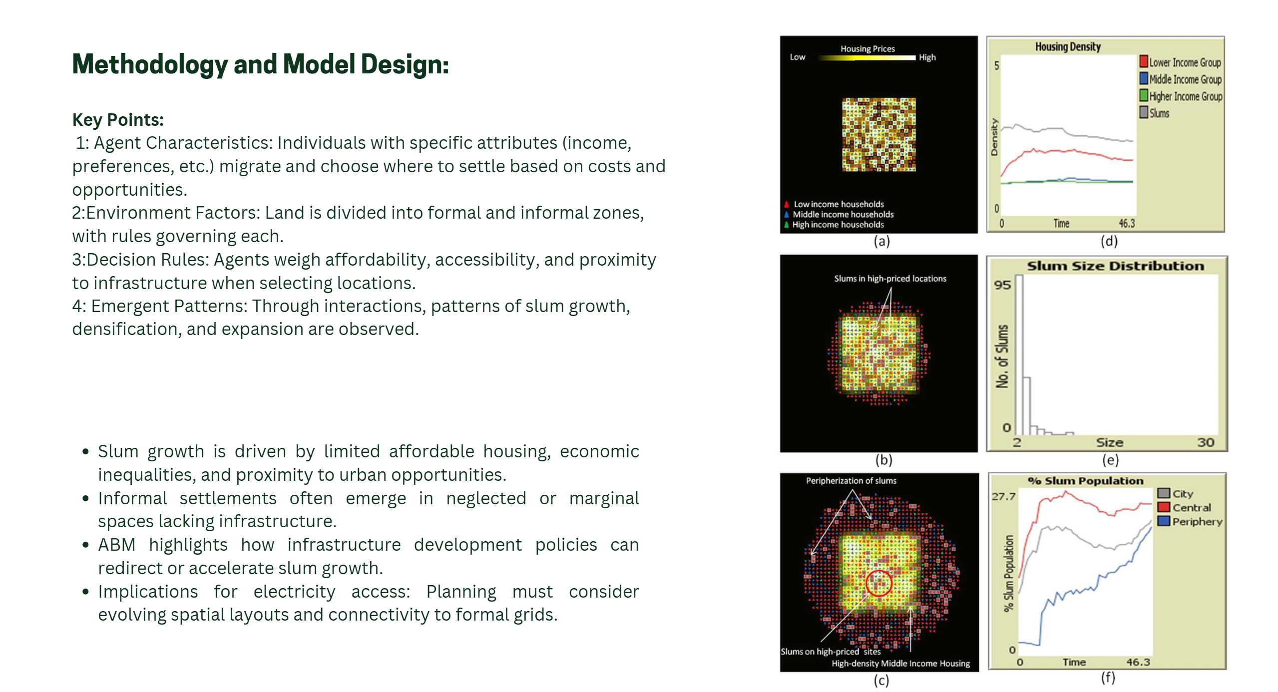
- The study by Patel, Crooks, and Koizumi explores slum formation using agent-based modeling (ABM).
- Focuses on the dynamic interplay of social, economic, and spatial factors contributing to slum growth.
- Incorporates individual decision-making (e.g., migration and settlement preferences) and external factors (e.g., government policies and land availability).
- Aims to better understand the complex evolution of informal settlements.
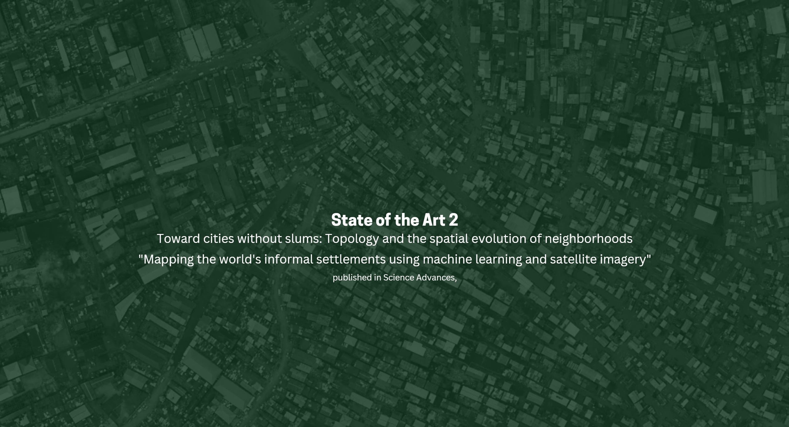
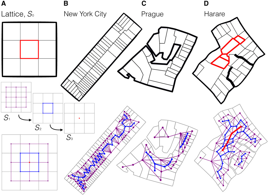
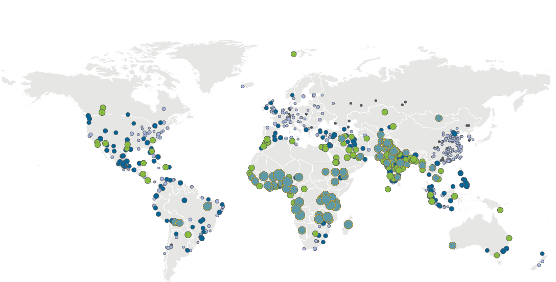
The research, “Mapping the world’s informal settlements using machine learning and satellite imagery,” aims to solve a critical problem: understanding and identifying informal settlements around the globe. Informal settlements house over 1 billion people, yet they often lack basic infrastructure like electricity, clean water, and proper sanitation. Despite this, data on these areas is incomplete or outdated, making it difficult for urban planners and policymakers to allocate resources effectively.
This study tackles the issue by combining cutting-edge machine learning with satellite imagery to create an automated, scalable method for identifying these settlements. By mapping informal settlements on a global scale, it provides a much-needed tool for understanding how these areas are organized and where resources are most urgently needed.
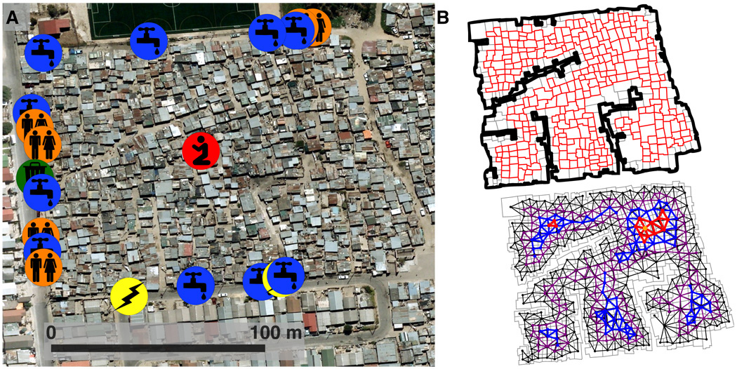
How Does the Research Work?
- Data Sources:
- Satellite Imagery: High-resolution satellite images are the main input to detect informal settlements.
- Ground-Truth Data: This includes previously known information about slums, such as their location and features, which is used to train the machine learning model.
- Machine Learning Approach:
- The study employs Convolutional Neural Networks (CNNs), a type of machine learning algorithm specifically designed for image recognition.
- The CNNs analyze visual patterns like building density, irregular layouts, and proximity to infrastructure to differentiate informal settlements from other types of urban or rural areas.
- Global Scale:
- The approach is applied globally, across multiple regions with diverse settlement types and conditions.
- It highlights spatial patterns, connectivity, and growth trends in informal settlements worldwide.
- Validation:
- The predictions from the model are compared with real-world data to ensure accuracy. The results demonstrate a high degree of precision in mapping informal settlements.
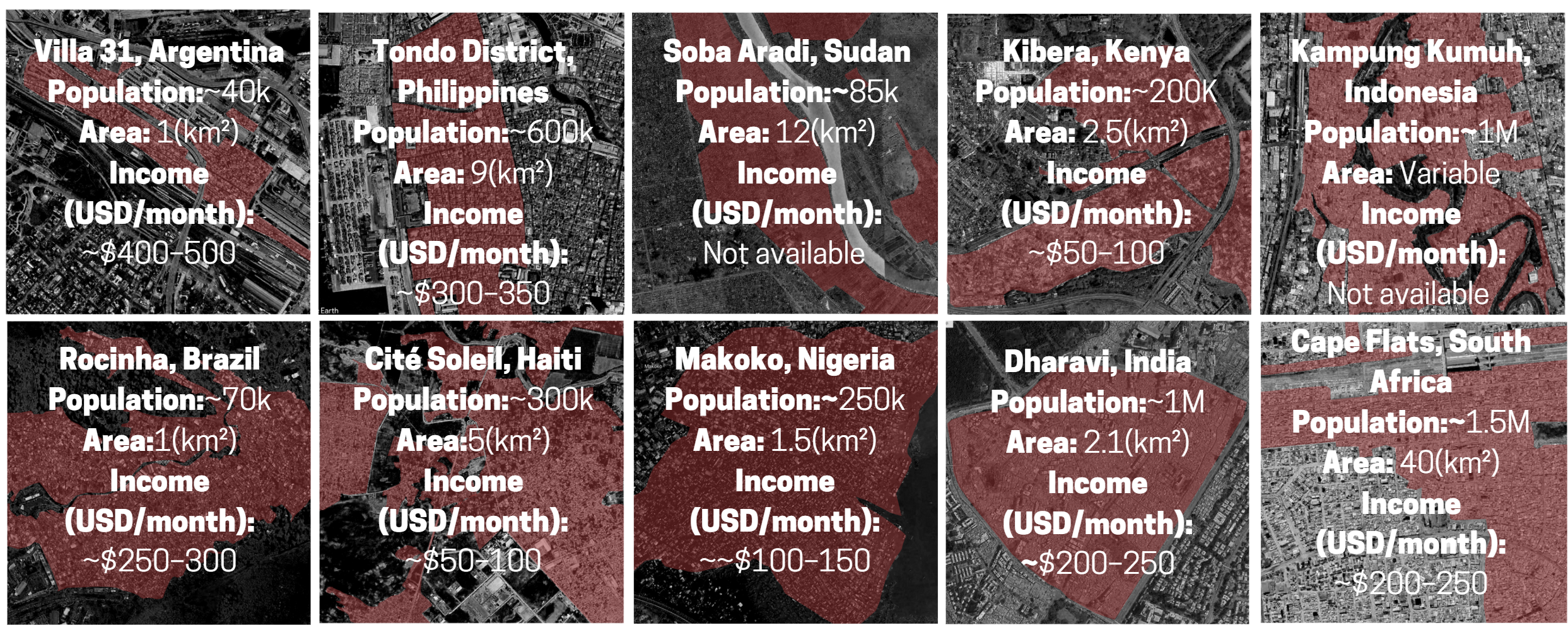
1. Selection of Study Areas

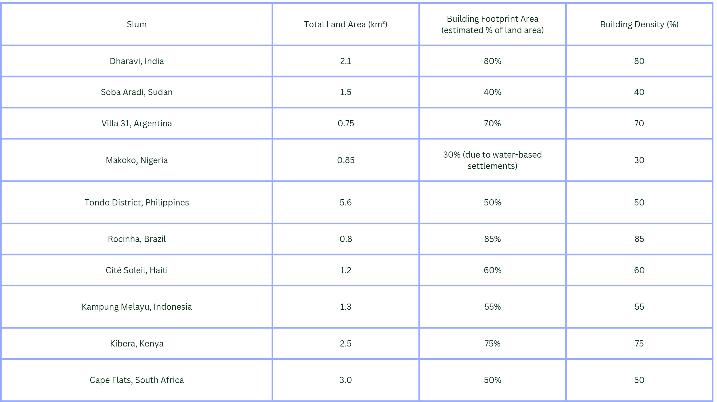
1. Dharavi, India:

- Location: Mumbai, India.
- Population: Approximately 1 million people.
- Area: 2.1 square kilometers.
- Key Features:
- One of the largest slums in the world, characterized by extreme population density (~300,000 people per square kilometer).
- A mix of residential, industrial, and commercial activities with significant informal economies, including recycling and leather production.
- Limited access to formal infrastructure, with irregular electricity supply and overburdened systems.
- Relevance: Its compact urban morphology and high population density make it a critical case for studying decentralized solar energy solutions to meet localized energy needs.
2. Soba Aradi , Sudan:

- Location: Khartoum, Sudan.
- Population: Estimated at 70,000–100,000 residents.
- Area: Approximately 12 square kilometers.
- Key Features:
- An informal settlement that has grown rapidly due to displacement caused by conflict and economic instability.
- Limited access to electricity, with the majority of residents relying on kerosene and charcoal for energy.
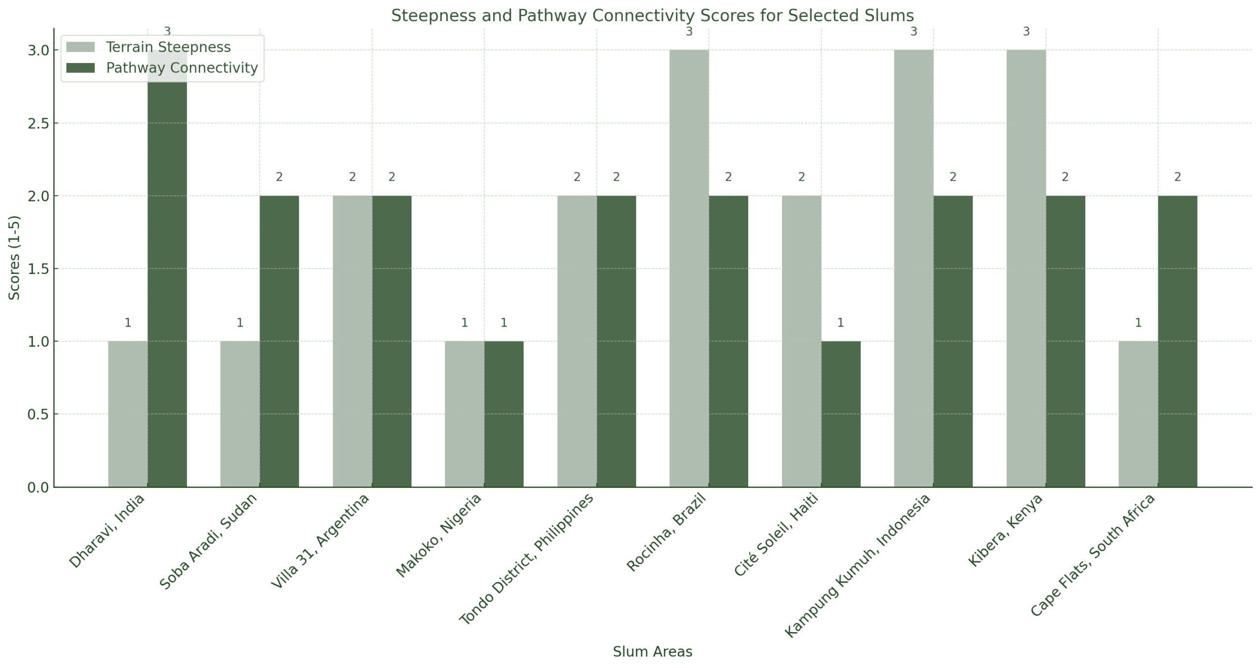
- Flat terrain with scattered housing patterns and poor connectivity to central infrastructure.
- Relevance: Highlights the potential for solar energy to improve energy access in conflict-affected regions with little to no existing grid infrastructure.
3. Villa 31, Argentina:

- Location: Buenos Aires, Argentina.
- Population: Approximately 40,000 residents.
- Area: 1 square kilometer.
- Key Features:
- Known for its proximity to central Buenos Aires yet disconnected from formal urban services.
- High levels of unemployment and socio-economic inequality.
- Residents face challenges related to overcrowding, poor housing quality, and limited energy infrastructure.
- Relevance: Provides insight into how decentralized solar systems can bridge the gap between informal and formal urban networks in rapidly urbanizing regions.
4. Makoko, Nigeria:

- Location: Lagos, Nigeria.
- Population: Approximately 250,000 residents.
- Area: ~1.5 square kilometers.
- Key Features:
- A floating slum located on the Lagos Lagoon, where houses are built on stilts.
- Poor access to basic infrastructure, with most residents relying on generators for electricity.
- Highly vulnerable to flooding and environmental degradation.
- Relevance: Highlights the feasibility of solar-powered floating energy hubs to meet the unique challenges of water-based settlements.
5. Tondo District, Philippines:

- Location: Manila, Philippines.
- Population: Over 600,000 residents.
- Area: Approximately 9 square kilometers.
- Key Features:
- Densely populated urban slum with a mix of informal settlements and high-rise public housing.
- Limited access to electricity, particularly in informal settlements.
- Vulnerability to natural disasters, including typhoons and flooding.
- Relevance: Examines how solar energy can increase resilience to climate-related risks in densely populated urban areas.
6. Rocinha, Brazil:

- Location: Rio de Janeiro, Brazil.
- Population: Approximately 70,000–100,000 residents.
- Area: 1 square kilometer.
- Key Features:
- The largest favela in Brazil, located on steep hillsides overlooking affluent neighborhoods.
- Overcrowded housing with limited access to clean water, sanitation, and electricity.
- Vibrant informal economies and social dynamics despite infrastructure challenges.
- Relevance: Demonstrates how solar energy can address energy inequities and promote sustainable development in hillside settlements.
7. Cité Soleil, Haiti:

- Location: Port-au-Prince, Haiti.
- Population: Estimated 300,000 residents.
- Area: 5 square kilometers.
- Key Features:
- One of the poorest and most underserved areas in Haiti, with high levels of unemployment and poverty.
- Limited electricity access, with most residents relying on illegal grid connections or fuel-based generators.
- High vulnerability to environmental risks, including flooding and hurricanes.
- Relevance: A critical case for studying how hybrid solar systems can provide reliable energy in disaster-prone areas.
8. Kampung Kumuh, Indonesia:

- Location: Jakarta, Indonesia.
- Population: Approximately 1 million people across several informal kampungs.
- Area: Variable across different settlements; most are highly dense.
- Key Features:
- Informal settlements located along rivers and canals, prone to severe flooding.
- High reliance on informal energy systems, with limited access to the formal electricity grid.
- Rapid urbanization is putting further strain on infrastructure.
- Relevance: Provides insight into solar-powered solutions for settlements facing environmental and infrastructural pressures.

- Location: Nairobi, Kenya.
- Population: Approximately 200,000–250,000 residents.
- Area: 2.5 square kilometers.
- Key Features:
- One of Africa’s largest slums, characterized by overcrowding, poverty, and inadequate infrastructure.
- Residents rely on illegal electricity connections and fuel-based lighting.
- High levels of community engagement and grassroots initiatives.
- Relevance: Examines how community-driven solar energy projects can improve energy access in resource-constrained environments.
10. Kibera, Kenya:
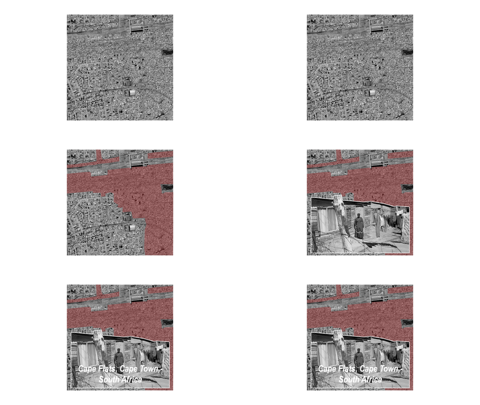
- Location: Cape Town, South Africa.
- Population: Approximately 1.5 million people across multiple settlements.
- Area: 40 square kilometers.
- Key Features:
- A sprawling low-income area with a mix of informal settlements and formal housing.
- High unemployment rates and social challenges such as gang violence and drug abuse.
- Limited infrastructure, with frequent electricity outages in informal areas.
- Relevance: Explores how solar energy can address energy poverty and promote economic opportunities in marginalized urban areas.
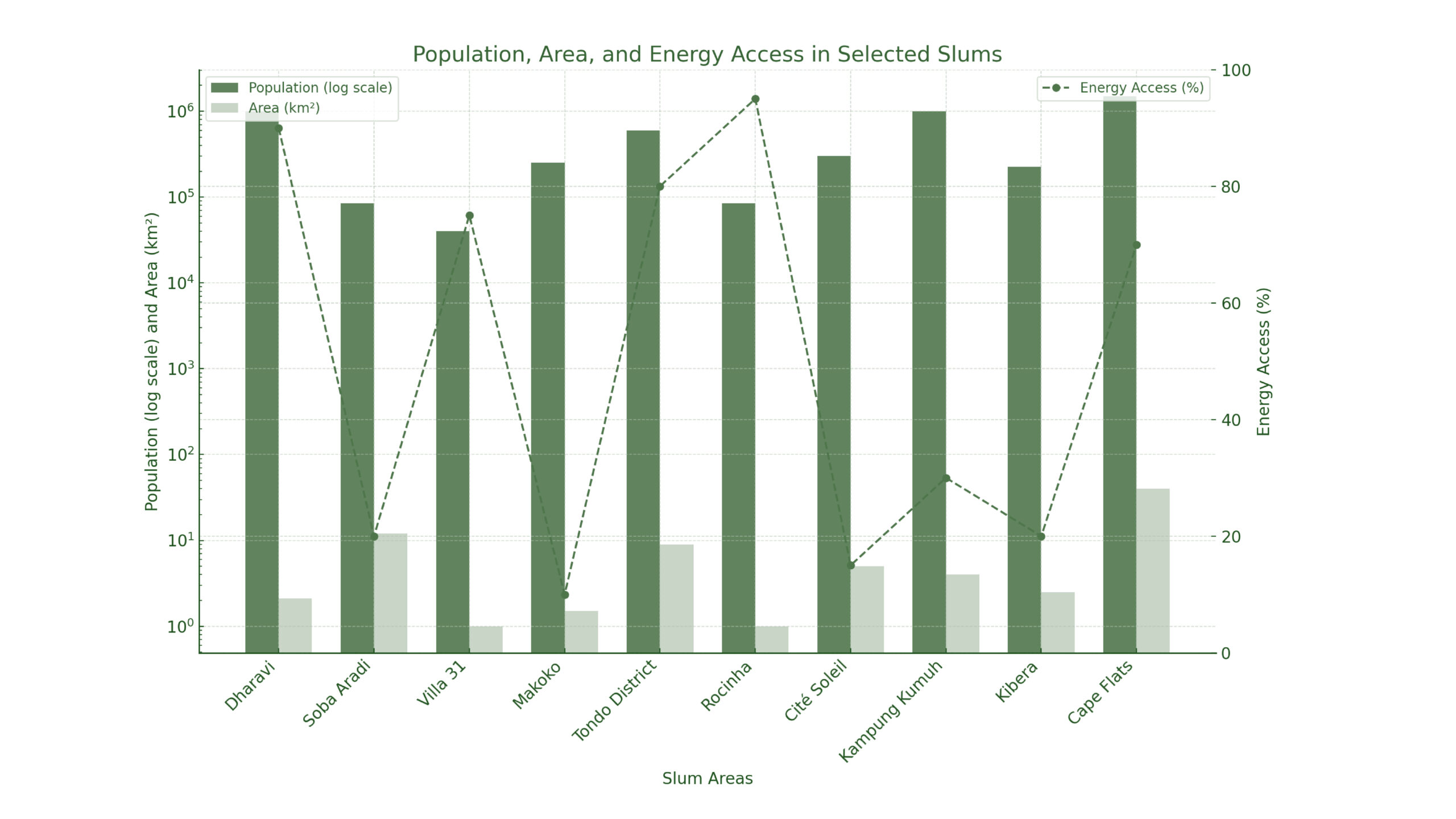
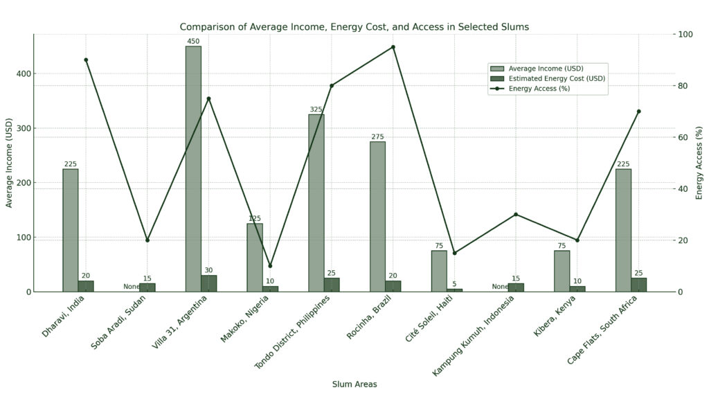
2. Areas, Population and Energy Access Analysis :

2. Spatial Data: Mapping:
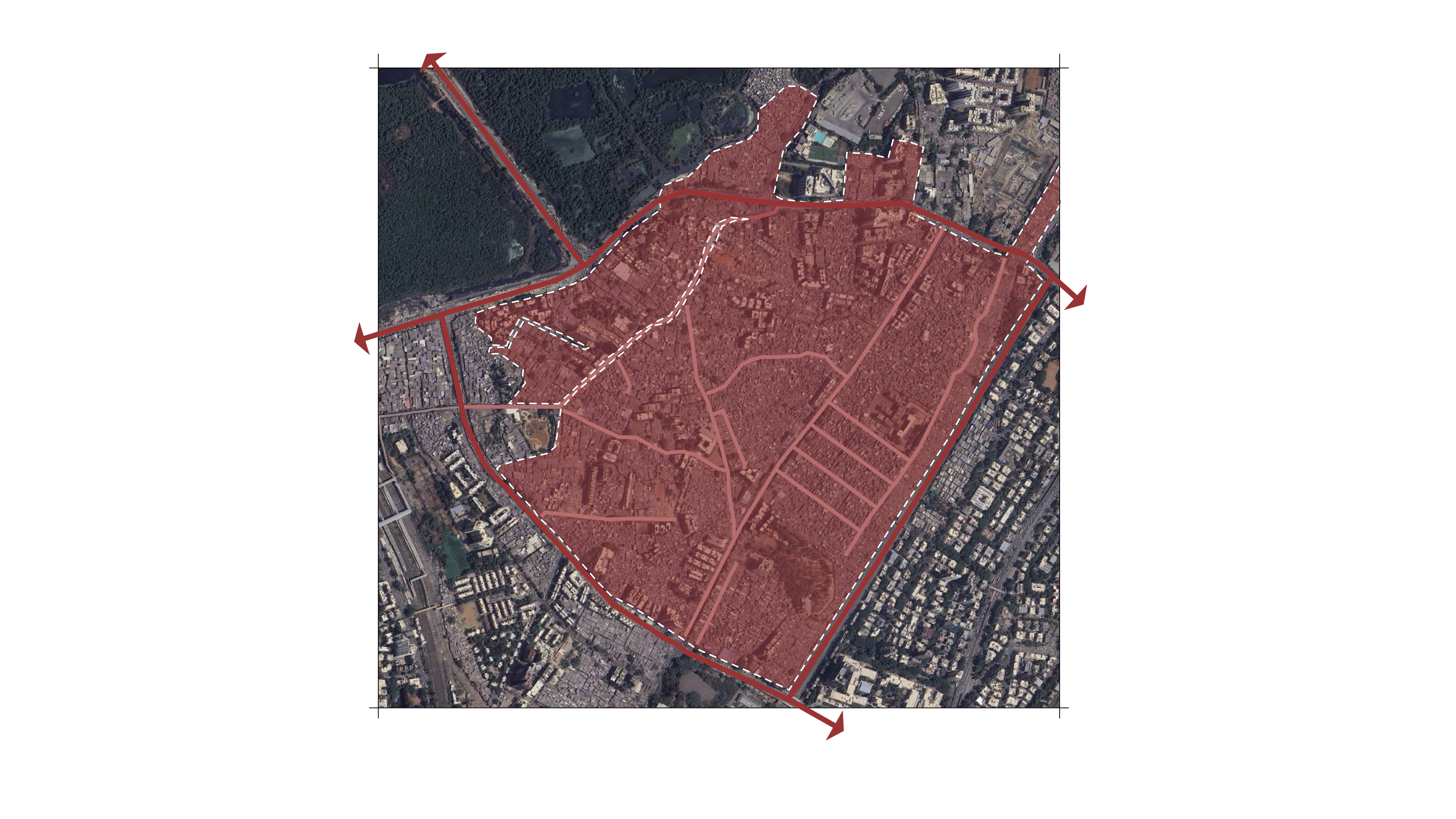
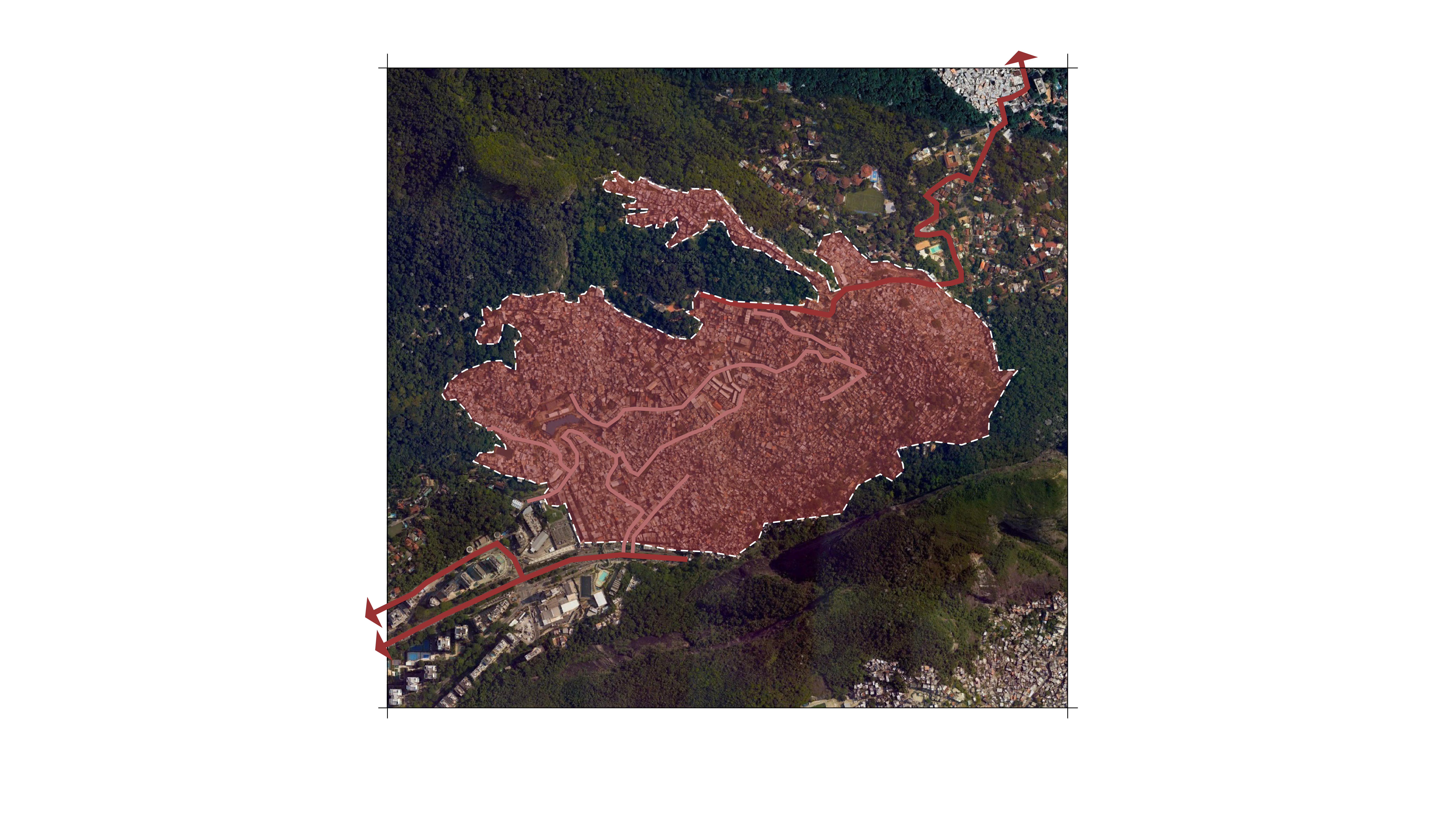
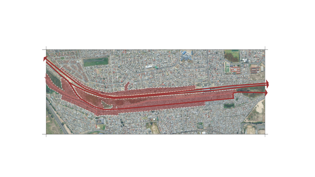
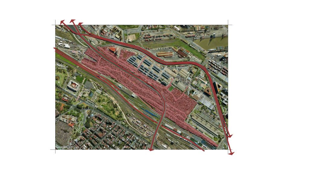
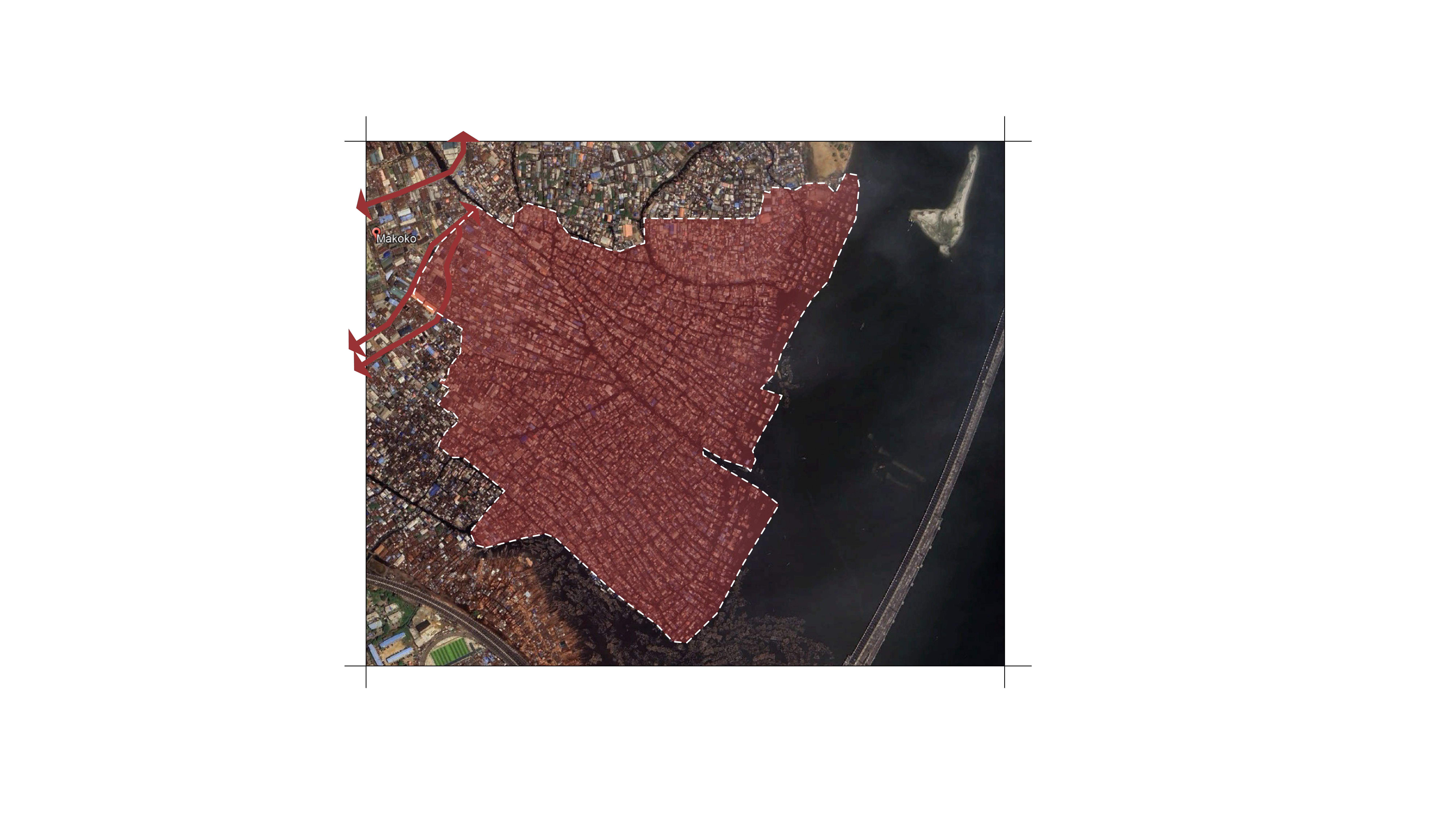
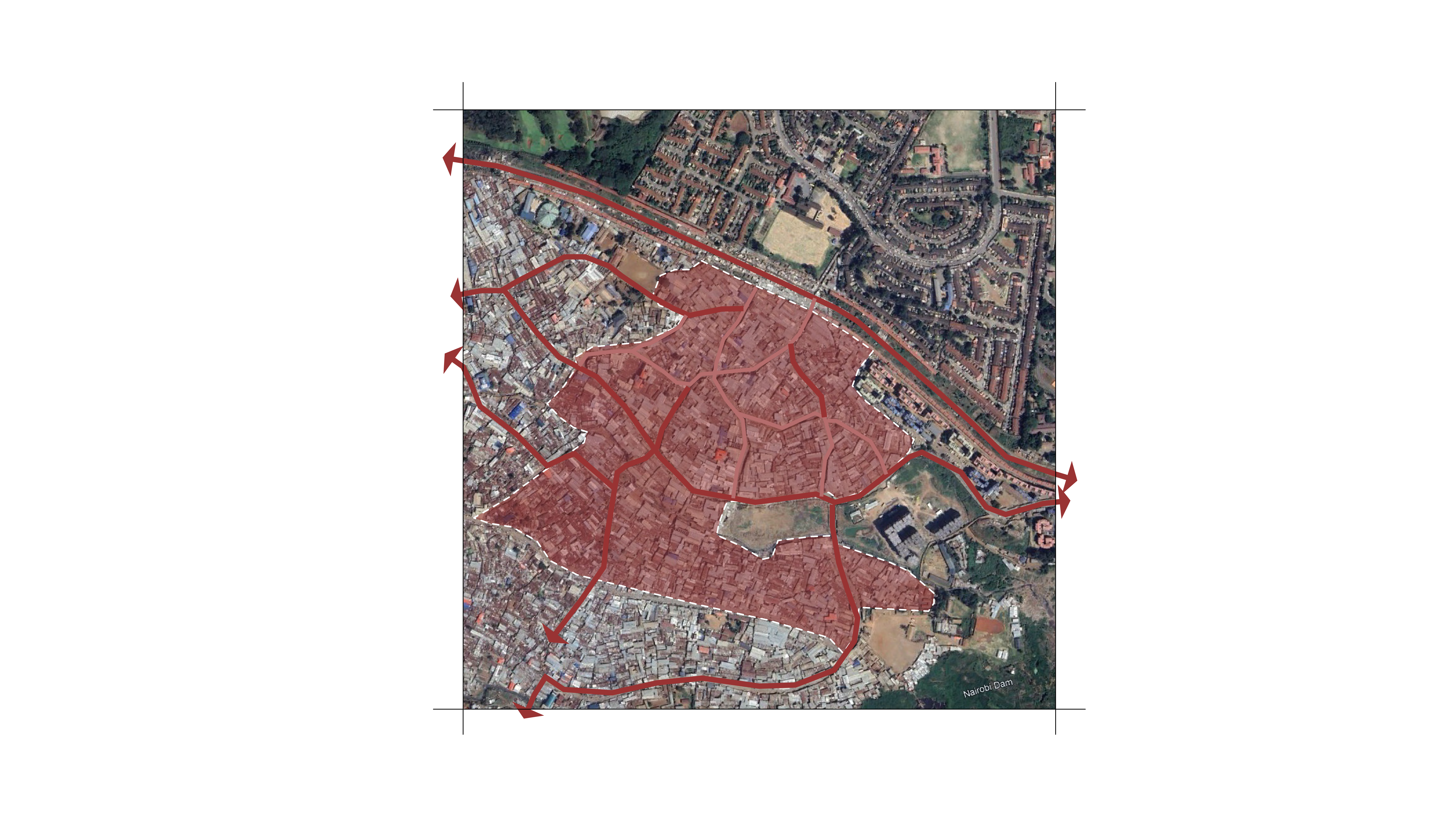
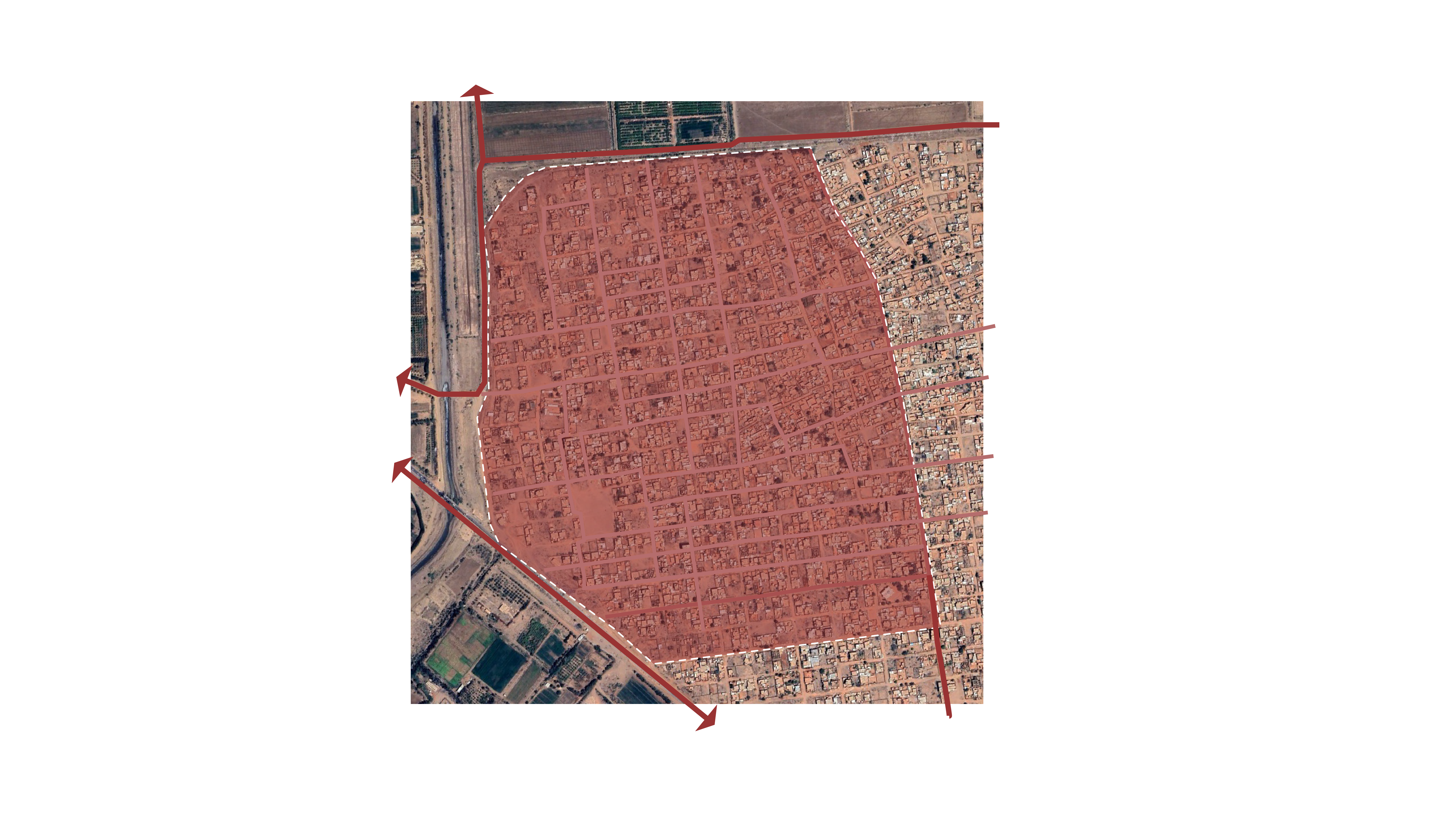
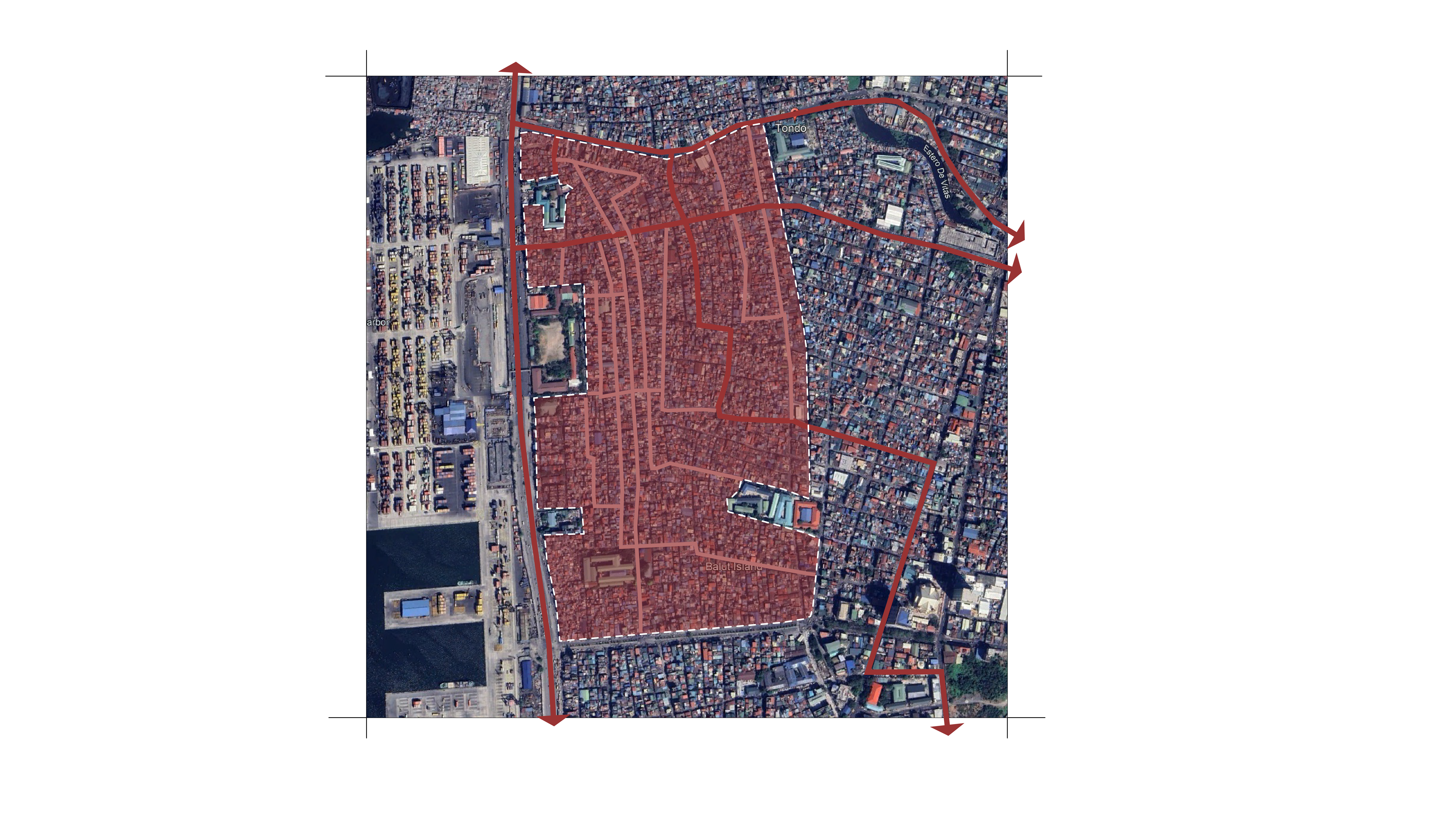
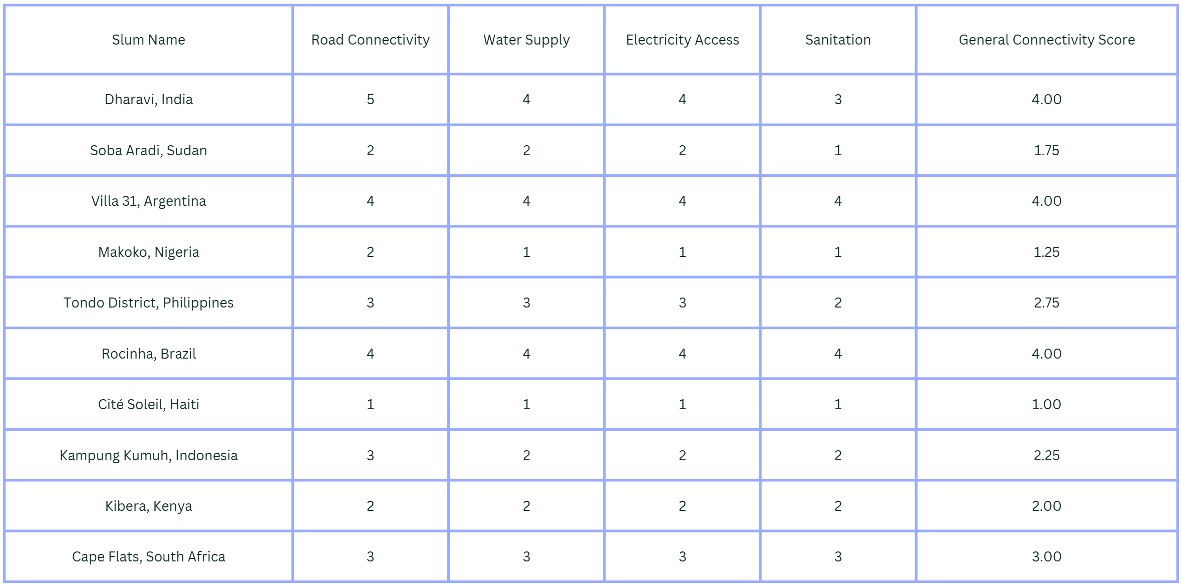
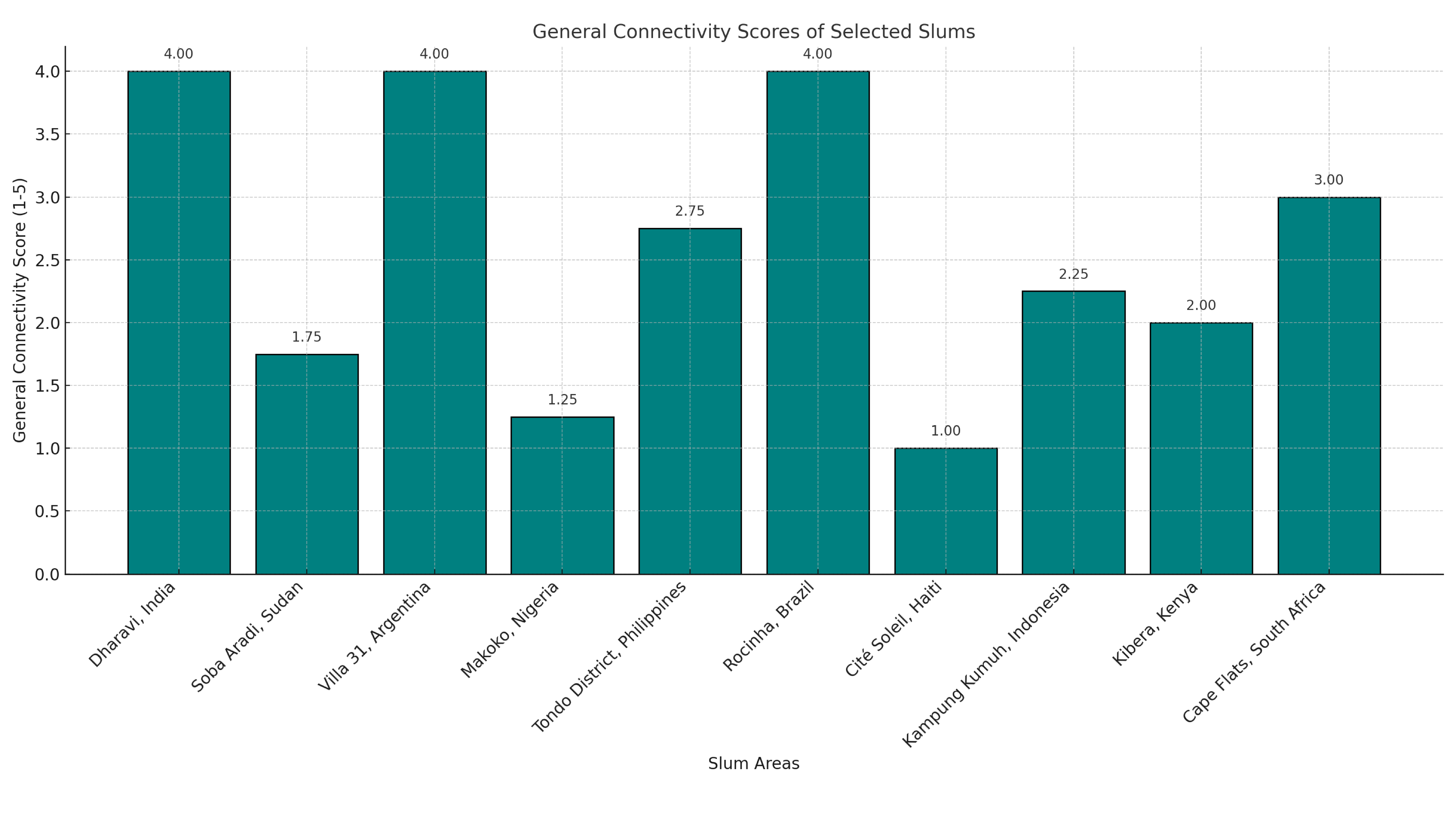
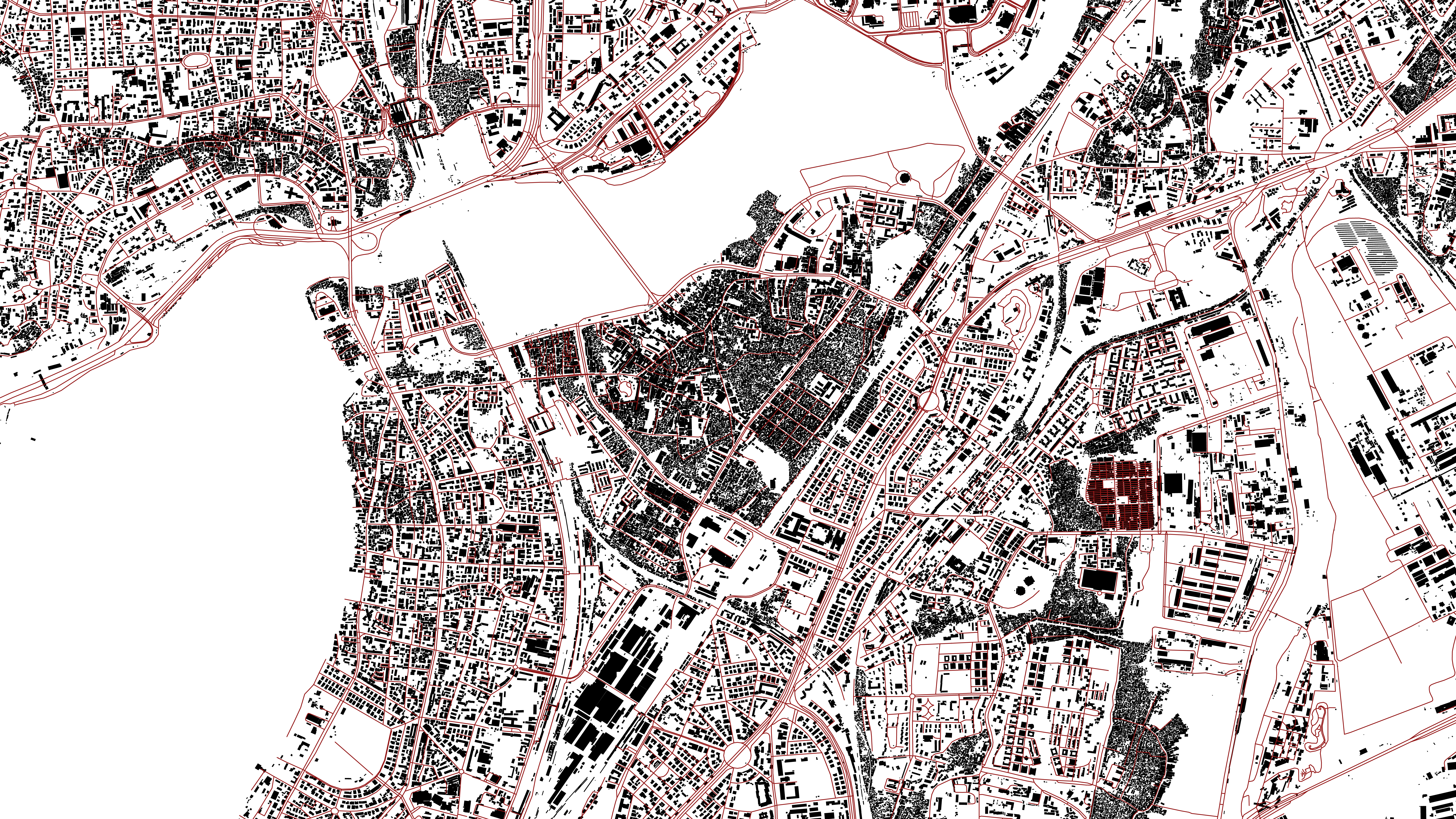
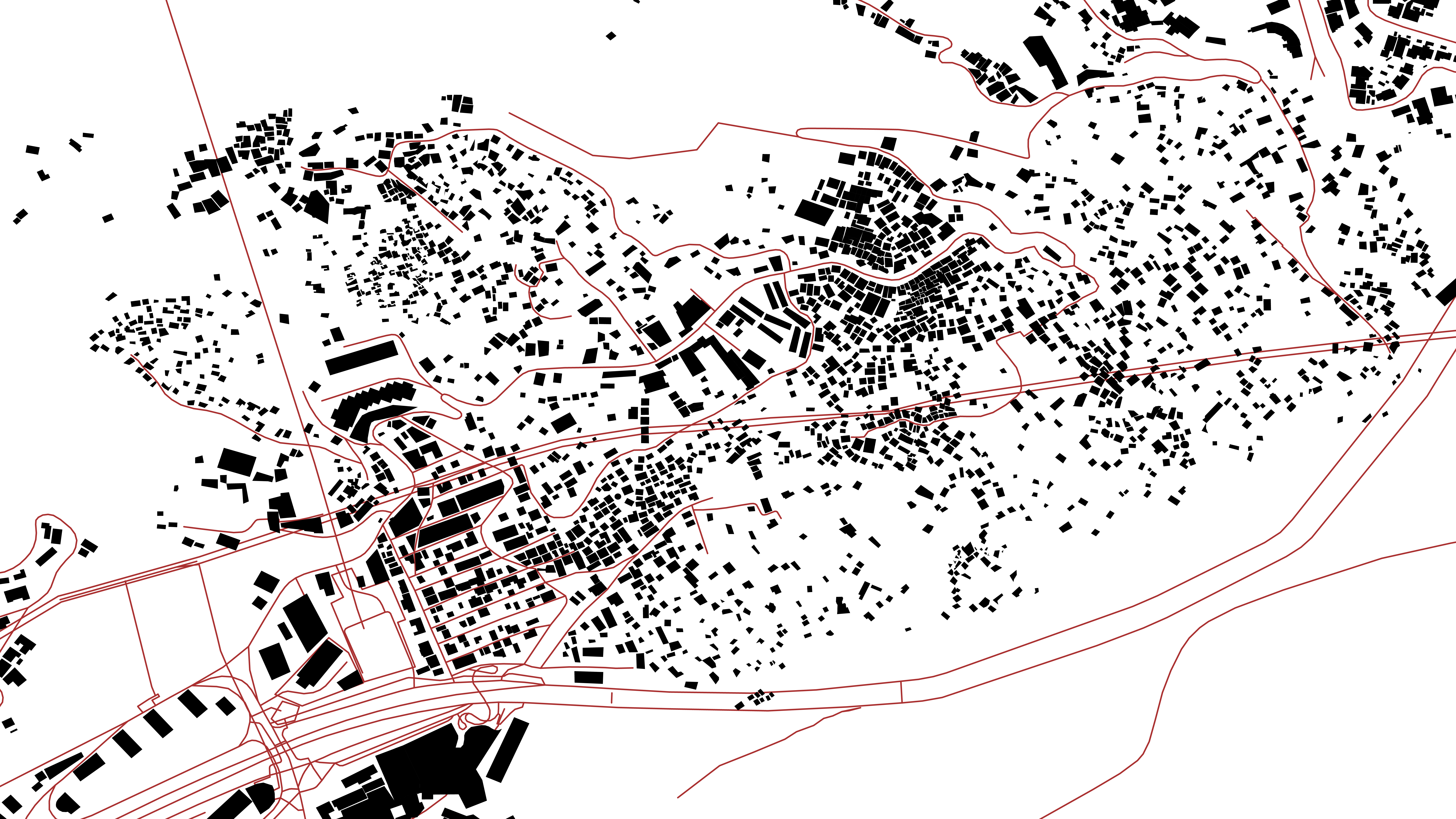
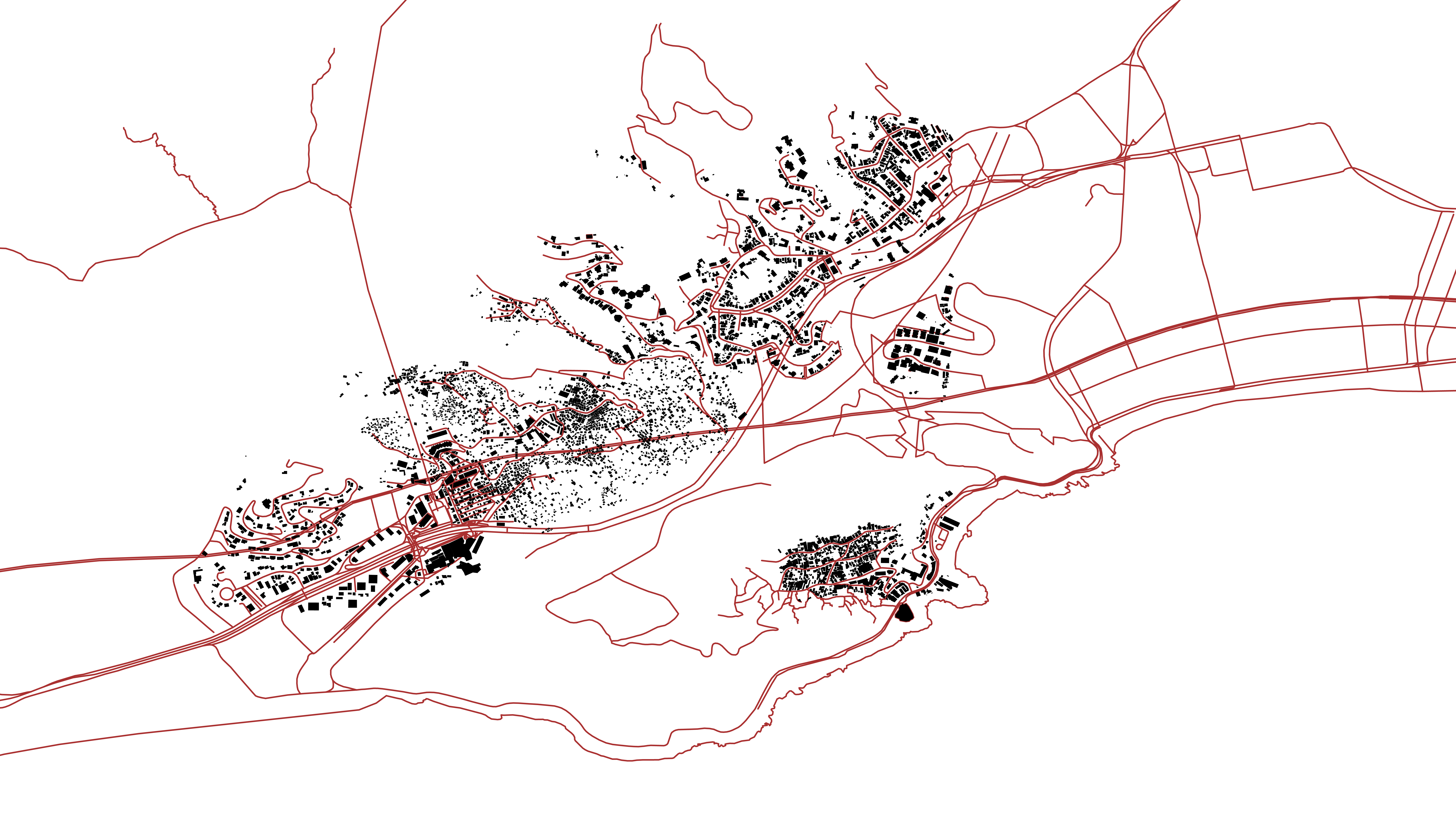
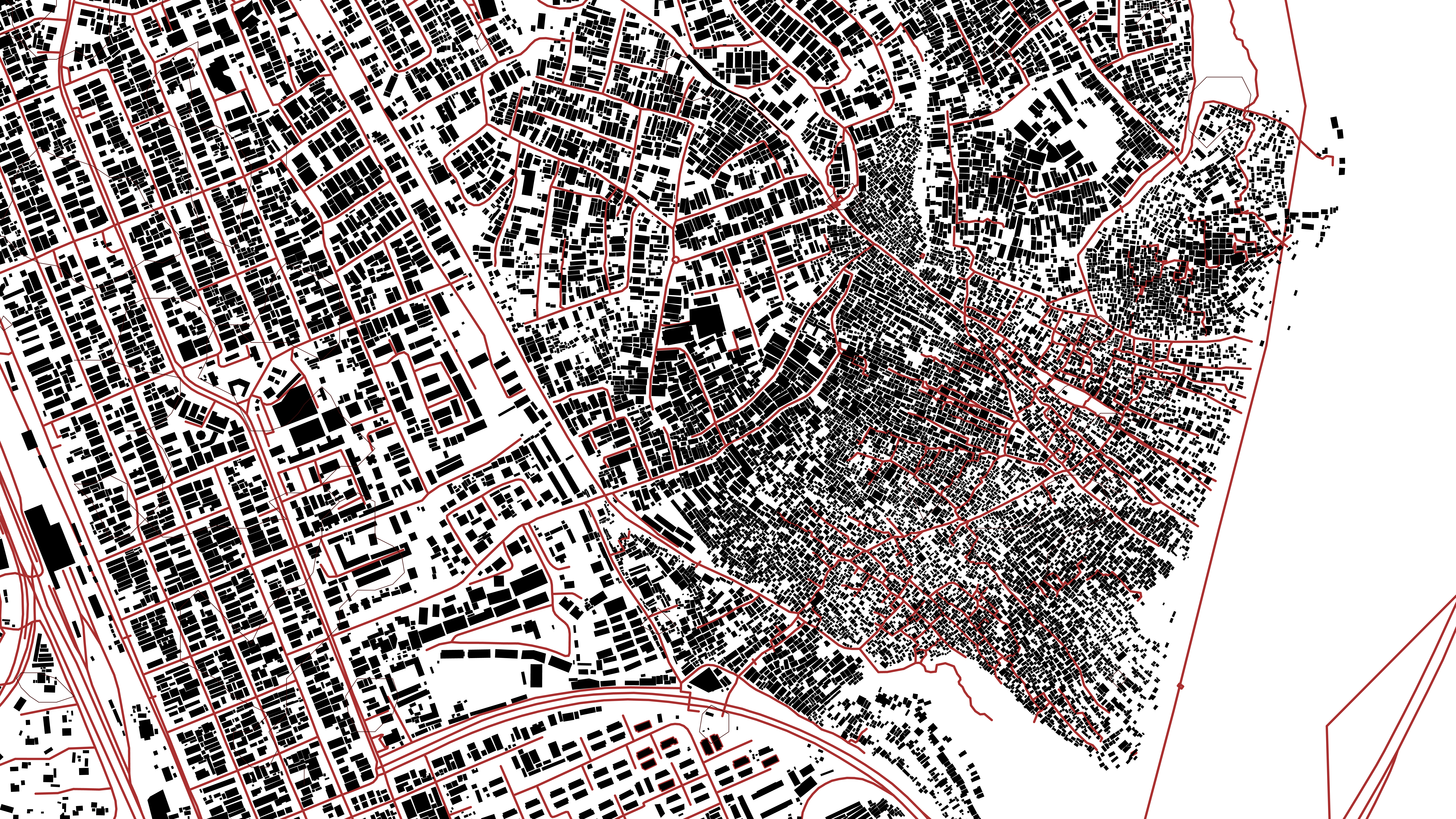
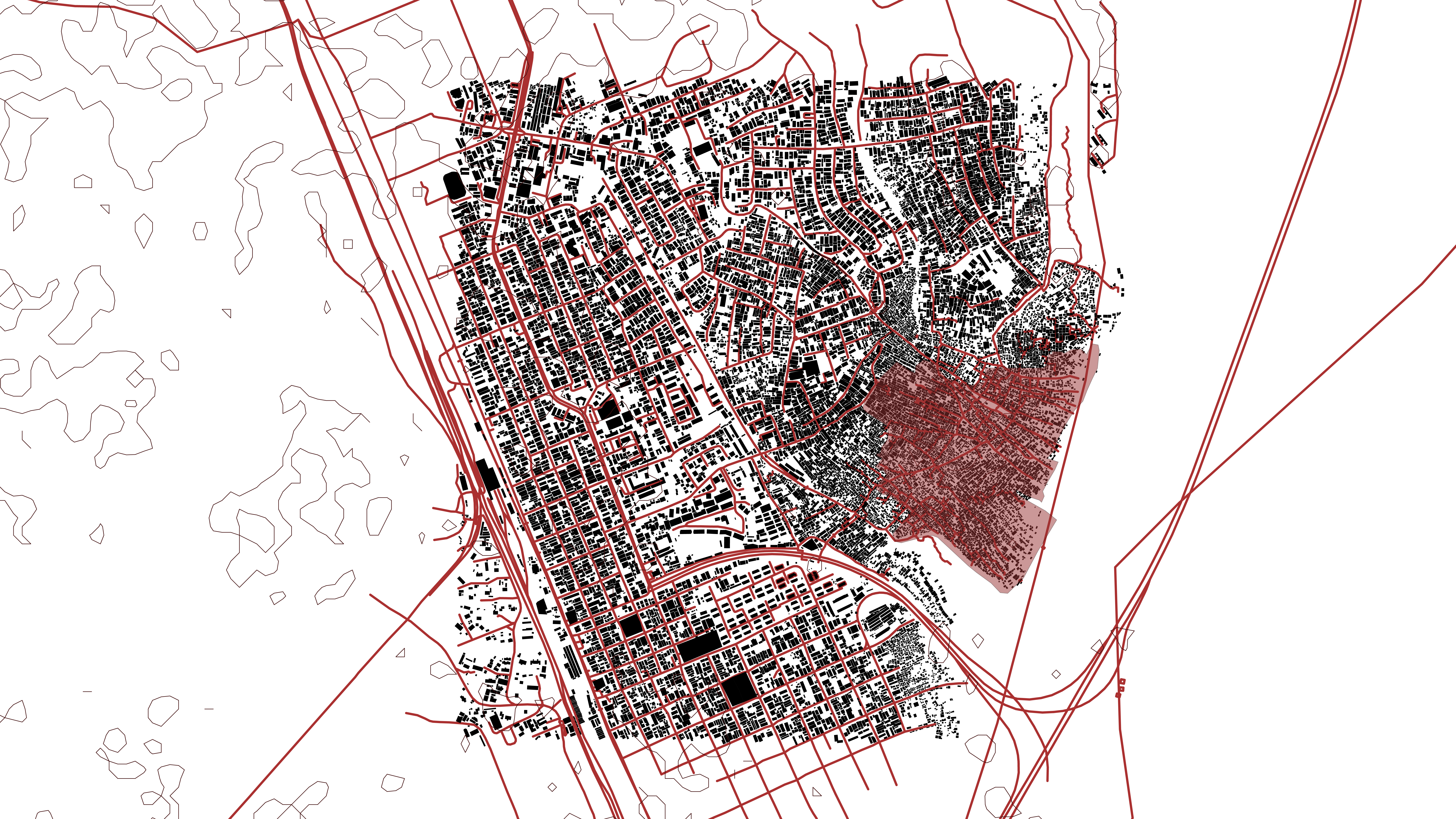
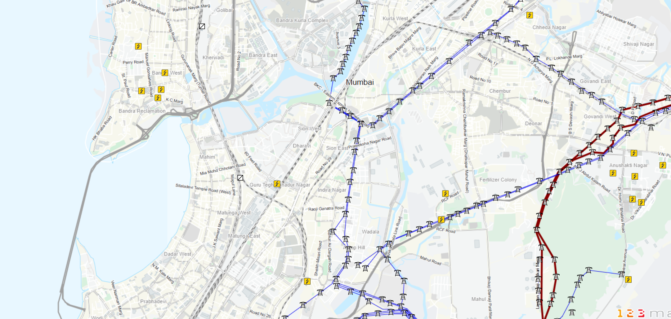
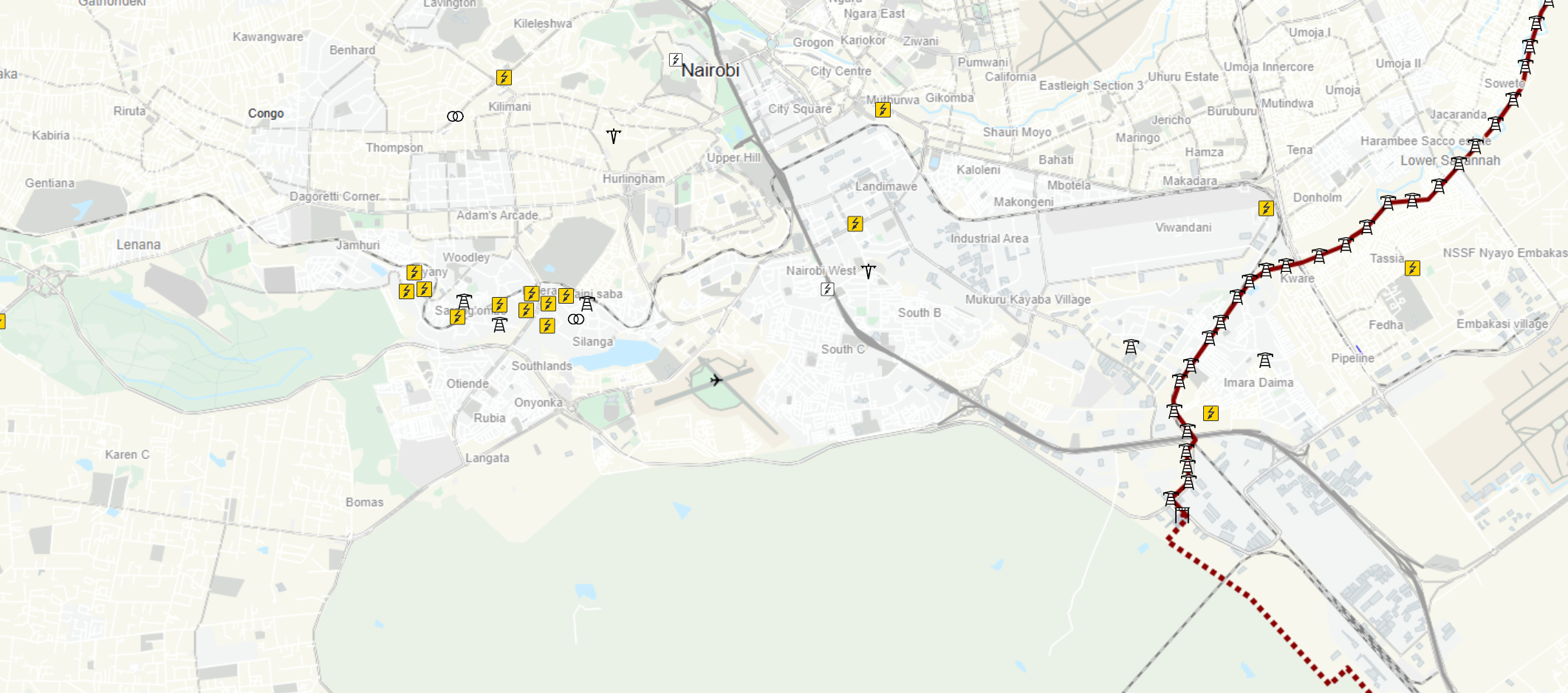
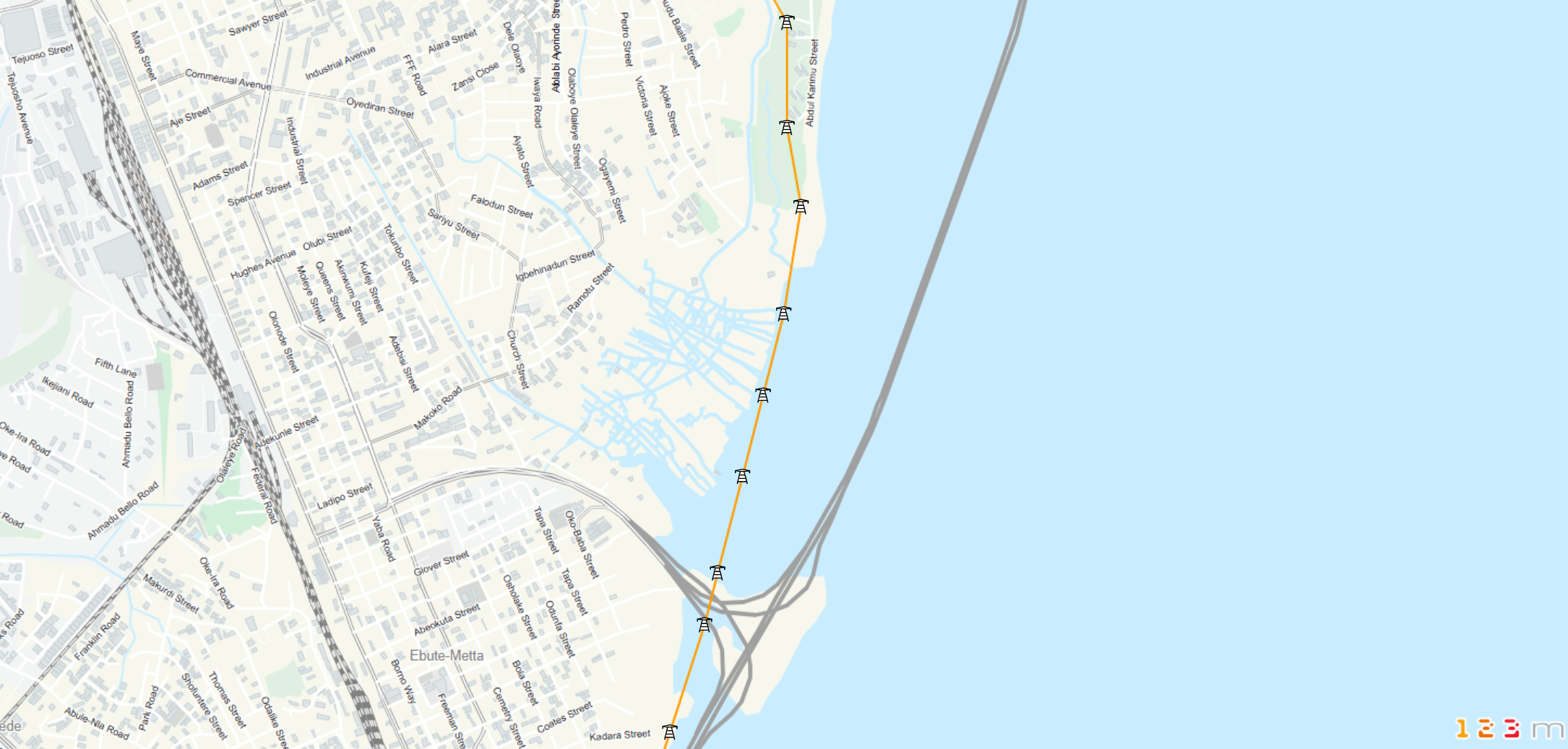
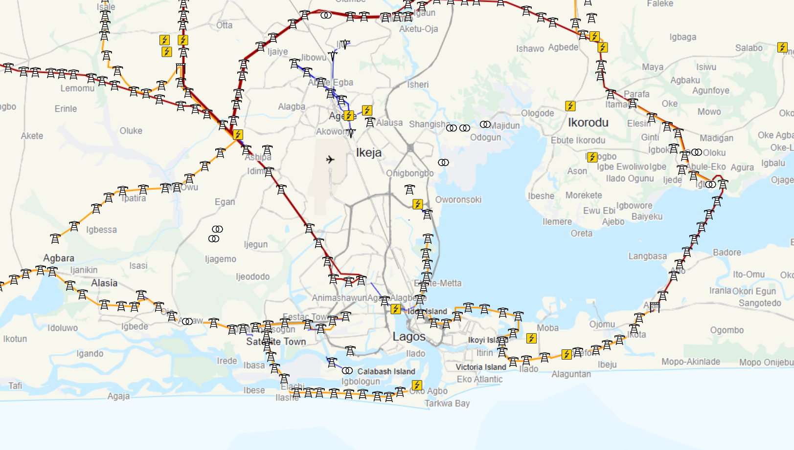
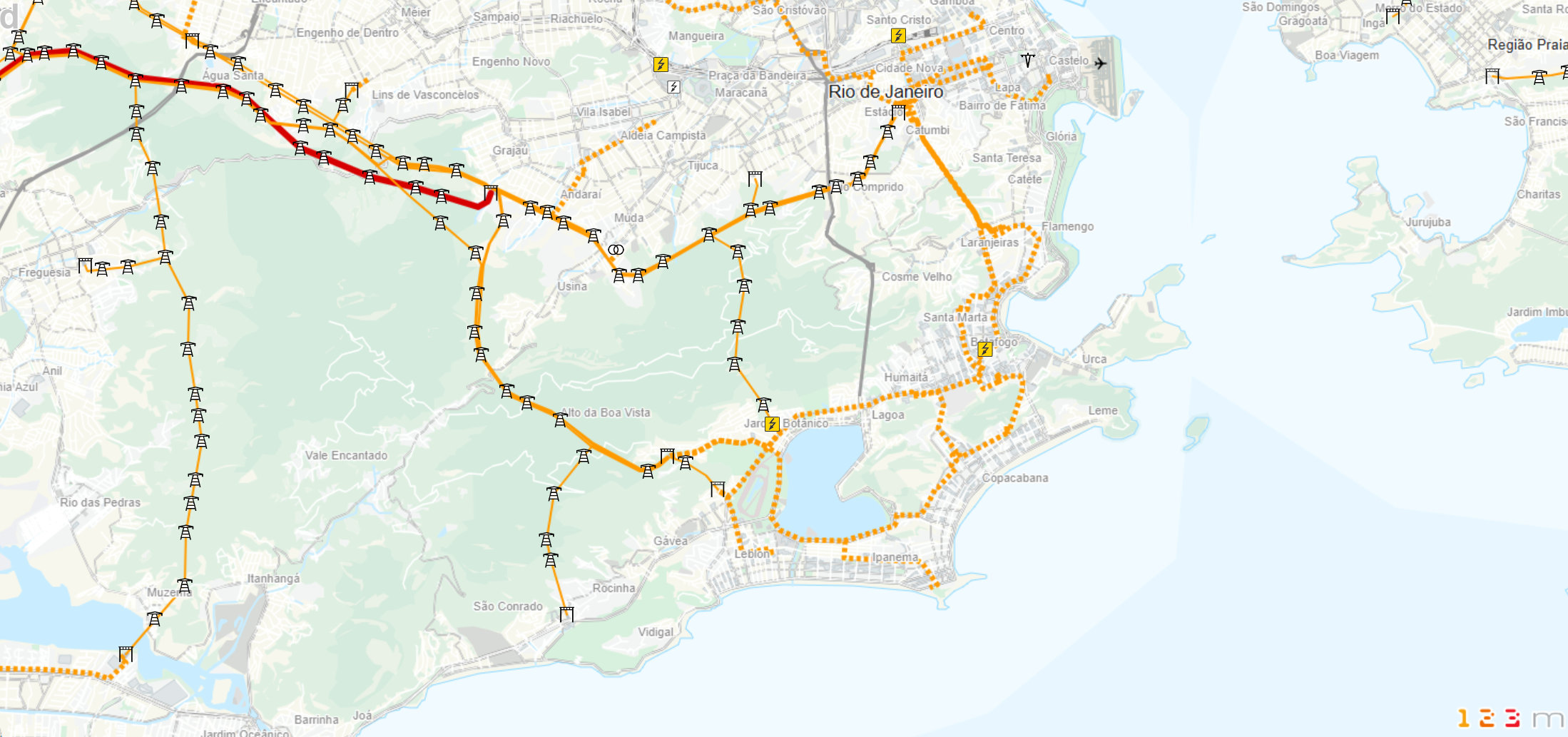
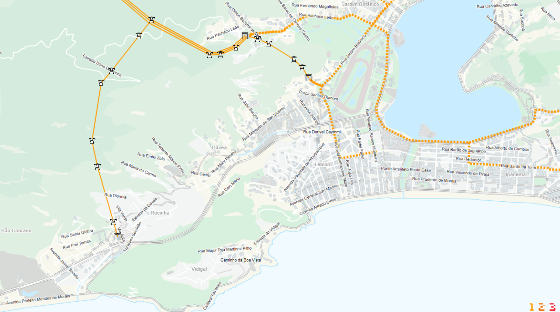
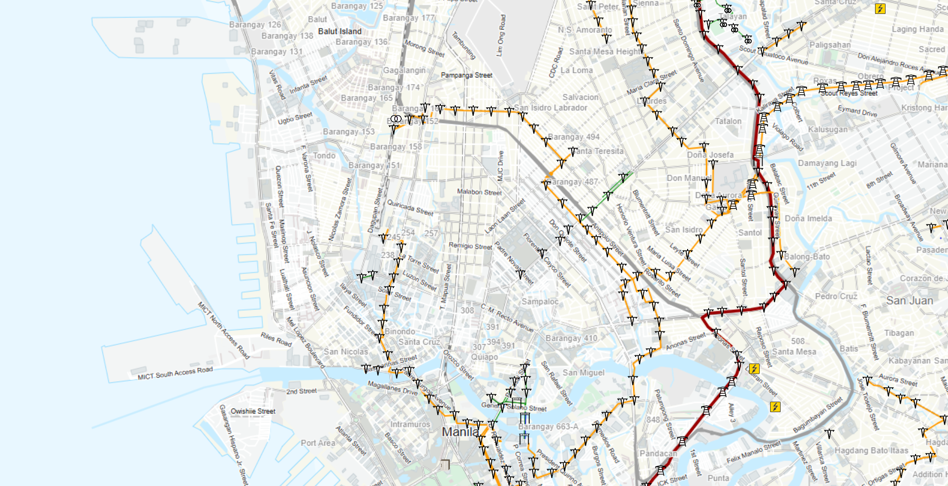
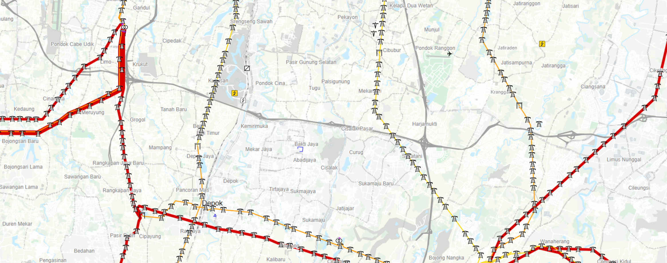
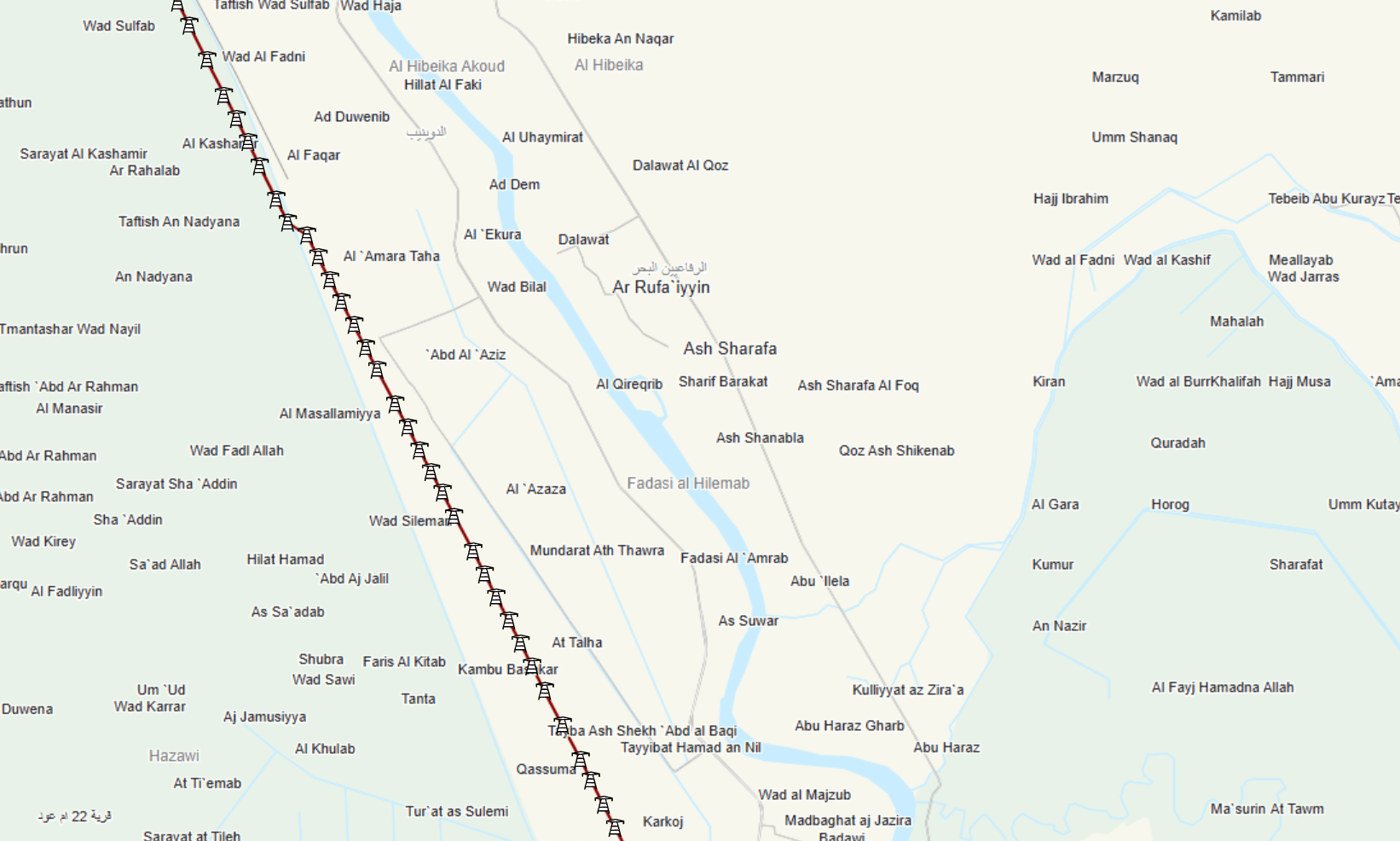
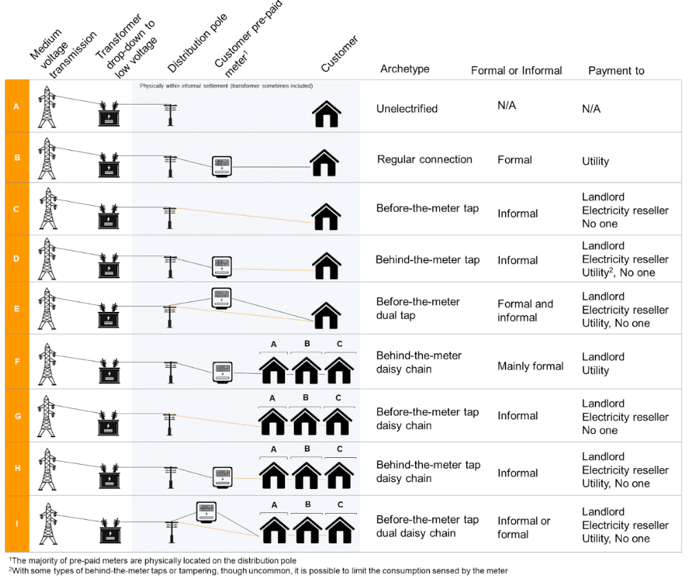
Informal urban communities often face challenges in accessing reliable electricity due to gaps in infrastructure and the complexity of integrating them into formal grid systems. The strategy to transfer electricity from high-voltage grids to residential areas in these settlements involves a multi-step approach:
- Step-Down Transformation: Electricity is first transferred from high-voltage transmission lines to lower-voltage distribution systems through substations equipped with transformers.
- Decentralized Distribution Nodes: Small, localized transformers and distribution nodes are installed closer to the settlements to further reduce voltage levels and ensure safer delivery of electricity.
- Flexible and Scalable Network Design: Micro-grids or hybrid systems are incorporated to address irregular settlement layouts and limited access to centralized infrastructure. These systems can function both as standalone grids and as part of the main electricity network.
- Upgrading Infrastructure: Existing informal wiring systems are replaced with standardized, safer materials to reduce technical losses and improve efficiency.
- Energy Justice Measures: Subsidized connections and pay-as-you-go systems are introduced to make electricity access affordable and scalable for low-income households.
This phased approach ensures that electricity can be safely and effectively delivered to informal settlements, while addressing their unique spatial and socio-economic challenges. The goal is to integrate these areas into the national grid without compromising reliability, safety, or equity.
3. Urban Morphology Analysis:
Multi-layered analysis to understand the spatial and infrastructural dynamics of informal settlements:
- Spatial Layout and Density Analysis
- Examining building arrangement, road layouts, and plot density.
- Identifying high-density clusters with concentrated energy needs.
- Mapping open spaces for potential solar hub installations.
- Topographical Analysis
- Using DEMs to analyze slopes, natural barriers, and flood-prone areas.
- Identifying zones with optimal solar exposure based on elevation and orientation.
- Connectivity and Accessibility Analysis
- Analyzing road networks and pathways to evaluate ease of access for energy system installations.
- Studying proximity to key urban centers for logistical feasibility.
- Infrastructure Mapping
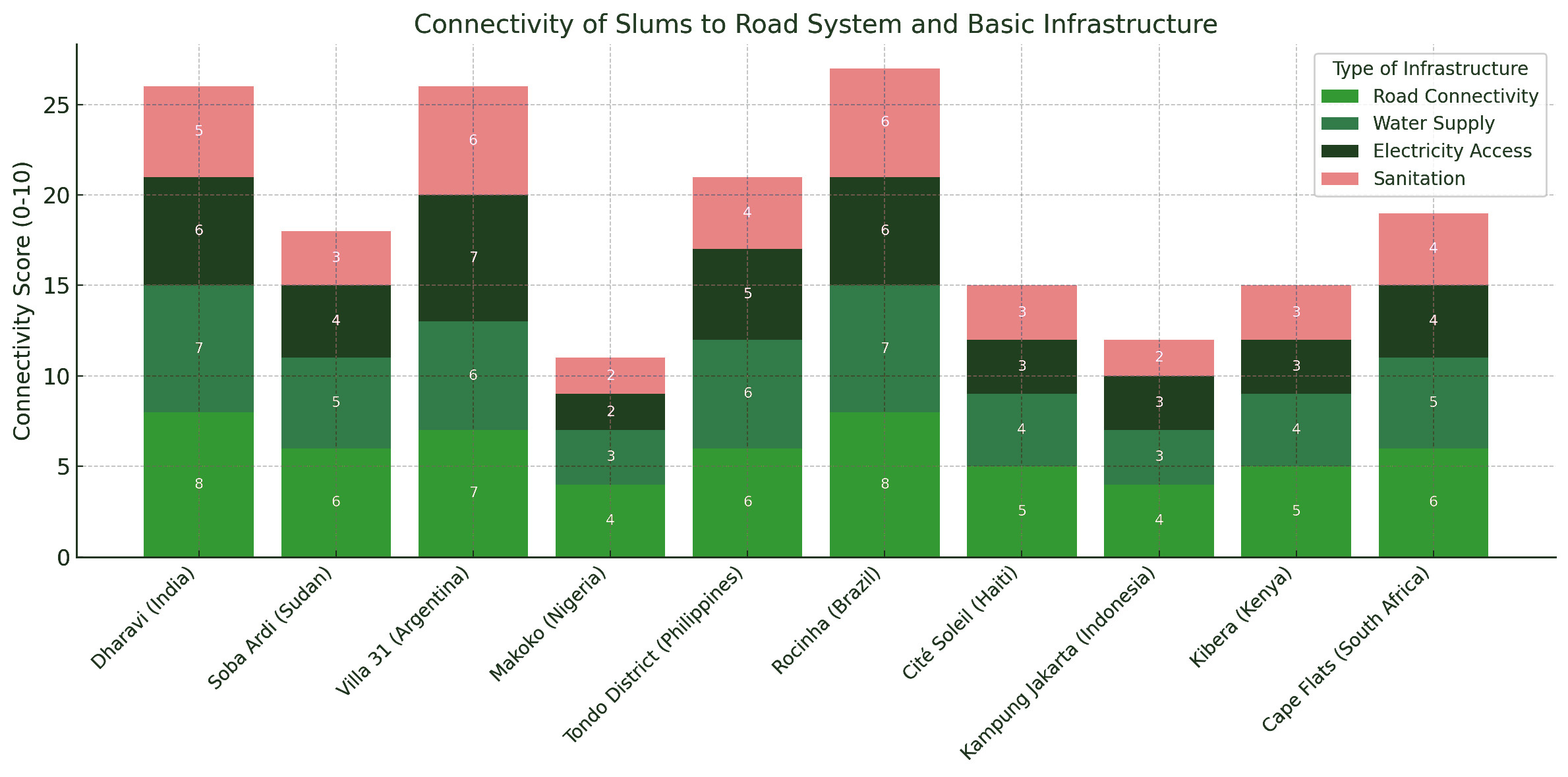
- Documenting the spatial reach of current energy, water, and waste management systems.
- Overlapping infrastructure maps with population density to identify underserved areas.
- Growth Pattern Analysis
- Mapping historical growth patterns using archival satellite imagery.
- Identifying trends in settlement expansion to predict future energy demand.
- Solar Exposure and Shading Analysis
- Simulating solar paths using QGIS and Grasshopper to identify optimal locations for solar panels.
- Assessing shading effects from buildings, vegetation, and terrain.
- Social and Economic Layer Analysis
- Mapping socio-economic disparities to prioritize areas most in need of affordable energy solutions.
- Highlighting demographic factors influencing energy access and usage.
1. Urban Growth Simulation:
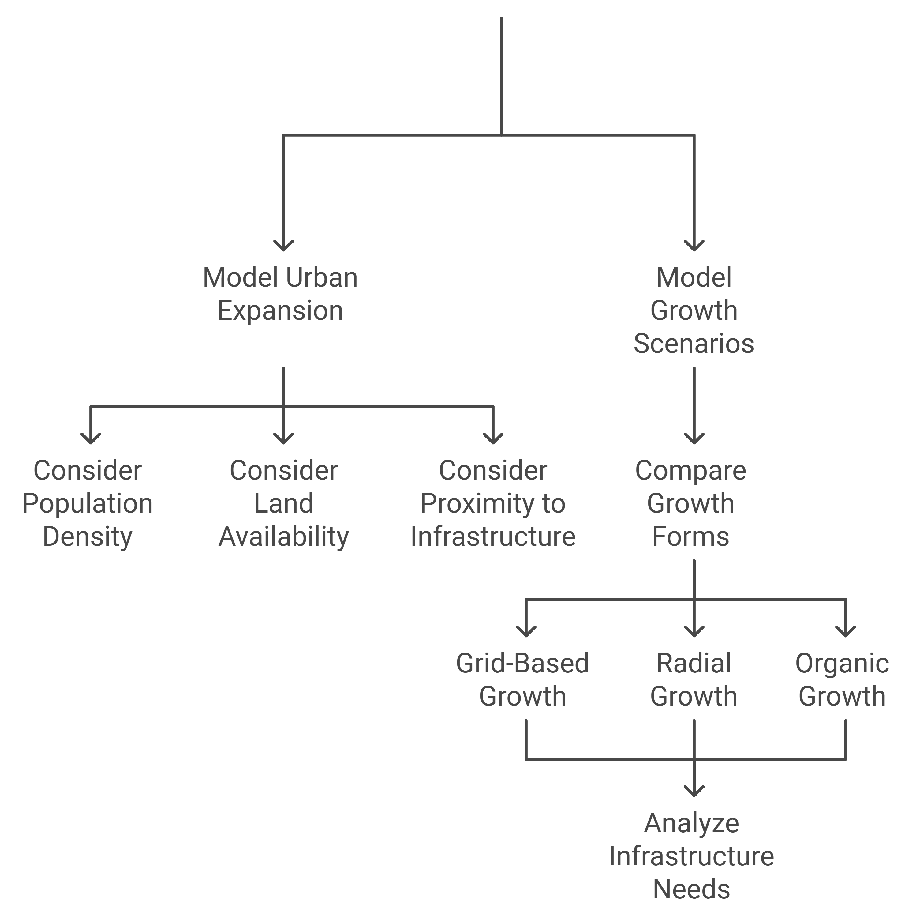
- Using Grasshopper’s GH_UrbanGrowth to model settlement expansion based on land availability, population density, and infrastructure constraints.
- Simulating growth scenarios to assess how urban morphologies evolve under varying conditions (e.g., grid-based vs. organic growth).
- Dynamic visualization of infrastructure expansion needs based on growth predictions.
2. Energy Demand and Distribution Mapping:
- Modeling energy demand variations across time (peak vs. off-peak) and space within settlements.
- Identifying zones with critical energy shortages or poor grid access.
- Overlaying energy demand maps with socio-economic data to prioritize interventions.

3. Solar Integration and Scenario Testing:
- Solar exposure and shading simulations to identify areas most suited for decentralized solar installations.
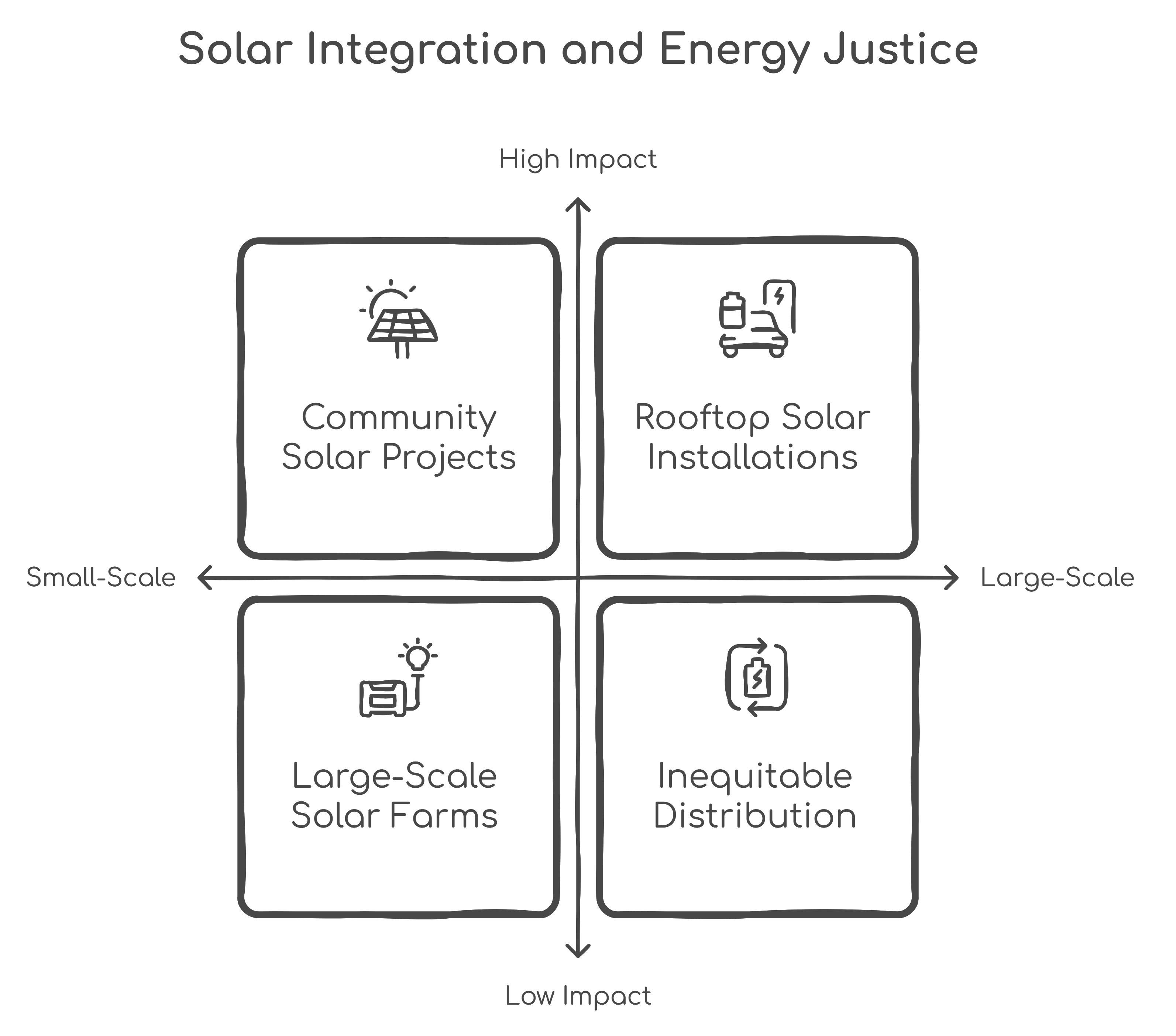
- Testing hybrid energy configurations, including rooftop solar panels, community solar hubs, and standalone units.
- Assessing the reliability and efficiency of solar-only vs. hybrid systems under different urban morphologies.
4. Pattern Recognition Using Machine Learning:
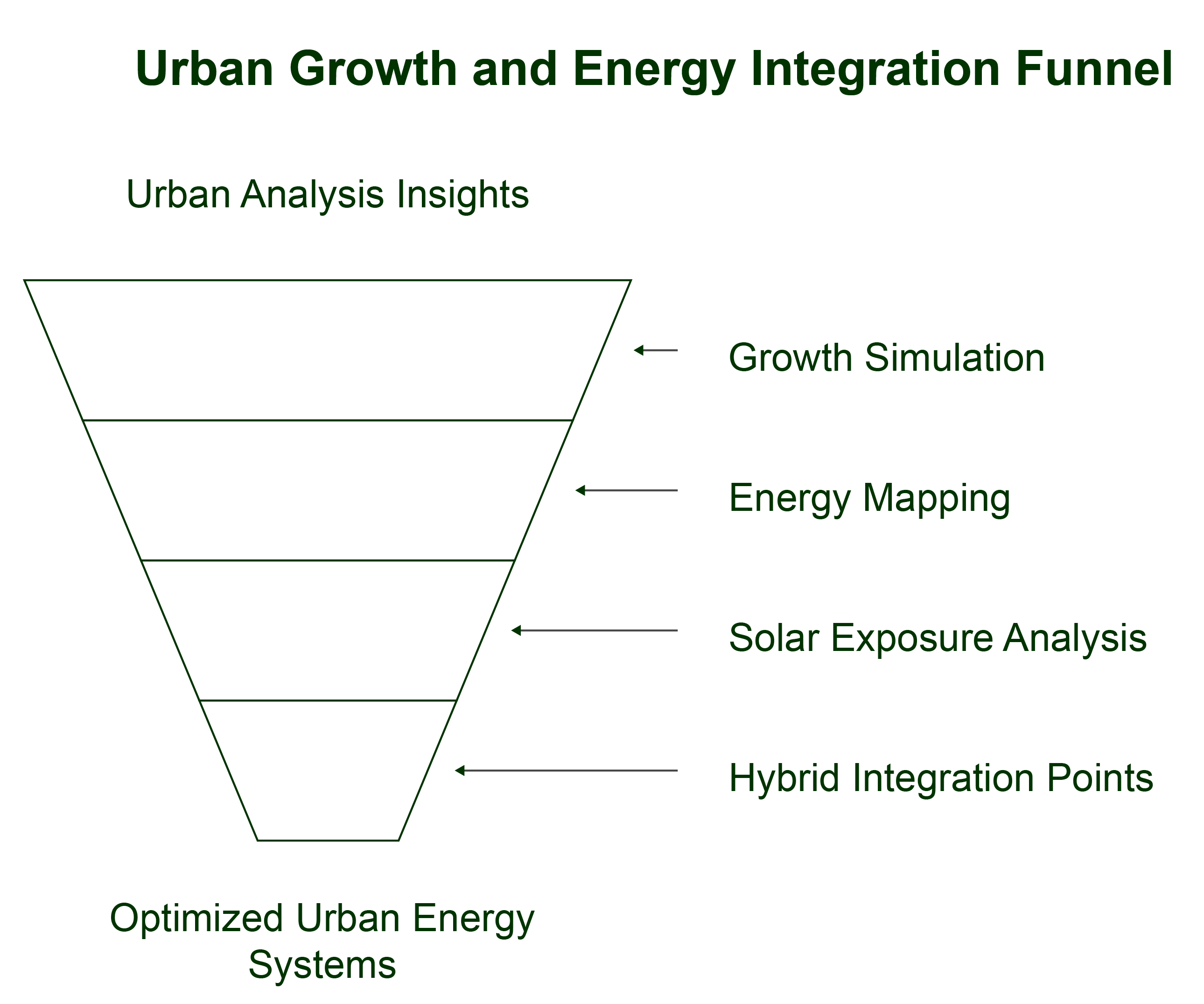
- Training AI models to detect urban morphology patterns, infrastructure networks, and settlement density from satellite imagery.
- Automating the identification of areas with high solar potential and critical energy shortages.
- Using image detection tools for growth pattern recognition and predictive modeling.

