Overview
Visualizing Visibility of Women+ Safety is a research initiative aimed at evaluating how the design of public spaces influences perceptions of safety for women+ in India, particularly in Delhi. The central question driving this study is:
“How can we assess the current paradigms of urban design to better understand and improve perceptions of safety for women+, enabling freer movement in cities?”
The project explores urban safety through the lens of women+ by examining Delhi’s urban configuration and its impact on safety perceptions. In India, efforts to prevent sexual harassment have largely been defensive, relying on increased policing and surveillance. However, these measures have had little effect on serious crimes like rape, which remains alarmingly high in Delhi. In response, various NGOs, support groups, and digital platforms have emerged to enhance women+ safety in public spaces. Despite these efforts, a significant gap remains in understanding and integrating women+ tacit knowledge of safety into urban design solutions.
This research seeks to bridge this gap by quantifying safety perceptions, translating qualitative insights into actionable data for urban designers. Adopting a pathogenic investigative approach, it aims to uncover the root causes of safety concerns by analysing human behaviour patterns, conducting literature reviews, and collecting qualitative data. The objective is to critically examine how urban design enables or deters offenders and how it can be reimagined to support the free movement of women+ in Delhi.
Introduction
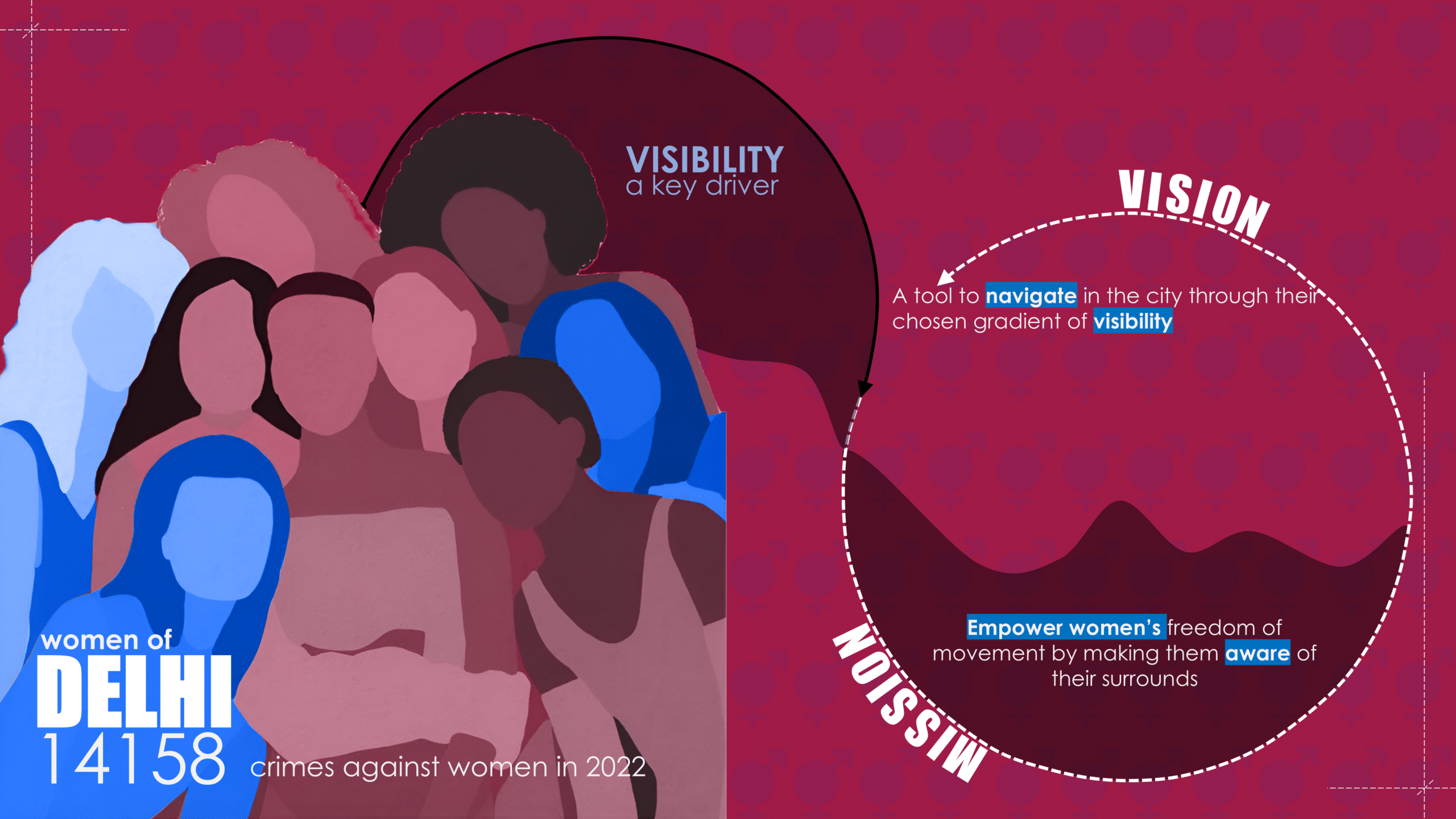
In the capital city of Delhi it is noticed that in a woman+ circle at the least 1/3rd of the other women+ she knows has been harassed or attacked sexually at some point in their life. Many of these incidences go without being reported to the police and are not in the records of crimes against women. This leads to an approximation of 14.2K reported events of crimes against women in 2022, which is still not the real aggregate. Through this research it has been unveiled that Visibility and it gradients is a key driver behind the perceptions of safety for women+ in Delhi. The mission on this research is to empower women’s freedom of movement by making them aware of their surroundings which would be step towards protecting their safety rights. With the mission mentioned, the ultimate vision of this research would be to empower women with a tool that can help women navigate Delhi better with their chosen gradients of Visibility.
Context
On December 16, 2012, India witnessed one of the most heinous and shocking crimes against a young woman in Delhi. Nirbhaya—a name given to protect her identity—was a 23-year-old physiotherapy trainee who was brutally gang-raped and mutilated by six men in a moving bus before being thrown, severely injured, onto the streets of South Delhi.
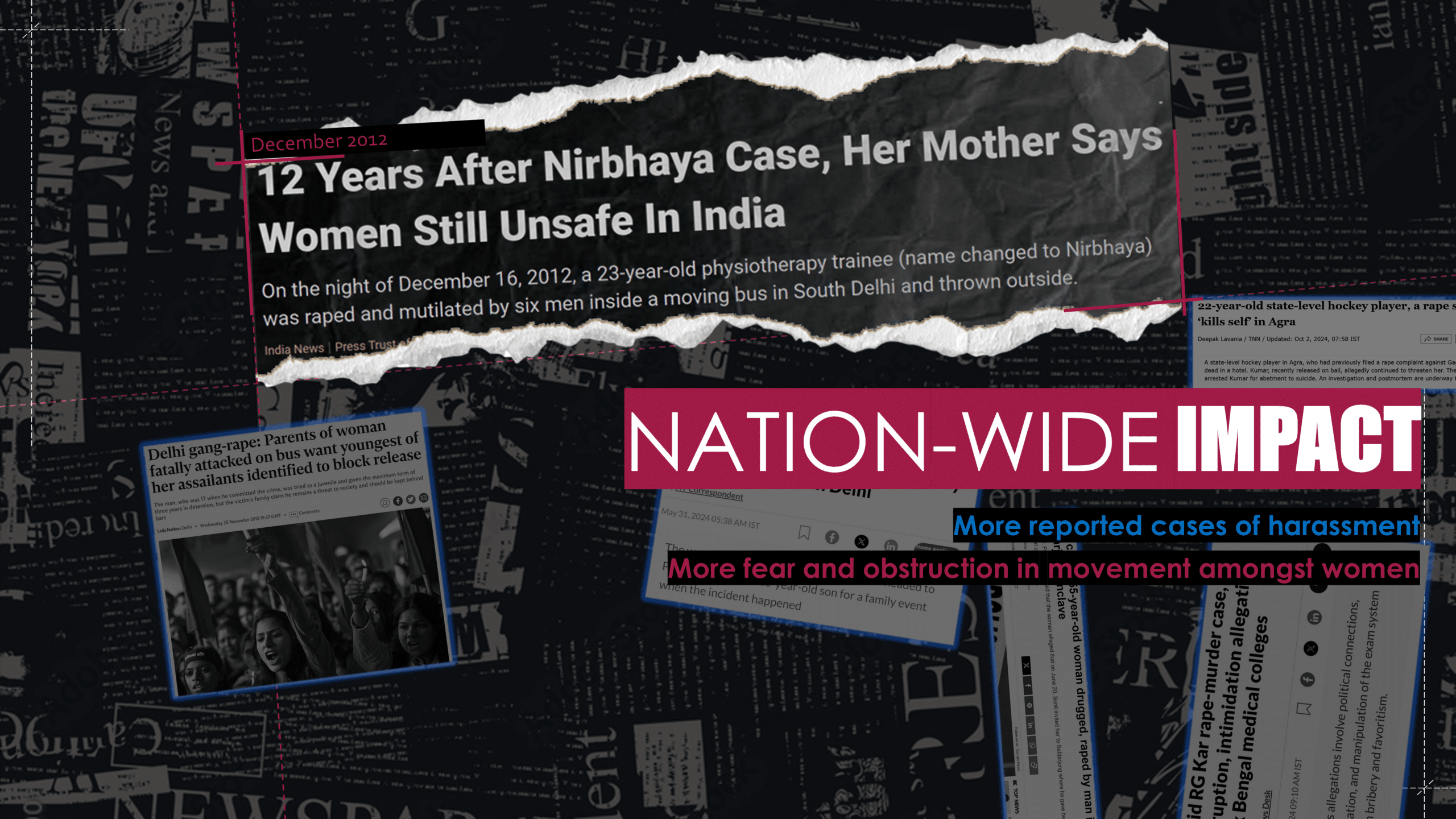
This incident had a nationwide impact, triggering both positive and negative societal shifts. On one hand, it led to a surge in reports of sexual harassment and gender-based crimes, as more women+ came forward to share their experiences. On the other hand, it intensified fear among women+, further restricting their freedom in urban spaces. Many began avoiding public spaces after dark, becoming hyper-aware of their surroundings while navigating the city. While similar crimes had occurred before—and continue to occur—this case became a turning point in conversations around women+ safety, reshaping how public spaces are perceived and experienced by women+ across India.
Drifts of Crimes Against Women in India
India currently has 19 metropolitan cities, where most crime data related to women+ is recorded. These cities also report a higher number of complaints filed by women+ against offenders. Such complaints fall under the category of Crimes Against Women, as defined by the two primary legal frameworks governing criminal offenses: the Indian Penal Code (IPC) and Special and Local Laws (SLL). According to these laws, while women+ can be victims of general crimes, this category specifically addresses offenses that target and defame women+. Through this research and data available in the National Crime Records Bureau(NCRB), the number of reported cases across various subcategories of crimes against women+ in India’s 19 metropolitan cities, have highlighted how women+ are not safe even the most developed cities of the country. Among them, Delhi stands out with an alarmingly high number of cases, making it a critical focus of this research. Between 2020 and 2022, 37,922 cases were reported in the capital alone.
Alarming Crime drifts in Delhi
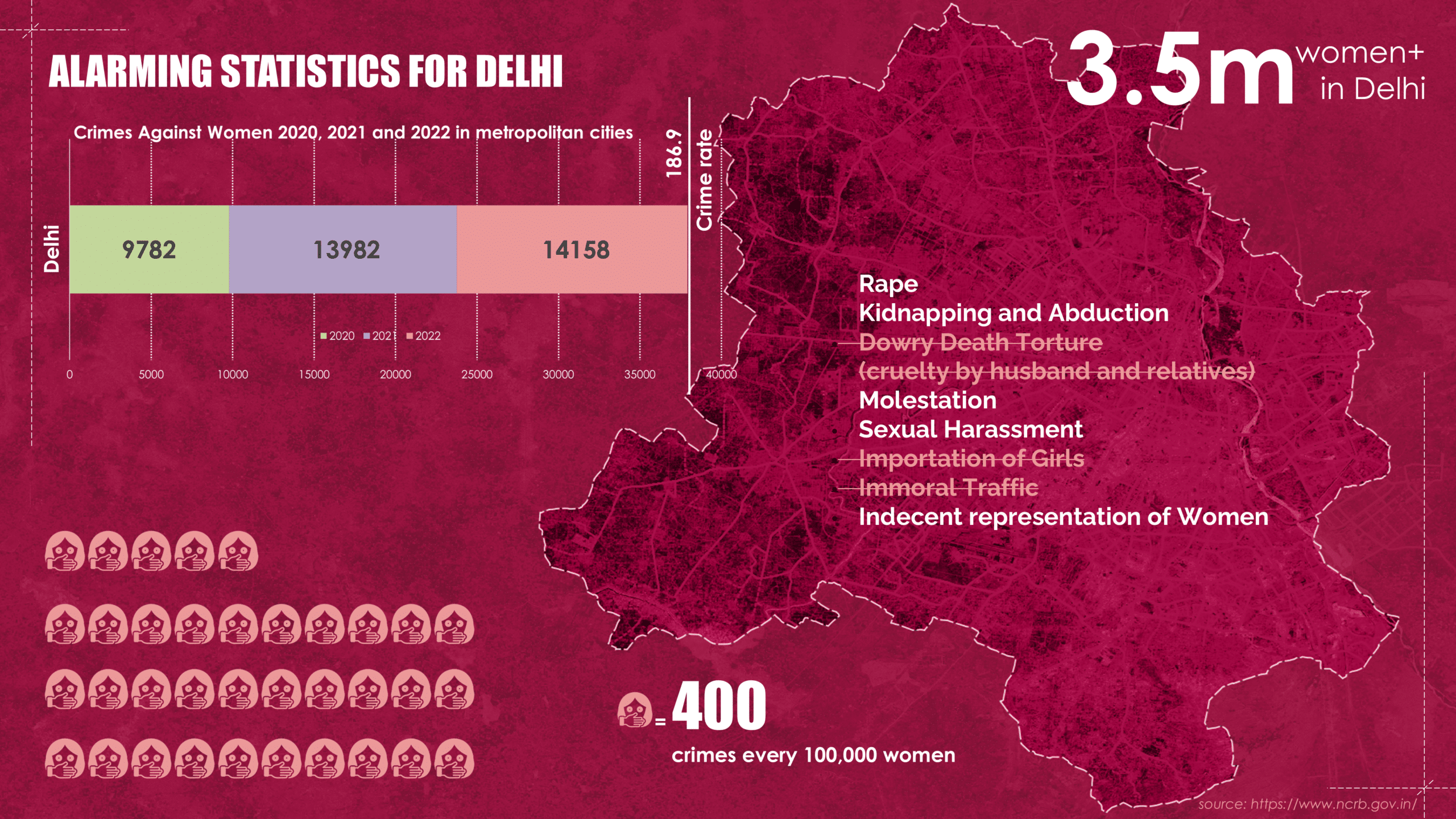
Delhi, the capital of India, has a projected population of 7.5 million spread across 700 km², resulting in a population density of approximately 10,700 people per km². Women+ make up roughly 46.27% of this population. As mentioned earlier, crimes against women+ in Delhi have reached alarming levels. From 2020 to the end of 2022, reported cases steadily increased, with the crime rate against women+ reaching approximately 400 per 100,000 in 2022. These crimes fall under various subcategories, with the highest number of cases recorded in:
- Rape
- Kidnapping and Abduction
Dowry Deaths and Domestic Torture- Molestation
- Sexual Harassment
Importation of GirlsImmoral Trafficking- Indecent Representation of Women
These crimes, categorized under the Indian Penal Code (IPC) and Special & Local Laws (SLL), occur across different settings and scales. However, this research specifically focuses on those that take place within the urban landscape, examining how city design influences the prevalence and perception of such crimes.
Empirical Research through Data Collection
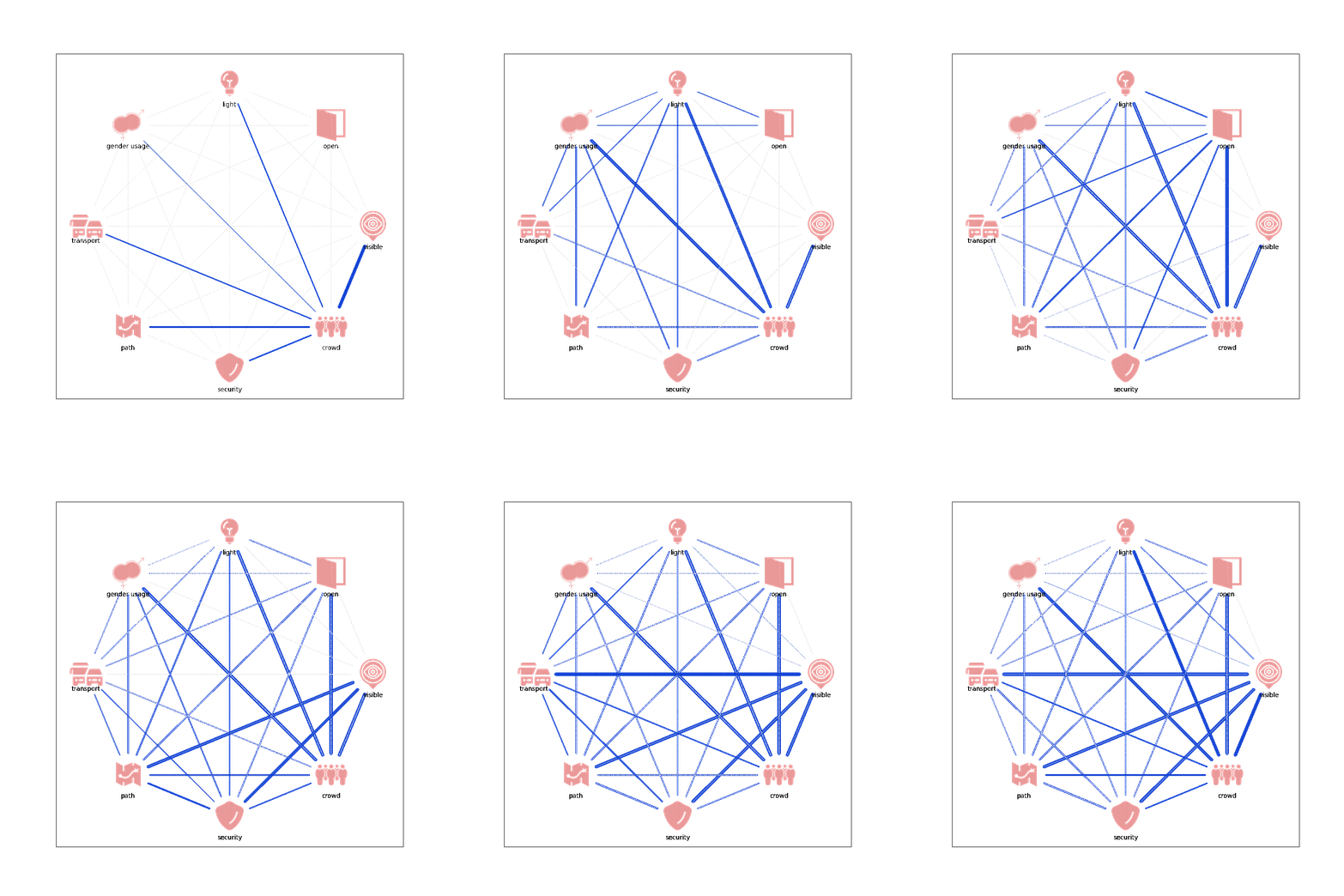
After the desktop research on statistics of crimes against women in Delhi and also looking through multiple state of the art projects around the topic in focus, it was discovered that there is a lack of data and methodologies of understanding perceptions of safety for women+. However, Safetipin, a project that makes an attempts to understand the factors that impact the perception of Safety for women+ in Delhi was insightful for this research. The research highlights that factors like Visibility, Light, Gender Usage and Crowds have higher positive correlation in the perception of Safety as opposed to Openness, Security, Walkability and Public Transport have lower positive correlation in the perception of Safety in Delhi.
The project helps to identify some key concepts for carrying on this research, however it only looks at the correlations of these concepts with the perception of safety in isolation, but not their impacts when these concepts overlap. To carry forward the project, the research proceeds into an Empirical data collection process.
Data Collection
During the research an approach to collect qualitative data was made through Instagram and a tailored website. This approach helped in gathering data in the form of texts and visuals which helped in a qualitative analysis of the overlapped urban concepts and the urban safety of women+. The collected data highlights what sort of choices women+ make while traversing the city and also their experiences of what safe and unsafe spaces look like. This allows the research to sneak a peek into understanding the perceptions initially in a superficial manner and then performing deeper analysis.
Performing analysis on Textual Data
After the collection of all the textual data from people the next objective was to understand which is the most fundamental concept that drives women+ perceptions of safety in Delhi and which secondary concepts shows highest overlap with the fundamental concept. In order to do so some processes were performed on this textual database.
Step 01: SYNTAX ANALYSIS (to only filter the words that highlight some qualitative relation between space and the experience)
Step 02: BERT LLM (to find connections between words and concepts of perceptions of Safety)
Step 03: Cosine Similarity (to see overlaps in the concepts and narrow down to the fundamental concept)
The analysis highlights that visibility is the fundamental concept that has occurred in the textual database of responses in the data collection process and that it is extremely important even when overlapped with all the other concepts. This analysis brings to light that there are gradients of visibility that transpire when overlapped with the secondary concepts of crowding, walking paths and public transport.
Hence the research focuses on unpacking the understanding perceptions of safety of women+ through the lenses of visibility with mobility while traversing through crowds.
Visibility
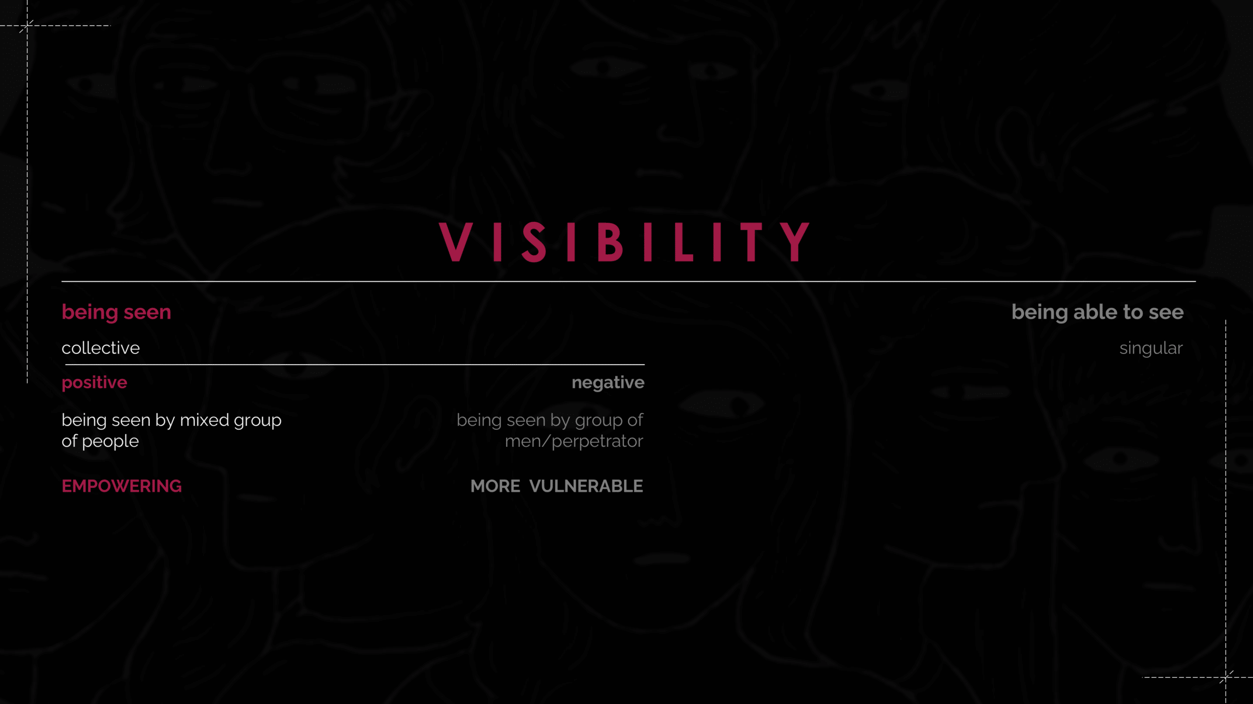
Visibility exists on a spectrum. At one end, it refers to the state of being seen, which is a collective experience involving others beyond the individual. On the other end, it refers to the ability to observe one’s surroundings, a personal experience that enhances awareness of the immediate environment. The experience of being seen is influenced by different types of crowding, which shape perceptions of safety. Positive crowding, where diverse, mixed-gender groups are present, can create a sense of empowerment and security for women+, reinforcing a greater perception of safety. In contrast, negative crowding, where a group consists of only one gender, often increases feelings of vulnerability and unease.
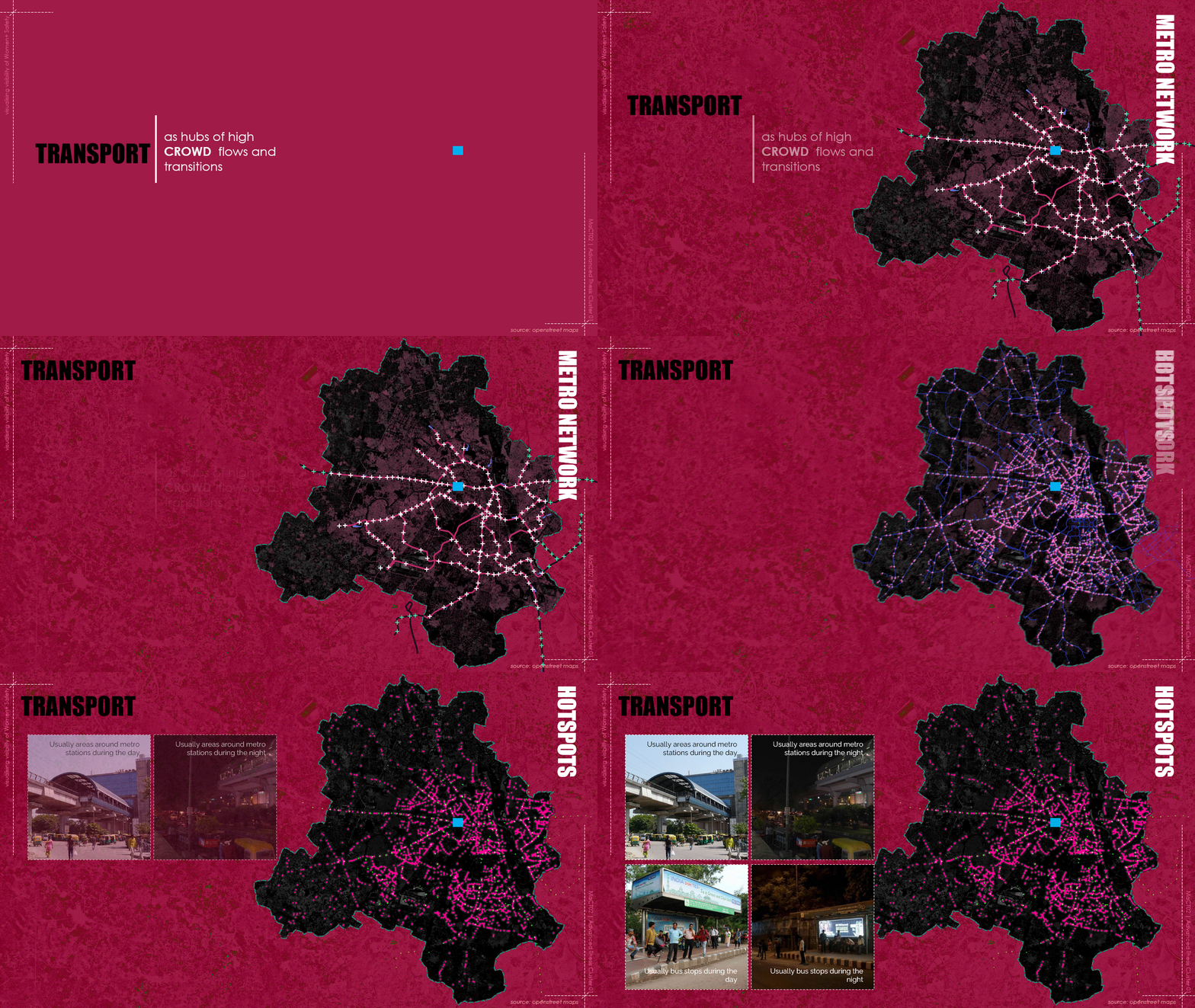
This research focuses on women+ perception of safety, emphasizing how frequent visibility in mixed crowds can be empowering in Delhi. To advance this research, the focus is on urban mobility, particularly within public transport systems and first- and last-mile connectivity, as these spaces are key points of crowd flow and transition.
Visibility Analysis
IsoVist Analysis
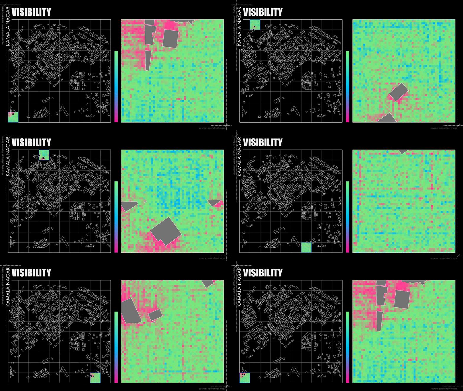
While gathering basic urban data for Delhi, a significant roadblock emerged due to the lack of detailed and comprehensive data on OpenStreetMap. The available data was either incomplete or lacked the granularity needed for an in-depth analysis of women+ visibility in the city. The graphic below presents the results of an Iso-Vist analysis conducted on a 1 km² area of Delhi. Given the scale, this analysis is performed in smaller segments, focusing on visibility in relation to buildings. However, this approach alone is insufficient. Open spaces in Delhi contain various urban elements that significantly enhance or obstruct visibility, influencing how crowds perceive and interact with individuals when the topic in focus is about the safety of women. This sort of analysis can reap better results with higher granularity of data on street maps.
Segmentation Appropriation
As previously mentioned, analyzing visibility solely through Iso-Vist does not fully capture the perception of safety for women+. To gain a more comprehensive understanding, this research incorporates SegForm, a segmentation model that offers a different perspective on visibility. The data collection process played a crucial role in this approach, particularly through videowalks contributed by participants. These 10-15 second videos document the routes women+ choose while commuting in Delhi, providing valuable insights into real-world mobility patterns.
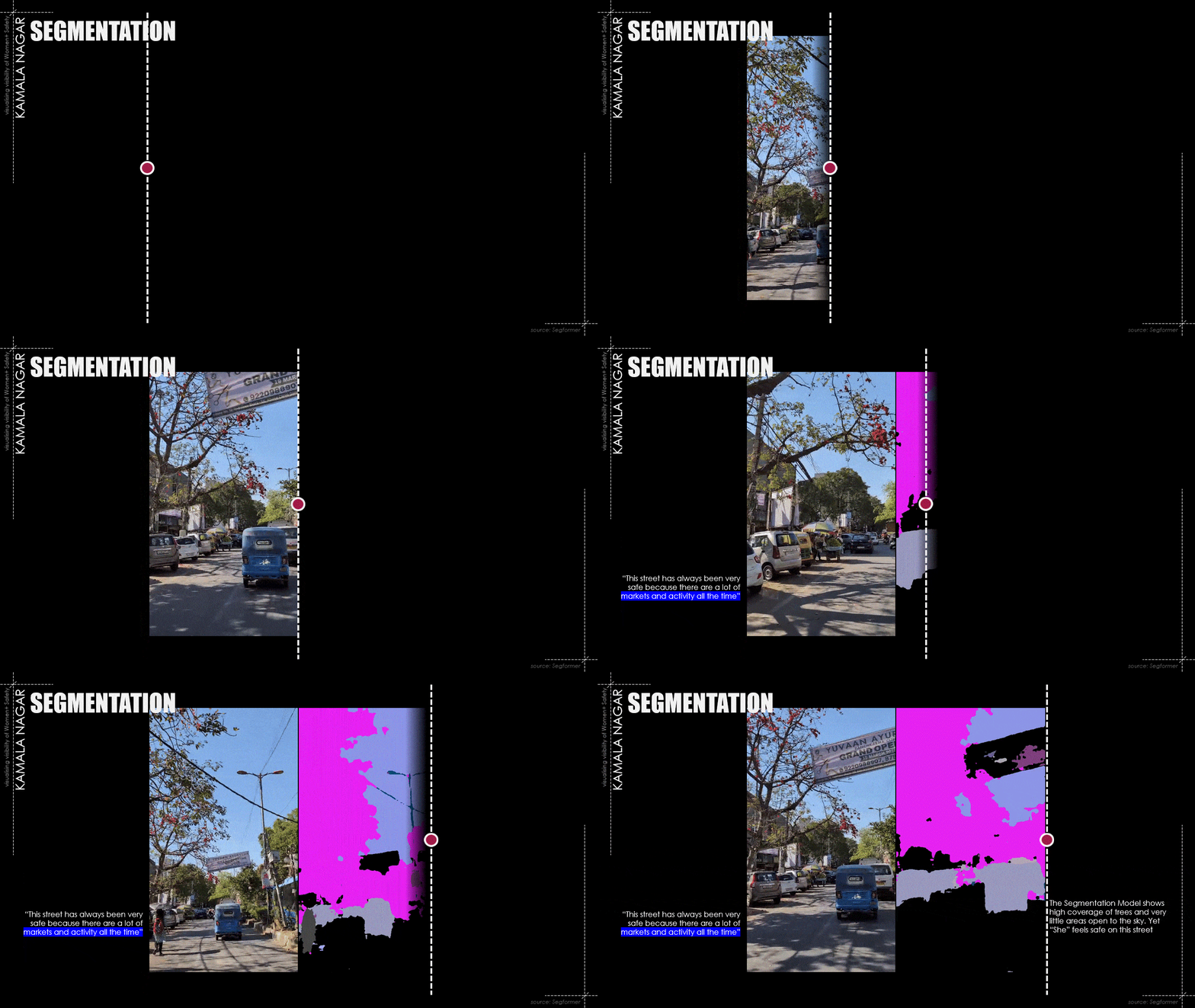
A more detailed analysis of visibility is achieved by performing segmentation on the collected videowalks. SegForm enhances this research by enabling a detailed breakdown of urban environments through pixel-wise segmentation of videowalks. This model identifies and categorizes various urban elements, such as streetlights, vegetation, parked vehicles, and built structures, all of which influence visibility and perceived safety. By quantifying these elements, SegForm provides a data-driven understanding of how different features contribute to street transparency, helping to pinpoint areas where urban design interventions can improve safety for women+. This method allows for a deeper understanding of urban elements that enhance or obstruct street transparency. By identifying these elements, the research can assess how visibility influences urban safety, ultimately contributing to a better-informed approach to designing safer public spaces.
It is possible to conclude by mentioning that by combining Iso-Vist analysis and SegForm segmentation, a more holistic approach to understanding urban safety can be achieved. Iso-Vist analysis provides spatial visibility insights, mapping out the areas that are visually accessible from a given point. While this is useful for understanding line-of-sight limitations, it does not account for the qualitative aspects of visibility, such as obstructions caused by street furniture, parked vehicles, or foliage. SegForm segmentation bridges this gap by categorizing urban elements in real-world environments through videowalks. By segmenting objects like buildings, vegetation, streetlights, and pedestrian flows, SegForm provides highly detailed visibility data, making it possible to assess how these elements enhance or obstruct street transparency. When these methods are channelled together, Iso-Vist can highlight blind spots and low-visibility zones, while SegForm can explain why those areas feel unsafe by analysing physical obstructions. This integrated approach allows for a data-driven assessment of how urban design influences safety perception but also visualises these transparencies and opacities.
Components of Visibility
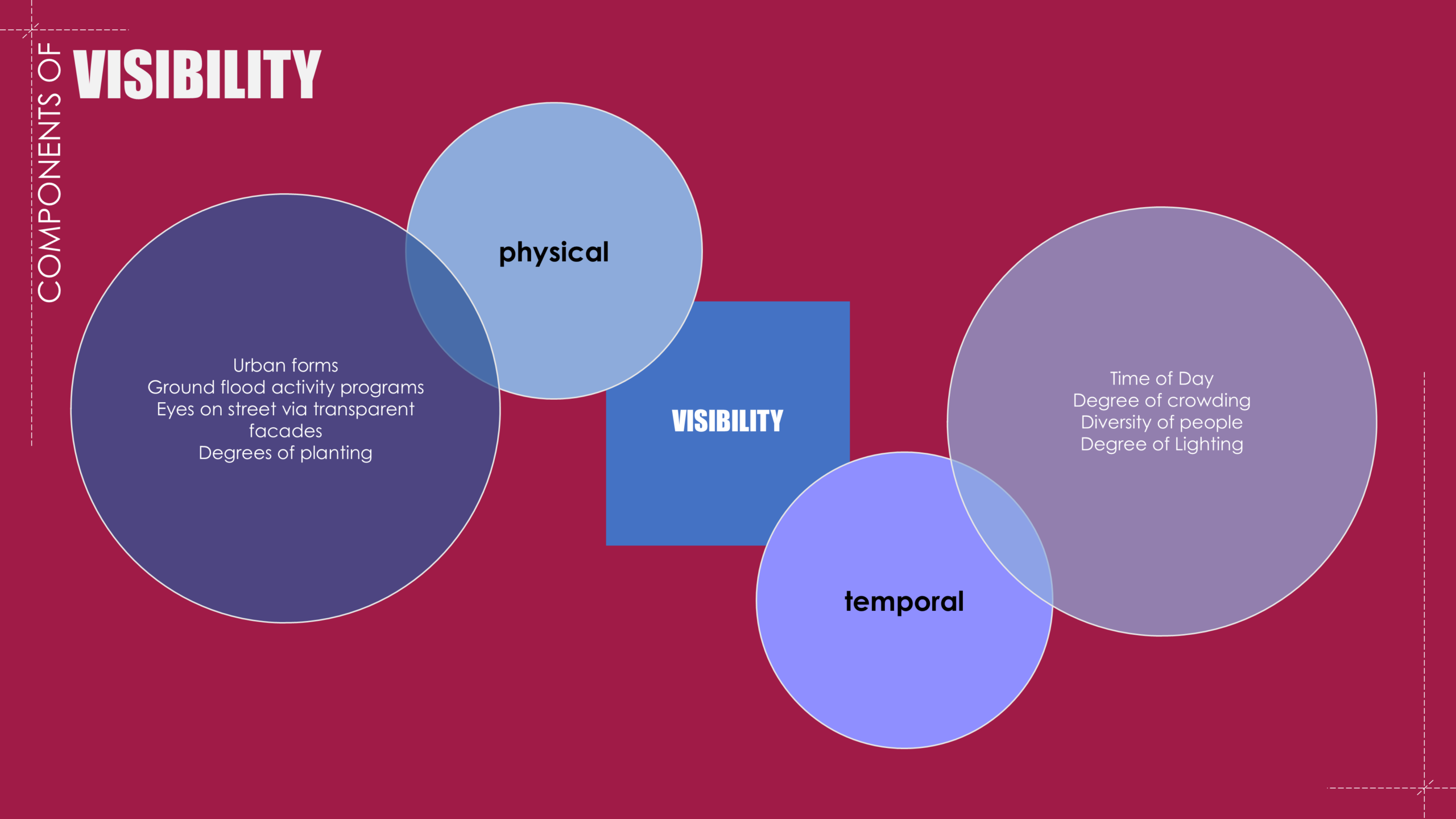
Through the research so far we uncover that concept of visibility in urban spaces plays a critical role in shaping the perception of safety for women+. This framework categorizes visibility into two key components: physical and temporal, both of which influence how safe individuals feel in public spaces.
Physical visibility is determined by urban design elements that impact how easily individuals can be seen and see others. Factors such as urban forms, ground-floor activity programs, transparent facades, and levels of planting all contribute to the overall openness and surveillance of a space. For example, active street fronts with businesses and clear sightlines promote natural surveillance, reducing opportunities for crime.
Temporal visibility, on the other hand, accounts for time-sensitive factors that influence safety perceptions. These include the time of day, crowd density, diversity of people, and degree of lighting. A well-lit, diverse, and moderately crowded space tends to feel safer than an isolated or heavily gender-skewed environment.
The need for a tool to enhance Visibility and Safety
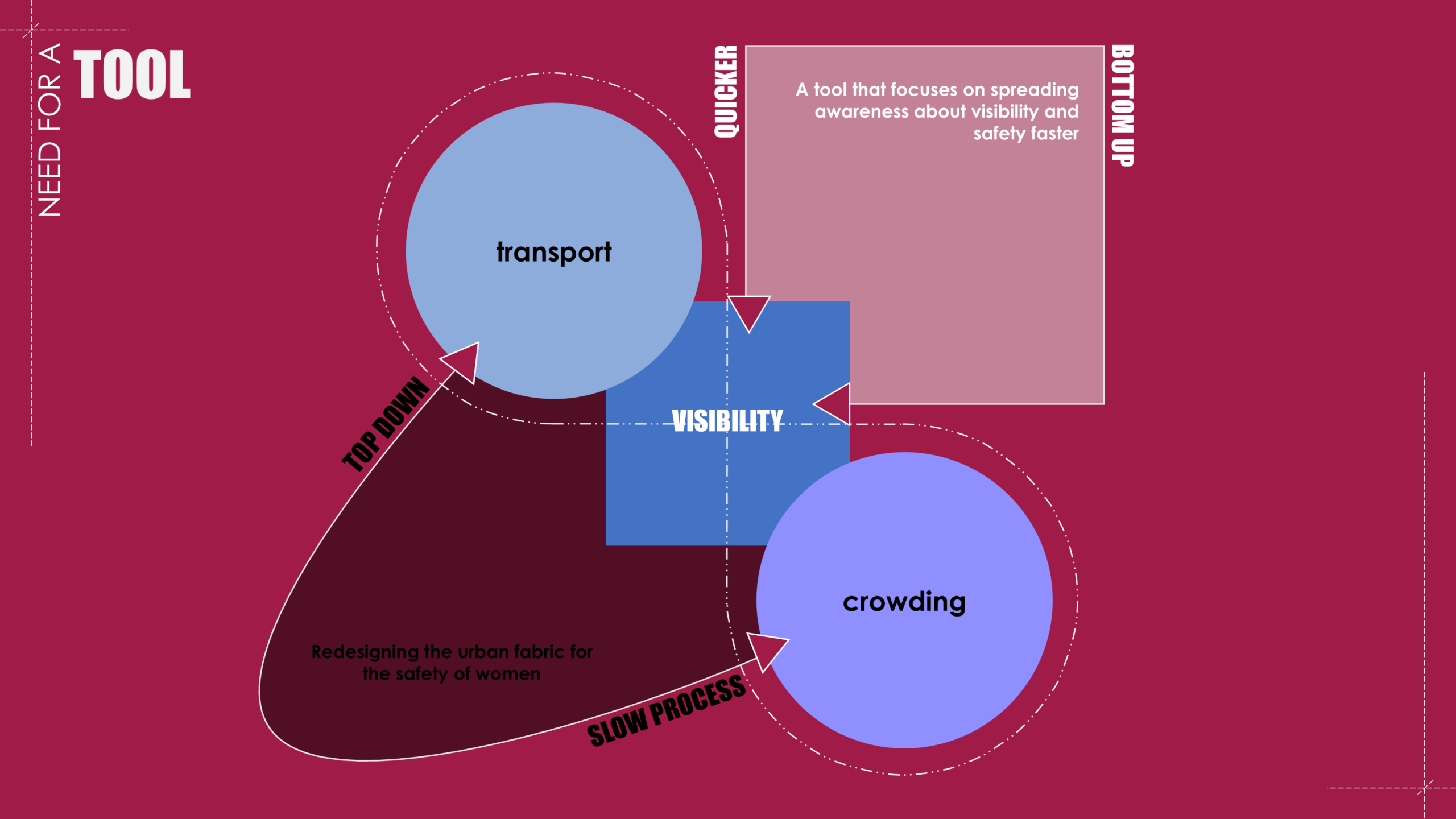
Building on the previous discussion of visibility as a key factor in urban safety, the research goes on to underline the need for a dedicated tool to address safety concerns through visibility enhancement. It acknowledges the two major forces influencing visibility in urban spaces—transport(physical) and crowding(temporal)—and how they interact with different strategies to improve women+ safety.
One approach is the top-down method, which involves redesigning the urban fabric to improve safety. This includes implementing better urban design practices, and integrating safety-oriented policies. However, this is a slow process that requires significant planning, investment, and time before meaningful changes are realized.
On the other hand, a bottom-up approach leverages quicker, grassroots solutions that directly engage communities in improving safety awareness. By utilizing real-time data, participatory mapping, and digital tools, individuals can contribute to and access safety-related insights in their immediate surroundings. This creates a more dynamic and responsive way to address visibility challenges.
The research emphasizes on the need for a tool that operates at the intersection of these two approaches—one that leverages transport data, crowd movement, and visibility metrics to create a fast, scalable, and impactful solution. Such a tool would help spread awareness and empower women+ to make informed mobility decisions, ultimately fostering a safer urban environment.
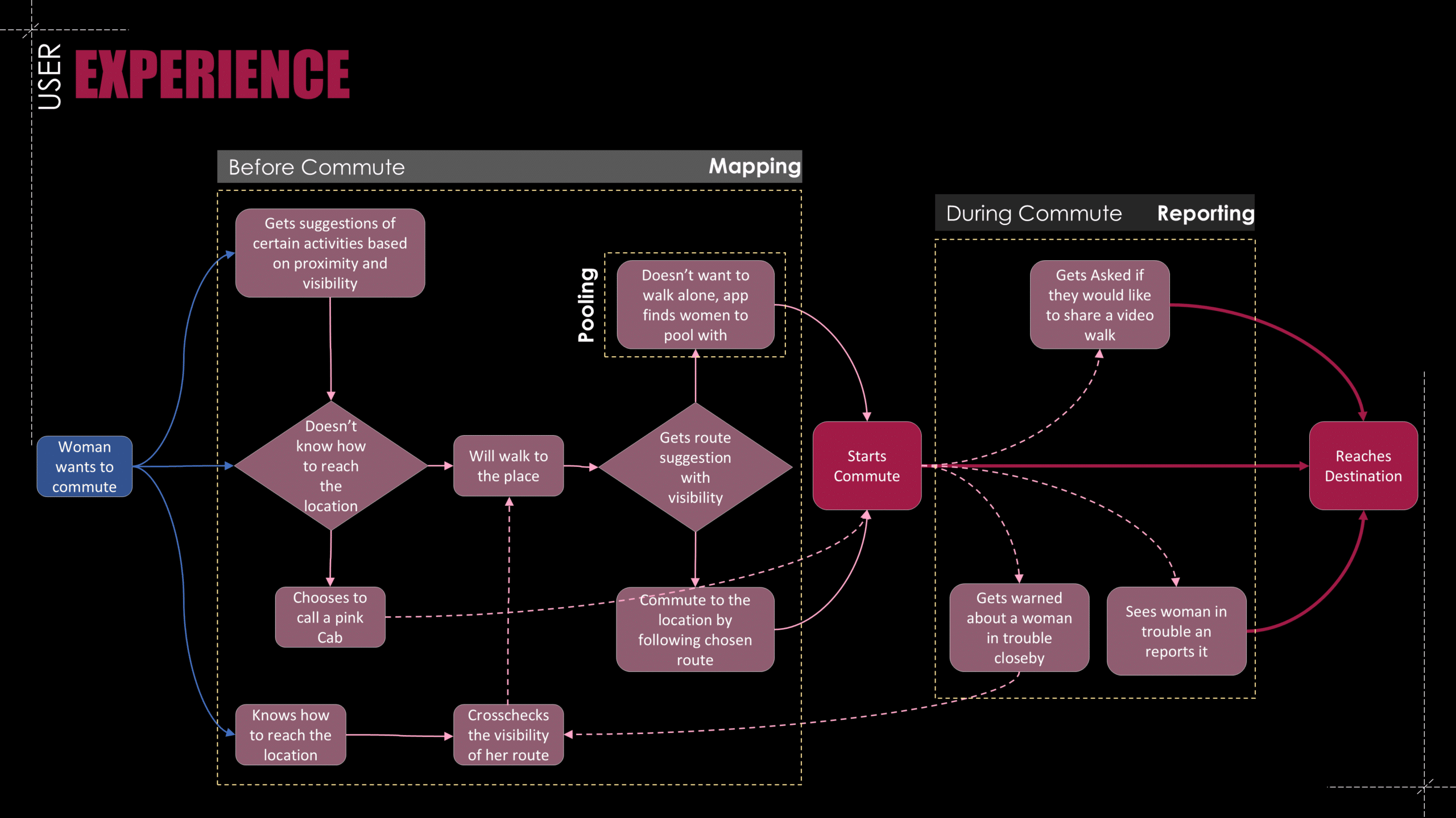
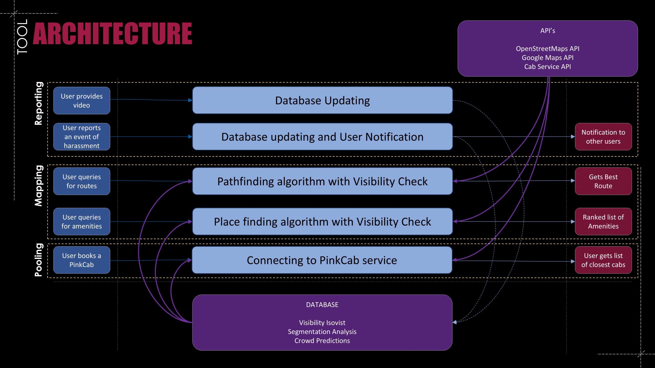
The proposed tool aims to function as an enhanced version of Google Maps, specifically designed to improve women+’s perception of safety by integrating real-time visibility data into navigation. The tool operates on two core pillars: Navigation and Data Collection.
The Navigation aspect focuses on providing users with visibility-informed route options. By leveraging real-time data from OSM API and Google API, the tool will map out paths based on crowd composition and street transparency, helping users choose safer and more comfortable routes. Additionally, a pooling feature can enable users to coordinate with others traveling in the same direction, further enhancing the perception of safety through shared mobility(Cab Service API).
The Data Collection component ensures that the system remains adaptive and responsive. Through user-contributed reporting, the tool can continuously update visibility conditions by gathering insights on crowd types, street activity, and potential risk factors. This bottom-up approach empowers users to actively participate in shaping safer urban experiences.
By combining live mapping, data aggregation, and community-driven insights, this tool creates an ecosystem where women+ can navigate cities with greater confidence and security. It bridges the gap between urban visibility analysis and real-world mobility, offering a proactive and scalable solution to enhance safety in public spaces.
Challenge and Discourse
- Can we protect the confidentiality of the information on the tool from perpetrator?
- The navigation and routing based on visibility and crowding might end up make some street emptier than now.
- Will this be a way to bring a systemic change and bringing back the freedom of movement for women?
- The data for now might be a challenge, but can having a digital twin make assessing visibility better?

