Roving the Red Planet
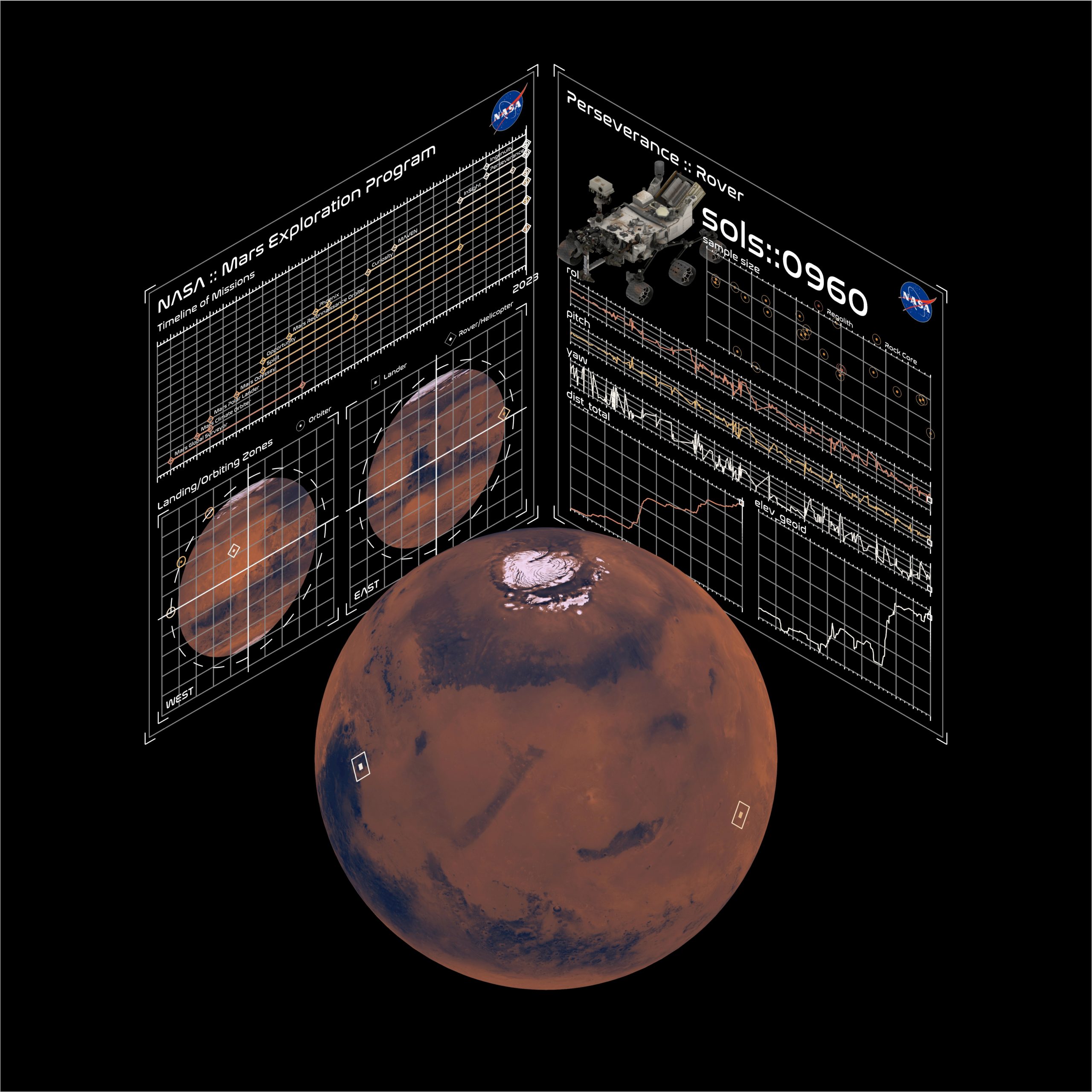
A rich and ongoing history… Mars exploration missions started in the second half of the 20th century, with the first successful one being NASA’s flyby mission Mariner-Mars in 1964. Since then there has been a steady influx of many other missions throughout the years, from NASA as well as from other space agencies from around … Read more